Suspension Bridges Crossing Isère River
This is a list of all 21 bridges from the suspension bridge inventory crossing Isère River. Please note that different rivers with the same name will be grouped together. For example, selecting 'Bear Creek' shows bridges across several different Bear Creeks. Also, similarly named rivers are grouped separately. For example, 'River Dee' (UK) bridges are grouped separately from 'Dee River' (Australia) bridges. Wherever you see a Bridgemeister ID number click it to isolate the bridge on its own page.
Related Lists:
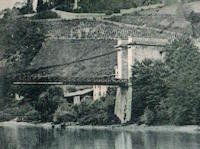
1833: La Sône
La Sône, Isère, France - Isère River
| Bridgemeister ID: | 1730 (added 2005-04-06) |
| Year Completed: | 1833 |
| Name: | La Sône |
| Location: | La Sône, Isère, France |
| Crossing: | Isère River |
| Coordinates: | 45.109403 N 5.276853 E |
| Maps: | Acme, GeoHack, Google, OpenStreetMap |
| References: | AAJ |
| Use: | Vehicular, with walkway |
| Status: | Derelict (last checked: 2020) |
| Main Cables: | Wire (iron) |
| Suspended Spans: | 1 |
| Main Span: | 1 x 92 meters (301.85 feet) |
| Deck width: | 14.76 feet |
Notes:
- Towers and cables remain (as of 2020), though possibly from a replacement structure built later in the 1800s.
- Near La Sône - La Sône, Isère, France.
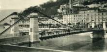
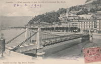
1838: Saint Laurent
Grenoble, Isère, France - Isère River
| Bridgemeister ID: | 1158 (added 2004-01-18) |
| Year Completed: | 1838 |
| Name: | Saint Laurent |
| Location: | Grenoble, Isère, France |
| Crossing: | Isère River |
| Coordinates: | 45.194433 N 5.729017 E |
| Maps: | Acme, GeoHack, Google, OpenStreetMap |
| Use: | Vehicular |
| Status: | Restricted to foot traffic (last checked: 2022) |
| Main Cables: | Wire (iron) |
| Suspended Spans: | 1 |
| Main Span: | 1 x 61 meters (200.1 feet) estimated |
Notes:
- 1909: The bridge is extensively renovated.
External Links:
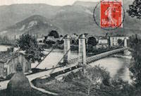
1839: Saint-Gervais
Saint-Gervais and L'Albenc, Isère, France - Isère River
| Bridgemeister ID: | 1753 (added 2005-04-20) |
| Year Completed: | 1839 |
| Name: | Saint-Gervais |
| Location: | Saint-Gervais and L'Albenc, Isère, France |
| Crossing: | Isère River |
| Coordinates: | 45.207083 N 5.465333 E |
| Maps: | Acme, GeoHack, Google, OpenStreetMap |
| Principals: | Escarraguel Brothers |
| Use: | Vehicular |
| Status: | Only towers remain, since 1940 (last checked: 2022) |
| Suspended Spans: | 1 |
| Main Span: | 1 x 93 meters (305.1 feet) |
Notes:
- 1940: Destroyed during WWII.
1840: Brignoud
Brignoud, Isère, France - Isère River
| Bridgemeister ID: | 2320 (added 2007-05-05) |
| Year Completed: | 1840 |
| Name: | Brignoud |
| Location: | Brignoud, Isère, France |
| Crossing: | Isère River |
| Use: | Vehicular |
| Status: | Removed |
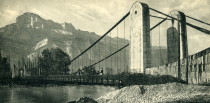
1840: Domène
Domène and Montbonnot-Saint-Martin, Isère, France - Isère River
| Bridgemeister ID: | 7573 (added 2023-04-16) |
| Year Completed: | 1840 |
| Name: | Domène |
| Location: | Domène and Montbonnot-Saint-Martin, Isère, France |
| Crossing: | Isère River |
| Coordinates: | 45.211855 N 5.829792 E |
| Maps: | Acme, GeoHack, Google, OpenStreetMap |
| Use: | Vehicular |
| Status: | Removed |
| Main Cables: | Wire (iron) |
| Main Span: | 1 |
External Links:
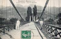
1840: La Gâche
Barraux and Pontcharra, Isère, France - Isère River
| Bridgemeister ID: | 7140 (added 2022-06-25) |
| Year Completed: | 1840 |
| Name: | La Gâche |
| Location: | Barraux and Pontcharra, Isère, France |
| Crossing: | Isère River |
| Coordinates: | 45.434917 N 6.004250 E |
| Maps: | Acme, GeoHack, Google, OpenStreetMap |
| Use: | Vehicular |
| Status: | Removed |
| Main Cables: | Wire |
| Suspended Spans: | 1 |
| Main Span: | 1 |
External Links:
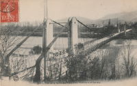
1847: Beauvoir
Beauvoir, Saint-Romans, Isère, France - Isère River
| Bridgemeister ID: | 7713 (added 2023-07-07) |
| Year Completed: | 1847 |
| Name: | Beauvoir |
| Location: | Beauvoir, Saint-Romans, Isère, France |
| Crossing: | Isère River |
| Coordinates: | 45.124700 N 5.330327 E |
| Maps: | Acme, GeoHack, Google, OpenStreetMap |
| Use: | Vehicular |
| Status: | Removed |
| Main Cables: | Wire |
| Suspended Spans: | 1 |
External Links:
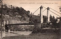
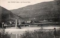
1852: Veurey
Veurey-Voroize, Isère, France - Isère River
| Bridgemeister ID: | 4880 (added 2020-07-18) |
| Year Completed: | 1852 |
| Name: | Veurey |
| Location: | Veurey-Voroize, Isère, France |
| Crossing: | Isère River |
| Coordinates: | 45.271117 N 5.621434 E |
| Maps: | Acme, GeoHack, Google, OpenStreetMap |
| References: | AAJ |
| Use: | Vehicular |
| Status: | Destroyed, 1928 |
| Main Cables: | Wire (iron) |
Notes:
- 1928: Destroyed by flood.
- Replaced by 1933 Veurey - Veurey-Voroize, Isère, France.
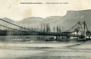
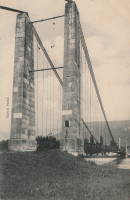
1853: Saint-Quentin-sur-Isère
Saint-Quentin-sur-Isère, Isère, France - Isère River
| Bridgemeister ID: | 2131 (added 2006-10-22) |
| Year Completed: | 1853 |
| Name: | Saint-Quentin-sur-Isère |
| Location: | Saint-Quentin-sur-Isère, Isère, France |
| Crossing: | Isère River |
| Use: | Vehicular |
| Status: | Removed |
| Main Cables: | Wire |
| Suspended Spans: | 1 |
External Links:
1857: Izeron
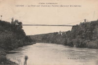
Izeron and Saint-Sauveur, Isère, France - Isère River
| Bridgemeister ID: | 7159 (added 2022-06-25) |
| Year Completed: | 1857 |
| Name: | Izeron |
| Location: | Izeron and Saint-Sauveur, Isère, France |
| Crossing: | Isère River |
| Coordinates: | 45.154651 N 5.363855 E |
| Maps: | Acme, GeoHack, Google, OpenStreetMap |
| Use: | Vehicular |
| Status: | Removed |
| Main Cables: | Wire (iron) |
| Suspended Spans: | 1 |
Notes:
External Links:
- Art-et-Histoire.com - Pont suspendu d'Izeron sur l'Isère - 1857. Art-et-Histoire also mentions a possible earlier suspension bridge that opened in 1849 and collapsed soon after due to a landslide.
1857: Saint-Lattier
Saint-Lattier, Isère and Eymeux, Drôme, France - Isère River
| Bridgemeister ID: | 7385 (added 2022-11-24) |
| Year Completed: | 1857 |
| Name: | Saint-Lattier |
| Location: | Saint-Lattier, Isère and Eymeux, Drôme, France |
| Crossing: | Isère River |
| Use: | Vehicular |
| Status: | Replaced |
| Main Cables: | Wire |
| Suspended Spans: | 1 |
Notes:
- Later at same location Saint-Lattier (Eymeux) - Saint-Lattier, Isère and Eymeux, Drôme, France. Unclear if the newer bridge was a direct replacement for the older bridge.
External Links:
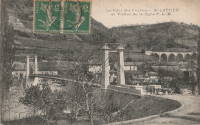
1875: Saint-Nazaire
Saint-Nazaire-en-Royans, Drôme and Saint-Hilaire-du-Rosier, Isère, France - Isère River
| Bridgemeister ID: | 7328 (added 2022-09-02) |
| Year Completed: | 1875 |
| Name: | Saint-Nazaire |
| Location: | Saint-Nazaire-en-Royans, Drôme and Saint-Hilaire-du-Rosier, Isère, France |
| Crossing: | Isère River |
| Coordinates: | 45.067313 N 5.243247 E |
| Maps: | Acme, GeoHack, Google, OpenStreetMap |
| Use: | Vehicular |
| Status: | Removed |
| Main Cables: | Wire |
| Suspended Spans: | 1 |
External Links:
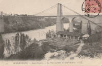
1906: Trellins
Vinay vicinity, Isère, France - Isère River
| Bridgemeister ID: | 1423 (added 2004-07-17) |
| Year Completed: | 1906 |
| Name: | Trellins |
| Location: | Vinay vicinity, Isère, France |
| Crossing: | Isère River |
| Coordinates: | 45.19536 N 5.42482 E |
| Maps: | Acme, GeoHack, Google, OpenStreetMap |
| References: | AAJ |
| Use: | Vehicular |
| Status: | Derelict (last checked: 2009) |
| Main Cables: | Wire |
| Suspended Spans: | 3 |
| Main Span: | 1 x 146.6 meters (481 feet) |
| Side Spans: | 2 x 25.3 meters (83 feet) |
Notes:
- 2022: Still standing, but suspenders and deck have been removed.
External Links:
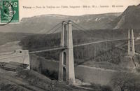
1933: Veurey
Veurey-Voroize, Isère, France - Isère River
| Bridgemeister ID: | 4881 (added 2020-07-18) |
| Year Completed: | 1933 |
| Name: | Veurey |
| Location: | Veurey-Voroize, Isère, France |
| Crossing: | Isère River |
| References: | AAJ |
| Use: | Vehicular |
| Status: | Removed |
| Main Cables: | Wire (steel) |
Notes:
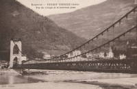
1943: Izeron
Izeron and Saint-Sauveur, Isère, France - Isère River
| Bridgemeister ID: | 7160 (added 2022-06-25) |
| Year Completed: | 1943 |
| Name: | Izeron |
| Location: | Izeron and Saint-Sauveur, Isère, France |
| Crossing: | Isère River |
| Coordinates: | 45.154525 N 5.364199 E |
| Maps: | Acme, GeoHack, Google, OpenStreetMap |
| Use: | Vehicular (one-lane) |
| Status: | Demolished, 2013 |
| Main Cables: | Wire (steel) |
| Suspended Spans: | 1 |
| Main Span: | 1 x 166 meters (544.6 feet) |
Notes:
(suspension bridge)
Tencin and La Terrasse, Isère, France - Isère River
| Bridgemeister ID: | 3194 (added 2019-11-10) |
| Name: | (suspension bridge) |
| Location: | Tencin and La Terrasse, Isère, France |
| Crossing: | Isère River |
| Coordinates: | 45.315937 N 5.945173 E |
| Maps: | Acme, GeoHack, Google, OpenStreetMap |
| Use: | Vehicular (one-lane) |
| Status: | In use (last checked: 2019) |
| Main Cables: | Wire (steel) |
| Suspended Spans: | 1 |
Notes:
- At former location of (suspension bridge) - Tencin and La Terrasse, Isère, France. Unclear if the newer bridge was an immediate replacement.
(suspension bridge)
Tencin and La Terrasse, Isère, France - Isère River
| Bridgemeister ID: | 5666 (added 2021-01-24) |
| Name: | (suspension bridge) |
| Location: | Tencin and La Terrasse, Isère, France |
| Crossing: | Isère River |
| Coordinates: | 45.315676 N 5.945550 E |
| Maps: | Acme, GeoHack, Google, OpenStreetMap |
| Use: | Vehicular (one-lane) |
| Status: | Removed |
| Main Cables: | Wire |
| Suspended Spans: | 1 |
Notes:
- Coordinates are for the present day (2021) suspension bridge at this location. This older suspension bridge appears to have been built on the same alignment or extremely close to it.
- Later at same location (suspension bridge) - Tencin and La Terrasse, Isère, France. Unclear if the later bridge was an immediate replacement.
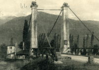
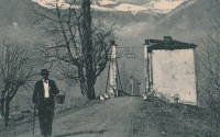
Châteauneuf-sur-Isère
Châteauneuf-sur-Isère and Beaumont-Monteux, Drôme, France - Isère River
| Bridgemeister ID: | 4879 (added 2020-07-18) |
| Name: | Châteauneuf-sur-Isère |
| Location: | Châteauneuf-sur-Isère and Beaumont-Monteux, Drôme, France |
| Crossing: | Isère River |
| Use: | Vehicular |
| Status: | Removed |
| Main Cables: | Wire (iron) |
External Links:
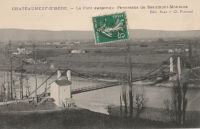
Goncelin
Goncelin, Isère, France - Isère River
| Bridgemeister ID: | 7137 (added 2022-06-20) |
| Name: | Goncelin |
| Location: | Goncelin, Isère, France |
| Crossing: | Isère River |
| Use: | Vehicular |
| Status: | Removed |
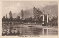
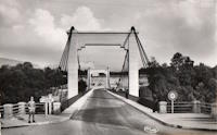
La Sône
La Sône, Isère, France - Isère River
| Bridgemeister ID: | 5563 (added 2020-12-19) |
| Name: | La Sône |
| Location: | La Sône, Isère, France |
| Crossing: | Isère River |
| Coordinates: | 45.111177 N 5.280148 E |
| Maps: | Acme, GeoHack, Google, OpenStreetMap |
| Use: | Vehicular (two-lane), with walkway |
| Status: | In use (last checked: 2020) |
| Main Cables: | Wire (steel) |
| Suspended Spans: | 1 |
Notes:
Saint-Lattier
Saint-Lattier, Isère and Eymeux, Drôme, France - Isère River
| Bridgemeister ID: | 4913 (added 2020-07-19) |
| Name: | Saint-Lattier |
| Also Known As: | Eymeux |
| Location: | Saint-Lattier, Isère and Eymeux, Drôme, France |
| Crossing: | Isère River |
| Coordinates: | 45.084972 N 5.183313 E |
| Maps: | Acme, GeoHack, Google, OpenStreetMap |
| Use: | Vehicular (one-lane) |
| Status: | In use (last checked: 2020) |
| Main Cables: | Wire (steel) |
| Suspended Spans: | 1 |
| Main Span: | 1 x 10⁸ meters (354.3 feet) estimated |
Notes:
- At former location of 1857 Saint-Lattier - Saint-Lattier, Isère and Eymeux, Drôme, France.
External Links:
Do you have any information or photos for these bridges that you would like to share? Please email david.denenberg@bridgemeister.com.