Suspension Bridges of USA (601-700 of 1,437)
This is a list of bridges 601 through 700 (of 1,437 total) from the suspension bridge inventory for the country USA . Wherever you see a Bridgemeister ID number click it to isolate the bridge on its own page.
Related Lists:
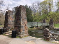
Bridgemeister ID: 2670 (added 2019-03-15)Year Completed: 2017 Name: Gulf Coast Research Laboratory Cedar Point Location: Ocean Springs, Mississippi , USA Coordinates: 30.391250 N 88.776583 W Maps: Acme , GeoHack , Google , OpenStreetMap Principals: Seattle Bridge LLC Use: Footbridge Status: In use (last checked: 2017) Main Cables: Wire (steel) Main Span: 1 x 61.6 meters (202 feet)
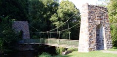
Bridgemeister ID: 3044 (added 2019-10-19)Year Completed: 2017 Name: Inkana Location: Sulphur, Oklahoma , USA Crossing: Rock Creek At or Near Feature: Chickasaw Cultural Center Coordinates: 34.491860 N 96.992191 W Maps: Acme , GeoHack , Google , OpenStreetMap Use: Footbridge Status: In use (last checked: 2019) Main Cables: Wire (steel)
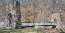
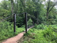
Bridgemeister ID: 3571 (added 2019-12-26)Year Completed: 2017 Name: Preddy Creek Location: Rivanna, Virginia , USA Crossing: Preddy Creek At or Near Feature: Preddy Creek Trail Park Coordinates: 38.178779 N 78.362761 W Maps: Acme , GeoHack , Google , OpenStreetMap Use: Footbridge Status: In use (last checked: 2017) Main Cables: Wire (iron)
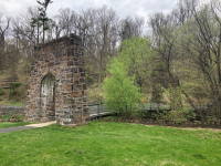
Bridgemeister ID: 3317 (added 2019-11-30)Year Completed: 2018 Name: (footbridge) Location: Gadsden, Alabama , USA Crossing: Black Creek At or Near Feature: Noccalula Falls Park Use: Footbridge Status: In use (last checked: 2019) Main Cables: Wire (steel)
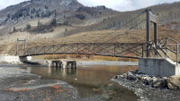
Bridgemeister ID: 2919 (added 2019-09-15)Year Completed: 2018 Name: Gunsight Location: Crested Butte, Colorado , USA Crossing: Slate River Coordinates: 38.908224 N 107.025381 W Maps: Acme , GeoHack , Google , OpenStreetMap Principals: Canyon Bridge LLC Use: Footbridge Status: In use (last checked: 2019) Main Cables: Wire (steel) Suspended Spans: 1 Main Span: 1 x 30.5 meters (100 feet)
Bridgemeister ID: 5861 (added 2021-05-15)Year Completed: 2018 Name: Hemlock Location: Logan vicinity, Ohio , USA At or Near Feature: Hocking Hills State Park Principals: Woolpert, Ohio Department of Natural Resources Use: Footbridge Status: In use (last checked: 2022) Main Cables: Wire (steel) Deck width: 16 inches
Bridgemeister ID: 5546 (added 2020-12-13)Year Completed: 2018 Name: Manning Crevice Location: Riggins Hot Springs vicinity, Idaho , USA Crossing: Salmon River Coordinates: 45.401611 N 116.116483 W Maps: Acme , GeoHack , Google , OpenStreetMap Use: Vehicular Status: In use (last checked: 2018) Main Cables: Wire (steel) Suspended Spans: 1 Main Span: 1 x 91.4 meters (300 feet)
Bridgemeister ID: 5638 (added 2020-12-29)Year Completed: 2019 Name: J. Polk Currin Swinging Location: Cottage Grove, Oregon , USA Crossing: Willamette River Coast Fork At or Near Feature: Prospector Park Coordinates: 43.793857 N 123.069210 W Maps: Acme , GeoHack , Google , OpenStreetMap Principals: Ausland Group, Hamilton Construction Use: Footbridge Status: In use (last checked: 2020) Main Cables: Wire (steel) Suspended Spans: 3 Main Span: 1 Side Spans: 2
Bridgemeister ID: 5110 (added 2020-09-05)Year Completed: 2020 Name: (footbridge) Location: Spanish Fork, Utah , USA Crossing: Spanish Fork At or Near Feature: Dripping Rock Trail Coordinates: 40.084505 N 111.596595 W Maps: Acme , GeoHack , Google , OpenStreetMap Use: Footbridge Status: In use (last checked: 2020) Main Cables: Wire (steel) Suspended Spans: 1
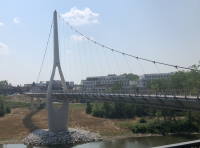
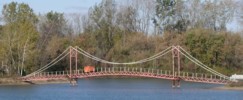
Bridgemeister ID: 3903 (added 2020-03-14)Year Completed: 2020 Name: Dublin Link Location: Dublin, Ohio , USA Crossing: Scioto River Coordinates: 40.102094 N 83.111697 W Maps: Acme , GeoHack , Google , OpenStreetMap Principals: Endrestudio, T.Y. Lin International, Kokosing Construction Co. Use: Footbridge Status: In use (last checked: 2022) Main Cables: Wire (steel)
Bridgemeister ID: 5923 (added 2021-06-15)Year Completed: 2021 Name: (footbridge) Location: Pueblo, Colorado , USA Crossing: Arkansas River Coordinates: 38.267861 N 104.623417 W Maps: Acme , GeoHack , Google , OpenStreetMap Use: Footbridge Status: In use (last checked: 2021) Main Cables: Wire (steel) Suspended Spans: 1 Main Span: 1
Opened for one weekend in early June 2021 as part of ceremonies commemorating those that lost their lives during the flood that devasted Pueblo 100 years ago, on June 3, 1921. Bridge is expected to be fully open to the public in July 2021. Bridgemeister ID: 6244 (added 2021-07-18)Year Completed: 2021 Name: Mohican Cable Pedestrian Location: Loudounville, Ohio , USA Crossing: Clear Fork Mohican River At or Near Feature: Mohican State Park Coordinates: 40.612051 N 82.286537 W Maps: Acme , GeoHack , Google , OpenStreetMap Principals: Woolpert, The Righter Company Use: Footbridge Status: In use (last checked: 2021) Main Cables: Wire (steel) Suspended Spans: 1 Main Span: 1 x 36.6 meters (120 feet)
Bridgemeister ID: 5860 (added 2021-05-15)Year Completed: 2021 Name: Stillwater Prairie Connector Location: Covington, Ohio , USA Crossing: Stillwater River At or Near Feature: Maple Ridge Reserve, Stillwater Prairie Reserve Coordinates: 40.156364 N 84.398538 W Maps: Acme , GeoHack , Google , OpenStreetMap Principals: Woolpert, Brumbaugh Construction Use: Footbridge Status: In use (last checked: 2021) Main Cables: Wire (steel) Suspended Spans: 1 Main Span: 1 x 51.8 meters (170 feet) Deck width: 32 inches
Bridgemeister ID: 7687 (added 2023-07-04)Year Completed: 2021 Name: Welch Ditch Location: Clear Creek Canyon Park, Golden, Colorado , USA Crossing: Clear Creek At or Near Feature: Welch Ditch Trail, Peaks to Plains Trail Coordinates: 39.744912 N 105.248592 W Maps: Acme , GeoHack , Google , OpenStreetMap Use: Footbridge Status: In use (last checked: 2023) Main Cables: Wire (steel) Suspended Spans: 1
Bridgemeister ID: 7051 (added 2022-05-26)Year Completed: 2022 Name: Amanda Trail Location: Yachats, Oregon , USA Crossing: Amanda Grotto At or Near Feature: Amanda Statue Coordinates: 44.291975 N 124.106961 W Maps: Acme , GeoHack , Google , OpenStreetMap Use: Footbridge Status: In use (last checked: 2022) Main Cables: Wire (steel) Suspended Spans: 1
Bridgemeister ID: 7577 (added 2023-04-23)Year Completed: 2022 Name: Hidden Lake Gardens Location: Tipton, Michigan , USA At or Near Feature: Hidden Lake Gardens Principals: Phoenix Experiential Designs Use: Footbridge Status: In use (last checked: 2023) Main Cables: Wire (steel) Suspended Spans: 2 Main Spans: 2
Walters, Alex. "MSU’s Hidden Lake Gardens hopes to be found with new canopy walk." The State News , 13 Dec 2022, https://statenews.com/article/2022/12/msus-hidden-lake-gardens-hopes-to-be-found-with-an-ambitious-new-attraction "Since Oct. 2017, they have been designing, funding, and building a suspension bridge hanging off of a 70 foot central tower. The bridge, an idea sparked by a frequent hiker, runs over a valley, giving visitors an up-close view of the trees without the climb."
Graham, Lester. "Suspension bridge through the tree tops could attract more visitors to an MSU hidden gem." Michigan Radio , 20 Oct. 2022, https://www.michiganradio.org/environment-climate-change/2022-10-20/suspension-bridge-through-the-tree-tops-could-attract-more-visitors-to-an-msu-hidden-gem "Oates says there was a perfect site [for the bridge] at Hidden Lake Gardens. There’s this sort of bowl-shaped valley. It’s called a kettle hole, a deep depression caused by a chunk of glacier falling off. The 700 foot bridge spans that ‘kettle hole’ valley."
Bridgemeister ID: 2572 (added 2012-11-17)Name: (conveyor bridge) Location: Beverly vicinity, Ohio , USA Crossing: Muskingum River At or Near Feature: Muskingum River Power Plant Coordinates: 39.59230 N 81.68519 W Maps: Acme , GeoHack , Google , OpenStreetMap Use: Conveyor Status: Removed, c. 2015-2021 Main Cables: Wire (steel) Suspended Spans: 1
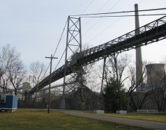
Approaches were dismantled by 2015. Another portion of the beltway collapsed during preparations for demolition in December 2015 killing the CEO of the demolition company. Unclear if the suspension span was completely demolished at this time. By 2021, the bridge appears to have been completely demolished. Bridgemeister ID: 7391 (added 2022-11-25)Name: (conveyor bridge) Location: Gary, West Virginia , USA Coordinates: 37.373762 N 81.558262 W Maps: Acme , GeoHack , Google , OpenStreetMap Use: Conveyor Status: Extant (last checked: 2020) Main Cables: Wire (steel) Main Span: 1 x 179 meters (587.3 feet) estimated
Bridgemeister ID: 2574 (added 2012-11-18)Name: (conveyor bridge) Location: Joliet, Illinois , USA Crossing: Des Plaines River At or Near Feature: Joliet 29 Generating Station Coordinates: 41.494281 N 88.119729 W Maps: Acme , GeoHack , Google , OpenStreetMap Use: Conveyor Status: Extant (last checked: 2012) Main Cables: Wire (steel)
Bridgemeister ID: 2034 (added 2006-05-01)Name: (conveyor bridge) Location: Pasco vicinity, Washington , USA Crossing: Snake River At or Near Feature: Ice Harbor Lock and Dam Principals: John A. Roebling's Sons Use: Conveyor Status: Removed Main Cables: Wire (steel) Suspended Spans: 1 Main Span: 1 x 304.8 meters (1,000 feet)
Built late 1950s or 1960. Pictured and described in Roebling ad in July 1960 issue of Civil Engineering. Built to transport concrete aggregate during construction of the dam. Likely removed. Bridgemeister ID: 1951 (added 2005-11-04)Name: (conveyor bridge) Location: Starbrick, Pennsylvania , USA Crossing: Allegheny River Coordinates: 41.837083 N 79.20475 W Maps: Acme , GeoHack , Google , OpenStreetMap Use: Conveyor Status: Removed (last checked: 2008) Main Cables: Wire (steel) Suspended Spans: 1 Main Span: 1 x 115.8 meters (380 feet) estimated
Crossed a portion of the Allegheny River to Mead Island. Appears to have been removed 2006-2008. Jason Oliphant writes in early 2009: "The north shore suspension supports still exist but the bridge doesn't. I have no idea when it was taken down but I can say that it wasn't there in summer 2008." Bridgemeister ID: 1615 (added 2005-02-22)Name: (conveyor bridge) Location: Thornton, Colorado , USA Crossing: South Platte River Coordinates: 39.86809 N 104.92068 W Maps: Acme , GeoHack , Google , OpenStreetMap Use: Pipeline and Footbridge Status: Derelict (last checked: 2007) Main Cables: Wire (steel) Suspended Spans: 1 Main Span: 1 x 121.9 meters (400 feet) estimated
Bridgemeister ID: 1630 (added 2005-03-11)Name: (conveyor bridge) Location: Thornton, Colorado , USA Crossing: South Platte River Coordinates: 39.87968 N 104.90335 W Maps: Acme , GeoHack , Google , OpenStreetMap Use: Conveyor and Footbridge Status: In use (last checked: 2007) Main Cables: Wire (steel) Suspended Spans: 1 Main Span: 1 x 106.7 meters (350 feet)
Bridgemeister ID: 1692 (added 2005-03-27)Name: (flume bridge) Location: Proctor, Vermont , USA Crossing: Otter Creek At or Near Feature: Sutherland Falls Use: Flume Status: Removed Main Cables: Wire
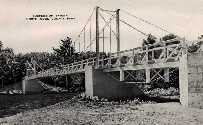
The postcard presented here doesn't show much, but other photos show a large wood-shingled tower at one end of the bridge. The bridge was likely completed in the late 1800s. Robert Ratti provided the following information: "it was a carrier of marble slurry from the Vermont Marble Co. and ended in the swamp nearby... In 1936, I lived right at the end of the swamp and climbed on that waste carrier many times." Appears to have been damaged by flood in the 2018-2019 time frame. Bridgemeister ID: 1151 (added 2004-01-18)Name: (footbridge) Location: Akron, Ohio , USA Crossing: Cuyahoga River At or Near Feature: High Bridge Glens Park, now Gorge Metro Park Use: Footbridge Status: Removed Main Cables: Wire
This bridge is visible in the foreground of a popular late 19th century stereoview showing the "high bridge" and falls. No longer in existence. Bridgemeister ID: 1784 (added 2005-05-16)Name: (footbridge) Location: Akron, Ohio , USA At or Near Feature: F.A. Seiberling Nature Realm, Sand Run Metro Park Coordinates: 41.135883 N 81.5735 W Maps: Acme , GeoHack , Google , OpenStreetMap Use: Footbridge Status: In use (last checked: 2012) Main Cables: Wire Suspended Spans: 1
Bridgemeister ID: 1342 (added 2004-05-08)Name: (footbridge) Location: Alum Wells vicinity and Craigs Mill vicinity, Virginia , USA Crossing: North Fork Holston River At or Near Feature: Buffalo Ford Coordinates: 36.74740 N 82.18636 W Maps: Acme , GeoHack , Google , OpenStreetMap Principals: VDOT Use: Footbridge Status: In use (last checked: 2004) Main Cables: Wire (steel) Suspended Spans: 2 Main Span: 1 x 58.2 meters (191 feet) estimated Side Span: 1 x 18.3 meters (60 feet) estimated
Bridgemeister ID: 1689 (added 2005-03-27)Name: (footbridge) Location: Antes Fort vicinity, Pennsylvania , USA Crossing: Antes Creek Coordinates: 41.179603 N 77.226050 W Maps: Acme , GeoHack , Google , OpenStreetMap Use: Footbridge Status: In use (last checked: 2020) Main Cables: Wire (steel) Suspended Spans: 1 Main Span: 1 x 30.8 meters (101 feet) estimated
Bridgemeister ID: 2367 (added 2007-09-08)Name: (footbridge) Location: Artrip, Virginia , USA Crossing: Clinch River Coordinates: 36.96490 N 82.11193 W Maps: Acme , GeoHack , Google , OpenStreetMap Principals: VDOT Status: Closed (last checked: 2004) Main Cables: Wire Suspended Spans: 3 Main Span: 1 Side Spans: 2
Bridgemeister ID: 2169 (added 2007-01-12)Name: (footbridge) Location: Auburn, Washington , USA Crossing: Green River At or Near Feature: Isaac Evans Park Coordinates: 47.32745 N 122.21021 W Maps: Acme , GeoHack , Google , OpenStreetMap Use: Footbridge Status: In use (last checked: 2007) Main Cables: Wire (steel) Suspended Spans: 1 Main Span: 1 x 50 meters (164 feet) estimated
Bridgemeister ID: 1559 (added 2004-11-26)Name: (footbridge) Location: Aurora, Illinois , USA Crossing: Blackberry Creek At or Near Feature: Virgil L. Gilman Trail Coordinates: 41.760533 N 88.388141 W Maps: Acme , GeoHack , Google , OpenStreetMap Use: Footbridge Status: In use (last checked: 2020) Main Cables: Wire (steel) Suspended Spans: 1 Main Span: 1 x 33 meters (108.3 feet) estimated Deck width: 2.7 meters
On the Virgil L. Gilman Trail near the intersection of Orchard Rd. and Prairie St. At mile marker 6.5 on the trail. Bridgemeister ID: 5587 (added 2020-12-22)Name: (footbridge) Location: Avoca vicinity, Oklahoma , USA Coordinates: 35.002361 N 96.970450 W Maps: Acme , GeoHack , Google , OpenStreetMap Use: Footbridge Status: In use (last checked: 2011) Main Cables: Wire (steel) Suspended Spans: 1
Bridgemeister ID: 2484 (added 2008-12-22)Name: (footbridge) Location: Bad Axe vicinity, Michigan , USA Coordinates: 43.78363 N 82.94364 W Maps: Acme , GeoHack , Google , OpenStreetMap Use: Footbridge Status: Extant (last checked: 2008) Main Span: 1
Bridgemeister ID: 2060 (added 2006-06-03)Name: (footbridge) Location: Bakertown vicinity, New York , USA Coordinates: 43.402783 N 74.127383 W Maps: Acme , GeoHack , Google , OpenStreetMap Use: Footbridge Status: In use (last checked: 2006) Suspended Spans: 1
Bridgemeister ID: 1875 (added 2005-09-22)Name: (footbridge) Location: Baldwin vicinity, Iowa , USA Crossing: Bear Creek At or Near Feature: Eden Valley County Refuge Coordinates: 42.04455 N 90.86093 W Maps: Acme , GeoHack , Google , OpenStreetMap Use: Footbridge Status: In use (last checked: 2007) Suspended Spans: 1 Main Span: 1 x 27.4 meters (90 feet)
Bridgemeister ID: 1864 (added 2005-08-01)Name: (footbridge) Location: Baltimore, Maryland , USA At or Near Feature: Druid Hill Park Coordinates: 39.326730 N 76.646482 W Maps: Acme , GeoHack , Google , OpenStreetMap Use: Footbridge Status: In use (last checked: 2021) Main Cables: Wire (steel) Suspended Spans: 1
Bridgemeister ID: 1375 (added 2004-07-03)Name: (footbridge) Location: Barbours Creek vicinity, Virginia , USA Crossing: Craig Creek Coordinates: 37.54998 N 80.01515 W Maps: Acme , GeoHack , Google , OpenStreetMap Principals: VDOT Use: Footbridge Status: In use (last checked: 2004) Main Cables: Wire (steel) Suspended Spans: 1 Main Span: 1 x 61.3 meters (201 feet) estimated
Bridgemeister ID: 2445 (added 2008-04-23)Name: (footbridge) Location: Barwick, Breathitt County, Kentucky , USA Crossing: North Fork Kentucky River Coordinates: 37.37142 N 83.35669 W Maps: Acme , GeoHack , Google , OpenStreetMap Use: Footbridge Status: In use (last checked: 2008) Main Cables: Wire Suspended Spans: 4 Main Spans: 1 x 39.6 meters (130 feet), Side Spans: 1 x 36.6 meters (120 feet),
Bridgemeister ID: 808 (added 2003-05-28)Name: (footbridge) Location: Batavia, Illinois , USA Crossing: Fox River At or Near Feature: Clark Park Coordinates: 41.846869 N 88.307962 W Maps: Acme , GeoHack , Google , OpenStreetMap Use: Footbridge Status: Removed, c. 2005-2007 Main Cables: Wire (steel) Suspended Spans: 1 Main Span: 1 x 25 meters (82 feet) estimated Deck width: 1.5 meters
There were two small footbridges at this location. This record represents the bridge that connected from the Batavia side (west) of the Fox River to a small island. The other bridge is about 200 feet away and connects the first island to another island. Removed at some point between 2005 and 2007. Connects to (footbridge) - Batavia, Illinois, USA . Bridgemeister ID: 1840 (added 2005-07-09)Name: (footbridge) Location: Batavia, Illinois , USA Crossing: Fox River At or Near Feature: Clark Park Coordinates: 41.846270 N 88.307685 W Maps: Acme , GeoHack , Google , OpenStreetMap Use: Footbridge Status: Closed (last checked: 2021) Main Cables: Wire (steel) Suspended Spans: 1 Main Span: 1 x 25 meters (82 feet) estimated Deck width: 1.5 meters
Bridgemeister ID: 2267 (added 2007-04-21)Name: (footbridge) Location: Beatrice vicinity, Nebraska , USA Crossing: Cub Creek At or Near Feature: Homestead National Monument Coordinates: 40.29049 N 96.83587 W Maps: Acme , GeoHack , Google , OpenStreetMap Use: Footbridge Status: In use (last checked: 2006) Main Cables: Wire (steel) Suspended Spans: 1 Main Span: 1 x 24.4 meters (80 feet)
Bridgemeister ID: 2457 (added 2008-09-20)Name: (footbridge) Location: Beatrice vicinity, Ritchie County, West Virginia , USA Crossing: South Fork Hughes River Use: Footbridge Status: In use (last checked: 2008) Main Cables: Wire Suspended Spans: 1 Main Span: 1
Coordinates and photos of this private bridge have been withheld at the request of the owner. Bridgemeister ID: 1372 (added 2004-07-03)Name: (footbridge) Location: Bellamy vicinity, Virginia , USA Crossing: Copper Creek Coordinates: 36.66061 N 82.68509 W Maps: Acme , GeoHack , Google , OpenStreetMap Principals: VDOT Use: Footbridge Status: In use (last checked: 2004) Main Cables: Wire (steel) Suspended Spans: 3 Main Span: 1 x 26.5 meters (87 feet) estimated Side Spans: 1 x 6.1 meters (20 feet) estimated,
Bridgemeister ID: 1378 (added 2004-07-03)Name: (footbridge) Location: Bellamy vicinity, Virginia , USA Crossing: Copper Creek Coordinates: 36.66067 N 82.67929 W Maps: Acme , GeoHack , Google , OpenStreetMap Use: Footbridge Status: In use (last checked: 2004) Main Cables: Wire (steel) Suspended Spans: 2 Main Span: 1 x 27.4 meters (90 feet) estimated Side Span: 1 x 14 meters (46 feet) estimated
Carries a private pier that extends into the Long Island Sound. Bridgemeister ID: 1622 (added 2005-02-27)Name: (footbridge) Location: Bellefonte, Pennsylvania , USA Crossing: Spring Creek At or Near Feature: Talleyrand Park Coordinates: 40.910683 N 77.781517 W Maps: Acme , GeoHack , Google , OpenStreetMap Use: Footbridge Status: In use (last checked: 2007) Main Cables: Wire Suspended Spans: 1
Bridgemeister ID: 2220 (added 2007-03-11)Name: (footbridge) Location: Bellepoint vicinity, Ohio , USA Crossing: Mill Creek Coordinates: 40.248596 N 83.163559 W Maps: Acme , GeoHack , Google , OpenStreetMap Use: Footbridge Status: Derelict (last checked: 2007) Main Cables: Wire
Bridgemeister ID: 1056 (added 2003-12-13)Name: (footbridge) Location: Belton vicinity, Texas , USA Crossing: Lampasas River At or Near Feature: Chalk Ridge Falls Park Coordinates: 31.018 N 97.525 W Maps: Acme , GeoHack , Google , OpenStreetMap Use: Footbridge Status: In use (last checked: 2020) Main Cables: Wire (steel) Suspended Spans: 1
Short footbridge with wood towers near Stillhouse Hollow Lake Dam. Bridgemeister ID: 2411 (added 2007-12-25)Name: (footbridge) Location: Benton Harbor, Michigan , USA At or Near Feature: Eastman Springs Use: Footbridge
Bridgemeister ID: 292 (added before 2003)Name: (footbridge) Location: Bethel, Marshfield vicinity, Wisconsin , USA Crossing: Dexter Lake At or Near Feature: North Wood County Park Coordinates: 44.5186 N 90.14035 W Maps: Acme , GeoHack , Google , OpenStreetMap Use: Footbridge Status: In use (last checked: 2021) Main Cables: Wire (steel) Suspended Spans: 1 Main Span: 1 x 45.7 meters (150 feet) estimated
Bridgemeister ID: 805 (added 2003-03-30)Name: (footbridge) Location: Bethlehem, Pennsylvania , USA Crossing: Monocacy Creek At or Near Feature: Monocacy Park Coordinates: 40.64248 N 75.38225 W Maps: Acme , GeoHack , Google , OpenStreetMap Use: Footbridge Status: In use (last checked: 2021) Main Cables: Wire (steel) Suspended Spans: 1
2004: Damaged by flooding during Hurricane Ivan. Remained closed through 2005. Built in 1920s. Bridgemeister ID: 1495 (added 2004-09-24)Name: (footbridge) Location: Bethlehem, Pennsylvania , USA Crossing: Saucon Creek At or Near Feature: Saucon Park Coordinates: 40.603255 N 75.346362 W Maps: Acme , GeoHack , Google , OpenStreetMap Use: Footbridge Status: In use (last checked: 2021) Main Cables: Wire (steel) Suspended Spans: 1
Bridgemeister ID: 911 (added 2003-10-11)Name: (footbridge) Location: Blackburn vicinity, Arkansas , USA Crossing: Lee Creek At or Near Feature: Devil's Den State Park Coordinates: 35.777113 N 94.253950 W Maps: Acme , GeoHack , Google , OpenStreetMap Use: Footbridge Status: Destroyed, April, 2004 Main Cables: Wire Suspended Spans: 1
An April 28, 2004 AP wire story mentions: "Weekend flooding did an estimated $3 million in damage at Devil's Den State Park... A suspension bridge at the park was taken down by the flood waters." It appears to have since been rebuilt. Replaced by (footbridge) - Blackburn vicinity, Arkansas, USA . Bridgemeister ID: 2495 (added 2003-10-11)Name: (footbridge) Location: Blackburn vicinity, Arkansas , USA Crossing: Lee Creek At or Near Feature: Devil's Den State Park Coordinates: 35.777184 N 94.254335 W Maps: Acme , GeoHack , Google , OpenStreetMap Use: Footbridge Status: In use (last checked: 2008) Main Cables: Wire (steel) Suspended Spans: 1
Bridgemeister ID: 1457 (added 2004-08-15)Name: (footbridge) Location: Blackford vicinity, Virginia , USA Crossing: Clinch River Coordinates: 37.00014 N 81.92902 W Maps: Acme , GeoHack , Google , OpenStreetMap Principals: VDOT Use: Footbridge Status: In use (last checked: 2004) Main Cables: Wire Suspended Spans: 1 Main Span: 1 x 59.1 meters (194 feet) estimated
Bridgemeister ID: 1608 (added 2005-02-13)Name: (footbridge) Location: Bonneville vicinity, Oregon , USA Crossing: Eagle Creek Coordinates: 45.63995 N 121.92358 W Maps: Acme , GeoHack , Google , OpenStreetMap Use: Footbridge Status: In use (last checked: 2005) Main Cables: Wire Suspended Spans: 1
Bridgemeister ID: 5990 (added 2021-07-02)Name: (footbridge) Location: Boulder, Utah , USA Crossing: Calf Creek At or Near Feature: Grand Escalante National Monument Coordinates: 37.794371 N 111.413965 W Maps: Acme , GeoHack , Google , OpenStreetMap Use: Footbridge Status: In use (last checked: 2021) Main Cables: Wire (steel) Suspended Spans: 1 Main Span: 1
Bridgemeister ID: 1842 (added 2005-07-15)Name: (footbridge) Location: Brandon, South Dakota , USA Crossing: Big Sioux River At or Near Feature: Big Sioux State Recreation Area Coordinates: 43.577467 N 96.6051 W Maps: Acme , GeoHack , Google , OpenStreetMap Use: Footbridge Status: In use (last checked: 2016) Main Cables: Wire Suspended Spans: 1 Main Span: 1 x 36.6 meters (120 feet) estimated
Bridgemeister ID: 5545 (added 2020-12-13)Name: (footbridge) Location: Brandon, South Dakota , USA At or Near Feature: Beaver Creek State Nature Area Coordinates: 43.551489 N 96.542894 W Maps: Acme , GeoHack , Google , OpenStreetMap Use: Footbridge Status: In use (last checked: 2011) Main Cables: Wire (steel) Suspended Spans: 1
Bridgemeister ID: 2338 (added 2007-08-11)Name: (footbridge) Location: Bridgewater, Virginia , USA Crossing: North River arm At or Near Feature: Wildwood Park Coordinates: 38.38494 N 78.98827 W Maps: Acme , GeoHack , Google , OpenStreetMap Use: Footbridge Status: In use (last checked: 2007) Main Cables: Wire Suspended Spans: 1 Main Span: 1 x 23.8 meters (78 feet)
Replaced a bridge destroyed by flood in 1996. Bridgemeister ID: 1125 (added 2004-01-11)Name: (footbridge) Location: Broken Arrow, Oklahoma , USA At or Near Feature: Ray Harral Nature Park Coordinates: 35.98443 N 95.78731 W Maps: Acme , GeoHack , Google , OpenStreetMap Use: Footbridge Status: In use (last checked: 2006) Main Cables: Wire (steel) Suspended Spans: 1
Bridgemeister ID: 2084 (added 2006-06-18)Name: (footbridge) Location: Brookville, Pennsylvania , USA Crossing: North Fork Creek At or Near Feature: Dr. Walter Dick Memorial Park Coordinates: 41.168117 N 79.074767 W Maps: Acme , GeoHack , Google , OpenStreetMap Use: Footbridge Status: Closed, February, 2021 (last checked: July, 2022) Main Cables: Wire (steel) Suspended Spans: 1 Main Span: 1 x 54.3 meters (178 feet) estimated
2021, February: Closed indefinitely after failing a safety inspection. Nelson, Alex. "Good news for the swinging bridge." Jeffersonian Democrat , 14, Apr. 2021, http://www.thecourierexpress.com/jeffersonian_democrat/good-news-for-the-swinging-bridge/article_6a72a49c-7ed2-538d-a154-d719a7650c48.html"Borough Manager Dana Rooney provided a positive update to the swinging bridge at the Walter Dick Memorial Park, saying there is a way for council to repair the existing bridge during last Tuesday’s meeting." Article discusses the council's plan to repair the bridge, rather than replace it, and their progress engaging an engineer to approve the repairs.
Leads to island across a very narrow section of the river. Bridgemeister ID: 1661 (added 2005-03-20)Name: (footbridge) Location: Buckhannon, West Virginia , USA Use: Footbridge Main Cables: Wire Suspended Spans: 1
Long footbridge circa early 1900's, unsure of river. Likely removed. Bridgemeister ID: 2625 (added 2018-12-31)Name: (footbridge) Location: Burlington, North Dakota , USA Crossing: Des Lacs River At or Near Feature: Old Settlers Park Coordinates: 48.282898 N 101.429323 W Maps: Acme , GeoHack , Google , OpenStreetMap Use: Footbridge Status: In use (last checked: 2018) Main Cables: Wire (steel) Suspended Spans: 1
Bridgemeister ID: 4381 (added 2020-04-12)Name: (footbridge) Location: Burnsville vicinity, North Carolina , USA Crossing: Cane River Use: Footbridge Status: In use (last checked: 2003) Main Cables: Wire Suspended Spans: 1
Bridgemeister ID: 4382 (added 2020-04-12)Name: (footbridge) Location: Burnsville vicinity, North Carolina , USA Crossing: Cane River Use: Footbridge Status: In use (last checked: 2003) Main Cables: Wire Suspended Spans: 1
Do you have any information or photos for these bridges that you would like to share? Please email david.denenberg@bridgemeister.com .
Mail | Facebook | Twitter
