Suspension Bridges of USA (1,001-1,100 of 1,437)
This is a list of bridges 1,001 through 1,100 (of 1,437 total) from the suspension bridge inventory for the country USA. Wherever you see a Bridgemeister ID number click it to isolate the bridge on its own page.
Related Lists:
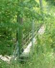
(footbridge)
Sperryville, Virginia, USA - Thornton River
| Bridgemeister ID: | 2394 (added 2007-12-02) |
| Name: | (footbridge) |
| Location: | Sperryville, Virginia, USA |
| Crossing: | Thornton River |
| Coordinates: | 38.653168 N 78.248300 W |
| Maps: | Acme, GeoHack, Google, OpenStreetMap |
| Use: | Footbridge |
| Status: | In use (last checked: 2019) |
| Main Cables: | Wire (steel) |
| Suspended Spans: | 1 |
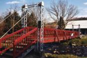
(footbridge)
Spivey Ford, Bellamy vicinity, Virginia, USA - Copper Creek
| Bridgemeister ID: | 1382 (added 2004-07-03) |
| Name: | (footbridge) |
| Location: | Spivey Ford, Bellamy vicinity, Virginia, USA |
| Crossing: | Copper Creek |
| Coordinates: | 36.65955 N 82.70329 W |
| Maps: | Acme, GeoHack, Google, OpenStreetMap |
| Principals: | VDOT |
| Use: | Footbridge |
| Status: | In use (last checked: 2004) |
| Main Cables: | Wire (steel) |
| Suspended Spans: | 3 |
| Main Span: | 1 x 30.5 meters (100 feet) estimated |
| Side Spans: | 1 x 10.1 meters (33 feet) estimated, 1 x 13.7 meters (45 feet) estimated |

(footbridge)
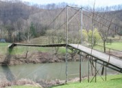
Sprigg vicinity, West Virginia and Pike County, Kentucky, USA - Tug Fork River
| Bridgemeister ID: | 2227 (added 2007-03-18) |
| Name: | (footbridge) |
| Location: | Sprigg vicinity, West Virginia and Pike County, Kentucky, USA |
| Crossing: | Tug Fork River |
| At or Near Feature: | Tug Valley Country Club |
| Coordinates: | 37.63102 N 82.18641 W |
| Maps: | Acme, GeoHack, Google, OpenStreetMap |
| Use: | Footbridge |
| Status: | In use (last checked: 2007) |
| Main Cables: | Wire (steel) |
| Suspended Spans: | 1 |
| Main Span: | 1 x 97.5 meters (320 feet) estimated |
Notes:
- Wide footbridge used by golf carts.
(footbridge)
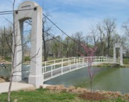
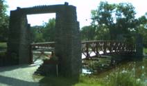
St. Charles, Illinois, USA - Fox River arm
| Bridgemeister ID: | 1841 (added 2005-07-10) |
| Name: | (footbridge) |
| Location: | St. Charles, Illinois, USA |
| Crossing: | Fox River arm |
| At or Near Feature: | Pottawatomie Golf Course |
| Coordinates: | 41.924122 N 88.318123 W |
| Maps: | Acme, GeoHack, Google, OpenStreetMap |
| Use: | Footbridge |
| Status: | In use (last checked: 2005) |
| Main Cables: | Wire |
| Suspended Spans: | 1 |
| Main Span: | 1 x 30 meters (98.4 feet) estimated |
| Deck width: | 2.1 meters |
| Bridgemeister ID: | 1901 (added 2005-10-07) |
| Name: | (footbridge) |
| Location: | St. Joseph, Missouri, USA |
| At or Near Feature: | Hyde Park |
| Coordinates: | 39.71055 N 94.852683 W |
| Maps: | Acme, GeoHack, Google, OpenStreetMap |
| Use: | Footbridge |
| Status: | In use (last checked: 2010) |
| Suspended Spans: | 1 |
| Main Span: | 1 x 17.1 meters (56 feet) |
Notes:
- Crosses a bicycle trail.
(footbridge)
Staffordsville vicinity, Kentucky, USA - Paint Creek
| Bridgemeister ID: | 2598 (added 2014-04-14) |
| Name: | (footbridge) |
| Location: | Staffordsville vicinity, Kentucky, USA |
| Crossing: | Paint Creek |
| Use: | Footbridge |
| Status: | In use (last checked: 2004) |
| Main Cables: | Wire |
| Suspended Spans: | 1 |
(footbridge)
Staffordsville vicinity, Kentucky, USA - Paint Creek
| Bridgemeister ID: | 2599 (added 2014-04-14) |
| Name: | (footbridge) |
| Location: | Staffordsville vicinity, Kentucky, USA |
| Crossing: | Paint Creek |
| Use: | Footbridge |
| Status: | In use (last checked: 2004) |
| Main Cables: | Wire |
| Suspended Spans: | 1 |
(footbridge)
Starnes Slant, Kerns vicinity, Virginia, USA - Clinch River
| Bridgemeister ID: | 1392 (added 2004-07-03) |
| Name: | (footbridge) |
| Location: | Starnes Slant, Kerns vicinity, Virginia, USA |
| Crossing: | Clinch River |
| Coordinates: | 36.73696 N 82.61993 W |
| Maps: | Acme, GeoHack, Google, OpenStreetMap |
| Principals: | VDOT |
| Use: | Footbridge |
| Status: | In use (last checked: 2004) |
| Main Cables: | Wire (steel) |
| Suspended Spans: | 3 |
| Main Span: | 1 x 79.2 meters (260 feet) estimated |
| Side Spans: | 1 x 18.9 meters (62 feet) estimated, 1 x 26.2 meters (86 feet) estimated |
(footbridge)
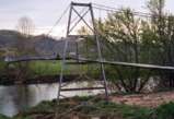
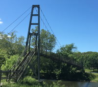
Strasburg vicinity, Virginia, USA - North Fork Shenandoah River
| Bridgemeister ID: | 1267 (added 2004-03-14) |
| Name: | (footbridge) |
| Location: | Strasburg vicinity, Virginia, USA |
| Crossing: | North Fork Shenandoah River |
| Coordinates: | 38.95416 N 78.37521 W |
| Maps: | Acme, GeoHack, Google, OpenStreetMap |
| Principals: | VDOT |
| Use: | Footbridge |
| Status: | In use (last checked: 2017) |
| Main Cables: | Wire (steel) |
| Suspended Spans: | 1 |
Notes:
- Adjacent to Deer Rapids Rd. low-water vehicular crossing.
(footbridge)
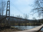
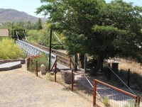
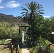
Superior, Arizona, USA - Queen Creek
| Bridgemeister ID: | 2611 (added 2014-04-15) |
| Name: | (footbridge) |
| Location: | Superior, Arizona, USA |
| Crossing: | Queen Creek |
| Coordinates: | 33.290709 N 111.105738 W |
| Maps: | Acme, GeoHack, Google, OpenStreetMap |
| Use: | Footbridge |
| Status: | In use (last checked: 2019) |
| Main Cables: | Wire (steel) |
| Suspended Spans: | 1 |
| Main Span: | 1 x 35.4 meters (116 feet) estimated |
(footbridge)
Superior, Arizona, USA - Queen Creek
| Bridgemeister ID: | 2920 (added 2019-09-15) |
| Name: | (footbridge) |
| Location: | Superior, Arizona, USA |
| Crossing: | Queen Creek |
| Coordinates: | 33.292711 N 111.098853 W |
| Maps: | Acme, GeoHack, Google, OpenStreetMap |
| Use: | Footbridge |
| Status: | In use (last checked: 2019) |
| Main Cables: | Wire (steel) |
(footbridge)
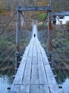
Talbert, Kentucky, USA - Middle Fork Kentucky River
| Bridgemeister ID: | 3785 (added 2020-02-29) |
| Name: | (footbridge) |
| Location: | Talbert, Kentucky, USA |
| Crossing: | Middle Fork Kentucky River |
| Coordinates: | 37.411760 N 83.475680 W |
| Maps: | Acme, GeoHack, Google, OpenStreetMap |
| Use: | Footbridge |
| Status: | In use (last checked: 2007) |
| Main Cables: | Wire (steel) |
| Suspended Spans: | 3 |
| Main Span: | 1 |
| Side Spans: | 2 |
(footbridge)
Talbert, Kentucky, USA - Middle Fork Kentucky River
| Bridgemeister ID: | 3786 (added 2020-02-29) |
| Name: | (footbridge) |
| Location: | Talbert, Kentucky, USA |
| Crossing: | Middle Fork Kentucky River |
| Coordinates: | 37.401790 N 83.468470 W |
| Maps: | Acme, GeoHack, Google, OpenStreetMap |
| Use: | Footbridge |
| Status: | In use (last checked: 2007) |
| Main Cables: | Wire |
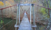
(footbridge)
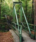
Tettegouche State Park, Minnesota, USA - Baptism River
| Bridgemeister ID: | 2135 (added 2006-10-28) |
| Name: | (footbridge) |
| Location: | Tettegouche State Park, Minnesota, USA |
| Crossing: | Baptism River |
| Coordinates: | 47.351708 N 91.210297 W |
| Maps: | Acme, GeoHack, Google, OpenStreetMap |
| Use: | Footbridge |
| Status: | In use (last checked: 2018) |
| Main Cables: | Wire (steel) |
Notes:
- Monocable.

(footbridge)
Toonerville, Kentucky, USA - Big Sandy River Levisa Fork
| Bridgemeister ID: | 2263 (added 2007-04-20) |
| Name: | (footbridge) |
| Location: | Toonerville, Kentucky, USA |
| Crossing: | Big Sandy River Levisa Fork |
| Coordinates: | 37.36810 N 82.23335 W |
| Maps: | Acme, GeoHack, Google, OpenStreetMap |
| Use: | Footbridge |
| Status: | Derelict (last checked: 2007) |
| Main Cables: | Wire |
| Suspended Spans: | 1 |
Notes:
- Patrick S. O'Donnell provided a rough main span estimate of 175 feet.
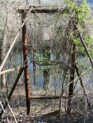
(footbridge)
Toonerville, Kentucky, USA - Big Sandy River Levisa Fork
| Bridgemeister ID: | 3816 (added 2020-03-01) |
| Name: | (footbridge) |
| Location: | Toonerville, Kentucky, USA |
| Crossing: | Big Sandy River Levisa Fork |
| Coordinates: | 37.369177 N 82.246554 W |
| Maps: | Acme, GeoHack, Google, OpenStreetMap |
| Use: | Footbridge |
| Status: | Derelict (last checked: 2007) |
| Main Cables: | Wire |
| Main Span: | 1 x 38.1 meters (125 feet) estimated |
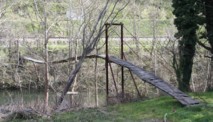
(footbridge)
Trenton, New Jersey, USA
| Bridgemeister ID: | 2305 (added 2007-04-29) |
| Name: | (footbridge) |
| Location: | Trenton, New Jersey, USA |
| Coordinates: | 40.20902 N 74.75405 W |
| Maps: | Acme, GeoHack, Google, OpenStreetMap |
| Principals: | John A. Roebling's Sons Co. |
| Use: | Footbridge |
| Status: | Extant (last checked: 2007) |
| Main Cables: | Wire (steel) |
| Suspended Spans: | 1 |
| Main Span: | 1 x 14.3 meters (47 feet) estimated |
Notes:
- This bridge connects two office buildings (former Roebling buildings).

(footbridge)
Troy vicinity, Gilmer County, West Virginia, USA - Fink Creek
| Bridgemeister ID: | 558 (added before 2003) |
| Name: | (footbridge) |
| Location: | Troy vicinity, Gilmer County, West Virginia, USA |
| Crossing: | Fink Creek |
| Coordinates: | 39.03230 N 80.74106 W |
| Maps: | Acme, GeoHack, Google, OpenStreetMap |
| Use: | Footbridge |
| Status: | In use (last checked: 2007) |
| Main Cables: | Wire |
| Suspended Spans: | 2 |
| Main Span: | 1 x 41.8 meters (137 feet) estimated |
| Side Span: | 1 |
Notes:
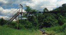
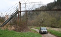
(footbridge)
Troy vicinity, Gilmer County, West Virginia, USA - Fink Creek
| Bridgemeister ID: | 2288 (added 2007-04-23) |
| Name: | (footbridge) |
| Location: | Troy vicinity, Gilmer County, West Virginia, USA |
| Crossing: | Fink Creek |
| Coordinates: | 39.03254 N 80.73385 W |
| Maps: | Acme, GeoHack, Google, OpenStreetMap |
| Use: | Footbridge |
| Status: | In use (last checked: 2007) |
| Main Cables: | Wire |
| Suspended Spans: | 4 |
| Main Spans: | 2 |
| Side Spans: | 2 |
Notes:
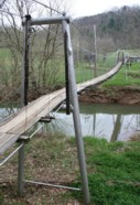
(footbridge)
Troy vicinity, Gilmer County, West Virginia, USA - Cove Creek
| Bridgemeister ID: | 2520 (added 2009-12-30) |
| Name: | (footbridge) |
| Location: | Troy vicinity, Gilmer County, West Virginia, USA |
| Crossing: | Cove Creek |
| Coordinates: | 39.03336 N 80.76961 W |
| Maps: | Acme, GeoHack, Google, OpenStreetMap |
| Use: | Footbridge |
| Status: | In use (last checked: 2008) |
| Main Cables: | Wire |
| Suspended Spans: | 1 |
Notes:
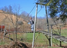
(footbridge)
Troy, Gilmer County, West Virginia, USA - Leading Creek
| Bridgemeister ID: | 2511 (added 2009-12-30) |
| Name: | (footbridge) |
| Location: | Troy, Gilmer County, West Virginia, USA |
| Crossing: | Leading Creek |
| Coordinates: | 39.01879 N 80.76152 W |
| Maps: | Acme, GeoHack, Google, OpenStreetMap |
| Use: | Footbridge |
| Status: | In use (last checked: 2008) |
| Main Cables: | Wire |
| Suspended Spans: | 1 |
Notes:
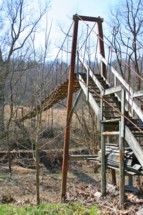
(footbridge)
Troy, Gilmer County, West Virginia, USA - Leading Creek
| Bridgemeister ID: | 2512 (added 2009-12-30) |
| Name: | (footbridge) |
| Location: | Troy, Gilmer County, West Virginia, USA |
| Crossing: | Leading Creek |
| Coordinates: | 39.01724 N 80.75551 W |
| Maps: | Acme, GeoHack, Google, OpenStreetMap |
| Use: | Footbridge |
| Status: | In use (last checked: 2008) |
| Main Cables: | Wire |
| Suspended Spans: | 1 |
Notes:
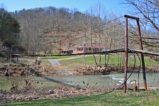
(footbridge)
Turkeypen Gap vicinity, South Carolina, USA - South Mills River
| Bridgemeister ID: | 2618 (added 2018-12-30) |
| Name: | (footbridge) |
| Location: | Turkeypen Gap vicinity, South Carolina, USA |
| Crossing: | South Mills River |
| At or Near Feature: | South Mills River Trail |
| Coordinates: | 35.343850 N 82.665317 W |
| Maps: | Acme, GeoHack, Google, OpenStreetMap |
| Use: | Footbridge |
| Status: | In use (last checked: 2018) |
| Main Cables: | Wire (steel) |
| Suspended Spans: | 1 |
(footbridge)
Twin Falls, Idaho, USA - Snake River
| Bridgemeister ID: | 7349 (added 2022-10-15) |
| Name: | (footbridge) |
| Location: | Twin Falls, Idaho, USA |
| Crossing: | Snake River |
| At or Near Feature: | Shoshone Falls |
| Coordinates: | 42.596689 N 114.400463 W |
| Maps: | Acme, GeoHack, Google, OpenStreetMap |
| Use: | Footbridge |
| Status: | In use (last checked: 2022) |
| Main Cables: | Wire (steel) |
| Suspended Spans: | 1 |
| Main Span: | 1 x 63 meters (206.7 feet) estimated |
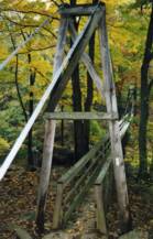
| Bridgemeister ID: | 786 (added 2003-03-22) |
| Name: | (footbridge) |
| Location: | Tyro vicinity, Virginia, USA |
| Crossing: | Tye River |
| At or Near Feature: | Appalachian Trail |
| Coordinates: | 37.83738 N 79.02061 W |
| Maps: | Acme, GeoHack, Google, OpenStreetMap |
| Use: | Footbridge |
| Status: | In use (last checked: 2007) |
| Main Cables: | Wire (steel) |
| Suspended Spans: | 1 |
| Main Span: | 1 x 75.6 meters (248 feet) |
Notes:
- Ken Frants notes the bridge was rebuilt in 1992.
- Similar to 1992 Kimberling Creek - Mechanicsburg vicinity, Virginia, USA.
(footbridge)
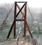
Vulcan, West Virginia and Pike County, Kentucky, USA - Tug Fork River
| Bridgemeister ID: | 2262 (added 2007-04-20) |
| Name: | (footbridge) |
| Location: | Vulcan, West Virginia and Pike County, Kentucky, USA |
| Crossing: | Tug Fork River |
| Coordinates: | 37.55934 N 82.11506 W |
| Maps: | Acme, GeoHack, Google, OpenStreetMap |
| Use: | Footbridge |
| Status: | Removed, c. 2010s |
| Main Cables: | Wire (steel) |
| Suspended Spans: | 1 |
| Main Span: | 1 x 61 meters (200 feet) estimated |
Notes:
- Was still standing in very derelict condition in 2009. Appears to have been completely removed in the 2010s.
- Similar to (footbridge) - Kewanee, Kentucky, USA.
- Near 1907 Vulcan - Vulcan, West Virginia and Pike County, Kentucky, USA. Although similar in appearance, these appear to have been different bridges.
(footbridge)
Wadsworth, Nevada, USA - Truckee River
| Bridgemeister ID: | 1124 (added 2004-01-11) |
| Name: | (footbridge) |
| Location: | Wadsworth, Nevada, USA |
| Crossing: | Truckee River |
| Coordinates: | 39.63488 N 119.28208 W |
| Maps: | Acme, GeoHack, Google, OpenStreetMap |
| Use: | Footbridge |
| Status: | In use (last checked: 2009) |
| Main Cables: | Wire (steel) |
Notes:
- Narrow footbridge with short timber towers. Appears to also carry a narrow pipeline across the deck.
(footbridge)
Wagoner County, Oklahoma, USA - Verdigris River
| Bridgemeister ID: | 2683 (added 2019-05-26) |
| Name: | (footbridge) |
| Location: | Wagoner County, Oklahoma, USA |
| Crossing: | Verdigris River |
| Coordinates: | 35.902837 N 95.473832 W |
| Maps: | Acme, GeoHack, Google, OpenStreetMap |
| Use: | Footbridge |
| Status: | Extant (last checked: 2015) |
| Main Cables: | Wire |
Notes:
- One of two nearby likely derelict suspension bridges across arms of the Verdigris. May be a third nearby suspension bridge across the arm of the Verdigris into which Strawberry Creek flows.
- Near (footbridge) - Wagoner County, Oklahoma, USA.
External Links:
(footbridge)
Wagoner County, Oklahoma, USA - Verdigris River
| Bridgemeister ID: | 2684 (added 2019-05-26) |
| Name: | (footbridge) |
| Location: | Wagoner County, Oklahoma, USA |
| Crossing: | Verdigris River |
| Coordinates: | 35.903865 N 95.477601 W |
| Maps: | Acme, GeoHack, Google, OpenStreetMap |
| Use: | Footbridge |
| Status: | Extant (last checked: 2015) |
| Main Cables: | Wire |
Notes:
- One of two nearby likely derelict suspension bridges across arms of the Verdigris. May be a third nearby suspension bridge across the arm of the Verdigris into which Strawberry Creek flows.
- Near (footbridge) - Wagoner County, Oklahoma, USA.
External Links:
(footbridge)
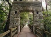
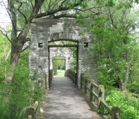
Wauwatosa, Wisconsin, USA - Menomonee River
| Bridgemeister ID: | 1067 (added 2003-12-27) |
| Name: | (footbridge) |
| Location: | Wauwatosa, Wisconsin, USA |
| Crossing: | Menomonee River |
| At or Near Feature: | Hoyt Park |
| Coordinates: | 43.05428 N 88.02231 W |
| Maps: | Acme, GeoHack, Google, OpenStreetMap |
| Use: | Footbridge |
| Status: | In use (last checked: 2012) |
| Main Cables: | Wire (steel) |
| Suspended Spans: | 1 |
| Main Span: | 1 x 25.3 meters (83 feet) estimated |
(footbridge)
Waxhaw, North Carolina, USA - Twelvemile Creek
| Bridgemeister ID: | 2983 (added 2019-10-12) |
| Name: | (footbridge) |
| Location: | Waxhaw, North Carolina, USA |
| Crossing: | Twelvemile Creek |
| Coordinates: | 34.935784 N 80.782029 W |
| Maps: | Acme, GeoHack, Google, OpenStreetMap |
| Use: | Footbridge |
| Status: | In use (last checked: 2019) |
| Main Cables: | Wire (steel) |
(footbridge)
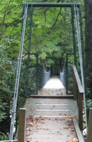
Webster Springs vicinity, West Virginia, USA - Back Fork Elk River
| Bridgemeister ID: | 1406 (added 2004-07-04) |
| Name: | (footbridge) |
| Location: | Webster Springs vicinity, West Virginia, USA |
| Crossing: | Back Fork Elk River |
| At or Near Feature: | Sycamore Park |
| Coordinates: | 38.5105 N 80.364433 W |
| Maps: | Acme, GeoHack, Google, OpenStreetMap |
| Use: | Footbridge |
| Status: | In use (last checked: 2004) |
| Main Cables: | Wire (steel) |
| Suspended Spans: | 1 |
(footbridge)
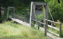
Webster Springs, West Virginia, USA - Back Fork River
| Bridgemeister ID: | 1484 (added 2004-09-07) |
| Name: | (footbridge) |
| Location: | Webster Springs, West Virginia, USA |
| Crossing: | Back Fork River |
| Coordinates: | 38.48053 N 80.40888 W |
| Maps: | Acme, GeoHack, Google, OpenStreetMap |
| Use: | Footbridge |
| Status: | In use (last checked: 2004) |
| Main Cables: | Wire (steel) |
| Suspended Spans: | 1 |
Notes:
(footbridge)
Webster Springs, West Virginia, USA - Back Fork River
| Bridgemeister ID: | 1485 (added 2004-09-07) |
| Name: | (footbridge) |
| Location: | Webster Springs, West Virginia, USA |
| Crossing: | Back Fork River |
| Coordinates: | 38.48041 N 80.39865 W |
| Maps: | Acme, GeoHack, Google, OpenStreetMap |
| Use: | Footbridge |
| Status: | In use (last checked: 2004) |
| Main Cables: | Wire (steel) |
| Suspended Spans: | 1 |
Notes:
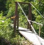
(footbridge)
Welch, West Virginia, USA - Tug Fork
| Bridgemeister ID: | 6682 (added 2021-09-12) |
| Name: | (footbridge) |
| Location: | Welch, West Virginia, USA |
| Crossing: | Tug Fork |
| Coordinates: | 37.414504 N 81.586626 W |
| Maps: | Acme, GeoHack, Google, OpenStreetMap |
| Use: | Footbridge |
| Status: | Extant (last checked: 2020) |
| Main Span: | 1 |
(footbridge)
Wesser vicinity, North Carolina, USA - Nantahala River
| Bridgemeister ID: | 792 (added 2003-03-22) |
| Name: | (footbridge) |
| Location: | Wesser vicinity, North Carolina, USA |
| Crossing: | Nantahala River |
| Coordinates: | 35.33163 N 83.60677 W |
| Maps: | Acme, GeoHack, Google, OpenStreetMap |
| Use: | Footbridge |
| Status: | In use |
| Main Cables: | Wire |
| Suspended Spans: | 1 |
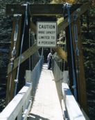
(footbridge)
West Union, West Virginia, USA - Middle Island Creek
| Bridgemeister ID: | 4939 (added 2020-08-08) |
| Name: | (footbridge) |
| Location: | West Union, West Virginia, USA |
| Crossing: | Middle Island Creek |
| Coordinates: | 39.297712 N 80.776627 W |
| Maps: | Acme, GeoHack, Google, OpenStreetMap |
| Use: | Footbridge |
| Status: | Removed |
| Main Cables: | Wire |
Notes:
- Coordinates are suspected location of this bridge along the alignment of the present day (2020) non-suspension footbridge in West Union.
External Links:
(footbridge)
Weston, West Virginia, USA - West Fork River
| Bridgemeister ID: | 3145 (added 2019-11-03) |
| Name: | (footbridge) |
| Location: | Weston, West Virginia, USA |
| Crossing: | West Fork River |
| Coordinates: | 39.026069 N 80.473931 W |
| Maps: | Acme, GeoHack, Google, OpenStreetMap |
| Use: | Footbridge |
| Status: | In use (last checked: 2015) |
| Main Cables: | Wire (steel) |
(footbridge)
Wests Mill vicinity, North Carolina, USA - Little Tennessee River
| Bridgemeister ID: | 810 (added 2003-05-29) |
| Name: | (footbridge) |
| Location: | Wests Mill vicinity, North Carolina, USA |
| Crossing: | Little Tennessee River |
| Coordinates: | 35.26383 N 83.41654 W |
| Maps: | Acme, GeoHack, Google, OpenStreetMap |
| Use: | Footbridge |
| Status: | In use |
| Main Cables: | Wire |
| Suspended Spans: | 1 |
| Main Span: | 1 x 48.8 meters (160 feet) estimated |

(footbridge)
Weybridge, Vermont, USA - Otter Creek
| Bridgemeister ID: | 5858 (added 2021-05-15) |
| Name: | (footbridge) |
| Location: | Weybridge, Vermont, USA |
| Crossing: | Otter Creek |
| At or Near Feature: | Belden Falls |
| Coordinates: | 44.051929 N 73.177332 W |
| Maps: | Acme, GeoHack, Google, OpenStreetMap |
| Use: | Footbridge |
| Status: | In use (last checked: 2021) |
| Main Cables: | Wire (steel) |
| Suspended Spans: | 1 |
Notes:
- Connects to (footbridge) - Weybridge, Vermont, USA.
(footbridge)
Weybridge, Vermont, USA - Otter Creek
| Bridgemeister ID: | 5859 (added 2021-05-15) |
| Name: | (footbridge) |
| Location: | Weybridge, Vermont, USA |
| Crossing: | Otter Creek |
| At or Near Feature: | Belden Falls |
| Coordinates: | 44.051998 N 73.177593 W |
| Maps: | Acme, GeoHack, Google, OpenStreetMap |
| Use: | Footbridge |
| Status: | In use (last checked: 2021) |
| Main Cables: | Wire (steel) |
Notes:
- Connects to (footbridge) - Weybridge, Vermont, USA.
(footbridge)
Whick, Breathitt County, Kentucky, USA - North Fork Kentucky River
| Bridgemeister ID: | 5656 (added 2021-01-01) |
| Name: | (footbridge) |
| Location: | Whick, Breathitt County, Kentucky, USA |
| Crossing: | North Fork Kentucky River |
| Coordinates: | 37.422370 N 83.374900 W |
| Maps: | Acme, GeoHack, Google, OpenStreetMap |
| Use: | Footbridge |
| Status: | In use (last checked: 2007) |
| Main Cables: | Wire (steel) |
| Suspended Spans: | 5 |
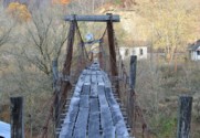
(footbridge)
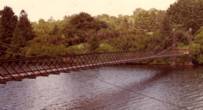
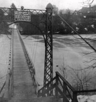
Whitneyville, Connecticut, USA - Lake Whitney
| Bridgemeister ID: | 305 (added before 2003) |
| Name: | (footbridge) |
| Location: | Whitneyville, Connecticut, USA |
| Crossing: | Lake Whitney |
| At or Near Feature: | New Haven Country Club |
| Use: | Footbridge |
| Status: | Removed |
| Main Cables: | Wire (steel) |
| Suspended Spans: | 1 |
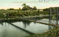
(footbridge)
Wichita Falls, Texas, USA - Wichita River
| Bridgemeister ID: | 1060 (added 2003-12-13) |
| Name: | (footbridge) |
| Location: | Wichita Falls, Texas, USA |
| Crossing: | Wichita River |
| At or Near Feature: | Lucy Park |
| Coordinates: | 33.917 N 98.51218 W |
| Maps: | Acme, GeoHack, Google, OpenStreetMap |
| Use: | Footbridge |
| Status: | In use (last checked: 2012) |
| Main Cables: | Wire |
(footbridge)
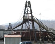
Williamson, West Virginia, USA - Williamson Rail Yard
| Bridgemeister ID: | 2277 (added 2007-04-22) |
| Name: | (footbridge) |
| Location: | Williamson, West Virginia, USA |
| Crossing: | Williamson Rail Yard |
| Coordinates: | 37.66431 N 82.26774 W |
| Maps: | Acme, GeoHack, Google, OpenStreetMap |
| Use: | Footbridge |
| Status: | Extant (last checked: 2007) |
| Main Cables: | Wire (steel) |
| Suspended Spans: | 1 |
Notes:
- This private bridge spans 16 sets of rail tracks at Williamson. Patrick S. O'Donnell provided a rough main span estimate of 175 feet.
(footbridge)
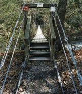
Williamsville vicinity, Virginia, USA - Bullpasture River
| Bridgemeister ID: | 796 (added 2003-03-28) |
| Name: | (footbridge) |
| Location: | Williamsville vicinity, Virginia, USA |
| Crossing: | Bullpasture River |
| At or Near Feature: | Highland Wildlife Management Area |
| Coordinates: | 38.21390 N 79.59108 W |
| Maps: | Acme, GeoHack, Google, OpenStreetMap |
| Use: | Footbridge |
| Status: | In use |
| Main Cables: | Wire |
| Suspended Spans: | 1 |
| Main Span: | 1 x 49.4 meters (162 feet) estimated |
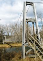
(footbridge)
Williamsville, Virginia, USA - Cowpasture River
| Bridgemeister ID: | 795 (added 2003-03-28) |
| Name: | (footbridge) |
| Location: | Williamsville, Virginia, USA |
| Crossing: | Cowpasture River |
| Coordinates: | 38.18913 N 79.56386 W |
| Maps: | Acme, GeoHack, Google, OpenStreetMap |
| Principals: | VDOT |
| Use: | Footbridge |
| Status: | In use |
| Main Cables: | Wire |
| Main Span: | 1 x 57.9 meters (190 feet) estimated |
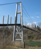
(footbridge)
Willow Grove, Virginia, USA - North Fork Shenandoah River
| Bridgemeister ID: | 1269 (added 2004-03-14) |
| Name: | (footbridge) |
| Location: | Willow Grove, Virginia, USA |
| Crossing: | North Fork Shenandoah River |
| Coordinates: | 38.84426 N 78.53328 W |
| Maps: | Acme, GeoHack, Google, OpenStreetMap |
| Principals: | VDOT |
| Use: | Footbridge |
| Status: | In use (last checked: 2018) |
| Main Cables: | Wire (steel) |
| Suspended Spans: | 2 |
| Main Span: | 1 |
| Side Span: | 1 |
Notes:
- Adjacent to Chapman Landing Rd. low-water vehicular crossing near area known as "Narrow Passage" where Narrow Passage Creek flows into the Shenandoah.
- The side span against the hillside is suspended.
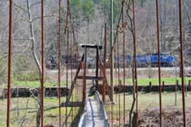
(footbridge)
Wilmore, McDowell County, West Virginia, USA - Tug Fork Big Sandy River
| Bridgemeister ID: | 2510 (added 2009-12-30) |
| Name: | (footbridge) |
| Location: | Wilmore, McDowell County, West Virginia, USA |
| Crossing: | Tug Fork Big Sandy River |
| Coordinates: | 37.45758 N 81.75380 W |
| Maps: | Acme, GeoHack, Google, OpenStreetMap |
| Use: | Footbridge |
| Status: | In use (last checked: 2015) |
| Main Cables: | Wire (steel) |
| Suspended Spans: | 2 |
| Main Span: | 1 x 48.8 meters (160 feet) |
| Side Span: | 1 x 6.7 meters (22 feet) |
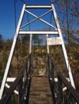
(footbridge)
Wilson Hill vicinity, Virginia, USA - Powell River
| Bridgemeister ID: | 1354 (added 2004-05-15) |
| Name: | (footbridge) |
| Location: | Wilson Hill vicinity, Virginia, USA |
| Crossing: | Powell River |
| Coordinates: | 36.61521 N 83.29997 W |
| Maps: | Acme, GeoHack, Google, OpenStreetMap |
| Principals: | VDOT |
| Use: | Footbridge |
| Status: | In use (last checked: 2004) |
| Main Cables: | Wire |
| Suspended Spans: | 2 |
| Main Span: | 1 x 61 meters (200 feet) estimated |
| Side Span: | 1 x 15.8 meters (52 feet) estimated |
(footbridge)
Wilson Hill vicinity, Virginia, USA - Powell River
| Bridgemeister ID: | 1364 (added 2004-07-02) |
| Name: | (footbridge) |
| Location: | Wilson Hill vicinity, Virginia, USA |
| Crossing: | Powell River |
| Coordinates: | 36.63608 N 83.22846 W |
| Maps: | Acme, GeoHack, Google, OpenStreetMap |
| Principals: | VDOT |
| Use: | Footbridge |
| Status: | In use (last checked: 2004) |
| Main Cables: | Wire (steel) |
| Suspended Spans: | 2 |
| Main Span: | 1 x 74.7 meters (245 feet) estimated |
| Side Span: | 1 x 15.2 meters (50 feet) estimated |
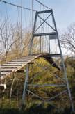
(footbridge)
Wilstacy, Kentucky, USA - South Fork Quicksand Creek
| Bridgemeister ID: | 3777 (added 2020-02-29) |
| Name: | (footbridge) |
| Location: | Wilstacy, Kentucky, USA |
| Crossing: | South Fork Quicksand Creek |
| Coordinates: | 37.518470 N 83.236130 W |
| Maps: | Acme, GeoHack, Google, OpenStreetMap |
| Use: | Footbridge |
| Status: | In use (last checked: 2007) |
| Main Cables: | Wire |
| Suspended Spans: | 3 |
| Main Span: | 1 |
| Side Spans: | 2 |
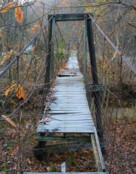
(footbridge)
Wilstacy, Kentucky, USA - Quicksand Creek
| Bridgemeister ID: | 3811 (added 2020-03-01) |
| Name: | (footbridge) |
| Location: | Wilstacy, Kentucky, USA |
| Crossing: | Quicksand Creek |
| Coordinates: | 37.558230 N 83.285530 W |
| Maps: | Acme, GeoHack, Google, OpenStreetMap |
| Use: | Footbridge |
| Status: | In use (last checked: 2007) |
| Main Cables: | Wire (steel) |
| Suspended Spans: | 3 |
| Main Span: | 1 x 27.4 meters (90 feet) estimated |
| Side Spans: | 2 |
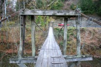
(footbridge)
Wing, North Carolina, USA - North Toe River
| Bridgemeister ID: | 856 (added 2003-08-07) |
| Name: | (footbridge) |
| Location: | Wing, North Carolina, USA |
| Crossing: | North Toe River |
| Coordinates: | 35.93782 N 82.14224 W |
| Maps: | Acme, GeoHack, Google, OpenStreetMap |
| Use: | Footbridge |
| Status: | Extant |
| Main Cables: | Wire |
| Suspended Spans: | 1 |
| Main Span: | 1 x 43.9 meters (144 feet) estimated |

(footbridge)
Winterset, Iowa, USA - North River
| Bridgemeister ID: | 2746 (added 2019-06-23) |
| Name: | (footbridge) |
| Location: | Winterset, Iowa, USA |
| Crossing: | North River |
| At or Near Feature: | Guye Woods County Park |
| Coordinates: | 41.416563 N 93.957499 W |
| Maps: | Acme, GeoHack, Google, OpenStreetMap |
| Use: | Footbridge |
| Status: | In use (last checked: 2015) |
| Main Cables: | Wire (steel) |
(footbridge)
Wolfhurst, Bridgeport, Ohio, USA - Wheeling Creek
| Bridgemeister ID: | 7095 (added 2022-05-29) |
| Name: | (footbridge) |
| Location: | Wolfhurst, Bridgeport, Ohio, USA |
| Crossing: | Wheeling Creek |
| Coordinates: | 40.067440 N 80.788920 W |
| Maps: | Acme, GeoHack, Google, OpenStreetMap |
| Use: | Footbridge |
| Status: | Extant (last checked: 2021) |
| Main Span: | 1 x 37.5 meters (123 feet) estimated |
(footbridge)
Wood vicinity, Virginia, USA - Clinch River
| Bridgemeister ID: | 1371 (added 2004-07-03) |
| Name: | (footbridge) |
| Location: | Wood vicinity, Virginia, USA |
| Crossing: | Clinch River |
| Coordinates: | 36.78314 N 82.56162 W |
| Maps: | Acme, GeoHack, Google, OpenStreetMap |
| Principals: | VDOT |
| Use: | Footbridge |
| Status: | In use (last checked: 2007) |
| Main Cables: | Wire (steel) |
| Suspended Spans: | 3 |
| Main Span: | 1 x 68.6 meters (225 feet) estimated |
| Side Spans: | 1 x 11.6 meters (38 feet) estimated, 1 x 14 meters (46 feet) estimated |
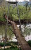
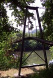
(footbridge)
Wood, Virginia, USA - Clinch River
| Bridgemeister ID: | 1362 (added 2004-07-02) |
| Name: | (footbridge) |
| Location: | Wood, Virginia, USA |
| Crossing: | Clinch River |
| Coordinates: | 36.79557 N 82.53400 W |
| Maps: | Acme, GeoHack, Google, OpenStreetMap |
| Principals: | VDOT |
| Use: | Footbridge |
| Status: | Closed (last checked: 2004) |
| Main Cables: | Wire (steel) |
| Suspended Spans: | 3 |
| Main Span: | 1 x 74.4 meters (244 feet) estimated |
| Side Spans: | 1 x 11.6 meters (38 feet) estimated, 1 x 15.8 meters (52 feet) estimated |
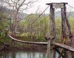
(footbridge)
Woodstock, Virginia, USA - North Fork Shenandoah River
| Bridgemeister ID: | 1268 (added 2004-03-14) |
| Name: | (footbridge) |
| Location: | Woodstock, Virginia, USA |
| Crossing: | North Fork Shenandoah River |
| Coordinates: | 38.860289 N 78.501842 W |
| Maps: | Acme, GeoHack, Google, OpenStreetMap |
| Principals: | VDOT |
| Use: | Footbridge |
| Status: | Demolished, 2010 |
| Main Cables: | Wire (steel) |
| Suspended Spans: | 1 |
Notes:
- Adjacent to S. Hollingsworth Rd. low-water vehicular crossing.
- Demolished in late 2010 after a large crack was found in one of the concrete tower piers.
- Replaced by 2011 (footbridge) - Woodstock, Virginia, USA.
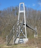
(footbridge)
Woodstock, Virginia, USA - North Fork Shenandoah River
| Bridgemeister ID: | 1270 (added 2004-03-14) |
| Name: | (footbridge) |
| Location: | Woodstock, Virginia, USA |
| Crossing: | North Fork Shenandoah River |
| Coordinates: | 38.87105 N 78.49601 W |
| Maps: | Acme, GeoHack, Google, OpenStreetMap |
| Principals: | VDOT |
| Use: | Footbridge |
| Status: | In use |
| Main Cables: | Wire (steel) |
Notes:
- Adjacent to Lupton Rd. low-water vehicular crossing.
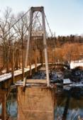
(footbridge)
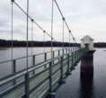
Worrell, Pennsylvania, USA - Springton Lake
| Bridgemeister ID: | 847 (added 2003-06-28) |
| Name: | (footbridge) |
| Location: | Worrell, Pennsylvania, USA |
| Crossing: | Springton Lake |
| Coordinates: | 39.95421 N 75.39321 W |
| Maps: | Acme, GeoHack, Google, OpenStreetMap |
| Use: | Footbridge |
| Status: | In use |
| Suspended Spans: | 1 |
| Main Span: | 1 x 45.7 meters (150 feet) estimated |
Notes:
- Connects the roadway to an intake tower in the Springton reservoir.
(footbridge)
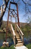
Zenobia vicinity, Virginia, USA - North Fork Holston River
| Bridgemeister ID: | 1343 (added 2004-05-08) |
| Name: | (footbridge) |
| Location: | Zenobia vicinity, Virginia, USA |
| Crossing: | North Fork Holston River |
| Coordinates: | 36.73956 N 82.20114 W |
| Maps: | Acme, GeoHack, Google, OpenStreetMap |
| Principals: | VDOT |
| Use: | Footbridge |
| Status: | In use (last checked: 2004) |
| Main Cables: | Wire (steel) |
| Suspended Spans: | 1 |
| Main Span: | 1 x 49.4 meters (162 feet) estimated |
(footbridge)
Zumwalt Meadow, Cedar Grove, California, USA - Kings River
| Bridgemeister ID: | 6525 (added 2021-08-28) |
| Name: | (footbridge) |
| Location: | Zumwalt Meadow, Cedar Grove, California, USA |
| Crossing: | Kings River |
| At or Near Feature: | Sequoia & Kings Canyon National Parks |
| Coordinates: | 36.791148 N 118.600442 W |
| Maps: | Acme, GeoHack, Google, OpenStreetMap |
| Use: | Footbridge |
| Status: | In use (last checked: 2021) |
| Main Cables: | Wire (steel) |
| Main Span: | 1 |
(pipeline bridge)
Alsip, Illinois, USA - Calumet Sag Channel
| Bridgemeister ID: | 3246 (added 2019-11-16) |
| Name: | (pipeline bridge) |
| Location: | Alsip, Illinois, USA |
| Crossing: | Calumet Sag Channel |
| Coordinates: | 41.651809 N 87.699943 W |
| Maps: | Acme, GeoHack, Google, OpenStreetMap |
| Use: | Pipeline |
| Status: | Extant (last checked: 2019) |
| Main Cables: | Wire (steel) |
Notes:
- Next to (pipeline bridge) - Alsip, Illinois, USA.
- Next to (pipeline bridge) - Alsip, Illinois, USA.
- Next to (pipeline bridge) - Alsip, Illinois, USA.
External Links:
(pipeline bridge)
Alsip, Illinois, USA - Calumet Sag Channel
| Bridgemeister ID: | 3247 (added 2019-11-16) |
| Name: | (pipeline bridge) |
| Location: | Alsip, Illinois, USA |
| Crossing: | Calumet Sag Channel |
| Coordinates: | 41.651663 N 87.703783 W |
| Maps: | Acme, GeoHack, Google, OpenStreetMap |
| Use: | Pipeline |
| Status: | Extant (last checked: 2019) |
| Main Cables: | Wire (steel) |
Notes:
- Next to (pipeline bridge) - Alsip, Illinois, USA.
- Next to (pipeline bridge) - Alsip, Illinois, USA.
- Next to (pipeline bridge) - Alsip, Illinois, USA.
External Links:
(pipeline bridge)
Alsip, Illinois, USA - Calumet Sag Channel
| Bridgemeister ID: | 3248 (added 2019-11-16) |
| Name: | (pipeline bridge) |
| Location: | Alsip, Illinois, USA |
| Crossing: | Calumet Sag Channel |
| Coordinates: | 41.651633 N 87.706524 W |
| Maps: | Acme, GeoHack, Google, OpenStreetMap |
| Use: | Pipeline |
| Status: | Extant (last checked: 2019) |
| Main Cables: | Wire (steel) |
Notes:
- Next to (pipeline bridge) - Alsip, Illinois, USA.
- Next to (pipeline bridge) - Alsip, Illinois, USA.
- Next to (pipeline bridge) - Alsip, Illinois, USA.
External Links:
(pipeline bridge)
Alsip, Illinois, USA - Calumet Sag Channel
| Bridgemeister ID: | 3249 (added 2019-11-16) |
| Name: | (pipeline bridge) |
| Location: | Alsip, Illinois, USA |
| Crossing: | Calumet Sag Channel |
| Coordinates: | 41.651614 N 87.713846 W |
| Maps: | Acme, GeoHack, Google, OpenStreetMap |
| Use: | Pipeline |
| Status: | Extant (last checked: 2019) |
| Main Cables: | Wire (steel) |
Notes:
- Next to (pipeline bridge) - Alsip, Illinois, USA.
- Next to (pipeline bridge) - Alsip, Illinois, USA.
- Next to (pipeline bridge) - Alsip, Illinois, USA.
External Links:
(pipeline bridge)
Antioch vicinity, Texas, USA - Trinity River
| Bridgemeister ID: | 3327 (added 2019-12-01) |
| Name: | (pipeline bridge) |
| Location: | Antioch vicinity, Texas, USA |
| Crossing: | Trinity River |
| Coordinates: | 31.061728 N 95.651119 W |
| Maps: | Acme, GeoHack, Google, OpenStreetMap |
| Use: | Pipeline |
| Status: | Extant (last checked: 2019) |
| Main Cables: | Wire (steel) |
Notes:
- 2019: Appears to be flood damaged.
(pipeline bridge)
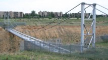
Aurora, Colorado, USA - Cherry Creek Reservoir spillway
| Bridgemeister ID: | 1588 (added 2005-01-24) |
| Name: | (pipeline bridge) |
| Location: | Aurora, Colorado, USA |
| Crossing: | Cherry Creek Reservoir spillway |
| Coordinates: | 39.65919 N 104.82509 W |
| Maps: | Acme, GeoHack, Google, OpenStreetMap |
| Use: | Pipeline |
| Status: | Extant (last checked: 2006) |
| Main Cables: | Wire (steel) |
| Suspended Spans: | 1 |
Notes:
- Carrys a 66-inch water pipeline. Patrick O'Donnell estimates the length of the suspended portion of the span at 250 feet.
(pipeline bridge)
Benson, Arizona, USA - San Pedro River
| Bridgemeister ID: | 2328 (added 2007-06-11) |
| Name: | (pipeline bridge) |
| Location: | Benson, Arizona, USA |
| Crossing: | San Pedro River |
| Coordinates: | 31.975290 N 110.278883 W |
| Maps: | Acme, GeoHack, Google, OpenStreetMap |
| Use: | Pipeline |
| Status: | Extant (last checked: 2019) |
| Main Cables: | Wire (steel) |
Notes:
- Likely several pipeline suspension bridges across the San Pedro near Benson.
- Next to (pipeline bridge) - Benson, Arizona, USA.
- Near (pipeline bridge) - Benson, Arizona, USA.
(pipeline bridge)
Benson, Arizona, USA - San Pedro River
| Bridgemeister ID: | 3303 (added 2019-11-28) |
| Name: | (pipeline bridge) |
| Location: | Benson, Arizona, USA |
| Crossing: | San Pedro River |
| Coordinates: | 31.980649 N 110.281095 W |
| Maps: | Acme, GeoHack, Google, OpenStreetMap |
| Use: | Pipeline |
| Status: | Extant (last checked: 2019) |
| Main Cables: | Wire (steel) |
Notes:
(pipeline bridge)
Benson, Arizona, USA - San Pedro River
| Bridgemeister ID: | 3304 (added 2019-11-28) |
| Name: | (pipeline bridge) |
| Location: | Benson, Arizona, USA |
| Crossing: | San Pedro River |
| Coordinates: | 31.974698 N 110.278894 W |
| Maps: | Acme, GeoHack, Google, OpenStreetMap |
| Use: | Pipeline |
| Status: | Extant (last checked: 2019) |
| Main Cables: | Wire (steel) |
Notes:
(pipeline bridge)
Blythe, California and Ehrenberg, Arizona, USA - Colorado River
| Bridgemeister ID: | 2522 (added 2010-01-02) |
| Name: | (pipeline bridge) |
| Location: | Blythe, California and Ehrenberg, Arizona, USA |
| Crossing: | Colorado River |
| Coordinates: | 33.60182 N 114.53324 W |
| Maps: | Acme, GeoHack, Google, OpenStreetMap |
| Use: | Pipeline |
| Status: | Extant (last checked: 2010) |
| Main Cables: | Wire (steel) |
| Suspended Spans: | 1 |
(pipeline bridge)
Bradford, Pennsylvania, USA
| Bridgemeister ID: | 4827 (added 2020-07-05) |
| Name: | (pipeline bridge) |
| Location: | Bradford, Pennsylvania, USA |
| Coordinates: | 41.967963 N 78.625340 W |
| Maps: | Acme, GeoHack, Google, OpenStreetMap |
| Use: | Pipeline |
| Status: | Extant (last checked: 2020) |
| Main Cables: | Wire (steel) |
| Suspended Spans: | 1 |
(pipeline bridge)
Bradford, Pennsylvania, USA - Tunungwant Creek
| Bridgemeister ID: | 4828 (added 2020-07-05) |
| Name: | (pipeline bridge) |
| Location: | Bradford, Pennsylvania, USA |
| Crossing: | Tunungwant Creek |
| Coordinates: | 41.967349 N 78.629287 W |
| Maps: | Acme, GeoHack, Google, OpenStreetMap |
| Use: | Pipeline |
| Status: | Extant (last checked: 2020) |
| Main Cables: | Wire (steel) |
| Suspended Spans: | 1 |
(pipeline bridge)
Burbank, California, USA - Los Angeles River
| Bridgemeister ID: | 2523 (added 2010-01-02) |
| Name: | (pipeline bridge) |
| Location: | Burbank, California, USA |
| Crossing: | Los Angeles River |
| Coordinates: | 34.15051 N 118.32908 W |
| Maps: | Acme, GeoHack, Google, OpenStreetMap |
| Use: | Pipeline |
| Status: | Extant (last checked: 2009) |
| Main Cables: | Wire |
| Suspended Spans: | 1 |
(pipeline bridge)
Burgess Falls, Sparta vicinity, Tennessee, USA - Falling Water River
| Bridgemeister ID: | 2346 (added 2007-08-12) |
| Name: | (pipeline bridge) |
| Location: | Burgess Falls, Sparta vicinity, Tennessee, USA |
| Crossing: | Falling Water River |
| At or Near Feature: | Burgess Falls State Park |
| Use: | Pipeline |
| Status: | Derelict (last checked: 2007) |
| Main Cables: | Wire |
Notes:
- Likely constructed in 1920s as part of the dam and powerhouse project at Burgess Falls. There may have been two of these bridges at this location. The current map for Burgess Falls State Park shows two historical "pipeline bridges." I have only seen images of one derelict suspension bridge.
(pipeline bridge)
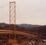
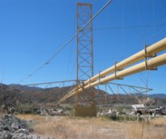
Canyon Country, California, USA - Soledad Canyon
| Bridgemeister ID: | 1259 (added 2004-03-06) |
| Name: | (pipeline bridge) |
| Location: | Canyon Country, California, USA |
| Crossing: | Soledad Canyon |
| Coordinates: | 34.43219 N 118.39074 W |
| Maps: | Acme, GeoHack, Google, OpenStreetMap |
| Use: | Pipeline |
| Status: | In use (last checked: 2007) |
| Main Cables: | Wire (steel) |
| Suspended Spans: | 2 |
| Main Span: | 1 x 187.5 meters (615 feet) estimated |
| Side Span: | 1 |
(pipeline bridge)
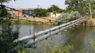
Casper, Wyoming, USA - North Platte River
| Bridgemeister ID: | 2107 (added 2006-09-03) |
| Name: | (pipeline bridge) |
| Location: | Casper, Wyoming, USA |
| Crossing: | North Platte River |
| Coordinates: | 42.859117 N 106.327517 W |
| Maps: | Acme, GeoHack, Google, OpenStreetMap |
| Use: | Pipeline |
| Status: | Extant (last checked: 2006) |
| Main Cables: | Wire (steel) |
| Suspended Spans: | 1 |
| Main Span: | 1 x 61 meters (200 feet) estimated |
(pipeline bridge)
Castaic vicinity, California, USA - Castaic Creek
| Bridgemeister ID: | 2329 (added 2007-07-04) |
| Name: | (pipeline bridge) |
| Location: | Castaic vicinity, California, USA |
| Crossing: | Castaic Creek |
| Coordinates: | 34.47552 N 118.61212 W |
| Maps: | Acme, GeoHack, Google, OpenStreetMap |
| Use: | Pipeline |
| Status: | Extant (last checked: 2007) |
| Main Cables: | Wire (steel) |
| Suspended Spans: | 2 |
| Side Spans: | 2 |
(pipeline bridge)
Charleston, Tennessee, USA - Hiwassee River
| Bridgemeister ID: | 2036 (added 2006-05-01) |
| Name: | (pipeline bridge) |
| Location: | Charleston, Tennessee, USA |
| Crossing: | Hiwassee River |
| Principals: | John A. Roebling's Sons Co., Pittsburgh Bridge & Iron Co. |
| Use: | Pipeline |
| Main Cables: | Wire (steel) |
Notes:
- Built to connect Blaw-Knox chemical plan to nearby Bowaters Southern Paper Corp. Described in Roebling ad in March 1963 issue of Civil Engineering.
(pipeline bridge)
Chula Vista vicinity, California, USA - Otay River
| Bridgemeister ID: | 1573 (added 2004-12-11) |
| Name: | (pipeline bridge) |
| Location: | Chula Vista vicinity, California, USA |
| Crossing: | Otay River |
| Coordinates: | 32.6003 N 116.92888 W |
| Maps: | Acme, GeoHack, Google, OpenStreetMap |
| Use: | Pipeline |
| Status: | In use (last checked: 2004) |
| Main Cables: | Wire (steel) |
| Suspended Spans: | 1 |
(pipeline bridge)
Council Bluffs, Iowa, USA - Mosquito Creek
| Bridgemeister ID: | 2268 (added 2007-04-21) |
| Name: | (pipeline bridge) |
| Location: | Council Bluffs, Iowa, USA |
| Crossing: | Mosquito Creek |
| Coordinates: | 41.20985 N 95.82730 W |
| Maps: | Acme, GeoHack, Google, OpenStreetMap |
| Use: | Pipeline |
| Status: | Extant (last checked: 2010) |
| Main Cables: | Wire (steel) |
Notes:
- Patrick S. O'Donnell estimated the main span of this bridge at roughly 550 feet.
(pipeline bridge)
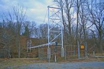
Covington, Virginia, USA - Potts Creek
| Bridgemeister ID: | 1413 (added 2004-07-04) |
| Name: | (pipeline bridge) |
| Location: | Covington, Virginia, USA |
| Crossing: | Potts Creek |
| Coordinates: | 37.75240 N 79.99713 W |
| Maps: | Acme, GeoHack, Google, OpenStreetMap |
| Use: | Pipeline |
| Status: | In use (last checked: 2008) |
| Main Cables: | Wire (steel) |
| Suspended Spans: | 1 |
| Main Span: | 1 x 61 meters (200 feet) estimated |
Notes:
- Just barely visible to the north as your cross over Potts Creek on VA18 heading into Covington.
(pipeline bridge)
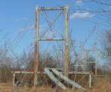
Curtis vicinity, Arkansas, USA - South Boat Ditch
| Bridgemeister ID: | 2432 (added 2008-04-22) |
| Name: | (pipeline bridge) |
| Location: | Curtis vicinity, Arkansas, USA |
| Crossing: | South Boat Ditch |
| Use: | Pipeline |
| Status: | Extant (last checked: 2008) |
| Main Cables: | Wire (steel) |
| Suspended Spans: | 1 |
(pipeline bridge)
Dayton Lakes vicinity, Texas, USA - Trinity River
| Bridgemeister ID: | 3326 (added 2019-12-01) |
| Name: | (pipeline bridge) |
| Location: | Dayton Lakes vicinity, Texas, USA |
| Crossing: | Trinity River |
| Coordinates: | 30.213426 N 94.825076 W |
| Maps: | Acme, GeoHack, Google, OpenStreetMap |
| Use: | Pipeline |
| Status: | Extant (last checked: 2019) |
| Main Cables: | Wire (steel) |
(pipeline bridge)
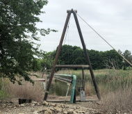
Dearborn, Michigan, USA - Rouge River
| Bridgemeister ID: | 7125 (added 2022-06-17) |
| Name: | (pipeline bridge) |
| Location: | Dearborn, Michigan, USA |
| Crossing: | Rouge River |
| Coordinates: | 42.290501 N 83.166260 W |
| Maps: | Acme, GeoHack, Google, OpenStreetMap |
| Use: | Pipeline |
| Status: | Extant (last checked: 2022) |
| Main Cables: | Wire (steel) |
| Main Span: | 1 x 76 meters (249.3 feet) estimated |
(pipeline bridge)
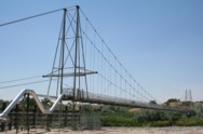
Durkee, Worland vicinity, Wyoming, USA - Big Horn River
| Bridgemeister ID: | 2108 (added 2006-09-03) |
| Name: | (pipeline bridge) |
| Location: | Durkee, Worland vicinity, Wyoming, USA |
| Crossing: | Big Horn River |
| Coordinates: | 44.125767 N 107.927817 W |
| Maps: | Acme, GeoHack, Google, OpenStreetMap |
| Use: | Pipeline |
| Status: | Extant (last checked: 2006) |
| Main Cables: | Wire (steel) |
| Suspended Spans: | 1 |
Notes:
(pipeline bridge)
Durkee, Worland vicinity, Wyoming, USA - Big Horn River
| Bridgemeister ID: | 2601 (added 2014-04-14) |
| Name: | (pipeline bridge) |
| Location: | Durkee, Worland vicinity, Wyoming, USA |
| Crossing: | Big Horn River |
| Coordinates: | 44.126801 N 107.928528 W |
| Maps: | Acme, GeoHack, Google, OpenStreetMap |
| Use: | Pipeline |
| Status: | Removed |
| Main Cables: | Wire |
| Main Span: | 1 |
Notes:
- Appears to have been removed at some point after 2007.
- Near (pipeline bridge) - Durkee, Worland vicinity, Wyoming, USA.
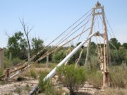
(pipeline bridge)
Eagle Creek Township and Keener Township, Indiana, USA - Kankakee River
| Bridgemeister ID: | 8412 (added 2024-03-03) |
| Name: | (pipeline bridge) |
| Location: | Eagle Creek Township and Keener Township, Indiana, USA |
| Crossing: | Kankakee River |
| Coordinates: | 41.220361 N 87.270806 W |
| Maps: | Acme, GeoHack, Google, OpenStreetMap |
| Use: | Pipeline |
| Status: | Extant (last checked: 2023) |
| Main Spans: | 1 x 72 meters (236.2 feet) estimated, 1 x 25 meters (82 feet) estimated |
Notes:
- One of six short suspended pipelines along a five mile stretch of, what appears to be, the same pipeline. This one, crossing the Kankakee River is the longest of the group by far.
- Connects to (pipeline bridge) - Eagle Creek Township, Indiana, USA.
- Connects to (pipeline bridge) - Eagle Creek Township, Indiana, USA.
- Connects to (pipeline bridge) - Eagle Creek Township, Indiana, USA.
- Connects to (pipeline bridge) - Keener Township, Indiana, USA.
- Connects to (pipeline bridge) - Keener Township, Indiana, USA.
(pipeline bridge)
Eagle Creek Township, Indiana, USA - Singleton Ditch
| Bridgemeister ID: | 8409 (added 2024-03-03) |
| Name: | (pipeline bridge) |
| Location: | Eagle Creek Township, Indiana, USA |
| Crossing: | Singleton Ditch |
| Coordinates: | 41.260667 N 87.300861 W |
| Maps: | Acme, GeoHack, Google, OpenStreetMap |
| Use: | Pipeline |
| Status: | Extant (last checked: 2023) |
| Suspended Spans: | 1 |
| Main Span: | 1 x 20 meters (65.6 feet) estimated |
Notes:
- One of six short suspended pipelines along a five mile stretch of, what appears to be, the same pipeline.
- Connects to (pipeline bridge) - Eagle Creek Township and Keener Township, Indiana, USA.
- Connects to (pipeline bridge) - Eagle Creek Township, Indiana, USA.
- Connects to (pipeline bridge) - Eagle Creek Township, Indiana, USA.
- Connects to (pipeline bridge) - Keener Township, Indiana, USA.
- Connects to (pipeline bridge) - Keener Township, Indiana, USA.
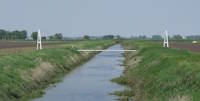
(pipeline bridge)
Eagle Creek Township, Indiana, USA - Little Ditch
| Bridgemeister ID: | 8410 (added 2024-03-03) |
| Name: | (pipeline bridge) |
| Location: | Eagle Creek Township, Indiana, USA |
| Crossing: | Little Ditch |
| Coordinates: | 41.257639 N 87.298583 W |
| Maps: | Acme, GeoHack, Google, OpenStreetMap |
| Use: | Pipeline |
| Status: | Extant (last checked: 2023) |
| Suspended Spans: | 1 |
| Main Span: | 1 x 21 meters (68.9 feet) estimated |
Notes:
- One of six short suspended pipelines along a five mile stretch of, what appears to be, the same pipeline.
- Connects to (pipeline bridge) - Eagle Creek Township and Keener Township, Indiana, USA.
- Connects to (pipeline bridge) - Eagle Creek Township, Indiana, USA.
- Connects to (pipeline bridge) - Eagle Creek Township, Indiana, USA.
- Connects to (pipeline bridge) - Keener Township, Indiana, USA.
- Connects to (pipeline bridge) - Keener Township, Indiana, USA.

(pipeline bridge)
Eagle Creek Township, Indiana, USA - Brown Ditch
| Bridgemeister ID: | 8411 (added 2024-03-03) |
| Name: | (pipeline bridge) |
| Location: | Eagle Creek Township, Indiana, USA |
| Crossing: | Brown Ditch |
| Coordinates: | 41.239583 N 87.285444 W |
| Maps: | Acme, GeoHack, Google, OpenStreetMap |
| Use: | Pipeline |
| Status: | Extant (last checked: 2023) |
| Suspended Spans: | 1 |
| Main Span: | 1 x 16 meters (52.5 feet) estimated |
Notes:
- One of six short suspended pipelines along a five mile stretch of, what appears to be, the same pipeline.
- Connects to (pipeline bridge) - Eagle Creek Township and Keener Township, Indiana, USA.
- Connects to (pipeline bridge) - Eagle Creek Township, Indiana, USA.
- Connects to (pipeline bridge) - Eagle Creek Township, Indiana, USA.
- Connects to (pipeline bridge) - Keener Township, Indiana, USA.
- Connects to (pipeline bridge) - Keener Township, Indiana, USA.
(pipeline bridge)
Eccles, Worland vicinity, Wyoming, USA - Big Horn River
| Bridgemeister ID: | 2109 (added 2006-09-03) |
| Name: | (pipeline bridge) |
| Location: | Eccles, Worland vicinity, Wyoming, USA |
| Crossing: | Big Horn River |
| Coordinates: | 44.15685 N 107.928117 W |
| Maps: | Acme, GeoHack, Google, OpenStreetMap |
| Use: | Pipeline |
| Status: | Extant (last checked: 2006) |
| Main Cables: | Wire (steel) |
| Suspended Spans: | 1 |
Notes:
- Patrick S. O'Donnell estimates the main span at 400 feet based on aerial imagery.
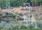
(pipeline bridge)
Elk, California, USA - Greenwood Creek
| Bridgemeister ID: | 5685 (added 2021-03-26) |
| Name: | (pipeline bridge) |
| Location: | Elk, California, USA |
| Crossing: | Greenwood Creek |
| Coordinates: | 39.126247 N 123.714382 W |
| Maps: | Acme, GeoHack, Google, OpenStreetMap |
| Principals: | Elk County Water District |
| Use: | Pipeline |
| Status: | In use (last checked: 2021) |
| Main Cables: | Wire (steel) |
(pipeline bridge)
Eugene vicinity, Oregon, USA - McKenzie River
| Bridgemeister ID: | 2148 (added 2006-11-18) |
| Name: | (pipeline bridge) |
| Location: | Eugene vicinity, Oregon, USA |
| Crossing: | McKenzie River |
| At or Near Feature: | Armitage State Park vicinity |
| Coordinates: | 44.11456 N 123.05380 W |
| Maps: | Acme, GeoHack, Google, OpenStreetMap |
| Use: | Pipeline |
| Status: | Extant (last checked: 2006) |
| Main Cables: | Wire |
Notes:
Do you have any information or photos for these bridges that you would like to share? Please email david.denenberg@bridgemeister.com.
