Suspension Bridges of Wyoming
This is a list of all 12 bridges from the suspension bridge inventory for Wyoming in USA. Wherever you see a Bridgemeister ID number click it to isolate the bridge on its own page.
Related Lists:
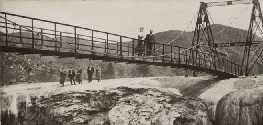
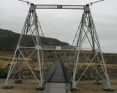
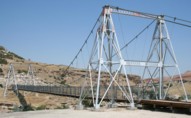
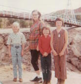
1916: Swinging
Thermopolis, Wyoming, USA - Big Horn River
| Bridgemeister ID: | 301 (added before 2003) |
| Year Completed: | 1916 |
| Name: | Swinging |
| Location: | Thermopolis, Wyoming, USA |
| Crossing: | Big Horn River |
| At or Near Feature: | Hot Springs State Park |
| Coordinates: | 43.654733 N 108.196167 W |
| Maps: | Acme, GeoHack, Google, OpenStreetMap |
| Use: | Footbridge |
| Status: | In use (last checked: 2024) |
| Main Cables: | Wire (steel) |
| Suspended Spans: | 2 |
| Main Span: | 1 x 58.8 meters (193 feet) estimated |
| Side Span: | 1 x 10.7 meters (35 feet) estimated |
Notes:
- According to sign at the bridge: condemned 1984, removed 1991, restored 1992.
External Links:
Image Sets:
1922: Dodge
Sweetwater County, Wyoming, USA - Green River
| Bridgemeister ID: | 5557 (added 2020-12-18) |
| Year Completed: | 1922 |
| Name: | Dodge |
| Location: | Sweetwater County, Wyoming, USA |
| Crossing: | Green River |
| Principals: | Harold H. Dodge |
| Use: | Stock |
| Status: | Removed |
| Main Cables: | Wire (steel) |
| Main Span: | 1 |
Notes:
- This bridge was located northwest of the present-day Seedskadee National Wildlife Refuge before Fontenelle. Appears to have been primarily a "sheep" bridge.
1962: (pipeline bridge)
Flaming Gorge National Recreation Area, Wyoming, USA - Green River
| Bridgemeister ID: | 1309 (added 2004-04-10) |
| Year Completed: | 1962 |
| Name: | (pipeline bridge) |
| Location: | Flaming Gorge National Recreation Area, Wyoming, USA |
| Crossing: | Green River |
| At or Near Feature: | Flaming Gorge Reservoir |
| Coordinates: | 41.03215 N 109.55519 W |
| Maps: | Acme, GeoHack, Google, OpenStreetMap |
| Use: | Pipeline |
| Status: | In use (last checked: 2019) |
| Main Cables: | Wire (steel) |
| Suspended Spans: | 1 |
| Main Span: | 1 x 584.9 meters (1,919 feet) |
Notes:
- Located two miles north of the Utah-Wyoming border.
External Links:
Image Sets:
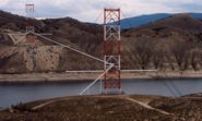
1988: (pipeline bridge)
Cody, Wyoming, USA - Sulphur Creek
| Bridgemeister ID: | 3325 (added 2019-12-01) |
| Year Completed: | 1988 |
| Name: | (pipeline bridge) |
| Location: | Cody, Wyoming, USA |
| Crossing: | Sulphur Creek |
| Coordinates: | 44.523354 N 109.084426 W |
| Maps: | Acme, GeoHack, Google, OpenStreetMap |
| Principals: | Clear Span Engineering |
| Use: | Pipeline |
| Status: | Extant (last checked: 2019) |
| Main Cables: | Wire (steel) |
| Main Span: | 1 x 137.2 meters (450 feet) |
Notes:
- Carries a 16-inch sewer line.
(footbridge)
Pahaska vicinity, Wyoming, USA - North Fork Shoshone River
| Bridgemeister ID: | 2110 (added 2006-09-03) |
| Name: | (footbridge) |
| Location: | Pahaska vicinity, Wyoming, USA |
| Crossing: | North Fork Shoshone River |
| At or Near Feature: | Sleeping Giant Campground and Winter Sports Area |
| Coordinates: | 44.490833 N 109.938767 W |
| Maps: | Acme, GeoHack, Google, OpenStreetMap |
| Use: | Footbridge |
| Status: | Derelict (last checked: 2006) |
| Main Cables: | Wire |
| Suspended Spans: | 2 |
| Main Span: | 1 |
| Side Span: | 1 |
Image Sets:
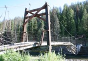
(pipeline bridge)
Casper, Wyoming, USA - North Platte River
| Bridgemeister ID: | 2107 (added 2006-09-03) |
| Name: | (pipeline bridge) |
| Location: | Casper, Wyoming, USA |
| Crossing: | North Platte River |
| Coordinates: | 42.859117 N 106.327517 W |
| Maps: | Acme, GeoHack, Google, OpenStreetMap |
| Use: | Pipeline |
| Status: | Extant (last checked: 2006) |
| Main Cables: | Wire (steel) |
| Suspended Spans: | 1 |
| Main Span: | 1 x 61 meters (200 feet) estimated |
Image Sets:
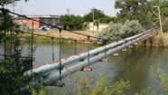
(pipeline bridge)
Durkee, Worland vicinity, Wyoming, USA - Big Horn River
| Bridgemeister ID: | 2108 (added 2006-09-03) |
| Name: | (pipeline bridge) |
| Location: | Durkee, Worland vicinity, Wyoming, USA |
| Crossing: | Big Horn River |
| Coordinates: | 44.125767 N 107.927817 W |
| Maps: | Acme, GeoHack, Google, OpenStreetMap |
| Use: | Pipeline |
| Status: | Extant (last checked: 2006) |
| Main Cables: | Wire (steel) |
| Suspended Spans: | 1 |
Notes:
Image Sets:
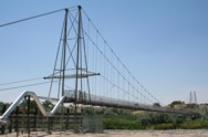
(pipeline bridge)
Durkee, Worland vicinity, Wyoming, USA - Big Horn River
| Bridgemeister ID: | 2601 (added 2014-04-14) |
| Name: | (pipeline bridge) |
| Location: | Durkee, Worland vicinity, Wyoming, USA |
| Crossing: | Big Horn River |
| Coordinates: | 44.126801 N 107.928528 W |
| Maps: | Acme, GeoHack, Google, OpenStreetMap |
| Use: | Pipeline |
| Status: | Removed |
| Main Cables: | Wire |
| Main Span: | 1 |
Notes:
- Appears to have been removed at some point after 2007.
- Near (pipeline bridge) - Durkee, Worland vicinity, Wyoming, USA.
Image Sets:
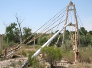
(pipeline bridge)
Eccles, Worland vicinity, Wyoming, USA - Big Horn River
| Bridgemeister ID: | 2109 (added 2006-09-03) |
| Name: | (pipeline bridge) |
| Location: | Eccles, Worland vicinity, Wyoming, USA |
| Crossing: | Big Horn River |
| Coordinates: | 44.15685 N 107.928117 W |
| Maps: | Acme, GeoHack, Google, OpenStreetMap |
| Use: | Pipeline |
| Status: | Extant (last checked: 2006) |
| Main Cables: | Wire (steel) |
| Suspended Spans: | 1 |
Notes:
- Patrick S. O'Donnell estimates the main span at 400 feet based on aerial imagery.
Image Sets:
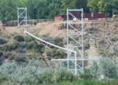
Lava Creek
Mammoth, Wyoming, USA - Lava Creek
| Bridgemeister ID: | 5583 (added 2020-12-21) |
| Name: | Lava Creek |
| Location: | Mammoth, Wyoming, USA |
| Crossing: | Lava Creek |
| At or Near Feature: | Lava Creek Trail, Yellowstone National Park |
| Coordinates: | 44.973740 N 110.683292 W |
| Maps: | Acme, GeoHack, Google, OpenStreetMap |
| Use: | Footbridge |
| Status: | In use (last checked: 2020) |
| Main Cables: | Wire (steel) |
| Suspended Spans: | 1 |
Sinks Canyon State Park
Lander, Wyoming, USA - Middle Popo Agie River
| Bridgemeister ID: | 7205 (added 2022-07-07) |
| Name: | Sinks Canyon State Park |
| Location: | Lander, Wyoming, USA |
| Crossing: | Middle Popo Agie River |
| At or Near Feature: | Popo Agie Campground, Sinks Canyon State Park |
| Coordinates: | 42.741043 N 108.823235 W |
| Maps: | Acme, GeoHack, Google, OpenStreetMap |
| Use: | Footbridge |
| Status: | Closed, November 2024 (last checked: 2024) |
| Main Cables: | Wire (steel) |
| Main Span: | 1 |
Notes:
- 2024, November: The bridge is closed for maintenance. Expected to reopen Spring 2025.
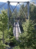
Tower
Mammoth Hot Springs vicinity, Wyoming, USA - Yellowstone River
| Bridgemeister ID: | 928 (added 2003-10-20) |
| Name: | Tower |
| Also Known As: | Hellroaring, Yellowstone River |
| Location: | Mammoth Hot Springs vicinity, Wyoming, USA |
| Crossing: | Yellowstone River |
| At or Near Feature: | Hellroaring Creek Trail, Yellowstone National Park |
| Coordinates: | 44.9597 N 110.447067 W |
| Maps: | Acme, GeoHack, Google, OpenStreetMap |
| Use: | Footbridge |
| Status: | In use (last checked: 2006) |
| Main Cables: | Wire (steel) |
| Suspended Spans: | 1 |
| Main Span: | 1 x 67.1 meters (220 feet) estimated |
Notes:
- Near the confluence of Hellroaring Creek and the Yellowstone River. Patrick S. O'Donnell clarifies: " It carries the Hellroaring Creek Trail. It crosses the Yellowstone River then continues to the Hellroaring Creek. Shortly thereafter the Yellowstone River Trail is met."
- Near (footbridge) - Gardiner vicinity, Montana, USA. The bridges are similar in appearance.
External Links:
Image Sets:
Do you have any information or photos for these bridges that you would like to share? Please email david.denenberg@bridgemeister.com.
Mail | Facebook | X (Twitter) | Bluesky