Suspension Bridges of Wisconsin
This is a list of all 16 bridges from the suspension bridge inventory for Wisconsin in USA. Wherever you see a Bridgemeister ID number click it to isolate the bridge on its own page.
Related Lists:
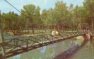
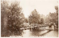
1913: Swing
Sheboygan Falls, Wisconsin, USA - Sheboygan River
| Bridgemeister ID: | 314 (added before 2003) |
| Year Completed: | 1913 |
| Name: | Swing |
| Also Known As: | Swinging |
| Location: | Sheboygan Falls, Wisconsin, USA |
| Crossing: | Sheboygan River |
| At or Near Feature: | River Park |
| Coordinates: | 43.727528 N 87.816472 W |
| Maps: | Acme, GeoHack, Google, OpenStreetMap |
| Use: | Footbridge |
| Status: | Replaced, 1987 |
| Main Cables: | Wire (steel) |
| Suspended Spans: | 1 |
| Main Span: | 1 x 45.7 meters (150 feet) estimated |
Notes:
- Jim Lucht writes that this bridge was "Damaged beyond repair when a vehicle struck the timber tower."
- Replaced by 1987 Swing - Sheboygan Falls, Wisconsin, USA.
- All past and present bridges at this location.
Image Sets:
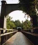
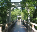
1925: Swinging
River Falls, Wisconsin, USA - Kinnickinnic River South Fork
| Bridgemeister ID: | 1193 (added 2004-01-25) |
| Year Completed: | 1925 |
| Name: | Swinging |
| Location: | River Falls, Wisconsin, USA |
| Crossing: | Kinnickinnic River South Fork |
| At or Near Feature: | Glen Park |
| Coordinates: | 44.853817 N 92.6333 W |
| Maps: | Acme, GeoHack, Google, OpenStreetMap |
| Use: | Footbridge |
| Status: | In use (last checked: 2006) |
| Main Cables: | Wire (steel) |
| Suspended Spans: | 3 |
| Main Span: | 1 x 39.6 meters (130 feet) |
| Side Spans: | 2 x 9.1 meters (30 feet) |
Notes:
- Rehabilitated, 1985.
Image Sets:
1932: Boyd Park
Eau Claire, Wisconsin, USA - Eau Claire River
| Bridgemeister ID: | 1803 (added 2005-05-18) |
| Year Completed: | 1932 |
| Name: | Boyd Park |
| Also Known As: | Uniroyal |
| Location: | Eau Claire, Wisconsin, USA |
| Crossing: | Eau Claire River |
| Use: | Footbridge |
| Status: | Removed (last checked: 2005) |
| Main Cables: | Wire (steel) |
| Main Span: | 1 |
Image Sets:
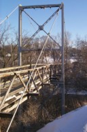
1932: Prairie du Chien
Praire du Chien, Wisconsin and Marquette, Iowa, USA - Mississippi River
| Bridgemeister ID: | 177 (added before 2003) |
| Year Completed: | 1932 |
| Name: | Prairie du Chien |
| Location: | Praire du Chien, Wisconsin and Marquette, Iowa, USA |
| Crossing: | Mississippi River |
| Coordinates: | 43.046 N 91.17 W |
| Maps: | Acme, GeoHack, Google, OpenStreetMap |
| Principals: | Austin Bridge Co. |
| References: | AAJ, AUB, BPL |
| Use: | Vehicular (two-lane) |
| Status: | Removed, 1974 |
| Main Cables: | Wire (steel) |
| Main Span: | 1 x 144.2 meters (473 feet) |
Notes:
- There were two back-to-back suspension bridges at this location.
- Connects to 1932 Prairie du Chien - Praire du Chien, Wisconsin and Marquette, Iowa, USA.
- All past and present bridges at this location.
External Links:
Image Sets:
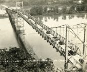
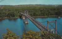
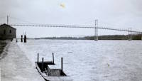
1932: Prairie du Chien
Praire du Chien, Wisconsin and Marquette, Iowa, USA - Mississippi River
| Bridgemeister ID: | 1256 (added before 2003) |
| Year Completed: | 1932 |
| Name: | Prairie du Chien |
| Location: | Praire du Chien, Wisconsin and Marquette, Iowa, USA |
| Crossing: | Mississippi River |
| Coordinates: | 43.05 N 91.162 W |
| Maps: | Acme, GeoHack, Google, OpenStreetMap |
| Principals: | Austin Bridge Co. |
| References: | AAJ, AUB, BPL |
| Use: | Vehicular (two-lane) |
| Status: | Removed, 1974 |
| Main Cables: | Wire (steel) |
| Main Span: | 1 x 144.2 meters (473 feet) |
Notes:
- There were two back-to-back suspension bridges at this location.
- Connects to 1932 Prairie du Chien - Praire du Chien, Wisconsin and Marquette, Iowa, USA.
- All past and present bridges at this location.
External Links:
Image Sets:


1953: (footbridge)
Richland Center, Wisconsin, USA - Pine Creek
| Bridgemeister ID: | 263 (added before 2003) |
| Year Completed: | 1953 |
| Name: | (footbridge) |
| Location: | Richland Center, Wisconsin, USA |
| Crossing: | Pine Creek |
| Coordinates: | 43.33931 N 90.39205 W |
| Maps: | Acme, GeoHack, Google, OpenStreetMap |
| Use: | Footbridge |
| Status: | In use (last checked: 2020) |
| Main Cables: | Wire (steel) |
| Suspended Spans: | 10 |
| Main Spans: | 8 x 22.9 meters (75 feet) estimated |
| Side Spans: | 1 x 9.8 meters (32 feet), 1 x 10.4 meters (34 feet) |
Notes:
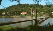
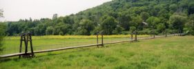
- Long low-level footbridge across marshy Pine Creek. Larry Beranek writes: "A flood in Spring 1951, just after I was born, washed out the original bridge. The [current bridge pictured here] was built in 1953. The dam [mentioned here] is gone now so the river remains a trickle til heavy rains or snow melt beef it up as happened in September of [2007]. The water was up to the stringer which supports the walking surface and the police had it taped off so no one would go on it."
Image Sets:
1987: Swing
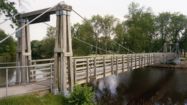
Sheboygan Falls, Wisconsin, USA - Sheboygan River
| Bridgemeister ID: | 1802 (added 2005-05-18) |
| Year Completed: | 1987 |
| Name: | Swing |
| Location: | Sheboygan Falls, Wisconsin, USA |
| Crossing: | Sheboygan River |
| At or Near Feature: | River Park |
| Coordinates: | 43.72765 N 87.81647 W |
| Maps: | Acme, GeoHack, Google, OpenStreetMap |
| Principals: | Donohue & Associates, Pheifer Brothers Construction Co. |
| Use: | Footbridge |
| Status: | In use (last checked: 2005) |
| Main Cables: | Wire (steel) |
| Suspended Spans: | 1 |
| Main Span: | 1 x 45.7 meters (150 feet) estimated |
Notes:
- Replaced 1913 Swing (Swinging) - Sheboygan Falls, Wisconsin, USA.
- All past and present bridges at this location.
Image Sets:
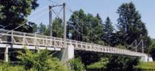
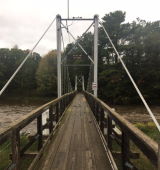
(footbridge)
Bethel, Marshfield vicinity, Wisconsin, USA - Dexter Lake
| Bridgemeister ID: | 292 (added before 2003) |
| Name: | (footbridge) |
| Location: | Bethel, Marshfield vicinity, Wisconsin, USA |
| Crossing: | Dexter Lake |
| At or Near Feature: | North Wood County Park |
| Coordinates: | 44.5186 N 90.14035 W |
| Maps: | Acme, GeoHack, Google, OpenStreetMap |
| Use: | Footbridge |
| Status: | In use (last checked: 2021) |
| Main Cables: | Wire (steel) |
| Suspended Spans: | 1 |
| Main Span: | 1 x 45.7 meters (150 feet) estimated |
Image Sets:
(footbridge)
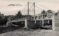
Clintonville, Wisconsin, USA - Pigeon River
| Bridgemeister ID: | 2384 (added 2007-11-08) |
| Name: | (footbridge) |
| Location: | Clintonville, Wisconsin, USA |
| Crossing: | Pigeon River |
| At or Near Feature: | Walter A. Olen Park |
| Coordinates: | 44.61846 N 88.75838 W |
| Maps: | Acme, GeoHack, Google, OpenStreetMap |
| Use: | Footbridge |
| Status: | In use (last checked: 2007) |
| Main Cables: | Wire (steel) |
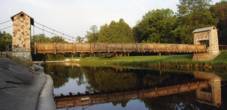
(footbridge)
Green Bay, Wisconsin, USA - Duck Creek
| Bridgemeister ID: | 257 (added before 2003) |
| Name: | (footbridge) |
| Location: | Green Bay, Wisconsin, USA |
| Crossing: | Duck Creek |
| At or Near Feature: | Pamperin Park |
| Coordinates: | 44.54537 N 88.10242 W |
| Maps: | Acme, GeoHack, Google, OpenStreetMap |
| Use: | Footbridge |
| Status: | In use (last checked: 2008) |
| Main Cables: | Wire |
| Suspended Spans: | 1 |
| Main Span: | 1 x 32.6 meters (107 feet) estimated |
Image Sets:
(footbridge)
Keshena, Wisconsin, USA - Wolf River
| Bridgemeister ID: | 7675 (added 2023-06-17) |
| Name: | (footbridge) |
| Location: | Keshena, Wisconsin, USA |
| Crossing: | Wolf River |
| Coordinates: | 44.886710 N 88.654358 W |
| Maps: | Acme, GeoHack, Google, OpenStreetMap |
| Use: | Footbridge |
| Status: | Closed (last checked: 2016) |
| Main Cables: | Wire (steel) |
| Main Span: | 1 |
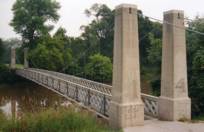
(footbridge)
Racine, Wisconsin, USA - Root River
| Bridgemeister ID: | 1505 (added 2004-10-09) |
| Name: | (footbridge) |
| Location: | Racine, Wisconsin, USA |
| Crossing: | Root River |
| At or Near Feature: | Washington Park |
| Coordinates: | 42.72005 N 87.807933 W |
| Maps: | Acme, GeoHack, Google, OpenStreetMap |
| Use: | Footbridge |
| Status: | In use (last checked: 2004) |
| Main Cables: | Wire (steel) |
| Suspended Spans: | 1 |
| Main Span: | 1 x 48.8 meters (160 feet) estimated |
Image Sets:
(footbridge)
Wauwatosa, Wisconsin, USA - Menomonee River
| Bridgemeister ID: | 1067 (added 2003-12-27) |
| Name: | (footbridge) |
| Location: | Wauwatosa, Wisconsin, USA |
| Crossing: | Menomonee River |
| At or Near Feature: | Hoyt Park |
| Coordinates: | 43.05428 N 88.02231 W |
| Maps: | Acme, GeoHack, Google, OpenStreetMap |
| Use: | Footbridge |
| Status: | In use (last checked: 2012) |
| Main Cables: | Wire (steel) |
| Suspended Spans: | 1 |
| Main Span: | 1 x 25.3 meters (83 feet) estimated |
Image Sets:
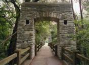
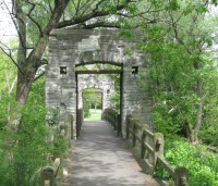
| Bridgemeister ID: | 8955 (added 2024-11-29) |
| Name: | Browns Lake Golf Course |
| Location: | Burlington, Wisconsin, USA |
| Crossing: | Fox River |
| Coordinates: | 42.688194 N 88.261167 W |
| Maps: | Acme, GeoHack, Google, OpenStreetMap |
| Use: | Golf cart |
| Status: | In use (last checked: 2021) |
| Main Cables: | Wire (steel) |
| Suspended Spans: | 3 |
| Main Span: | 1 x 45 meters (147.6 feet) estimated |
| Side Spans: | 2 |
Image Sets:

High Cliff Park
Galesville, Wisconsin, USA - Beaver Creek
| Bridgemeister ID: | 1386 (added 2004-07-03) |
| Name: | High Cliff Park |
| Location: | Galesville, Wisconsin, USA |
| Crossing: | Beaver Creek |
| Coordinates: | 44.08065 N 91.348517 W |
| Maps: | Acme, GeoHack, Google, OpenStreetMap |
| Use: | Footbridge |
| Status: | In use (last checked: 2006) |
| Main Cables: | Wire |
| Suspended Spans: | 1 |
| Main Span: | 1 x 35.1 meters (115 feet) estimated |
Notes:
- Rebuilt 1976.
Image Sets:

Pine Grove
Sheboygan, Wisconsin, USA - Pigeon River
| Bridgemeister ID: | 8997 (added 2024-12-24) |
| Name: | Pine Grove |
| Location: | Sheboygan, Wisconsin, USA |
| Crossing: | Pigeon River |
| Use: | Footbridge |
| Status: | Removed |
| Main Cables: | Wire |
Notes:
- Bridge was in existence in 1909. Although it resembles the original nearby Swinging Bridge at Sheboygan Falls, this bridge at "Pine Grove" appears to have been located within the Sheboygan park now known as "Evergreen Park" and also previously known as "Pine Woods".
- See 1913 Swing (Swinging) - Sheboygan Falls, Wisconsin, USA.
Image Sets:

Do you have any information or photos for these bridges that you would like to share? Please email david.denenberg@bridgemeister.com.
Mail | Facebook | X (Twitter) | Bluesky