Suspension Bridges of South Carolina
This is a list of all 6 bridges from the suspension bridge inventory for South Carolina in USA. Wherever you see a Bridgemeister ID number click it to isolate the bridge on its own page.
Related Lists:
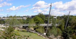
2004: Liberty
Greenville, South Carolina, USA - Reedy River
| Bridgemeister ID: | 1524 (added 2004-10-16) |
| Year Completed: | 2004 |
| Name: | Liberty |
| Location: | Greenville, South Carolina, USA |
| Crossing: | Reedy River |
| At or Near Feature: | Falls Park |
| Coordinates: | 34.844568 N 82.401113 W |
| Maps: | Acme, GeoHack, Google, OpenStreetMap |
| Use: | Footbridge |
| Status: | In use (last checked: 2020) |
| Main Cables: | Wire (steel) |
Notes:
- Unconventional design with a curved deck that is only suspended along one edge.
- Similar to 1987 (footbridge) - Kelheim, Germany.
- Similar to 2003 Erzbahnschwinge - Bochum, Germany.
External Links:
Image Sets:

2022: Auro
Greenville, South Carolina, USA - Reedy River
| Bridgemeister ID: | 8895 (added 2024-11-25) |
| Year Completed: | 2022 |
| Name: | Auro |
| Location: | Greenville, South Carolina, USA |
| Crossing: | Reedy River |
| At or Near Feature: | Unity Park |
| Coordinates: | 34.851278 N 82.412444 W |
| Maps: | Acme, GeoHack, Google, OpenStreetMap |
| Use: | Footbridge |
| Status: | In use (last checked: 2024) |
| Main Cables: | Wire (steel) |
| Suspended Spans: | 3 |
| Main Span: | 1 |
| Side Spans: | 2 |
External Links:
- YouTube - Auro Bridge Rises at Unity Park. Video showing the bridge under construction. Posted December 10, 2021.
(footbridge)
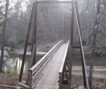
Chauga Heights vicinity, South Carolina, USA - Chauga River
| Bridgemeister ID: | 1260 (added 2004-03-13) |
| Name: | (footbridge) |
| Location: | Chauga Heights vicinity, South Carolina, USA |
| Crossing: | Chauga River |
| At or Near Feature: | Chau Ram County Park |
| Coordinates: | 34.68241 N 83.1468 W |
| Maps: | Acme, GeoHack, Google, OpenStreetMap |
| Use: | Footbridge |
| Status: | In use (last checked: 2009) |
| Main Cables: | Wire (steel) |
| Suspended Spans: | 1 |
| Main Span: | 1 x 53.3 meters (175 feet) |
Notes:
- Douglas E. McClure writes (in 2009): "This bridge span is 175 feet and was constructed a few years ago. The earlier bridge was also a swinging bridge at the same location and type, but was washed out during heavy rains. The new bridge was raised 5 feet."
Image Sets:

(footbridge)
Turkeypen Gap vicinity, South Carolina, USA - South Mills River
| Bridgemeister ID: | 2618 (added 2018-12-30) |
| Name: | (footbridge) |
| Location: | Turkeypen Gap vicinity, South Carolina, USA |
| Crossing: | South Mills River |
| At or Near Feature: | South Mills River Trail |
| Coordinates: | 35.343850 N 82.665317 W |
| Maps: | Acme, GeoHack, Google, OpenStreetMap |
| Use: | Footbridge |
| Status: | In use (last checked: 2018) |
| Main Cables: | Wire (steel) |
| Suspended Spans: | 1 |
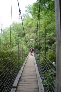
Raven Cliff Falls
Caesars Head State Park, South Carolina, USA - Matthew's Creek
| Bridgemeister ID: | 2388 (added 2007-11-19) |
| Name: | Raven Cliff Falls |
| Location: | Caesars Head State Park, South Carolina, USA |
| Crossing: | Matthew's Creek |
| At or Near Feature: | Raven Cliff Falls |
| Coordinates: | 35.104862 N 82.661154 W |
| Maps: | Acme, GeoHack, Google, OpenStreetMap |
| Use: | Footbridge |
| Status: | In use (last checked: 2020) |
| Main Cables: | Wire (steel) |
| Suspended Spans: | 1 |
Image Sets:

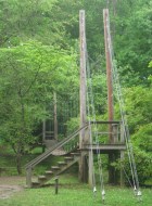
Swinging
Fort Mill, South Carolina, USA - Steele Creek
| Bridgemeister ID: | 871 (added 2003-08-30) |
| Name: | Swinging |
| Location: | Fort Mill, South Carolina, USA |
| Crossing: | Steele Creek |
| At or Near Feature: | Anne Springs Close Greenway |
| Coordinates: | 35.040867 N 80.939233 W |
| Maps: | Acme, GeoHack, Google, OpenStreetMap |
| Use: | Footbridge |
| Status: | In use (last checked: 2012) |
| Main Cables: | Wire |
| Suspended Spans: | 1 |
Notes:
- Trail footbridge.
Image Sets:

Do you have any information or photos for these bridges that you would like to share? Please email david.denenberg@bridgemeister.com.
Mail | Facebook | X (Twitter) | Bluesky