Suspension Bridges of New Hampshire
This is a list of all 16 bridges from the suspension bridge inventory for New Hampshire in USA. Wherever you see a Bridgemeister ID number click it to isolate the bridge on its own page.
Related Lists:
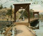
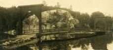
1877: Lead Mine
Gorham, New Hampshire, USA
| Bridgemeister ID: | 1198 (added 2004-01-28) |
| Year Completed: | 1877 |
| Name: | Lead Mine |
| Also Known As: | Hutchinson |
| Location: | Gorham, New Hampshire, USA |
| Coordinates: | 44.400583 N 71.179056 W |
| Maps: | Acme, GeoHack, Google, OpenStreetMap |
| Principals: | Timothy H. Hutchinson |
| Use: | Vehicular (one-lane) |
| Status: | Collapsed, 1921 |
| Main Cables: | Wire |
| Suspended Spans: | 1 |
Notes:
- Provided access to Mascot Mine. Collapsed, 1921.
Image Sets:
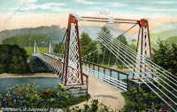
1889: Chesterfield
Chesterfield vicinity, New Hampshire and Brattleboro, Vermont, USA - Connecticut River
| Bridgemeister ID: | 95 (added before 2003) |
| Year Completed: | 1889 |
| Name: | Chesterfield |
| Also Known As: | Brattleboro |
| Location: | Chesterfield vicinity, New Hampshire and Brattleboro, Vermont, USA |
| Crossing: | Connecticut River |
| Coordinates: | 42.883889 N 72.551833 W |
| Maps: | Acme, GeoHack, Google, OpenStreetMap |
| Principals: | Berlin Iron Bridge Co. |
| References: | AAJ, CCR |
| Use: | Vehicular |
| Status: | Destroyed, March 19, 1936 |
| Main Cables: | Wire |
| Suspended Spans: | 1 |
Notes:
- Destroyed by flood March 19, 1936.
External Links:
- The one-bridge idea that faded into history | Community-news | reformer.com. Article about the bridge by the Brattleboro Historic Society. Dated August 5, 2021. Photos and history of the bridge.
Image Sets:
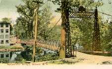
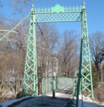
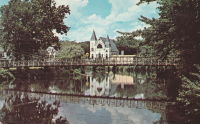
1889: Swing
Milford, New Hampshire, USA - Souhegan River
| Bridgemeister ID: | 293 (added before 2003) |
| Year Completed: | 1889 |
| Name: | Swing |
| Location: | Milford, New Hampshire, USA |
| Crossing: | Souhegan River |
| Coordinates: | 42.8366 N 71.645533 W |
| Maps: | Acme, GeoHack, Google, OpenStreetMap |
| Principals: | Berlin Iron Bridge Co. |
| Use: | Footbridge |
| Status: | In use (last checked: 2021) |
| Main Cables: | Wire (steel) |
| Suspended Spans: | 1 |
Image Sets:
1902: (footbridge)
Littleton, New Hampshire, USA - Ammonoosuc River
| Bridgemeister ID: | 2917 (added 2019-09-15) |
| Year Completed: | 1902 |
| Name: | (footbridge) |
| Location: | Littleton, New Hampshire, USA |
| Crossing: | Ammonoosuc River |
| Status: | Destroyed, 1938 |
| Main Cables: | Wire |
| Suspended Spans: | 1 |
Notes:
- Destroyed during the Great New England Hurricane, 1938.
- Replaced by 1939 Curran - Littleton, New Hampshire, USA.
- All past and present bridges at this location.
1931: Bemis
Notchland, Hart's Location vicinity, New Hampshire, USA - Saco River
| Bridgemeister ID: | 316 (added before 2003) |
| Year Completed: | 1931 |
| Name: | Bemis |
| Location: | Notchland, Hart's Location vicinity, New Hampshire, USA |
| Crossing: | Saco River |
| At or Near Feature: | Davis Path trail, White Mountain National Park |
| Coordinates: | 44.12047 N 71.35367 W |
| Maps: | Acme, GeoHack, Google, OpenStreetMap |
| References: | PQU |
| Use: | Footbridge |
| Status: | Replaced, c. 2001 |
| Suspended Spans: | 2 |
| Main Span: | 1 x 32.9 meters (108 feet) |
| Side Span: | 1 x 15.2 meters (50 feet) |
Notes:
- Replaced by a small single-towered cable-stayed bridge, circa 2001.
External Links:
1939: Curran
Littleton, New Hampshire, USA - Ammonoosuc River
| Bridgemeister ID: | 2583 (added 2013-09-22) |
| Year Completed: | 1939 |
| Name: | Curran |
| Location: | Littleton, New Hampshire, USA |
| Crossing: | Ammonoosuc River |
| Coordinates: | 44.306115 N 71.778048 W |
| Maps: | Acme, GeoHack, Google, OpenStreetMap |
| Principals: | Kenneth Curran |
| Use: | Footbridge |
| Status: | In use (last checked: 2019) |
| Main Cables: | Wire (steel) |
| Suspended Spans: | 3 |
| Main Span: | 1 x 74.4 meters (244 feet) estimated |
| Side Spans: | 1 x 15.2 meters (50 feet) estimated, 1 x 7 meters (23 feet) estimated |
Notes:
1977: Dry River
Bretton Woods vicinity, New Hampshire, USA - Dry River
| Bridgemeister ID: | 2477 (added 2008-12-20) |
| Year Completed: | 1977 |
| Name: | Dry River |
| Location: | Bretton Woods vicinity, New Hampshire, USA |
| Crossing: | Dry River |
| At or Near Feature: | Dry River Trail, Dry River Wilderness |
| Coordinates: | 44.177914 N 71.351531 W |
| Maps: | Acme, GeoHack, Google, OpenStreetMap |
| Use: | Footbridge |
| Status: | Replaced, 2009 |
| Main Cables: | Wire (steel) |
| Suspended Spans: | 1 |
| Main Span: | 1 x 30.5 meters (100 feet) |
Notes:
- Damaged by flood and permanently closed, 2005.
- Replaced by 2009 Dry River - Hart's Location vicinity, New Hampshire, USA.
- All past and present bridges at this location.
Image Sets:
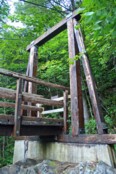
2009: Dry River
Hart's Location vicinity, New Hampshire, USA - Dry River
| Bridgemeister ID: | 2667 (added 2019-03-15) |
| Year Completed: | 2009 |
| Name: | Dry River |
| Location: | Hart's Location vicinity, New Hampshire, USA |
| Crossing: | Dry River |
| At or Near Feature: | Dry River Trail, Dry River Wilderness |
| Coordinates: | 44.177890 N 71.351410 W |
| Maps: | Acme, GeoHack, Google, OpenStreetMap |
| Principals: | Sahale LLC |
| Use: | Footbridge |
| Status: | In use (last checked: 2009) |
| Main Cables: | Wire (steel) |
| Suspended Spans: | 1 |
| Main Span: | 1 x 33.5 meters (110 feet) |
Notes:
- Replaced 1977 Dry River - Bretton Woods vicinity, New Hampshire, USA.
- All past and present bridges at this location.
External Links:
(footbridge)
Gorham, New Hampshire, USA - Peabody River
| Bridgemeister ID: | 1547 (added 2004-11-13) |
| Name: | (footbridge) |
| Location: | Gorham, New Hampshire, USA |
| Crossing: | Peabody River |
| Coordinates: | 44.3835 N 71.169117 W |
| Maps: | Acme, GeoHack, Google, OpenStreetMap |
| Use: | Footbridge and Snowmobile |
| Status: | In use (last checked: 2010) |
| Main Cables: | Wire |
| Suspended Spans: | 1 |
(footbridge)
Lincoln vicinity, New Hampshire, USA - Pemigewasset River E. Branch
| Bridgemeister ID: | 288 (added before 2003) |
| Name: | (footbridge) |
| Location: | Lincoln vicinity, New Hampshire, USA |
| Crossing: | Pemigewasset River E. Branch |
| At or Near Feature: | Pemigewasset Wilderness, Lincoln Woods trail |
| Coordinates: | 44.06425 N 71.58815 W |
| Maps: | Acme, GeoHack, Google, OpenStreetMap |
| Use: | Footbridge |
| Status: | In use (last checked: 2021) |
| Main Cables: | Wire (steel) |
| Suspended Spans: | 1 |
| Main Span: | 1 x 50 meters (164 feet) estimated |
(footbridge)
Lisbon, New Hampshire, USA - Ammonoosuc River
| Bridgemeister ID: | 261 (added before 2003) |
| Name: | (footbridge) |
| Location: | Lisbon, New Hampshire, USA |
| Crossing: | Ammonoosuc River |
| Coordinates: | 44.210489 N 71.917350 W |
| Maps: | Acme, GeoHack, Google, OpenStreetMap |
| Use: | Footbridge |
| Status: | Removed |
| Main Cables: | Wire |
Notes:
- One pier survives (as of 2020) along Young Road.
Image Sets:
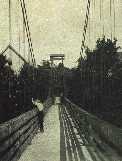
(footbridge)
Pemigewasset Wilderness, New Hampshire, USA
| Bridgemeister ID: | 1417 (added 2004-07-17) |
| Name: | (footbridge) |
| Location: | Pemigewasset Wilderness, New Hampshire, USA |
| At or Near Feature: | Cedar Brook Trail |
| Use: | Footbridge |
| Status: | Removed, 2009 |
| Main Cables: | Wire (steel) |
| Suspended Spans: | 1 |
| Main Span: | 1 x 54.9 meters (180 feet) |
Image Sets:
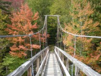
(suspension bridge)
Claremont, New Hampshire, USA - Sugar River?
| Bridgemeister ID: | 881 (added 2003-09-06) |
| Name: | (suspension bridge) |
| Location: | Claremont, New Hampshire, USA |
| Crossing: | Sugar River? |
| Status: | Removed |
External Links:
- On This Date in New England Fire Rescue History (link reported not working). "Jul 04, 1856 - Claremont, NH - North Street - Mascoma Fire Company from Lebanon fell through wire suspension bridge during holiday parade - A fifer broke his back during the fall and was removed from river, dead."
Chandler's
Gorham, New Hampshire, USA - Androscoggin River
| Bridgemeister ID: | 322 (added before 2003) |
| Name: | Chandler's |
| Location: | Gorham, New Hampshire, USA |
| Crossing: | Androscoggin River |
| Coordinates: | 44.392639 N 71.172694 W |
| Maps: | Acme, GeoHack, Google, OpenStreetMap |
| Use: | Footbridge |
| Status: | Removed |
| Main Cables: | Wire |
| Main Span: | 1 x 68.6 meters (225 feet) |
Notes:
- Was located at the end of present-day Alpine Street.
Image Sets:
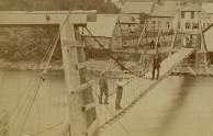
Great Gulf Wilderness
Dolly Copp Campground vicinity, New Hampshire, USA - Peabody River
| Bridgemeister ID: | 333 (added before 2003) |
| Name: | Great Gulf Wilderness |
| Location: | Dolly Copp Campground vicinity, New Hampshire, USA |
| Crossing: | Peabody River |
| At or Near Feature: | Appalachian Trail |
| Coordinates: | 44.31248 N 71.22038 W |
| Maps: | Acme, GeoHack, Google, OpenStreetMap |
| References: | PQU |
| Use: | Footbridge |
Jackson Mills
Nashua, New Hampshire, USA - Nashua River
| Bridgemeister ID: | 2639 (added 2019-03-03) |
| Name: | Jackson Mills |
| Location: | Nashua, New Hampshire, USA |
| Crossing: | Nashua River |
| At or Near Feature: | Jackson Mill Number 2 |
| Coordinates: | 42.762681 N 71.456383 W |
| Maps: | Acme, GeoHack, Google, OpenStreetMap |
| Use: | Footbridge |
| Status: | Removed |
| Suspended Spans: | 1 |
Notes:
- Coordinates provided are for approximate location of the bridge crossing the Nashua River from the railroad tracks north of Temple St., to Jackson Mill building number 2.
- Bridge was in existence in 1875 when it was photographed for a popular stereoview image.
Do you have any information or photos for these bridges that you would like to share? Please email david.denenberg@bridgemeister.com.
Mail | Facebook | X (Twitter) | Bluesky