Suspension Bridges of Hawaii
This is a list of all 7 bridges from the suspension bridge inventory for Hawaii in USA. Wherever you see a Bridgemeister ID number click it to isolate the bridge on its own page.
Related Lists:
1948: Kapaia
Kapaia, Hawaii, USA - Hanamaulu Stream
| Bridgemeister ID: | 2470 (added 2008-12-20) |
| Year Completed: | 1948 |
| Name: | Kapaia |
| Location: | Kapaia, Hawaii, USA |
| Crossing: | Hanamaulu Stream |
| Coordinates: | 21.990740 N 159.364568 W |
| Maps: | Acme, GeoHack, Google, OpenStreetMap |
| Use: | Footbridge |
| Status: | Replaced, 2018 |
| Main Cables: | Wire |
| Suspended Spans: | 1 |
Notes:
- Replaced in 2018 with a replica structure after having been derelict and falling into increasing disrepair since 2006.
- Replaced by 2018 Kapaia - Kapaia, Hawaii, USA.
- All past and present bridges at this location.
Image Sets:
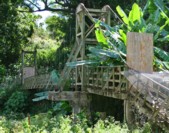
1996: Waimea Swinging
Waimea, Hawaii, USA - Waimea River
| Bridgemeister ID: | 643 (added 2003-02-16) |
| Year Completed: | 1996 |
| Name: | Waimea Swinging |
| Location: | Waimea, Hawaii, USA |
| Crossing: | Waimea River |
| Coordinates: | 21.96979 N 159.65652 W |
| Maps: | Acme, GeoHack, Google, OpenStreetMap |
| Use: | Footbridge |
| Status: | In use (last checked: 2022) |
| Main Cables: | Wire (steel) |
| Suspended Spans: | 1 |
| Main Span: | 1 x 76.2 meters (250 feet) |
Notes:
- Replaced a suspension bridge destroyed by Hurricane Iniki in 1992.
- 2022, January: Closed due to mudslide that occurred at one end of the bridge destroying the road next to the bridge and possibly damaging part of the bridge.
- 2022, February: Project started to repair the bridge and provide temporary pedestrian access.
Annotated Citations:
- KITV Web Staff. "Repair work beginning for temporary pedestrian access to Waimea Swinging Bridge." KITV Island Television, 14 Feb. 2022, www.kitv.com/news/local/repair-work-beginning-for-temporary-pedestrian-access-to-waimea-swinging-bridge/article_692c5d5e-8ddd-11ec-bcb1-87a6464d51be.html
"Kauai County's contractor will begin repairs for temporary pedestrian access to the Waimea Swinging Bridge… the scope of work includes restoring the section of the bridge’s pedestrian walkway, landing platform, and stairs damaged by the rockfall."
Image Sets:
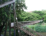
2008: Kapalua
Kapalua Resort, Maui, Hawaii, USA - Kaopala Gulch
| Bridgemeister ID: | 2451 (added 2008-07-13) |
| Year Completed: | 2008 |
| Name: | Kapalua |
| Location: | Kapalua Resort, Maui, Hawaii, USA |
| Crossing: | Kaopala Gulch |
| Coordinates: | 20.96236 N 156.63227 W |
| Maps: | Acme, GeoHack, Google, OpenStreetMap |
| Principals: | Sahale, LLC (including Patrick S. O'Donnell) |
| Use: | Footbridge |
| Status: | In use (last checked: 2009) |
| Main Cables: | Wire (steel) |
| Suspended Spans: | 1 |
| Main Span: | 1 x 109.7 meters (360 feet) |
Image Sets:
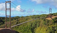
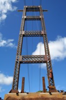
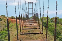
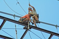

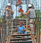
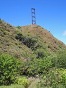
2018: Kapaia
Kapaia, Hawaii, USA - Hanamaulu Stream
| Bridgemeister ID: | 2938 (added 2008-12-20) |
| Year Completed: | 2018 |
| Name: | Kapaia |
| Location: | Kapaia, Hawaii, USA |
| Crossing: | Hanamaulu Stream |
| Coordinates: | 21.990874 N 159.364376 W |
| Maps: | Acme, GeoHack, Google, OpenStreetMap |
| Use: | Footbridge |
| Status: | In use (last checked: 2019) |
| Main Cables: | Wire (steel) |
| Suspended Spans: | 1 |
Notes:
| Bridgemeister ID: | 2504 (added 2009-03-02) |
| Name: | (footbridge) |
| Location: | Makawao vicinity, Hawaii, USA |
| At or Near Feature: | Piiholo Ranch |
| Coordinates: | 20.845529 N 156.293467 W |
| Maps: | Acme, GeoHack, Google, OpenStreetMap |
| Use: | Footbridge |
| Status: | In use (last checked: 2020) |
| Main Cables: | Wire (steel) |
| Main Span: | 1 x 96.6 meters (317 feet) |
Kapaa
Kapaa, Hawaii, USA - Kapaa Stream
| Bridgemeister ID: | 2471 (added 2008-12-20) |
| Name: | Kapaa |
| Location: | Kapaa, Hawaii, USA |
| Crossing: | Kapaa Stream |
| Coordinates: | 22.10394 N 159.32420 W |
| Maps: | Acme, GeoHack, Google, OpenStreetMap |
| Use: | Footbridge |
| Status: | In use (last checked: 2008) |
| Main Cables: | Wire (steel) |
| Suspended Spans: | 1 |
| Main Span: | 1 x 45.7 meters (150 feet) |
Image Sets:
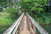
Swinging
Hanapepe, Hawaii, USA - Hanapepe River
| Bridgemeister ID: | 283 (added before 2003) |
| Name: | Swinging |
| Location: | Hanapepe, Hawaii, USA |
| Crossing: | Hanapepe River |
| Coordinates: | 21.912333 N 159.58875 W |
| Maps: | Acme, GeoHack, Google, OpenStreetMap |
| References: | HA20050114, HA20050206 |
| Use: | Footbridge |
| Status: | In use (last checked: 2008) |
| Main Cables: | Wire (steel) |
| Suspended Spans: | 1 |
| Main Span: | 1 x 67.1 meters (220 feet) |
Notes:
- Destroyed by Hurricane Iniki, 1992. Rebuilt.
- Temporarily closed, week of January 10, 2005, because of damage due to storm. HA20050114: "A portion of the bridge has completely split apart from the end support at the town side of the bridge, said Al Afos of the county Roads Division." Appears to have reopened later in 2005.
- Near (footbridge) - Hanapepe vicinity, Hawaii, USA.
Image Sets:
Do you have any information or photos for these bridges that you would like to share? Please email david.denenberg@bridgemeister.com.
Mail | Facebook | X (Twitter) | Bluesky