Inventory Search Results (8,201-8,300 of 8,542)
Results : << < ... 7801-7900 7901-8000 8001-8100 8101-8200 8201-8300 8301-8400 8401-8500 8501-8542 > >> All
8,542 suspension bridges were found for search criteria: * .
Bridges 8,201 through 8,300 (of 8,542 total) appear below. Click the Bridgemeister ID number to isolate the bridge on its own page.
If you don't see what you were looking for, try an image search with the same criteria: *
Related:
Bridgemeister ID: 6316 (added 2021-07-24)Name: Silbu Location: Silbu, Gilgit-Baltistan, Pakistan Crossing: Indus River Coordinates: 35.632783 N 74.962705 E Maps: Acme , GeoHack , Google , OpenStreetMap Use: Vehicular (one-lane) Status: Extant (last checked: 2021) Main Cables: Wire (steel) Suspended Spans: 1
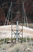
Bridgemeister ID: 351 (added before 2003)Name: Silver Location: Bright Angel Campground vicinity, Arizona , USA Crossing: Colorado River At or Near Feature: Grand Canyon National Park Coordinates: 36.09745 N 112.09550 W Maps: Acme , GeoHack , Google , OpenStreetMap Use: Footbridge and Pipeline Status: In use (last checked: 2020) Main Cables: Wire (steel) Suspended Spans: 1 Main Span: 1 x 149.4 meters (490 feet)
Bridgemeister ID: 6784 (added 2021-10-29)Name: Singal Nala Location: Singal, Gilgit-Baltistan, Pakistan Crossing: Singal Gah Coordinates: 36.111192 N 73.885661 E Maps: Acme , GeoHack , Google , OpenStreetMap Use: Vehicular (one-lane) Status: In use (last checked: 2021) Main Cables: Wire Suspended Spans: 1 Main Span: 1 x 96.6 meters (317 feet) estimated
Bridgemeister ID: 3861 (added 2020-03-07)Name: Singsås Location: Singsås, Midtre Gauldal, Trøndelag, Norway Crossing: Gaula Coordinates: 62.954830 N 10.730960 E Maps: Acme , GeoHack , Google , kart.1881.no , OpenStreetMap Use: Vehicular (one-lane) Status: Removed Main Cables: Wire Suspended Spans: 1 Main Span: 1 x 63 meters (206.7 feet) estimated
Bridgemeister ID: 3862 (added 2020-03-07)Name: Singsås Location: Singsås, Midtre Gauldal, Trøndelag, Norway Crossing: Gaula Coordinates: 62.95499 N 10.72968 E Maps: Acme , GeoHack , Google , kart.1881.no , OpenStreetMap Use: Vehicular (one-lane) Status: Removed Suspended Spans: 1 Main Span: 1 x 75 meters (246.1 feet) estimated
Bridgemeister ID: 2720 (added 2019-06-22)Name: Singshore Location: Uttarey, Sikkim , India Coordinates: 27.260882 N 88.112271 E Maps: Acme , GeoHack , Google , OpenStreetMap Use: Vehicular (one-lane) Status: In use (last checked: 2019) Main Cables: Wire (steel) Suspended Spans: 1 Main Span: 1 x 240 meters (787.4 feet)
Facebook . Image of the bridge. Posted December 27, 2014.Facebook . Image of the bridge. Posted September 29, 2014.Facebook . Image of the bridge. Posted September 7, 2014.Facebook . Image of the replacement arch bridge with suspension bridge visible behind it. Posted June 7, 2020 but is an older image.Facebook . Image of the suspension bridge and nearly completed arch bridge. Posted November 29, 2011.Facebook . Image of the bridge. Posted August 24, 2015 but is an older image.Google Maps . Image of the arch bridge with extant suspension bridge tower visible along left edge. Dated January 2022.Google Maps . Image of the arch bridge with extant suspension bridge tower visible behind the arch bridge. Dated January 2022.X (Twitter) . Image of the arch bridge with partially dismantled suspension bridge visible. Posted February 3, 2016.Bridgemeister ID: 8156 (added 2024-02-03)Name: Sinwa Location: Sinwa, Limkhim (लिमखिम) and Sawadin (सवादिन), Nepal Crossing: Tamor River Coordinates: 27.441229 N 87.700855 E Maps: Acme , GeoHack , Google , OpenStreetMap Use: Footbridge Status: Extant Main Span: 1 x 10⁸ meters (354.3 feet)
Bridgemeister ID: 8157 (added 2024-02-03)Name: Sinwa Location: Sinwa, Limkhim (लिमखिम) and Sawadin (सवादिन), Nepal Crossing: Tamor River Use: Footbridge Status: Removed Main Span: 1 x 83 meters (272.3 feet)
Scribd - Standard Trail Suspended and Suspension Bridges . Maintenance report dated February 27, 1977 mentioning a suspension bridge over the Tamor River near Sinwa: "Actual condition of the bridge: This bridge is in a very dangerous condition. The tower (masonry tower) is partly broken. Also the planking is in a very bad condition. The best way to maintain this bridge is to build a new bridge."Bridgemeister ID: 649 (added 2003-02-17)Name: Sister Island Location: Niagara Falls, New York , USA Crossing: Niagara River At or Near Feature: Three Sister Islands References: HBE Use: Footbridge Status: Removed Main Cables: Wire Suspended Spans: 1
Bridgemeister ID: 2822 (added 2019-07-04)Name: Siyuan Also Known As: 思源吊橋, Siyuandiao Location: Ren'ai Township, Nantou County, Taiwan Coordinates: 23.916838 N 121.055186 E Maps: Acme , GeoHack , Google , OpenStreetMap Use: Footbridge Status: In use (last checked: 2016) Main Cables: Wire (steel) Suspended Spans: 1
Bridgemeister ID: 3755 (added 2020-02-29)Name: Sjønstå Gård Location: Sjønstå, Fauske, Nordland, Norway Crossing: Sjønståelva Coordinates: 67.20575 N 15.71460 E Maps: Acme , GeoHack , Google , kart.1881.no , OpenStreetMap Use: Footbridge Status: In use (last checked: 2019) Main Cables: Wire (steel) Suspended Spans: 1 Main Span: 1 x 53 meters (173.9 feet) estimated
Bridgemeister ID: 3918 (added 2020-03-20)Name: Sjulhusbrua Location: Alvdal, Innlandet, Norway Crossing: Glomma Coordinates: 62.09653 N 10.64445 E Maps: Acme , GeoHack , Google , kart.1881.no , OpenStreetMap Use: Vehicular (one-lane) Status: Removed Main Cables: Wire (steel) Suspended Spans: 1 Main Span: 1 x 82.5 meters (270.7 feet) estimated
Based on historic aerial images, removed after 1969 and before 1980. Bridgemeister ID: 4484 (added 2020-04-26)Name: Skårabrui Location: Teigen vicinity, Årdal, Vestland, Norway Crossing: Utla Coordinates: 61.347986 N 7.879549 E Maps: Acme , GeoHack , Google , kart.1881.no , OpenStreetMap Use: Vehicular (one-lane) Status: Closed (last checked: 2019) Main Cables: Wire Suspended Spans: 1 Main Span: 1 x 21.5 meters (70.5 feet) estimated
Based on historical aerial imagery, removed at some point 1961-2004. Bridgemeister ID: 8544 (added 2024-03-31)Name: Sky Walk Location: Scheidegg, Germany Coordinates: 47.564500 N 9.826806 E Maps: Acme , GeoHack , Google , OpenStreetMap Use: Footbridge Status: In use (last checked: 2023) Main Cables: Wire (steel) Suspended Spans: 13 Main Spans: 13
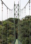
Treetop walkway attraction with thirteen connected suspension spans and two cable-stayed spans. Completed at some point in the 2010-2012 time frame. Bridgemeister ID: 1118 (added 2004-01-06)Name: Sky Walk 1 Location: Monteverde, Santa Elena vicinity, Costa Rica Crossing: Monteverde Cloud Forest At or Near Feature: Sky Adventures Monteverde Park Coordinates: 10.336227 N 84.808606 W Maps: Acme , GeoHack , Google , OpenStreetMap Use: Footbridge Status: In use (last checked: 2023) Main Cables: Wire (steel) Suspended Spans: 1
One of six suspension bridges on the treetop Sky Walk. Near (footbridge) - Monteverde, Santa Elena vicinity, Costa Rica . Near (footbridge) - Monteverde, Santa Elena vicinity, Costa Rica . Near Sky Walk 2 - Monteverde, Santa Elena vicinity, Costa Rica . Near Sky Walk 3 - Monteverde, Santa Elena vicinity, Costa Rica . Near Sky Walk 4 - Monteverde, Santa Elena vicinity, Costa Rica . Near Sky Walk 5 - Monteverde, Santa Elena vicinity, Costa Rica . Near Sky Walk 6 - Monteverde, Santa Elena vicinity, Costa Rica . Bridgemeister ID: 7786 (added 2023-08-21)Name: Sky Walk 2 Location: Monteverde, Santa Elena vicinity, Costa Rica Crossing: Monteverde Cloud Forest At or Near Feature: Sky Adventures Monteverde Park Coordinates: 10.336986 N 84.805990 W Maps: Acme , GeoHack , Google , OpenStreetMap Use: Footbridge Status: In use (last checked: 2023) Main Cables: Wire (steel) Suspended Spans: 1
One of six suspension bridges along the treetop Sky Walk. Near (footbridge) - Monteverde, Santa Elena vicinity, Costa Rica . Near (footbridge) - Monteverde, Santa Elena vicinity, Costa Rica . Near Sky Walk 1 - Monteverde, Santa Elena vicinity, Costa Rica . Near Sky Walk 3 - Monteverde, Santa Elena vicinity, Costa Rica . Near Sky Walk 4 - Monteverde, Santa Elena vicinity, Costa Rica . Near Sky Walk 5 - Monteverde, Santa Elena vicinity, Costa Rica . Near Sky Walk 6 - Monteverde, Santa Elena vicinity, Costa Rica . Bridgemeister ID: 7787 (added 2023-08-21)Name: Sky Walk 3 Location: Monteverde, Santa Elena vicinity, Costa Rica Crossing: Monteverde Cloud Forest At or Near Feature: Sky Adventures Monteverde Park Coordinates: 10.339592 N 84.807801 W Maps: Acme , GeoHack , Google , OpenStreetMap Use: Footbridge Status: In use (last checked: 2023) Main Cables: Wire (steel) Suspended Spans: 1
One of six suspension bridges along the treetop Sky Walk. Near (footbridge) - Monteverde, Santa Elena vicinity, Costa Rica . Near (footbridge) - Monteverde, Santa Elena vicinity, Costa Rica . Near Sky Walk 1 - Monteverde, Santa Elena vicinity, Costa Rica . Near Sky Walk 2 - Monteverde, Santa Elena vicinity, Costa Rica . Near Sky Walk 4 - Monteverde, Santa Elena vicinity, Costa Rica . Near Sky Walk 5 - Monteverde, Santa Elena vicinity, Costa Rica . Near Sky Walk 6 - Monteverde, Santa Elena vicinity, Costa Rica . Bridgemeister ID: 7788 (added 2023-08-21)Name: Sky Walk 4 Location: Monteverde, Santa Elena vicinity, Costa Rica Crossing: Monteverde Cloud Forest At or Near Feature: Sky Adventures Monteverde Park Coordinates: 10.339206 N 84.808631 W Maps: Acme , GeoHack , Google , OpenStreetMap Use: Footbridge Status: In use (last checked: 2023) Main Cables: Wire (steel) Suspended Spans: 1
One of six suspension bridges along the treetop Sky Walk. Near (footbridge) - Monteverde, Santa Elena vicinity, Costa Rica . Near (footbridge) - Monteverde, Santa Elena vicinity, Costa Rica . Near Sky Walk 1 - Monteverde, Santa Elena vicinity, Costa Rica . Near Sky Walk 2 - Monteverde, Santa Elena vicinity, Costa Rica . Near Sky Walk 3 - Monteverde, Santa Elena vicinity, Costa Rica . Near Sky Walk 5 - Monteverde, Santa Elena vicinity, Costa Rica . Near Sky Walk 6 - Monteverde, Santa Elena vicinity, Costa Rica . Bridgemeister ID: 7789 (added 2023-08-21)Name: Sky Walk 5 Location: Monteverde, Santa Elena vicinity, Costa Rica Crossing: Monteverde Cloud Forest At or Near Feature: Sky Adventures Monteverde Park Coordinates: 10.338204 N 84.808238 W Maps: Acme , GeoHack , Google , OpenStreetMap Use: Footbridge Status: In use (last checked: 2023) Main Cables: Wire (steel) Suspended Spans: 3 Main Spans: 3
One of six suspension bridges on the treetop Sky Walk. This is the largest of the group and the only multi-span bridge. Near (footbridge) - Monteverde, Santa Elena vicinity, Costa Rica . Near (footbridge) - Monteverde, Santa Elena vicinity, Costa Rica . Near Sky Walk 1 - Monteverde, Santa Elena vicinity, Costa Rica . Near Sky Walk 2 - Monteverde, Santa Elena vicinity, Costa Rica . Near Sky Walk 3 - Monteverde, Santa Elena vicinity, Costa Rica . Near Sky Walk 4 - Monteverde, Santa Elena vicinity, Costa Rica . Near Sky Walk 6 - Monteverde, Santa Elena vicinity, Costa Rica . Bridgemeister ID: 7790 (added 2023-08-21)Name: Sky Walk 6 Location: Monteverde, Santa Elena vicinity, Costa Rica Crossing: Monteverde Cloud Forest At or Near Feature: Sky Adventures Monteverde Park Coordinates: 10.338119 N 84.808717 W Maps: Acme , GeoHack , Google , OpenStreetMap Use: Footbridge Status: In use (last checked: 2023) Main Cables: Wire (steel) Suspended Spans: 1
One of six suspension bridges on the treetop Sky Walk. Near (footbridge) - Monteverde, Santa Elena vicinity, Costa Rica . Near (footbridge) - Monteverde, Santa Elena vicinity, Costa Rica . Near Sky Walk 1 - Monteverde, Santa Elena vicinity, Costa Rica . Near Sky Walk 2 - Monteverde, Santa Elena vicinity, Costa Rica . Near Sky Walk 3 - Monteverde, Santa Elena vicinity, Costa Rica . Near Sky Walk 4 - Monteverde, Santa Elena vicinity, Costa Rica . Near Sky Walk 5 - Monteverde, Santa Elena vicinity, Costa Rica . Bridgemeister ID: 4022 (added 2020-03-28)Name: Slawe Location: Slawe, Gondang District, Mojokerto Regency, East Java , Indonesia Coordinates: 7.636569 S 112.510955 E Maps: Acme , GeoHack , Google , OpenStreetMap Use: Footbridge Status: In use (last checked: 2020) Main Cables: Wire (steel)
Bridgemeister ID: 4318 (added 2020-04-10)Name: Slogedalsbrua Location: Håbbesland, Birkenes, Agder, Norway Crossing: Tovdalselva Coordinates: 58.349402 N 8.241430 E Maps: Acme , GeoHack , Google , kart.1881.no , OpenStreetMap Use: Footbridge Status: Closed, 2017 Main Cables: Wire (steel) Suspended Spans: 1 Main Span: 1 x 69 meters (226.4 feet) estimated
Restored 2005. Damaged by flood 2017. Plans underway to restore Spring 2020. Bridgemeister ID: 3985 (added 2020-03-22)Name: Sofutanitsuri Location: Shokawacho Ushimaru, Takayama, Gifu , Japan Crossing: Shō River Coordinates: 36.052426 N 136.943336 E Maps: Acme , GeoHack , Google , OpenStreetMap Status: Closed (last checked: 2019) Main Cables: Wire (steel) Suspended Spans: 1
Bridgemeister ID: 7236 (added 2022-07-16)Name: Sogamoso Location: Girón and Betulia, Santander, Colombia Crossing: Rio Sogamoo Coordinates: 7.105687 N 73.416158 W Maps: Acme , GeoHack , Google , OpenStreetMap Use: Vehicular Status: Extant (last checked: 2021) Main Cables: Wire (steel) Main Span: 1 x 120 meters (393.7 feet) estimated
Bridgemeister ID: 5154 (added 2020-09-07)Name: Somanoko Also Known As: 杣の小橋 Location: Ome, Tokyo , Japan Crossing: Tama River Coordinates: 35.799926 N 139.178124 E Maps: Acme , GeoHack , Google , OpenStreetMap Use: Footbridge Status: In use (last checked: 2020) Main Cables: Wire (steel) Suspended Spans: 1
Bridgemeister ID: 5706 (added 2021-04-02)Name: Songdo Yonggung Also Known As: 송도 용궁구름다리 Location: Amnam-dong, Seo-gu, Busan, South Korea Coordinates: 35.061998 N 129.022241 E Maps: Acme , GeoHack , Google , OpenStreetMap Use: Footbridge Status: In use (last checked: 2021) Main Cables: Wire (steel) Main Span: 1
Bridgemeister ID: 1346 (added 2004-05-08)Name: Sorthfork River Ranch Location: Southfork River Ranch, Idaho , USA Crossing: South Fork Clearwater River Coordinates: 46.01567 N 115.96030 W Maps: Acme , GeoHack , Google , OpenStreetMap Use: Vehicular (one-lane) Status: In use (last checked: 2003) Main Cables: Wire (steel) Suspended Spans: 1 Main Span: 1 x 45.7 meters (150 feet) estimated
Bridgemeister ID: 1997 (added 2005-12-25)Name: South Fork Trinity River Trail Location: Forest Glen vicinity, California , USA Crossing: South Fork Trinity River At or Near Feature: Trinity National Forest Coordinates: 40.361383 N 123.306617 W Maps: Acme , GeoHack , Google , OpenStreetMap Use: Footbridge Status: In use (last checked: 2005) Main Cables: Wire (steel) Suspended Spans: 1 Main Span: 1 x 39.6 meters (130 feet) estimated
Bridgemeister ID: 3072 (added 2019-10-26)Name: Southern Discoveries Location: Arrowtown, New Zealand Crossing: Arrow River At or Near Feature: Queenstown Trail - Arrow River Bridges Ride Coordinates: 44.968425 S 168.855546 E Maps: Acme , GeoHack , Google , OpenStreetMap Use: Footbridge Status: In use (last checked: 2019) Main Cables: Wire (steel) Suspended Spans: 1
Located off of Front Street. Heavily damaged by November, 2003 floods. Bridgemeister ID: 7524 (added 2023-01-14)Name: Sozukyoonsennotsuri Also Known As: 雙津峡温泉の吊橋 Location: Iwakuni, Yamaguchi , Japan Crossing: Usa River Coordinates: 34.313748 N 131.987646 E Maps: Acme , GeoHack , Google , OpenStreetMap Use: Vehicular (one-lane) Status: In use (last checked: 2021) Main Cables: Wire (steel) Suspended Spans: 1 Main Span: 1 x 39 meters (128 feet) estimated
Bridgemeister ID: 4569 (added 2020-06-02)Name: Speybrug Location: Lievegem, Gent vicinity, East Flanders, Belgium Crossing: Ringvaart Coordinates: 51.085412 N 3.658703 E Maps: Acme , GeoHack , Google , OpenStreetMap Use: Vehicular (two-lane) Status: In use (last checked: 2019) Main Cables: Wire (steel) Suspended Spans: 1 Main Span: 1 x 54.5 meters (178.8 feet) estimated
Bridgemeister ID: 1410 (added 2004-07-04)Name: Split Creek Pack Location: Lowell vicinity, Idaho , USA Crossing: Lochsa River Coordinates: 46.2307 N 115.416733 W Maps: Acme , GeoHack , Google , OpenStreetMap Use: Pack Status: In use (last checked: 2007) Main Cables: Wire (steel) Suspended Spans: 1 Main Span: 1 x 45.7 meters (150 feet) estimated
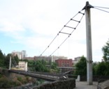
Bridgemeister ID: 354 (added before 2003)Name: Spokane Falls I Location: Spokane, Washington , USA Crossing: Spokane River Coordinates: 47.66276 N 117.42269 W Maps: Acme , GeoHack , Google , OpenStreetMap Use: Footbridge Status: In use (last checked: 2024) Main Cables: Wire (steel) Suspended Spans: 1 Main Span: 1 x 68.9 meters (226 feet) estimated
This entry refers to the southernmost of the two footbridges at this location. 2022, March 30: Reopened, but in need of further repairs. Unclear if it was closed because its companion bridge was also closed for repairs or for other safety reasons. 2023, May: Closed for extensive repairs. 2024, March: Reopened upon complation of repairs. Connects to Spokane Falls II - Spokane, Washington, USA . Bridgemeister ID: 355 (added before 2003)Name: Spokane Falls II Location: Spokane, Washington , USA Crossing: Spokane River Coordinates: 47.66374 N 117.42298 W Maps: Acme , GeoHack , Google , OpenStreetMap Use: Footbridge Status: In use (last checked: 2022) Main Cables: Wire (steel) Suspended Spans: 1 Main Span: 1 x 90.2 meters (296 feet) estimated
This entry refers to the northernmost of the two footbridges at this location. 2019, April: Closed awaiting deck repairs. 2022, March 30: Reopened following completion of repairs including deck replacement. Connects to Spokane Falls I - Spokane, Washington, USA . Bridgemeister ID: 2353 (added 2007-08-19)Name: Spring Also Known As: Hanging Location: Blanchisseuse, Trinidad and Tobago Crossing: Marianne River Use: Vehicular (one-lane) Status: In use (last checked: 2007) Main Cables: Wire Suspended Spans: 1
Bridgemeister ID: 3760 (added 2020-02-29)Name: Stabbursdalen Location: Bævkopp, Porsanger, Lakselv vicinity, Troms og Finnmark, Norway Crossing: Stabburselva Coordinates: 70.17401 N 24.86980 E Maps: Acme , GeoHack , Google , kart.1881.no , OpenStreetMap Use: Footbridge Status: In use (last checked: 2019) Main Cables: Wire (steel) Suspended Spans: 1 Main Span: 1 x 70 meters (229.7 feet) estimated
Temporary suspension bridge erected some time after the destruction of the historic Stari Most arch in November 1993. Was in existence in 1997. Removed late 1990s or early 2000s. A different cable-stayed replacement was erected at some point during (or prior to) the arch reconstruction started in 2001. That temporary cable-stayed structure was different than this true suspension bridge. Bridgemeister ID: 4490 (added 2020-04-30)Name: Storablåfjell Location: Hjelmeland, Rogaland, Norway Coordinates: 59.351075 N 6.753190 E Maps: Acme , GeoHack , Google , kart.1881.no , OpenStreetMap Use: Footbridge Status: In use (last checked: 2019) Main Cables: Wire (steel) Suspended Spans: 1 Main Span: 1 x 20.5 meters (67.3 feet) estimated
Bridgemeister ID: 3849 (added 2020-03-07)Name: Storeng Location: Kvikne, Innlandet, Norway Crossing: Orkla Coordinates: 62.622040 N 10.248190 E Maps: Acme , GeoHack , Google , kart.1881.no , OpenStreetMap Use: Vehicular (one-lane) Status: Removed Main Cables: Wire Suspended Spans: 1 Main Span: 1 x 46.5 meters (152.6 feet) estimated
Bridgemeister ID: 3455 (added 2019-12-22)Name: Storms River Location: Tsitsikamma National Park, Pretoria, South Africa Crossing: Storms River Coordinates: 34.019532 S 23.903529 E Maps: Acme , GeoHack , Google , OpenStreetMap Use: Footbridge Status: In use (last checked: 2019) Main Cables: Wire (steel) Suspended Spans: 1
Bridgemeister ID: 3456 (added 2019-12-22)Name: Storms River Location: Tsitsikamma National Park, Pretoria, South Africa Crossing: Storms River Coordinates: 34.019545 S 23.902928 E Maps: Acme , GeoHack , Google , OpenStreetMap Use: Footbridge Status: In use (last checked: 2019) Main Cables: Wire (steel) Suspended Spans: 1
Bridgemeister ID: 3457 (added 2019-12-22)Name: Storms River Location: Tsitsikamma National Park, Pretoria, South Africa Crossing: Storms River Coordinates: 34.019803 S 23.902611 E Maps: Acme , GeoHack , Google , OpenStreetMap Use: Footbridge Status: In use (last checked: 2019) Main Cables: Wire (steel) Suspended Spans: 1
Bridgemeister ID: 3948 (added 2020-03-21)Name: Strømbu Rasteplass Location: Folldal, Innlandet, Norway Crossing: Atna Coordinates: 61.92238 N 10.05187 E Maps: Acme , GeoHack , Google , kart.1881.no , OpenStreetMap Use: Footbridge Status: In use (last checked: 2019) Main Cables: Wire (steel) Suspended Spans: 1 Main Span: 1 x 26 meters (85.3 feet) estimated
Based on historic aerial images, completed between 1978 and 2004. Bridgemeister ID: 7566 (added 2023-04-08)Name: Streghe Also Known As: Witches Location: Marzabotto, Bologna, Italy Crossing: Reno River Coordinates: 44.344316 N 11.208215 E Maps: Acme , GeoHack , Google , OpenStreetMap Use: Footbridge Status: In use (last checked: 2022) Main Cables: Wire (steel) Main Span: 1 x 94 meters (308.4 feet) estimated
Coordinates provided reflect the approximate location of the bridge. A detailed interpretive sign located 40 meters south of the coordinates appears to explain the location of the former suspension bridge in detail but I haven't been able to find a clear image of the text. Bridgemeister ID: 8111 (added 2024-01-06)Name: Suhovo Rope Location: Suhovo (Сухово) and Snezhinka (Снежинка), Kardzhali, Bulgaria Crossing: Kardzhali Reservoir Coordinates: 41.661938 N 25.265297 E Maps: Acme , GeoHack , Google , OpenStreetMap Use: Footbridge Status: In use Main Cables: Wire (steel) Suspended Spans: 1 Main Span: 1 x 184.7 meters (606 feet) estimated
Bridgemeister ID: 6046 (added 2021-07-03)Name: Suiha Also Known As: 翠波橋 Location: Shikokuchuo, Ehime , Japan Crossing: Dōzan River Coordinates: 33.935751 N 133.550722 E Maps: Acme , GeoHack , Google , OpenStreetMap Status: In use (last checked: 2020) Main Cables: Wire (steel) Suspended Spans: 1 Main Span: 1 x 130.5 meters (428.1 feet) estimated
Bridgemeister ID: 7434 (added 2022-12-10)Name: Sujupalbong Also Known As: 수주팔봉 구름다리 Location: Chungju-si, Chungcheongbuk-do, South Korea At or Near Feature: Sujupalbong Peaks 수주팔봉(水周八峰) Coordinates: 36.898282 N 127.924571 E Maps: Acme , GeoHack , Google , OpenStreetMap Use: Footbridge Status: In use (last checked: 2022) Main Cables: Wire (iron) Suspended Spans: 1
Bridgemeister ID: 8456 (added 2024-03-16)Name: Sundar Nagar Location: Mahakali (Dodhara Chandani, दोधारा-चाँदनी नगरपालिका), Kanchanpur, Nepal Crossing: Jogbuda River Coordinates: 28.841737 N 80.069208 E Maps: Acme , GeoHack , Google , OpenStreetMap Use: Footbridge Status: Extant (last checked: 2024) Main Span: 1 x 168.8 meters (553.8 feet)
Completed at some point in 2016 or early 2017. Bridgemeister ID: 2767 (added 2019-06-30)Name: Suoaji Also Known As: 索阿紀吊橋 Location: Taoyuan District, Kaohsiung City, Taiwan Coordinates: 23.131207 N 120.724871 E Maps: Acme , GeoHack , Google , OpenStreetMap Use: Vehicular (one-lane) Status: In use (last checked: 2019) Main Cables: Wire (steel) Suspended Spans: 3 Main Span: 1 Side Spans: 2
Bridgemeister ID: 2824 (added 2019-07-04)Name: Susigong Also Known As: 蘇斯共吊橋 Location: Xinyi Township, Nantou County, Taiwan Coordinates: 23.788090 N 120.994845 E Maps: Acme , GeoHack , Google , OpenStreetMap Use: Footbridge Status: In use Main Cables: Wire (steel) Suspended Spans: 1
Bridgemeister ID: 2825 (added 2019-07-04)Name: Susigong Location: Xinyi Township, Nantou County, Taiwan Coordinates: 23.789332 N 120.995116 E Maps: Acme , GeoHack , Google , OpenStreetMap Use: Footbridge Status: In use Main Cables: Wire (steel) Suspended Spans: 1
Bridgemeister ID: 7680 (added 2023-06-24)Name: Suspiros Location: Tocaima, Cundinamarca, Colombia Crossing: Rio Bogotá Coordinates: 4.448261 N 74.641850 W Maps: Acme , GeoHack , Google , OpenStreetMap Use: Vehicular (one-lane) Status: In use (last checked: 2017) Main Cables: Wire Suspended Spans: 1
Bridgemeister ID: 3900 (added 2020-03-14)Name: Svartøybrua Location: Breen, Oppdal, Trøndelag, Norway Crossing: Driva River Coordinates: 62.59187 N 9.43331 E Maps: Acme , GeoHack , Google , kart.1881.no , OpenStreetMap Use: Vehicular (one-lane) Status: In use (last checked: 2019) Main Cables: Wire (steel) Suspended Spans: 1 Main Span: 1 x 32 meters (105 feet) estimated
Based on historical aerial images, completed prior to 1958. Bridgemeister ID: 3877 (added 2020-03-08)Name: Svorka Kraftverk Location: Bøverfjorden, Surnadal, Møre og Romsdal, Norway Crossing: Bøvra Coordinates: 63.03943 N 8.65641 E Maps: Acme , GeoHack , Google , kart.1881.no , OpenStreetMap Use: Footbridge Status: Extant (last checked: 2017) Main Cables: Wire Main Span: 1 x 46.5 meters (152.6 feet) estimated
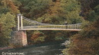
Completed in 2012 or 2013. Replaced a bridge that was damaged by flood in 1881. Cotherstone Footbridge . "...the second bridge [at this location] was a suspension bridge whose cable snapped in 1929 with 40 people on the bridge, killing one."Bridgemeister ID: 8298 (added 2024-02-08)Name: Swing Location: Dala-Floda, Gagnef, Dalarna, Sweden Crossing: Västerdalälven Coordinates: 60.505667 N 14.817861 E Maps: Acme , GeoHack , Google , OpenStreetMap Use: Footbridge Status: In use (last checked: 2019) Main Cables: Wire (steel) Main Span: 1 x 61 meters (200.1 feet) estimated
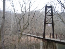
Collapsed September 13, 1842 under weight of troops (ONC). Collapsed under weight of snow, winter 2009-2010. Remnants extant, 2019. Bridgemeister ID: 1304 (added 2004-04-09)Name: Swinger Location: Owensboro vicinity, Kentucky , USA At or Near Feature: Panther Creek Park Coordinates: 37.716904 N 87.222139 W Maps: Acme , GeoHack , Google , OpenStreetMap Use: Footbridge Status: In use (last checked: 2021) Main Cables: Wire (steel) Suspended Spans: 1
Bridgemeister ID: 1982 (added 2005-12-02)Name: Swinging Also Known As: Haviland Avenue Location: Audubon, New Jersey , USA Crossing: Haviland Avenue gully Use: Footbridge Status: Demolished, 1942 Main Cables: Wire
Bridgemeister ID: 361 (added before 2003)Name: Swinging Also Known As: Orange Grove Location: Catonsville, Maryland , USA Crossing: Patapsco River At or Near Feature: Patapsco Valley State Park Coordinates: 39.241086 N 76.749746 W Maps: Acme , GeoHack , Google , OpenStreetMap Use: Footbridge Status: In use (last checked: 2009) Main Cables: Wire (steel) Suspended Spans: 1
Bridgemeister ID: 3332 (added 2019-12-07)Name: Swinging Also Known As: Orange Grove Location: Catonsville, Maryland , USA Crossing: Patapsco River At or Near Feature: Patapsco Valley State Park Coordinates: 39.241433 N 76.749293 W Maps: Acme , GeoHack , Google , OpenStreetMap Use: Footbridge Status: Removed Main Cables: Wire
Bridgemeister ID: 1442 (added 2004-07-31)Name: Swinging Location: Browns Park National Wildlife Refuge vicinity, Colorado , USA Crossing: Green River Coordinates: 40.827833 N 109.030444 W Maps: Acme , GeoHack , Google , OpenStreetMap Use: Vehicular (one-lane) Status: In use (last checked: 2019) Main Cables: Wire (steel) Suspended Spans: 1 Main Span: 1 x 96.3 meters (316 feet) estimated
June 2014: Damaged when a tractor, well over the posted weight limit, tried to cross and broke through the bridge deck. Reopened August 23, 2018 after an "extensive reconstruction" that completely replaced the deck and possibly cables. After reconstruction, the weight limit was increased from 3 tons to 20 tons. November 2009: Closed due to safety concerns after six cable strrands were found to be broken. Repaired June-August 2010 and reopened. Bridgemeister ID: 358 (added before 2003)Name: Swinging Location: Carthage and Carterville, Missouri , USA Crossing: Center Creek At or Near Feature: Lakeside Park Use: Footbridge Suspended Spans: 1
Was in use in early 1900's. Bridgemeister ID: 1910 (added 2005-10-08)Name: Swinging Location: Dallas, Oregon , USA Crossing: Rickreall Creek At or Near Feature: Delbert Hunter Arboretum and Botanical Garden, Dallas City Park Coordinates: 44.924933 N 123.324833 W Maps: Acme , GeoHack , Google , OpenStreetMap Use: Footbridge Status: In use (last checked: 2021) Main Cables: Wire (steel) Suspended Spans: 1 Main Span: 1
Bridgemeister ID: 1266 (added 2004-03-14)Name: Swinging Location: Danville, Indiana , USA Crossing: White Lick Creek At or Near Feature: Ellis Park Coordinates: 39.762317 N 86.5152 W Maps: Acme , GeoHack , Google , OpenStreetMap Use: Footbridge Status: In use (last checked: 2005) Main Cables: Wire Suspended Spans: 1 Main Span: 1 x 41.8 meters (137 feet) estimated
Destroyed by flood before 2003. Supposedly was located across the street from Coffey's General Store which is still in existence as of 2020. Coordinates indicate approximate location based on that description. Closed since 2016 after an inspection deemed it unsafe. Was mentioned in local press several times in 2019 and 2020 with the community upset that no action was taken to repair the bridge which provided a convenient means of reaching downtown Elkins. Various articles in this time frame refer to the bridge as 76 or 80 years old. Bridgemeister ID: 1617 (added 2005-02-26)Name: Swinging Location: Everett, Pennsylvania , USA Crossing: Raystown Branch Juniata River Coordinates: 40.01670 N 78.3539 W Maps: Acme , GeoHack , Google , OpenStreetMap Use: Vehicular (one-lane) Status: In use (last checked: 2021) Main Cables: Wire (steel) Suspended Spans: 3 Main Span: 1 x 43 meters (141 feet) estimated Side Spans: 1 x 11 meters (36 feet) estimated,
Crossed a channel of the Kennebec River to Mill Island. Appears to have been located at the coordinates provided here. Bridgemeister ID: 871 (added 2003-08-30)Name: Swinging Location: Fort Mill, South Carolina , USA Crossing: Steele Creek At or Near Feature: Anne Springs Close Greenway Coordinates: 35.040867 N 80.939233 W Maps: Acme , GeoHack , Google , OpenStreetMap Use: Footbridge Status: In use (last checked: 2012) Main Cables: Wire Suspended Spans: 1
Bridgemeister ID: 1119 (added 2004-01-09)Name: Swinging Location: Greenville, Ohio , USA Crossing: Greenville Creek At or Near Feature: Greenville City Park Coordinates: 40.109252 N 84.630494 W Maps: Acme , GeoHack , Google , OpenStreetMap Use: Footbridge Status: In use (last checked: 2007) Main Cables: Wire (steel) Suspended Spans: 1
Destroyed by Hurricane Iniki, 1992. Rebuilt. Temporarily closed, week of January 10, 2005, because of damage due to storm. HA20050114: "A portion of the bridge has completely split apart from the end support at the town side of the bridge, said Al Afos of the county Roads Division." Appears to have reopened later in 2005. Near (footbridge) - Hanapepe vicinity, Hawaii, USA . Bridgemeister ID: 259 (added before 2003)Name: Swinging Location: Iron Mountain, Michigan , USA At or Near Feature: Twin Falls vicinity Use: Footbridge Main Cables: Wire
Bridgemeister ID: 918 (added 2003-10-17)Name: Swinging Location: James Creek, Raystown Lake vicinity, Pennsylvania , USA Crossing: Trough Creek At or Near Feature: Trough Creek State Park Coordinates: 40.32213 N 78.13003 W Maps: Acme , GeoHack , Google , OpenStreetMap Use: Footbridge Status: In use (last checked: 2020) Main Cables: Wire Suspended Spans: 1 Main Span: 1 x 30.5 meters (100 feet) estimated
Bridgemeister ID: 310 (added before 2003)Name: Swinging Location: Kinzel Springs (Townsend), Tennessee , USA Crossing: Little River Use: Footbridge Main Cables: Wire
There are at least two swinging bridge locations at Townsend, Tennessee. There have been at least two bridges at this location known as Kinzel Springs (also Sunshine) at the western end of Townsend. This entry is for the older of the two Kinzel Springs bridges. Bridgemeister ID: 1138 (added 2004-01-17)Name: Swinging Location: Kinzel Springs (Townsend), Tennessee , USA Crossing: Little River Coordinates: 35.68701 N 83.79791 W Maps: Acme , GeoHack , Google , OpenStreetMap Use: Footbridge Status: Closed, 2019 (last checked: 2020) Main Cables: Wire (steel) Suspended Spans: 1
There are at least two swinging bridge locations at Townsend, Tennessee. There have been at least two bridges at this location known as Kinzel Springs (also Sunshine) at the western end of Townsend. This entry is for the present-day (2020) of the Kinzel Springs bridges. 2019: Closed due to decaying timber structural members. 2020, June: Repairs started. Expected to be reopened in 2020. Mail | Facebook | Twitter

