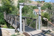
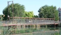
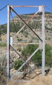
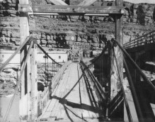
Suspension Bridges of Utah
This is a list of all 13 bridges from the suspension bridge inventory for Utah in USA. Wherever you see a Bridgemeister ID number click it to isolate the bridge on its own page.
Related Lists:
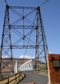
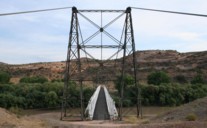
Bridgemeister ID: 135 (added before 2003)Year Completed: 1916 Name: Dewey Location: Moab vicinity, Utah , USA Crossing: Colorado River Coordinates: 38.81187 N 109.30333 W Maps: Acme , GeoHack , Google , OpenStreetMap Use: Vehicular (one-lane) Status: Derelict, since April, 2008 (last checked: 2008) Main Cables: Wire (steel) Suspended Spans: 1 Main Span: 1 x 151.2 meters (496 feet) estimated
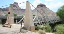
Restored as footbridge, 2000. Deck destroyed by fire April 6, 2008. News reports stated a nearby brush fire (started by a young boy playing with matches) ignited the bridge. Bridgemeister ID: 362 (added before 2003)Year Completed: 1937 Name: San Rafael Swinging Also Known As: Buckhorn Wash Location: San Rafael Bridge Recreation Site, Utah , USA Crossing: San Rafael River Coordinates: 39.08112 N 110.66639 W Maps: Acme , GeoHack , Google , OpenStreetMap Principals: CCC, Milton P. Greaves Use: Vehicular Status: Restricted to foot traffic (last checked: 2020) Main Cables: Wire (steel) Main Span: 1 x 48.8 meters (160 feet)
Restored, c.1994. Some web sites state this bridge was destroyed by fire in 2008. This appears to be caused by confusion with Utah's Dewey bridge destroyed by a fire in 2008. The San Rafael bridge was not destroyed and was still in active use as of 2020. Bridgemeister ID: 2628 (added 2018-12-31)Year Completed: 2014 Name: Pioneer Crossing Location: West Valley City, Utah , USA Crossing: Jordan River At or Near Feature: Jordan River Parkway Trail Coordinates: 40.703250 N 111.927649 W Maps: Acme , GeoHack , Google , OpenStreetMap Use: Footbridge Status: In use (last checked: 2018) Main Cables: Wire (steel) Suspended Spans: 1
Bridgemeister ID: 2926 (added 2019-09-15)Year Completed: 2015 Name: Bear Canyon Location: Draper, Utah , USA Coordinates: 40.524024 N 111.826085 W Maps: Acme , GeoHack , Google , OpenStreetMap Principals: Ralph L. Wadsworth Construction Co. Inc. Use: Footbridge Status: In use (last checked: 2019) Main Cables: Wire (steel) Suspended Spans: 1 Main Span: 1 x 56.4 meters (185 feet)
Bridgemeister ID: 5110 (added 2020-09-05)Year Completed: 2020 Name: (footbridge) Location: Spanish Fork, Utah , USA Crossing: Spanish Fork At or Near Feature: Dripping Rock Trail Coordinates: 40.084505 N 111.596595 W Maps: Acme , GeoHack , Google , OpenStreetMap Use: Footbridge Status: In use (last checked: 2020) Main Cables: Wire (steel) Suspended Spans: 1
Bridgemeister ID: 5990 (added 2021-07-02)Name: (footbridge) Location: Boulder, Utah , USA Crossing: Calf Creek At or Near Feature: Grand Escalante National Monument Coordinates: 37.794371 N 111.413965 W Maps: Acme , GeoHack , Google , OpenStreetMap Use: Footbridge Status: In use (last checked: 2021) Main Cables: Wire (steel) Suspended Spans: 1 Main Span: 1
Bridgemeister ID: 1415 (added 2004-07-04)Name: (footbridge) Location: Helper, Utah , USA Crossing: Price River Coordinates: 39.688467 N 110.855617 W Maps: Acme , GeoHack , Google , OpenStreetMap Use: Footbridge Status: In use (last checked: 2022) Main Cables: Wire (steel) Suspended Spans: 1 Main Span: 1 x 37.8 meters (124 feet) estimated
Bridgemeister ID: 2216 (added 2007-02-13)Name: (footbridge) Location: Helper, Utah , USA Crossing: Price River Coordinates: 39.68397 N 110.85598 W Maps: Acme , GeoHack , Google , OpenStreetMap Use: Footbridge Status: In use (last checked: 2006) Main Cables: Wire (steel) Suspended Spans: 1 Main Span: 1 x 24.1 meters (79 feet) estimated
Bridgemeister ID: 2217 (added 2007-02-13)Name: (footbridge) Location: Hog Springs Rest Area, Utah , USA Crossing: North Wash At or Near Feature: Glen Canyon Nat. Rec. Area vicinity Coordinates: 37.96283 N 110.49188 W Maps: Acme , GeoHack , Google , OpenStreetMap Use: Footbridge Status: In use (last checked: 2006) Main Cables: Wire (steel) Suspended Spans: 1 Main Span: 1 x 21.6 meters (71 feet) estimated
Bridgemeister ID: 869 (added 2003-08-30)Name: (footbridge) Location: Salem, Utah , USA Crossing: Salem Lake Coordinates: 40.05256 N 111.67755 W Maps: Acme , GeoHack , Google , OpenStreetMap Use: Footbridge Status: In use (last checked: 2006) Main Cables: Wire (steel) Suspended Spans: 1 Main Span: 1 x 25.9 meters (85 feet) estimated
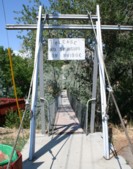
After collapse, main span rebuilt by suspending a large donated highway overhead sign truss making an effective through truss. Bridgemeister ID: 2215 (added 2007-02-13)Name: (pipeline bridge) Location: Helper vicinity, Utah , USA Crossing: Price River Coordinates: 39.70666 N 110.86906 W Maps: Acme , GeoHack , Google , OpenStreetMap Use: Pipeline Status: Extant (last checked: 2006) Main Cables: Wire Suspended Spans: 1 Main Span: 1 x 45.7 meters (150 feet) estimated
Bridgemeister ID: 7518 (added 2023-01-13)Name: (pipeline bridge) Location: Marriott-Slaterville, Ogden vicinity, Utah , USA Crossing: Weber River Coordinates: 41.237267 N 112.013819 W Maps: Acme , GeoHack , Google , OpenStreetMap Use: Pipeline Status: Extant (last checked: 2022) Main Cables: Wire (steel) Suspended Spans: 1 Main Span: 1 x 45.4 meters (149 feet) estimated
Do you have any information or photos for these bridges that you would like to share? Please email david.denenberg@bridgemeister.com .
Mail | Facebook | Twitter
