Suspension Bridges Crossing Mohawk River
This is a list of all 2 bridges from the suspension bridge inventory crossing Mohawk River. Please note that different rivers with the same name will be grouped together. For example, selecting 'Bear Creek' shows bridges across several different Bear Creeks. Also, similarly named rivers are grouped separately. For example, 'River Dee' (UK) bridges are grouped separately from 'Dee River' (Australia) bridges. Wherever you see a Bridgemeister ID number click it to isolate the bridge on its own page.
Related Lists:
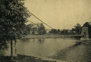
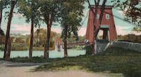
1853: Fort Hunter
Tribes Hill and Fort Hunter, New York, USA - Mohawk River
| Bridgemeister ID: | 44 (added before 2003) |
| Year Completed: | 1853 |
| Name: | Fort Hunter |
| Also Known As: | Fonda |
| Location: | Tribes Hill and Fort Hunter, New York, USA |
| Crossing: | Mohawk River |
| Coordinates: | 42.945500 N 74.287028 W |
| Maps: | Acme, GeoHack, Google, OpenStreetMap |
| Principals: | John W. Murphy, Thomas R. Hulett |
| References: | ONC, PTS2 |
| Use: | Vehicular |
| Status: | Dismantled, 1935 |
| Main Cables: | Wire (iron) |
| Suspended Spans: | 1 |
| Main Span: | 1 x 169.5 meters (556 feet) |
Notes:
- According to ONC: Designed by John W. Murphy (who designed several suspension bridges in the 1850s and 1860s in New York and Pennsylvania). Fort Hunter Suspension Bridge Company incorporated in 1852, but cables were not installed until 1853.
- Crossed the Mohawk River on the old alignment of Main Street, east of the current Main Street bridge, at the ends of the streets now known as Brown Place in Fort Hunter and Locust Avenue in Tribes Hill.
- 1935: Bridge is dismantled (ONC).
External Links:
Image Sets:


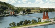
1870: Finck's
Little Falls, New York, USA - Mohawk River
| Bridgemeister ID: | 328 (added before 2003) |
| Year Completed: | 1870 |
| Name: | Finck's |
| Also Known As: | Fink's |
| Location: | Little Falls, New York, USA |
| Crossing: | Mohawk River |
| Coordinates: | 43.034102 N 74.830185 W |
| Maps: | Acme, GeoHack, Google, OpenStreetMap |
| References: | ONC |
| Use: | Vehicular |
| Status: | Destroyed, 1917 |
| Main Cables: | Wire |
Notes:
- Heavily damaged by fire, 1917.
- Coordinates reflect where modern Fincks Basin Road meets the Mohawk River, likely approximate location of this bridge.
External Links:
Image Sets:

Do you have any information or photos for these bridges that you would like to share? Please email david.denenberg@bridgemeister.com.
Mail | Facebook | X (Twitter) | Bluesky