Suspension Bridges Crossing Glomma
This is a list of all 30 bridges from the suspension bridge inventory crossing Glomma. Please note that different rivers with the same name will be grouped together. For example, selecting 'Bear Creek' shows bridges across several different Bear Creeks. Also, similarly named rivers are grouped separately. For example, 'River Dee' (UK) bridges are grouped separately from 'Dee River' (Australia) bridges. Wherever you see a Bridgemeister ID number click it to isolate the bridge on its own page.
Related Lists:
| Bridgemeister ID: | 4502 (added 2020-05-02) |
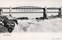
| Year Completed: | 1854 |
| Name: | Sarp |
| Also Known As: | Sarpsbro, Sarpsbrua |
| Location: | Sarpsborg, Viken, Norway |
| Crossing: | Glomma |
| At or Near Feature: | Sarpefossen |
| Coordinates: | 59.276684 N 11.132073 E |
| Maps: | Acme, GeoHack, Google, kart.1881.no, OpenStreetMap |
| Use: | Vehicular |
| Status: | Removed |
| Main Cables: | Eyebar (iron) |
| Suspended Spans: | 3 |
| Main Span: | 1 x 47 meters (154.2 feet) |
| Side Spans: | 1 x 23 meters (75.5 feet), 1 x 15 meters (49.2 feet) |
Notes:
- Originally constructed as a typical eyebar suspension bridge. Reconstructed in 1879 to support a three-span lenticular rail bridge on top of the suspension bridge towers, creating an upper deck for rail traffic. The original deck was suspended from the lower chord of the lenticular trusses.
- See Tamaris-les-Forges - Alès vicinity, Gard, France. Another interesting hybrid rail and suspension bridge.
External Links:
- DigitaltMuseum - Bru over Glomma ved Sarpsfossen
- DigitaltMuseum - Bru over Glomma ved Sarpsfossen, sett fra kjørebanen ved østre hovedpillar
- DigitaltMuseum - Damplokomotiv, trolig type 9a, med godstog på Sarpsfossen bru
- DigitaltMuseum - Sarpsfossen og Sarpsbrua
- DigitaltMuseum - Sarpsfossen og Sarpsbrua, bygd i 1854
- DigitaltMuseum - Tegning til Sarpsbrua i Sarpsborg
- Wikipedia - Sarp Bridge
- Wikiwand - Sarp Bridge
Image Sets:
| Bridgemeister ID: | 3917 (added 2020-03-20) |
| Year Completed: | 1906 |
| Name: | Auma |
| Location: | Auma, Tynset, Innlandet, Norway |
| Crossing: | Glomma |
| Coordinates: | 62.21952 N 10.65307 E |
| Maps: | Acme, GeoHack, Google, kart.1881.no, OpenStreetMap |
| Use: | Vehicular (one-lane) |
| Status: | Removed |
| Main Cables: | Wire (steel) |
| Suspended Spans: | 1 |
| Main Span: | 1 x 67 meters (219.8 feet) estimated |
Notes:
- Removed prior to replacement by a truss bridge constructed on the same piers in 1961.
External Links:
| Bridgemeister ID: | 3911 (added 2020-03-15) |
| Year Completed: | 1908 |
| Name: | Erlinesset |
| Location: | Tolga, Østerdalen, Innlandet, Norway |
| Crossing: | Glomma |
| Coordinates: | 62.42619 N 11.09129 E |
| Maps: | Acme, GeoHack, Google, kart.1881.no, OpenStreetMap |
| Use: | Vehicular (one-lane) |
| Status: | In use (last checked: 2019) |
| Main Cables: | Wire (steel) |
| Suspended Spans: | 2 |
| Main Spans: | 2 x 42.5 meters (139.4 feet) estimated |
Notes:
- Restored 1951 and 1999.
External Links:
| Bridgemeister ID: | 3920 (added 2020-03-20) |
| Year Completed: | 1913 |
| Name: | Bellingmo |
| Location: | Bellingmo, Alvdal, Innlandet, Norway |
| Crossing: | Glomma |
| Coordinates: | 62.02715 N 10.78453 E |
| Maps: | Acme, GeoHack, Google, kart.1881.no, OpenStreetMap |
| Use: | Vehicular (one-lane) |
| Status: | In use (last checked: 2019) |
| Main Cables: | Wire (steel) |
| Suspended Spans: | 1 |
| Main Span: | 1 x 80 meters (262.5 feet) estimated |
| Bridgemeister ID: | 4084 (added 2020-04-04) |
| Year Completed: | 1918 |
| Name: | Rånåsfoss |
| Location: | Rånåsfoss, Viken, Norway |
| Crossing: | Glomma |
| Coordinates: | 60.030429 N 11.329303 E |
| Maps: | Acme, GeoHack, Google, kart.1881.no, OpenStreetMap |
| Use: | Vehicular (one-lane) |
| Status: | Replaced |
| Main Cables: | Wire (steel) |
| Main Span: | 1 x 184 meters (603.7 feet) estimated |
Notes:
- Patrick S. O'Donnell notes: "This bridge was built in 1918 as a provisional suspension bridge to facilitate the construction of the dam a little less than a half kilometer downstream. Then it was built over and transformed into the 1927 Rånåsfoss bridge. It appears everything of the original bridge was replaced or new, except the lattice towers which in effect became rebar and are now encased in concrete. New anchorage pits were dug and new anchor eyebars placed within to accept the new main cables."
- Replaced by 1927 Rånåsfoss - Rånåsfoss, Viken, Norway.
- All past and present bridges at this location.
External Links:
| Bridgemeister ID: | 3908 (added 2020-03-15) |
| Year Completed: | 1921 |
| Name: | Høistad |
| Location: | Høistad, Norway |
| Crossing: | Glomma |
| Coordinates: | 62.50644 N 11.26111 E |
| Maps: | Acme, GeoHack, Google, kart.1881.no, OpenStreetMap |
| Use: | Vehicular (one-lane) |
| Status: | Removed |
| Main Cables: | Wire |
| Main Span: | 1 x 36 meters (118.1 feet) estimated |
Notes:
- Based on historic aerial images, removed 1953-1963.
External Links:
- DigitaltMuseum - Den gamle Høistad bru, med Røstfossen kraftverk i bakgrunnen. The 1818 - 1921 bridge that existed prior with the Røstefossen Kraftverk (Dam) just beyond.
- DigitaltMuseum - Kabelbru. Showing the northwest tower of the suspension bridge being constructed (~1920) on the far side of the river alongside of the 1818 bridge. One of the struts (topped with snow) extending out from the nearside tower is visible half way up the left edge.
| Bridgemeister ID: | 3921 (added 2020-03-20) |
| Year Completed: | 1923 |
| Name: | Atna |
| Location: | Atna, Stor-Elvdal, Innlandet, Norway |
| Crossing: | Glomma |
| Coordinates: | 61.72890 N 10.82639 E |
| Maps: | Acme, GeoHack, Google, kart.1881.no, OpenStreetMap |
| Use: | Vehicular (one-lane) |
| Status: | In use (last checked: 2019) |
| Main Cables: | Wire (steel) |
| Suspended Spans: | 1 |
| Main Span: | 1 x 150 meters (492.1 feet) estimated |
Notes:
- Rehabilitated, 1989.
| Bridgemeister ID: | 3931 (added 2020-03-20) |
| Year Completed: | 1927 |
| Name: | Bingsfoss |
| Location: | Sørumsand, Lillestrøm, Viken, Norway |
| Crossing: | Glomma |
| Coordinates: | 59.98854 N 11.26129 E |
| Maps: | Acme, GeoHack, Google, kart.1881.no, OpenStreetMap |
| Use: | Vehicular |
| Status: | Removed, 1978 |
| Main Cables: | Wire (steel) |
| Suspended Spans: | 1 |
| Main Span: | 1 x 132 meters (433.1 feet) estimated |
External Links:
| Bridgemeister ID: | 3930 (added 2020-03-20) |
| Year Completed: | 1927 |
| Name: | Rånåsfoss |
| Location: | Rånåsfoss, Viken, Norway |
| Crossing: | Glomma |
| Coordinates: | 60.031390 N 11.327592 E |
| Maps: | Acme, GeoHack, Google, kart.1881.no, OpenStreetMap |
| Use: | Vehicular (one-lane) |
| Status: | In use (last checked: 2019) |
| Main Cables: | Wire (steel) |
| Suspended Spans: | 1 |
| Main Span: | 1 x 184 meters (603.7 feet) estimated |
Notes:
- Rehabilitation completed, 2016.
- Replaced 1918 Rånåsfoss - Rånåsfoss, Viken, Norway.
- All past and present bridges at this location.
External Links:
Image Sets:
| Bridgemeister ID: | 3914 (added 2020-03-20) |
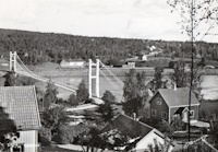
| Year Completed: | 1928 |
| Name: | Åbrua |
| Also Known As: | Aaen |
| Location: | Tynset, Innlandet, Norway |
| Crossing: | Glomma |
| Coordinates: | 62.288617 N 10.823438 E |
| Maps: | Acme, GeoHack, Google, kart.1881.no, OpenStreetMap |
| Use: | Vehicular (one-lane) |
| Status: | Replaced, 1980 |
| Main Cables: | Wire (steel) |
| Suspended Spans: | 1 |
| Main Span: | 1 x 10⁹ meters (357.6 feet) estimated |
Notes:
- Heavily damaged by flood, likely prior to 1969. Appears to have been repaired before being replaced with another suspension bridge in 1980.
- Replaced by 1980 Åbrua (Aaen) - Tynset, Innlandet, Norway.
- All past and present bridges at this location.
External Links:
| Bridgemeister ID: | 3926 (added 2020-03-20) |
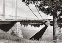
| Year Completed: | 1936 |
| Name: | Elverum |
| Also Known As: | Nybrua |
| Location: | Elverum, Innlandet, Norway |
| Crossing: | Glomma |
| Coordinates: | 60.88287 N 11.55644 E |
| Maps: | Acme, GeoHack, Google, kart.1881.no, OpenStreetMap |
| Use: | Vehicular (two-lane), with walkway |
| Status: | In use (last checked: 2023) |
| Main Cables: | Wire (steel) |
| Suspended Spans: | 1 |
| Main Span: | 1 x 160 meters (524.9 feet) estimated |
External Links:
- DigitaltMuseum - Bygging av Nybrua 1934.Reising av østre tårn.
- DigitaltMuseum - Bygging av Nybrua 1935.Arbeidere på brua.
- Hamar Dagblad - 80 år som Nybru - og like vakker!
- Structurae - Structure ID 20086232
Image Sets:
| Bridgemeister ID: | 3919 (added 2020-03-20) |
| Year Completed: | 1936 |
| Name: | Kveberg |
| Location: | Alvdal, Innlandet, Norway |
| Crossing: | Glomma |
| Coordinates: | 62.07803 N 10.69445 E |
| Maps: | Acme, GeoHack, Google, kart.1881.no, OpenStreetMap |
| Use: | Vehicular (one-lane) |
| Status: | In use (last checked: 2019) |
| Main Cables: | Wire (steel) |
| Suspended Spans: | 1 |
| Main Span: | 1 x 90 meters (295.3 feet) estimated |
| Bridgemeister ID: | 3912 (added 2020-03-15) |
| Year Completed: | 1943 |
| Name: | Tynset |
| Location: | Tynset, Innlandet, Norway |
| Crossing: | Glomma |
| Coordinates: | 62.28051 N 10.77184 E |
| Maps: | Acme, GeoHack, Google, kart.1881.no, OpenStreetMap |
| Use: | Vehicular |
| Status: | Removed, 2000 |
| Main Cables: | Wire (steel) |
| Suspended Spans: | 1 |
| Main Span: | 1 x 130 meters (426.5 feet) estimated |
External Links:
| Bridgemeister ID: | 3932 (added 2020-03-20) |
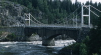
| Year Completed: | 1944 |
| Name: | Fossum |
| Location: | Askim and Spydeberg, Østfold, Norway |
| Crossing: | Glomma |
| Coordinates: | 59.60155 N 11.09936 E |
| Maps: | Acme, GeoHack, Google, kart.1881.no, OpenStreetMap |
| Use: | Vehicular |
| Status: | Replaced, 1961 |
| Main Cables: | Wire (steel) |
| Suspended Spans: | 1 |
| Main Span: | 1 x 84 meters (275.6 feet) |
Notes:
- Built as a temporary replacement for the 1856 two-span wood Fossum bridge damaged during 1940 hostilities. The suspension bridge was built directly over the 1856 bridge resulting in an odd appearance with minimal clearance between the two bridges.
- Replaced by 1961 Fossum - Askim and Spydeberg, Østfold, Norway.
- All past and present bridges at this location.
Image Sets:
| Bridgemeister ID: | 3928 (added 2020-03-20) |
| Year Completed: | 1949 |
| Name: | Brandval |
| Location: | Brandval, Innlandet, Norway |
| Crossing: | Glomma |
| Coordinates: | 60.31928 N 12.01030 E |
| Maps: | Acme, GeoHack, Google, kart.1881.no, OpenStreetMap |
| Use: | Vehicular (one-lane), with walkway |
| Status: | In use (last checked: 2019) |
| Main Cables: | Wire (steel) |
| Suspended Spans: | 1 |
| Main Span: | 1 x 187 meters (613.5 feet) estimated |
| Bridgemeister ID: | 3929 (added 2020-03-20) |
| Year Completed: | 1949 |
| Name: | Kongsvinger |
| Location: | Kongsvinger, Innlandet, Norway |
| Crossing: | Glomma |
| Coordinates: | 60.18934 N 11.99692 E |
| Maps: | Acme, GeoHack, Google, kart.1881.no, OpenStreetMap |
| Use: | Vehicular (two-lane), with walkway |
| Status: | In use (last checked: 2019) |
| Main Cables: | Wire (steel) |
| Suspended Spans: | 1 |
| Main Span: | 1 x 10⁴ meters (341.2 feet) estimated |
Image Sets:
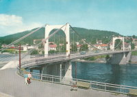
| Bridgemeister ID: | 3925 (added 2020-03-20) |
| Year Completed: | 1950 |
| Name: | Glomstadfoss |
| Location: | Åsta, Åmot, Innlandet, Norway |
| Crossing: | Glomma |
| Coordinates: | 61.07884 N 11.36695 E |
| Maps: | Acme, GeoHack, Google, kart.1881.no, OpenStreetMap |
| Use: | Vehicular (one-lane) |
| Status: | In use (last checked: 2019) |
| Main Cables: | Wire (steel) |
| Suspended Spans: | 1 |
| Main Span: | 1 x 100 meters (328.1 feet) estimated |
| Bridgemeister ID: | 3924 (added 2020-03-20) |
| Year Completed: | 1955 |
| Name: | Opphus |
| Location: | Opphus, Rena, Hedmark, Norway |
| Crossing: | Glomma |
| Coordinates: | 61.330527 N 11.259730 E |
| Maps: | Acme, GeoHack, Google, kart.1881.no, OpenStreetMap |
| Use: | Vehicular |
| Status: | In use (last checked: 2019) |
| Main Cables: | Wire (steel) |
| Suspended Spans: | 1 |
| Main Span: | 1 x 120 meters (393.7 feet) estimated |
External Links:
| Bridgemeister ID: | 3910 (added 2020-03-15) |
| Year Completed: | 1958 |
| Name: | Stormyrbrua |
| Location: | Os, Innlandet, Norway |
| Crossing: | Glomma |
| Coordinates: | 62.48435 N 11.17481 E |
| Maps: | Acme, GeoHack, Google, kart.1881.no, OpenStreetMap |
| Use: | Footbridge |
| Status: | In use (last checked: 2019) |
| Main Cables: | Wire (steel) |
| Suspended Spans: | 1 |
| Main Span: | 1 x 82 meters (269 feet) estimated |
Notes:
- Restored, 1995.
| Bridgemeister ID: | 3927 (added 2020-03-20) |
| Year Completed: | 1959 |
| Name: | Glomdals |
| Location: | Elverum, Innlandet, Norway |
| Crossing: | Glomma |
| Coordinates: | 60.87215 N 11.55240 E |
| Maps: | Acme, GeoHack, Google, kart.1881.no, OpenStreetMap |
| Use: | Footbridge |
| Status: | In use (last checked: 2019) |
| Main Cables: | Wire (steel) |
| Suspended Spans: | 1 |
| Main Span: | 1 x 97 meters (318.2 feet) estimated |
Notes:
- Connects the Glomdals Museum and Norwegian Forestry Museum's open-air museum crossing the Prestfossen waterfalls.
External Links:
| Bridgemeister ID: | 1325 (added 2004-04-28) |
| Year Completed: | 1961 |
| Name: | Fossum |
| Location: | Askim and Spydeberg, Østfold, Norway |
| Crossing: | Glomma |
| Coordinates: | 59.603194 N 11.102166 E |
| Maps: | Acme, GeoHack, Google, kart.1881.no, OpenStreetMap |
| Use: | Vehicular (two-lane) |
| Status: | In use (last checked: 2018) |
| Main Cables: | Wire (steel) |
| Suspended Spans: | 1 |
| Main Span: | 1 x 125 meters (410.1 feet) |
Notes:
- Replaced 1944 Fossum - Askim and Spydeberg, Østfold, Norway.
- All past and present bridges at this location.
External Links:
Image Sets:
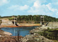
| Bridgemeister ID: | 3933 (added 2020-03-20) |
| Year Completed: | 1962 |
| Name: | Vamma |
| Location: | Askim and Skiptvet, Østfold, Norway |
| Crossing: | Glomma |
| Coordinates: | 59.53805 N 11.16776 E |
| Maps: | Acme, GeoHack, Google, kart.1881.no, OpenStreetMap |
| Use: | Vehicular (two-lane) |
| Status: | In use (last checked: 2019) |
| Main Cables: | Wire (steel) |
| Suspended Spans: | 1 |
| Main Span: | 1 x 180 meters (590.6 feet) estimated |
| Bridgemeister ID: | 3923 (added 2020-03-20) |
| Year Completed: | 1968 |
| Name: | Sundfloen |
| Location: | Koppang, Stor-Elvda, Innlandet, Norway |
| Crossing: | Glomma |
| Coordinates: | 61.56972 N 11.02122 E |
| Maps: | Acme, GeoHack, Google, kart.1881.no, OpenStreetMap |
| Use: | Vehicular (two-lane, heavy vehicles), with walkway |
| Status: | In use (last checked: 2019) |
| Main Cables: | Wire (steel) |
| Suspended Spans: | 1 |
| Main Span: | 1 x 170 meters (557.7 feet) |
Notes:
- Deck strengthened in 2015 to accommodate heavier timber trucks up to 60 tons.
| Bridgemeister ID: | 3915 (added 2020-03-20) |
| Year Completed: | 1980 |
| Name: | Åbrua |
| Also Known As: | Aaen |
| Location: | Tynset, Innlandet, Norway |
| Crossing: | Glomma |
| Coordinates: | 62.288074 N 10.823862 E |
| Maps: | Acme, GeoHack, Google, kart.1881.no, OpenStreetMap |
| Use: | Vehicular (one-lane) |
| Status: | In use (last checked: 2019) |
| Main Cables: | Wire (steel) |
| Suspended Spans: | 1 |
| Main Span: | 1 x 10⁶ meters (347.8 feet) estimated |
Notes:
- Replaced 1928 Åbrua (Aaen) - Tynset, Innlandet, Norway.
- All past and present bridges at this location.
External Links:
| Bridgemeister ID: | 4515 (added 2020-05-02) |
| Year Completed: | 2020 |
| Name: | Neby |
| Location: | Neby, Tynset, Innlandet, Norway |
| Crossing: | Glomma |
| Coordinates: | 62.28211 N 10.75636 E |
| Maps: | Acme, GeoHack, Google, kart.1881.no, OpenStreetMap |
| Use: | Footbridge |
| Status: | In use (last checked: 2020) |
| Main Cables: | Wire (steel) |
| Suspended Spans: | 3 |
| Main Spans: | 2 x 30.25 meters (99.2 feet), 1 x 33 meters (108.3 feet) |
External Links:
- DigitaltMuseum - Tynset, Neby bru. Patick S. O'Donnell writes: "The 2020 Neby bridge is being built on the same alignment of the last bridge to stand here from 1843 to 1943. That century old bridge was demolished upon completion of the 1943 Tynset suspension bridge less than a mile upstream. The 1843 bridge was the third bridge here and consisted of three timber arch spans with stone abutments on the banks, and a pair of stone piers within the river. Sediment had formed tiny islands where those pair of piers once stood and from these islets two piers will rise to support two of the four suspension bridge towers, with the other two towers close to where the abutments were."
| Bridgemeister ID: | 3907 (added 2020-03-14) |
| Name: | (suspension bridge) |
| Location: | Galåa, Røros, Trøndelag, Norway |
| Crossing: | Glomma |
| Coordinates: | 62.54824 N 11.28900 E |
| Maps: | Acme, GeoHack, Google, kart.1881.no, OpenStreetMap |
| Status: | Removed |
| Main Span: | 1 x 66.5 meters (218.2 feet) estimated |
Notes:
- Based on historical aerial images, completed by 1937, still in existence in 1969, and removed by 2003.
| Bridgemeister ID: | 4457 (added 2020-04-25) |
| Name: | (suspension bridge) |
| Location: | Spydeberg vicinity, Viken, Norway |
| Crossing: | Glomma |
| At or Near Feature: | Solbergfoss |
| Coordinates: | 59.637980 N 11.153810 E |
| Maps: | Acme, GeoHack, Google, kart.1881.no, OpenStreetMap |
| Status: | Removed |
| Main Cables: | Wire |
Notes:
- Temporary suspension bridge used in the construction of the dam at Solbergfoss Coordinates are approximate.
- An accident occurred in 1920 where it appears the bridge was overloaded and a main cable gave way causing a couple of trolley cars hauling rocks and workers to be thrown from the bridge including two men that disappeared.
External Links:
| Bridgemeister ID: | 4470 (added 2020-04-26) |
| Name: | Borregaard |
| Location: | Sarpsborg, Viken, Norway |
| Crossing: | Glomma |
| Coordinates: | 59.274801 N 11.126999 E |
| Maps: | Acme, GeoHack, Google, kart.1881.no, OpenStreetMap |
| Use: | Pipeline |
| Status: | Removed |
| Main Cables: | Wire |
| Suspended Spans: | 1 |
| Main Span: | 1 x 135 meters (442.9 feet) estimated |
Notes:
- Built before 1938. Removed at some point between 1963 and 1978.
- There was a simple (drooping) suspension bridge immediately adjacent to this pipeline bridge. The simple suspension bridge is not tracked in the Bridgemeister inventory.
External Links:
- DigitaltMuseum - Borregaard Sarpsfossen
- DigitaltMuseum - Borregaard Sarpsfossen
- DigitaltMuseum - fabrikk, Borregaard, foss, Sarpefossen
Image Sets:
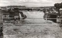
| Bridgemeister ID: | 3918 (added 2020-03-20) |
| Name: | Sjulhusbrua |
| Location: | Alvdal, Innlandet, Norway |
| Crossing: | Glomma |
| Coordinates: | 62.09653 N 10.64445 E |
| Maps: | Acme, GeoHack, Google, kart.1881.no, OpenStreetMap |
| Use: | Vehicular (one-lane) |
| Status: | Removed |
| Main Cables: | Wire (steel) |
| Suspended Spans: | 1 |
| Main Span: | 1 x 82.5 meters (270.7 feet) estimated |
Notes:
- Based on historic aerial images, removed after 1969 and before 1980.
External Links:
Do you have any information or photos for these bridges that you would like to share? Please email david.denenberg@bridgemeister.com.
Mail | Facebook | X (Twitter) | Bluesky