Suspension Bridges Crossing Dordogne River
This is a list of all 27 bridges from the suspension bridge inventory crossing Dordogne River. Please note that different rivers with the same name will be grouped together. For example, selecting 'Bear Creek' shows bridges across several different Bear Creeks. Also, similarly named rivers are grouped separately. For example, 'River Dee' (UK) bridges are grouped separately from 'Dee River' (Australia) bridges. Wherever you see a Bridgemeister ID number click it to isolate the bridge on its own page.
Related Lists:
1829: Argentat
Argentat, Corrèze, France - Dordogne River
| Bridgemeister ID: | 627 (added 2003-01-20) |
| Year Completed: | 1829 |
| Name: | Argentat |
| Also Known As: | Marie |
| Location: | Argentat, Corrèze, France |
| Crossing: | Dordogne River |
| Principals: | L. T. Vicat |
| References: | AAJ, MOS, PTS2 |
| Use: | Vehicular, with walkway |
| Status: | Replaced, 1903 |
| Main Cables: | Wire (iron) |
| Suspended Spans: | 1 |
| Main Span: | 1 x 100 meters (328 feet) |
External Links:
Image Sets:
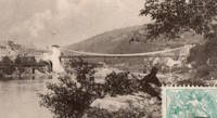
1829: Port-Sainte-Foy
Port-Sainte-Foy-et-Ponchapt, Dordogne and Sainte-Foy-la-Grande, Gironde, France - Dordogne River
| Bridgemeister ID: | 7351 (added 2022-10-22) |
| Year Completed: | 1829 |
| Name: | Port-Sainte-Foy |
| Location: | Port-Sainte-Foy-et-Ponchapt, Dordogne and Sainte-Foy-la-Grande, Gironde, France |
| Crossing: | Dordogne River |
| Coordinates: | 44.842132 N 0.211552 E |
| Maps: | Acme, GeoHack, Google, OpenStreetMap |
| Use: | Vehicular (one-lane) |
| Status: | Replaced |
| Main Cables: | Wire |
| Suspended Spans: | 2 |
| Main Spans: | 2 |
Notes:
- Replaced by 1897 Port-Sainte-Foy - Port-Sainte-Foy-et-Ponchapt, Dordogne and Sainte-Foy-la-Grande, Gironde, France.
- All past and present bridges at this location.
External Links:
Image Sets:

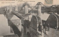
1835: Saint-Jean-de-Blaignac
Saint-Jean-de-Blaignac and Lavagnac, Gironde, France - Dordogne River
| Bridgemeister ID: | 2069 (added 2006-06-07) |
| Year Completed: | 1835 |
| Name: | Saint-Jean-de-Blaignac |
| Location: | Saint-Jean-de-Blaignac and Lavagnac, Gironde, France |
| Crossing: | Dordogne River |
| Coordinates: | 44.814153 N 0.138769 W |
| Maps: | Acme, GeoHack, Google, OpenStreetMap |
| Use: | Vehicular |
| Status: | Replaced, 1939 |
| Main Cables: | Wire (iron) |
| Suspended Spans: | 3 |
| Main Spans: | 3 |
Notes:
- Replaced by 1939 Saint-Jean-de-Blaignac - Saint-Jean-de-Blaignac and Lavagnac, Gironde, France.
- All past and present bridges at this location.
Image Sets:
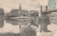
1836: Branne
Branne, Gironde, France - Dordogne River
| Bridgemeister ID: | 6999 (added 2022-04-24) |
| Year Completed: | 1836 |
| Name: | Branne |
| Location: | Branne, Gironde, France |
| Crossing: | Dordogne River |
| Coordinates: | 44.832286 N 0.186143 W |
| Maps: | Acme, GeoHack, Google, OpenStreetMap |
| Use: | Vehicular |
| Status: | Removed, 1911 |
| Main Cables: | Wire (iron) |
| Main Spans: | 2 |
External Links:
Image Sets:
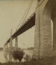
1839: Saint André-de-Cubzac
Saint André-de-Cubzac, Gironde, France - Dordogne River
| Bridgemeister ID: | 550 (added before 2003) |
| Year Completed: | 1839 |
| Name: | Saint André-de-Cubzac |
| Also Known As: | Cubzac |
| Location: | Saint André-de-Cubzac, Gironde, France |
| Crossing: | Dordogne River |
| Coordinates: | 44.962000 N 0.461444 W |
| Maps: | Acme, GeoHack, Google, OpenStreetMap |
| Principals: | Marie Fortuné de Vergès, Emil Martin |
| References: | AAJ, HBE, PTS2 |
| Use: | Vehicular |
| Status: | Destroyed, 1869 |
| Main Cables: | Wire (iron) |
| Suspended Spans: | 5 |
| Main Spans: | 5 x 10⁹ meters (357.6 feet) |
| Deck width: | 23 feet |
Notes:
- This is perhaps one of the most fanciful large suspension bridges ever built.
- Destroyed in a storm, 1869. Its replacement (a truss bridge) was completed in 1883. The approaches and the bottom halves of the suspension bridge towers were strengthened and used for the replacement.
- AAJ citing Engineering News-Record: "Vergès used inclined tie cables running from the top of the tower at one end of a span to a roadway-level connection on the opposite tower."
External Links:
- Structurae - Cubzac Bridge. Photos of the replacement truss structure.
- Structurae - Structure ID 20000898
Image Sets:

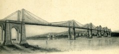
1841: Vernéjoux
Vernéjoux, Corrèze and Cantal, France - Dordogne River
| Bridgemeister ID: | 1988 (added 2005-12-02) |
| Year Completed: | 1841 |
| Name: | Vernéjoux |
| Location: | Vernéjoux, Corrèze and Cantal, France |
| Crossing: | Dordogne River |
| Coordinates: | 45.365917 N 2.367694 E |
| Maps: | Acme, GeoHack, Google, OpenStreetMap |
| Use: | Vehicular (one-lane) |
| Status: | Removed |
| Main Cables: | Wire |
| Suspended Spans: | 1 |
Notes:
- May have been replaced in 1929 by another suspension bridge that was destroyed in 1944 during WWII.
- 2023: Remnants of a former suspension bridge still exist below the current concrete arch bridge and are visible when the water level is low.
Image Sets:
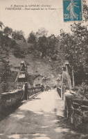
1844: Puybrun
Puybrun, Corrèze and Girac, Lot, France - Dordogne River
| Bridgemeister ID: | 1932 (added 2005-10-27) |
| Year Completed: | 1844 |
| Name: | Puybrun |
| Location: | Puybrun, Corrèze and Girac, Lot, France |
| Crossing: | Dordogne River |
| Coordinates: | 44.920806 N 1.800833 E |
| Maps: | Acme, GeoHack, Google, OpenStreetMap |
| Use: | Vehicular |
| Status: | Removed |
| Suspended Spans: | 1 |
External Links:
Image Sets:
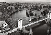
1846: Carennac
Carennac, Lot, France - Dordogne River
| Bridgemeister ID: | 7842 (added 2023-09-03) |
| Year Completed: | 1846 |
| Name: | Carennac |
| Location: | Carennac, Lot, France |
| Crossing: | Dordogne River |
| Coordinates: | 44.915091 N 1.743699 E |
| Maps: | Acme, GeoHack, Google, OpenStreetMap |
| Use: | Vehicular |
| Status: | Removed |
| Main Cables: | Wire (iron) |
| Suspended Spans: | 1 |
Notes:
External Links:
- Pont de Carennac - 1846 - Art-et-Histoire
- Sur Lorand: Le pont suspendu de Carennac. History of the bridges at this location.
Image Sets:

1850: Brivezac
Brivezac, Corrèze, France - Dordogne River
| Bridgemeister ID: | 1974 (added 2005-11-27) |
| Year Completed: | 1850 |
| Name: | Brivezac |
| Location: | Brivezac, Corrèze, France |
| Crossing: | Dordogne River |
| Status: | Removed |
| Suspended Spans: | 1 |
External Links:
Image Sets:
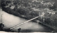
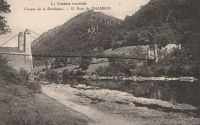
1850: Chambon
Saint-Merd-de-Lapleau, Auriac vicinity, Corrèze, France - Dordogne River
| Bridgemeister ID: | 7029 (added 2022-05-21) |
| Year Completed: | 1850 |
| Name: | Chambon |
| Location: | Saint-Merd-de-Lapleau, Auriac vicinity, Corrèze, France |
| Crossing: | Dordogne River |
| Use: | Vehicular (one-lane) |
| Status: | Removed |
| Main Cables: | Wire |
| Main Span: | 1 |
Notes:
- Later at same location Auriac (Chambon) - Saint-Merd-de-Lapleau, Auriac vicinity, Corrèze, France.
- All past and present bridges at this location.
External Links:
Image Sets:
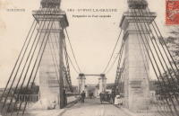
1897: Port-Sainte-Foy
Port-Sainte-Foy-et-Ponchapt, Dordogne and Sainte-Foy-la-Grande, Gironde, France - Dordogne River
| Bridgemeister ID: | 1594 (added 2005-02-06) |
| Year Completed: | 1897 |
| Name: | Port-Sainte-Foy |
| Location: | Port-Sainte-Foy-et-Ponchapt, Dordogne and Sainte-Foy-la-Grande, Gironde, France |
| Crossing: | Dordogne River |
| Coordinates: | 44.842400 N 0.211233 E |
| Maps: | Acme, GeoHack, Google, OpenStreetMap |
| Use: | Vehicular (two-lane) |
| Status: | Only towers remain (last checked: 2019) |
| Main Cables: | Wire |
| Suspended Spans: | 2 |
| Main Spans: | 2 |
Notes:
- Replaced by a nearby suspension bridge, but the end pylons are still present at the ends of the replacement span as of 2019.
- Replaced 1829 Port-Sainte-Foy - Port-Sainte-Foy-et-Ponchapt, Dordogne and Sainte-Foy-la-Grande, Gironde, France.
- Near future location of 1961 Saint-Foy-la-Grande - Saint-Foy-la-Grande, Gironde and Port-Sainte-Foy-et-Ponchapt, Dordogne, France.
- All past and present bridges at this location.
External Links:
Image Sets:
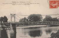
1911: Pessac-sur-Dordogne
Pessac-sur-Dordogne, Gironde and Dordogne, France - Dordogne River
| Bridgemeister ID: | 2333 (added 2007-07-09) |
| Year Completed: | 1911 |
| Name: | Pessac-sur-Dordogne |
| Location: | Pessac-sur-Dordogne, Gironde and Dordogne, France |
| Crossing: | Dordogne River |
| Status: | Removed |
| Main Cables: | Wire |
Notes:
- Replaced Pessac-sur-Dordogne - Pessac-sur-Dordogne, Gironde, France.
- All past and present bridges at this location.
Image Sets:
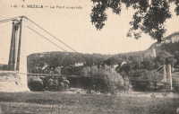
1912: Miret
Saint-Denis-lès-Martel and Floirac, Lot, France - Dordogne River
| Bridgemeister ID: | 1986 (added 2005-12-02) |
| Year Completed: | 1912 |
| Name: | Miret |
| Also Known As: | Mezels |
| Location: | Saint-Denis-lès-Martel and Floirac, Lot, France |
| Crossing: | Dordogne River |
| Coordinates: | 44.927380 N 1.670215 E |
| Maps: | Acme, GeoHack, Google, OpenStreetMap |
| Use: | Vehicular (one-lane) |
| Status: | In use (last checked: 2019) |
| Main Cables: | Wire |
| Suspended Spans: | 1 |
| Main Span: | 1 x 140 meters (459.3 feet) |
Notes:
- Possibly completed 1914, not 1912.
- In vicinity of Mezels and Floirac.
External Links:
Image Sets:
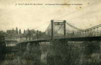
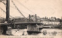
1939: Saint-Jean-de-Blaignac
Saint-Jean-de-Blaignac and Lavagnac, Gironde, France - Dordogne River
| Bridgemeister ID: | 7336 (added 2022-09-03) |
| Year Completed: | 1939 |
| Name: | Saint-Jean-de-Blaignac |
| Location: | Saint-Jean-de-Blaignac and Lavagnac, Gironde, France |
| Crossing: | Dordogne River |
| Coordinates: | 44.814528 N 0.138583 W |
| Maps: | Acme, GeoHack, Google, OpenStreetMap |
| Use: | Vehicular |
| Status: | Destroyed |
| Suspended Spans: | 3 |
| Main Spans: | 3 |
Notes:
- Replaced 1835 Saint-Jean-de-Blaignac - Saint-Jean-de-Blaignac and Lavagnac, Gironde, France.
- All past and present bridges at this location.
Image Sets:
1941: Carennac
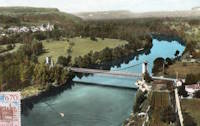
Carennac, Lot, France - Dordogne River
| Bridgemeister ID: | 3067 (added 2019-10-26) |
| Year Completed: | 1941 |
| Name: | Carennac |
| Location: | Carennac, Lot, France |
| Crossing: | Dordogne River |
| Coordinates: | 44.915186 N 1.743939 E |
| Maps: | Acme, GeoHack, Google, OpenStreetMap |
| Use: | Vehicular (two-lane) |
| Status: | In use (last checked: 2019) |
| Main Cables: | Wire (steel) |
| Suspended Spans: | 1 |
| Main Span: | 1 x 134 meters (439.6 feet) estimated |
Notes:
- Likely completed in 1941, possibly 1940.
- Replaced 1846 Carennac - Carennac, Lot, France.
- All past and present bridges at this location.
External Links:
Image Sets:
1961: Saint-Foy-la-Grande
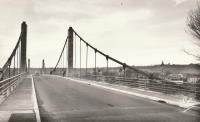
Saint-Foy-la-Grande, Gironde and Port-Sainte-Foy-et-Ponchapt, Dordogne, France - Dordogne River
| Bridgemeister ID: | 1970 (added 2005-11-26) |
| Year Completed: | 1961 |
| Name: | Saint-Foy-la-Grande |
| Location: | Saint-Foy-la-Grande, Gironde and Port-Sainte-Foy-et-Ponchapt, Dordogne, France |
| Crossing: | Dordogne River |
| Coordinates: | 44.840960 N 0.208675 E |
| Maps: | Acme, GeoHack, Google, OpenStreetMap |
| Use: | Vehicular (two-lane), with walkway |
| Status: | In use (last checked: 2019) |
| Main Cables: | Wire (steel) |
| Suspended Spans: | 3 |
| Main Span: | 1 |
| Side Spans: | 2 |
Notes:
- Near former location of 1897 Port-Sainte-Foy - Port-Sainte-Foy-et-Ponchapt, Dordogne and Sainte-Foy-la-Grande, Gironde, France.
External Links:
Image Sets:
Auriac
Saint-Merd-de-Lapleau, Auriac vicinity, Corrèze, France - Dordogne River
| Bridgemeister ID: | 3066 (added 2019-10-26) |
| Name: | Auriac |
| Also Known As: | Chambon |
| Location: | Saint-Merd-de-Lapleau, Auriac vicinity, Corrèze, France |
| Crossing: | Dordogne River |
| Coordinates: | 45.219999 N 2.112607 E |
| Maps: | Acme, GeoHack, Google, OpenStreetMap |
| Use: | Vehicular |
| Status: | In use (last checked: 2019) |
| Main Cables: | Wire (steel) |
| Suspended Spans: | 1 |
Notes:
- At former location of 1850 Chambon - Saint-Merd-de-Lapleau, Auriac vicinity, Corrèze, France.
- All past and present bridges at this location.
Image Sets:
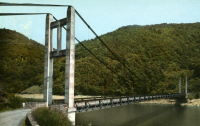
Beaulieu-sur-Dordogne
Beaulieu-sur-Dordogne, Corrèze, France - Dordogne River
| Bridgemeister ID: | 1177 (added 2004-01-24) |
| Name: | Beaulieu-sur-Dordogne |
| Location: | Beaulieu-sur-Dordogne, Corrèze, France |
| Crossing: | Dordogne River |
| Coordinates: | 44.977361 N 1.843167 E |
| Maps: | Acme, GeoHack, Google, OpenStreetMap |
| Use: | Vehicular (one-lane) |
| Status: | Removed |
| Main Cables: | Wire (iron) |
| Suspended Spans: | 2 |
| Main Spans: | 2 |
Image Sets:

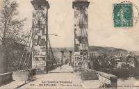
Castillon
Castillon-la-Bataille, Gironde, France - Dordogne River
| Bridgemeister ID: | 2961 (added 2019-10-06) |
| Name: | Castillon |
| Location: | Castillon-la-Bataille, Gironde, France |
| Crossing: | Dordogne River |
| Use: | Vehicular |
| Status: | Removed |
Image Sets:

Eylac
Saint-Martin-la-Méanne vicinity, Corrèze, France - Dordogne River
| Bridgemeister ID: | 3160 (added 2019-11-03) |
| Name: | Eylac |
| Location: | Saint-Martin-la-Méanne vicinity, Corrèze, France |
| Crossing: | Dordogne River |
| Coordinates: | 45.165692 N 2.007450 E |
| Maps: | Acme, GeoHack, Google, OpenStreetMap |
| Use: | Vehicular (one-lane) |
| Status: | Removed |
| Suspended Spans: | 1 |
Notes:
- Location inundated behind Chastang Dam. Coordinates are approximate location in the Dordogne valley. Unclear if the bridge was removed before the valley was inundated.
Image Sets:

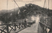
Gluges
Gluges, Lot, France - Dordogne River
| Bridgemeister ID: | 1584 (added 2005-01-22) |
| Name: | Gluges |
| Location: | Gluges, Lot, France |
| Crossing: | Dordogne River |
| Coordinates: | 44.907676 N 1.627499 E |
| Maps: | Acme, GeoHack, Google, OpenStreetMap |
| References: | AAJ |
| Use: | Vehicular (two-lane) |
| Status: | In use (last checked: 2022) |
| Main Cables: | Wire (steel) |
| Suspended Spans: | 1 |
Notes:
- This is the modern suspension bridge of 20th-century construction at Gluges. It is unclear if this bridge is at the same location as the older Gluges suspension bridge.
- See Gluges - Gluges, Lot, France.
External Links:
Image Sets:
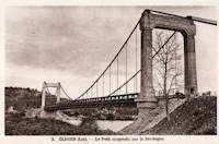
Gluges
Gluges, Lot, France - Dordogne River
| Bridgemeister ID: | 2326 (added 2007-05-12) |
| Name: | Gluges |
| Location: | Gluges, Lot, France |
| Crossing: | Dordogne River |
| Use: | Vehicular |
Notes:
- This is an older bridge of 19th-century construction that has likely been removed. It is unclear if this bridge was at the same location as the current Gluges suspension bridge.
- See Gluges - Gluges, Lot, France.
Image Sets:
Groléjac
Groléjac, Dordogne, France - Dordogne River
| Bridgemeister ID: | 1930 (added 2005-10-27) |
| Name: | Groléjac |
| Location: | Groléjac, Dordogne, France |
| Crossing: | Dordogne River |
| References: | AAJ |
| Use: | Vehicular (one-lane) |
| Status: | Removed |
Notes:
- AAJ estimates completed in 1844 because of source indicating contract was let in 1841 with construction time set at three years.
- Currently, there is a bridge at Groléjac that has the shape of a suspension bridge, but appears to be a concrete cantilever. This newer bridge was completed in 1932.
Image Sets:
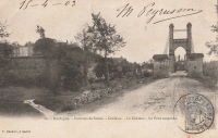
Meyronne
Meyronne and Saint-Sozy, Lot, France - Dordogne River
| Bridgemeister ID: | 2313 (added 2007-05-05) |
| Name: | Meyronne |
| Location: | Meyronne and Saint-Sozy, Lot, France |
| Crossing: | Dordogne River |
| Use: | Vehicular |
| Status: | Demolished, c. 1969 |
| Main Cables: | Wire |
Notes:
- Appears to have been dismantled following an accident that damaged the cables while the bridge was being restored, c. 1969.
Image Sets:
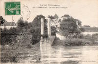
Nauzenac
Nauzenac, Mauriac vicinity, Cantal and Corrèze, France - Dordogne River
| Bridgemeister ID: | 1973 (added 2005-11-27) |
| Name: | Nauzenac |
| Location: | Nauzenac, Mauriac vicinity, Cantal and Corrèze, France |
| Crossing: | Dordogne River |
| Use: | Vehicular (one-lane) |
| Main Cables: | Wire |
| Suspended Spans: | 1 |
Notes:
- Village of Nauzenac was apparently inundated after construction of L'Aigle Dam.
Image Sets:
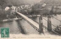
Pessac-sur-Dordogne
Pessac-sur-Dordogne, Gironde, France - Dordogne River
| Bridgemeister ID: | 8176 (added 2024-02-04) |
| Name: | Pessac-sur-Dordogne |
| Location: | Pessac-sur-Dordogne, Gironde, France |
| Crossing: | Dordogne River |
| Status: | Removed |
| Main Cables: | Wire |
Notes:
- Replaced by 1911 Pessac-sur-Dordogne - Pessac-sur-Dordogne, Gironde and Dordogne, France.
- All past and present bridges at this location.
Image Sets:
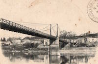
Saint-Projet
Arches, Mauriac vicinity, Cantal and Neuvic, Corrèze, France - Dordogne River
| Bridgemeister ID: | 5578 (added 2020-12-20) |
| Name: | Saint-Projet |
| Location: | Arches, Mauriac vicinity, Cantal and Neuvic, Corrèze, France |
| Crossing: | Dordogne River |
| Coordinates: | 45.286816 N 2.279728 E |
| Maps: | Acme, GeoHack, Google, OpenStreetMap |
| Use: | Vehicular (two-lane) |
| Status: | In use (last checked: 2021) |
| Main Cables: | Wire (steel) |
| Suspended Spans: | 1 |
Image Sets:
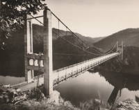
Do you have any information or photos for these bridges that you would like to share? Please email david.denenberg@bridgemeister.com.
Mail | Facebook | X (Twitter) | Bluesky