Suspension Bridges of Colombia (1-100 of 132)
This is a list of bridges 1 through 100 (of 132 total) from the suspension bridge inventory for the country Colombia . Wherever you see a Bridgemeister ID number click it to isolate the bridge on its own page.
Related Lists:
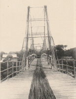
Crossed at the location of the present-day Puente San Rafael (Puente Benito Hernández). The suspension bridge was still standing in the 1930s. Bridgemeister ID: 7637 (added 2023-05-28)Year Completed: 1886 Name: Pescadero Ituango Location: Ituango, Antioquia, Colombia Crossing: Cauca River Coordinates: 7.088510 N 75.694706 W Maps: Acme , GeoHack , Google , OpenStreetMap Principals: José María Villa Use: Footbridge and Vehicular Status: Removed Main Cables: Wire Suspended Spans: 1
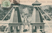
1963: Replaced by Puente Juan de la Cruz Posada 2018: Former location of both bridges completely inundated behind the Pescadero-Ituango dam. Bridgemeister ID: 934 (added 2003-10-25)Year Completed: 1894 Name: Occidente Also Known As: Western Location: Santa Fé de Antioquia, Colombia Crossing: Cauca River Coordinates: 6.577965 N 75.798177 W Maps: Acme , GeoHack , Google , OpenStreetMap Principals: José María Villa References: AAJ , HBE , PTS2 Use: Vehicular (one-lane), with walkway Status: In use (last checked: 2019) Main Cables: Wire Main Span: 1 x 286.5 meters (940 feet)
Bridgemeister ID: 433 (added before 2003)Year Completed: 1917 Name: Bolombolo Location: Bolombolo, Colombia Crossing: Cauca River Coordinates: 5.967033 N 75.843217 W Maps: Acme , GeoHack , Google , OpenStreetMap References: USS Use: Vehicular (two-lane) Status: In use (last checked: 2015) Main Cables: Wire (steel) Suspended Spans: 1 Main Span: 1 x 118.9 meters (390 feet) Deck width: 10 feet
Bridgemeister ID: 2019 (added 2006-01-14)Year Completed: 1919 Name: Boyacá Also Known As: Irra Location: Irra, Colombia Crossing: Cauca River Status: Removed Suspended Spans: 1 Main Span: 1 x 120 meters (393.7 feet)
Bridgemeister ID: 2017 (added 2006-01-14)Year Completed: 1922 Name: Arauca Location: Arauca, Colombia Crossing: Cauca River Use: Vehicular Status: Replaced, 1957 Main Cables: Wire (steel) Suspended Spans: 1 Main Span: 1 x 10² meters (334.6 feet)
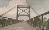
Bridgemeister ID: 2007 (added 2006-01-04)Year Completed: 1922 Name: Carlos Holguín Location: Juanchito, Cali vicinity and Candelaria vicinity, Colombia Crossing: Cauca River Use: Vehicular Status: Dismantled, 1956 Main Cables: Wire (steel) Suspended Spans: 1 Main Span: 1 x 120 meters (393.7 feet)
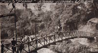
Bridgemeister ID: 9231 (added 2025-05-26)Year Completed: 1923 Name: Pepino Location: Mocoa vicinity and Villagarzón, Putumayo, Colombia Crossing: Rio Pepino Coordinates: 1.087917 N 76.627833 W Maps: Acme , GeoHack , Google , OpenStreetMap Principals: Julio Souza Alvez Main Cables: Wire Suspended Spans: 1
The coordinates provided here indicate the likely location of the bridge pictured. Bridgemeister ID: 2012 (added 2006-01-04)Year Completed: 1926 Name: Eustaquio Palacios Location: Roldanillo vicinity and Zarzal vicinity, Colombia Crossing: Cauca River Coordinates: 4.405070 N 76.101374 W Maps: Acme , GeoHack , Google , OpenStreetMap Use: Vehicular (one-lane) Status: Derelict (last checked: 2007) Main Cables: Wire (steel) Suspended Spans: 1
Bridgemeister ID: 7648 (added 2023-06-03)Year Completed: 1926 Name: La Guasca Also Known As: Puerto Rico Location: El Peñol and Policarpa, Narino, Colombia Crossing: Patia River Coordinates: 1.594139 N 77.429486 W Maps: Acme , GeoHack , Google , OpenStreetMap Principals: Julio Souza Alves Use: Vehicular (one-lane) Status: Demolished, 2003 and 2020-2021 Main Cables: Wire (steel)
2003: Much of the bridge is dynamited. Stone towers remain. 2020 (or early 2021): The stone towers are demolished to make way for a replacement bridge. Bridgemeister ID: 439 (added before 2003)Year Completed: 1926 Name: Yunguita Location: Colombia Crossing: Suaza River References: USS Use: Vehicular Main Cables: Wire (steel) Suspended Spans: 1 Main Span: 1 x 103.3 meters (339 feet) Deck width: 10 feet
Bridgemeister ID: 2010 (added 2006-01-04)Year Completed: 1927 Name: Mediacanoa Location: Buga, Colombia Crossing: Cauca River References: PTS2 Use: Vehicular Status: Replaced Main Cables: Wire (steel) Suspended Spans: 1 Main Span: 1 x 110 meters (360.9 feet)
Bridgemeister ID: 2016 (added 2006-01-14)Year Completed: 1928 Name: Bernardo Arango Location: La Virginia vicinity and Cerritos vicinity, Colombia Crossing: Cauca River Coordinates: 4.891980 N 75.882927 W Maps: Acme , GeoHack , Google , OpenStreetMap Use: Vehicular (one-lane) Status: In use (last checked: 2019) Main Cables: Wire (steel) Suspended Spans: 1 Main Span: 1 x 190 meters (623.4 feet)
Bridgemeister ID: 2015 (added 2006-01-14)Year Completed: 1929 Name: Roberto Delgado Also Known As: Anacaro Location: Anacaro, Ansermanuevo vicinity and Cartago vicinity, Colombia Crossing: Cauca River Coordinates: 4.784574 N 75.968443 W Maps: Acme , GeoHack , Google , OpenStreetMap Use: Vehicular Status: Derelict (last checked: 2015) Main Cables: Wire (steel) Suspended Spans: 1 Main Span: 1 x 120 meters (393.7 feet)
Bridgemeister ID: 7086 (added 2022-05-29)Year Completed: 1933 Name: Colonial Location: Guamo, Tolima, Colombia Crossing: Rio Luisa Coordinates: 4.036234 N 74.969426 W Maps: Acme , GeoHack , Google , OpenStreetMap Status: In use (last checked: 2022) Main Cables: Wire (steel) Suspended Spans: 1 Main Span: 1
Bridgemeister ID: 2011 (added 2006-01-04)Year Completed: 1940 Name: General Santander Location: Tuluá vicinity and Riofrio vicinity, Colombia Crossing: Cauca River Coordinates: 4.123901 N 76.269404 W Maps: Acme , GeoHack , Google , OpenStreetMap Principals: American Bridge Co. Use: Vehicular Status: Replaced Main Cables: Wire (iron) Suspended Spans: 1 Main Span: 1 x 130.15 meters (427 feet)
Partially collapsed, 1955. Rehabilitated, 1956. Dismantled, 2000. Coordinates are for likely alignment. Pier and abutment visible in 2014. Bridgemeister ID: 2901 (added 2019-09-13)Year Completed: 1950 Name: Ospina Perez Location: Girardot, Colombia Crossing: Magdalena River Coordinates: 4.288280 N 74.809032 W Maps: Acme , GeoHack , Google , OpenStreetMap Use: Vehicular (two-lane, heavy vehicles) Status: In use (last checked: 2019) Main Cables: Wire (steel)
Bridgemeister ID: 2013 (added 2006-01-04)Year Completed: 1954 Name: Mariano Ospina Perez Also Known As: 13 de Junio Location: La Victoria vicinity and La Unión, Colombia Crossing: Cauca River Coordinates: 4.525439 N 76.043608 W Maps: Acme , GeoHack , Google , OpenStreetMap Use: Vehicular (one-lane) Status: In use (last checked: 2014) Main Cables: Wire (steel) Suspended Spans: 1 Main Span: 1 x 164 meters (538.1 feet)
Bridgemeister ID: 2018 (added 2006-01-14)Year Completed: 1957 Name: Aquilino Villegas Also Known As: Arauca Location: Arauca, Palestina, Caldas, Colombia Crossing: Cauca River Coordinates: 5.112300 N 75.704100 W Maps: Acme , GeoHack , Google , OpenStreetMap Use: Vehicular (two-lane) Status: In use (last checked: 2022) Main Cables: Wire (steel) Suspended Spans: 1
Bridgemeister ID: 2008 (added 2006-01-04)Year Completed: 1957 Name: Carlos Holguín Location: Juanchito, Cali vicinity and Candelaria vicinity, Colombia Crossing: Cauca River Coordinates: 3.450412 N 76.475798 W Maps: Acme , GeoHack , Google , OpenStreetMap Use: Vehicular (two-lane), with walkway Status: In use (last checked: 2018) Main Cables: Wire (steel) Suspended Spans: 1 Main Span: 1 x 120 meters (393.7 feet)
Bridgemeister ID: 6874 (added 2022-01-09)Year Completed: 1960 Name: Gustavo Rojas Pinilla Location: Montería, Córdoba, Colombia Crossing: Rio Sinu Coordinates: 8.751342 N 75.892026 W Maps: Acme , GeoHack , Google , OpenStreetMap Use: Vehicular (two-lane, heavy vehicles), with walkway Status: In use (last checked: 2021) Main Cables: Wire (steel) Suspended Spans: 1 Main Span: 1 x 139 meters (456 feet) estimated
Bridgemeister ID: 7427 (added 2022-12-09)Year Completed: 2013 Name: El Progreso Also Known As: Eccehomo Location: Támara, Casanare, Colombia Crossing: Río Pauto Coordinates: 5.78860 N 72.20746 W Maps: Acme , GeoHack , Google , OpenStreetMap Use: Footbridge Status: In use (last checked: 2017) Main Cables: Wire (steel) Suspended Spans: 5 Main Spans: 5
2015, April: The deck and one tower collapses under the weight of cattle. 2017, October 22: The rebuilt bridge is reopened. A finales de abril se pondrá al servicio de la comunidad el Puente Eccehomo en Támara después de dos años de su colapso - Radio Noticias de Casanare . The repaired bridge is expected to reopen in 2017.Facebook . Images of the collapsed bridge, posted April 29, 2015.Inaugurado Puente El Progreso En Támara - Prensa Libre Casanare . Inauguration of the bridge, August 2013.Twitter . Images of the collapsed bridge, posted April 29, 2015.Twitter . Image of the collapsed bridge, posted April 27, 2015.Twitter . Image of the collapsed bridge, posted April 27, 2015.Twitter . Image of the base of a new tower under construction, posted April 29, 2016.Twitter . Images of reconstruction progress, posted July 25, 2017.Twitter . Image of reconstruction progress, posted June 14, 2017.Twitter . Images from the reopening of the bridge posted October 22, 2017.Twitter . Images from the reopening of the bridge posted October 22, 2017.Twitter . Images from the reopening of the bridge posted October 22, 2017.YouTube - Puente Eccehomo . Video of the reopening of the bridge, posted October 23, 2017.Bridgemeister ID: 7671 (added 2023-06-11)Year Completed: 2015 Name: Guambuyaco Location: Taminango vicinity and El Peñol vicinity, Narino, Colombia Crossing: Rio Juanambu Coordinates: 1.541880 N 77.396349 W Maps: Acme , GeoHack , Google , OpenStreetMap Use: Vehicular (two-lane) Status: In use (last checked: 2023) Main Cables: Wire (steel) Suspended Spans: 3 Main Span: 1 x 100 meters (328.1 feet) estimated Side Spans: 2
Facebook . Image of the bridge towers during construction. Posted June 3, 2014.Facebook . Image taken during construction of the bridge. Posted June 3, 2014.Facebook . Image taken during construction of the bridge. Posted November 5, 2014.Facebook . Image taken during construction of the bridge. Posted January 14, 2015.Facebook . Post with several images of the completed bridge. Posted November 23, 2015.Google Maps - Puente Guambuyaco y Rio Juanambu . Image of the bridge. May 2022.Bridgemeister ID: 7494 (added 2022-12-30)Year Completed: 2015 Name: San Ignacio Location: Guapotá and Chima, Santander, Colombia Crossing: Rio Suarez Coordinates: 6.310700 N 73.374841 W Maps: Acme , GeoHack , Google , OpenStreetMap Status: In use (last checked: 2018) Main Cables: Wire (steel) Suspended Spans: 1
Bridgemeister ID: 7439 (added 2022-12-17)Year Completed: 2016 Name: (footbridge) Location: Yopal and Aguazul, Casanare, Colombia Crossing: Rio Charte Coordinates: 5.256656 N 72.485903 W Maps: Acme , GeoHack , Google , OpenStreetMap Use: Footbridge Status: Replaced, September 2020 Main Cables: Wire (steel) Suspended Spans: 1
Bridgemeister ID: 7438 (added 2022-12-17)Year Completed: 2016 Name: Chárte Location: Yopal and Aguazul, Casanare, Colombia Crossing: Rio Charte Coordinates: 5.256633 N 72.485867 W Maps: Acme , GeoHack , Google , OpenStreetMap Use: Vehicular Status: Replaced, September 2020 Main Cables: Wire (steel) Suspended Spans: 1
Facebook . Images of the temporary structures, posted October 15, 2016.Facebook . Image of the permanent replacement bridge under construction alongside the suspension bridges, posted July 14, 2020.Facebook . Image of the permanent replacement bridge with the two temporary adjacent suspension bridges and another temporary suspension bridge for truck traffic in the background, posted September 18, 2020.Facebook - Así Quedó El Puente Sobre El Rio, Charte. La Vía #Yopal-#Aguazul, Se Encuentra Incomunicada . Image of the collapsed bridge that necessitated the temporary suspension bridges, posted August 23, 2016.Twitter . Image showing the bridge and the adjacent footbridge, posted November 15, 2016.Twitter . Images from the opening of the permanent replacement bridge, posted September 19, 2020.Bridgemeister ID: 4173 (added 2020-04-07)Year Completed: 2016 Name: La Guaya Location: Tenza vicinity, Boyaca, Colombia Coordinates: 5.073583 N 73.396222 W Maps: Acme , GeoHack , Google , OpenStreetMap Principals: Bridges to Prosperity Use: Footbridge Status: In use (last checked: 2016) Main Cables: Wire (steel) Suspended Spans: 1 Main Span: 1 x 58 meters (190.3 feet)
Bridgemeister ID: 8680 (added 2024-06-23)Year Completed: 2017 Name: (suspension bridge) Location: Ricaurte, Cauca, Colombia Crossing: Rio Páez Coordinates: 2.5233941 N 75.9616497 W Maps: Acme , GeoHack , Google , OpenStreetMap Use: Vehicular (one-lane) Status: In use (last checked: 2022) Main Cables: Wire (steel) Suspended Spans: 1 Main Span: 1 x 185 meters (607 feet)
Bridgemeister ID: 7440 (added 2022-12-17)Year Completed: 2017 Name: Chárte Location: Yopal and Aguazul, Casanare, Colombia Crossing: Rio Charte Coordinates: 5.258722 N 72.486978 W Maps: Acme , GeoHack , Google , OpenStreetMap Use: Vehicular Status: Demolished, 2021 Main Cables: Wire (steel) Suspended Spans: 1
Facebook . Images of the bridge, posted January 14, 2017.Facebook . Image of the bridge, posted January 15, 2017.Facebook . Image of the bridge opening ceremony, posted January 15, 2017.Facebook . Image of the bridge opening ceremony, posted January 16, 2017.Bridgemeister ID: 7425 (added 2022-12-09)Year Completed: 2018 Name: Agua Blanca Location: San Luis de Chucarima, Chitagá, North Santander, Colombia Coordinates: 7.114830 N 72.498570 W Maps: Acme , GeoHack , Google , OpenStreetMap Use: Footbridge and Pack Status: In use (last checked: 2018) Main Cables: Wire (steel) Suspended Spans: 1
Facebook . Several images of the bridge, posted May 21, 2018.Bridgemeister ID: 7410 (added 2022-12-04)Year Completed: 2021 Name: Bolivia Location: San Luis de Chucarima, Chitagá, North Santander, Colombia Crossing: Río Valegra Coordinates: 7.11991 N 72.49790 W Maps: Acme , GeoHack , Google , OpenStreetMap Use: Vehicular Status: In use (last checked: 2021) Main Cables: Wire (steel) Suspended Spans: 1 Main Span: 1 x 70 meters (229.7 feet)
Construcción del puente Bolivia, en el municipio de Chitagá, avanza en un 70% - Noticias Gobernación Norte de Santander . Article and photos regarding construction progress, August 5, 2019.Facebook . Image of the bridge under construction, posted August 5, 2019.Facebook . Images of the bridge under construction, posted August 4, 2019.Facebook . Images of the bridge under construction, posted August 5, 2019.Facebook . Image of the bridge under construction, posted April 25, 2020.Facebook . Images of the bridge under construction, posted March 3, 2019.Facebook . Images of the bridge under construction, posted April 12, 2019.Facebook . Image of the bridge under construction, posted June 29, 2020.Facebook . Images of the bridge under construction, posted July 11, 2020.Facebook . Images of the bridge under construction, posted July 22, 2020.Facebook . Image of the bridge, nearly completed, posted November 1, 2020.Facebook . Image of the bridge, nearly completed, posted November 1, 2020.Facebook . Image of the bridge, undergoing load testing, posted December 10, 2020.Facebook . Images of the open bridge, posted February 28, 2021.Facebook . Image of a schematic of the bridge, posted May 21, 2018.Twitter . Images of the bridge under construction, posted November 18, 2020.Bridgemeister ID: 8857 (added 2024-09-30)Year Completed: 2023 Name: La Victoria Location: La Victoria, Cantagallo, Bolívar, Colombia Coordinates: 7.343306 N 73.983000 W Maps: Acme , GeoHack , Google , OpenStreetMap Use: Footbridge Status: In use (last checked: 2023) Main Cables: Wire (steel)
The coordinates appear to be the location of the bridge mentioned in the linked article. Bridgemeister ID: 7404 (added 2022-12-04)Name: (footbridge) Location: Apartadó, Antioquia, Colombia Crossing: Rio Apartadó Coordinates: 7.881961 N 76.627881 W Maps: Acme , GeoHack , Google , OpenStreetMap Use: Footbridge Status: Removed, c. 2017-2018 Main Cables: Wire (steel) Suspended Spans: 1 Main Span: 1 x 56.4 meters (185 feet) estimated
Twitter . March 19, 2015: Photos of the inauguration of a nearby replacement bridge and one image of the suspension bridge.Bridgemeister ID: 8183 (added 2024-02-05)Name: (footbridge) Location: Bucaramanga, Santander, Colombia Crossing: Rio de Oro Coordinates: 7.148028 N 73.151333 W Maps: Acme , GeoHack , Google , OpenStreetMap Use: Footbridge Status: In use (last checked: 2023) Main Cables: Wire Main Span: 1
Bridgemeister ID: 8184 (added 2024-02-05)Name: (footbridge) Location: Bucaramanga, Santander, Colombia Crossing: Rio de Oro Coordinates: 7.125361 N 73.160917 W Maps: Acme , GeoHack , Google , OpenStreetMap Status: Extant (last checked: 2023) Main Span: 1 x 74 meters (242.8 feet) estimated
Bridgemeister ID: 6016 (added 2021-07-02)Name: (footbridge) Location: Cali and Candelaria, Valle del Cauca, Colombia Crossing: Cauca River Coordinates: 3.446939 N 76.474629 W Maps: Acme , GeoHack , Google , OpenStreetMap Use: Footbridge Status: Extant (last checked: 2021) Main Cables: Wire (steel) Main Span: 1
Bridgemeister ID: 7408 (added 2022-12-04)Name: (footbridge) Location: Condoto, Choco, Colombia Crossing: Rio Condoto Coordinates: 5.096590 N 76.694830 W Maps: Acme , GeoHack , Google , OpenStreetMap Use: Footbridge Status: In use (last checked: 2021) Main Cables: Wire (steel) Main Span: 1
Facebook . 2021, August 11: Image of the bridge.Facebook . 2021, November 3: Aerial image of the bridge.Bridgemeister ID: 7426 (added 2022-12-09)Name: (footbridge) Location: Elle Valle, Bahía Solano, Choco, Colombia Crossing: Río Valle Coordinates: 6.10064 N 77.42355 W Maps: Acme , GeoHack , Google , OpenStreetMap Use: Footbridge Status: In use (last checked: 2019) Main Cables: Wire (steel) Main Spans: 3
Bridgemeister ID: 8186 (added 2024-02-05)Name: (footbridge) Location: Girón, Santander, Colombia Crossing: Rio de Oro Coordinates: 7.065000 N 73.169889 W Maps: Acme , GeoHack , Google , OpenStreetMap Use: Footbridge Status: Derelict (last checked: 2023) Main Cables: Wire Suspended Spans: 1 Main Span: 1 x 60 meters (196.9 feet) estimated
Bridgemeister ID: 8563 (added 2024-04-06)Name: (footbridge) Location: Guayabetal, Cundinamarca, Colombia Crossing: Rio Negro Coordinates: 4.216028 N 73.815750 W Maps: Acme , GeoHack , Google , OpenStreetMap Use: Footbridge Status: In use (last checked: 2014) Main Cables: Wire (steel) Suspended Spans: 1
Bridgemeister ID: 8567 (added 2024-04-06)Name: (footbridge) Location: Mocoa, Putumayo, Colombia Crossing: Rio Mocoa Coordinates: 1.213583 N 76.657750 W Maps: Acme , GeoHack , Google , OpenStreetMap Use: Footbridge Status: In use (last checked: 2023) Main Cables: Wire (steel) Suspended Spans: 1
Bridgemeister ID: 8568 (added 2024-04-06)Name: (footbridge) Location: Mocoa, Putumayo, Colombia Crossing: Rio Mocoa Coordinates: 1.125194 N 76.631972 W Maps: Acme , GeoHack , Google , OpenStreetMap Use: Footbridge Status: In use (last checked: 2022) Main Cables: Wire (steel)
Bridgemeister ID: 6849 (added 2022-01-01)Name: (footbridge) Location: Montenegro, Quindio, Colombia At or Near Feature: Parque del Café - National Coffee Park Coordinates: 4.539473 N 75.768394 W Maps: Acme , GeoHack , Google , OpenStreetMap Use: Footbridge Status: In use (last checked: 2021) Main Cables: Wire (steel) Suspended Spans: 1 Main Span: 1
Within the grounds of a theme park devoted to coffee. Bridgemeister ID: 7638 (added 2023-05-28)Name: (footbridge) Location: Valdivia, Antioquia, Colombia Crossing: Cauca River Coordinates: 7.338668 N 75.346602 W Maps: Acme , GeoHack , Google , OpenStreetMap Use: Footbridge Status: In use (last checked: 2022) Main Cables: Wire (steel) Suspended Spans: 1
Bridgemeister ID: 8185 (added 2024-02-05)Name: (pipeline bridge) Location: Girón, Santander, Colombia Crossing: Rio Frio Coordinates: 7.066056 N 73.166333 W Maps: Acme , GeoHack , Google , OpenStreetMap Use: Pipeline Status: Extant (last checked: 2023) Main Cables: Wire (steel) Suspended Spans: 1
Bridgemeister ID: 9014 (added 2024-12-25)Name: (pipeline bridge) Location: Honda, Tolima, Colombia Crossing: Rio Guali Coordinates: 5.203917 N 74.741444 W Maps: Acme , GeoHack , Google , OpenStreetMap Use: Pipeline Status: Extant (last checked: 2021) Main Cables: Wire (steel)
Bridgemeister ID: 6887 (added 2022-01-15)Name: (pipeline bridge) Location: Jenesano, Boyaca, Colombia Crossing: Rio Jenesano Coordinates: 5.384360 N 73.361741 W Maps: Acme , GeoHack , Google , OpenStreetMap Use: Pipeline Status: Extant (last checked: 2021) Main Cables: Wire Suspended Spans: 1
Bridgemeister ID: 8565 (added 2024-04-06)Name: (pipeline bridge) Location: Mocoa, Putumayo, Colombia Crossing: Rio Sangoyaco Coordinates: 1.148944 N 76.648167 W Maps: Acme , GeoHack , Google , OpenStreetMap Use: Pipeline Status: Extant (last checked: 2024) Main Cables: Wire (steel) Suspended Spans: 1
Bridgemeister ID: 3593 (added 2019-12-30)Name: (pipeline bridge) Location: Roldanillo vicinity and Zarzal vicinity, Colombia Crossing: Cauca River Coordinates: 4.405403 N 76.101366 W Maps: Acme , GeoHack , Google , OpenStreetMap Use: Pipeline Status: Extant (last checked: 2015) Main Cables: Wire (steel)
Bridgemeister ID: 7437 (added 2022-12-16)Name: (pipeline bridge) Location: Yopal and Aguazul, Casanare, Colombia Crossing: Rio Charte Coordinates: 5.255028 N 72.484250 W Maps: Acme , GeoHack , Google , OpenStreetMap Use: Pipeline Status: Extant (last checked: 2022) Main Cables: Wire (steel) Main Span: 1 x 178.3 meters (585 feet) estimated
Facebook . Image with bridge visible in the background, posted August 25, 2016.Bridgemeister ID: 6816 (added 2021-12-23)Name: (suspension bridge) Location: Barbosa, Antioquia, Colombia Coordinates: 6.465925 N 75.334513 W Maps: Acme , GeoHack , Google , OpenStreetMap Status: In use (last checked: 2021) Main Cables: Wire (steel) Main Span: 1
Bridgemeister ID: 8677 (added 2024-06-23)Name: (suspension bridge) Location: Belalcazar, Cauca, Colombia Crossing: Rio Páez Coordinates: 2.643222 N 75.974056 W Maps: Acme , GeoHack , Google , OpenStreetMap Status: Extant (last checked: 2024) Main Cables: Wire (steel) Main Span: 1 x 110 meters (360.9 feet) estimated
Bridgemeister ID: 7240 (added 2022-07-16)Name: (suspension bridge) Location: Capitanejo, Santander and Covarachía, Boyaca, Colombia Crossing: Rio Chimomocha Coordinates: 6.554170 N 72.720850 W Maps: Acme , GeoHack , Google , OpenStreetMap Status: Extant (last checked: 2019) Main Cables: Wire (steel) Main Span: 1 x 119 meters (390.4 feet) estimated
Bridgemeister ID: 7238 (added 2022-07-16)Name: (suspension bridge) Location: Cepitá, Santander, Colombia Crossing: Rio Umpala Coordinates: 6.752016 N 72.981233 W Maps: Acme , GeoHack , Google , OpenStreetMap Use: Vehicular Status: In use (last checked: 2021) Main Cables: Wire (steel) Suspended Spans: 1 Main Span: 1 x 76 meters (249.3 feet) estimated
Remains of another bridge are visible at the site, possibly a similar-sized suspension bridge. Bridgemeister ID: 7087 (added 2022-05-29)Name: (suspension bridge) Location: Condoto, Choco, Colombia Crossing: Rio Condoto Coordinates: 5.095250 N 76.654194 W Maps: Acme , GeoHack , Google , OpenStreetMap Use: Vehicular (one-lane) Status: In use (last checked: 2021) Main Cables: Wire (steel) Suspended Spans: 1 Main Span: 1
Suspension system replaced or significantly strengthened at some point between 2013 and 2021. Bridgemeister ID: 7393 (added 2022-11-25)Name: (suspension bridge) Location: Dabeiba, Antioquia, Colombia Crossing: Rio Sucio Coordinates: 7.000303 N 76.263908 W Maps: Acme , GeoHack , Google , OpenStreetMap Status: In use (last checked: 2019) Main Cables: Wire (steel) Suspended Spans: 1
2018: Major rehabilitation completed. Patrick S. O'Donnell observes: "It received an entirely new deck. The towers appear they were at least reinforced with another layer of concrete around the original legs. The walkway / ramp and stairway down to the bridge were totally redone. The anchorage block at the other end was reinforced." Facebook . Photos of the inauguration of the recently refurbished bridge, posted October 2, 2018.Facebook . Photos of the bridge, posted October 2, 2018.Facebook . Photo of the bridge prior to the rehabilitation project, posted March 3, 2018.Twitter . Photos of the refurbished bridge, posted July 12, 2018.Bridgemeister ID: 3614 (added 2019-12-31)Name: (suspension bridge) Location: El Balseadero, Colombia Crossing: Magdalena River Coordinates: 2.232436 N 75.647969 W Maps: Acme , GeoHack , Google , OpenStreetMap Use: Vehicular (one-lane) Status: In use (last checked: 2014) Main Cables: Wire (steel) Suspended Spans: 1
Location may have been inundated at some point between 2015 and 2019. Bridgemeister ID: 7039 (added 2022-05-21)Name: (suspension bridge) Location: El Cairo, Montebello, Antioquia, Colombia Crossing: Rio Buey Coordinates: 5.860724 N 75.533574 W Maps: Acme , GeoHack , Google , OpenStreetMap Use: Vehicular (one-lane) Status: In use (last checked: 2022) Main Cables: Wire (steel) Main Span: 1
Bridgemeister ID: 3602 (added 2019-12-31)Name: (suspension bridge) Location: El Doce, Tarazá, Antioquia, Colombia Crossing: Cauca River Coordinates: 7.448611 N 75.306621 W Maps: Acme , GeoHack , Google , OpenStreetMap Use: Vehicular Status: Extant (last checked: 2022) Main Cables: Wire (steel) Main Span: 1
Bridgemeister ID: 4746 (added 2020-06-27)Name: (suspension bridge) Location: El Peñol, Antioquia, Colombia Coordinates: 6.205313 N 75.188482 W Maps: Acme , GeoHack , Google , OpenStreetMap Use: Vehicular (one-lane) Status: In use (last checked: 2020) Main Cables: Wire (steel)
Bridgemeister ID: 8678 (added 2024-06-23)Name: (suspension bridge) Location: Guadualejo, Cauca, Colombia Crossing: Rio Páez Coordinates: 2.572639 N 75.968028 W Maps: Acme , GeoHack , Google , OpenStreetMap Status: Extant (last checked: 2024) Main Span: 1 x 93 meters (305.1 feet) estimated
Bridgemeister ID: 6335 (added 2021-07-24)Name: (suspension bridge) Location: Itaibe, Páez, Cauca and Paicol, Huila, Colombia Crossing: Páez River Coordinates: 2.476990 N 75.829033 W Maps: Acme , GeoHack , Google , OpenStreetMap Use: Vehicular Status: Extant (last checked: 2021) Main Span: 1
Bridgemeister ID: 7775 (added 2023-08-18)Name: (suspension bridge) Location: Ituango and Briceño, Colombia Crossing: Cauca River Coordinates: 7.125049 N 75.664629 W Maps: Acme , GeoHack , Google , OpenStreetMap Use: Vehicular Status: Inundated, c. 2018 Suspended Spans: 1 Main Span: 1 x 135 meters (442.9 feet) estimated
c. 2018: Location of the bridge inundated behind the Ituango dam. Unclear if the bridge was removed beforehand. Bridgemeister ID: 8890 (added 2024-11-24)Name: (suspension bridge) Location: Jardín, Antioquia, Colombia Crossing: Rio Volcanes Coordinates: 5.595556 N 75.820611 W Maps: Acme , GeoHack , Google , OpenStreetMap Use: Vehicular (one-lane) Status: In use (last checked: 2024) Main Cables: Wire (steel) Suspended Spans: 1
Completed at some point in the 2014-2018 time frame. Bridgemeister ID: 6886 (added 2022-01-15)Name: (suspension bridge) Location: Jenesano, Boyaca, Colombia Crossing: Rio Jenesano Coordinates: 5.384310 N 73.361692 W Maps: Acme , GeoHack , Google , OpenStreetMap Status: Restricted to foot traffic (last checked: 2021) Main Cables: Wire (steel)
Bridgemeister ID: 8683 (added 2024-06-23)Name: (suspension bridge) Location: La Plata, Huila and Cauca, Colombia Crossing: Rio Páez Coordinates: 2.455528 N 75.914583 W Maps: Acme , GeoHack , Google , OpenStreetMap Status: Extant (last checked: 2022) Main Cables: Wire (steel) Suspended Spans: 1 Main Span: 1 x 72 meters (236.2 feet) estimated
Bridgemeister ID: 3616 (added 2019-12-31)Name: (suspension bridge) Location: Maito and Elias, Colombia Crossing: Magdalena River Status: Only towers remain (last checked: 2019)
Bridgemeister ID: 8564 (added 2024-04-06)Name: (suspension bridge) Location: Mocoa, Putumayo, Colombia Crossing: Rio Mocoa Coordinates: 1.145806 N 76.642056 W Maps: Acme , GeoHack , Google , OpenStreetMap Status: Extant (last checked: 2024) Main Span: 1 x 65 meters (213.3 feet) estimated
Bridgemeister ID: 8566 (added 2024-04-06)Name: (suspension bridge) Location: Mocoa, Putumayo, Colombia Crossing: Rio Mocoa Coordinates: 1.194389 N 76.644917 W Maps: Acme , GeoHack , Google , OpenStreetMap Use: Vehicular (two-lane) Status: In use (last checked: 2022) Main Cables: Wire (steel) Suspended Spans: 1 Main Span: 1 x 92 meters (301.8 feet) estimated
Completed at some point in the mid-1970s. Facebook . Image of the bridge under construction in 1974.Bridgemeister ID: 3611 (added 2019-12-31)Name: (suspension bridge) Location: Neiva, Colombia Crossing: Magdalena River Coordinates: 2.942510 N 75.308717 W Maps: Acme , GeoHack , Google , OpenStreetMap Use: Vehicular (one-lane) Status: In use (last checked: 2015) Main Cables: Wire (iron) Suspended Spans: 1
Bridgemeister ID: 7343 (added 2022-09-30)Name: (suspension bridge) Location: Nemizaque, Charala, Santander, Colombia Crossing: Rio Pienta Coordinates: 6.229461 N 73.171758 W Maps: Acme , GeoHack , Google , OpenStreetMap Use: Vehicular (one-lane) Status: In use (last checked: 2022) Main Cables: Wire (steel) Suspended Spans: 1
Bridgemeister ID: 8676 (added 2024-06-23)Name: (suspension bridge) Location: Páez, Cauca, Colombia Crossing: Rio Simbola Coordinates: 2.671500 N 75.973417 W Maps: Acme , GeoHack , Google , OpenStreetMap Use: Vehicular Status: In use (last checked: 2024) Main Cables: Wire (steel) Main Span: 1 x 110 meters (360.9 feet) estimated
Bridgemeister ID: 7237 (added 2022-07-16)Name: (suspension bridge) Location: Puente Sogamoso, Santander, Colombia Crossing: Rio Sogamoso Coordinates: 7.243182 N 73.788582 W Maps: Acme , GeoHack , Google , OpenStreetMap Status: Extant (last checked: 2019) Main Cables: Wire (steel) Main Span: 1
Bridgemeister ID: 7406 (added 2022-12-04)Name: (suspension bridge) Location: Puerto Berrío, Antioquia, Colombia Crossing: Río Nus Coordinates: 6.343169 N 74.681127 W Maps: Acme , GeoHack , Google , OpenStreetMap Status: In use (last checked: 2019) Main Cables: Wire (steel) Suspended Spans: 1 Main Span: 1 x 43.3 meters (142 feet) estimated
Bridgemeister ID: 3607 (added 2019-12-31)Name: (suspension bridge) Location: Purificación, Colombia Crossing: Magdalena River Coordinates: 3.851737 N 74.931029 W Maps: Acme , GeoHack , Google , OpenStreetMap Use: Vehicular (two-lane) Status: In use (last checked: 2013) Main Cables: Wire (steel) Suspended Spans: 1 Main Span: 1 x 208 meters (682.4 feet) estimated
Bridgemeister ID: 3596 (added 2019-12-31)Name: (suspension bridge) Location: Rafael Uribe Uribe and Bocas, Colombia Crossing: Cauca River Coordinates: 5.734029 N 75.599689 W Maps: Acme , GeoHack , Google , OpenStreetMap Use: Vehicular Status: In use (last checked: 2015) Main Cables: Wire (steel)
Bridgemeister ID: 3597 (added 2019-12-31)Name: (suspension bridge) Location: Rafael Uribe Uribe and La Pintada, Colombia Crossing: Cauca River Coordinates: 5.744707 N 75.604588 W Maps: Acme , GeoHack , Google , OpenStreetMap Use: Vehicular Status: Restricted to foot traffic (last checked: 2013) Main Cables: Wire (iron)
Bridgemeister ID: 3601 (added 2019-12-31)Name: (suspension bridge) Location: Remolino and Puerto Valdivia, Valdivia, Antioquia, Colombia Crossing: Cauca River Coordinates: 7.287532 N 75.396959 W Maps: Acme , GeoHack , Google , OpenStreetMap Status: Removed, c. 2018 Main Cables: Wire
Removed, or possibly destroyed, at some point between late 2017 and early 2019. Replacement appears to be under construction as of mid-2022. Bridgemeister ID: 3612 (added 2019-12-31)Name: (suspension bridge) Location: Remolino Del Vicho, Colombia Crossing: Magdalena River Coordinates: 2.463053 N 75.567119 W Maps: Acme , GeoHack , Google , OpenStreetMap Use: Vehicular Status: In use (last checked: 2014) Main Cables: Wire (steel) Suspended Spans: 1
Bridgemeister ID: 3599 (added 2019-12-31)Name: (suspension bridge) Location: San Nicolás, Colombia Coordinates: 6.480035 N 75.819757 W Maps: Acme , GeoHack , Google , OpenStreetMap Use: Vehicular (one-lane) Status: In use (last checked: 2014) Main Cables: Wire (steel) Suspended Spans: 1
Bridgemeister ID: 3608 (added 2019-12-31)Name: (suspension bridge) Location: Suárez, Colombia Crossing: Magdalena River Coordinates: 4.042801 N 74.834412 W Maps: Acme , GeoHack , Google , OpenStreetMap Use: Vehicular (two-lane) Status: In use (last checked: 2014) Main Cables: Wire (iron) Suspended Spans: 1 Main Span: 1 x 151 meters (495.4 feet) estimated
Do you have any information or photos for these bridges that you would like to share? Please email david.denenberg@bridgemeister.com .
Mail
| Facebook
| X (Twitter)
| Bluesky
