Suspension Bridges of Australia
This is a list of all 97 bridges from the suspension bridge inventory for the country Australia. Wherever you see a Bridgemeister ID number click it to isolate the bridge on its own page.
Related Lists:
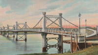
1880: Fitzroy
Rockhampton, Queensland, Australia - Fitzroy River
| Bridgemeister ID: | 416 (added before 2003) |
| Year Completed: | 1880 |
| Name: | Fitzroy |
| Location: | Rockhampton, Queensland, Australia |
| Crossing: | Fitzroy River |
| Principals: | F. J. Byerley, Owen Jones |
| References: | AAJ, STC |
| Use: | Vehicular |
| Status: | Demolished, 1956 |
| Main Cables: | Chain (iron) |
| Suspended Spans: | 6 |
| Main Spans: | 4 x 70.7 meters (232 feet) |
| Side Spans: | 2 x 26.5 meters (86.9 feet) |
| Deck width: | 21 feet |
Notes:
- Damaged during flood, 1890. Repaired, 1891.
External Links:
1890: Wollaston
Warrnambool, Victoria, Australia - Merri River
| Bridgemeister ID: | 420 (added before 2003) |
| Year Completed: | 1890 |
| Name: | Wollaston |
| Location: | Warrnambool, Victoria, Australia |
| Crossing: | Merri River |
| Coordinates: | 38.36343 S 142.49163 E |
| Maps: | Acme, GeoHack, Google, OpenStreetMap |
| Principals: | Arthur Dobson |
| References: | STC |
| Use: | Vehicular (one-lane) |
| Status: | Restricted to foot traffic (last checked: 2005) |
| Main Cables: | Wire |
| Suspended Spans: | 1 |
| Main Span: | 1 x 36.6 meters (120.1 feet) |
| Deck width: | 3.2 meters |
1891: (pipeline bridge)
Lane Cove North, New South Wales, Australia - Lane Cove River
| Bridgemeister ID: | 2685 (added 2019-05-26) |
| Year Completed: | 1891 |
| Name: | (pipeline bridge) |
| Location: | Lane Cove North, New South Wales, Australia |
| Crossing: | Lane Cove River |
| Coordinates: | 33.802904 S 151.143883 E |
| Maps: | Acme, GeoHack, Google, OpenStreetMap |
| Use: | Pipeline |
| Status: | Replaced |
| Main Cables: | Wire (steel) |
Notes:
- Multi-span pipeline suspension bridge carrying a large water main. Since replaced with a bridge carrying both pedestrians and a large pipeline.
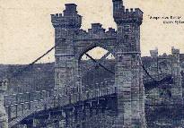
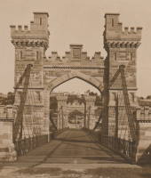
1892: Cammeray
Willoughby, New South Wales, Australia - Long Bay Gully
| Bridgemeister ID: | 421 (added before 2003) |
| Year Completed: | 1892 |
| Name: | Cammeray |
| Also Known As: | North Sydney, Northbridge |
| Location: | Willoughby, New South Wales, Australia |
| Crossing: | Long Bay Gully |
| Coordinates: | 33.816899 S 151.212336 E |
| Maps: | Acme, GeoHack, Google, OpenStreetMap |
| References: | PTS2, STC |
| Use: | Vehicular |
| Status: | Only towers remain, since 1939 (last checked: 2019) |
| Main Cables: | Wire |
| Suspended Spans: | 3 |
| Main Span: | 1 x 152.4 meters (500 feet) |
| Side Spans: | 2 x 38.1 meters (125 feet) |
Notes:
- Replaced with arch in 1939, but original towers retained. STC says replaced 1937.
External Links:
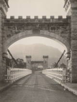
1898: Hampden
Kangaroo Valley, New South Wales, Australia - Kangaroo River
| Bridgemeister ID: | 423 (added before 2003) |
| Year Completed: | 1898 |
| Name: | Hampden |
| Location: | Kangaroo Valley, New South Wales, Australia |
| Crossing: | Kangaroo River |
| Coordinates: | 34.727454 S 150.520910 E |
| Maps: | Acme, GeoHack, Google, OpenStreetMap |
| Principals: | E.M. de Burgh |
| References: | AAJ, STC |
| Use: | Vehicular (one-lane) |
| Status: | In use (last checked: 2023) |
| Main Cables: | Wire (steel) |
| Suspended Spans: | 1 |
| Main Span: | 1 x 77.1 meters (253 feet) |
External Links:
1901: Queanbeyan
Queanbeyan, New South Wales, Australia - Queanbeyan River
| Bridgemeister ID: | 425 (added before 2003) |
| Year Completed: | 1901 |
| Name: | Queanbeyan |
| Location: | Queanbeyan, New South Wales, Australia |
| Crossing: | Queanbeyan River |
| Status: | Destroyed, 1925 |
| Main Span: | 1 |
Notes:
- Destroyed by flood 1925.
- Replaced by 1938 Queanbeyan - Queanbeyan, New South Wales, Australia.
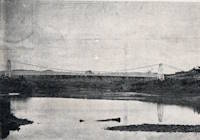
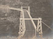
1903: Maldon
Picton vicinity, New South Wales, Australia - Nepean River
| Bridgemeister ID: | 427 (added before 2003) |
| Year Completed: | 1903 |
| Name: | Maldon |
| Location: | Picton vicinity, New South Wales, Australia |
| Crossing: | Nepean River |
| Coordinates: | 34.202104 S 150.632321 E |
| Maps: | Acme, GeoHack, Google, OpenStreetMap |
| Principals: | E.M. de Burgh |
| References: | STC |
| Use: | Vehicular (one-lane) |
| Status: | Derelict (last checked: 2020) |
| Main Cables: | Wire (steel) |
| Suspended Spans: | 1 |
| Main Span: | 1 x 68.9 meters (226 feet) |
Notes:
- Timber towers damaged by fire, replaced with steel towers 1939.
External Links:
- Maldon Suspension Bridge, Jan 28th 2020 - YouTube. Close-up drone footage of the derelict bridge.
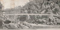
1904: Alexandra
Launceston, Tasmania, Australia - South Esk River
| Bridgemeister ID: | 428 (added before 2003) |
| Year Completed: | 1904 |
| Name: | Alexandra |
| Also Known As: | Basin |
| Location: | Launceston, Tasmania, Australia |
| Crossing: | South Esk River |
| At or Near Feature: | First Basin Water, Cataract Gorge Reserve |
| Principals: | C. St John David, Salisbury's Foundry Co. |
| References: | STC |
| Use: | Footbridge |
| Status: | Destroyed, 1929 |
| Main Cables: | Wire |
| Suspended Spans: | 3 |
| Main Span: | 1 x 45.7 meters (149.9 feet) |
| Side Spans: | 2 x 10.7 meters (35.1 feet) |
Notes:
- Washed away by flood, 1929.
- Near 1895 Duck Reach - Launceston, Tasmania, Australia.
- Replaced by 1930 Alexandra (Basin) - Launceston, Tasmania, Australia of similar construction.
1907: Sandy Creek
Mackay, Queensland, Australia - Sandy Creek
| Bridgemeister ID: | 527 (added before 2003) |
| Year Completed: | 1907 |
| Name: | Sandy Creek |
| Location: | Mackay, Queensland, Australia |
| Crossing: | Sandy Creek |
| Coordinates: | 21.267726 S 149.138815 E |
| Maps: | Acme, GeoHack, Google, OpenStreetMap |
| References: | STC |
| Use: | Vehicular (one-lane) |
| Status: | Removed |
| Main Cables: | Wire |
| Suspended Spans: | 1 |
Notes:
- Damaged in 1957 and 1958 by overweight vehicles. Bridge was repaired each time. Structure was still standing when a replacement was completed in 1966.
1909: Cowwarr
Cowwarr, Victoria, Australia - Thompson River
| Bridgemeister ID: | 430 (added before 2003) |
| Year Completed: | 1909 |
| Name: | Cowwarr |
| Location: | Cowwarr, Victoria, Australia |
| Crossing: | Thompson River |
| Use: | Footbridge |
| Status: | Destroyed, 1934 |
| Main Cables: | Wire |
Notes:
- 1934: Destroyed by flood
External Links:
- Facebook - COWWARR SUSPENSION BRIDGE. Images and history of the bridge, posted March 31, 2017.
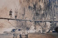
1919: Gordon
Gordon, New South Wales, Australia - Stony Creek
| Bridgemeister ID: | 8163 (added 2024-02-03) |
| Year Completed: | 1919 |
| Name: | Gordon |
| Location: | Gordon, New South Wales, Australia |
| Crossing: | Stony Creek |
| Coordinates: | 33.750472 S 151.156917 E |
| Maps: | Acme, GeoHack, Google, OpenStreetMap |
| Use: | Footbridge |
| Status: | Removed |
| Main Cables: | Wire |
| Main Span: | 1 x 67.1 meters (220 feet) |
External Links:
- 23 Jun 1919 - GORDON SUSPENSION BRIDGE. - Trove. Article from The Sydney Morning Herald dated Monday June 23 1919 titled "Gordon Suspension Bridge" regarding the grand opening of the bridge. The article indicates the bridge was on the alignment of Rosedale Road over Stony Creek.

1929: Kane's
Melbourne, Victoria, Australia - Yarra River
| Bridgemeister ID: | 443 (added before 2003) |
| Year Completed: | 1929 |
| Name: | Kane's |
| Location: | Melbourne, Victoria, Australia |
| Crossing: | Yarra River |
| At or Near Feature: | Yarra Bend Park, Studley Park |
| Coordinates: | 37.80006 S 145.00966 E |
| Maps: | Acme, GeoHack, Google, OpenStreetMap |
| Use: | Footbridge |
| Status: | In use (last checked: 2022) |
| Main Cables: | Wire (steel) |
| Suspended Spans: | 1 |
| Main Span: | 1 x 64 meters (210 feet) estimated |
Notes:
- Rebuilt 1935.
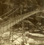
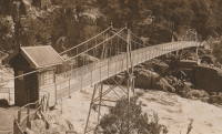
1930: Alexandra
Launceston, Tasmania, Australia - South Esk River
| Bridgemeister ID: | 444 (added before 2003) |
| Year Completed: | 1930 |
| Name: | Alexandra |
| Also Known As: | Basin |
| Location: | Launceston, Tasmania, Australia |
| Crossing: | South Esk River |
| At or Near Feature: | First Basin Water, Cataract Gorge Reserve |
| Coordinates: | 41.44681 S 147.11813 E |
| Maps: | Acme, GeoHack, Google, OpenStreetMap |
| References: | STC |
| Use: | Footbridge |
| Status: | In use (last checked: 2019) |
| Main Cables: | Wire (steel) |
| Suspended Spans: | 3 |
| Main Span: | 1 x 45.7 meters (149.9 feet) |
| Side Spans: | 1 x 16.8 meters (55.1 feet), 1 x 10.7 meters (35.1 feet) |
Notes:
- 2004: Refurbished, including replacement of cables which supposedly dated to the first Alexandra bridge.
- 2020, October: Maintenance project started focused on corrosion prevention including stripping paint and repainting.
- Replaced 1904 Alexandra (Basin) - Launceston, Tasmania, Australia.
- Near 1939 Duck Reach - Launceston, Tasmania, Australia.
- Near 1995 Duck Reach - Launceston, Tasmania, Australia.
External Links:
1936: Kindee
Kindee, Ellenborough vicinity, New South Wales, Australia - Hastings River
| Bridgemeister ID: | 1296 (added 2004-03-19) |
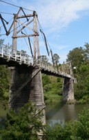
| Year Completed: | 1936 |
| Name: | Kindee |
| Location: | Kindee, Ellenborough vicinity, New South Wales, Australia |
| Crossing: | Hastings River |
| Coordinates: | 31.42233 S 152.47044 E |
| Maps: | Acme, GeoHack, Google, OpenStreetMap |
| References: | AAJ |
| Use: | Vehicular (one-lane) |
| Status: | In use (last checked: 2019) |
| Main Cables: | Wire (steel) |
| Suspended Spans: | 3 |
| Main Span: | 1 x 67.1 meters (220 feet) |
| Side Spans: | 2 x 26.8 meters (88 feet) |
| Characteristics: | Braced (trussed) chain/cable, Hinged cables |
Notes:
- Odd timber suspension bridge that has large diagonal stiffening members giving it the appearance of a "braced chain" bridge. AAJ describes it: "the construction in each span is of the three-hinged, trussed cable type or inverted three-hinged arch type. The form of the trussed cable is the Fidler truss."
- Brett Evill transcribed a plaque at the bridge: "This bridge with unusual trussed cables was designed by DMR engineers V Karmalsky and A T Britton. Steelwork was supplied by Morison and Bearby of Newcastle and timber by R McMillan of Long Flat. Sadly, the contractor R B Haydon was killed during construction and work was completed by the Department. Opened on 19 December 1936, the bridge and its approaches cost £5,000.
"Erected to commemorate Australia's bicentenary in 1988 by the Department of Main Roads and the National Roads and Motorists Association (NRMA)" - Similar to 1951 Marias River (Pugsley) - Chester vicinity, Montana, USA.
- Similar to (footbridge) - Sarov (Саров), Nizhny Novgorod Oblast, Russia.
- Similar to Allan - Segenhoe, Scone vicinity, New South Wales, Australia.
- Similar to Ininskiy (Ининский) - Inya (Иня), Altai Republic, Russia.
- Similar to Reku Vel' - Solginskiy (Солгинский), Arkhangelsk Oblast, Russia.
1936: Walter Taylor
Indooroopilly and Chelmer, Queensland, Australia - Brisbane River
| Bridgemeister ID: | 449 (added before 2003) |
| Year Completed: | 1936 |
| Name: | Walter Taylor |
| Location: | Indooroopilly and Chelmer, Queensland, Australia |
| Crossing: | Brisbane River |
| Coordinates: | 27.505467 S 152.9737 E |
| Maps: | Acme, GeoHack, Google, OpenStreetMap |
| References: | AAJ, STC |
| Use: | Vehicular |
| Status: | In use (last checked: 2015) |
| Main Cables: | Wire (steel) |
| Suspended Spans: | 1 |
| Main Span: | 1 x 182.9 meters (600.1 feet) |
Notes:
- Hybrid truss-suspension where truss rises up to meet main cables.
- Two-year refurbishment started, late 2007, to replace and strengthen joints along the cables and deck truss.
External Links:
1937: Lorne
Lorne, Victoria, Australia - Erskine River
| Bridgemeister ID: | 1656 (added 2005-03-19) |
| Year Completed: | 1937 |
| Name: | Lorne |
| Location: | Lorne, Victoria, Australia |
| Crossing: | Erskine River |
| Coordinates: | 38.533600 S 143.977918 E |
| Maps: | Acme, GeoHack, Google, OpenStreetMap |
| Use: | Footbridge |
| Status: | In use (last checked: 2018) |
| Main Cables: | Wire |
| Suspended Spans: | 1 |
1938: Queanbeyan
Queanbeyan, New South Wales, Australia - Queanbeyan River
| Bridgemeister ID: | 454 (added before 2003) |
| Year Completed: | 1938 |
| Name: | Queanbeyan |
| Location: | Queanbeyan, New South Wales, Australia |
| Crossing: | Queanbeyan River |
| Coordinates: | 35.35567 S 149.23857 E |
| Maps: | Acme, GeoHack, Google, OpenStreetMap |
| Use: | Footbridge |
| Status: | Restricted to foot traffic (last checked: 2021) |
| Main Cables: | Wire (steel) |
| Suspended Spans: | 1 |
Notes:
1939: Far Red Hill
Mount Morgan, Queensland, Australia - Dee River
| Bridgemeister ID: | 1748 (added 2005-04-20) |
| Year Completed: | 1939 |
| Name: | Far Red Hill |
| Location: | Mount Morgan, Queensland, Australia |
| Crossing: | Dee River |
| Coordinates: | 23.651006 S 150.376080 E |
| Maps: | Acme, GeoHack, Google, OpenStreetMap |
| Use: | Footbridge |
| Status: | Only towers remain (last checked: 2019) |
| Main Cables: | Wire |
Notes:
External Links:
- Mount Morgan web site (link reported not working). Notes: "At a special meeting of the Mount Morgan Shire Council in February 1939, the Council accepted a tender from Mr. W. Kerrigan to rebuild [the previous Far Red Hill bridge]. The bridge is now neglected and in a very bad state of repair and is unusable."
1950: Warragamba Dam
Warragamba, New South Wales, Australia - Warragamba River
| Bridgemeister ID: | 2687 (added 2019-05-26) |
| Year Completed: | 1950 |
| Name: | Warragamba Dam |
| Location: | Warragamba, New South Wales, Australia |
| Crossing: | Warragamba River |
| Coordinates: | 33.882494 S 150.598102 E |
| Maps: | Acme, GeoHack, Google, OpenStreetMap |
| Use: | Footbridge |
| Status: | Removed, 2005 |
| Main Cables: | Wire (steel) |
Notes:
- Heavily damaged by brush fire, 2001. Removed 2005 or later.
1967: (pipeline bridge)
Savage River, Tasmania, Australia - Savage River
| Bridgemeister ID: | 4600 (added 2020-06-06) |
| Year Completed: | 1967 |
| Name: | (pipeline bridge) |
| Location: | Savage River, Tasmania, Australia |
| Crossing: | Savage River |
| Coordinates: | 41.475961 S 145.215867 E |
| Maps: | Acme, GeoHack, Google, OpenStreetMap |
| Use: | Pipeline |
| Status: | Extant (last checked: 2019) |
| Main Cables: | Wire (steel) |
| Suspended Spans: | 1 |
| Main Span: | 1 x 305 meters (1,000.7 feet) |
External Links:
1985: Harding Road
Preston, Victoria, Australia - Merri Creek
| Bridgemeister ID: | 2696 (added 2019-05-27) |
| Year Completed: | 1985 |
| Name: | Harding Road |
| Location: | Preston, Victoria, Australia |
| Crossing: | Merri Creek |
| At or Near Feature: | W.H. Robinson Reserve |
| Coordinates: | 37.746454 S 144.980239 E |
| Maps: | Acme, GeoHack, Google, OpenStreetMap |
| Use: | Footbridge |
| Status: | In use (last checked: 2019) |
| Main Cables: | Wire (steel) |
1986: Rex Creek
Mossman Gorge, Queensland, Australia - Rex Creek
| Bridgemeister ID: | 2623 (added 2018-12-31) |
| Year Completed: | 1986 |
| Name: | Rex Creek |
| Location: | Mossman Gorge, Queensland, Australia |
| Crossing: | Rex Creek |
| Use: | Footbridge |
| Status: | Replaced (last checked: 2010) |
| Main Cables: | Wire (steel) |
Notes:
1988: York Swing
York, Western Australia, Australia - Avon River
| Bridgemeister ID: | 1300 (added 2004-04-03) |
| Year Completed: | 1988 |
| Name: | York Swing |
| Location: | York, Western Australia, Australia |
| Crossing: | Avon River |
| Coordinates: | 31.8868 S 116.770717 E |
| Maps: | Acme, GeoHack, Google, OpenStreetMap |
| Use: | Footbridge |
| Status: | In use (last checked: 2007) |
| Main Cables: | Wire (steel) |
Notes:
- Replaced a 1906 structure that was likely a suspension bridge.
1993: Melbourne Road
Wodonga, Victoria, Australia - House River
| Bridgemeister ID: | 2619 (added 2018-12-30) |
| Year Completed: | 1993 |
| Name: | Melbourne Road |
| Location: | Wodonga, Victoria, Australia |
| Crossing: | House River |
| Coordinates: | 36.119260 S 146.877882 E |
| Maps: | Acme, GeoHack, Google, OpenStreetMap |
| Use: | Footbridge |
| Status: | Replaced, 2018 (last checked: 2018) |
| Main Cables: | Wire (steel) |
| Bridgemeister ID: | 1861 (added 2005-07-25) |
| Year Completed: | 1995 |
| Name: | Duck Reach |
| Location: | Launceston, Tasmania, Australia |
| Coordinates: | 41.459291 S 147.112215 E |
| Maps: | Acme, GeoHack, Google, OpenStreetMap |
| Use: | Footbridge |
| Status: | In use (last checked: 2022) |
| Main Cables: | Wire (steel) |
| Suspended Spans: | 1 |
| Main Span: | 1 x 57 meters (187 feet) estimated |
Notes:
1995: Timber
Laidley, Queensland, Australia - Narda Lagoon
| Bridgemeister ID: | 838 (added 2003-06-28) |
| Year Completed: | 1995 |
| Name: | Timber |
| Location: | Laidley, Queensland, Australia |
| Crossing: | Narda Lagoon |
| Coordinates: | 27.647895 S 152.391248 E |
| Maps: | Acme, GeoHack, Google, OpenStreetMap |
| Principals: | John Wilson and Partners |
| Use: | Footbridge |
| Status: | In use (last checked: 2018) |
| Main Cables: | Wire (steel) |
1998: (footbridge)
Tumut vicinity, New South Wales, Australia
| Bridgemeister ID: | 1676 (added 2005-03-25) |
| Year Completed: | 1998 |
| Name: | (footbridge) |
| Location: | Tumut vicinity, New South Wales, Australia |
| Coordinates: | 35.389083 S 148.248133 E |
| Maps: | Acme, GeoHack, Google, OpenStreetMap |
| Principals: | Waldren Bridges, Australian Army 21 Construction Regiment Royal Australian Engineers |
| Use: | Footbridge |
| Status: | In use (last checked: 2005) |
| Main Cables: | Wire (steel) |
| Suspended Spans: | 1 |
| Main Span: | 1 x 60.2 meters (197.5 feet) |
Notes:
- A sign at the bridge reads, "The construction of the pedestrian suspension bridge has allowed The Hume and Hovell Walking Track to be re-routed off the Snowy Mountains Highway and Blowering Dam access road onto a now disused section of the old hightway. The bridge was designed by Waldren Bridges Pty Ltd of Yackandandah Victoria and has a span of 60.2 metres. Ironbark timber decking which is supported from two 30mm steel cables. End supports are made from 4 ironbark timber poles 9.3 meters in height. The bridge was constructed by the Australian Army 21 Construction Regiment Royal Australian Engineers as a training program in 7 days."
1998: Dry Gully Creek
Omeo, Victoria, Australia - Dy Gully Creek
| Bridgemeister ID: | 2867 (added 2019-09-08) |
| Year Completed: | 1998 |
| Name: | Dry Gully Creek |
| Also Known As: | Ah Fong |
| Location: | Omeo, Victoria, Australia |
| Crossing: | Dy Gully Creek |
| Coordinates: | 37.108319 S 147.576992 E |
| Maps: | Acme, GeoHack, Google, OpenStreetMap |
| Use: | Footbridge |
| Status: | In use (last checked: 2019) |
| Main Cables: | Wire (steel) |
| Suspended Spans: | 1 |
| Bridgemeister ID: | 1691 (added 2005-03-27) |
| Year Completed: | 2000 |
| Name: | Loch |
| Location: | Loch, Victoria, Australia |
| Coordinates: | 38.368133 S 145.71105 E |
| Maps: | Acme, GeoHack, Google, OpenStreetMap |
| Use: | Footbridge |
| Status: | In use (last checked: 2016) |
| Main Cables: | Wire |
Notes:
- A sign at the bridge reads, "Loch Stock & Barrell - Pedestrian Suspension Bridge - A Loch Memorial Reserve Community Project."
2001: (footbridge)
Shepparton, Victoria, Australia - Goulburn River
| Bridgemeister ID: | 1750 (added 2005-04-20) |
| Year Completed: | 2001 |
| Name: | (footbridge) |
| Location: | Shepparton, Victoria, Australia |
| Crossing: | Goulburn River |
| Coordinates: | 36.387517 S 145.393 E |
| Maps: | Acme, GeoHack, Google, OpenStreetMap |
| Use: | Footbridge |
| Status: | In use (last checked: 2013) |
| Main Cables: | Wire (steel) |
Notes:
- Wide footbridge.
2001: East Street
Mount Morgan, Queensland, Australia - Dee River
| Bridgemeister ID: | 2675 (added 2019-03-24) |
| Year Completed: | 2001 |
| Name: | East Street |
| Also Known As: | Private Victor Stanley Jones |
| Location: | Mount Morgan, Queensland, Australia |
| Crossing: | Dee River |
| Coordinates: | 23.642740 S 150.389375 E |
| Maps: | Acme, GeoHack, Google, OpenStreetMap |
| Use: | Footbridge |
| Status: | In use (last checked: 2021) |
| Main Cables: | Wire |
| Suspended Spans: | 1 |
Notes:
- Closed briefly in late 2020 for repairs and refurbishment.
- At former location of East Street - Mount Morgan, Queensland, Australia.
2004: (footbridge)
Charlton, Victoria, Australia - Avoca River
| Bridgemeister ID: | 1501 (added 2004-10-08) |
| Year Completed: | 2004 |
| Name: | (footbridge) |
| Location: | Charlton, Victoria, Australia |
| Crossing: | Avoca River |
| Coordinates: | 36.26725 S 143.351283 E |
| Maps: | Acme, GeoHack, Google, OpenStreetMap |
| Use: | Footbridge |
| Status: | In use (last checked: 2004) |
| Main Cables: | Wire |
2008: Lloyd's
Yungaburra, Queensland, Australia - Peterson's Creek
| Bridgemeister ID: | 4747 (added 2020-06-27) |
| Year Completed: | 2008 |
| Name: | Lloyd's |
| Location: | Yungaburra, Queensland, Australia |
| Crossing: | Peterson's Creek |
| At or Near Feature: | Peterson Creek Wildlife and Botanical Walking Track |
| Coordinates: | 17.270106 S 145.579070 E |
| Maps: | Acme, GeoHack, Google, OpenStreetMap |
| Use: | Footbridge |
| Status: | In use (last checked: 2020) |
| Main Cables: | Wire (steel) |
| Suspended Spans: | 1 |
External Links:
2010: Rex Creek
Mossman Gorge, Queensland, Australia - Rex Creek
| Bridgemeister ID: | 2622 (added 2018-12-31) |
| Year Completed: | 2010 |
| Name: | Rex Creek |
| Location: | Mossman Gorge, Queensland, Australia |
| Crossing: | Rex Creek |
| Use: | Footbridge |
| Status: | In use (last checked: 2017) |
| Main Cables: | Wire (steel) |
| Suspended Spans: | 1 |
Notes:
External Links:

2014: Glen Willow
Mudgee, New South Wales, Australia - Cudgegong River
| Bridgemeister ID: | 2843 (added 2019-07-06) |
| Year Completed: | 2014 |
| Name: | Glen Willow |
| Location: | Mudgee, New South Wales, Australia |
| Crossing: | Cudgegong River |
| Coordinates: | 32.586267 S 149.582181 E |
| Maps: | Acme, GeoHack, Google, OpenStreetMap |
| Use: | Footbridge |
| Status: | In use (last checked: 2019) |
| Main Cables: | Wire (steel) |
| Suspended Spans: | 1 |
2015: Donnelly River
Glenoran, Western Australia, Australia - Donnelly River
| Bridgemeister ID: | 2694 (added 2019-05-27) |
| Year Completed: | 2015 |
| Name: | Donnelly River |
| Location: | Glenoran, Western Australia, Australia |
| Crossing: | Donnelly River |
| Coordinates: | 34.213859 S 115.941370 E |
| Maps: | Acme, GeoHack, Google, OpenStreetMap |
| Use: | Footbridge |
| Status: | In use (last checked: 2016) |
| Main Cables: | Wire (steel) |
| Suspended Spans: | 1 |
2019: Old Noarlunga Swing
Old Noarlunga, South Australia, Australia - Onkaparinga River
| Bridgemeister ID: | 5100 (added 2020-09-05) |
| Year Completed: | 2019 |
| Name: | Old Noarlunga Swing |
| Location: | Old Noarlunga, South Australia, Australia |
| Crossing: | Onkaparinga River |
| Coordinates: | 35.181591 S 138.504563 E |
| Maps: | Acme, GeoHack, Google, OpenStreetMap |
| Use: | Footbridge |
| Status: | In use (last checked: 2020) |
| Main Cables: | Wire (steel) |
| Suspended Spans: | 1 |
Notes:
2020: Port Campbell
Port Campbell, Victoria, Australia - Port Campbell Creek
| Bridgemeister ID: | 7344 (added 2022-10-07) |
| Year Completed: | 2020 |
| Name: | Port Campbell |
| Also Known As: | Campbells Creek |
| Location: | Port Campbell, Victoria, Australia |
| Crossing: | Port Campbell Creek |
| Coordinates: | 38.617883 S 142.993342 E |
| Maps: | Acme, GeoHack, Google, OpenStreetMap |
| Use: | Footbridge |
| Status: | In use (last checked: 2022) |
| Main Cables: | Wire (steel) |
| Suspended Spans: | 1 |
| Main Span: | 1 x 53 meters (173.9 feet) estimated |
Notes:
- At (or near) former location of Port Campbell (Campbells Creek) - Port Campbell, Victoria, Australia.
2020: Whitton Malt House
Whitton, New South Wales, Australia
| Bridgemeister ID: | 8420 (added 2024-03-04) |
| Year Completed: | 2020 |
| Name: | Whitton Malt House |
| Location: | Whitton, New South Wales, Australia |
| Coordinates: | 34.589583 S 146.165806 E |
| Maps: | Acme, GeoHack, Google, OpenStreetMap |
| Use: | Footbridge |
| Status: | In use (last checked: 2024) |
| Main Cables: | Wire (steel) |
| Main Span: | 1 |
| Side Span: | 1 |
External Links:
- Facebook. Images of the bridge under construction. Posted July 8, 2020.
2021: (footbridge)
Antechamber Bay, Kangaroo Island, South Australia, Australia - Chapman River
| Bridgemeister ID: | 5987 (added 2021-07-01) |
| Year Completed: | 2021 |
| Name: | (footbridge) |
| Location: | Antechamber Bay, Kangaroo Island, South Australia, Australia |
| Crossing: | Chapman River |
| At or Near Feature: | Lashmar Conservation Park |
| Coordinates: | 35.784974 S 138.066628 E |
| Maps: | Acme, GeoHack, Google, OpenStreetMap |
| Use: | Footbridge |
| Status: | In use (last checked: 2021) |
| Main Cables: | Wire (steel) |
| Main Span: | 1 |

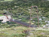
2021: (footbridge)
Guthega vicinity, New South Wales, Australia - Spencer Creek
| Bridgemeister ID: | 5924 (added 2021-06-16) |
| Year Completed: | 2021 |
| Name: | (footbridge) |
| Location: | Guthega vicinity, New South Wales, Australia |
| Crossing: | Spencer Creek |
| At or Near Feature: | Snowies Alpine Walk, Kosciuszko National Park |
| Coordinates: | 36.399539 S 148.348952 E |
| Maps: | Acme, GeoHack, Google, OpenStreetMap |
| Use: | Footbridge |
| Status: | In use (last checked: 2021) |
| Main Cables: | Wire (steel) |
| Suspended Spans: | 1 |
External Links:
- The Epoch Times - Australia’s Highest Suspension Bridge Opens, Expected to Attract 50,000 Visitors per Year. June 10, 2022 article about the bridge and Snowies Alpine Walk.
2022: (footbridge)
Shepparton, Victoria, Australia - Broken River
| Bridgemeister ID: | 7161 (added 2022-06-26) |
| Year Completed: | 2022 |
| Name: | (footbridge) |
| Location: | Shepparton, Victoria, Australia |
| Crossing: | Broken River |
| At or Near Feature: | Australian Botanic Gardens Shepparton |
| Coordinates: | 36.398024 S 145.381404 E |
| Maps: | Acme, GeoHack, Google, OpenStreetMap |
| Use: | Footbridge |
| Status: | In use (last checked: 2022) |
| Main Cables: | Wire (steel) |
| Main Span: | 1 |
2022: Rockies
Euroa, Victoria, Australia - Seven Creeks
| Bridgemeister ID: | 8860 (added 2024-10-01) |
| Year Completed: | 2022 |
| Name: | Rockies |
| Location: | Euroa, Victoria, Australia |
| Crossing: | Seven Creeks |
| Coordinates: | 36.762556 S 145.586167 E |
| Maps: | Acme, GeoHack, Google, OpenStreetMap |
| Use: | Footbridge |
| Status: | In use (last checked: 2022) |
| Main Cables: | Wire (steel) |
| Suspended Spans: | 1 |
2023: Dwaarlindjirraap
Dwellingup, Western Australia, Australia - Murray River
| Bridgemeister ID: | 7865 (added 2023-09-17) |
| Year Completed: | 2023 |
| Name: | Dwaarlindjirraap |
| Location: | Dwellingup, Western Australia, Australia |
| Crossing: | Murray River |
| Coordinates: | 32.772495 S 116.083750 E |
| Maps: | Acme, GeoHack, Google, OpenStreetMap |
| Principals: | Arup, Bocol Constructions |
| Use: | Footbridge |
| Status: | In use (last checked: 2023) |
| Main Cables: | Wire (steel) |
| Suspended Spans: | 1 |
2023: Warrawee
Latrobe, Tasmania, Australia - Mersey River
| Bridgemeister ID: | 8795 (added 2024-09-14) |
| Year Completed: | 2023 |
| Name: | Warrawee |
| Location: | Latrobe, Tasmania, Australia |
| Crossing: | Mersey River |
| At or Near Feature: | Wild Mersey Mountain Bike Trails, Warrawee Conservation Area |
| Coordinates: | 41.282250 S 146.425694 E |
| Maps: | Acme, GeoHack, Google, OpenStreetMap |
| Principals: | BridgePro Engineering |
| Use: | Footbridge |
| Status: | In use (last checked: 2024) |
| Main Cables: | Wire (steel) |
External Links:
- Building the Warrawee Suspension Bridge | BridgePro Engineering. Overview of the design and construction of the bridge.
- Warrawee Suspension Bridge | BridgePro Engineering. Engineering project overview.
2024: (footbridge)
Weyba Downs, Queensland, Australia - Horsemen Creek
| Bridgemeister ID: | 8782 (added 2024-09-01) |
| Year Completed: | 2024 |
| Name: | (footbridge) |
| Location: | Weyba Downs, Queensland, Australia |
| Crossing: | Horsemen Creek |
| Coordinates: | 26.448750 S 153.054056 E |
| Maps: | Acme, GeoHack, Google, OpenStreetMap |
| Use: | Footbridge |
| Status: | In use (last checked: 2024) |
| Main Cables: | Wire (steel) |
| Main Span: | 1 x 24 meters (78.7 feet) |
2024: Grey Gully
Hallett Cove, South Australia, Australia
| Bridgemeister ID: | 8784 (added 2024-09-01) |
| Year Completed: | 2024 |
| Name: | Grey Gully |
| Location: | Hallett Cove, South Australia, Australia |
| At or Near Feature: | Marion Coastal Walkway |
| Coordinates: | 35.059806 S 138.503250 E |
| Maps: | Acme, GeoHack, Google, OpenStreetMap |
| Use: | Footbridge |
| Status: | In use (last checked: 2024) |
| Main Cables: | Wire (steel) |
| Suspended Spans: | 1 |
Notes:
- Built as part of same project as 2024 Kuranabinna Gully - Hallett Cove, South Australia, Australia.
2024: Kuranabinna Gully
Hallett Cove, South Australia, Australia
| Bridgemeister ID: | 8785 (added 2024-09-02) |
| Year Completed: | 2024 |
| Name: | Kuranabinna Gully |
| Location: | Hallett Cove, South Australia, Australia |
| At or Near Feature: | Marion Coastal Walkway |
| Coordinates: | 35.062972 S 138.501667 E |
| Maps: | Acme, GeoHack, Google, OpenStreetMap |
| Use: | Footbridge |
| Status: | In use (last checked: 2024) |
| Main Cables: | Wire (steel) |
| Suspended Spans: | 1 |
Notes:
- Built as part of same project as 2024 Grey Gully - Hallett Cove, South Australia, Australia.
(footbridge)
Bright, Victoria, Australia - Ovens River
| Bridgemeister ID: | 2709 (added 2019-06-16) |
| Name: | (footbridge) |
| Location: | Bright, Victoria, Australia |
| Crossing: | Ovens River |
| Coordinates: | 36.726115 S 146.953136 E |
| Maps: | Acme, GeoHack, Google, OpenStreetMap |
| Use: | Footbridge |
| Status: | In use (last checked: 2019) |
| Main Cables: | Wire (steel) |
| Suspended Spans: | 1 |
(footbridge)
Clarendon vicinity and Kangarilla vicinity, South Australia, Australia - Onkaparinga River
| Bridgemeister ID: | 511 (added before 2003) |
| Name: | (footbridge) |
| Location: | Clarendon vicinity and Kangarilla vicinity, South Australia, Australia |
| Crossing: | Onkaparinga River |
| At or Near Feature: | Mt. Bold Reservoir |
| Coordinates: | 35.124283 S 138.6829 E |
| Maps: | Acme, GeoHack, Google, OpenStreetMap |
| Use: | Footbridge |
| Status: | In use (last checked: 2008) |
| Suspended Spans: | 1 |
(footbridge)
Deloraine, Tasmania, Australia - Meander River
| Bridgemeister ID: | 4958 (added 2020-08-09) |
| Name: | (footbridge) |
| Location: | Deloraine, Tasmania, Australia |
| Crossing: | Meander River |
| Coordinates: | 41.522748 S 146.659433 E |
| Maps: | Acme, GeoHack, Google, OpenStreetMap |
| Use: | Footbridge |
| Status: | In use (last checked: 2016) |
| Main Cables: | Wire (steel) |
| Suspended Spans: | 1 |
External Links:
(footbridge)
Dorrigo Mountain, New South Wales, Australia
| Bridgemeister ID: | 3324 (added 2019-12-01) |
| Name: | (footbridge) |
| Location: | Dorrigo Mountain, New South Wales, Australia |
| At or Near Feature: | Crystal Shower Falls |
| Coordinates: | 30.380666 S 152.729510 E |
| Maps: | Acme, GeoHack, Google, OpenStreetMap |
| Use: | Footbridge |
| Status: | In use (last checked: 2019) |
| Main Cables: | Wire (steel) |
(footbridge)
Germantown, Queensland, Australia - Mena Creek
| Bridgemeister ID: | 5777 (added 2021-04-08) |
| Name: | (footbridge) |
| Location: | Germantown, Queensland, Australia |
| Crossing: | Mena Creek |
| At or Near Feature: | Mena Creek Falls, Paronella Park |
| Coordinates: | 17.653107 S 145.956446 E |
| Maps: | Acme, GeoHack, Google, OpenStreetMap |
| Use: | Footbridge |
| Status: | In use (last checked: 2021) |
| Main Cables: | Wire (steel) |
| Suspended Spans: | 1 |
(footbridge)
Mount Morgan, Queensland, Australia - Dee River
| Bridgemeister ID: | 1745 (added 2005-04-20) |
| Name: | (footbridge) |
| Location: | Mount Morgan, Queensland, Australia |
| Crossing: | Dee River |
| Status: | Destroyed, 1928, by flood. |
| Main Cables: | Wire |
Notes:
- According to a sign at one of the remaining Mount Morgan suspension bridges, "[this bridge] spanned from Tipperary Road to the 'lower yards' of the mine, 100 metres past where the western end of Morgan Street crosses the Dee. It was destroyed in 1928."
(footbridge)
Mount Morgan, Queensland, Australia - Dee River
| Bridgemeister ID: | 1746 (added 2005-04-20) |
| Name: | (footbridge) |
| Location: | Mount Morgan, Queensland, Australia |
| Crossing: | Dee River |
| Status: | Destroyed, 1928, by flood. |
| Main Cables: | Wire |
Notes:
- According to a sign at one of the remaining Mount Morgan suspension bridges, "[this bridge] crossed from the mine side of the Dee, west of the gold sheds, to Tipperary Road, opposite where Mountain View and Sunburst Hotels once stood. It too was swept away in 1928."
(footbridge)
Murrurundi, New South Wales, Australia - Pages River
| Bridgemeister ID: | 1338 (added 2004-05-01) |
| Name: | (footbridge) |
| Location: | Murrurundi, New South Wales, Australia |
| Crossing: | Pages River |
| Coordinates: | 31.762522 S 150.830908 E |
| Maps: | Acme, GeoHack, Google, OpenStreetMap |
| Use: | Footbridge |
| Status: | In use (last checked: 2010) |
| Main Cables: | Wire |
| Suspended Spans: | 1 |
(footbridge)
Northam, Western Australia, Australia - Avon River
| Bridgemeister ID: | 2118 (added 2006-09-13) |
| Name: | (footbridge) |
| Location: | Northam, Western Australia, Australia |
| Crossing: | Avon River |
| Coordinates: | 31.652167 S 116.6705 E |
| Maps: | Acme, GeoHack, Google, OpenStreetMap |
| Use: | Footbridge |
| Status: | In use (last checked: 2021) |
| Main Cables: | Wire (steel) |
| Main Span: | 1 |
(footbridge)
Nowra, New South Wales, Australia - Nowra Creek
| Bridgemeister ID: | 5351 (added 2020-11-15) |
| Name: | (footbridge) |
| Location: | Nowra, New South Wales, Australia |
| Crossing: | Nowra Creek |
| Coordinates: | 34.874960 S 150.588932 E |
| Maps: | Acme, GeoHack, Google, OpenStreetMap |
| Use: | Footbridge |
| Status: | In use (last checked: 2020) |
| Main Cables: | Wire (steel) |
Notes:
- An older Nowra Creek drooping suspension bridge that may have preceded this bridge: Nowra Creek Footbridge.
(footbridge)
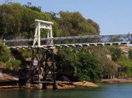
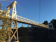
Parsley Bay, Sydney vicinity, New South Wales, Australia - Parsley Bay
| Bridgemeister ID: | 517 (added before 2003) |
| Name: | (footbridge) |
| Location: | Parsley Bay, Sydney vicinity, New South Wales, Australia |
| Crossing: | Parsley Bay |
| Coordinates: | 33.8498803 S 151.2758018 E |
| Maps: | Acme, GeoHack, Google, OpenStreetMap |
| Use: | Footbridge |
| Status: | In use (last checked: 2017) |
| Main Cables: | Wire (steel) |
| Suspended Spans: | 3 |
| Main Span: | 1 |
| Side Spans: | 2 |
External Links:
- The Happy Pontist: Australian Bridges: 6. Parsley Bay Bridge, Sydney
- Structurae - Structure ID 20011100
(footbridge)
Pinjarra, Western Australia, Australia - Murray River
| Bridgemeister ID: | 860 (added 2003-08-09) |
| Name: | (footbridge) |
| Location: | Pinjarra, Western Australia, Australia |
| Crossing: | Murray River |
| Coordinates: | 32.62923 S 115.87603 E |
| Maps: | Acme, GeoHack, Google, OpenStreetMap |
| Use: | Footbridge |
| Status: | In use (last checked: 2019) |
(footbridge)
Walcha, New South Wales, Australia - Apsley River
| Bridgemeister ID: | 5556 (added 2020-12-17) |
| Name: | (footbridge) |
| Location: | Walcha, New South Wales, Australia |
| Crossing: | Apsley River |
| At or Near Feature: | Oxley Walking Track |
| Coordinates: | 31.050426 S 151.766863 E |
| Maps: | Acme, GeoHack, Google, OpenStreetMap |
| Use: | Footbridge |
| Status: | In use (last checked: 2020) |
| Main Cables: | Wire (steel) |
| Suspended Spans: | 1 |
(footbridge)
Warburton, Victoria, Australia - Yarra River
| Bridgemeister ID: | 1579 (added 2005-01-22) |
| Name: | (footbridge) |
| Location: | Warburton, Victoria, Australia |
| Crossing: | Yarra River |
| Coordinates: | 37.7542 S 145.686433 E |
| Maps: | Acme, GeoHack, Google, OpenStreetMap |
| Use: | Footbridge |
| Status: | In use (last checked: 2019) |
| Main Cables: | Wire (steel) |
| Suspended Spans: | 1 |
Notes:
(footbridge)
Warburton, Victoria, Australia - Yarra River
| Bridgemeister ID: | 1880 (added 2005-09-24) |
| Name: | (footbridge) |
| Location: | Warburton, Victoria, Australia |
| Crossing: | Yarra River |
| Coordinates: | 37.751167 S 145.69895 E |
| Maps: | Acme, GeoHack, Google, OpenStreetMap |
| Use: | Footbridge |
| Status: | In use (last checked: 2019) |
| Main Cables: | Wire (steel) |
Notes:
(footbridge)
Wellington, New South Wales, Australia - Bell River
| Bridgemeister ID: | 6234 (added 2021-07-17) |
| Name: | (footbridge) |
| Location: | Wellington, New South Wales, Australia |
| Crossing: | Bell River |
| At or Near Feature: | Bell Park |
| Coordinates: | 32.553357 S 148.941165 E |
| Maps: | Acme, GeoHack, Google, OpenStreetMap |
| Use: | Footbridge |
| Status: | Closed, 2017 (last checked: 2020) |
| Main Cables: | Wire (steel) |
| Main Span: | 1 |
Notes:
- 2017: Closed due to safety concerns.
- 2021: Non-suspension replacement construction expected to start in late 2021.
| Bridgemeister ID: | 7416 (added 2022-12-07) |
| Name: | (footbridge) |
| Location: | Yea, Victoria, Australia |
| Crossing: | Yea River |
| At or Near Feature: | Yea Wetlands John Cummins Reserve |
| Coordinates: | 37.209540 S 145.428938 E |
| Maps: | Acme, GeoHack, Google, OpenStreetMap |
| Use: | Footbridge |
| Status: | In use (last checked: 2022) |
| Main Cables: | Wire (steel) |
| Main Span: | 1 |
(suspension bridge)
Waddamana, Tasmania, Australia - River Ouse
| Bridgemeister ID: | 5835 (added 2021-05-01) |
| Name: | (suspension bridge) |
| Location: | Waddamana, Tasmania, Australia |
| Crossing: | River Ouse |
| Coordinates: | 42.149948 S 146.753111 E |
| Maps: | Acme, GeoHack, Google, OpenStreetMap |
| Use: | Vehicular (one-lane) |
| Status: | In use (last checked: 2021) |
| Main Cables: | Wire (steel) |
| Suspended Spans: | 1 |
| Main Span: | 1 x 61.5 meters (201.8 feet) estimated |
(suspension bridge)
Warwick Farm, New South Wales, Australia - Georges River
| Bridgemeister ID: | 6236 (added 2021-07-17) |
| Name: | (suspension bridge) |
| Location: | Warwick Farm, New South Wales, Australia |
| Crossing: | Georges River |
| Use: | Vehicular (one-lane) |
| Status: | Removed |
| Main Cables: | Wire (steel) |
Notes:
- 1982, iuly 1: Bridge is expected to be demolished soon.
External Links:
Allan
Segenhoe, Scone vicinity, New South Wales, Australia - Pages River
| Bridgemeister ID: | 1402 (added 2004-07-04) |
| Name: | Allan |
| Location: | Segenhoe, Scone vicinity, New South Wales, Australia |
| Crossing: | Pages River |
| Coordinates: | 32.123321 S 150.925866 E |
| Maps: | Acme, GeoHack, Google, OpenStreetMap |
| Use: | Vehicular (one-lane) |
| Status: | In use (last checked: 2017) |
| Main Cables: | Wire (steel) |
| Suspended Spans: | 3 |
| Main Span: | 1 |
| Side Spans: | 2 |
| Characteristics: | Braced (trussed) chain/cable, Hinged cables |
Notes:
- Similar to 1889 Fiorentini (Ferro, Soldo, Soldino) - Rome, Italy.
- Similar to 1936 Kindee - Kindee, Ellenborough vicinity, New South Wales, Australia.
- Similar to 1951 Marias River (Pugsley) - Chester vicinity, Montana, USA.
- Similar to (footbridge) - Sarov (Саров), Nizhny Novgorod Oblast, Russia.
- Similar to Ininskiy (Ининский) - Inya (Иня), Altai Republic, Russia.
- Similar to Reku Vel' - Solginskiy (Солгинский), Arkhangelsk Oblast, Russia.
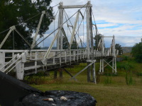
Beedelup Falls
Beedelup, Western Australia, Australia - Beedelup Falls
| Bridgemeister ID: | 2912 (added 2019-09-15) |
| Name: | Beedelup Falls |
| Location: | Beedelup, Western Australia, Australia |
| Crossing: | Beedelup Falls |
| Coordinates: | 34.418449 S 115.867800 E |
| Maps: | Acme, GeoHack, Google, OpenStreetMap |
| Use: | Footbridge |
| Status: | In use (last checked: 2018) |
| Main Cables: | Wire (steel) |
| Suspended Spans: | 1 |
Blackwood
Murrindindi, Victoria, Australia - Murrindindi River
| Bridgemeister ID: | 5541 (added 2020-12-02) |
| Name: | Blackwood |
| Location: | Murrindindi, Victoria, Australia |
| Crossing: | Murrindindi River |
| At or Near Feature: | Murrindindi Scenic Reserve |
| Coordinates: | 37.388431 S 145.554292 E |
| Maps: | Acme, GeoHack, Google, OpenStreetMap |
| Use: | Footbridge |
| Status: | In use (last checked: 2020) |
| Main Cables: | Wire (steel) |
| Suspended Spans: | 1 |
Corrigan's
Balook, Victoria, Australia - Macks Creek
| Bridgemeister ID: | 518 (added before 2003) |
| Name: | Corrigan's |
| Location: | Balook, Victoria, Australia |
| Crossing: | Macks Creek |
| At or Near Feature: | Tarra-Bulga National Park |
| Coordinates: | 38.425584 S 146.572375 E |
| Maps: | Acme, GeoHack, Google, OpenStreetMap |
| Use: | Footbridge |
| Status: | In use (last checked: 2022) |
| Main Cables: | Wire (steel) |
| Suspended Spans: | 1 |
East Street
Mount Morgan, Queensland, Australia - Dee River
| Bridgemeister ID: | 1744 (added 2005-04-20) |
| Name: | East Street |
| Location: | Mount Morgan, Queensland, Australia |
| Crossing: | Dee River |
| Coordinates: | 23.642281 S 150.389351 E |
| Maps: | Acme, GeoHack, Google, OpenStreetMap |
| Status: | Dismantled, 1904 |
| Main Cables: | Wire |
Notes:
- Completed circa 1891. According to a sign at one of the remaining Mount Morgan suspension bridges, "East Street bridge crossed from Byrnes Parade to near the junction of Cornes and Bridge Street. Built around 1891, it was dismantled in 1904 after the East Street Bridge, now demolished, was erected."
- Later at same location 2001 East Street (Private Victor Stanley Jones) - Mount Morgan, Queensland, Australia.
Far Red Hill
Mount Morgan, Queensland, Australia - Dee River
| Bridgemeister ID: | 1747 (added 2005-04-20) |
| Name: | Far Red Hill |
| Location: | Mount Morgan, Queensland, Australia |
| Crossing: | Dee River |
| Status: | Destroyed, 1928, by flood. |
| Main Cables: | Wire |
Notes:
- Completed circa 1890s.
- Replaced by 1939 Far Red Hill - Mount Morgan, Queensland, Australia.
External Links:
- Mount Morgan (link reported not working). Notes that this bridge was destroyed by flood in 1928 and later replaced. A sign at one of the remaining Mount Morgan suspension bridges says this bridge "spanned the river on the far side of Red Hill, from Baldwin Street on the south to School Street on the west."
Federation
Inverleigh, Victoria, Australia - Leigh River
| Bridgemeister ID: | 3021 (added 2019-10-13) |
| Name: | Federation |
| Location: | Inverleigh, Victoria, Australia |
| Crossing: | Leigh River |
| Coordinates: | 38.097643 S 144.054283 E |
| Maps: | Acme, GeoHack, Google, OpenStreetMap |
| Use: | Footbridge |
| Status: | In use (last checked: 2019) |
| Main Cables: | Wire (steel) |
Joseph's
Pinjarra vicinity, Western Australia, Australia - Murray River
| Bridgemeister ID: | 1264 (added 2004-03-13) |
| Name: | Joseph's |
| Location: | Pinjarra vicinity, Western Australia, Australia |
| Crossing: | Murray River |
| Coordinates: | 32.610466 S 115.868920 E |
| Maps: | Acme, GeoHack, Google, OpenStreetMap |
| Use: | Footbridge |
| Status: | Extant (last checked: 2021) |
| Main Cables: | Wire (steel) |
| Main Span: | 1 |
MacIntosh Island
Surfers Paradise, Queensland, Australia
| Bridgemeister ID: | 2152 (added 2006-11-19) |
| Name: | MacIntosh Island |
| Location: | Surfers Paradise, Queensland, Australia |
| Coordinates: | 27.98602 S 153.42884 E |
| Maps: | Acme, GeoHack, Google, OpenStreetMap |
| Use: | Footbridge |
| Status: | Replaced, 2007 |
| Main Cables: | Wire |
Notes:
- Closed due to safety concerns, late 2006. Replaced by a cable-stayed footbridge, 2007. New bridge opened October, 2007.
Merri
Warrnambool, Victoria, Australia - Merri River
| Bridgemeister ID: | 8551 (added 2024-04-06) |
| Name: | Merri |
| Location: | Warrnambool, Victoria, Australia |
| Crossing: | Merri River |
| Coordinates: | 38.399972 S 142.471694 E |
| Maps: | Acme, GeoHack, Google, OpenStreetMap |
| Use: | Footbridge |
| Status: | Collapsed, 1920 |
Notes:
- Completed at some point in the 1890s. Was replaced by the current (as of the 2020s) Merri Bridge.

Moonan Flat
Moonan Flat, New South Wales, Australia - Hunter River
| Bridgemeister ID: | 4714 (added 2020-06-25) |
| Name: | Moonan Flat |
| Location: | Moonan Flat, New South Wales, Australia |
| Crossing: | Hunter River |
| Coordinates: | 31.925329 S 151.237098 E |
| Maps: | Acme, GeoHack, Google, OpenStreetMap |
| Use: | Footbridge |
| Status: | In use (last checked: 2020) |
| Main Cables: | Wire (steel) |
| Suspended Spans: | 1 |
Notes:
- Sometimes referred to as the "Rex Collison" bridge, but that is the name of the adjacent low water road bridge.
Old Noarlunga Swing
Old Noarlunga, South Australia, Australia - Onkaparinga River
| Bridgemeister ID: | 837 (added 2003-06-28) |
| Name: | Old Noarlunga Swing |
| Location: | Old Noarlunga, South Australia, Australia |
| Crossing: | Onkaparinga River |
| Coordinates: | 35.18185 S 138.5042 E |
| Maps: | Acme, GeoHack, Google, OpenStreetMap |
| Use: | Footbridge |
| Status: | Destroyed, September, 2016 |
| Main Cables: | Wire (steel) |
| Suspended Spans: | 1 |
Notes:
- Destroyed by flood in September 2016.
- Replaced by 2019 Old Noarlunga Swing - Old Noarlunga, South Australia, Australia.
Phil Houghton
Kariong, New South Wales, Australia - Piles Creek
| Bridgemeister ID: | 7632 (added 2023-05-27) |
| Name: | Phil Houghton |
| Location: | Kariong, New South Wales, Australia |
| Crossing: | Piles Creek |
| At or Near Feature: | Piles Creek Loop Track |
| Coordinates: | 33.442680 S 151.265750 E |
| Maps: | Acme, GeoHack, Google, OpenStreetMap |
| Use: | Footbridge |
| Status: | In use (last checked: 2023) |
| Main Cables: | Wire (steel) |
| Main Span: | 1 |
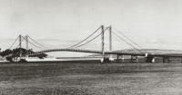
| Bridgemeister ID: | 6246 (added 2021-07-18) |
| Name: | Phillip Island |
| Location: | San Remo and Newhaven, Victoria, Australia |
| Coordinates: | 38.517426 S 145.365328 E |
| Maps: | Acme, GeoHack, Google, OpenStreetMap |
| Use: | Vehicular (two-lane) |
| Status: | Removed, c. 1969 |
| Main Cables: | Wire (steel) |
| Suspended Spans: | 1 |
| Main Span: | 1 |
Notes:
- Likely built in 1920s. Crossed the inlet to Phillip Island on an alignment a bit north of the current (2021) bridge.
External Links:
- "SUSPENSION BRIDGE BETWEEN SAN REMO and PHILLIP ISLAND, VIC." - State Library Victoria
- Photograph, Country Roads Board, 1960's
Port Campbell
Port Campbell, Victoria, Australia - Port Campbell Creek
| Bridgemeister ID: | 8769 (added 2024-08-24) |
| Name: | Port Campbell |
| Also Known As: | Campbells Creek |
| Location: | Port Campbell, Victoria, Australia |
| Crossing: | Port Campbell Creek |
| Use: | Footbridge |
| Status: | Removed |
| Main Span: | 1 |
Notes:
- One of possibly two suspension bridges predating the 2020 Port Campbell suspension bridge.
- Later at same (or nearby) location 2020 Port Campbell (Campbells Creek) - Port Campbell, Victoria, Australia.
Purling Brook Falls
Springbook, Queensland, Australia
| Bridgemeister ID: | 3976 (added 2020-03-22) |
| Name: | Purling Brook Falls |
| Location: | Springbook, Queensland, Australia |
| Coordinates: | 28.188949 S 153.271152 E |
| Maps: | Acme, GeoHack, Google, OpenStreetMap |
| Use: | Footbridge |
| Status: | In use (last checked: 2020) |
| Main Cables: | Wire (steel) |
| Suspended Spans: | 1 |
Ruffey Trail
Templestowe Lower, Victoria, Australia - Yarra River
| Bridgemeister ID: | 2862 (added 2019-09-08) |
| Name: | Ruffey Trail |
| Location: | Templestowe Lower, Victoria, Australia |
| Crossing: | Yarra River |
| Coordinates: | 37.752838 S 145.117476 E |
| Maps: | Acme, GeoHack, Google, OpenStreetMap |
| Use: | Footbridge |
| Status: | In use (last checked: 2019) |
| Main Cables: | Wire (steel) |
Swing
Balranald, New South Wales, Australia - Murrumbidgee River
| Bridgemeister ID: | 7169 (added 2022-06-26) |
| Name: | Swing |
| Location: | Balranald, New South Wales, Australia |
| Crossing: | Murrumbidgee River |
| Coordinates: | 34.642350 S 143.564183 E |
| Maps: | Acme, GeoHack, Google, OpenStreetMap |
| Use: | Footbridge |
| Status: | In use (last checked: 2022) |
| Main Cables: | Wire (steel) |
| Main Span: | 1 |
Notes:
- Completed in 2012 or 2013.
Swinging
Quirindi, New South Wales, Australia - Quirindi Creek
| Bridgemeister ID: | 7413 (added 2022-12-06) |
| Name: | Swinging |
| Location: | Quirindi, New South Wales, Australia |
| Crossing: | Quirindi Creek |
| At or Near Feature: | Pittsford Street |
| Coordinates: | 31.512852 S 150.686212 E |
| Maps: | Acme, GeoHack, Google, OpenStreetMap |
| Use: | Footbridge |
| Status: | Destroyed, 2022 |
| Main Cables: | Wire |
| Suspended Spans: | 1 |
Notes:
- 2022: Destroyed by flood.
Thredbo Valley Track
Thredbo, New South Wales, Australia - Thredbo River
| Bridgemeister ID: | 6738 (added 2021-10-23) |
| Name: | Thredbo Valley Track |
| Location: | Thredbo, New South Wales, Australia |
| Crossing: | Thredbo River |
| At or Near Feature: | Kosciuszko National Park |
| Coordinates: | 36.489195 S 148.333436 E |
| Maps: | Acme, GeoHack, Google, OpenStreetMap |
| Use: | Footbridge |
| Status: | In use (last checked: 2021) |
| Main Cables: | Wire (steel) |
| Suspended Spans: | 1 |
| Main Span: | 1 |
Notes:
- Near Thredbo Valley Track - Thredbo, New South Wales, Australia.
- Near Thredbo Valley Track - Thredbo, New South Wales, Australia.

Thredbo Valley Track
Thredbo, New South Wales, Australia - Thredbo River
| Bridgemeister ID: | 6739 (added 2021-10-23) |
| Name: | Thredbo Valley Track |
| Location: | Thredbo, New South Wales, Australia |
| Crossing: | Thredbo River |
| At or Near Feature: | Kosciuszko National Park |
| Coordinates: | 36.489870 S 148.332086 E |
| Maps: | Acme, GeoHack, Google, OpenStreetMap |
| Use: | Footbridge |
| Status: | In use (last checked: 2021) |
| Main Cables: | Wire (steel) |
| Suspended Spans: | 3 |
| Main Span: | 1 |
| Side Spans: | 2 |
Notes:
Thredbo Valley Track
Thredbo, New South Wales, Australia - Thredbo River
| Bridgemeister ID: | 6740 (added 2021-10-23) |
| Name: | Thredbo Valley Track |
| Location: | Thredbo, New South Wales, Australia |
| Crossing: | Thredbo River |
| At or Near Feature: | Kosciuszko National Park |
| Coordinates: | 36.494634 S 148.323923 E |
| Maps: | Acme, GeoHack, Google, OpenStreetMap |
| Use: | Footbridge |
| Status: | In use (last checked: 2021) |
| Main Cables: | Wire (steel) |
| Suspended Spans: | 3 |
| Main Span: | 1 |
| Side Spans: | 2 |
Notes:
Tipperary Point-Red Hill
Mount Morgan, Queensland, Australia - Dee River
| Bridgemeister ID: | 1749 (added 2005-04-20) |
| Name: | Tipperary Point-Red Hill |
| Location: | Mount Morgan, Queensland, Australia |
| Crossing: | Dee River |
| Coordinates: | 23.649004 S 150.377834 E |
| Maps: | Acme, GeoHack, Google, OpenStreetMap |
| Use: | Footbridge |
| Status: | Closed (last checked: 2010) |
| Main Cables: | Wire |
| Suspended Spans: | 1 |
Notes:
- Damaged by flood, 1928. Rebuilt, 1937.
Tree Top Walk
O'Reilly, Queensland, Australia
| Bridgemeister ID: | 5637 (added 2020-12-29) |
| Name: | Tree Top Walk |
| Location: | O'Reilly, Queensland, Australia |
| At or Near Feature: | Lamington National Park |
| Coordinates: | 28.233076 S 153.138488 E |
| Maps: | Acme, GeoHack, Google, OpenStreetMap |
| Use: | Footbridge |
| Status: | In use (last checked: 2020) |
| Main Cables: | Wire (steel) |
| Main Spans: | 9 |
Tuena Creek
Tuena, New South Wales, Australia - Tuena Creek
| Bridgemeister ID: | 2630 (added 2019-01-01) |
| Name: | Tuena Creek |
| Location: | Tuena, New South Wales, Australia |
| Crossing: | Tuena Creek |
| Coordinates: | 34.017867 S 149.331483 E |
| Maps: | Acme, GeoHack, Google, OpenStreetMap |
| Use: | Footbridge |
| Status: | In use (last checked: 2016) |
| Main Cables: | Wire (steel) |
| Suspended Spans: | 1 |
Upper Dee
Mount Morgan, Queensland, Australia - Dee River
| Bridgemeister ID: | 1743 (added 2005-04-20) |
| Name: | Upper Dee |
| Location: | Mount Morgan, Queensland, Australia |
| Crossing: | Dee River |
| Use: | Footbridge |
| Status: | Replaced |
| Main Cables: | Wire |
Notes:
- Completed 1890s. According to a sign at one of the remaining Mount Morgan suspension bridges, "Upper Dee suspension bridge spanned from Byrnes Parade to River Street but was washed away during fierce flooding on 21 April 1928."
External Links:
- Mount Morgan (link reported not working). Mentions that the bridge had already been "converted to a pile-supported bridge" by the time it was destroyed in 1928.
Wodonga Creek
Wodonga, Victoria, Australia - Wodonga Creek
| Bridgemeister ID: | 2620 (added 2018-12-30) |
| Name: | Wodonga Creek |
| Location: | Wodonga, Victoria, Australia |
| Crossing: | Wodonga Creek |
| Coordinates: | 36.109893 S 146.890992 E |
| Maps: | Acme, GeoHack, Google, OpenStreetMap |
| Use: | Footbridge |
| Status: | In use (last checked: 2018) |
| Main Cables: | Wire (steel) |
| Suspended Spans: | 1 |
Do you have any information or photos for these bridges that you would like to share? Please email david.denenberg@bridgemeister.com.