Inventory Search Results
15 suspension bridges were found for search criteria: SSS. All 15 bridges from the search results appear below. Click the Bridgemeister ID number to isolate the bridge on its own page. If you don't see what you were looking for, try an image search with the same criteria: SSS. This will find the bridge if it is pictured on the site, but is not a catenary suspension bridge.
Related:
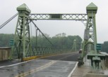
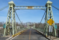
1904: Riegelsville
Riegelsville, Pennsylvania and Riegelsville, New Jersey, USA - Delaware River
| Bridgemeister ID: | 113 (added before 2003) |
| Year Completed: | 1904 |
| Name: | Riegelsville |
| Location: | Riegelsville, Pennsylvania and Riegelsville, New Jersey, USA |
| Crossing: | Delaware River |
| Coordinates: | 40.59427 N 75.19062 W |
| Maps: | Acme, GeoHack, Google, OpenStreetMap |
| Principals: | John A. Roebling's Sons Co., S. A. Cooney |
| References: | BDR, BPL, SSS |
| Use: | Vehicular (two-lane, heavy vehicles), with walkway |
| Status: | In use (last checked: 2007) |
| Main Cables: | Wire (steel) |
| Suspended Spans: | 3 |
| Main Spans: | 3 |
External Links:
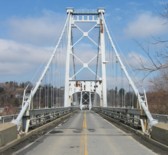
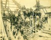
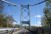
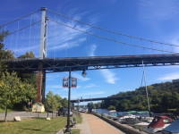
1921: Kingston-Port Ewen
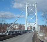
Kingston, New York, USA - Rondout Creek
| Bridgemeister ID: | 138 (added before 2003) |
| Year Completed: | 1921 |
| Name: | Kingston-Port Ewen |
| Also Known As: | Wurts Street, Rondout Creek |
| Location: | Kingston, New York, USA |
| Crossing: | Rondout Creek |
| Coordinates: | 41.916129 N 73.983999 W |
| Maps: | Acme, GeoHack, Google, OpenStreetMap |
| Principals: | Holton D. Robinson, Daniel E. Moran, William Yates |
| References: | AAJ, PTS, PTS2, SJR, SSS |
| Use: | Vehicular (two-lane, heavy vehicles), with walkway |
| Status: | In use, September 2020 (last checked: 2021) |
| Main Cables: | Wire (steel) |
| Suspended Spans: | 3 |
| Main Span: | 1 x 214.9 meters (705 feet) |
| Side Spans: | 2 x 53.7 meters (176.25 feet) |
| Deck width: | 37 feet |
Notes:
- 2008, March: Closed for ten weeks for cable inspection.
- 2018, December: Closed for maintenance. Expected to reopen February, 2019.
- 2019: Major rehabilitation continues to be delayed for several years.
- 2020, September: Closed temporarily. Major renovation project continues to be delayed.
- 2020, December: Closed indefinitely.
- 2021, May: Bids for renovation to be sought in June. Work expected to start in September.
- 2021, October: Groundbreaking ceremony for long-anticipated restoration project. Expected to be completed in 2023 at a cost of US$44.6M
Annotated Citations:
- Kirby, Paul. "Bids for Rondout Creek Bridge overhaul to be sought next month; work expected to start in September." Daily Freeman, 5 May 2021, www.dailyfreeman.com/news/local-news/bids-for-rondout-creek-bridge-overhaul-to-be-sought-next-month-work-expected-to-start/article_612258c4-adce-11eb-8dd6-9f0ac0c85540.html.
"Bids for the planned overhaul of the Rondout Creek Bridge will be sought in June, and the state Department of Transportation expects to award contracts for the work in August, the office of state Assemblyman Kevin Cahill said this week... The rehabilitation of the suspension bridge, which carries Wurts Street over the creek between Kingston and Port Ewen, could cost as much as $37 million, Cahill said previously. The state will pay for the project, which is expected to begin this fall."
External Links:
- Dave Longendyke's website. Several photos of the bridge's construction.
- Structurae - Structure ID 20007345
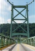
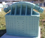
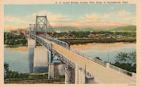
1927: General U.S. Grant
Portsmouth, Ohio and Fullerton, Kentucky, USA - Ohio River
| Bridgemeister ID: | 151 (added before 2003) |
| Year Completed: | 1927 |
| Name: | General U.S. Grant |
| Location: | Portsmouth, Ohio and Fullerton, Kentucky, USA |
| Crossing: | Ohio River |
| Coordinates: | 38.725 N 82.99833 W |
| Maps: | Acme, GeoHack, Google, OpenStreetMap |
| Principals: | Robinson and Steinman, J.E. Greiner, Dravo Co. |
| References: | AAJ, PTS2, SSS |
| Use: | Vehicular (two-lane, heavy vehicles) |
| Status: | Demolished, July 2001 |
| Main Cables: | Wire (steel) |
| Suspended Spans: | 3 |
| Main Span: | 1 x 213.4 meters (700 feet) |
| Side Spans: | 2 x 106.7 meters (350 feet) |
| Deck width: | 28.5 feet |
Notes:
- AAJ: "Recabled" in 1939.
External Links:
1928: Kiyosu
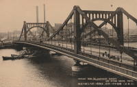
Chuo City, Tokyo, Japan - Sumida River
| Bridgemeister ID: | 440 (added before 2003) |
| Year Completed: | 1928 |
| Name: | Kiyosu |
| Also Known As: | 清洲橋 |
| Location: | Chuo City, Tokyo, Japan |
| Crossing: | Sumida River |
| Coordinates: | 35.682395 N 139.792022 E |
| Maps: | Acme, GeoHack, Google, OpenStreetMap |
| Principals: | Yutaka Tanaka |
| References: | AAJ, BAAW, PTS2, SSS |
| Use: | Vehicular (four-lane), with walkway |
| Status: | In use (last checked: 2022) |
| Main Cables: | Eyebar (steel) |
| Suspended Spans: | 3 |
| Main Span: | 1 x 91.4 meters (299.9 feet) |
| Side Spans: | 2 |
| Deck width: | 85 feet |
| Characteristics: | Self-anchored |
Notes:
- Self-anchored.
- 2019: Major rehabilitation in progress.
External Links:
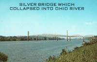
1928: Point Pleasant
Point Pleasant, West Virginia and Kanauga, Gallipolis vicinity, Ohio, USA - Ohio River
| Bridgemeister ID: | 156 (added before 2003) |
| Year Completed: | 1928 |
| Name: | Point Pleasant |
| Also Known As: | Silver |
| Location: | Point Pleasant, West Virginia and Kanauga, Gallipolis vicinity, Ohio, USA |
| Crossing: | Ohio River |
| Coordinates: | 38.845 N 82.141111 W |
| Maps: | Acme, GeoHack, Google, OpenStreetMap |
| Principals: | J.E. Greiner Co. |
| References: | AAJ, BDO, ENR19290620a, ENR19290620b, GBD, LAB, PTS2, SSS |
| Use: | Vehicular, with walkway |
| Status: | Collapsed, 1967 |
| Main Cables: | Eyebar (steel) |
| Suspended Spans: | 3 |
| Main Span: | 1 x 213.4 meters (700 feet) |
| Side Spans: | 2 x 115.8 meters (380 feet) |
| Deck width: | 27 feet |
Notes:
- Hybrid truss, suspension bridge. Collapsed December 15, 1967 while full with traffic. 46 people died.
- Companion to 1928 Saint Marys (Hi Carpenter, Short Route) - Saint Marys, West Virginia and Newport, Ohio, USA.
External Links:

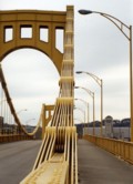
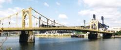
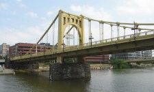
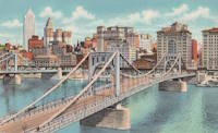
1928: Roberto Clemente
Pittsburgh, Pennsylvania, USA - Allegheny River
| Bridgemeister ID: | 158 (added before 2003) |
| Year Completed: | 1928 |
| Name: | Roberto Clemente |
| Also Known As: | Sixth Street |
| Location: | Pittsburgh, Pennsylvania, USA |
| Crossing: | Allegheny River |
| Coordinates: | 40.44558 N 80.00332 W |
| Maps: | Acme, GeoHack, Google, OpenStreetMap |
| Principals: | Vernon R. Covell, T.J. Wilkerson, A.D. Nutter, H.E. Dodge, Stanley L. Roush |
| References: | AAJ, BOP, BPL, PBR, PTS2, SSS, USS |
| Use: | Vehicular (four-lane), with walkway |
| Status: | In use (last checked: 2014) |
| Main Cables: | Eyebar (steel) |
| Suspended Spans: | 3 |
| Main Span: | 1 x 131.1 meters (430 feet) |
| Side Spans: | 2 x 65.5 meters (215 feet) |
| Characteristics: | Self-anchored |
Notes:
- Self-anchored.
- Next to 1926 Andy Warhol (Seventh Street) - Pittsburgh, Pennsylvania, USA.
- Next to 1927 Rachel Carson (Ninth Street) - Pittsburgh, Pennsylvania, USA.
External Links:
1929: Hipólito Yrigoyen
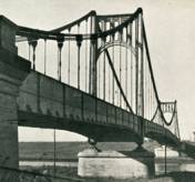
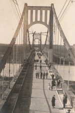
Necochea and Quequén, Argentina - Rio Quequén
| Bridgemeister ID: | 441 (added before 2003) |
| Year Completed: | 1929 |
| Name: | Hipólito Yrigoyen |
| Also Known As: | Rio Quequén |
| Location: | Necochea and Quequén, Argentina |
| Crossing: | Rio Quequén |
| Coordinates: | 38.552048 S 58.725680 W |
| Maps: | Acme, GeoHack, Google, OpenStreetMap |
| Principals: | P. Palazzo |
| References: | AAJ, SSS |
| Use: | Vehicular (two-lane), with walkway |
| Status: | In use (last checked: 2019) |
| Main Cables: | Wire (steel) |
| Suspended Spans: | 3 |
| Main Span: | 1 x 150 meters (492 feet) |
| Side Spans: | 2 x 59.7 meters (196 feet) |
External Links:
1931: Anthony Wayne
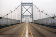
Toledo, Ohio, USA - Maumee River
| Bridgemeister ID: | 168 (added before 2003) |
| Year Completed: | 1931 |
| Name: | Anthony Wayne |
| Location: | Toledo, Ohio, USA |
| Crossing: | Maumee River |
| Coordinates: | 41.64086 N 83.53361 W |
| Maps: | Acme, GeoHack, Google, OpenStreetMap |
| Principals: | Waddell and Hardesty |
| References: | AAJ, SJR, SSS |
| Use: | Vehicular (major highway), with walkway |
| Status: | In use (last checked: 2021) |
| Main Cables: | Wire (steel) |
| Suspended Spans: | 3 |
| Main Span: | 1 x 239.3 meters (785 feet) |
| Side Spans: | 2 x 71.2 meters (233.5 feet) |
| Deck width: | 60 feet |
External Links:
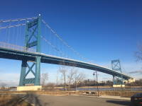

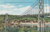
1931: Simon Kenton Memorial
Maysville, Kentucky and Aberdeen, Ohio, USA - Ohio River
| Bridgemeister ID: | 172 (added before 2003) |
| Year Completed: | 1931 |
| Name: | Simon Kenton Memorial |
| Also Known As: | Maysville |
| Location: | Maysville, Kentucky and Aberdeen, Ohio, USA |
| Crossing: | Ohio River |
| Coordinates: | 38.649890 N 83.759670 W |
| Maps: | Acme, GeoHack, Google, OpenStreetMap |
| Principals: | Modjeski, Masters & Chase |
| References: | AAJ, SJR, SSS |
| Use: | Vehicular (two-lane), with walkway |
| Status: | In use (last checked: 2022) |
| Main Cables: | Wire (steel) |
| Suspended Spans: | 3 |
| Main Span: | 1 x 323.1 meters (1,060 feet) |
| Side Spans: | 2 x 141.7 meters (464.9 feet) |
| Deck width: | 28 feet |
Notes:
- 2022, March: USD$23.4 million budgeted for rehabilitation project including suspender cable replacements, steel repairs, and painting.
- 2019: Closed late 2019 due to suspender cable corrosion. Short-term fixes applied to reduce the stress on the suspenders and to prevent rusting.
- 2020, June: Reopened with a 15-ton weight limit after installation of temporary support rods and brackets to reduce the stress on damaged cables.
External Links:
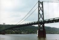
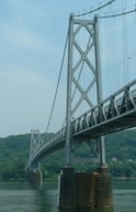
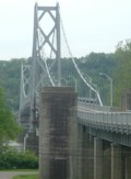
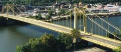
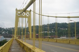
1931: South Tenth Street
Pittsburgh, Pennsylvania, USA - Monongahela River
| Bridgemeister ID: | 173 (added before 2003) |
| Year Completed: | 1931 |
| Name: | South Tenth Street |
| Also Known As: | South Side, Tenth Street, Philip Murray |
| Location: | Pittsburgh, Pennsylvania, USA |
| Crossing: | Monongahela River |
| Coordinates: | 40.43166 N 79.989 W |
| Maps: | Acme, GeoHack, Google, OpenStreetMap |
| Principals: | Sydney A. Shubin |
| References: | AAJ, BOP, BPL, PBR, SSS, USS |
| Use: | Vehicular (four-lane), with walkway |
| Status: | In use (last checked: 2019) |
| Main Cables: | Wire (steel) |
| Suspended Spans: | 3 |
| Main Span: | 1 x 228.6 meters (750 feet) |
| Side Spans: | 2 x 83.8 meters (275 feet) |
| Deck width: | 54 feet |
External Links:
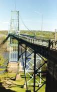
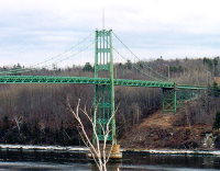
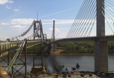
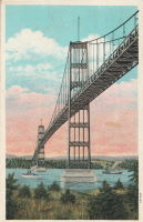
1931: Waldo-Hancock
Verona and Bucksport vicinity, Maine, USA - Penobscot River
| Bridgemeister ID: | 175 (added before 2003) |
| Year Completed: | 1931 |
| Name: | Waldo-Hancock |
| Location: | Verona and Bucksport vicinity, Maine, USA |
| Crossing: | Penobscot River |
| Coordinates: | 44.56 N 68.80333 W |
| Maps: | Acme, GeoHack, Google, OpenStreetMap |
| Principals: | Robinson and Steinman |
| References: | AAJ, ADDS, GBD, SSS, USS |
| Use: | Vehicular (two-lane, heavy vehicles), with walkway |
| Status: | Demolished, 2012 |
| Main Cables: | Wire (steel) |
| Suspended Spans: | 3 |
| Main Span: | 1 x 243.8 meters (800 feet) |
| Side Spans: | 2 x 106.7 meters (350 feet) |
| Deck width: | 27 feet |
Notes:
- Replacement cable-stayed bridge, (the Penobscot Narrows Bridge) completed, late 2006.
External Links:
1932: Lewis River
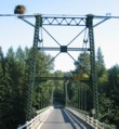
Yale, Washington, USA - Lewis River
| Bridgemeister ID: | 176 (added before 2003) |
| Year Completed: | 1932 |
| Name: | Lewis River |
| Also Known As: | Yale |
| Location: | Yale, Washington, USA |
| Crossing: | Lewis River |
| Coordinates: | 45.96167 N 122.37167 W |
| Maps: | Acme, GeoHack, Google, OpenStreetMap |
| Principals: | Harold H. Gilbert, Gilpin Construction Co. |
| References: | AAJ, SPW, SSS |
| Use: | Vehicular (one-lane) |
| Status: | In use (last checked: 2005) |
| Main Cables: | Wire (steel) |
| Suspended Spans: | 1 |
| Main Span: | 1 x 91.4 meters (300 feet) |
| Deck width: | 17 feet |
Notes:
- Rebuilt 1957, 1958.
External Links:
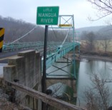
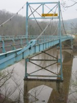
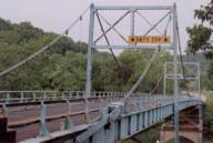
1933: Green's Mill
Camden County, Missouri, USA - Little Niangua River
| Bridgemeister ID: | 179 (added before 2003) |
| Year Completed: | 1933 |
| Name: | Green's Mill |
| Also Known As: | Little Niangua, J Road |
| Location: | Camden County, Missouri, USA |
| Crossing: | Little Niangua River |
| Coordinates: | 38.065326 N 92.909309 W |
| Maps: | Acme, GeoHack, Google, OpenStreetMap |
| Principals: | Howard Mullins, Scully Steel Co., American Steel & Wire Co., Clinton Bridge Works |
| References: | AAJ, SSS, USS |
| Use: | Vehicular (two-lane, heavy vehicles) |
| Status: | Bypassed, 2020 (last checked: 2023) |
| Main Cables: | Wire (steel) |
| Suspended Spans: | 3 |
| Main Span: | 1 x 68.6 meters (225 feet) |
| Side Spans: | 1 x 34.3 meters (112.5 feet), 1 x 34.3 meters (112.4 feet) |
| Deck width: | 20 feet |
| Characteristics: | Self-anchored |
Notes:
- Self-anchored.
- 2007, October: Closed for a few weeks for emergency repairs. According to an October 4, 2007 article in the Lake Sun Leader (Missouri): "a routine inspection revealed a problem in the substructure... too much movement was detected at a location underneath the north side of the bridge." Other sources mentioned a faulty "pin."
- 2018: Missouri Department of Transportation (MoDOT) plans to replace the bridge and is seeking groups to take ownership of the bridge and possibly relocate it.
- 2020: A new bridge is completed, bypassing the suspension bridge.
- 2023, March: Ownership transferred from Missouri Department of Transportation to Green's Mill Historic Bridge, Inc. to preserve the since bypassed bridge.
1933: San Rafael
Mao, Dominican Republic - Rio Yakue Del Norte
| Bridgemeister ID: | 447 (added before 2003) |
| Year Completed: | 1933 |
| Name: | San Rafael |
| Location: | Mao, Dominican Republic |
| Crossing: | Rio Yakue Del Norte |
| Principals: | John A. Roebling's Sons Co. |
| References: | AAJ, SJR, SSS |
| Use: | Vehicular (two-lane, heavy vehicles) |
| Main Cables: | Wire (steel) |
| Suspended Spans: | 1 |
| Main Span: | 1 x 137.6 meters (451.5 feet) |
| Deck width: | 18 feet |
1934: Rio Higuamo
San Pedro de Macoris vicinity, Dominican Republic - Rio Higuamo
| Bridgemeister ID: | 448 (added before 2003) |
| Year Completed: | 1934 |
| Name: | Rio Higuamo |
| Also Known As: | Ramfis |
| Location: | San Pedro de Macoris vicinity, Dominican Republic |
| Crossing: | Rio Higuamo |
| Coordinates: | 18.503230 N 69.336561 W |
| Maps: | Acme, GeoHack, Google, OpenStreetMap |
| Principals: | John A. Roebling's Sons Co. |
| References: | AAJ, SSS |
| Use: | Vehicular |
| Status: | In use (last checked: 2023) |
| Main Cables: | Wire (steel) |
| Suspended Spans: | 3 |
| Main Span: | 1 x 168.9 meters (554 feet) |
| Side Spans: | 2 x 56.7 meters (186 feet) |
