Inventory Search Results
8 suspension bridges were found for search criteria: SPW. All 8 bridges from the search results appear below. Click the Bridgemeister ID number to isolate the bridge on its own page. If you don't see what you were looking for, try an image search with the same criteria: SPW. This will find the bridge if it is pictured on the site, but is not a catenary suspension bridge.
Related:
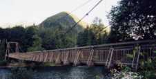
1899: Baring
Baring, Washington, USA - Skykomish River
| Bridgemeister ID: | 1902 (added 2005-10-07) |
| Year Completed: | 1899 |
| Name: | Baring |
| Location: | Baring, Washington, USA |
| Crossing: | Skykomish River |
| Coordinates: | 47.765407 N 121.480206 W |
| Maps: | Acme, GeoHack, Google, OpenStreetMap |
| References: | SPW |
| Use: | Vehicular |
| Status: | Collapsed, 1952 |
Notes:
- Replaced by 1953 Baring - Baring, Washington, USA.
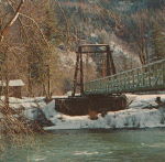
1913: Wind River
Carson, Washington, USA - Wind River
| Bridgemeister ID: | 1005 (added 2003-11-21) |
| Year Completed: | 1913 |
| Name: | Wind River |
| Location: | Carson, Washington, USA |
| Crossing: | Wind River |
| References: | SPW |
| Use: | Vehicular (one-lane) |
| Status: | Replaced |
| Main Cables: | Wire |
| Suspended Spans: | 1 |
Notes:
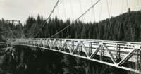
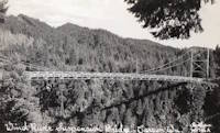
- The bridge appears identical in the two photos except for the tops of the towers. In one of the photos, it appears some protective housing has been added to cover the cable saddles and an extra brace has been added across the tower.
- Replaced by 1925 Wind River - Carson, Washington, USA.
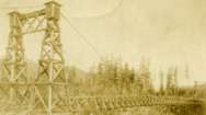
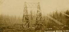
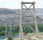
1919: Beebe
Beebe and Chelan, Washington, USA - Columbia River
| Bridgemeister ID: | 1188 (added 2004-01-24) |
| Year Completed: | 1919 |
| Name: | Beebe |
| Location: | Beebe and Chelan, Washington, USA |
| Crossing: | Columbia River |
| Coordinates: | 47.81308 N 119.97245 W |
| Maps: | Acme, GeoHack, Google, OpenStreetMap |
| Principals: | A. Munster, Wenatchee-Beebe Orchard Co. |
| References: | AAJ, PTS2, SPW |
| Use: | Pipeline and Vehicular |
| Status: | Only towers remain, since 1963 (last checked: 2022) |
| Main Cables: | Wire (steel) |
| Suspended Spans: | 1 |
| Main Span: | 1 x 192.6 meters (632 feet) |
| Deck width: | 12 feet |
Notes:
- The towers are still standing next to the current US97 crossing at Beebe.
- AAJ: Private bridge, built primarily to carry water to the owner's orchard, but also carried a roadway.
External Links:
- The Beebe Bridge | Empire Press | wenatcheeworld.com. Article about the history of the bridge.
- Structurae - Structure ID 20052092
1925: Wind River
Carson, Washington, USA - Wind River
| Bridgemeister ID: | 1004 (added 2003-11-21) |
| Year Completed: | 1925 |
| Name: | Wind River |
| Location: | Carson, Washington, USA |
| Crossing: | Wind River |
| References: | SPW |
| Use: | Vehicular |
| Status: | Replaced, 1961 |
| Main Cables: | Wire (steel) |
| Suspended Spans: | 1 |
Notes:
- Circa 1930's steel vehicular suspension bridge. Bypassed, 1961 (by the Conrad Lundy Jr. bridge) and removed some time after.
- Replaced 1913 Wind River - Carson, Washington, USA.

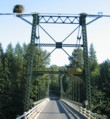
1932: Lewis River
Yale, Washington, USA - Lewis River
| Bridgemeister ID: | 176 (added before 2003) |
| Year Completed: | 1932 |
| Name: | Lewis River |
| Also Known As: | Yale |
| Location: | Yale, Washington, USA |
| Crossing: | Lewis River |
| Coordinates: | 45.96167 N 122.37167 W |
| Maps: | Acme, GeoHack, Google, OpenStreetMap |
| Principals: | Harold H. Gilbert, Gilpin Construction Co. |
| References: | AAJ, SPW, SSS |
| Use: | Vehicular (one-lane) |
| Status: | In use (last checked: 2005) |
| Main Cables: | Wire (steel) |
| Suspended Spans: | 1 |
| Main Span: | 1 x 91.4 meters (300 feet) |
| Deck width: | 17 feet |
Notes:
- Rebuilt 1957, 1958.
External Links:
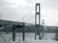
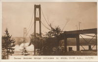
1940: Tacoma Narrows
Tacoma and Gig Harbor, Washington, USA - Puget Sound
| Bridgemeister ID: | 198 (added before 2003) |
| Year Completed: | 1940 |
| Name: | Tacoma Narrows |
| Also Known As: | Galloping Gertie |
| Location: | Tacoma and Gig Harbor, Washington, USA |
| Crossing: | Puget Sound |
| Coordinates: | 47.267015 N 122.548462 W |
| Maps: | Acme, GeoHack, Google, OpenStreetMap |
| Principals: | Leon Moisseiff |
| References: | AAJ, BAR, BBR, BFL, BMA, BPL, COB, CTT, GBD, IT1999F, SPW |
| Use: | Vehicular (two-lane, heavy vehicles), with walkway |
| Status: | Collapsed, 1940 |
| Main Cables: | Wire (steel) |
| Suspended Spans: | 3 |
| Main Span: | 1 x 853.4 meters (2,800 feet) |
| Side Spans: | 2 x 335.3 meters (1,100 feet) |
| Deck width: | 39 feet |
Notes:
- Famously destroyed by wind, November 7, 1940.
- Replaced by 1950 Tacoma Narrows (Sturdy Gertie, Second Tacoma Narrows) - Tacoma and Gig Harbor, Washington, USA.
- See 1944 Liard River - Liard River Hot Springs vicinity, British Columbia, Canada. According to CTT, "Two sections from the Tacoma bridge's east approach were [re]used in the Liard span."
External Links:



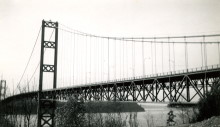
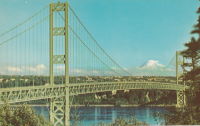
1950: Tacoma Narrows
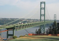
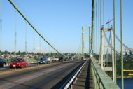
Tacoma and Gig Harbor, Washington, USA - Puget Sound
| Bridgemeister ID: | 206 (added before 2003) |
| Year Completed: | 1950 |
| Name: | Tacoma Narrows |
| Also Known As: | Sturdy Gertie, Second Tacoma Narrows |
| Location: | Tacoma and Gig Harbor, Washington, USA |
| Crossing: | Puget Sound |
| Coordinates: | 47.270540 N 122.552895 W |
| Maps: | Acme, GeoHack, Google, OpenStreetMap |
| Principals: | Dexter R. Smith |
| References: | BBR, BC3, BCO, BFL, COB, CTT, SPW |
| Use: | Vehicular (major highway), with walkway |
| Status: | In use (last checked: 2022) |
| Main Cables: | Wire (steel) |
| Suspended Spans: | 3 |
| Main Span: | 1 x 853.4 meters (2,800 feet) |
| Side Spans: | 2 x 335.3 meters (1,100 feet) |
| Deck width: | 46f 8in |
Notes:
- Retrofit scheduled for completion, spring 2008.
- Replaced 1940 Tacoma Narrows (Galloping Gertie) - Tacoma and Gig Harbor, Washington, USA.
- Next to 2007 Third Tacoma Narrows - Tacoma and Gig Harbor, Washington, USA.
External Links:

1953: Baring
Baring, Washington, USA - Skykomish River
| Bridgemeister ID: | 894 (added 2003-09-07) |
| Year Completed: | 1953 |
| Name: | Baring |
| Location: | Baring, Washington, USA |
| Crossing: | Skykomish River |
| Coordinates: | 47.765158 N 121.480893 W |
| Maps: | Acme, GeoHack, Google, OpenStreetMap |
| References: | SPW |
| Use: | Vehicular (one-lane) |
| Status: | In use (last checked: 2003) |
| Main Cables: | Wire (steel) |
| Suspended Spans: | 1 |
| Main Span: | 1 x 106.7 meters (350 feet) |
Notes:
- Towers replaced, 1958. Substantially rehabilitated 1978, 1993.
- Replaced 1899 Baring - Baring, Washington, USA.
