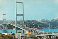
Inventory Search Results
12 suspension bridges were found for search criteria: BMA. All 12 bridges from the search results appear below. Click the Bridgemeister ID number to isolate the bridge on its own page. If you don't see what you were looking for, try an image search with the same criteria: BMA. This will find the bridge if it is pictured on the site, but is not a catenary suspension bridge.
Related:
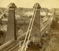
1855: Niagara Suspension
Niagara Falls, New York, USA and Niagara Falls, Ontario, Canada - Niagara River
| Bridgemeister ID: | 51 (added before 2003) |
| Year Completed: | 1855 |
| Name: | Niagara Suspension |
| Location: | Niagara Falls, New York, USA and Niagara Falls, Ontario, Canada |
| Crossing: | Niagara River |
| Principals: | John A. Roebling |
| References: | AAJ, BAAW, BBR, BFL, BMA, BOB, BPL, HBE, LIR, NSB, ONF, PTS2, SA18810716, SJR |
| Use: | Rail (heavy rail) and Vehicular (double-deck), with walkway |
| Status: | Replaced, 1897 |
| Main Cables: | Wire (iron) |
| Suspended Spans: | 1 |
| Main Span: | 1 x 250.3 meters (821.3 feet) |
Notes:
- Cables renovated, 1877. Wooden stiffening trusses replaced, 1880. Towers replaced, c. 1886. Bridge replaced with steel arch, 1897.
- AAJ notes the roadway deck opened in 1854, but the railway deck did not open until 1855.
- Replaced 1848 Niagara Suspension - Niagara Falls, New York, USA and Niagara Falls, Ontario, Canada.
External Links:
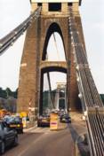
1864: Clifton
Bristol, England, United Kingdom - River Avon
| Bridgemeister ID: | 413 (added before 2003) |
| Year Completed: | 1864 |
| Name: | Clifton |
| Location: | Bristol, England, United Kingdom |
| Crossing: | River Avon |
| Coordinates: | 51.45496 N 2.62781 W |
| Maps: | Acme, GeoHack, Google, OpenStreetMap |
| Principals: | Isambard K. Brunel, P.W. Barlow, Hawkshaw |
| References: | AOB, BBR, BC3, BEM, BMA, BOU, BRB, CTW, HBE, NTB, ONF, PTS2 |
| Use: | Vehicular, with walkway |
| Status: | In use (last checked: 2021) |
| Main Cables: | Eyebar (iron) |
| Suspended Spans: | 1 |
| Main Span: | 1 x 214 meters (702 feet) |
Notes:
- Built with chain cables reused from the Hungerford bridge.
- See 1845 Hungerford - London, England, United Kingdom.
External Links:

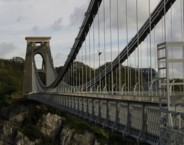
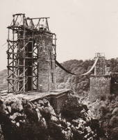
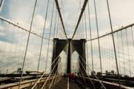
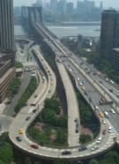
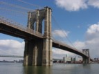
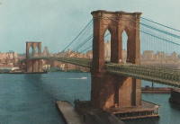
1883: Brooklyn
New York and Brooklyn, New York, USA - East River
| Bridgemeister ID: | 89 (added before 2003) |
| Year Completed: | 1883 |
| Name: | Brooklyn |
| Also Known As: | Great East River |
| Location: | New York and Brooklyn, New York, USA |
| Crossing: | East River |
| Coordinates: | 40.706 N 73.99667 W |
| Maps: | Acme, GeoHack, Google, OpenStreetMap |
| Principals: | John A. Roebling, Washington A. Roebling |
| References: | AAJ, BAAW, BBR, BBTS, BC3, BFL, BLD, BMA, BOB, BOU, BPL, COB, CTW, GB, GBD, HBE, LAB, LACE, NG198305, ONF, PTS2, SJR |
| Use: | Rail (light rail) and Vehicular (major highway), with walkway |
| Status: | In use (last checked: 2022) |
| Main Cables: | Wire (steel) |
| Suspended Spans: | 3 |
| Main Span: | 1 x 486.3 meters (1,595.5 feet) |
| Side Spans: | 2 x 283.5 meters (930 feet) |
| Deck width: | 85 feet |
Notes:
- Became longest suspension bridge by eclipsing 1869 Clifton (Niagara-Clifton, Falls View, First Falls View) - Niagara Falls, New York, USA and Niagara Falls, Ontario, Canada.
- Eclipsed by new longest suspension bridge 1903 Williamsburg - New York and Brooklyn, New York, USA.
- Next to 1909 Manhattan - New York and Brooklyn, New York, USA.
- Near 1903 Williamsburg - New York and Brooklyn, New York, USA.
External Links:
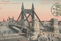
1903: Elisabeth
Budapest, Hungary - Danube River
| Bridgemeister ID: | 426 (added before 2003) |
| Year Completed: | 1903 |
| Name: | Elisabeth |
| Also Known As: | Elizabeth, Erzsébet |
| Location: | Budapest, Hungary |
| Crossing: | Danube River |
| Principals: | Aurel Czekelius, M. Nagy |
| References: | AAJ, BMA, HBE, PTS2, SA19050909 |
| Use: | Vehicular, with walkway |
| Status: | Destroyed, 1945 |
| Main Cables: | Eyebar |
| Suspended Spans: | 3 |
| Main Span: | 1 x 289.9 meters (951 feet) |
| Side Spans: | 2 x 44.2 meters (145 feet) |
Notes:
- Replaced by 1964 Elisabeth (Erzsébet) - Budapest, Hungary.
External Links:
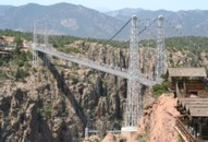
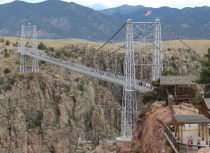
1929: Royal Gorge
Canon City, Colorado, USA - Arkansas River
| Bridgemeister ID: | 164 (added before 2003) |
| Year Completed: | 1929 |
| Name: | Royal Gorge |
| Location: | Canon City, Colorado, USA |
| Crossing: | Arkansas River |
| Coordinates: | 38.46129 N 105.32541 W |
| Maps: | Acme, GeoHack, Google, OpenStreetMap |
| Principals: | George F. Cole, O.K. Peck |
| References: | AAJ, BC3, BMA, GBD |
| Use: | Vehicular (two-lane) |
| Status: | In use (last checked: 2020) |
| Main Cables: | Wire (steel) |
| Suspended Spans: | 3 |
| Main Span: | 1 x 268.2 meters (880 feet) |
| Side Spans: | 2 |
| Deck width: | 18 feet |
Notes:
- This bridge was built solely as a tourist attraction.
External Links:
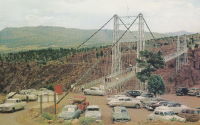
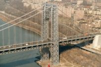
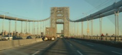
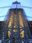
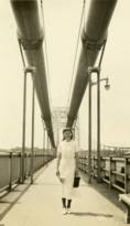
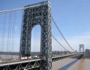
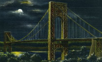
1931: George Washington
New York, New York and Fort Lee, New Jersey, USA - Hudson River
| Bridgemeister ID: | 169 (added before 2003) |
| Year Completed: | 1931 |
| Name: | George Washington |
| Also Known As: | GWB |
| Location: | New York, New York and Fort Lee, New Jersey, USA |
| Crossing: | Hudson River |
| Coordinates: | 40.85333 N 73.955 W |
| Maps: | Acme, GeoHack, Google, OpenStreetMap |
| Principals: | O.H. Ammann, Leon Moisseiff, Dana, Gilbert |
| References: | AAJ, AOB, ARF, BBR, BC3, BFL, BMA, BONJ, BOU, BPL, BRU, COB, CTW, ENR19270811a, ENR19270811b, ENR19290411c, GBD, LAB, LACE, PTS2, SIX, SJR |
| Use: | Vehicular (double-deck), with walkway |
| Status: | In use (last checked: 2022) |
| Main Cables: | Wire (steel) |
| Suspended Spans: | 3 |
| Main Span: | 1 x 1,066.8 meters (3,500 feet) |
| Side Spans: | 2 x 198.1 meters (650 feet) |
| Deck width: | 120 feet |
Notes:
- Became longest suspension bridge by eclipsing 1929 Ambassador - Detroit, Michigan, USA and Windsor, Ontario, Canada.
- Eclipsed by new longest suspension bridge 1937 Golden Gate - San Francisco and Marin County, California, USA.
External Links:
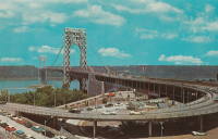
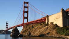
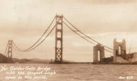
1937: Golden Gate
San Francisco and Marin County, California, USA - San Francisco Bay
| Bridgemeister ID: | 188 (added before 2003) |
| Year Completed: | 1937 |
| Name: | Golden Gate |
| Location: | San Francisco and Marin County, California, USA |
| Crossing: | San Francisco Bay |
| Coordinates: | 37.82 N 122.47667 W |
| Maps: | Acme, GeoHack, Google, OpenStreetMap |
| Principals: | Joseph B. Strauss, Leon Moisseiff, Charles A. Ellis, Irving F. Morrow |
| References: | AAJ, AZB, BAAW, BBR, BC3, BFL, BLD, BMA, BOU, BPL, BRU, COB, CTW, GAT, GBD, GGB, LAB, SPG |
| Use: | Vehicular (major highway), with walkway |
| Status: | In use (last checked: 2022) |
| Main Cables: | Wire (steel) |
| Suspended Spans: | 3 |
| Main Span: | 1 x 1,280.2 meters (4,200 feet) |
| Side Spans: | 2 x 343 meters (1,125.41 feet) |
| Deck width: | 80 feet |
Notes:
- Became longest suspension bridge by eclipsing 1931 George Washington (GWB) - New York, New York and Fort Lee, New Jersey, USA.
- Eclipsed by new longest suspension bridge 1964 Verrazzano Narrows (Verrazano Narrows) - Brooklyn and Staten Island, New York, USA.
External Links:
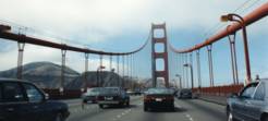
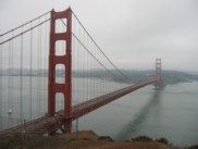
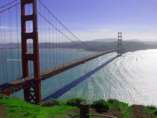
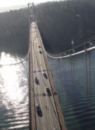
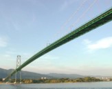
1939: Lions Gate
Vancouver, British Columbia, Canada - Vancouver Harbor
| Bridgemeister ID: | 194 (added before 2003) |
| Year Completed: | 1939 |
| Name: | Lions Gate |
| Also Known As: | First Narrows |
| Location: | Vancouver, British Columbia, Canada |
| Crossing: | Vancouver Harbor |
| At or Near Feature: | Burrard Inlet |
| Coordinates: | 49.31533 N 123.13846 W |
| Maps: | Acme, GeoHack, Google, OpenStreetMap |
| Principals: | Monsarrat and Pratley |
| References: | AAJ, BAR, BMA |
| Use: | Vehicular (major highway) |
| Status: | In use (last checked: 2019) |
| Main Cables: | Wire (steel) |
| Suspended Spans: | 3 |
| Main Span: | 1 x 472.4 meters (1,550 feet) |
| Side Spans: | 2 x 187.5 meters (615 feet) |
| Deck width: | 39 feet |
External Links:

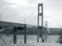
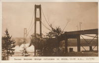
1940: Tacoma Narrows
Tacoma and Gig Harbor, Washington, USA - Puget Sound
| Bridgemeister ID: | 198 (added before 2003) |
| Year Completed: | 1940 |
| Name: | Tacoma Narrows |
| Also Known As: | Galloping Gertie |
| Location: | Tacoma and Gig Harbor, Washington, USA |
| Crossing: | Puget Sound |
| Coordinates: | 47.267015 N 122.548462 W |
| Maps: | Acme, GeoHack, Google, OpenStreetMap |
| Principals: | Leon Moisseiff |
| References: | AAJ, BAR, BBR, BFL, BMA, BPL, COB, CTT, GBD, IT1999F, SPW |
| Use: | Vehicular (two-lane, heavy vehicles), with walkway |
| Status: | Collapsed, 1940 |
| Main Cables: | Wire (steel) |
| Suspended Spans: | 3 |
| Main Span: | 1 x 853.4 meters (2,800 feet) |
| Side Spans: | 2 x 335.3 meters (1,100 feet) |
| Deck width: | 39 feet |
Notes:
- Famously destroyed by wind, November 7, 1940.
- Replaced by 1950 Tacoma Narrows (Sturdy Gertie, Second Tacoma Narrows) - Tacoma and Gig Harbor, Washington, USA.
- See 1944 Liard River - Liard River Hot Springs vicinity, British Columbia, Canada. According to CTT, "Two sections from the Tacoma bridge's east approach were [re]used in the Liard span."
External Links:



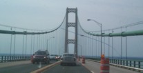
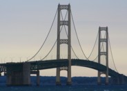
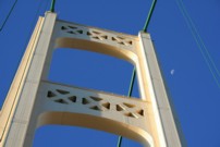
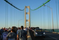
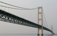
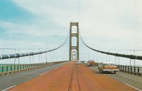
1957: Mackinac
St. Ignace and Mackinaw City, Michigan, USA - Straits of Mackinac
| Bridgemeister ID: | 210 (added before 2003) |
| Year Completed: | 1957 |
| Name: | Mackinac |
| Also Known As: | Mighty Mac |
| Location: | St. Ignace and Mackinaw City, Michigan, USA |
| Crossing: | Straits of Mackinac |
| Coordinates: | 45.820533 N 84.727667 W |
| Maps: | Acme, GeoHack, Google, OpenStreetMap |
| Principals: | David B. Steinman |
| References: | ADDS, BBR, BC3, BFL, BLD, BMA, COB, GBD, LAB, MACB, MM, WOT |
| Use: | Vehicular (four-lane) |
| Status: | In use (last checked: 2022) |
| Main Cables: | Wire (steel) |
| Suspended Spans: | 3 |
| Main Span: | 1 x 1,158.2 meters (3,800 feet) |
| Side Spans: | 2 x 548.6 meters (1,800 feet) |
External Links:

1966: 25 de Abril
Lisbon, Portugal - Tagus River
| Bridgemeister ID: | 464 (added before 2003) |
| Year Completed: | 1966 |
| Name: | 25 de Abril |
| Also Known As: | Tagus, Salazar, April 25th |
| Location: | Lisbon, Portugal |
| Crossing: | Tagus River |
| Coordinates: | 38.6968 N 9.179 W |
| Maps: | Acme, GeoHack, Google, OpenStreetMap |
| Principals: | David B. Steinman, Ray M. Boynton, et. al. |
| References: | BAAW, BAR, BBR, BC3, BDU, BFL, BMA, CTW |
| Use: | Rail and Vehicular (major highway) |
| Status: | In use (last checked: 2019) |
| Main Cables: | Wire (steel) |
| Suspended Spans: | 3 |
| Main Span: | 1 x 1,012.9 meters (3,323 feet) |
| Side Spans: | 2 x 483.4 meters (1,586 feet) |
Notes:
- Major retrofit completed in 1999 to add rail deck and extra vehicle lane.
External Links:
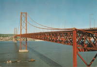
1973: Bosporus
Istanbul, Türkiye - Bosporus Strait
| Bridgemeister ID: | 472 (added before 2003) |
| Year Completed: | 1973 |
| Name: | Bosporus |
| Also Known As: | Bogaziçi, 15 July Martyrs, First, Bosphorus |
| Location: | Istanbul, Türkiye |
| Crossing: | Bosporus Strait |
| Coordinates: | 41.046655 N 29.033788 E |
| Maps: | Acme, GeoHack, Google, OpenStreetMap |
| References: | BAR, BDU, BFL, BMA, CTW |
| Use: | Vehicular (major highway) |
| Status: | In use (last checked: 2019) |
| Main Cables: | Wire (steel) |
| Suspended Spans: | 1 |
| Main Span: | 1 x 1,073.8 meters (3,523 feet) |
External Links:
