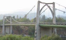
Inventory Search Results
8 suspension bridges were found for search criteria: BCO. All 8 bridges from the search results appear below. Click the Bridgemeister ID number to isolate the bridge on its own page. If you don't see what you were looking for, try an image search with the same criteria: BCO. This will find the bridge if it is pictured on the site, but is not a catenary suspension bridge.
Related:
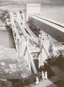
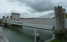
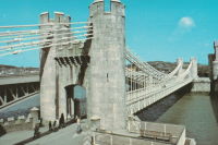
1826: Conwy
Conwy, Wales, United Kingdom - River Conwy
| Bridgemeister ID: | 380 (added before 2003) |
| Year Completed: | 1826 |
| Name: | Conwy |
| Also Known As: | Conway |
| Location: | Conwy, Wales, United Kingdom |
| Crossing: | River Conwy |
| Coordinates: | 53.280476 N 3.823742 W |
| Maps: | Acme, GeoHack, Google, OpenStreetMap |
| Principals: | Thomas Telford |
| References: | AAJ, BBR, BC3, BCO, BEM, HBE, MOS, NTB, PTS2 |
| Use: | Vehicular |
| Status: | Restricted to foot traffic (last checked: 2021) |
| Main Cables: | Chain (iron) |
| Suspended Spans: | 1 |
| Main Span: | 1 x 99.7 meters (327 feet) |
Notes:
- 1904: Major reinforcement and strengthening project.
- 2008, February: Major refurbishment project completed.
- Next to 1904 (footbridge) - Conwy, Wales, United Kingdom.
Annotated Citations:
- "Conway Suspension Bridge." The Engineer, 20 May 1904.
Details regarding the 1904 reinforcement project: "...It was therefore decided to renew all the suspension rods, and pins, and to fix steel cables above the suspension links, to supplement them so that the maximum stress in the links due to any possible travelling load should not exceed 5 tons per square inch. It was also decided to build a stiffening girder coupled to the suspension rod on each side of the bridge, and at the same time to widen the bridge by building a footway 6ft. wide outside the suspenders on the north side of the bridge."
External Links:
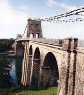
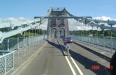
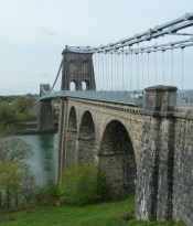
1826: Menai Strait
Menai Bridge and Bangor vicinity, Wales, United Kingdom - Menai Strait
| Bridgemeister ID: | 382 (added before 2003) |
| Year Completed: | 1826 |
| Name: | Menai Strait |
| Location: | Menai Bridge and Bangor vicinity, Wales, United Kingdom |
| Crossing: | Menai Strait |
| Coordinates: | 53.221367 N 4.1646 W |
| Maps: | Acme, GeoHack, Google, OpenStreetMap |
| Principals: | Thomas Telford |
| References: | AAJ, BBR, BC3, BCO, BDU, BEM, BOU, HBE, MOS, NTB, PTS2 |
| Use: | Vehicular (two-lane), with walkway |
| Status: | In use (last checked: 2022) |
| Main Cables: | Chain (iron) |
| Suspended Spans: | 1 |
| Main Span: | 1 x 176.5 meters (579 feet) |
Notes:
- 1839 (or 1840): Restored. Deck strengthened.
- 1893: Original wood deck replaced with a steel deck.
- 1938-1940: Original wrought-iron chains replaced with steel eyebars, deck strengthened.
- 1999: Deck resurfaced and other improvements to strengthen bridge.
- 2020: Major maintenance project planned to start January, 2021.
- 2022, October: Closed due to serious structural concerns. Expected to reopen January 2023 with a weight restriction.
- Became longest suspension bridge by eclipsing 1820 Union - Horncliffe, Berwick-upon-Tweed vicinity, England and Fishwick, Scotland, United Kingdom.
- Eclipsed by new longest suspension bridge 1834 Zaehringen (Grand Pont Suspendu) - Fribourg, Switzerland.
External Links:
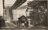
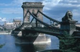
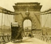
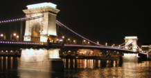
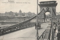
1849: Chain
Budapest, Hungary - Danube River
| Bridgemeister ID: | 402 (added before 2003) |
| Year Completed: | 1849 |
| Name: | Chain |
| Also Known As: | Széchenyi Lánchíd |
| Location: | Budapest, Hungary |
| Crossing: | Danube River |
| Coordinates: | 47.49945 N 19.046567 E |
| Maps: | Acme, GeoHack, Google, OpenStreetMap |
| Principals: | William Tierney Clark, Adam Clark |
| References: | AAJ, BC3, BCO, CTW, HBE, ONF |
| Use: | Vehicular |
| Status: | In use (last checked: 2021) |
| Main Cables: | Chain (iron) |
| Suspended Spans: | 3 |
| Main Span: | 1 x 203 meters (666 feet) |
| Side Spans: | 2 x 90.8 meters (298 feet) |
Notes:
- Don Sayenga notes, the bridge was designed by W.T. Clark, but built by Adam Clark (no relation).
- 1945: Destroyed during WWII, rebuilt 1949.
- 2020: Major rehabilitation project expected to start May, 2021.
External Links:
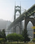
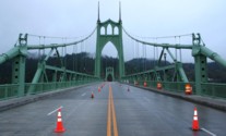
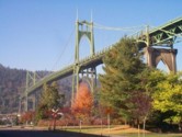
1931: St. Johns
Portland, Oregon, USA - Willamette River
| Bridgemeister ID: | 174 (added before 2003) |
| Year Completed: | 1931 |
| Name: | St. Johns |
| Location: | Portland, Oregon, USA |
| Crossing: | Willamette River |
| Coordinates: | 45.585 N 122.76333 W |
| Maps: | Acme, GeoHack, Google, OpenStreetMap |
| Principals: | Robinson and Steinman |
| References: | AAJ, ADDS, BC3, BCO, BFL, BPL, GBD, LAB, SJR |
| Use: | Vehicular (four-lane), with walkway |
| Status: | In use (last checked: 2022) |
| Main Cables: | Wire (steel) |
| Suspended Spans: | 3 |
| Main Span: | 1 x 367.9 meters (1,207 feet) |
| Side Spans: | 2 x 131.1 meters (430.25 feet) |
| Deck width: | 52 feet |
Notes:
- Substantially rehabilitated, 2003-2005.
External Links:
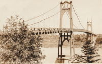
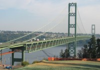
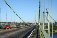
1950: Tacoma Narrows
Tacoma and Gig Harbor, Washington, USA - Puget Sound
| Bridgemeister ID: | 206 (added before 2003) |
| Year Completed: | 1950 |
| Name: | Tacoma Narrows |
| Also Known As: | Sturdy Gertie, Second Tacoma Narrows |
| Location: | Tacoma and Gig Harbor, Washington, USA |
| Crossing: | Puget Sound |
| Coordinates: | 47.270540 N 122.552895 W |
| Maps: | Acme, GeoHack, Google, OpenStreetMap |
| Principals: | Dexter R. Smith |
| References: | BBR, BC3, BCO, BFL, COB, CTT, SPW |
| Use: | Vehicular (major highway), with walkway |
| Status: | In use (last checked: 2022) |
| Main Cables: | Wire (steel) |
| Suspended Spans: | 3 |
| Main Span: | 1 x 853.4 meters (2,800 feet) |
| Side Spans: | 2 x 335.3 meters (1,100 feet) |
| Deck width: | 46f 8in |
Notes:
- Retrofit scheduled for completion, spring 2008.
- Replaced 1940 Tacoma Narrows (Galloping Gertie) - Tacoma and Gig Harbor, Washington, USA.
- Next to 2007 Third Tacoma Narrows - Tacoma and Gig Harbor, Washington, USA.
External Links:

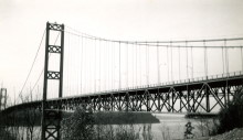
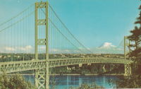
1961: Throgs Neck
The Bronx and Queens, New York, USA - East River
| Bridgemeister ID: | 215 (added before 2003) |
| Year Completed: | 1961 |
| Name: | Throgs Neck |
| Location: | The Bronx and Queens, New York, USA |
| Crossing: | East River |
| Coordinates: | 40.8 N 73.795 W |
| Maps: | Acme, GeoHack, Google, OpenStreetMap |
| Principals: | O. H. Ammann |
| References: | ARF, BCO, SIX, VNB |
| Use: | Vehicular (major highway) |
| Status: | In use (last checked: 2022) |
| Main Cables: | Wire (steel) |
| Suspended Spans: | 3 |
| Main Span: | 1 x 548.6 meters (1,800 feet) |
| Side Spans: | 2 |
Notes:
External Links:
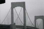
1963: Deschutes River
Opal Springs vicinity, Oregon, USA - Deschutes River at Lake Billy Chinook
| Bridgemeister ID: | 338 (added before 2003) |
| Year Completed: | 1963 |
| Name: | Deschutes River |
| Location: | Opal Springs vicinity, Oregon, USA |
| Crossing: | Deschutes River at Lake Billy Chinook |
| Coordinates: | 44.525672 N 121.299591 W |
| Maps: | Acme, GeoHack, Google, OpenStreetMap |
| References: | BCO, WOT |
| Use: | Vehicular (one-lane) |
| Status: | In use (last checked: 2017) |
| Main Cables: | Wire (steel) |
| Suspended Spans: | 1 |
| Main Span: | 1 x 111 meters (364.17 feet) |
Notes:
External Links:
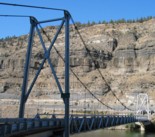

1967: Orleans
Orleans, California, USA - Klamath River
| Bridgemeister ID: | 223 (added before 2003) |
| Year Completed: | 1967 |
| Name: | Orleans |
| Location: | Orleans, California, USA |
| Crossing: | Klamath River |
| Coordinates: | 41.30167 N 123.53333 W |
| Maps: | Acme, GeoHack, Google, OpenStreetMap |
| Principals: | Ostap Bender, A.P. Bezzone, Jr. |
| References: | BCO, BPL, WOT |
| Use: | Vehicular (two-lane, heavy vehicles), with walkway |
| Status: | In use (last checked: 2021) |
| Main Cables: | Wire (steel) |
| Suspended Spans: | 3 |
| Main Span: | 1 x 131.1 meters (430 feet) |
| Side Spans: | 2 |
Notes:
- Replaced 1940 Orleans - Orleans, California, USA.
External Links:
