Inventory Search Results
50 suspension bridges were found for search criteria: BAR. All 50 bridges from the search results appear below. Click the Bridgemeister ID number to isolate the bridge on its own page. If you don't see what you were looking for, try an image search with the same criteria: BAR. This will find the bridge if it is pictured on the site, but is not a catenary suspension bridge.
Related:
1855: Whiskey Bar
El Dorado County, California, USA - American River
| Bridgemeister ID: | 3357 (added 2019-12-15) |
| Year Completed: | 1855 |
| Name: | Whiskey Bar |
| Also Known As: | Pioneer, Whisky |
| Location: | El Dorado County, California, USA |
| Crossing: | American River |
| Use: | Vehicular |
| Status: | Destroyed, 1862 |
| Main Cables: | Wire (iron) |
Notes:
- Destroyed by flood, 1862. Cables supposedly reused for the Rattlesnake Bar bridge.
- See 1862 Rattlesnake Bar - Folsom vicinity, California, USA.
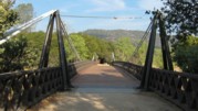
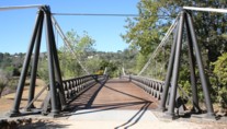
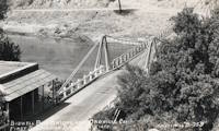
1856: Bidwell Bar
Oroville, California, USA - Feather River
| Bridgemeister ID: | 52 (added before 2003) |
| Year Completed: | 1856 |
| Name: | Bidwell Bar |
| Location: | Oroville, California, USA |
| Crossing: | Feather River |
| Coordinates: | 39.537483 N 121.45415 W |
| Maps: | Acme, GeoHack, Google, OpenStreetMap |
| Principals: | Bidwell Bridge Co. |
| References: | BPL, DSL200106, LACE |
| Use: | Vehicular (one-lane) |
| Status: | Restricted to foot traffic (last checked: 2020) |
| Main Cables: | Wire (iron) |
| Suspended Spans: | 1 |
| Main Span: | 1 x 67.1 meters (220 feet) estimated |
Notes:
- Dismantled before completion of Oroville Dam and replaced by the 1965 high-level Bidwell Bar suspension bridge. The 1856 structure was later reassembled about 1.5 miles south of the new Bidwell Bar bridge. Coordinates provided here are for the current location of the bridge at Kelly Ridge.
- Replaced by 1965 Bidwell Bar - Oroville, California, USA.
External Links:
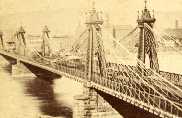
1860: Allegheny River
Pittsburgh, Pennsylvania, USA - Allegheny River
| Bridgemeister ID: | 59 (added before 2003) |
| Year Completed: | 1860 |
| Name: | Allegheny River |
| Also Known As: | Sixth Street, St. Clair |
| Location: | Pittsburgh, Pennsylvania, USA |
| Crossing: | Allegheny River |
| Principals: | John A. Roebling |
| References: | BOB, BOP, BPL, HBE, PBR, PTS2, SJR |
| Use: | Vehicular, with walkway |
| Status: | Replaced, 1892 |
| Main Cables: | Wire (iron) |
| Suspended Spans: | 4 |
| Main Spans: | 2 x 104.9 meters (344 feet) |
| Side Spans: | 2 x 52.1 meters (171 feet) |
| Deck width: | 40 feet |
Notes:
- BPL cites this bridge as the first suspension bridge with metal towers. However, at least two earlier suspension bridges (1857 Watertown, New York and 1856 Bidwell Bar, California) are known to have metal towers and even Roebling's 1846 Smithfield Street Bridge in Pittsburgh had cast iron towers.
- Next to 1884 North Side (Seventh Street) - Pittsburgh, Pennsylvania, USA.
External Links:
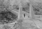
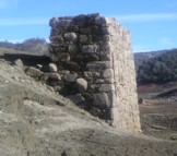
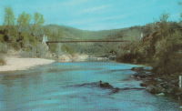
1862: Rattlesnake Bar
Folsom vicinity, California, USA - American River
| Bridgemeister ID: | 1091 (added 2004-01-01) |
| Year Completed: | 1862 |
| Name: | Rattlesnake Bar |
| Location: | Folsom vicinity, California, USA |
| Crossing: | American River |
| At or Near Feature: | Rattlesnake Bar |
| Coordinates: | 38.814397 N 121.091726 W |
| Maps: | Acme, GeoHack, Google, OpenStreetMap |
| Principals: | Andrew S. Hallidie |
| References: | DSL200106 |
| Use: | Vehicular (one-lane) |
| Status: | Collapsed, December 21, 1954 |
| Main Cables: | Wire (iron) |
| Suspended Spans: | 1 |
Notes:
- The location of Rattlesnake Bar is closer to present-day Auburn than Folsom, near the location of Goose Flat marked on modern topographical maps of the region. The area was inundated during the creation of Folsom Lake, but the piers and abutments of the Rattlesnake Bar bridge are visible when the water level is low.
- Rodi Lee writes: "[The bridge] collapsed in 1954 when an overweight truck filled with manure crossed it. The driver was unhurt. There are newspaper articles about the incident (Auburn Journal, Auburn). There are some photos in the article as well. The bridge abutments show when the the lake water is low. The bridge was upstream of Wild Goose Flats."
- See 1855 Whiskey Bar (Pioneer, Whisky) - El Dorado County, California, USA. The cables of the Rattlesnake Bar bridge were reportedly reused from the damaged Whiskey Bar bridge.
External Links:
- 1057. The Suspension Bridge over the American River at Rattlesnake Bar, Placer County - Calisphere.org
- Rattlesnake Bridge - Christine's Blog. Several images of the remnants of the bridge.
1863: Lamb's
Latrobe vicinity and Plymouth vicinity, California, USA - Cosumnes River
| Bridgemeister ID: | 2117 (added 2006-09-10) |
| Year Completed: | 1863 |
| Name: | Lamb's |
| Location: | Latrobe vicinity and Plymouth vicinity, California, USA |
| Crossing: | Cosumnes River |
| Coordinates: | 38.52222 N 120.95587 W |
| Maps: | Acme, GeoHack, Google, OpenStreetMap |
| Use: | Vehicular (one-lane) |
| Status: | Derelict (last checked: 2020) |
| Main Cables: | Wire (iron) |
| Suspended Spans: | 1 |
Notes:
- The location coordinates provided here are the approximate location of this bridge, crossing the Cosumnes between present day El Dorado and Amador counties at Michigan Bar (as named on USGS topographical maps) on current Latrobe Road where Clark Creek meets the Cosumnes River. Note that USGS topographical maps show another, more prominently marked, "Michigan Bar" a few miles west in Sacramento County.
- A California Highways and Public Works article (unsure of exact citation but it may be the article on the history of California bridges that appeared in the 1941 June issue and was reprinted in the 1950 September/October issue) says "there were four [suspension bridges] on the Cosumnes River, one of which (Lamb's Bridge on the Latrobe-Plymouth Road) killed one man and seven horses when it fell in 1869."
- The October 14, 1976 edition of The Mountain Democrat Times (Placerville, California) has an article about the nearby Huse Bridge (from the Heritage Association of El Dorado) which mentions Lamb's Bridge: "...Lamb's Bridge, several miles downriver, was reconstructed in 1872 and was also a wire bridge of the same type [as Huse's]."
- The Statutes of California passed at the Fourteenth Session of the Legislature, 1863 records: "Chapter XLI. An Act to grant to Larkin Lamb and his Associates the right to construct and maintain a Toll Bridge across the Cosumnes River, in the Counties of Amador and El Dorado. Approved March 6, 1863. The People of the State of California, represented in Senate and Assembly, do enact as follows: Section 1. Larkin Lamb, and those he may associate with him, their heirs and assigns, shall have full power to build, erect, construct, and maintain a public toll bridge across the Cosumnes River, at a point about eighty (80) rods below Dutch Hill;..."
- A November 12, 2017 article in Ledger Dispatch (of Amador and Calaveras counties) titled "Vestiges of Amador-Communities Along the Cosumnes, Part VI: The Lower Reaches - Michigan Bar to Wisconsin Bar" by Deborah Coleen Cook gives a more complete history of Lamb's bridge citing the enactment (February 9, 1863) of the bill to permit construction, construction completing six months later, failure of one of the cables in 1869 under the weight of a large freight wagon, and another cable/anchorage failure in 1872 while the bridge was undergoing major repairs.
- See 1852 Huse - Yeomet, California, USA.
- See 1852 Wilson's - Cosumne, California, USA.
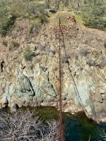
1877: Cottaneva
Cottaneva Creek, Rockport, California, USA - Rockport Bay, Pacific Ocean
| Bridgemeister ID: | 1152 (added 2004-01-18) |
| Year Completed: | 1877 |
| Name: | Cottaneva |
| Location: | Cottaneva Creek, Rockport, California, USA |
| Crossing: | Rockport Bay, Pacific Ocean |
| Coordinates: | 39.736703 N 123.832585 W |
| Maps: | Acme, GeoHack, Google, OpenStreetMap |
| Principals: | Pacific Bridge Co. |
| References: | AAJ |
| Use: | Vehicular (one-lane) |
| Status: | Removed |
| Main Cables: | Wire (iron) |
| Suspended Spans: | 1 |
| Main Span: | 1 x 82.3 meters (270 feet) |
Notes:
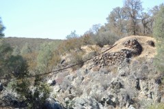
- This bridge was part of the Rockport lumber mill (Mendocino County). The bridge stretched over ocean to a large rock in the bay.
- Jakkula cites two sources describing the cables as steel.
- Don Sayenga transcribed one of Jakkula's references, The Iron Age Volume XX , No. 3 (August 2, 1877) Page 1: "A Steel Wire Suspension Bridge In California"
The Pacific Bridge Company are building in Mendocino county, California at Cottoneva, a suspension bridge which is described as follows "The distance from center to center of the saddles on the towers is 270 feet. The deflection or fall of the cable is 23 feet 6 inches. The cables are built in the same manner as those of the Clifton bridge at Niagara. The steel wire is about No. 11 Birmingham gauge, and is protected against rust by immersing in a bath which it a fine coat of zinc. There are eleven wires in each strand, seven strands in each rope, and seven ropes in each cable. The ropes are not twisted together to form the cable but gathered up every six feet by the suspender bands. Each rope is warranted to bear a strain of 60 tons. It is made fast to an independent anchor bar, 1 by 3 inches in diameter, and forming links 18 feet long, until connection is made with the anchors. The anchors are of cast iron, 3-1/2 by 3 feet in surface, weigh 1000 pounds each, and are placed 14 feet below the surface of the rock. Great care was taken in securing the anchors in place by means of cross I beams which run under the rock on either side. The lower part of each pit was enlarged to so as to form a hemispherical chamber, and the rock work, set in Portland cement, which is built upon the anchor, is so constructed that the upward strain is transmitted to the sides. The towers are of red wood. There are four posts 10 x 10 inches and two 10 x 12 inches, giving an effective area of 640 inches to withstand the strain of the cables on the tower. The wooden truss to prevent vertical vibration is 8 feet high and of the Howe truss pattern. The 270 feet of the bridge is divided into 45 pannels. The longest suspenders, 44 in number are of 7/8 inch steel wire, the 42 shorter ones are of 1-1/8 inch solid iron. The estimated dead load of the bridge is 1000 pounds per linear foot; live load, one ton per linear foot; in all, one and one half tons, or one fifth of actual breaking load. The bridge will be completed in about 30 days and promises to be a structure which the builders may well be proud of."
Don writes: "[In] Jakkula's last citation, he is saying that this is factory-made wire rope... The construction of the wire rope (7 by 11) used in the main cables is not common for the USA as of 1877; in fact it is extremely uncommon. The wire ropes used at Clifton/Niagara were made in England -- it wouldn't surprise me if these were made in England too."
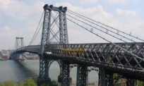
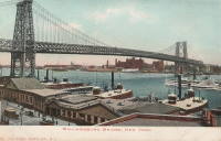
1903: Williamsburg
New York and Brooklyn, New York, USA - East River
| Bridgemeister ID: | 111 (added before 2003) |
| Year Completed: | 1903 |
| Name: | Williamsburg |
| Location: | New York and Brooklyn, New York, USA |
| Crossing: | East River |
| Coordinates: | 40.71355 N 73.97226 W |
| Maps: | Acme, GeoHack, Google, OpenStreetMap |
| Principals: | L.L. Buck |
| References: | AAJ, BAAW, BAR, BBR, BPL, GBD, HBE, PTS2, SJR |
| Use: | Rail (light rail) and Vehicular (major highway), with walkway |
| Status: | In use (last checked: 2022) |
| Main Cables: | Wire (steel) |
| Suspended Spans: | 1 |
| Main Span: | 1 x 487.7 meters (1,600 feet) |
Notes:
- Became longest suspension bridge by eclipsing 1883 Brooklyn (Great East River) - New York and Brooklyn, New York, USA.
- Eclipsed by new longest suspension bridge 1924 Bear Mountain - Anthony's Nose and Bear Mountain, New York, USA.
- Near 1883 Brooklyn (Great East River) - New York and Brooklyn, New York, USA.
- Near 1909 Manhattan - New York and Brooklyn, New York, USA.
External Links:
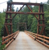
1938: Buker
Scott Bar vicinity, California, USA - Scott River
| Bridgemeister ID: | 581 (added 2003-01-01) |
| Year Completed: | 1938 |
| Name: | Buker |
| Also Known As: | Canyon Creek, Scott River |
| Location: | Scott Bar vicinity, California, USA |
| Crossing: | Scott River |
| At or Near Feature: | Klamath National Forest |
| Coordinates: | 41.63408 N 123.10570 W |
| Maps: | Acme, GeoHack, Google, OpenStreetMap |
| Use: | Vehicular (one-lane) |
| Status: | In use |
| Main Cables: | Wire (steel) |
| Suspended Spans: | 1 |
Notes:
- Restored 1998 (per plaque posted on bridge).
External Links:
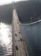
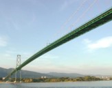
1939: Lions Gate
Vancouver, British Columbia, Canada - Vancouver Harbor
| Bridgemeister ID: | 194 (added before 2003) |
| Year Completed: | 1939 |
| Name: | Lions Gate |
| Also Known As: | First Narrows |
| Location: | Vancouver, British Columbia, Canada |
| Crossing: | Vancouver Harbor |
| At or Near Feature: | Burrard Inlet |
| Coordinates: | 49.31533 N 123.13846 W |
| Maps: | Acme, GeoHack, Google, OpenStreetMap |
| Principals: | Monsarrat and Pratley |
| References: | AAJ, BAR, BMA |
| Use: | Vehicular (major highway) |
| Status: | In use (last checked: 2019) |
| Main Cables: | Wire (steel) |
| Suspended Spans: | 3 |
| Main Span: | 1 x 472.4 meters (1,550 feet) |
| Side Spans: | 2 x 187.5 meters (615 feet) |
| Deck width: | 39 feet |
External Links:

1940: Hawkins Bar
Trinity Village and Hawkins Bar, California, USA - Trinity River
| Bridgemeister ID: | 2343 (added 2007-08-12) |
| Year Completed: | 1940 |
| Name: | Hawkins Bar |
| Location: | Trinity Village and Hawkins Bar, California, USA |
| Crossing: | Trinity River |
| Use: | Vehicular |
| Status: | Removed |
| Main Cables: | Wire |
Notes:
- Deck destroyed by fire 1954. Repaired and reopened, 1956. Bypassed late 1970s or 1980.
- May have been the site of a previous suspension bridge completed 1904.
- See (suspension bridge) - Salyer and Willow Creek, California, USA.
- See (suspension bridge) - Willow Creek vicinity, California, USA.
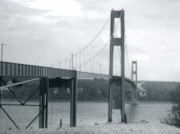
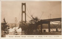
1940: Tacoma Narrows
Tacoma and Gig Harbor, Washington, USA - Puget Sound
| Bridgemeister ID: | 198 (added before 2003) |
| Year Completed: | 1940 |
| Name: | Tacoma Narrows |
| Also Known As: | Galloping Gertie |
| Location: | Tacoma and Gig Harbor, Washington, USA |
| Crossing: | Puget Sound |
| Coordinates: | 47.267015 N 122.548462 W |
| Maps: | Acme, GeoHack, Google, OpenStreetMap |
| Principals: | Leon Moisseiff |
| References: | AAJ, BAR, BBR, BFL, BMA, BPL, COB, CTT, GBD, IT1999F, SPW |
| Use: | Vehicular (two-lane, heavy vehicles), with walkway |
| Status: | Collapsed, 1940 |
| Main Cables: | Wire (steel) |
| Suspended Spans: | 3 |
| Main Span: | 1 x 853.4 meters (2,800 feet) |
| Side Spans: | 2 x 335.3 meters (1,100 feet) |
| Deck width: | 39 feet |
Notes:
- Famously destroyed by wind, November 7, 1940.
- Replaced by 1950 Tacoma Narrows (Sturdy Gertie, Second Tacoma Narrows) - Tacoma and Gig Harbor, Washington, USA.
- See 1944 Liard River - Liard River Hot Springs vicinity, British Columbia, Canada. According to CTT, "Two sections from the Tacoma bridge's east approach were [re]used in the Liard span."
External Links:



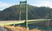
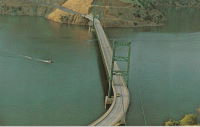
1965: Bidwell Bar
Oroville, California, USA - Feather River
| Bridgemeister ID: | 220 (added before 2003) |
| Year Completed: | 1965 |
| Name: | Bidwell Bar |
| Location: | Oroville, California, USA |
| Crossing: | Feather River |
| At or Near Feature: | Oroville Reservoir |
| Coordinates: | 39.54816 N 121.43006 W |
| Maps: | Acme, GeoHack, Google, OpenStreetMap |
| Principals: | California Department of Water Resources |
| Use: | Vehicular (two-lane, heavy vehicles), with walkway |
| Status: | In use (last checked: 2021) |
| Main Cables: | Wire (steel) |
| Suspended Spans: | 1 |
Notes:
External Links:
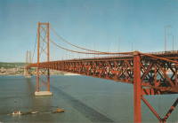
1966: 25 de Abril
Lisbon, Portugal - Tagus River
| Bridgemeister ID: | 464 (added before 2003) |
| Year Completed: | 1966 |
| Name: | 25 de Abril |
| Also Known As: | Tagus, Salazar, April 25th |
| Location: | Lisbon, Portugal |
| Crossing: | Tagus River |
| Coordinates: | 38.6968 N 9.179 W |
| Maps: | Acme, GeoHack, Google, OpenStreetMap |
| Principals: | David B. Steinman, Ray M. Boynton, et. al. |
| References: | BAAW, BAR, BBR, BC3, BDU, BFL, BMA, CTW |
| Use: | Rail and Vehicular (major highway) |
| Status: | In use (last checked: 2019) |
| Main Cables: | Wire (steel) |
| Suspended Spans: | 3 |
| Main Span: | 1 x 1,012.9 meters (3,323 feet) |
| Side Spans: | 2 x 483.4 meters (1,586 feet) |
Notes:
- Major retrofit completed in 1999 to add rail deck and extra vehicle lane.
External Links:
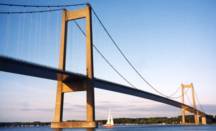
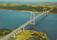
1970: New Little Belt
Jutland and Funen, Denmark - Little Belt
| Bridgemeister ID: | 471 (added before 2003) |
| Year Completed: | 1970 |
| Name: | New Little Belt |
| Also Known As: | New Lillebaelt, Nye Lillebæltsbro |
| Location: | Jutland and Funen, Denmark |
| Crossing: | Little Belt |
| Coordinates: | 55.518516 N 9.750336 E |
| Maps: | Acme, GeoHack, Google, OpenStreetMap |
| Principals: | Ostenfeld and Jonson |
| References: | BAR, BFL |
| Use: | Vehicular (major highway) |
| Status: | In use (last checked: 2019) |
| Main Cables: | Wire (steel) |
| Suspended Spans: | 3 |
| Main Span: | 1 x 600 meters (1,968.5 feet) |
| Side Spans: | 2 |
External Links:
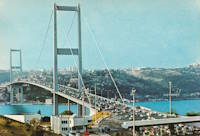
1973: Bosporus
Istanbul, Türkiye - Bosporus Strait
| Bridgemeister ID: | 472 (added before 2003) |
| Year Completed: | 1973 |
| Name: | Bosporus |
| Also Known As: | Bogaziçi, 15 July Martyrs, First, Bosphorus |
| Location: | Istanbul, Türkiye |
| Crossing: | Bosporus Strait |
| Coordinates: | 41.046655 N 29.033788 E |
| Maps: | Acme, GeoHack, Google, OpenStreetMap |
| References: | BAR, BDU, BFL, BMA, CTW |
| Use: | Vehicular (major highway) |
| Status: | In use (last checked: 2019) |
| Main Cables: | Wire (steel) |
| Suspended Spans: | 1 |
| Main Span: | 1 x 1,073.8 meters (3,523 feet) |
External Links:
1974: (footbridge)
Hayfork, California, USA - Hayfork Creek
| Bridgemeister ID: | 6707 (added 2021-10-05) |
| Year Completed: | 1974 |
| Name: | (footbridge) |
| Location: | Hayfork, California, USA |
| Crossing: | Hayfork Creek |
| At or Near Feature: | Bar 717 Ranch |
| Coordinates: | 40.628631 N 123.371112 W |
| Maps: | Acme, GeoHack, Google, OpenStreetMap |
| Principals: | Paul Wills, Willy Wills, Ed Clark |
| Use: | Footbridge |
| Status: | In use (last checked: 2021) |
| Main Cables: | Wire (steel) |
| Main Span: | 1 |
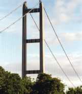
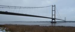
1981: Humber
Hull, Humberside, England, United Kingdom - Humber River
| Bridgemeister ID: | 475 (added before 2003) |
| Year Completed: | 1981 |
| Name: | Humber |
| Location: | Hull, Humberside, England, United Kingdom |
| Crossing: | Humber River |
| Coordinates: | 53.70654 N 0.44997 W |
| Maps: | Acme, GeoHack, Google, OpenStreetMap |
| Principals: | Gilbert Roberts, Bill Harvey, Freeman Fox & Partners |
| References: | AOB, BAR, BC3, BDU, BFL |
| Use: | Vehicular (four-lane), with walkway |
| Status: | In use (last checked: 2021) |
| Main Cables: | Wire (steel) |
| Suspended Spans: | 3 |
| Main Span: | 1 x 1,410 meters (4,626 feet) |
| Side Spans: | 1 x 280 meters (918.6 feet), 1 x 530 meters (1,738.8 feet) |
| Deck width: | 28.5 meters |
Notes:
- Became longest suspension bridge by eclipsing 1964 Verrazzano Narrows (Verrazano Narrows) - Brooklyn and Staten Island, New York, USA.
- Eclipsed by new longest suspension bridge 1998 Akashi Kaikyo (明石海峡大橋) - Maiko, Tarumi-ward, Kobe and Matsuho, Awaji Island, Hyogo, Japan.
External Links:
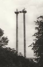
1982: (footbridge)
Glen Nevis vicinity, Scotland, United Kingdom - River Nevis
| Bridgemeister ID: | 1458 (added 2004-08-21) |
| Year Completed: | 1982 |
| Name: | (footbridge) |
| Location: | Glen Nevis vicinity, Scotland, United Kingdom |
| Crossing: | River Nevis |
| Coordinates: | 56.811717 N 5.076033 W |
| Maps: | Acme, GeoHack, Google, OpenStreetMap |
| Use: | Footbridge |
| Status: | In use (last checked: 2009) |
| Main Cables: | Wire (steel) |
| Suspended Spans: | 1 |
| Main Span: | 1 x 32.6 meters (107 feet) |
Notes:
- This is not the popular wire rope crossing at Glen Nevis which is literally three ropes -- two to hold onto and one to walk on. Instead, this listing is a traditional suspension footbridge just north of Glen Nevis.
- Don McGillivray worked on this bridge and sent information about its construction.
"The Suspension bridge was principally built by five Royal Engineers from 15 Field Support Squadron Royal Engineers in the summer of 1982. They were Sapper Terry Bradley (Metal workworker) Sapper Paul Brookes (Draughtsman), Sapper Ian Duggan (Surveyor), Sapper Taff Green (Draughtsman) Sapper Don McGillivray (Blacksmith).
"The pier footings and anchorages were excavated by hand as the plant machines were being used on another project at Caol and upriver at the priority bridge opposite the YMCA.The Accrow shuttering and Re-bar was humped and Concrete was pumped across the river over a series of aluminium Mk4 assualt boats. Once the concrete cured, the steel work, provided by Highland Engineering was manhandled across the river using the same boats. The steel uprights and main cable were raised and positioned using a block and tackle from a wooden Gyn. The main cables were anchored on the east bank and were tensioned on the west bank using two tirfor winches. The hangers and stringers were strung out from the west bank in a series like stepping stones until the decking could be positioned.
"The Bridge took five weeks start to finish the best part of the build was the weather which was hot and as we were constantly dropping tools etc. in the river, you had to jump in after it. We later moved up to finish the two span through deck bridge at the YMCA. This bridge replaced an old narrow bridge that used to be a part of a WW2 Mulberry Harbour section."
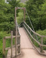
1984: Ohnaruto
Awajishima, Hyogo and Naruto, Tokushima, Japan - Naruto Strait
| Bridgemeister ID: | 480 (added before 2003) |
| Year Completed: | 1984 |
| Name: | Ohnaruto |
| Also Known As: | Onaruto |
| Location: | Awajishima, Hyogo and Naruto, Tokushima, Japan |
| Crossing: | Naruto Strait |
| Coordinates: | 34.238877 N 134.651243 E |
| Maps: | Acme, GeoHack, Google, OpenStreetMap |
| Principals: | Honshu-Shikoku Bridge Authority |
| References: | BAAW, BAR, BBR, BDU |
| Use: | Vehicular (major highway) |
| Status: | In use (last checked: 2019) |
| Main Cables: | Wire (steel) |
| Suspended Spans: | 3 |
| Main Span: | 1 x 876 meters (2,874 feet) |
| Side Spans: | 2 x 330 meters (1,082.7 feet) |
| Deck width: | 34 meters |
External Links:
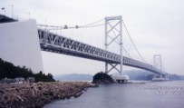
1987: Kita Bisan-Seto
Yoshima Island and Sakaide, Kagawa, Japan - Seto Inland Sea
| Bridgemeister ID: | 481 (added before 2003) |
| Year Completed: | 1987 |
| Name: | Kita Bisan-Seto |
| Also Known As: | 北備讃瀬戸大橋 |
| Location: | Yoshima Island and Sakaide, Kagawa, Japan |
| Crossing: | Seto Inland Sea |
| Coordinates: | 34.379065 N 133.820065 E |
| Maps: | Acme, GeoHack, Google, OpenStreetMap |
| Principals: | Honshu-Shikoku Bridge Authority |
| References: | BAAW, BAR, BBR, BDU |
| Use: | Vehicular (major highway) and Rail |
| Status: | In use (last checked: 2019) |
| Main Cables: | Wire (steel) |
| Suspended Spans: | 3 |
| Main Span: | 1 x 990 meters (3,248 feet) |
| Side Spans: | 2 x 274 meters (899 feet) |
| Deck width: | 35 meters upper deck, 30 meters lower deck |
Notes:
- Connects to 1988 Minami Bisan-Seto (南備讃瀬戸大橋) - Yoshima Island (与島) and Sakaide (坂出市), Kagawa, Japan.
- Near 1988 Shimotsui-Seto (下津井瀬戸大橋) - Kojima, Okayama and Hitsuishijima (櫃石島), Kagawa, Japan.
External Links:
1988: Max-Eyth
Stuttgart-Mühlhausen and Stuttgart-Hofen, Baden-Württemberg, Germany - Neckar River
| Bridgemeister ID: | 577 (added 2002-12-31) |
| Year Completed: | 1988 |
| Name: | Max-Eyth |
| Also Known As: | Neckar River |
| Location: | Stuttgart-Mühlhausen and Stuttgart-Hofen, Baden-Württemberg, Germany |
| Crossing: | Neckar River |
| At or Near Feature: | Max-Eyth-See |
| Coordinates: | 48.834163 N 9.208899 E |
| Maps: | Acme, GeoHack, Google, OpenStreetMap |
| Principals: | Schlaich Bergermann Partner |
| References: | BAR, BBU |
| Use: | Footbridge |
| Status: | In use (last checked: 2019) |
| Main Cables: | Wire (steel) |
| Suspended Spans: | 2 |
| Main Span: | 1 x 114 meters (374 feet) |
| Side Span: | 1 x 14 meters (45.9 feet) |
| Deck width: | 3.16 meters between side rails, 3.67 meters total |
External Links:
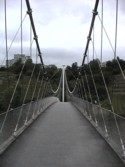
1988: Minami Bisan-Seto
Yoshima Island (与島) and Sakaide (坂出市), Kagawa, Japan - Seto Inland Sea
| Bridgemeister ID: | 485 (added before 2003) |
| Year Completed: | 1988 |
| Name: | Minami Bisan-Seto |
| Also Known As: | 南備讃瀬戸大橋 |
| Location: | Yoshima Island (与島) and Sakaide (坂出市), Kagawa, Japan |
| Crossing: | Seto Inland Sea |
| Coordinates: | 34.364167 N 133.825278 E |
| Maps: | Acme, GeoHack, Google, OpenStreetMap |
| Principals: | Honshu-Shikoku Bridge Authority |
| References: | BAAW, BAR, BBR, BDU |
| Use: | Vehicular (major highway) and Rail |
| Status: | In use (last checked: 2019) |
| Main Cables: | Wire (steel) |
| Suspended Spans: | 3 |
| Main Span: | 1 x 1,100 meters (3,608.9 feet) |
| Side Spans: | 2 x 274 meters (899 feet) |
| Deck width: | 35 meters upper deck, 30 meters lower deck |
Notes:
- Connects to 1987 Kita Bisan-Seto (北備讃瀬戸大橋) - Yoshima Island and Sakaide, Kagawa, Japan.
- Near 1988 Shimotsui-Seto (下津井瀬戸大橋) - Kojima, Okayama and Hitsuishijima (櫃石島), Kagawa, Japan.
External Links:

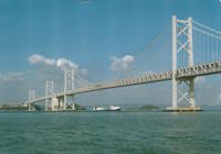
| Bridgemeister ID: | 484 (added before 2003) |
| Year Completed: | 1988 |
| Name: | Ohshima |
| Also Known As: | 伯方・大島大橋 |
| Location: | Hakata Island, Imabari and Imabari (今治市), Ehime, Japan |
| Coordinates: | 34.192724 N 133.072966 E |
| Maps: | Acme, GeoHack, Google, OpenStreetMap |
| Principals: | Honshu-Shikoku Bridge Authority |
| References: | BAAW, BAR |
| Use: | Vehicular (major highway) |
| Status: | In use (last checked: 2019) |
| Main Cables: | Wire (steel) |
| Suspended Spans: | 1 |
| Main Span: | 1 x 560 meters (1,837.3 feet) |
| Deck width: | 23.7 meters |
External Links:
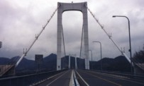
1988: Shimotsui-Seto
Kojima, Okayama and Hitsuishijima (櫃石島), Kagawa, Japan - Seto Inland Sea
| Bridgemeister ID: | 486 (added before 2003) |
| Year Completed: | 1988 |
| Name: | Shimotsui-Seto |
| Also Known As: | 下津井瀬戸大橋 |
| Location: | Kojima, Okayama and Hitsuishijima (櫃石島), Kagawa, Japan |
| Crossing: | Seto Inland Sea |
| Coordinates: | 34.431483 N 133.807833 E |
| Maps: | Acme, GeoHack, Google, OpenStreetMap |
| Principals: | Honshu-Shikoku Bridge Authority |
| References: | AOB, BAAW, BAR, BBR, BDU |
| Use: | Vehicular (major highway) |
| Status: | In use (last checked: 2019) |
| Main Cables: | Wire (steel) |
| Suspended Spans: | 1 |
| Main Span: | 1 x 940 meters (3,084 feet) |
Notes:
- Near 1987 Kita Bisan-Seto (北備讃瀬戸大橋) - Yoshima Island and Sakaide, Kagawa, Japan.
- Near 1988 Minami Bisan-Seto (南備讃瀬戸大橋) - Yoshima Island (与島) and Sakaide (坂出市), Kagawa, Japan.
External Links:
| Bridgemeister ID: | 489 (added before 2003) |
| Year Completed: | 1992 |
| Name: | Askøy |
| Location: | Askøy, Vestland and Olsvik, Bergen, Hordaland, Norway |
| Crossing: | Byfjorden |
| Coordinates: | 60.396143 N 5.214690 E |
| Maps: | Acme, GeoHack, Google, kart.1881.no, OpenStreetMap |
| References: | BAR, BC3 |
| Use: | Vehicular (two-lane, heavy vehicles), with walkway |
| Status: | In use (last checked: 2019) |
| Main Cables: | Wire (steel) |
| Suspended Spans: | 1 |
| Main Span: | 1 x 850 meters (2,788.7 feet) |
External Links:
1995: Glacisbrücke
Minden, North Rhine-Westphalia, Germany - Weser River
| Bridgemeister ID: | 578 (added 2002-12-31) |
| Year Completed: | 1995 |
| Name: | Glacisbrücke |
| Location: | Minden, North Rhine-Westphalia, Germany |
| Crossing: | Weser River |
| Coordinates: | 52.28607 N 8.92190 E |
| Maps: | Acme, GeoHack, Google, OpenStreetMap |
| Principals: | Schlaich Bergermann Partner |
| References: | BAR, BBU |
| Use: | Footbridge |
| Status: | In use (last checked: 2006) |
| Main Cables: | Wire (steel) |
| Suspended Spans: | 3 |
| Main Span: | 1 x 10³ meters (337.9 feet) |
| Side Spans: | 2 x 37 meters (121.4 feet) |
| Deck width: | 3.1 meters between side rails, 3.55 meters total |
External Links:

1997: Tsing Ma
Hong Kong, China - Ma Wan Channel
| Bridgemeister ID: | 500 (added before 2003) |
| Year Completed: | 1997 |
| Name: | Tsing Ma |
| Location: | Hong Kong, China |
| Crossing: | Ma Wan Channel |
| Coordinates: | 22.351220 N 114.072636 E |
| Maps: | Acme, GeoHack, Google, OpenStreetMap |
| Principals: | Mott MacDonald Hong Kong Ltd |
| References: | BAR, BCG, SA199712a |
| Use: | Vehicular (major highway) and Rail (light rail) |
| Status: | In use (last checked: 2021) |
| Main Cables: | Wire (steel) |
| Suspended Spans: | 3 |
| Main Span: | 1 x 1,377 meters (4,517.7 feet) |
| Side Spans: | 2 |
External Links:
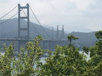
1998: Akashi Kaikyo
Maiko, Tarumi-ward, Kobe and Matsuho, Awaji Island, Hyogo, Japan - Akashi Strait
| Bridgemeister ID: | 501 (added before 2003) |
| Year Completed: | 1998 |
| Name: | Akashi Kaikyo |
| Also Known As: | 明石海峡大橋 |
| Location: | Maiko, Tarumi-ward, Kobe and Matsuho, Awaji Island, Hyogo, Japan |
| Crossing: | Akashi Strait |
| Coordinates: | 34.630617 N 135.0327 E |
| Maps: | Acme, GeoHack, Google, OpenStreetMap |
| Principals: | Honshu-Shikoku Bridge Authority |
| References: | BAR, BBR, BDU, CTW, PS199803, SA199712b |
| Use: | Vehicular (major highway) |
| Status: | In use (last checked: 2020) |
| Main Cables: | Wire (steel) |
| Suspended Spans: | 3 |
| Main Span: | 1 x 1,991 meters (6,532.2 feet) |
| Side Spans: | 2 x 960 meters (3,149.6 feet) |
| Deck width: | 35.5 meters |
Notes:
- Became longest suspension bridge by eclipsing 1981 Humber - Hull, Humberside, England, United Kingdom.
- Eclipsed by new longest suspension bridge 2022 Çanakkale 1915 - Sütlüce, Gelibolu and Lapseki, Çanakkale, Türkiye.
External Links:
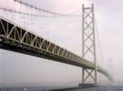
1998: Great Belt
Korsør and Nyborg, Denmark - Great Belt
| Bridgemeister ID: | 502 (added before 2003) |
| Year Completed: | 1998 |
| Name: | Great Belt |
| Also Known As: | Great Belt Fixed Link, Storebaelt, East, Storebælt, East Belt |
| Location: | Korsør and Nyborg, Denmark |
| Crossing: | Great Belt |
| At or Near Feature: | Storebaelt |
| Coordinates: | 55.342087 N 11.036430 E |
| Maps: | Acme, GeoHack, Google, OpenStreetMap |
| Principals: | COINFRA |
| References: | BAR, BBR, BC3, BDU, COB, CTW |
| Use: | Vehicular (major highway) |
| Status: | In use (last checked: 2023) |
| Main Cables: | Wire (steel) |
| Suspended Spans: | 3 |
| Main Span: | 1 x 1,624 meters (5,328.1 feet) |
| Side Spans: | 2 x 535 meters (1,755.2 feet) |
External Links:
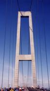
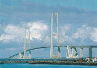
1998: Herrenkrugsteg
Magdeburg, Sachsen-Anhalt, Germany - Elbe River
| Bridgemeister ID: | 1147 (added 2004-01-17) |
| Year Completed: | 1998 |
| Name: | Herrenkrugsteg |
| Also Known As: | Buga |
| Location: | Magdeburg, Sachsen-Anhalt, Germany |
| Crossing: | Elbe River |
| Coordinates: | 52.15435 N 11.67372 E |
| Maps: | Acme, GeoHack, Google, OpenStreetMap |
| Principals: | Planungsgruppe Professor Laage, Ingenieurgemeinschaft Setzpfandt |
| References: | BAR |
| Use: | Footbridge and Vehicular |
| Status: | In use (last checked: 2006) |
| Main Cables: | Wire (steel) |
| Suspended Spans: | 3 |
| Main Span: | 1 x 143 meters (469.2 feet) |
| Side Spans: | 2 x 52 meters (170.6 feet) |
| Deck width: | 4.1 meters between side rails, 5.3 meters total |
Notes:
- Eckhard Bernstoff notes the bridge has one lane for light shuttle buses for special events and that the anchor system is similar to that of the WiHa-dukt bridge.
- See 2005 WiHa-dukt - Wilkau-Haßlau, Saxony, Germany.
External Links:
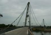
1999: Convertible
Duisburg, Germany - Inner Harbor
| Bridgemeister ID: | 576 (added 2002-12-31) |
| Year Completed: | 1999 |
| Name: | Convertible |
| Also Known As: | Inner Harbor |
| Location: | Duisburg, Germany |
| Crossing: | Inner Harbor |
| Coordinates: | 51.43861 N 6.76413 E |
| Maps: | Acme, GeoHack, Google, OpenStreetMap |
| Principals: | Schlaich Bergermann Partner |
| References: | AR200003, BAR, BBU |
| Use: | Footbridge |
| Status: | In use (last checked: 2004) |
| Main Cables: | Wire (steel) |
| Suspended Spans: | 1 |
| Main Span: | 1 x 73.72 meters (241.9 feet) estimated |
| Deck width: | 3.5 meters |
Notes:
- This footbridge is "convertible" because it can be raised to make way for boats. The backstays are shortened using jacks causing the towers to tilt back and the deck to arch up and out of the way. Eckhard Bernstorff notes, "the deck (weight 150 tons) has 14 segments. When the towers tilt back by shortening the main cables about 2.5 meters, the deck lifts 9 meters."
External Links:
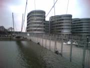
| Bridgemeister ID: | 503 (added before 2003) |
| Year Completed: | 1999 |
| Name: | Kurushima Kaikyō I |
| Also Known As: | 来島海峡大橋 |
| Location: | Ōshima (大島) and Imabari (今治市), Ehime, Japan |
| Coordinates: | 34.125903 N 133.013167 E |
| Maps: | Acme, GeoHack, Google, OpenStreetMap |
| Principals: | Honshu-Shikoku Bridge Authority |
| References: | BAR |
| Use: | Vehicular (major highway) |
| Status: | In use (last checked: 2019) |
| Main Cables: | Wire (steel) |
| Suspended Spans: | 3 |
| Main Span: | 1 x 600 meters (1,968.5 feet) |
| Side Spans: | 1 x 140 meters (459.3 feet), 1 x 170 meters (557.7 feet) |
| Deck width: | 27 meters |
Notes:
- Connects to 1999 Kurushima Kaikyō II (来島海峡大橋) - Onomichi and Imabari (今治市), Ehime, Japan.
- Connects to 1999 Kurushima Kaikyō III (来島海峡大橋) - Onomichi and Imabari (今治市), Ehime, Japan.
External Links:
| Bridgemeister ID: | 504 (added before 2003) |
| Year Completed: | 1999 |
| Name: | Kurushima Kaikyō II |
| Also Known As: | 来島海峡大橋 |
| Location: | Onomichi and Imabari (今治市), Ehime, Japan |
| Coordinates: | 34.121616 N 133.001921 E |
| Maps: | Acme, GeoHack, Google, OpenStreetMap |
| Principals: | Honshu-Shikoku Bridge Authority |
| References: | BAR |
| Use: | Vehicular (major highway) |
| Status: | In use (last checked: 2019) |
| Main Cables: | Wire (steel) |
| Suspended Spans: | 2 |
| Main Span: | 1 x 1,020 meters (3,346.5 feet) |
| Side Span: | 1 x 250 meters (820.2 feet) |
| Deck width: | 27 meters |
Notes:
- Connects to 1999 Kurushima Kaikyō I (来島海峡大橋) - Ōshima (大島) and Imabari (今治市), Ehime, Japan.
- Connects to 1999 Kurushima Kaikyō III (来島海峡大橋) - Onomichi and Imabari (今治市), Ehime, Japan.
External Links:
| Bridgemeister ID: | 505 (added before 2003) |
| Year Completed: | 1999 |
| Name: | Kurushima Kaikyō III |
| Also Known As: | 来島海峡大橋 |
| Location: | Onomichi and Imabari (今治市), Ehime, Japan |
| Coordinates: | 34.115198 N 132.984055 E |
| Maps: | Acme, GeoHack, Google, OpenStreetMap |
| Principals: | Honshu-Shikoku Bridge Authority |
| References: | BAR |
| Use: | Vehicular (major highway) |
| Status: | In use (last checked: 2019) |
| Main Cables: | Wire (steel) |
| Suspended Spans: | 1 |
| Main Span: | 1 x 1,030 meters (3,379.3 feet) |
| Deck width: | 27 meters |
Notes:
- Connects to 1999 Kurushima Kaikyō I (来島海峡大橋) - Ōshima (大島) and Imabari (今治市), Ehime, Japan.
- Connects to 1999 Kurushima Kaikyō II (来島海峡大橋) - Onomichi and Imabari (今治市), Ehime, Japan.
External Links:
2000: Akinada
Kawajirichokashiwa, Hiroshima, Japan - Menekonoseto Strait
| Bridgemeister ID: | 506 (added before 2003) |
| Year Completed: | 2000 |
| Name: | Akinada |
| Also Known As: | 安芸灘大橋 |
| Location: | Kawajirichokashiwa, Hiroshima, Japan |
| Crossing: | Menekonoseto Strait |
| Coordinates: | 34.206374 N 132.679199 E |
| Maps: | Acme, GeoHack, Google, OpenStreetMap |
| References: | BAR |
| Use: | Vehicular (two-lane, heavy vehicles), with walkway |
| Status: | In use (last checked: 2019) |
| Main Cables: | Wire (steel) |
| Suspended Spans: | 3 |
| Main Span: | 1 x 750 meters (2,460.6 feet) |
| Side Spans: | 1 x 170 meters (557.7 feet), 1 x 255 meters (836.6 feet) |
External Links:
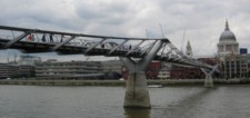
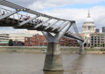
2000: Millennium
London, England, United Kingdom - River Thames
| Bridgemeister ID: | 568 (added 2002-12-31) |
| Year Completed: | 2000 |
| Name: | Millennium |
| Location: | London, England, United Kingdom |
| Crossing: | River Thames |
| Coordinates: | 51.50964 N 0.09856 W |
| Maps: | Acme, GeoHack, Google, OpenStreetMap |
| Principals: | Anthony Caro, Foster & Partners, Ove Arup & Partners |
| References: | BAR, BBU |
| Use: | Footbridge |
| Status: | In use (last checked: 2019) |
| Main Cables: | Wire (steel) |
| Suspended Spans: | 3 |
| Main Span: | 1 |
| Side Spans: | 2 |
External Links:
2001: Halgavor
Bodmin, Cornwall and Lanhydrock, England, United Kingdom - A30 Highway
| Bridgemeister ID: | 964 (added 2003-11-01) |
| Year Completed: | 2001 |
| Name: | Halgavor |
| Location: | Bodmin, Cornwall and Lanhydrock, England, United Kingdom |
| Crossing: | A30 Highway |
| Coordinates: | 50.4503 N 4.697267 W |
| Maps: | Acme, GeoHack, Google, OpenStreetMap |
| Principals: | Flint & Neill Partnership, Wilkinson Eyre |
| References: | BAR |
| Use: | Footbridge |
| Status: | In use (last checked: 2008) |
| Main Cables: | Wire (steel) |
| Suspended Spans: | 1 |
| Main Span: | 1 x 48 meters (157.5 feet) |
| Deck width: | 3.5 meters |
Notes:
- Unconventional design with swept-back towers. Wide deck, intended to carry pedestrians, cyclists, and horses.
External Links:
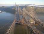
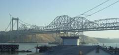
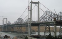
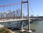
2003: Al Zampa Memorial
Crockett and Vallejo, California, USA - Carquinez Strait
| Bridgemeister ID: | 878 (added 2003-09-01) |
| Year Completed: | 2003 |
| Name: | Al Zampa Memorial |
| Location: | Crockett and Vallejo, California, USA |
| Crossing: | Carquinez Strait |
| Coordinates: | 38.06097 N 122.22639 W |
| Maps: | Acme, GeoHack, Google, OpenStreetMap |
| References: | AZB, BAR |
| Use: | Vehicular (major highway), with walkway |
| Status: | In use (last checked: 2018) |
| Main Cables: | Wire (steel) |
| Suspended Spans: | 3 |
| Main Span: | 1 x 728 meters (2,388.5 feet) |
| Side Spans: | 1 x 181 meters (593.8 feet), 1 x 147 meters (482.3 feet) |
External Links:
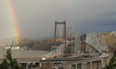
(suspension bridge)
Bar Kunar, Afghanistan - Kunar/Chitral/Mastuj River
| Bridgemeister ID: | 3858 (added 2020-03-07) |
| Name: | (suspension bridge) |
| Location: | Bar Kunar, Afghanistan |
| Crossing: | Kunar/Chitral/Mastuj River |
| Coordinates: | 35.149239 N 71.397382 E |
| Maps: | Acme, GeoHack, Google, OpenStreetMap |
| Status: | Extant (last checked: 2019) |
(suspension bridge)
Bar Sholtan vicinity, Afghanistan - Kunar/Chitral/Mastuj River
| Bridgemeister ID: | 5767 (added 2021-04-05) |
| Name: | (suspension bridge) |
| Location: | Bar Sholtan vicinity, Afghanistan |
| Crossing: | Kunar/Chitral/Mastuj River |
| Coordinates: | 34.983835 N 71.303381 E |
| Maps: | Acme, GeoHack, Google, OpenStreetMap |
| Status: | Extant (last checked: 2020) |
| Main Span: | 1 |
(suspension bridge)
Bar Valley, Chalt vicinity, Gilgit-Baltistan, Pakistan - Bar Budalas River
| Bridgemeister ID: | 6636 (added 2021-09-10) |
| Name: | (suspension bridge) |
| Location: | Bar Valley, Chalt vicinity, Gilgit-Baltistan, Pakistan |
| Crossing: | Bar Budalas River |
| Coordinates: | 36.349561 N 74.288011 E |
| Maps: | Acme, GeoHack, Google, OpenStreetMap |
| Status: | In use |
| Main Cables: | Wire (steel) |
| Suspended Spans: | 1 |
| Main Span: | 1 x 21.3 meters (70 feet) estimated |
(suspension bridge)
Budalas, Chalt vicinity, Gilgit-Baltistan, Pakistan - Bar Budalas River
| Bridgemeister ID: | 6638 (added 2021-09-11) |
| Name: | (suspension bridge) |
| Location: | Budalas, Chalt vicinity, Gilgit-Baltistan, Pakistan |
| Crossing: | Bar Budalas River |
| Coordinates: | 36.277539 N 74.332145 E |
| Maps: | Acme, GeoHack, Google, OpenStreetMap |
| Status: | Removed |
| Main Cables: | Wire (steel) |
| Suspended Spans: | 1 |
| Main Span: | 1 x 29.9 meters (98 feet) estimated |
Notes:
- Built in 2000s. Bypassed with a concrete girder bridge at some at point 2014-2017. Deck and cables gone by some point in 2018-2021. One tower destroyed by flood, July 2021.
External Links:
- Facebook - "Budalas vallag accident". July 2021 video of flood taking out one of the towers.
- Facebook - "The new Rcc bridge of budalas is under construction". Image showing adjacent bridge under construction.
(suspension bridge)
Willow Creek vicinity, California, USA - Trinity River
| Bridgemeister ID: | 2344 (added 2007-08-12) |
| Name: | (suspension bridge) |
| Location: | Willow Creek vicinity, California, USA |
| Crossing: | Trinity River |
| Use: | Vehicular |
| Main Cables: | Wire |
| Suspended Spans: | 1 |
Notes:
- The bridge pictured here appears to be similar to, but distinct from other Willow Creek vicinity bridges in the Bridgemeister inventory. The bridge does not match the bridges in images of the Salyer and Hawkins Bar bridges. The description on the reverse of this photo is: "Over Trinity River near Willow Creek, Cal. between Arcata and Redding. Nov. 21, 1951." Arcata and Redding are 141 miles apart, so that information is not helpful except to reinforce that the bridge was along the modern-day CA-299 corridor near Willow Creek. This bridge is likely no longer in existence.
- See 1940 Hawkins Bar - Trinity Village and Hawkins Bar, California, USA.
- See (suspension bridge) - Salyer and Willow Creek, California, USA.
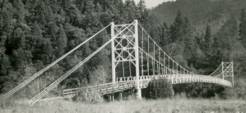
Baiyang Falls
Xiulin Township, Hualien County, Taiwan - Baiyang Falls
| Bridgemeister ID: | 1136 (added 2004-01-17) |
| Name: | Baiyang Falls |
| Also Known As: | 白楊吊橋 |
| Location: | Xiulin Township, Hualien County, Taiwan |
| Crossing: | Baiyang Falls |
| At or Near Feature: | Taroko Gorge |
| Coordinates: | 24.178318 N 121.475306 E |
| Maps: | Acme, GeoHack, Google, OpenStreetMap |
| Use: | Footbridge |
| Status: | In use (last checked: 2019) |
| Main Cables: | Wire (steel) |
| Suspended Spans: | 1 |
Notes:
- One of many suspension bridges in this area. This one is a short footbridge with simple rectangular red towers with one cross-bar.
Bar Creek
Oneida, Kentucky, USA - Red Bird River
| Bridgemeister ID: | 4943 (added 2020-08-08) |
| Name: | Bar Creek |
| Location: | Oneida, Kentucky, USA |
| Crossing: | Red Bird River |
| Coordinates: | 37.228593 N 83.631545 W |
| Maps: | Acme, GeoHack, Google, OpenStreetMap |
| Use: | Footbridge |
| Status: | Extant (last checked: 2020) |
| Main Cables: | Wire |
Euchre Bar
Casa Loma vicinity, California, USA - North Fork American River
| Bridgemeister ID: | 2119 (added 2006-09-17) |
| Name: | Euchre Bar |
| Location: | Casa Loma vicinity, California, USA |
| Crossing: | North Fork American River |
| At or Near Feature: | Tahoe National Forest |
| Coordinates: | 39.18558 N 120.7612 W |
| Maps: | Acme, GeoHack, Google, OpenStreetMap |
| Use: | Footbridge and Pack |
| Status: | In use |
| Main Cables: | Wire (steel) |
Hartman Bar
Hartman Bar, Plumas County, California, USA - Middle Fork Feather River
| Bridgemeister ID: | 5668 (added 2021-01-30) |
| Name: | Hartman Bar |
| Location: | Hartman Bar, Plumas County, California, USA |
| Crossing: | Middle Fork Feather River |
| Coordinates: | 39.777210 N 121.158777 W |
| Maps: | Acme, GeoHack, Google, OpenStreetMap |
| Use: | Footbridge |
| Status: | In use (last checked: 2019) |
| Main Cables: | Wire (steel) |
| Suspended Spans: | 1 |
External Links:
Hell's Gate
Boston Bar, British Columbia, Canada - Fraser River
| Bridgemeister ID: | 1244 (added 2004-02-16) |
| Name: | Hell's Gate |
| Location: | Boston Bar, British Columbia, Canada |
| Crossing: | Fraser River |
| At or Near Feature: | Hell's Gate |
| Coordinates: | 49.780421 N 121.449785 W |
| Maps: | Acme, GeoHack, Google, OpenStreetMap |
| Use: | Footbridge |
| Status: | In use (last checked: 2020) |
| Main Cables: | Wire (steel) |
| Suspended Spans: | 1 |
| Main Span: | 1 x 82.3 meters (270 feet) estimated |
Notes:
- Appears to be wide enough to have once carried vehicles, but is now restricted to pedestrians.

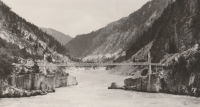
Mackay Bar
Mackay Bar, Idaho, USA - Salmon River
| Bridgemeister ID: | 2380 (added 2007-11-03) |
| Name: | Mackay Bar |
| Location: | Mackay Bar, Idaho, USA |
| Crossing: | Salmon River |
| At or Near Feature: | Frank Church-River of No Return Wilderness |
| Coordinates: | 45.38511 N 115.49917 W |
| Maps: | Acme, GeoHack, Google, OpenStreetMap |
| Use: | Pack and Footbridge |
| Status: | In use |
| Main Cables: | Wire (steel) |
Workman's Bar
Rock Creek, Plumas County, California, USA - North Fork Feather River
| Bridgemeister ID: | 5674 (added 2021-01-31) |
| Name: | Workman's Bar |
| Location: | Rock Creek, Plumas County, California, USA |
| Crossing: | North Fork Feather River |
| Coordinates: | 39.905172 N 121.344949 W |
| Maps: | Acme, GeoHack, Google, OpenStreetMap |
| Use: | Vehicular (one-lane) |
| Status: | Destroyed, 1907 |
| Main Cables: | Wire |
| Suspended Spans: | 1 |
Notes:
- Workman's Bar (named for Robert Workman) was located near the current location of the Pacific Gas and Electric Rock Creek Powerhouse. The coordinates reflect the bar observed at the present-day (2020) powerhouse, but may not be the exact location of the bridge.
External Links: