Lake Pontchartrain Causeway
This is an image set within the Bridgemeister collection.
| Bridge: | Lake Pontchartrain Causeway |
| Location: | New Orleans, Louisiana, USA - Lake Pontchartrain |
| Coordinates: | 30.067694 N 90.145694 W |
| Maps: | Acme, GeoHack, Google, OpenStreetMap |
| Image Set Contributor: | Patrick S. O'Donnell |
| Related Image Lists: | All from Patrick S. O'Donnell All in Louisiana All in USA All Other Bridge Types |
| Credit: | All photos by Patrick S. O'Donnell. Please do not reuse without permission. |
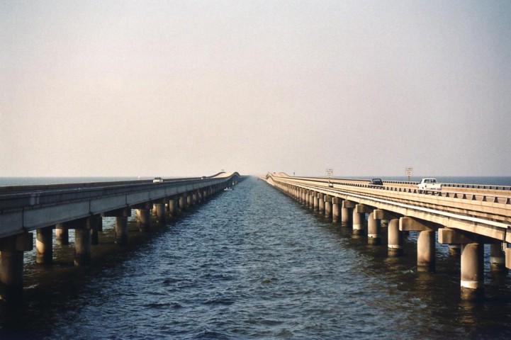
Patrick writes: This was my first bridge visited in Louisiana [in early 2005]. I took the I-10 causeway bridge known as the Pontchartrain Expressway (now very much damaged in the wake of Hurricane Katrina) heading SW into New Orleans just prior to swinging north across the Lake Pontchartrain Causeway. Once reaching landfall on the northern shores I simply turned around and came back across the Lake Pontchartrain Causeway south back into New Orleans. The overall length of the causeway made for a 48 mile round trip! All my pictures are from the return trip. The original causeway was opened in 1956 with the addition opened in 1969. There are 7 crossovers, thus dividing the complex into nearly equal eighths." Patrick's comments accompany the photos.
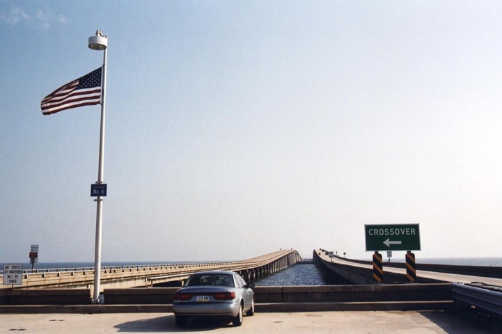
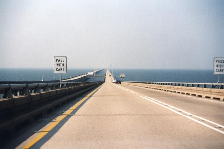
"From the first crossover looking north approximately 3 miles to the shores of Mandeville."
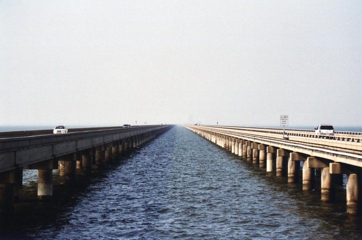
"Looking south from same crossover with still 20 miles of bridge to go."
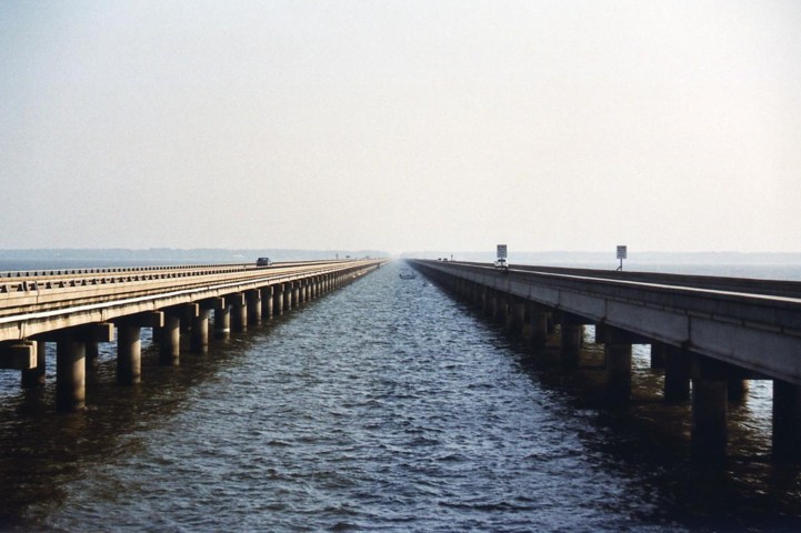
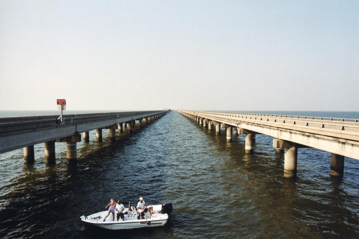
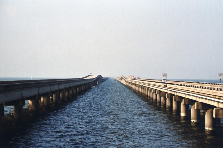
"This series of gradual zooms looks south from the railing at the first crossover not far from where my car is in the previous images. I kind of startled the folks in the fishing boat upon my standing on the curb - they surprised me as well as I wasn't expecting a fishing boat right there."
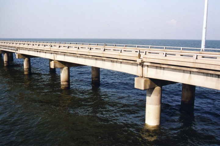
"Close up of the newer 1969 bridge that carries traffic northbound. For this bridge three pilings were used to support the header and had longer spans between piers as compared to.."
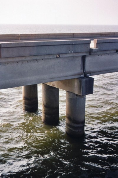
"The original causeway now carrying southbound travel lanes with its shorter spans and two pilings. The ride south on this bridge is much rougher than the ride north due to a few factors as being 13 years older and having the considerably shorter spans. At the posted 65mph speed limit, traveling over the joint at each pier spaced 55 feet apart made the 'thump-thump' at almost at a rate of 2 per second. I'm not sure which was worse - experience that physically on the return trip south, or viewing earlier the bouncing lights of on coming vehicles on the trip north. "
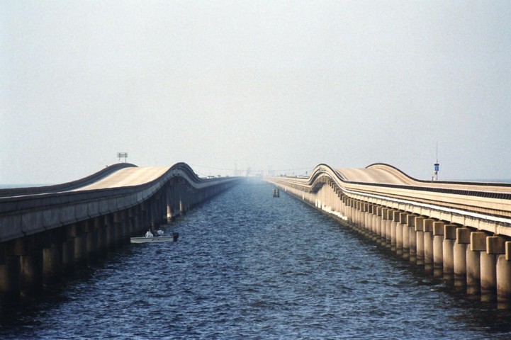
"About 3/4 of the way across the bridge descending a raised section for small craft approaching the sixth crossover."
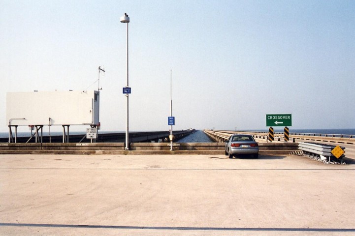
"At the sixth crossover looking south."
"Looking north from the sixth crossover and at the raised section of bridge I just came from."