Suspension Bridges of Tennessee
This is a list of all 19 bridges from the suspension bridge inventory for Tennessee in USA. Wherever you see a Bridgemeister ID number click it to isolate the bridge on its own page.
Related Lists:
1850: (suspension bridge)
Nashville and Edgefield, Tennessee, USA - Cumberland River
| Bridgemeister ID: | 33 (added before 2003) |
| Year Completed: | 1850 |
| Name: | (suspension bridge) |
| Location: | Nashville and Edgefield, Tennessee, USA |
| Crossing: | Cumberland River |
| Principals: | Adolphus Heiman, Mathew Dickinson Field |
| References: | AAJ |
| Use: | Vehicular |
| Status: | Destroyed, 1862 |
| Main Cables: | Wire (iron) |
| Main Span: | 1 x 164 meters (538 feet) |
Notes:
- Collapsed 1855, rebuilt, destroyed 1862 (possibly 1863). Was at site of present-day Woodland Street Bridge.
- Replaced by 1866 (suspension bridge) - Nashville and Edgefield, Tennessee, USA.
External Links:

1866: (suspension bridge)
Nashville and Edgefield, Tennessee, USA - Cumberland River
| Bridgemeister ID: | 1965 (added 2005-11-20) |
| Year Completed: | 1866 |
| Name: | (suspension bridge) |
| Location: | Nashville and Edgefield, Tennessee, USA |
| Crossing: | Cumberland River |
| References: | AAJ |
| Use: | Vehicular |
| Status: | Removed, 1884 |
| Main Cables: | Wire |
Notes:
1918: Swinging
Old Hickory, Nashville and Goodlettsville, Nashville, Tennessee, USA - Cumberland River
| Bridgemeister ID: | 587 (added 2003-01-05) |
| Year Completed: | 1918 |
| Name: | Swinging |
| Location: | Old Hickory, Nashville and Goodlettsville, Nashville, Tennessee, USA |
| Crossing: | Cumberland River |
| At or Near Feature: | Hadley Bend |
| Coordinates: | 36.289002 N 86.685355 W |
| Maps: | Acme, GeoHack, Google, OpenStreetMap |
| Principals: | William G. Grove, American Bridge Co. |
| References: | AAJ, PTS2 |
| Use: | Vehicular (one-lane) |
| Status: | Removed |
| Main Cables: | Wire (steel) |
| Suspended Spans: | 1 |
| Main Span: | 1 x 164.6 meters (540 feet) |
| Deck width: | 8 feet |
Notes:
- Coordinates provided are approximate based on current-day (2021) location of Swinging Bridge Road.
External Links:
- Bridgehunter.com | Old Hickory Suspension Bridge
- DuPont High School Alumni Association - The Swinging Bridge. According to the description in this article provided by Old Hickory Branch Library this large bridge had a 540-foot main span and was used for vehicular traffic. "The suspension bridge... Was diverted from its original destination in South America because of the urgency of the war effort. It was built for pedestrian traffic and used only for that purpose at first... Upon determination that the bridge was capable of handling light traffic, a flagman was stationed at each end of the bridge on a 24-hour-a-day basis and cars began using the one-lane span." Kris Brummett adds: "The 540 foot span had no supports to prevent sideways movement and literally swayed back and forth. The bridge was used until 1929."
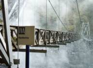
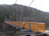
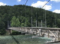
1945: TVA Apalachia
Reliance vicinity, Tennessee, USA - Hiwassee River
| Bridgemeister ID: | 790 (added 2003-03-22) |
| Year Completed: | 1945 |
| Name: | TVA Apalachia |
| Location: | Reliance vicinity, Tennessee, USA |
| Crossing: | Hiwassee River |
| Coordinates: | 35.18269 N 84.43894 W |
| Maps: | Acme, GeoHack, Google, OpenStreetMap |
| Use: | Footbridge |
| Status: | In use (last checked: 2022) |
| Main Cables: | Wire (steel) |
| Suspended Spans: | 1 |
| Main Span: | 1 x 120.4 meters (395 feet) |
Notes:
- Patrick S. O'Donnell notes this footbridge is large, "its main span is 395 feet with 455 feet between the towers, as [one] tower is set back from the end of the deck."
- Rebuilt 1975 and again in 2008.
External Links:
1948: (footbridge)
Chattanooga, Tennessee, USA - South Chickamauga Creek
| Bridgemeister ID: | 248 (added before 2003) |
| Year Completed: | 1948 |
| Name: | (footbridge) |
| Location: | Chattanooga, Tennessee, USA |
| Crossing: | South Chickamauga Creek |
| At or Near Feature: | Elise Chapin Wildlife Sanctuary |
| Coordinates: | 34.99694 N 85.18442 W |
| Maps: | Acme, GeoHack, Google, OpenStreetMap |
| Use: | Footbridge |
| Status: | Destroyed, July 16, 2000 |
Notes:
- Destroyed by falling tree, July 16, 2000.
- Replaced by 2001 (footbridge) - Chattanooga, Tennessee, USA.
1988: (footbridge)
Dayton, Tennessee, USA - Richland Creek
| Bridgemeister ID: | 1263 (added 2004-03-13) |
| Year Completed: | 1988 |
| Name: | (footbridge) |
| Location: | Dayton, Tennessee, USA |
| Crossing: | Richland Creek |
| Coordinates: | 35.49 N 85.013667 W |
| Maps: | Acme, GeoHack, Google, OpenStreetMap |
| Use: | Footbridge |
| Status: | In use (last checked: 2006) |
| Main Cables: | Wire |
| Suspended Spans: | 1 |

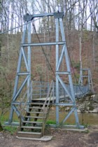
2001: (footbridge)
Chattanooga, Tennessee, USA - South Chickamauga Creek
| Bridgemeister ID: | 2513 (added 2009-12-30) |
| Year Completed: | 2001 |
| Name: | (footbridge) |
| Location: | Chattanooga, Tennessee, USA |
| Crossing: | South Chickamauga Creek |
| At or Near Feature: | Elise Chapin Sanctuary at Audobon Acres |
| Coordinates: | 34.996926 N 85.184675 W |
| Maps: | Acme, GeoHack, Google, OpenStreetMap |
| Principals: | S & R Construction |
| Use: | Footbridge |
| Status: | In use (last checked: 2019) |
| Main Cables: | Wire (steel) |
| Suspended Spans: | 1 |
| Main Span: | 1 x 38.1 meters (125 feet) |
Notes:
(footbridge)
Bluff City, Tennessee, USA - South Fork Holston River
| Bridgemeister ID: | 2341 (added 2007-08-11) |
| Name: | (footbridge) |
| Location: | Bluff City, Tennessee, USA |
| Crossing: | South Fork Holston River |
| Coordinates: | 36.47584 N 82.25487 W |
| Maps: | Acme, GeoHack, Google, OpenStreetMap |
| Use: | Footbridge |
| Status: | In use (last checked: 2008) |
| Main Cables: | Wire (steel) |
(footbridge)
Jamestown vicinity, Tennessee, USA - Thompson Creek
| Bridgemeister ID: | 2627 (added 2018-12-31) |
| Name: | (footbridge) |
| Location: | Jamestown vicinity, Tennessee, USA |
| Crossing: | Thompson Creek |
| At or Near Feature: | Pickett CCC Memorial State Park |
| Coordinates: | 36.55035 N 84.801530 W |
| Maps: | Acme, GeoHack, Google, OpenStreetMap |
| Use: | Footbridge |
| Status: | In use (last checked: 2015) |
| Main Cables: | Wire (steel) |
(footbridge)
Signal Mountain, Tennessee, USA - North Suck Creek
| Bridgemeister ID: | 4955 (added 2020-08-08) |
| Name: | (footbridge) |
| Location: | Signal Mountain, Tennessee, USA |
| Crossing: | North Suck Creek |
| Coordinates: | 35.161600 N 85.391151 W |
| Maps: | Acme, GeoHack, Google, OpenStreetMap |
| Use: | Footbridge |
| Status: | Extant (last checked: 2020) |
| Main Cables: | Wire (steel) |
| Suspended Spans: | 1 |
External Links:
(pipeline bridge)
Burgess Falls, Sparta vicinity, Tennessee, USA - Falling Water River
| Bridgemeister ID: | 2346 (added 2007-08-12) |
| Name: | (pipeline bridge) |
| Location: | Burgess Falls, Sparta vicinity, Tennessee, USA |
| Crossing: | Falling Water River |
| At or Near Feature: | Burgess Falls State Park |
| Use: | Pipeline |
| Status: | Derelict (last checked: 2007) |
| Main Cables: | Wire |
Notes:
- Likely constructed in 1920s as part of the dam and powerhouse project at Burgess Falls. There may have been two of these bridges at this location. The current map for Burgess Falls State Park shows two historical "pipeline bridges." I have only seen images of one derelict suspension bridge.
(pipeline bridge)
Charleston, Tennessee, USA - Hiwassee River
| Bridgemeister ID: | 2036 (added 2006-05-01) |
| Name: | (pipeline bridge) |
| Location: | Charleston, Tennessee, USA |
| Crossing: | Hiwassee River |
| Principals: | John A. Roebling's Sons Co., Pittsburgh Bridge & Iron Co. |
| Use: | Pipeline |
| Main Cables: | Wire (steel) |
Notes:
- Built to connect Blaw-Knox chemical plan to nearby Bowaters Southern Paper Corp. Described in Roebling ad in March 1963 issue of Civil Engineering.
Riverfront
Kingsport, Tennessee, USA - Holston River
| Bridgemeister ID: | 1086 (added 2004-01-01) |
| Name: | Riverfront |
| Also Known As: | Swinging |
| Location: | Kingsport, Tennessee, USA |
| Crossing: | Holston River |
| At or Near Feature: | Riverfront Park, Heritage Park |
| Coordinates: | 36.550017 N 82.586383 W |
| Maps: | Acme, GeoHack, Google, OpenStreetMap |
| Use: | Footbridge |
| Status: | In use (last checked: 2022) |
| Main Cables: | Wire (steel) |
| Suspended Spans: | 1 |
| Main Span: | 1 x 73.2 meters (240 feet) estimated |
Notes:
- 2007, October: Closed due to structural issues.
- 2009-2010: Repaired late 2009 or 2010 and reopened.
- 2021, May: Closed due to "hazardous conditions" pending repairs. Work expected to start in July.
- 2021, July: Bridge remains closed indefinitely. City of Kingsport soliciting more bids for repair work.
- 2022, April: Repairs in progress.
- 2022, June: Repairs completed, bridge reopened.
Annotated Citations:
- Hightower, Cliff. "Swinging bridge under repairs." The Kingsport Times News, 25 Apr. 2022, www.timesnews.net/news/swinging-bridge-under-repairs/article_2f96a368-c4cb-11ec-beff-2f8670dafd5b.html
"Inland [Construction] will replace all of the bridge’s existing wooden joists with new ones, while the existing chain link fencing and tension wire along the sides will be replaced with new, vinyl-coated green fencing."
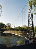
Swinging
Kinzel Springs (Townsend), Tennessee, USA - Little River
| Bridgemeister ID: | 310 (added before 2003) |
| Name: | Swinging |
| Location: | Kinzel Springs (Townsend), Tennessee, USA |
| Crossing: | Little River |
| Use: | Footbridge |
| Main Cables: | Wire |
Notes:
- There are at least two swinging bridge locations at Townsend, Tennessee. There have been at least two bridges at this location known as Kinzel Springs (also Sunshine) at the western end of Townsend. This entry is for the older of the two Kinzel Springs bridges.
Swinging
Kinzel Springs (Townsend), Tennessee, USA - Little River
| Bridgemeister ID: | 1138 (added 2004-01-17) |
| Name: | Swinging |
| Location: | Kinzel Springs (Townsend), Tennessee, USA |
| Crossing: | Little River |
| Coordinates: | 35.68701 N 83.79791 W |
| Maps: | Acme, GeoHack, Google, OpenStreetMap |
| Use: | Footbridge |
| Status: | Closed, 2019 (last checked: 2020) |
| Main Cables: | Wire (steel) |
| Suspended Spans: | 1 |
Notes:
- There are at least two swinging bridge locations at Townsend, Tennessee. There have been at least two bridges at this location known as Kinzel Springs (also Sunshine) at the western end of Townsend. This entry is for the present-day (2020) of the Kinzel Springs bridges.
- 2019: Closed due to decaying timber structural members.
- 2020, June: Repairs started. Expected to be reopened in 2020.
External Links:
- Bridge at Kinzel Springs repairs are underway. June 12, 2020 article in The Daily Times of Blount County (Tennessee).
Swinging
Townsend, Tennessee, USA - Little River
| Bridgemeister ID: | 1139 (added 2004-01-17) |
| Name: | Swinging |
| Location: | Townsend, Tennessee, USA |
| Crossing: | Little River |
| Coordinates: | 35.679553 N 83.750614 W |
| Maps: | Acme, GeoHack, Google, OpenStreetMap |
| Use: | Footbridge |
| Status: | In use (last checked: 2015) |
| Main Cables: | Wire |
| Suspended Spans: | 1 |
Notes:
- This is the droopier footbridge at the eastern end of Townsend, distinct from the bridge at the "Kinzel Springs" location on the western side of Townsend. Typically the droopy footbridges are omitted from the Bridgemeister inventory, but this one is included to avoid confusion with the other Townsend-area bridges.
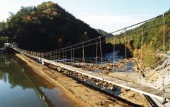
TVA Ocoee 2
Ducktown vicinity, Tennessee, USA - Ocoee River
| Bridgemeister ID: | 791 (added 2003-03-22) |
| Name: | TVA Ocoee 2 |
| Location: | Ducktown vicinity, Tennessee, USA |
| Crossing: | Ocoee River |
| Coordinates: | 35.08295 N 84.4906 W |
| Maps: | Acme, GeoHack, Google, OpenStreetMap |
| Use: | Footbridge |
| Status: | In use |
| Main Cables: | Wire |
| Suspended Spans: | 1 |
Do you have any information or photos for these bridges that you would like to share? Please email david.denenberg@bridgemeister.com.