Suspension Bridges of North Carolina
This is a list of all 43 bridges from the suspension bridge inventory for North Carolina in USA. Wherever you see a Bridgemeister ID number click it to isolate the bridge on its own page.
Related Lists:
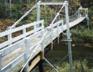
1947: Mitchell County Bridge 223
Red Hill vicinity, North Carolina, USA - Big Rock Creek
| Bridgemeister ID: | 788 (added 2003-03-22) |
| Year Completed: | 1947 |
| Name: | Mitchell County Bridge 223 |
| Location: | Red Hill vicinity, North Carolina, USA |
| Crossing: | Big Rock Creek |
| Coordinates: | 36.04363 N 82.22528 W |
| Maps: | Acme, GeoHack, Google, OpenStreetMap |
| Principals: | North Carolina Bridge Maintenance Unit |
| Use: | Footbridge |
| Status: | In use (last checked: 2018) |
| Main Cables: | Wire (steel) |
| Suspended Spans: | 1 |
| Main Span: | 1 x 28.2 meters (92.5 feet) |
Notes:
- From the NCDOT page about this bridge: "According to state records, the western deadman was replaced in 2002 along with several hangers. The anchor cable at the deadman was replaced in 1974, but otherwise records do not identify any major repairs to or rebuilding of the structure."
External Links:
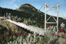
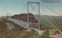
1952: Mile High Swinging
Grandfather Mountain, Linville, North Carolina, USA
| Bridgemeister ID: | 341 (added before 2003) |
| Year Completed: | 1952 |
| Name: | Mile High Swinging |
| Location: | Grandfather Mountain, Linville, North Carolina, USA |
| Coordinates: | 36.095054 N 81.832238 W |
| Maps: | Acme, GeoHack, Google, OpenStreetMap |
| Principals: | Charles Hartman, Jr. |
| References: | PQU, WSJ20060128 |
| Use: | Footbridge |
| Status: | In use (last checked: 2022) |
| Main Cables: | Wire (steel) |
| Suspended Spans: | 1 |
| Main Span: | 1 x 69.5 meters (228 feet) |
Notes:
- Major refurbishing, 1999, but soon after was wrecked by winds. WSJ20060128: "...winds blew it off its moorings. It might have been blown down the mountain if it hadn't wedged against the steel-frame supports." Reopened April 2000 with 21 new stabilizer cables on each side. Survived 200+ mph wind gust, January 2006.
External Links:
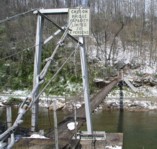
1961: Lunday
Lunday and Kona, North Carolina, USA - North Toe River
| Bridgemeister ID: | 2273 (added 2007-04-21) |
| Year Completed: | 1961 |
| Name: | Lunday |
| Also Known As: | Mitchell County Bridge 225 |
| Location: | Lunday and Kona, North Carolina, USA |
| Crossing: | North Toe River |
| Coordinates: | 35.95493 N 82.19544 W |
| Maps: | Acme, GeoHack, Google, OpenStreetMap |
| Principals: | North Carolina Bridge Maintenance Unit |
| Use: | Footbridge |
| Status: | In use (last checked: 2018) |
| Main Cables: | Wire (steel) |
| Suspended Spans: | 1 |
| Main Span: | 1 x 58.5 meters (192 feet) estimated |
Notes:
- Deck and floorbeams replaced, 1988.
External Links:
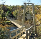
1964: (footbridge)
Wilmot vicinity and Dillsboro vicinity, North Carolina, USA - Tuckaseigee River
| Bridgemeister ID: | 218 (added before 2003) |
| Year Completed: | 1964 |
| Name: | (footbridge) |
| Location: | Wilmot vicinity and Dillsboro vicinity, North Carolina, USA |
| Crossing: | Tuckaseigee River |
| Coordinates: | 35.40421 N 83.29348 W |
| Maps: | Acme, GeoHack, Google, OpenStreetMap |
| Principals: | Roanoke Bridge Co. |
| Use: | Footbridge |
| Status: | In use (last checked: 2002) |
| Main Cables: | Wire (steel) |
| Suspended Spans: | 2 |
| Main Spans: | 1 x 42.4 meters (139 feet), 1 x 41.8 meters (137 feet) |
Notes:
- A 4/4/2002 article in The Sylva Herald And Ruralite ("Repairing Last Swinging Bridge") notes this bridge was completed 1964, but Patrick S. O'Donnell sent me a photo of a 1906 Roanoke Bridge Co. builder's plate attached to one of the towers.
2013: Neuse River Greenway
Raleigh, North Carolina, USA - Neuse River
| Bridgemeister ID: | 2691 (added 2019-05-27) |
| Year Completed: | 2013 |
| Name: | Neuse River Greenway |
| Location: | Raleigh, North Carolina, USA |
| Crossing: | Neuse River |
| At or Near Feature: | Neuse River Greenway Trail |
| Coordinates: | 35.817608 N 78.539325 W |
| Maps: | Acme, GeoHack, Google, OpenStreetMap |
| Use: | Footbridge |
| Status: | In use (last checked: 2019) |
| Main Cables: | Wire (steel) |
| Suspended Spans: | 1 |
Notes:
- Built as part of same project as 2013 Neuse River Greenway - Raleigh, North Carolina, USA.
2013: Neuse River Greenway
Raleigh, North Carolina, USA - Neuse River
| Bridgemeister ID: | 2692 (added 2019-05-27) |
| Year Completed: | 2013 |
| Name: | Neuse River Greenway |
| Location: | Raleigh, North Carolina, USA |
| Crossing: | Neuse River |
| At or Near Feature: | Neuse River Greenway Trail |
| Coordinates: | 35.884492 N 78.528419 W |
| Maps: | Acme, GeoHack, Google, OpenStreetMap |
| Use: | Footbridge |
| Status: | In use (last checked: 2019) |
| Main Cables: | Wire (steel) |
| Suspended Spans: | 1 |
Notes:
- Built as part of same project as 2013 Neuse River Greenway - Raleigh, North Carolina, USA.
2016: (footbridge)
Shelby, North Carolina, USA - First Broad River
| Bridgemeister ID: | 5582 (added 2020-12-21) |
| Year Completed: | 2016 |
| Name: | (footbridge) |
| Location: | Shelby, North Carolina, USA |
| Crossing: | First Broad River |
| At or Near Feature: | First Broad River Trail |
| Coordinates: | 35.302521 N 81.565729 W |
| Maps: | Acme, GeoHack, Google, OpenStreetMap |
| Use: | Footbridge |
| Status: | Destroyed, February, 2020 |
| Main Cables: | Wire (steel) |
| Main Span: | 1 |
Notes:
- 2020, February: Destroyed by flood.
- 2020, July: Grant funds received for replacement.
2016: Cub Creek
Wilkesboro, North Carolina, USA - Cub Creek
| Bridgemeister ID: | 2918 (added 2019-09-15) |
| Year Completed: | 2016 |
| Name: | Cub Creek |
| Location: | Wilkesboro, North Carolina, USA |
| Crossing: | Cub Creek |
| Coordinates: | 36.140573 N 81.153038 W |
| Maps: | Acme, GeoHack, Google, OpenStreetMap |
| Use: | Footbridge |
| Status: | In use (last checked: 2019) |
| Main Cables: | Wire (steel) |
| Suspended Spans: | 1 |
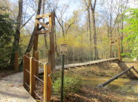
(footbridge)
Altapass vicinity, North Carolina, USA - North Toe River
| Bridgemeister ID: | 2271 (added 2007-04-21) |
| Name: | (footbridge) |
| Location: | Altapass vicinity, North Carolina, USA |
| Crossing: | North Toe River |
| Coordinates: | 35.90085 N 82.03152 W |
| Maps: | Acme, GeoHack, Google, OpenStreetMap |
| Use: | Footbridge |
| Status: | In use (last checked: 2007) |
| Main Cables: | Wire |
| Suspended Spans: | 1 |
| Main Span: | 1 x 39.6 meters (130 feet) estimated |
External Links:
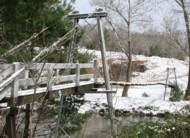
(footbridge)
Bryson City, North Carolina, USA - Nantahalah River
| Bridgemeister ID: | 1506 (added 2004-10-09) |
| Name: | (footbridge) |
| Location: | Bryson City, North Carolina, USA |
| Crossing: | Nantahalah River |
| Coordinates: | 35.43123 N 83.44296 W |
| Maps: | Acme, GeoHack, Google, OpenStreetMap |
| Use: | Footbridge |
| Status: | In use (last checked: 2004) |
| Main Cables: | Wire |
Notes:
- Leads to island across a very narrow section of the river.
(footbridge)
Burnsville vicinity, North Carolina, USA - Cane River
| Bridgemeister ID: | 4381 (added 2020-04-12) |
| Name: | (footbridge) |
| Location: | Burnsville vicinity, North Carolina, USA |
| Crossing: | Cane River |
| Use: | Footbridge |
| Status: | In use (last checked: 2003) |
| Main Cables: | Wire |
| Suspended Spans: | 1 |
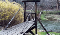
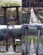
(footbridge)
Burnsville vicinity, North Carolina, USA - Cane River
| Bridgemeister ID: | 4382 (added 2020-04-12) |
| Name: | (footbridge) |
| Location: | Burnsville vicinity, North Carolina, USA |
| Crossing: | Cane River |
| Use: | Footbridge |
| Status: | In use (last checked: 2003) |
| Main Cables: | Wire |
| Suspended Spans: | 1 |
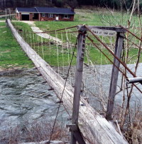

(footbridge)
Burnsville vicinity, North Carolina, USA - Cane River
| Bridgemeister ID: | 4383 (added 2020-04-12) |
| Name: | (footbridge) |
| Location: | Burnsville vicinity, North Carolina, USA |
| Crossing: | Cane River |
| Use: | Footbridge |
| Status: | In use (last checked: 2003) |
| Main Cables: | Wire |
| Main Span: | 1 |
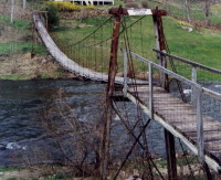

(footbridge)
Burnsville vicinity, North Carolina, USA - Cane River
| Bridgemeister ID: | 4384 (added 2020-04-12) |
| Name: | (footbridge) |
| Location: | Burnsville vicinity, North Carolina, USA |
| Crossing: | Cane River |
| Use: | Footbridge |
| Status: | In use (last checked: 2003) |
| Main Cables: | Wire |
| Main Span: | 1 |
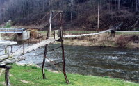

(footbridge)
Burnsville vicinity, North Carolina, USA - Cane River
| Bridgemeister ID: | 4385 (added 2020-04-12) |
| Name: | (footbridge) |
| Location: | Burnsville vicinity, North Carolina, USA |
| Crossing: | Cane River |
| Use: | Footbridge |
| Status: | In use (last checked: 2003) |
| Main Cables: | Wire |
| Main Span: | 1 |
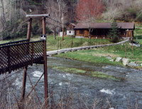

(footbridge)
Burnsville vicinity, North Carolina, USA - Cane River
| Bridgemeister ID: | 4386 (added 2020-04-12) |
| Name: | (footbridge) |
| Location: | Burnsville vicinity, North Carolina, USA |
| Crossing: | Cane River |
| Use: | Footbridge |
| Status: | In use (last checked: 2003) |
| Main Cables: | Wire |
| Suspended Spans: | 1 |
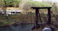

(footbridge)
Burnsville vicinity, North Carolina, USA - Cane River
| Bridgemeister ID: | 4387 (added 2020-04-12) |
| Name: | (footbridge) |
| Location: | Burnsville vicinity, North Carolina, USA |
| Crossing: | Cane River |
| Use: | Footbridge |
| Status: | In use (last checked: 2003) |
| Main Cables: | Wire |
| Suspended Spans: | 1 |
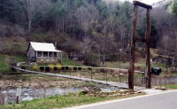

(footbridge)
Burnsville vicinity, North Carolina, USA - Cane River
| Bridgemeister ID: | 4388 (added 2020-04-12) |
| Name: | (footbridge) |
| Location: | Burnsville vicinity, North Carolina, USA |
| Crossing: | Cane River |
| Use: | Footbridge |
| Status: | In use (last checked: 2003) |
| Main Cables: | Wire |
| Suspended Spans: | 1 |
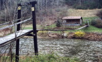

(footbridge)
Celo vicinity, North Carolina, USA - South Toe River
| Bridgemeister ID: | 2274 (added 2007-04-21) |
| Name: | (footbridge) |
| Location: | Celo vicinity, North Carolina, USA |
| Crossing: | South Toe River |
| Coordinates: | 35.86893 N 82.17425 W |
| Maps: | Acme, GeoHack, Google, OpenStreetMap |
| Use: | Footbridge |
| Status: | In use (last checked: 2007) |
| Main Cables: | Wire (steel) |
| Suspended Spans: | 1 |
| Main Span: | 1 x 36.6 meters (120 feet) estimated |
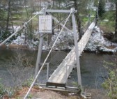
(footbridge)
Charlotte, North Carolina, USA - Little Sugar Creek
| Bridgemeister ID: | 772 (added 2003-03-14) |
| Name: | (footbridge) |
| Location: | Charlotte, North Carolina, USA |
| Crossing: | Little Sugar Creek |
| At or Near Feature: | Freedom Park |
| Coordinates: | 35.188381 N 80.844521 W |
| Maps: | Acme, GeoHack, Google, OpenStreetMap |
| Use: | Footbridge |
| Status: | In use (last checked: 2018) |
| Main Cables: | Wire (steel) |
| Suspended Spans: | 1 |
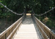
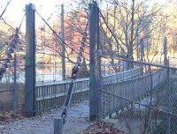
(footbridge)
Cherokee vicinity, North Carolina, USA - Oconaluftee River
| Bridgemeister ID: | 2604 (added 2014-04-14) |
| Name: | (footbridge) |
| Location: | Cherokee vicinity, North Carolina, USA |
| Crossing: | Oconaluftee River |
| At or Near Feature: | Chief Saunooke Trading Post |
| Coordinates: | 35.499332 N 83.304113 W |
| Maps: | Acme, GeoHack, Google, OpenStreetMap |
| Use: | Footbridge |
| Status: | Closed (last checked: 2016) |
| Main Cables: | Wire |
| Suspended Spans: | 2 |
| Main Span: | 1 x 36.6 meters (120 feet) estimated |
| Side Span: | 1 x 12.2 meters (40 feet) estimated |
(footbridge)
Cherokee, North Carolina, USA - Oconaluftee River
| Bridgemeister ID: | 1953 (added 2005-11-04) |
| Name: | (footbridge) |
| Location: | Cherokee, North Carolina, USA |
| Crossing: | Oconaluftee River |
| Coordinates: | 35.481217 N 83.319 W |
| Maps: | Acme, GeoHack, Google, OpenStreetMap |
| Use: | Footbridge |
| Status: | In use |
| Main Cables: | Wire |
| Suspended Spans: | 1 |
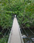
(footbridge)
Durham, North Carolina, USA - Eno River
| Bridgemeister ID: | 806 (added 2003-03-30) |
| Name: | (footbridge) |
| Location: | Durham, North Carolina, USA |
| Crossing: | Eno River |
| At or Near Feature: | Eno River State Park |
| Coordinates: | 36.075453 N 79.007745 W |
| Maps: | Acme, GeoHack, Google, OpenStreetMap |
| Use: | Footbridge |
| Status: | In use (last checked: 2021) |
| Main Cables: | Wire (steel) |
| Main Span: | 1 x 38 meters (124.7 feet) estimated |
(footbridge)
Halls Ford, North Carolina, USA - Little Tennessee River
| Bridgemeister ID: | 845 (added 2003-06-28) |
| Name: | (footbridge) |
| Location: | Halls Ford, North Carolina, USA |
| Crossing: | Little Tennessee River |
| Coordinates: | 35.35505 N 83.50540 W |
| Maps: | Acme, GeoHack, Google, OpenStreetMap |
| Use: | Footbridge |
| Status: | In use |
| Main Cables: | Wire |
| Suspended Spans: | 4 |
| Main Spans: | 1 x 50.3 meters (165 feet), 1 x 48.8 meters (160 feet) |
| Side Spans: | 2 |
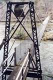
(footbridge)
Hamrick vicinity, North Carolina, USA - South Toe River
| Bridgemeister ID: | 2275 (added 2007-04-21) |
| Name: | (footbridge) |
| Location: | Hamrick vicinity, North Carolina, USA |
| Crossing: | South Toe River |
| Coordinates: | 35.78000 N 82.20553 W |
| Maps: | Acme, GeoHack, Google, OpenStreetMap |
| Use: | Footbridge |
| Status: | In use (last checked: 2007) |
| Main Cables: | Wire (steel) |
| Suspended Spans: | 1 |
| Main Span: | 1 x 43 meters (141 feet) estimated |
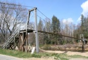
(footbridge)
Hamrick vicinity, North Carolina, USA - South Toe River
| Bridgemeister ID: | 2276 (added 2007-04-21) |
| Name: | (footbridge) |
| Location: | Hamrick vicinity, North Carolina, USA |
| Crossing: | South Toe River |
| Coordinates: | 35.81276 N 82.19618 W |
| Maps: | Acme, GeoHack, Google, OpenStreetMap |
| Use: | Footbridge |
| Status: | In use (last checked: 2007) |
| Main Cables: | Wire (steel) |
| Suspended Spans: | 1 |
| Main Span: | 1 x 29.6 meters (97 feet) |
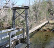
(footbridge)
Higgins, North Carolina, USA - Cane River
| Bridgemeister ID: | 857 (added 2003-08-08) |
| Name: | (footbridge) |
| Location: | Higgins, North Carolina, USA |
| Crossing: | Cane River |
| Coordinates: | 35.96742 N 82.38952 W |
| Maps: | Acme, GeoHack, Google, OpenStreetMap |
| Use: | Footbridge |
| Status: | In use |
| Main Cables: | Wire |
| Suspended Spans: | 1 |
| Main Span: | 1 x 41.1 meters (135 feet) estimated |
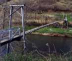
(footbridge)
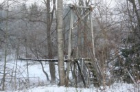
Ingalls, North Carolina, USA - North Toe River
| Bridgemeister ID: | 2269 (added 2007-04-21) |
| Name: | (footbridge) |
| Location: | Ingalls, North Carolina, USA |
| Crossing: | North Toe River |
| Coordinates: | 35.97301 N 82.01494 W |
| Maps: | Acme, GeoHack, Google, OpenStreetMap |
| Use: | Footbridge |
| Status: | Derelict (last checked: 2007) |
| Main Cables: | Wire |
| Suspended Spans: | 1 |
Notes:
- Patrick S. O'Donnell provided a rough main span estimate of 100 feet.
(footbridge)
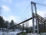
Kalmia, North Carolina, USA - North Toe River
| Bridgemeister ID: | 2270 (added 2007-04-21) |
| Name: | (footbridge) |
| Location: | Kalmia, North Carolina, USA |
| Crossing: | North Toe River |
| Coordinates: | 35.91802 N 82.00521 W |
| Maps: | Acme, GeoHack, Google, OpenStreetMap |
| Use: | Footbridge |
| Status: | In use (last checked: 2007) |
| Main Cables: | Wire (steel) |
| Suspended Spans: | 1 |
| Main Span: | 1 x 37.5 meters (123 feet) |
(footbridge)
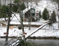
Loafers Glory vicinity, North Carolina, USA - North Toe River
| Bridgemeister ID: | 2272 (added 2007-04-21) |
| Name: | (footbridge) |
| Location: | Loafers Glory vicinity, North Carolina, USA |
| Crossing: | North Toe River |
| Coordinates: | 35.98999 N 82.19151 W |
| Maps: | Acme, GeoHack, Google, OpenStreetMap |
| Use: | Footbridge |
| Status: | In use (last checked: 2007) |
| Main Cables: | Wire (steel) |
| Suspended Spans: | 1 |
| Main Span: | 1 x 58.5 meters (192 feet) estimated |
(footbridge)
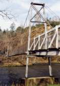
Needmore, North Carolina, USA - Little Tennessee River
| Bridgemeister ID: | 846 (added 2003-06-28) |
| Name: | (footbridge) |
| Location: | Needmore, North Carolina, USA |
| Crossing: | Little Tennessee River |
| Coordinates: | 35.32544 N 83.52328 W |
| Maps: | Acme, GeoHack, Google, OpenStreetMap |
| Use: | Footbridge |
| Status: | In use (last checked: 2004) |
| Main Cables: | Wire |
| Suspended Spans: | 2 |
| Main Spans: | 1 x 42.7 meters (140 feet), 1 x 41.1 meters (135 feet) |
(footbridge)
Oak Grove vicinity, North Carolina, USA - Little Tennessee River
| Bridgemeister ID: | 832 (added 2003-06-01) |
| Name: | (footbridge) |
| Location: | Oak Grove vicinity, North Carolina, USA |
| Crossing: | Little Tennessee River |
| Coordinates: | 35.27858 N 83.44881 W |
| Maps: | Acme, GeoHack, Google, OpenStreetMap |
| Use: | Footbridge |
| Status: | Closed |
| Main Cables: | Wire |
| Suspended Spans: | 1 |
| Main Span: | 1 x 52.7 meters (173 feet) estimated |
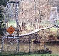
(footbridge)
Red Hill vicinity, North Carolina, USA - North Toe River
| Bridgemeister ID: | 789 (added 2003-03-22) |
| Name: | (footbridge) |
| Location: | Red Hill vicinity, North Carolina, USA |
| Crossing: | North Toe River |
| Coordinates: | 36.00779 N 82.24653 W |
| Maps: | Acme, GeoHack, Google, OpenStreetMap |
| Use: | Footbridge |
| Status: | In use (last checked: 2003) |
| Main Cables: | Wire |
| Suspended Spans: | 1 |
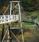
(footbridge)
Richfield, North Carolina, USA - Curl Tail Creek Pond
| Bridgemeister ID: | 1886 (added 2005-09-24) |
| Name: | (footbridge) |
| Location: | Richfield, North Carolina, USA |
| Crossing: | Curl Tail Creek Pond |
| At or Near Feature: | Richfield Park |
| Coordinates: | 35.478383 N 80.2626 W |
| Maps: | Acme, GeoHack, Google, OpenStreetMap |
| Use: | Footbridge |
| Status: | In use (last checked: 2005) |
| Main Cables: | Wire |
| Suspended Spans: | 2 |
| Main Spans: | 2 |
(footbridge)
Robbinsville vicinity, North Carolina, USA - Cheoah River
| Bridgemeister ID: | 7676 (added 2023-06-17) |
| Name: | (footbridge) |
| Location: | Robbinsville vicinity, North Carolina, USA |
| Crossing: | Cheoah River |
| Coordinates: | 35.397926 N 83.874163 W |
| Maps: | Acme, GeoHack, Google, OpenStreetMap |
| Use: | Footbridge |
| Status: | In use (last checked: 2021) |
| Main Cables: | Wire (steel) |
| Suspended Spans: | 1 |
(footbridge)
Waxhaw, North Carolina, USA - Twelvemile Creek
| Bridgemeister ID: | 2983 (added 2019-10-12) |
| Name: | (footbridge) |
| Location: | Waxhaw, North Carolina, USA |
| Crossing: | Twelvemile Creek |
| Coordinates: | 34.935784 N 80.782029 W |
| Maps: | Acme, GeoHack, Google, OpenStreetMap |
| Use: | Footbridge |
| Status: | In use (last checked: 2019) |
| Main Cables: | Wire (steel) |
(footbridge)
Wesser vicinity, North Carolina, USA - Nantahala River
| Bridgemeister ID: | 792 (added 2003-03-22) |
| Name: | (footbridge) |
| Location: | Wesser vicinity, North Carolina, USA |
| Crossing: | Nantahala River |
| Coordinates: | 35.33163 N 83.60677 W |
| Maps: | Acme, GeoHack, Google, OpenStreetMap |
| Use: | Footbridge |
| Status: | In use |
| Main Cables: | Wire |
| Suspended Spans: | 1 |
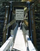
(footbridge)
Wests Mill vicinity, North Carolina, USA - Little Tennessee River
| Bridgemeister ID: | 810 (added 2003-05-29) |
| Name: | (footbridge) |
| Location: | Wests Mill vicinity, North Carolina, USA |
| Crossing: | Little Tennessee River |
| Coordinates: | 35.26383 N 83.41654 W |
| Maps: | Acme, GeoHack, Google, OpenStreetMap |
| Use: | Footbridge |
| Status: | In use |
| Main Cables: | Wire |
| Suspended Spans: | 1 |
| Main Span: | 1 x 48.8 meters (160 feet) estimated |

(footbridge)
Wing, North Carolina, USA - North Toe River
| Bridgemeister ID: | 856 (added 2003-08-07) |
| Name: | (footbridge) |
| Location: | Wing, North Carolina, USA |
| Crossing: | North Toe River |
| Coordinates: | 35.93782 N 82.14224 W |
| Maps: | Acme, GeoHack, Google, OpenStreetMap |
| Use: | Footbridge |
| Status: | Extant |
| Main Cables: | Wire |
| Suspended Spans: | 1 |
| Main Span: | 1 x 43.9 meters (144 feet) estimated |

Efirds Lake
Waxhaw, North Carolina, USA
| Bridgemeister ID: | 6782 (added 2021-10-29) |
| Name: | Efirds Lake |
| Location: | Waxhaw, North Carolina, USA |
| Coordinates: | 34.994126 N 80.743614 W |
| Maps: | Acme, GeoHack, Google, OpenStreetMap |
| Use: | Footbridge |
| Status: | In use (last checked: 2018) |
| Main Cables: | Wire |
| Suspended Spans: | 1 |
External Links:
Swinging
Edgemont, North Carolina, USA - Wilson's Creek
| Bridgemeister ID: | 876 (added 2003-08-31) |
| Name: | Swinging |
| Location: | Edgemont, North Carolina, USA |
| Crossing: | Wilson's Creek |
| Coordinates: | 36.004147 N 81.773188 W |
| Maps: | Acme, GeoHack, Google, OpenStreetMap |
| Use: | Footbridge |
| Status: | Destroyed |
| Main Cables: | Wire |
| Suspended Spans: | 1 |
Notes:
- Destroyed by flood before 2003. Supposedly was located across the street from Coffey's General Store which is still in existence as of 2020. Coordinates indicate approximate location based on that description.
Toxaway Creek
Cane Break vicinity, North Carolina, USA - Toxaway Creek
| Bridgemeister ID: | 2296 (added 2007-04-26) |
| Name: | Toxaway Creek |
| Location: | Cane Break vicinity, North Carolina, USA |
| Crossing: | Toxaway Creek |
| Use: | Footbridge |
| Status: | In use (last checked: 2009) |
| Main Cables: | Wire |
Notes:
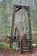
Toxaway River
Cane Break vicinity, North Carolina, USA - Toxaway River
| Bridgemeister ID: | 287 (added before 2003) |
| Name: | Toxaway River |
| Location: | Cane Break vicinity, North Carolina, USA |
| Crossing: | Toxaway River |
| Coordinates: | 35.07168 N 82.88685 W |
| Maps: | Acme, GeoHack, Google, OpenStreetMap |
| Principals: | Duke Power |
| Use: | Footbridge |
| Status: | In use (last checked: 2019) |
| Main Cables: | Wire (steel) |
| Suspended Spans: | 3 |
| Main Span: | 1 x 50.6 meters (166 feet) estimated |
| Side Spans: | 1 x 7.3 meters (24 feet) estimated, 1 x 10.1 meters (33 feet) estimated |
Notes:
- Refurbished, 2019.
- Near Toxaway Creek - Cane Break vicinity, North Carolina, USA.
Do you have any information or photos for these bridges that you would like to share? Please email david.denenberg@bridgemeister.com.