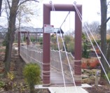
Suspension Bridges of Kentucky
This is a list of all 98 bridges from the suspension bridge inventory for Kentucky in USA. Wherever you see a Bridgemeister ID number click it to isolate the bridge on its own page.
Related Lists:
1810: (suspension bridge)
Frankfort, Kentucky, USA - Kentucky River
1852: (suspension bridge)
Frankfort, Kentucky, USA - Kentucky River
| Bridgemeister ID: | 1714 (added 2005-04-03) |
| Year Completed: | 1852 |
| Name: | (suspension bridge) |
| Location: | Frankfort, Kentucky, USA |
| Crossing: | Kentucky River |
| Coordinates: | 38.201998 N 84.881934 W |
| Maps: | Acme, GeoHack, Google, OpenStreetMap |
| Principals: | Mathew Dickinson Field |
| References: | AAJ, ENG18570605, HBE, HOF |
| Use: | Rail |
| Status: | Removed |
| Main Cables: | Wire (iron) |
| Suspended Spans: | 2 |
| Main Spans: | 1 x 61 meters (200 feet) estimated, 1 x 91.4 meters (300 feet) estimated |
Notes:
- An early attempt at a railroad suspension bridge, it was significantly reconstructed (because of excessive vibrations and increasing loads) by Julius W. Adams in 1857 to have three spans of 120, 163, and 163 feet. It is unclear whether the new structure was also a suspension bridge.
- HOF describes the location as "between the foot of Broadway and the neck of land near the mouth of Benson Creek." The coordinates provided here are for the later rail crossing at that general location, likely at or very close to the site of the suspension bridge.
1853: Falmouth
Falmouth, Kentucky, USA - Licking River
| Bridgemeister ID: | 42 (added before 2003) |
| Year Completed: | 1853 |
| Name: | Falmouth |
| Location: | Falmouth, Kentucky, USA |
| Crossing: | Licking River |
| Coordinates: | 38.678056 N 84.328222 W |
| Maps: | Acme, GeoHack, Google, OpenStreetMap |
| Principals: | D. Griffith Smith |
| References: | AAJ, EOV |
| Use: | Vehicular |
| Status: | Collapsed, 1868 |
| Main Cables: | Wire (iron) |
| Main Span: | 1 x 98.5 meters (323 feet) |
Notes:
- 1854: A brief article in March 22, 1854 Louisville Daily Courier states the bridge was destroyed ("rendering the whole structure useless… it cannot even be repaired") in the early 1854 flood that destroyed other Licking River bridges. However, other sources indicate the Falmouth bridge survived the flood. Unclear if it was completely destroyed and rebuilt or just damaged and repaired.
- Coordinates provided here indicate the likely location of the bridge over the main branch of the Licking River.
External Links:
- New Licking Bridge Stands On The Foundation of Its Predecessors - Rootsweb.com. Several anecdotes and snippets of history about the bridge. Indicates the bridge survived the January 1854 Licking River flood and survived until 1868.
1854: Licking River I
Covington and Newport, Kentucky, USA - Licking River
| Bridgemeister ID: | 47 (added before 2003) |
| Year Completed: | 1854 |
| Name: | Licking River I |
| Location: | Covington and Newport, Kentucky, USA |
| Crossing: | Licking River |
| Principals: | John Gray, George C. Tarvin |
| References: | BOB, BPL, EOV |
| Status: | Collapsed, 1854 |
Notes:
- BPL: Collapsed under weight of cattle 1853. BOB: Indicates year of completion and collapse as 1854. EOV: Appears more authoritative on the matter, "Although the bridge was not quite finished, Tarvin and the mayor of Covington rode the first vehicle across it on December 28, 1853. Less than two weeks later... the bridge collapsed."
- The January 18, 1854 edition of The New York Times has a small article with a January 16, 1854 byline reporting the collapse of the bridge: "The... bridge... gave way this evening, while two men and eighteen cattle were crossing it... The keys which held the wire cable to the anchors gave way."
- Replaced by 1854 Licking River II - Covington and Newport, Kentucky, USA.
1854: Licking River II
Covington and Newport, Kentucky, USA - Licking River
| Bridgemeister ID: | 48 (added before 2003) |
| Year Completed: | 1854 |
| Name: | Licking River II |
| Location: | Covington and Newport, Kentucky, USA |
| Crossing: | Licking River |
| Principals: | John Gray |
| References: | EOV |
| Status: | Removed |
Notes:
- Replaced 1854 Licking River I - Covington and Newport, Kentucky, USA which collapsed in January of 1854.
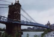
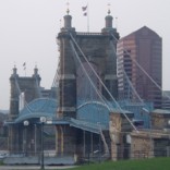
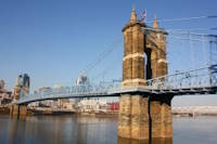
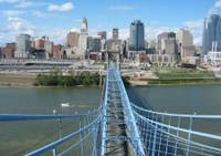
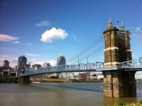
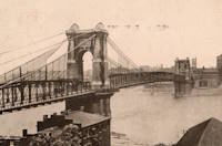
1867: John A. Roebling
Cincinnati, Ohio and Covington, Kentucky, USA - Ohio River
| Bridgemeister ID: | 65 (added before 2003) |
| Year Completed: | 1867 |
| Name: | John A. Roebling |
| Also Known As: | Cincinnati, Cincinnati and Covington |
| Location: | Cincinnati, Ohio and Covington, Kentucky, USA |
| Crossing: | Ohio River |
| Coordinates: | 39.09167 N 84.50833 W |
| Maps: | Acme, GeoHack, Google, OpenStreetMap |
| Principals: | John A. Roebling |
| References: | BAAW, BC3, BOB, BPL, COB, EOV, HBE, LAB, LACE, ONF, PTS2, SJR, TOB |
| Use: | Vehicular (two-lane), with walkway |
| Status: | Closed, February, 2021 (last checked: 2021) |
| Main Cables: | Wire (iron) |
| Suspended Spans: | 3 |
| Main Span: | 1 x 322.2 meters (1,057 feet) |
| Side Spans: | 2 |
Notes:
- 1892: Cable ends restored.
- 1899: Steel cables added to assist original cables.
- 2021, February: Closed to all vehicular traffic for a nine-month restoration project.
- Became longest suspension bridge by eclipsing 1849 Wheeling (Wheeling and Belmont) - Wheeling, West Virginia, USA.
- Eclipsed by new longest suspension bridge 1869 Clifton (Niagara-Clifton, Falls View, First Falls View) - Niagara Falls, New York, USA and Niagara Falls, Ontario, Canada.
External Links:
1868: Blue Lick Springs
Kentucky, USA - Licking River
| Bridgemeister ID: | 2659 (added 2019-03-09) |
| Year Completed: | 1868 |
| Name: | Blue Lick Springs |
| Location: | Kentucky, USA |
| Crossing: | Licking River |
| Coordinates: | 38.422314 N 83.999076 W |
| Maps: | Acme, GeoHack, Google, OpenStreetMap |
| Use: | Vehicular (one-lane) |
| Status: | Removed |
| Main Cables: | Wire |
| Suspended Spans: | 1 |
Notes:
- 1897: Replaced by two-span truss bridge that is still (as of 2019) at the same location. The truss bridge was built between the main suspension bridge cables and, apparently, the suspension bridge remained standing for several years.
1907: Vulcan
Vulcan, West Virginia and Pike County, Kentucky, USA - Tug Fork Big Sandy River
| Bridgemeister ID: | 2141 (added 2006-11-02) |
| Year Completed: | 1907 |
| Name: | Vulcan |
| Location: | Vulcan, West Virginia and Pike County, Kentucky, USA |
| Crossing: | Tug Fork Big Sandy River |
| References: | AAJ |
| Use: | Footbridge |
| Status: | Removed |
| Main Cables: | Wire |
| Main Span: | 1 x 121.9 meters (400 feet) |
Notes:
- On Page 13 of the December 27, 1967 edition of West Virginia's The Charleston Gazette newspaper, there is a photograph of this footbridge with a Jeep driving across. The caption reads: "Pedestrian bridge at Vulcan... is used by vehicles because it provides a route over the Tug River to Kentucky. A citizen's group has complained that the bridge is not strong enough to support cars." The photograph accompanies an article "Road Reform Call Urged" that says the bridge is "regularly used by Jeeps and small cars." Note the date of the article, December 27, 1967 is 12 days after the Silver Bridge disaster at Point Pleasant, West Virginia.
- Near (footbridge) - Vulcan, West Virginia and Pike County, Kentucky, USA. Although similar in appearance, these appear to have been different bridges.
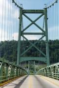
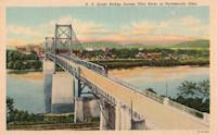
1927: General U.S. Grant
Portsmouth, Ohio and Fullerton, Kentucky, USA - Ohio River
| Bridgemeister ID: | 151 (added before 2003) |
| Year Completed: | 1927 |
| Name: | General U.S. Grant |
| Location: | Portsmouth, Ohio and Fullerton, Kentucky, USA |
| Crossing: | Ohio River |
| Coordinates: | 38.725 N 82.99833 W |
| Maps: | Acme, GeoHack, Google, OpenStreetMap |
| Principals: | Robinson and Steinman, J.E. Greiner, Dravo Co. |
| References: | AAJ, PTS2, SSS |
| Use: | Vehicular (two-lane, heavy vehicles) |
| Status: | Demolished, July 2001 |
| Main Cables: | Wire (steel) |
| Suspended Spans: | 3 |
| Main Span: | 1 x 213.4 meters (700 feet) |
| Side Spans: | 2 x 106.7 meters (350 feet) |
| Deck width: | 28.5 feet |
Notes:
- AAJ: "Recabled" in 1939.
External Links:
1927: White Star
Dayhoit, Kentucky, USA - Cumberland River
| Bridgemeister ID: | 2556 (added 2012-01-01) |
| Year Completed: | 1927 |
| Name: | White Star |
| Location: | Dayhoit, Kentucky, USA |
| Crossing: | Cumberland River |
| Use: | Vehicular (one-lane) |
| Status: | Removed |
| Main Cables: | Wire |
Notes:
- The town of Dayhoit has also been known as Day, White Star, and Wilhoit.
External Links:
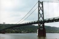
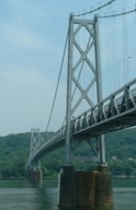
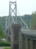
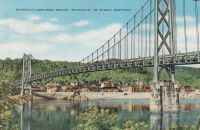
1931: Simon Kenton Memorial
Maysville, Kentucky and Aberdeen, Ohio, USA - Ohio River
| Bridgemeister ID: | 172 (added before 2003) |
| Year Completed: | 1931 |
| Name: | Simon Kenton Memorial |
| Also Known As: | Maysville |
| Location: | Maysville, Kentucky and Aberdeen, Ohio, USA |
| Crossing: | Ohio River |
| Coordinates: | 38.649890 N 83.759670 W |
| Maps: | Acme, GeoHack, Google, OpenStreetMap |
| Principals: | Modjeski, Masters & Chase |
| References: | AAJ, SJR, SSS |
| Use: | Vehicular (two-lane), with walkway |
| Status: | In use (last checked: 2022) |
| Main Cables: | Wire (steel) |
| Suspended Spans: | 3 |
| Main Span: | 1 x 323.1 meters (1,060 feet) |
| Side Spans: | 2 x 141.7 meters (464.9 feet) |
| Deck width: | 28 feet |
Notes:
- 2022, March: USD$23.4 million budgeted for rehabilitation project including suspender cable replacements, steel repairs, and painting.
- 2019: Closed late 2019 due to suspender cable corrosion. Short-term fixes applied to reduce the stress on the suspenders and to prevent rusting.
- 2020, June: Reopened with a 15-ton weight limit after installation of temporary support rods and brackets to reduce the stress on damaged cables.
External Links:
1936: Pauley
Pikeville, Kentucky, USA - Big Sandy River Levisa Fork
| Bridgemeister ID: | 1068 (added 2003-12-27) |
| Year Completed: | 1936 |
| Name: | Pauley |
| Location: | Pikeville, Kentucky, USA |
| Crossing: | Big Sandy River Levisa Fork |
| Coordinates: | 37.492833 N 82.5355 W |
| Maps: | Acme, GeoHack, Google, OpenStreetMap |
| Principals: | O.S. Batten, WPA |
| Use: | Vehicular (one-lane) |
| Status: | Restricted to foot traffic (last checked: 2021) |
| Main Cables: | Wire (steel) |
| Suspended Spans: | 1 |
| Main Span: | 1 x 115.8 meters (380 feet) estimated |
Notes:
- The National Register of Historic Places registration form is inconsistent regarding the completion year of this bridge stating (in one passage) it was completed in 1940 but also mentioning it was completed "circa 1940" a few times.
- Closed to vehicular traffic, 1991. Closed to all traffic, September 2000. Restored and reopened to pedestrian traffic, 2006.
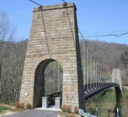
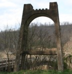
1940: Nolan Toll
Nolan, West Virginia and Pike County, Kentucky, USA - Tug Fork River
| Bridgemeister ID: | 2239 (added 2007-03-27) |
| Year Completed: | 1940 |
| Name: | Nolan Toll |
| Location: | Nolan, West Virginia and Pike County, Kentucky, USA |
| Crossing: | Tug Fork River |
| Coordinates: | 37.73986 N 82.33125 W |
| Maps: | Acme, GeoHack, Google, OpenStreetMap |
| Use: | Vehicular |
| Status: | Only towers remain (last checked: 2009) |
Notes:
- The suspension bridge, and later the current adjacent beam and girder bridge, are privately owned and were previously operated as toll bridges. The current bridge was closed by West Virginia in late 2007.
- Ron Thompson, a member of the family who owns these structures (the suspension bridge formerly, and now the current crossing) writes: "This was a private toll bridge constructed beginning in 1939 by the Big Creek Bridge Company, a privately held corporation headquartered first in Nolan, then in Williamson. The replacement bridge next to it was constructed by the same entity. My father, along with other relatives, inherited most of the corporate stock, and for the last several years he has owned it in its entirety... My grandfather built the original suspension bridge primarily to provide a way to get coal from the surrounding hills in Pike and Martin County, Kentucky to tipples and markets in West Virginia."
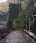
1962: (pipeline bridge)
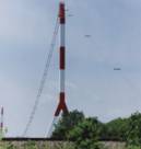
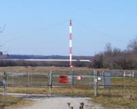
Grays Branch, Greenup vicinity, Kentucky and Franklin Furnace, Ohio, USA - Ohio River
| Bridgemeister ID: | 880 (added 2003-09-01) |
| Year Completed: | 1962 |
| Name: | (pipeline bridge) |
| Location: | Grays Branch, Greenup vicinity, Kentucky and Franklin Furnace, Ohio, USA |
| Crossing: | Ohio River |
| Coordinates: | 38.66058 N 82.85889 W |
| Maps: | Acme, GeoHack, Google, OpenStreetMap |
| Principals: | Weldon F. Appelt, P.E., Clear Span Engineering, Inc |
| Use: | Pipeline |
| Status: | Extant (last checked: 2021) |
| Main Cables: | Wire (steel) |
| Main Span: | 1 x 609.6 meters (2,000 feet) |
Notes:
- Just downstream of Greenup Dam. Built for Tennessee Gas Pipeline Co. Carries two 30" gas pipelines.
External Links:
1999: Forrest and Maxie Preston Memorial Pedestrian
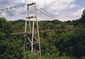
River, Johnson County, Kentucky, USA - Big Sandy River Levisa Fork
| Bridgemeister ID: | 329 (added before 2003) |
| Year Completed: | 1999 |
| Name: | Forrest and Maxie Preston Memorial Pedestrian |
| Location: | River, Johnson County, Kentucky, USA |
| Crossing: | Big Sandy River Levisa Fork |
| Coordinates: | 37.86015 N 82.726117 W |
| Maps: | Acme, GeoHack, Google, OpenStreetMap |
| Principals: | Bush and Burchett Inc., Bocook Engineering, S.E.A. Engineers Inc., Issam Harik |
| References: | UKODF99 |
| Use: | Footbridge |
| Status: | In use (last checked: 2005) |
| Main Cables: | Wire (steel) |
| Suspended Spans: | 3 |
| Main Span: | 1 x 96.3 meters (316 feet) estimated |
| Side Spans: | 2 x 14.3 meters (47 feet) estimated |
Notes:
- From an old Kentucky Transportation Cabinet web page: "Interested in seeing the world's longest plastic bridge? Visit Johnson County, where the 410-ft-long Forest and Maxie Preston Memorial Pedestrian Bridge recently opened. The bridge was built from a high performance composite material - glass fiber that is reinforced with plastic resins."
- A University of Kentucky web page refers to the deck material as "glass fiber-reinforced polymer composites."
External Links:
2000: Debbie's Dream Catcher
Owensboro vicinity, Kentucky, USA - Panther Creek
| Bridgemeister ID: | 7024 (added 2022-05-15) |
| Year Completed: | 2000 |
| Name: | Debbie's Dream Catcher |
| Location: | Owensboro vicinity, Kentucky, USA |
| Crossing: | Panther Creek |
| At or Near Feature: | Panther Creek Park |
| Coordinates: | 37.716219 N 87.222361 W |
| Maps: | Acme, GeoHack, Google, OpenStreetMap |
| Use: | Footbridge |
| Status: | In use (last checked: 2022) |
| Main Cables: | Wire (steel) |
| Suspended Spans: | 3 |
| Main Span: | 1 |
| Side Spans: | 2 |
Notes:
- 2022, February: Deck replaced.
- Connects to Swinger - Owensboro vicinity, Kentucky, USA.
(footbridge)
Ary, Kentucky, USA - Troublesome Creek
| Bridgemeister ID: | 3782 (added 2020-02-29) |
| Name: | (footbridge) |
| Location: | Ary, Kentucky, USA |
| Crossing: | Troublesome Creek |
| Coordinates: | 37.368240 N 83.141350 W |
| Maps: | Acme, GeoHack, Google, OpenStreetMap |
| Use: | Footbridge |
| Status: | In use (last checked: 2008) |
| Main Cables: | Wire (steel) |
| Suspended Spans: | 3 |
| Main Span: | 1 |
| Side Spans: | 2 |
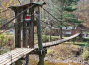
(footbridge)
Ary, Kentucky, USA - Troublesome Creek
| Bridgemeister ID: | 3783 (added 2020-02-29) |
| Name: | (footbridge) |
| Location: | Ary, Kentucky, USA |
| Crossing: | Troublesome Creek |
| Coordinates: | 37.385960 N 83.169710 W |
| Maps: | Acme, GeoHack, Google, OpenStreetMap |
| Use: | Footbridge |
| Status: | Derelict (last checked: 2007) |
| Main Cables: | Wire |
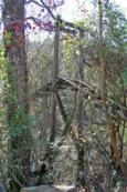
(footbridge)
Ary, Kentucky, USA - Troublesome Creek
| Bridgemeister ID: | 3817 (added 2020-03-01) |
| Name: | (footbridge) |
| Location: | Ary, Kentucky, USA |
| Crossing: | Troublesome Creek |
| Coordinates: | 37.383740 N 83.167130 W |
| Maps: | Acme, GeoHack, Google, OpenStreetMap |
| Use: | Footbridge |
| Status: | Derelict (last checked: 2009) |
| Main Cables: | Wire |
| Main Span: | 1 |
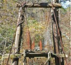
(footbridge)
Ary, Kentucky, USA - Troublesome Creek
| Bridgemeister ID: | 3819 (added 2020-03-01) |
| Name: | (footbridge) |
| Location: | Ary, Kentucky, USA |
| Crossing: | Troublesome Creek |
| Coordinates: | 37.357490 N 83.136850 W |
| Maps: | Acme, GeoHack, Google, OpenStreetMap |
| Status: | Derelict (last checked: 2007) |
| Main Cables: | Wire |
| Main Span: | 1 |
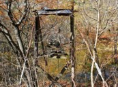
(footbridge)
Ary, Kentucky, USA - Troublesome Creek
| Bridgemeister ID: | 3821 (added 2020-03-01) |
| Name: | (footbridge) |
| Location: | Ary, Kentucky, USA |
| Crossing: | Troublesome Creek |
| Coordinates: | 37.380444 N 83.149273 W |
| Maps: | Acme, GeoHack, Google, OpenStreetMap |
| Use: | Footbridge |
| Status: | In use (last checked: 2008) |
| Main Cables: | Wire |
| Main Span: | 1 x 33.5 meters (110 feet) estimated |
| Side Spans: | 2 |
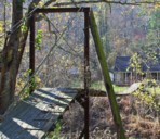
(footbridge)
Ary, Kentucky, USA - Troublesome Creek
| Bridgemeister ID: | 3823 (added 2020-03-01) |
| Name: | (footbridge) |
| Location: | Ary, Kentucky, USA |
| Crossing: | Troublesome Creek |
| Coordinates: | 37.381630 N 83.166180 W |
| Maps: | Acme, GeoHack, Google, OpenStreetMap |
| Use: | Footbridge |
| Status: | Derelict (last checked: 2007) |
| Main Cables: | Wire |
| Main Span: | 1 |
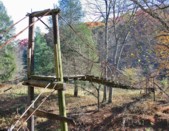
(footbridge)
Barwick, Breathitt County, Kentucky, USA - North Fork Kentucky River
| Bridgemeister ID: | 2445 (added 2008-04-23) |
| Name: | (footbridge) |
| Location: | Barwick, Breathitt County, Kentucky, USA |
| Crossing: | North Fork Kentucky River |
| Coordinates: | 37.37142 N 83.35669 W |
| Maps: | Acme, GeoHack, Google, OpenStreetMap |
| Use: | Footbridge |
| Status: | In use (last checked: 2008) |
| Main Cables: | Wire |
| Suspended Spans: | 4 |
| Main Spans: | 1 x 39.6 meters (130 feet), 1 x 36.6 meters (120 feet) |
| Side Spans: | 1 x 36.6 meters (120 feet), 1 x 24.4 meters (80 feet) |
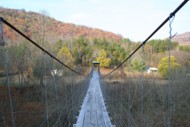
(footbridge)
Belcher vicinity, Kentucky, USA - Big Sandy River Russell Fork
| Bridgemeister ID: | 2265 (added 2007-04-20) |
| Name: | (footbridge) |
| Location: | Belcher vicinity, Kentucky, USA |
| Crossing: | Big Sandy River Russell Fork |
| Coordinates: | 37.33305 N 82.38559 W |
| Maps: | Acme, GeoHack, Google, OpenStreetMap |
| Use: | Footbridge |
| Status: | Derelict (last checked: 2007) |
| Main Cables: | Wire |
| Suspended Spans: | 2 |
| Main Span: | 1 |
| Side Span: | 1 |
Notes:
- Patrick S. O'Donnell provided a rough main span estimate of 225 feet.
- Near (footbridge) - Belcher, Kentucky, USA.
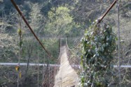
(footbridge)
Belcher, Kentucky, USA - Big Sandy River Russell Fork
| Bridgemeister ID: | 2264 (added 2007-04-20) |
| Name: | (footbridge) |
| Location: | Belcher, Kentucky, USA |
| Crossing: | Big Sandy River Russell Fork |
| Coordinates: | 37.34046 N 82.37359 W |
| Maps: | Acme, GeoHack, Google, OpenStreetMap |
| Use: | Footbridge |
| Status: | Derelict (last checked: 2007) |
| Main Cables: | Wire |
Notes:
- Patrick S. O'Donnell provided a rough main span estimate of 300 feet.
- Near (footbridge) - Belcher vicinity, Kentucky, USA.
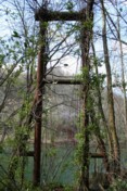
(footbridge)
Breathitt County, Kentucky, USA - Quicksand Creek
| Bridgemeister ID: | 2431 (added 2008-04-22) |
| Name: | (footbridge) |
| Location: | Breathitt County, Kentucky, USA |
| Crossing: | Quicksand Creek |
| Coordinates: | 37.56341 N 83.16221 W |
| Maps: | Acme, GeoHack, Google, OpenStreetMap |
| Use: | Footbridge |
| Status: | In use |
| Main Cables: | Rope |
| Suspended Spans: | 3 |
| Main Span: | 1 |
| Side Spans: | 2 |
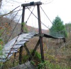
(footbridge)
Breathitt County, Kentucky, USA - Middle Fork Kentucky River
| Bridgemeister ID: | 3804 (added 2020-03-01) |
| Name: | (footbridge) |
| Location: | Breathitt County, Kentucky, USA |
| Crossing: | Middle Fork Kentucky River |
| Coordinates: | 37.391820 N 83.475160 W |
| Maps: | Acme, GeoHack, Google, OpenStreetMap |
| Use: | Footbridge |
| Status: | In use (last checked: 2007) |
| Main Cables: | Wire |
| Suspended Spans: | 3 |
| Main Span: | 1 |
| Side Spans: | 2 |
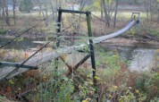
(footbridge)
Broad Bottom, Kentucky, USA - Big Sandy River Levisa Fork
| Bridgemeister ID: | 1468 (added 2004-08-28) |
| Name: | (footbridge) |
| Location: | Broad Bottom, Kentucky, USA |
| Crossing: | Big Sandy River Levisa Fork |
| Coordinates: | 37.536417 N 82.594967 W |
| Maps: | Acme, GeoHack, Google, OpenStreetMap |
| Use: | Footbridge |
| Status: | In use (last checked: 2005) |
| Main Cables: | Wire (steel) |
| Suspended Spans: | 1 |
| Main Span: | 1 x 121.9 meters (400 feet) estimated |
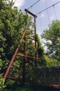
(footbridge)
Clayhole, Kentucky, USA - Troublesome Creek
| Bridgemeister ID: | 3784 (added 2020-02-29) |
| Name: | (footbridge) |
| Location: | Clayhole, Kentucky, USA |
| Crossing: | Troublesome Creek |
| Coordinates: | 37.469720 N 83.281660 W |
| Maps: | Acme, GeoHack, Google, OpenStreetMap |
| Use: | Footbridge |
| Status: | Destroyed, 2022 |
| Main Cables: | Wire (steel) |
| Suspended Spans: | 3 |
| Main Span: | 1 |
| Side Spans: | 2 |
Notes:
- 2007: Failed when one of the main cables snapped. Subsequently repaired.
- 2022: Destroyed by flood.
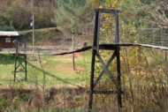
(footbridge)
Clayhole, Kentucky, USA - Troublesome Creek
| Bridgemeister ID: | 3820 (added 2020-03-01) |
| Name: | (footbridge) |
| Location: | Clayhole, Kentucky, USA |
| Crossing: | Troublesome Creek |
| Coordinates: | 37.476530 N 83.274250 W |
| Maps: | Acme, GeoHack, Google, OpenStreetMap |
| Use: | Footbridge |
| Status: | Derelict (last checked: 2007) |
| Main Cables: | Wire |
| Suspended Spans: | 3 |
| Main Span: | 1 |
| Side Spans: | 2 |
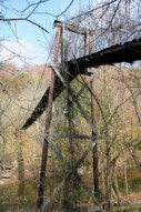
(footbridge)
Clayhole, Kentucky, USA - Troublesome Creek
| Bridgemeister ID: | 3824 (added 2020-03-01) |
| Name: | (footbridge) |
| Location: | Clayhole, Kentucky, USA |
| Crossing: | Troublesome Creek |
| Coordinates: | 37.474070 N 83.280920 W |
| Maps: | Acme, GeoHack, Google, OpenStreetMap |
| Use: | Footbridge |
| Status: | In use (last checked: 2007) |
| Main Cables: | Wire |
| Main Span: | 1 x 27.4 meters (90 feet) estimated |
| Side Spans: | 2 |
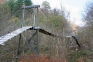
(footbridge)
Dwale, Kentucky, USA - Big Sandy River Levisa Fork
| Bridgemeister ID: | 2261 (added 2007-04-19) |
| Name: | (footbridge) |
| Location: | Dwale, Kentucky, USA |
| Crossing: | Big Sandy River Levisa Fork |
| Coordinates: | 37.62283 N 82.72169 W |
| Maps: | Acme, GeoHack, Google, OpenStreetMap |
| Use: | Footbridge |
| Status: | Derelict (last checked: 2007) |
| Main Cables: | Wire |
| Suspended Spans: | 1 |
Notes:
- Patrick S. O'Donnell provided a rough main span estimate of 300 feet.
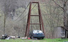
(footbridge)
Fords Branch, Kentucky, USA - Big Sandy River Levisa Fork
| Bridgemeister ID: | 1479 (added 2004-09-03) |
| Name: | (footbridge) |
| Location: | Fords Branch, Kentucky, USA |
| Crossing: | Big Sandy River Levisa Fork |
| Coordinates: | 37.43476 N 82.50923 W |
| Maps: | Acme, GeoHack, Google, OpenStreetMap |
| Use: | Footbridge |
| Status: | Derelict (last checked: 2007) |
| Main Cables: | Wire |
Notes:
- Patrick S. O'Donnell provided a rough main span estimate of 350 feet.
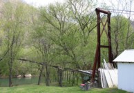
(footbridge)
Guage, Kentucky, USA - Quicksand Creek
| Bridgemeister ID: | 3781 (added 2020-02-29) |
| Name: | (footbridge) |
| Location: | Guage, Kentucky, USA |
| Crossing: | Quicksand Creek |
| Coordinates: | 37.571730 N 83.196140 W |
| Maps: | Acme, GeoHack, Google, OpenStreetMap |
| Use: | Footbridge |
| Status: | In use (last checked: 2007) |
| Main Cables: | Wire (steel) |
| Suspended Spans: | 2 |
| Main Span: | 1 |
| Side Span: | 1 |
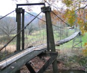
(footbridge)
Haddix, Kentucky, USA - North Fork Kentucky River
| Bridgemeister ID: | 2444 (added 2008-04-23) |
| Name: | (footbridge) |
| Location: | Haddix, Kentucky, USA |
| Crossing: | North Fork Kentucky River |
| Coordinates: | 37.48066 N 83.37641 W |
| Maps: | Acme, GeoHack, Google, OpenStreetMap |
| Use: | Footbridge |
| Status: | In use (last checked: 2007) |
| Main Cables: | Wire |
| Suspended Spans: | 3 |
| Main Span: | 1 x 64 meters (210 feet) |
| Side Spans: | 2 |
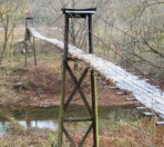
(footbridge)
Hardshell, Kentucky, USA - Troublesome Creek
| Bridgemeister ID: | 3818 (added 2020-03-01) |
| Name: | (footbridge) |
| Location: | Hardshell, Kentucky, USA |
| Crossing: | Troublesome Creek |
| Coordinates: | 37.465050 N 83.269670 W |
| Maps: | Acme, GeoHack, Google, OpenStreetMap |
| Use: | Footbridge |
| Status: | Derelict (last checked: 2007) |
| Main Cables: | Wire |
| Suspended Spans: | 3 |
| Main Span: | 1 |
| Side Spans: | 2 |
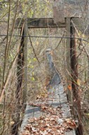
(footbridge)
Hardshell, Kentucky, USA - Troublesome Creek
| Bridgemeister ID: | 3822 (added 2020-03-01) |
| Name: | (footbridge) |
| Location: | Hardshell, Kentucky, USA |
| Crossing: | Troublesome Creek |
| Coordinates: | 37.449223 N 83.236257 W |
| Maps: | Acme, GeoHack, Google, OpenStreetMap |
| Use: | Footbridge |
| Status: | Derelict (last checked: 2007) |
| Main Cables: | Wire |
| Suspended Spans: | 3 |
| Main Span: | 1 |
| Side Spans: | 2 |
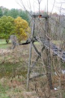
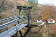
(footbridge)
Hardshell, Kentucky, USA - Troublesome Creek
| Bridgemeister ID: | 3825 (added 2020-03-01) |
| Name: | (footbridge) |
| Location: | Hardshell, Kentucky, USA |
| Crossing: | Troublesome Creek |
| Coordinates: | 37.450200 N 83.228820 W |
| Maps: | Acme, GeoHack, Google, OpenStreetMap |
| Use: | Footbridge |
| Status: | In use (last checked: 2007) |
| Main Cables: | Wire (steel) |
| Suspended Spans: | 2 |
| Main Span: | 1 |
| Side Span: | 1 x 30.5 meters (100 feet) estimated |
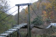
(footbridge)
Hawesville vicinity, Kentucky, USA - Vastwood Park Lake
| Bridgemeister ID: | 1414 (added 2004-07-04) |
| Name: | (footbridge) |
| Location: | Hawesville vicinity, Kentucky, USA |
| Crossing: | Vastwood Park Lake |
| At or Near Feature: | Vastwood Park |
| Coordinates: | 37.908467 N 86.790283 W |
| Maps: | Acme, GeoHack, Google, OpenStreetMap |
| Use: | Footbridge |
| Status: | In use (last checked: 2004) |
| Main Cables: | Wire (steel) |
(footbridge)
Jackson, Kentucky, USA - Quicksand Creek
| Bridgemeister ID: | 3810 (added 2020-03-01) |
| Name: | (footbridge) |
| Location: | Jackson, Kentucky, USA |
| Crossing: | Quicksand Creek |
| Coordinates: | 37.563010 N 83.291030 W |
| Maps: | Acme, GeoHack, Google, OpenStreetMap |
| Use: | Footbridge |
| Status: | In use (last checked: 2009) |
| Main Cables: | Wire |
| Suspended Spans: | 3 |
| Main Span: | 1 x 27.4 meters (90 feet) estimated |
| Side Spans: | 2 |
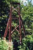
(footbridge)
Kewanee, Kentucky, USA - Big Sandy River Levisa Fork
| Bridgemeister ID: | 1478 (added 2004-09-03) |
| Name: | (footbridge) |
| Location: | Kewanee, Kentucky, USA |
| Crossing: | Big Sandy River Levisa Fork |
| Coordinates: | 37.445933 N 82.5153 W |
| Maps: | Acme, GeoHack, Google, OpenStreetMap |
| Use: | Footbridge |
| Status: | In use (last checked: 2007) |
| Main Cables: | Wire (steel) |
| Suspended Spans: | 1 |
| Main Span: | 1 x 125 meters (410 feet) estimated |
Notes:
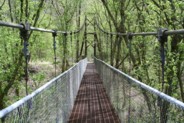
(footbridge)
Lambric, Kentucky, USA - South Fork Quicksand Creek
| Bridgemeister ID: | 3778 (added 2020-02-29) |
| Name: | (footbridge) |
| Location: | Lambric, Kentucky, USA |
| Crossing: | South Fork Quicksand Creek |
| Coordinates: | 37.560660 N 83.134170 W |
| Maps: | Acme, GeoHack, Google, OpenStreetMap |
| Use: | Footbridge |
| Status: | In use (last checked: 2007) |
| Main Cables: | Wire |
| Suspended Spans: | 3 |
| Main Span: | 1 |
| Side Spans: | 2 |
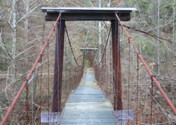
(footbridge)
Lambric, Kentucky, USA - Quicksand Creek
| Bridgemeister ID: | 3780 (added 2020-02-29) |
| Name: | (footbridge) |
| Location: | Lambric, Kentucky, USA |
| Crossing: | Quicksand Creek |
| Coordinates: | 37.568500 N 83.141290 W |
| Maps: | Acme, GeoHack, Google, OpenStreetMap |
| Use: | Footbridge |
| Status: | Extant (last checked: 2007) |
| Main Cables: | Wire (steel) |
| Suspended Spans: | 3 |
| Main Span: | 1 |
| Side Spans: | 2 |
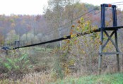
(footbridge)
Lawson and Vancleve, Kentucky, USA - North Fork Kentucky River
| Bridgemeister ID: | 2043 (added 2006-05-07) |
| Name: | (footbridge) |
| Location: | Lawson and Vancleve, Kentucky, USA |
| Crossing: | North Fork Kentucky River |
| Coordinates: | 37.60233 N 83.45424 W |
| Maps: | Acme, GeoHack, Google, OpenStreetMap |
| Principals: | American Bridge Co., Mt. Carmel High School |
| Use: | Footbridge |
| Status: | Derelict (last checked: 2007) |
| Main Cables: | Wire (steel) |
| Suspended Spans: | 2 |
| Main Span: | 1 x 74.6 meters (244.625 feet) |
| Side Span: | 1 |
| Deck width: | 6 feet |
Notes:
- According to an American Bridge Co. ad: Built for Mt. Carmel High School, fabricated by American Bridge Co, erected by the school's faculty and students.
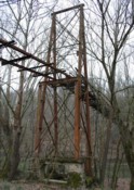
(footbridge)
Little vicinity, Kentucky, USA - North Fork Kentucky River
| Bridgemeister ID: | 3806 (added 2020-03-01) |
| Name: | (footbridge) |
| Location: | Little vicinity, Kentucky, USA |
| Crossing: | North Fork Kentucky River |
| Coordinates: | 37.455390 N 83.371840 W |
| Maps: | Acme, GeoHack, Google, OpenStreetMap |
| Use: | Footbridge |
| Status: | Derelict (last checked: 2019) |
| Main Cables: | Wire |
| Suspended Spans: | 3 |
| Main Span: | 1 x 73.2 meters (240 feet) estimated |
| Side Spans: | 2 |
Notes:
- Appears to be derelict in 2010s satellite images. Was in use in 2007.
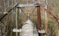
(footbridge)
Little, Kentucky, USA - North Fork Kentucky River
| Bridgemeister ID: | 3807 (added 2020-03-01) |
| Name: | (footbridge) |
| Location: | Little, Kentucky, USA |
| Crossing: | North Fork Kentucky River |
| Coordinates: | 37.437320 N 83.372160 W |
| Maps: | Acme, GeoHack, Google, OpenStreetMap |
| Use: | Footbridge |
| Status: | Derelict (last checked: 2007) |
| Main Cables: | Wire |
| Suspended Spans: | 3 |
| Main Span: | 1 |
| Side Spans: | 2 |
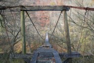
(footbridge)
Marrowbone vicinity, Pike County, Kentucky, USA - Big Sandy River Russell Fork
| Bridgemeister ID: | 2266 (added 2007-04-21) |
| Name: | (footbridge) |
| Location: | Marrowbone vicinity, Pike County, Kentucky, USA |
| Crossing: | Big Sandy River Russell Fork |
| Coordinates: | 37.35653 N 82.40935 W |
| Maps: | Acme, GeoHack, Google, OpenStreetMap |
| Use: | Footbridge |
| Status: | Derelict (last checked: 2007) |
| Main Cables: | Wire |
| Suspended Spans: | 2 |
| Main Span: | 1 |
| Side Span: | 1 |
Notes:
- Patrick S. O'Donnell provided a rough main span estimate of 200 feet.
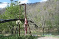
(footbridge)
Natural Bridge State Park, Kentucky, USA - Middle Fork Red River
| Bridgemeister ID: | 1361 (added 2004-06-30) |
| Name: | (footbridge) |
| Location: | Natural Bridge State Park, Kentucky, USA |
| Crossing: | Middle Fork Red River |
| Coordinates: | 37.775383 N 83.6773 W |
| Maps: | Acme, GeoHack, Google, OpenStreetMap |
| Use: | Footbridge |
| Status: | In use (last checked: 2004) |
| Main Cables: | Wire |
(footbridge)
Page Cutoff, Pineville vicinity, Kentucky, USA - Yellow Creek
| Bridgemeister ID: | 2351 (added 2007-08-18) |
| Name: | (footbridge) |
| Location: | Page Cutoff, Pineville vicinity, Kentucky, USA |
| Crossing: | Yellow Creek |
| Use: | Footbridge |
| Main Cables: | Wire |
Notes:
- Built circa 1957. Damaged by flood, 1977. Partially repaired by December, 1977. Descriptions and photographs of the 1977 flood damage and repairs appear in the December 2 and 30, 1977 editions of the Daily News newspaper (Middlesboro, Kentucky).
(footbridge)
Perry County, Kentucky, USA - Troublesome Creek
| Bridgemeister ID: | 2419 (added 2008-02-16) |
| Name: | (footbridge) |
| Location: | Perry County, Kentucky, USA |
| Crossing: | Troublesome Creek |
| Coordinates: | 37.42995 N 83.21446 W |
| Maps: | Acme, GeoHack, Google, OpenStreetMap |
| Use: | Footbridge |
| Status: | Closed |
| Main Cables: | Wire |
| Suspended Spans: | 1 |
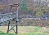
(footbridge)
Perry County, Kentucky, USA - Troublesome Creek
| Bridgemeister ID: | 2420 (added 2008-02-16) |
| Name: | (footbridge) |
| Location: | Perry County, Kentucky, USA |
| Crossing: | Troublesome Creek |
| Coordinates: | 37.41746 N 83.20749 W |
| Maps: | Acme, GeoHack, Google, OpenStreetMap |
| Use: | Footbridge |
| Status: | Closed |
| Main Cables: | Wire |
| Suspended Spans: | 1 |
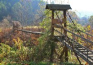
(footbridge)
Perry County, Kentucky, USA - Troublesome Creek
| Bridgemeister ID: | 2421 (added 2008-02-22) |
| Name: | (footbridge) |
| Location: | Perry County, Kentucky, USA |
| Crossing: | Troublesome Creek |
| Coordinates: | 37.38502 N 83.15154 W |
| Maps: | Acme, GeoHack, Google, OpenStreetMap |
| Use: | Footbridge |
| Status: | In use (last checked: 2007) |
| Main Cables: | Wire (steel) |
| Suspended Spans: | 2 |
| Main Spans: | 1 x 30.5 meters (100 feet) estimated, 1 x 16.8 meters (55 feet) estimated |
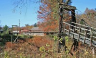
(footbridge)
Pikeville, Kentucky, USA - Pikeville City Pond
| Bridgemeister ID: | 1462 (added 2004-08-22) |
| Name: | (footbridge) |
| Location: | Pikeville, Kentucky, USA |
| Crossing: | Pikeville City Pond |
| Coordinates: | 37.48575 N 82.520067 W |
| Maps: | Acme, GeoHack, Google, OpenStreetMap |
| Use: | Footbridge |
| Status: | In use (last checked: 2004) |
| Main Cables: | Wire (steel) |
| Suspended Spans: | 2 |
| Main Span: | 1 x 96.9 meters (318 feet) estimated |
| Side Span: | 1 |
Notes:
- Crosses a pond formed by the Pikeville Cut-Thru project's diversion of the Levisa Fork of the Big Sandy River.
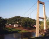
(footbridge)
Pineville vicinity, Kentucky, USA - Cumberland River
| Bridgemeister ID: | 4933 (added 2020-08-04) |
| Name: | (footbridge) |
| Location: | Pineville vicinity, Kentucky, USA |
| Crossing: | Cumberland River |
| Use: | Footbridge |
| Status: | In use (last checked: 1975) |
| Main Cables: | Wire |
Notes:
- The January 3, 1975 edition of the Middlesboro Daily News (Middlesboro, Kentucky) ran a front page photo with description: "As this young woman gazes out over the water of the Cumberland River she may be contemplating the first day of sunshine In the new year. The scenic suspension bridge from which she is gazing at the icy water below is located about two miles past Bell High School on the Harlan Road." That appears to place the bridge in Pineville or very nearby based on the present day (2020) locations of Bell County High School and Harlan Road (US119).
- Likely removed.
(footbridge)
Rosspoint vicinity, Kentucky, USA - Poor Fork Cumberland River
| Bridgemeister ID: | 4935 (added 2020-08-04) |
| Name: | (footbridge) |
| Location: | Rosspoint vicinity, Kentucky, USA |
| Crossing: | Poor Fork Cumberland River |
| Coordinates: | 36.893125 N 83.265826 W |
| Maps: | Acme, GeoHack, Google, OpenStreetMap |
| Use: | Footbridge |
| Status: | Extant (last checked: 2019) |
| Main Cables: | Wire |
(footbridge)
Rousseau, Kentucky, USA - Quicksand Creek
| Bridgemeister ID: | 3779 (added 2020-02-29) |
| Name: | (footbridge) |
| Location: | Rousseau, Kentucky, USA |
| Crossing: | Quicksand Creek |
| Coordinates: | 37.585230 N 83.241210 W |
| Maps: | Acme, GeoHack, Google, OpenStreetMap |
| Use: | Footbridge |
| Status: | In use (last checked: 2007) |
| Main Cables: | Wire (steel) |
| Suspended Spans: | 3 |
| Main Span: | 1 |
| Side Spans: | 2 |
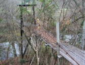
(footbridge)
Rowdy vicinity, Perry County, Kentucky, USA - Troublesome Creek
| Bridgemeister ID: | 5655 (added 2021-01-01) |
| Name: | (footbridge) |
| Location: | Rowdy vicinity, Perry County, Kentucky, USA |
| Crossing: | Troublesome Creek |
| Coordinates: | 37.419410 N 83.210633 W |
| Maps: | Acme, GeoHack, Google, OpenStreetMap |
| Use: | Footbridge |
| Status: | In use (last checked: 2008) |
| Main Cables: | Wire (steel) |
| Suspended Spans: | 2 |
| Main Span: | 1 |
| Side Span: | 1 |
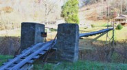
(footbridge)
Saldee, Kentucky, USA - South Fork Quicksand Creek
| Bridgemeister ID: | 3813 (added 2020-03-01) |
| Name: | (footbridge) |
| Location: | Saldee, Kentucky, USA |
| Crossing: | South Fork Quicksand Creek |
| Coordinates: | 37.538170 N 83.304140 W |
| Maps: | Acme, GeoHack, Google, OpenStreetMap |
| Use: | Footbridge |
| Status: | Derelict (last checked: 2007) |
| Main Cables: | Wire |
| Main Span: | 1 |
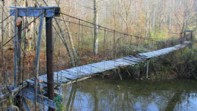
(footbridge)
Saldee, Kentucky, USA - South Fork Quicksand Creek
| Bridgemeister ID: | 3814 (added 2020-03-01) |
| Name: | (footbridge) |
| Location: | Saldee, Kentucky, USA |
| Crossing: | South Fork Quicksand Creek |
| Coordinates: | 37.534120 N 83.333790 W |
| Maps: | Acme, GeoHack, Google, OpenStreetMap |
| Use: | Footbridge |
| Status: | Derelict (last checked: 2007) |
| Main Cables: | Wire |
| Main Span: | 1 |
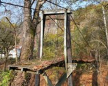
(footbridge)
Saldee, Kentucky, USA - South Fork Quicksand Creek
| Bridgemeister ID: | 3815 (added 2020-03-01) |
| Name: | (footbridge) |
| Location: | Saldee, Kentucky, USA |
| Crossing: | South Fork Quicksand Creek |
| Coordinates: | 37.539120 N 83.307150 W |
| Maps: | Acme, GeoHack, Google, OpenStreetMap |
| Use: | Footbridge |
| Status: | In use (last checked: 2007) |
| Main Cables: | Wire |
| Suspended Spans: | 3 |
| Main Span: | 1 x 48.8 meters (160 feet) estimated |
| Side Spans: | 2 |
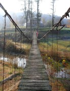
(footbridge)
South Wallins, Kentucky, USA - Cumberland River
| Bridgemeister ID: | 4934 (added 2020-08-04) |
| Name: | (footbridge) |
| Location: | South Wallins, Kentucky, USA |
| Crossing: | Cumberland River |
| Coordinates: | 36.840721 N 83.394699 W |
| Maps: | Acme, GeoHack, Google, OpenStreetMap |
| Use: | Footbridge |
| Status: | Derelict (last checked: 2019) |
| Main Cables: | Wire |
(footbridge)
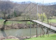
Sprigg vicinity, West Virginia and Pike County, Kentucky, USA - Tug Fork River
| Bridgemeister ID: | 2227 (added 2007-03-18) |
| Name: | (footbridge) |
| Location: | Sprigg vicinity, West Virginia and Pike County, Kentucky, USA |
| Crossing: | Tug Fork River |
| At or Near Feature: | Tug Valley Country Club |
| Coordinates: | 37.63102 N 82.18641 W |
| Maps: | Acme, GeoHack, Google, OpenStreetMap |
| Use: | Footbridge |
| Status: | In use (last checked: 2007) |
| Main Cables: | Wire (steel) |
| Suspended Spans: | 1 |
| Main Span: | 1 x 97.5 meters (320 feet) estimated |
Notes:
- Wide footbridge used by golf carts.
(footbridge)
Staffordsville vicinity, Kentucky, USA - Paint Creek
| Bridgemeister ID: | 2598 (added 2014-04-14) |
| Name: | (footbridge) |
| Location: | Staffordsville vicinity, Kentucky, USA |
| Crossing: | Paint Creek |
| Use: | Footbridge |
| Status: | In use (last checked: 2004) |
| Main Cables: | Wire |
| Suspended Spans: | 1 |
(footbridge)
Staffordsville vicinity, Kentucky, USA - Paint Creek
| Bridgemeister ID: | 2599 (added 2014-04-14) |
| Name: | (footbridge) |
| Location: | Staffordsville vicinity, Kentucky, USA |
| Crossing: | Paint Creek |
| Use: | Footbridge |
| Status: | In use (last checked: 2004) |
| Main Cables: | Wire |
| Suspended Spans: | 1 |
(footbridge)
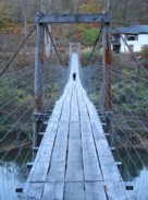
Talbert, Kentucky, USA - Middle Fork Kentucky River
| Bridgemeister ID: | 3785 (added 2020-02-29) |
| Name: | (footbridge) |
| Location: | Talbert, Kentucky, USA |
| Crossing: | Middle Fork Kentucky River |
| Coordinates: | 37.411760 N 83.475680 W |
| Maps: | Acme, GeoHack, Google, OpenStreetMap |
| Use: | Footbridge |
| Status: | In use (last checked: 2007) |
| Main Cables: | Wire (steel) |
| Suspended Spans: | 3 |
| Main Span: | 1 |
| Side Spans: | 2 |
(footbridge)
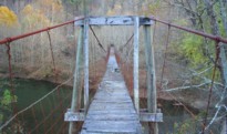
Talbert, Kentucky, USA - Middle Fork Kentucky River
| Bridgemeister ID: | 3786 (added 2020-02-29) |
| Name: | (footbridge) |
| Location: | Talbert, Kentucky, USA |
| Crossing: | Middle Fork Kentucky River |
| Coordinates: | 37.401790 N 83.468470 W |
| Maps: | Acme, GeoHack, Google, OpenStreetMap |
| Use: | Footbridge |
| Status: | In use (last checked: 2007) |
| Main Cables: | Wire |
(footbridge)
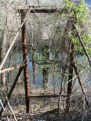
Toonerville, Kentucky, USA - Big Sandy River Levisa Fork
| Bridgemeister ID: | 2263 (added 2007-04-20) |
| Name: | (footbridge) |
| Location: | Toonerville, Kentucky, USA |
| Crossing: | Big Sandy River Levisa Fork |
| Coordinates: | 37.36810 N 82.23335 W |
| Maps: | Acme, GeoHack, Google, OpenStreetMap |
| Use: | Footbridge |
| Status: | Derelict (last checked: 2007) |
| Main Cables: | Wire |
| Suspended Spans: | 1 |
Notes:
- Patrick S. O'Donnell provided a rough main span estimate of 175 feet.
(footbridge)
Toonerville, Kentucky, USA - Big Sandy River Levisa Fork
| Bridgemeister ID: | 3816 (added 2020-03-01) |
| Name: | (footbridge) |
| Location: | Toonerville, Kentucky, USA |
| Crossing: | Big Sandy River Levisa Fork |
| Coordinates: | 37.369177 N 82.246554 W |
| Maps: | Acme, GeoHack, Google, OpenStreetMap |
| Use: | Footbridge |
| Status: | Derelict (last checked: 2007) |
| Main Cables: | Wire |
| Main Span: | 1 x 38.1 meters (125 feet) estimated |
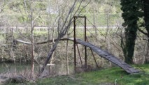
(footbridge)
Vulcan, West Virginia and Pike County, Kentucky, USA - Tug Fork River
| Bridgemeister ID: | 2262 (added 2007-04-20) |
| Name: | (footbridge) |
| Location: | Vulcan, West Virginia and Pike County, Kentucky, USA |
| Crossing: | Tug Fork River |
| Coordinates: | 37.55934 N 82.11506 W |
| Maps: | Acme, GeoHack, Google, OpenStreetMap |
| Use: | Footbridge |
| Status: | Removed, c. 2010s |
| Main Cables: | Wire (steel) |
| Suspended Spans: | 1 |
| Main Span: | 1 x 61 meters (200 feet) estimated |
Notes:
- Was still standing in very derelict condition in 2009. Appears to have been completely removed in the 2010s.
- Similar to (footbridge) - Kewanee, Kentucky, USA.
- Near 1907 Vulcan - Vulcan, West Virginia and Pike County, Kentucky, USA. Although similar in appearance, these appear to have been different bridges.
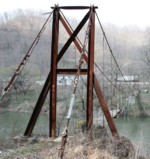
(footbridge)
Whick, Breathitt County, Kentucky, USA - North Fork Kentucky River
| Bridgemeister ID: | 5656 (added 2021-01-01) |
| Name: | (footbridge) |
| Location: | Whick, Breathitt County, Kentucky, USA |
| Crossing: | North Fork Kentucky River |
| Coordinates: | 37.422370 N 83.374900 W |
| Maps: | Acme, GeoHack, Google, OpenStreetMap |
| Use: | Footbridge |
| Status: | In use (last checked: 2007) |
| Main Cables: | Wire (steel) |
| Suspended Spans: | 5 |
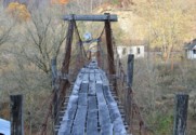
(footbridge)
Wilstacy, Kentucky, USA - South Fork Quicksand Creek
| Bridgemeister ID: | 3777 (added 2020-02-29) |
| Name: | (footbridge) |
| Location: | Wilstacy, Kentucky, USA |
| Crossing: | South Fork Quicksand Creek |
| Coordinates: | 37.518470 N 83.236130 W |
| Maps: | Acme, GeoHack, Google, OpenStreetMap |
| Use: | Footbridge |
| Status: | In use (last checked: 2007) |
| Main Cables: | Wire |
| Suspended Spans: | 3 |
| Main Span: | 1 |
| Side Spans: | 2 |
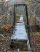
(footbridge)
Wilstacy, Kentucky, USA - Quicksand Creek
| Bridgemeister ID: | 3811 (added 2020-03-01) |
| Name: | (footbridge) |
| Location: | Wilstacy, Kentucky, USA |
| Crossing: | Quicksand Creek |
| Coordinates: | 37.558230 N 83.285530 W |
| Maps: | Acme, GeoHack, Google, OpenStreetMap |
| Use: | Footbridge |
| Status: | In use (last checked: 2007) |
| Main Cables: | Wire (steel) |
| Suspended Spans: | 3 |
| Main Span: | 1 x 27.4 meters (90 feet) estimated |
| Side Spans: | 2 |
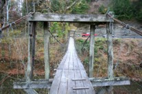
(suspension bridge)
Black Bottom, Kentucky, USA - Clover Fork Cumberland River
| Bridgemeister ID: | 4936 (added 2020-08-04) |
| Name: | (suspension bridge) |
| Location: | Black Bottom, Kentucky, USA |
| Crossing: | Clover Fork Cumberland River |
| Coordinates: | 36.910344 N 83.083958 W |
| Maps: | Acme, GeoHack, Google, OpenStreetMap |
| Status: | Extant (last checked: 2019) |
| Main Cables: | Wire |
Antepast
Oneida, Kentucky, USA - Red Bird River
| Bridgemeister ID: | 4945 (added 2020-08-08) |
| Name: | Antepast |
| Location: | Oneida, Kentucky, USA |
| Crossing: | Red Bird River |
| Coordinates: | 37.242900 N 83.636929 W |
| Maps: | Acme, GeoHack, Google, OpenStreetMap |
| Use: | Footbridge |
| Status: | Extant (last checked: 2020) |
| Main Cables: | Wire |
Antioch Church
Woollum, Manchester vicinity, Kentucky, USA - Collins Fork
| Bridgemeister ID: | 4959 (added 2020-08-09) |
| Name: | Antioch Church |
| Location: | Woollum, Manchester vicinity, Kentucky, USA |
| Crossing: | Collins Fork |
| Coordinates: | 37.033600 N 83.815568 W |
| Maps: | Acme, GeoHack, Google, OpenStreetMap |
| Use: | Footbridge |
| Status: | Derelict (last checked: 2015) |
| Main Cables: | Wire |
Bar Creek
Oneida, Kentucky, USA - Red Bird River
| Bridgemeister ID: | 4943 (added 2020-08-08) |
| Name: | Bar Creek |
| Location: | Oneida, Kentucky, USA |
| Crossing: | Red Bird River |
| Coordinates: | 37.228593 N 83.631545 W |
| Maps: | Acme, GeoHack, Google, OpenStreetMap |
| Use: | Footbridge |
| Status: | Extant (last checked: 2020) |
| Main Cables: | Wire |
Ben Salley
Viper and Cornettsville, Kentucky, USA - North Fork Kentucky River
| Bridgemeister ID: | 5913 (added 2021-05-23) |
| Name: | Ben Salley |
| Location: | Viper and Cornettsville, Kentucky, USA |
| Crossing: | North Fork Kentucky River |
| Coordinates: | 37.152879 N 83.089478 W |
| Maps: | Acme, GeoHack, Google, OpenStreetMap |
| Use: | Footbridge |
| Status: | In use (last checked: 2021) |
| Main Cables: | Wire (steel) |
| Main Span: | 1 |
Notes:
- Deck may have been replaced in the 2010s.
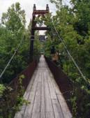
Bill Perk Litteral Memorial
Paintsville, Kentucky, USA - Big Sandy River Levisa Fork
| Bridgemeister ID: | 360 (added before 2003) |
| Name: | Bill Perk Litteral Memorial |
| Also Known As: | Swinging |
| Location: | Paintsville, Kentucky, USA |
| Crossing: | Big Sandy River Levisa Fork |
| Coordinates: | 37.81233 N 82.80991 W |
| Maps: | Acme, GeoHack, Google, OpenStreetMap |
| Use: | Footbridge |
| Status: | Derelict (last checked: 2023) |
| Main Cables: | Wire (steel) |
| Suspended Spans: | 3 |
| Main Span: | 1 x 59.4 meters (195 feet) estimated |
| Side Spans: | 1 x 27.1 meters (89 feet) estimated, 1 x 20.7 meters (68 feet) estimated |
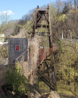
Boldman
Pikeville vicinity, Kentucky, USA - Big Sandy River Levisa Fork
| Bridgemeister ID: | 318 (added before 2003) |
| Name: | Boldman |
| Location: | Pikeville vicinity, Kentucky, USA |
| Crossing: | Big Sandy River Levisa Fork |
| Use: | Vehicular (one-lane) |
| Status: | Removed |
| Main Cables: | Wire (steel) |
| Suspended Spans: | 1 |
Notes:
- Carried Kentucky route 1384 over the Levisa Fork. Likely removed in time frame 1985-1994.
External Links:
Emma
Emma, Kentucky, USA - Big Sandy River Levisa Fork
| Bridgemeister ID: | 5597 (added 2020-12-23) |
| Name: | Emma |
| Location: | Emma, Kentucky, USA |
| Crossing: | Big Sandy River Levisa Fork |
| Coordinates: | 37.634650 N 82.699258 W |
| Maps: | Acme, GeoHack, Google, OpenStreetMap |
| Use: | Vehicular (one-lane) |
| Status: | Removed |
| Main Cables: | Wire |
| Main Span: | 1 |
External Links:
Farmer Road
Big Creek, Kentucky, USA - Red Bird River
| Bridgemeister ID: | 4947 (added 2020-08-08) |
| Name: | Farmer Road |
| Location: | Big Creek, Kentucky, USA |
| Crossing: | Red Bird River |
| Coordinates: | 37.124294 N 83.570737 W |
| Maps: | Acme, GeoHack, Google, OpenStreetMap |
| Use: | Footbridge |
| Status: | Extant (last checked: 2020) |
| Main Cables: | Wire |
Frazier Road Swinging
Tanksley, Kentucky, USA - Goose Creek
| Bridgemeister ID: | 3137 (added 2019-11-02) |
| Name: | Frazier Road Swinging |
| Location: | Tanksley, Kentucky, USA |
| Crossing: | Goose Creek |
| Coordinates: | 37.215129 N 83.718991 W |
| Maps: | Acme, GeoHack, Google, OpenStreetMap |
| Use: | Footbridge |
| Status: | In use (last checked: 2019) |
| Main Cables: | Wire (steel) |
Goose Creek Swinging
Manchester, Kentucky, USA - Goose Creek
| Bridgemeister ID: | 3136 (added 2019-11-02) |
| Name: | Goose Creek Swinging |
| Location: | Manchester, Kentucky, USA |
| Crossing: | Goose Creek |
| Coordinates: | 37.153261 N 83.759536 W |
| Maps: | Acme, GeoHack, Google, OpenStreetMap |
| Use: | Footbridge |
| Status: | In use (last checked: 2019) |
| Main Cables: | Wire (steel) |
Hawk Creek
Wood Creek Lake vicinity, Kentucky, USA - Hawk Creek
| Bridgemeister ID: | 1183 (added 2004-01-24) |
| Name: | Hawk Creek |
| Location: | Wood Creek Lake vicinity, Kentucky, USA |
| Crossing: | Hawk Creek |
| At or Near Feature: | Sheltowee Trace Trail |
| Use: | Footbridge |
| Status: | In use |
| Main Cables: | Wire (steel) |
| Suspended Spans: | 1 |
Knottly Hollow
Lancer, Kentucky, USA - Big Sandy River Levisa Fork
| Bridgemeister ID: | 5596 (added 2020-12-23) |
| Name: | Knottly Hollow |
| Location: | Lancer, Kentucky, USA |
| Crossing: | Big Sandy River Levisa Fork |
| Coordinates: | 37.671249 N 82.717030 W |
| Maps: | Acme, GeoHack, Google, OpenStreetMap |
| Use: | Vehicular |
| Status: | Collapsed |
| Main Cables: | Wire |
| Main Span: | 1 |
Notes:
- Collapsed, July, 1962 while a car was crossing. Three adults were killed, one child was injured, but survived.
- From a UPI wire news article appearing in July 1962 Kentucky newspapers: "The swinging bridge fell when a cable snapped afler being weakened by rubbing against a concrele abutment, [Commisioner of Highways Henry Ward] said."
Laurel Branch
Oneida, Kentucky, USA - Red Bird River
| Bridgemeister ID: | 4944 (added 2020-08-08) |
| Name: | Laurel Branch |
| Location: | Oneida, Kentucky, USA |
| Crossing: | Red Bird River |
| Coordinates: | 37.236435 N 83.644349 W |
| Maps: | Acme, GeoHack, Google, OpenStreetMap |
| Use: | Footbridge |
| Status: | Extant (last checked: 2020) |
| Main Cables: | Wire |
Martin Cemetary
Oneida, Kentucky, USA - Red Bird River
| Bridgemeister ID: | 4946 (added 2020-08-08) |
| Name: | Martin Cemetary |
| Location: | Oneida, Kentucky, USA |
| Crossing: | Red Bird River |
| Coordinates: | 37.248288 N 83.631116 W |
| Maps: | Acme, GeoHack, Google, OpenStreetMap |
| Use: | Footbridge |
| Status: | Extant (last checked: 2020) |
| Main Cables: | Wire |
Old Homeplace Swinging
Oneida vicinity, Kentucky, USA - Goose Creek
| Bridgemeister ID: | 3138 (added 2019-11-02) |
| Name: | Old Homeplace Swinging |
| Location: | Oneida vicinity, Kentucky, USA |
| Crossing: | Goose Creek |
| Coordinates: | 37.259634 N 83.668837 W |
| Maps: | Acme, GeoHack, Google, OpenStreetMap |
| Use: | Footbridge |
| Status: | Extant (last checked: 2009) |
| Main Cables: | Wire |
Oneida Baptist Institute
Oneida, Kentucky, USA - Goose Creek
| Bridgemeister ID: | 4948 (added 2020-08-08) |
| Name: | Oneida Baptist Institute |
| Also Known As: | OBI |
| Location: | Oneida, Kentucky, USA |
| Crossing: | Goose Creek |
| Coordinates: | 37.265185 N 83.648314 W |
| Maps: | Acme, GeoHack, Google, OpenStreetMap |
| Use: | Footbridge |
| Status: | Extant (last checked: 2020) |
| Main Cables: | Wire (steel) |
Rooster Branch
Oneida, Kentucky, USA - South Fork Kentucky River
| Bridgemeister ID: | 4960 (added 2020-08-09) |
| Name: | Rooster Branch |
| Location: | Oneida, Kentucky, USA |
| Crossing: | South Fork Kentucky River |
| Coordinates: | 37.321095 N 83.665840 W |
| Maps: | Acme, GeoHack, Google, OpenStreetMap |
| Use: | Footbridge |
| Status: | Extant (last checked: 2020) |
| Main Cables: | Wire |
| Bridgemeister ID: | 1182 (added 2004-01-24) |
| Name: | Sheltowee |
| Also Known As: | Swinging |
| Location: | Red River Gorge Geologic Area, Kentucky, USA |
| Crossing: | Red River |
| At or Near Feature: | Sheltowee Trace Trail |
| Coordinates: | 37.82781 N 83.62427 W |
| Maps: | Acme, GeoHack, Google, OpenStreetMap |
| Use: | Footbridge |
| Status: | Destroyed, 2023 |
| Main Cables: | Wire (steel) |
| Suspended Spans: | 1 |
Notes:
- 2023, March: Destroyed when a tree fell on it. May be rebuilt by mid-2023.
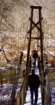
| Bridgemeister ID: | 1304 (added 2004-04-09) |
| Name: | Swinger |
| Location: | Owensboro vicinity, Kentucky, USA |
| At or Near Feature: | Panther Creek Park |
| Coordinates: | 37.716904 N 87.222139 W |
| Maps: | Acme, GeoHack, Google, OpenStreetMap |
| Use: | Footbridge |
| Status: | In use (last checked: 2021) |
| Main Cables: | Wire (steel) |
| Suspended Spans: | 1 |
Notes:
Swinging
Paintsville, Kentucky, USA - Big Sandy River Levisa Fork
| Bridgemeister ID: | 1490 (added 2004-09-19) |
| Name: | Swinging |
| Location: | Paintsville, Kentucky, USA |
| Crossing: | Big Sandy River Levisa Fork |
| At or Near Feature: | Paintsville Country Club |
| Coordinates: | 37.808576 N 82.773829 W |
| Maps: | Acme, GeoHack, Google, OpenStreetMap |
| Use: | Footbridge and Golf cart |
| Status: | In use (last checked: 2019) |
| Main Cables: | Wire (steel) |
| Suspended Spans: | 1 |
| Main Span: | 1 x 112.8 meters (370 feet) |
Notes:
- Used by golf carts. Just barely wide enough for one golf cart.
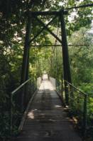
Tram
Tram, Kentucky, USA - Big Sandy River Levisa Fork
| Bridgemeister ID: | 5598 (added 2020-12-23) |
| Name: | Tram |
| Location: | Tram, Kentucky, USA |
| Crossing: | Big Sandy River Levisa Fork |
| Coordinates: | 37.573858 N 82.646108 W |
| Maps: | Acme, GeoHack, Google, OpenStreetMap |
| Use: | Vehicular (one-lane) |
| Status: | Removed |
| Main Cables: | Wire |
| Main Span: | 1 |
Notes:
- Appears to have been removed at some point in 1980s or early 1990s.
Do you have any information or photos for these bridges that you would like to share? Please email david.denenberg@bridgemeister.com.
