Suspension Bridges of Connecticut
This is a list of all 7 bridges from the suspension bridge inventory for Connecticut in USA. Wherever you see a Bridgemeister ID number click it to isolate the bridge on its own page.
Related Lists:
1876: Zoar
Stevenson vicinity, Connecticut, USA - Housatonic River
| Bridgemeister ID: | 85 (added before 2003) |
| Year Completed: | 1876 |
| Name: | Zoar |
| Location: | Stevenson vicinity, Connecticut, USA |
| Crossing: | Housatonic River |
| Use: | Vehicular (one-lane) |
| Status: | Demolished, 1919 |
| Main Cables: | Wire |
| Suspended Spans: | 1 |
Notes:
- Located on the road connecting Monroe to Oxford, until 1919 when the Stevenson Dam was built.
- May have been significantly widened, c. 1910.

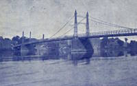
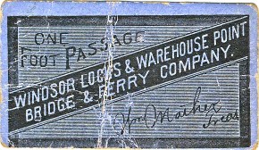
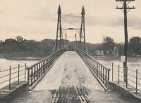
1886: (suspension bridge)
Windsor Locks and Warehouse Point, Connecticut, USA - Connecticut River
| Bridgemeister ID: | 306 (added before 2003) |
| Year Completed: | 1886 |
| Name: | (suspension bridge) |
| Location: | Windsor Locks and Warehouse Point, Connecticut, USA |
| Crossing: | Connecticut River |
| Principals: | James Shipman |
| References: | AAJ, PTS2 |
| Use: | Vehicular |
| Status: | Removed |
| Main Cables: | Wire |
| Suspended Spans: | 3 |
| Main Span: | 1 x 167.6 meters (550 feet) |
| Side Spans: | 2 x 91.4 meters (300 feet) |
External Links:
1991: Hauser
Washington vicinity, Connecticut, USA - Shepaug River
| Bridgemeister ID: | 1711 (added 2005-04-02) |
| Year Completed: | 1991 |
| Name: | Hauser |
| Location: | Washington vicinity, Connecticut, USA |
| Crossing: | Shepaug River |
| At or Near Feature: | Steep Rock State Park, The Clamshell |
| Coordinates: | 41.604933 N 73.333617 W |
| Maps: | Acme, GeoHack, Google, OpenStreetMap |
| Use: | Footbridge |
| Status: | In use (last checked: 2005) |
| Main Cables: | Wire |
| Suspended Spans: | 1 |
Notes:
- Crosses the river at the "bottom" of an interesting geological formation known as "The Clamshell."

2015: Henry David Thoreau
Washington, Connecticut, USA - Shepaug River
| Bridgemeister ID: | 2669 (added 2019-03-15) |
| Year Completed: | 2015 |
| Name: | Henry David Thoreau |
| Location: | Washington, Connecticut, USA |
| Crossing: | Shepaug River |
| At or Near Feature: | Hidden Valley Preserve |
| Coordinates: | 41.656833 N 73.316306 W |
| Maps: | Acme, GeoHack, Google, OpenStreetMap |
| Principals: | Seattle Bridge LLC |
| Use: | Footbridge |
| Status: | In use (last checked: 2018) |
| Main Cables: | Wire (steel) |
| Main Span: | 1 x 40.8 meters (134 feet) |
External Links:
(footbridge)
Belle Haven, Connecticut, USA - Long Island Sound
| Bridgemeister ID: | 2545 (added 2011-12-31) |
| Name: | (footbridge) |
| Location: | Belle Haven, Connecticut, USA |
| Crossing: | Long Island Sound |
| Coordinates: | 41.00501 N 73.62444 W |
| Maps: | Acme, GeoHack, Google, OpenStreetMap |
| Use: | Footbridge |
| Status: | In use (last checked: 2010) |
| Main Cables: | Wire (steel) |
Notes:
- Carries a private pier that extends into the Long Island Sound.
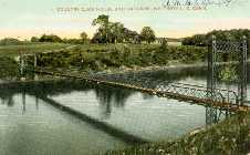
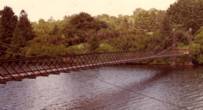
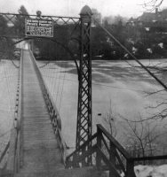
(footbridge)
Whitneyville, Connecticut, USA - Lake Whitney
| Bridgemeister ID: | 305 (added before 2003) |
| Name: | (footbridge) |
| Location: | Whitneyville, Connecticut, USA |
| Crossing: | Lake Whitney |
| At or Near Feature: | New Haven Country Club |
| Use: | Footbridge |
| Status: | Removed |
| Main Cables: | Wire (steel) |
| Suspended Spans: | 1 |
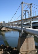
(pipeline bridge)
New Haven, Connecticut, USA - Quinnipiac River
| Bridgemeister ID: | 2040 (added 2006-05-07) |
| Name: | (pipeline bridge) |
| Location: | New Haven, Connecticut, USA |
| Crossing: | Quinnipiac River |
| Coordinates: | 41.320917 N 72.89015 W |
| Maps: | Acme, GeoHack, Google, OpenStreetMap |
| Use: | Pipeline |
| Status: | Extant (last checked: 2005) |
| Main Cables: | Wire (steel) |
| Suspended Spans: | 1 |
| Main Span: | 1 x 45.7 meters (150 feet) estimated |
Do you have any information or photos for these bridges that you would like to share? Please email david.denenberg@bridgemeister.com.