Suspension Bridges of Colorado
This is a list of all 24 bridges from the suspension bridge inventory for Colorado in USA. Wherever you see a Bridgemeister ID number click it to isolate the bridge on its own page.
Related Lists:
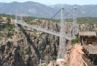
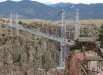
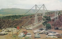
Suspended flume, carried waste material away from the Great Western Sugar Co. factory. Has not been used since 1950s. Bridgemeister ID: 164 (added before 2003)Year Completed: 1929 Name: Royal Gorge Location: Canon City, Colorado , USA Crossing: Arkansas River Coordinates: 38.46129 N 105.32541 W Maps: Acme , GeoHack , Google , OpenStreetMap Principals: George F. Cole, O.K. Peck References: AAJ , BC3 , BMA , GBD Use: Vehicular (two-lane) Status: In use (last checked: 2020) Main Cables: Wire (steel) Suspended Spans: 3 Main Span: 1 x 268.2 meters (880 feet) Side Spans: 2 Deck width: 18 feet
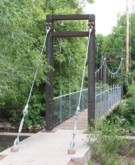
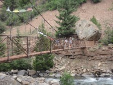
This bridge was built solely as a tourist attraction. Bridgemeister ID: 2226 (added 2007-03-18)Year Completed: 2002 Name: Swinging Location: Basalt, Colorado , USA Crossing: Frying Pan River Coordinates: 39.36828 N 107.03178 W Maps: Acme , GeoHack , Google , OpenStreetMap Principals: Sahale, LLC Use: Footbridge Status: In use (last checked: 2006) Main Cables: Wire (steel) Suspended Spans: 1 Main Span: 1 x 19.8 meters (65 feet) estimated
A display at the bridge indicates this bridge was a replacement for another suspension bridge. Completion year of 2002 is taken from the dedication date, January 11, 2002. Bridge may have been completed earlier (in late 2001). Bridgemeister ID: 2665 (added 2008-04-12)Year Completed: 2008 Name: Needleton Location: Needleton vicinity, Colorado , USA Crossing: Animas River At or Near Feature: Chicago Basin Trail Coordinates: 37.633320 N 107.692475 W Maps: Acme , GeoHack , Google , OpenStreetMap Principals: Sahale LLC Use: Footbridge Status: In use (last checked: 2008) Main Cables: Wire (steel) Suspended Spans: 1 Main Span: 1 x 32 meters (105 feet)
Bridgemeister ID: 2521 (added 2009-12-31)Year Completed: 2009 Name: Keystone Gorge Location: Telluride, Colorado , USA Crossing: San Miguel River At or Near Feature: Keystone Gorge Coordinates: 37.945772 N 107.893521 W Maps: Acme , GeoHack , Google , OpenStreetMap Principals: Chris Haaland Use: Footbridge Status: In use (last checked: 2021) Main Cables: Wire (steel) Suspended Spans: 1 Main Span: 1 x 27.4 meters (90 feet)
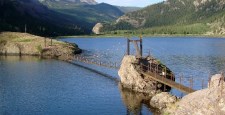
Bridgemeister ID: 2612 (added 2014-04-15)Year Completed: 2010 Name: (footbridge) Location: Lake City, Colorado , USA Crossing: Lake San Cristobal Coordinates: 37.96624 N 107.29273 W Maps: Acme , GeoHack , Google , OpenStreetMap Principals: Chris Haaland Use: Footbridge Status: In use (last checked: 2010) Main Cables: Wire (steel) Suspended Spans: 1 Main Span: 1 x 67.1 meters (220 feet)
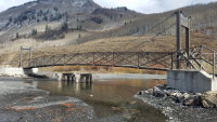
Bridgemeister ID: 2919 (added 2019-09-15)Year Completed: 2018 Name: Gunsight Location: Crested Butte, Colorado , USA Crossing: Slate River Coordinates: 38.908224 N 107.025381 W Maps: Acme , GeoHack , Google , OpenStreetMap Principals: Canyon Bridge LLC Use: Footbridge Status: In use (last checked: 2019) Main Cables: Wire (steel) Suspended Spans: 1 Main Span: 1 x 30.5 meters (100 feet)
Bridgemeister ID: 5923 (added 2021-06-15)Year Completed: 2021 Name: (footbridge) Location: Pueblo, Colorado , USA Crossing: Arkansas River Coordinates: 38.267861 N 104.623417 W Maps: Acme , GeoHack , Google , OpenStreetMap Use: Footbridge Status: In use (last checked: 2021) Main Cables: Wire (steel) Suspended Spans: 1 Main Span: 1
Opened for one weekend in early June 2021 as part of ceremonies commemorating those that lost their lives during the flood that devasted Pueblo 100 years ago, on June 3, 1921. Bridge is expected to be fully open to the public in July 2021. Bridgemeister ID: 7687 (added 2023-07-04)Year Completed: 2021 Name: Welch Ditch Location: Clear Creek Canyon Park, Golden, Colorado , USA Crossing: Clear Creek At or Near Feature: Welch Ditch Trail, Peaks to Plains Trail Coordinates: 39.744912 N 105.248592 W Maps: Acme , GeoHack , Google , OpenStreetMap Use: Footbridge Status: In use (last checked: 2023) Main Cables: Wire (steel) Suspended Spans: 1
Bridgemeister ID: 1615 (added 2005-02-22)Name: (conveyor bridge) Location: Thornton, Colorado , USA Crossing: South Platte River Coordinates: 39.86809 N 104.92068 W Maps: Acme , GeoHack , Google , OpenStreetMap Use: Pipeline and Footbridge Status: Derelict (last checked: 2007) Main Cables: Wire (steel) Suspended Spans: 1 Main Span: 1 x 121.9 meters (400 feet) estimated
Bridgemeister ID: 1630 (added 2005-03-11)Name: (conveyor bridge) Location: Thornton, Colorado , USA Crossing: South Platte River Coordinates: 39.87968 N 104.90335 W Maps: Acme , GeoHack , Google , OpenStreetMap Use: Conveyor and Footbridge Status: In use (last checked: 2007) Main Cables: Wire (steel) Suspended Spans: 1 Main Span: 1 x 106.7 meters (350 feet)
Bridgemeister ID: 811 (added 2003-05-29)Name: (footbridge) Location: Fort Collins, Colorado , USA Crossing: Cache La Poudre River At or Near Feature: Environmental Learning Center Coordinates: 40.55705 N 105.019417 W Maps: Acme , GeoHack , Google , OpenStreetMap Use: Footbridge Status: In use (last checked: 2005) Main Cables: Wire Suspended Spans: 1
Bridgemeister ID: 6140 (added 2021-07-06)Name: (footbridge) Location: Nathrop, Colorado , USA Crossing: Arkansas River At or Near Feature: Chateau Chaparral Coordinates: 38.743944 N 106.067806 W Maps: Acme , GeoHack , Google , OpenStreetMap Use: Footbridge Status: In use (last checked: 2021) Main Cables: Wire (steel) Suspended Spans: 1 Main Span: 1
Bridgemeister ID: 1554 (added 2004-11-23)Name: (footbridge) Location: Salida, Colorado , USA Crossing: Arkansas River Use: Footbridge Main Cables: Wire Suspended Spans: 1
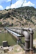
Call numbers X-13282 and CHS.X5149 of the Denver Public Library's Western History Photos collection show a suspension footbridge (circa 1890-1910) near the base of Tenderfoot Hill. Carrys a 66-inch water pipeline. Patrick O'Donnell estimates the length of the suspended portion of the span at 250 feet. Bridgemeister ID: 2225 (added 2007-03-18)Name: (pipeline bridge) Location: Glenwood Springs, Colorado , USA Crossing: Colorado River Coordinates: 39.55085 N 107.31878 W Maps: Acme , GeoHack , Google , OpenStreetMap Use: Pipeline Status: Extant (last checked: 2006) Main Cables: Wire (steel) Suspended Spans: 1 Main Span: 1 x 61 meters (200 feet) estimated
Span length of approximately 200 feet is for the suspended pipeline. Patrick O'Donnell estimates the anchorage-to-anchorage distance is 450 feet. Bridgemeister ID: 1553 (added 2004-11-23)Name: (suspension bridge) Location: Hot Springs Hotel, Canon City, Colorado , USA Crossing: Arkansas River Main Cables: Wire
Call number X-2456 of the Denver Public Library's Western History Photos collection shows a small suspension bridge (circa 1901-1905) at the Hot Springs Hotel. This bridge is not related to the Royal Gorge bridge. Bridgemeister ID: 296 (added before 2003)Name: (suspension bridge) Location: Palisade, Colorado , USA Crossing: Colorado River Status: Removed Main Cables: Wire Suspended Spans: 1
Scheduled for reconstruction starting April 2008. According to an article in the March 24, 2008 issue of The Durango Herald : "The wood support frames will be replaced with steel while the railing and deck will be replaced with a wood polymer such as Trex, which is made of recycled plastic and wood fibers." Bridgemeister ID: 822 (added 2003-05-31)Name: James Craig Bair Sheep Ranch Location: Dotsero vicinity, Colorado , USA Crossing: Colorado River At or Near Feature: Glenwood Canyon vicinity Coordinates: 39.64485 N 107.07813 W Maps: Acme , GeoHack , Google , OpenStreetMap Use: Footbridge and Stock Status: Extant (last checked: 2020) Main Cables: Wire (steel) Suspended Spans: 2 Main Span: 1 x 64 meters (210 feet) estimated Side Span: 1 x 16.5 meters (54 feet) estimated
Bridgemeister ID: 2429 (added 2008-04-12)Name: Needleton Location: Needleton vicinity, Colorado , USA Crossing: Animas River At or Near Feature: Chicago Basin Trail Coordinates: 37.633477 N 107.692765 W Maps: Acme , GeoHack , Google , OpenStreetMap Use: Footbridge Status: Replaced, 2008 Main Cables: Wire Suspended Spans: 1
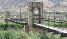
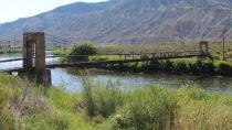
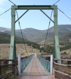
Bridgemeister ID: 1442 (added 2004-07-31)Name: Swinging Location: Browns Park National Wildlife Refuge vicinity, Colorado , USA Crossing: Green River Coordinates: 40.827833 N 109.030444 W Maps: Acme , GeoHack , Google , OpenStreetMap Use: Vehicular (one-lane) Status: In use (last checked: 2019) Main Cables: Wire (steel) Suspended Spans: 1 Main Span: 1 x 96.3 meters (316 feet) estimated
June 2014: Damaged when a tractor, well over the posted weight limit, tried to cross and broke through the bridge deck. Reopened August 23, 2018 after an "extensive reconstruction" that completely replaced the deck and possibly cables. After reconstruction, the weight limit was increased from 3 tons to 20 tons. November 2009: Closed due to safety concerns after six cable strrands were found to be broken. Repaired June-August 2010 and reopened. Do you have any information or photos for these bridges that you would like to share? Please email david.denenberg@bridgemeister.com .
Mail | Facebook | Twitter
