Suspension Bridges of Arkansas
This is a list of all 27 bridges from the suspension bridge inventory for Arkansas in USA. Wherever you see a Bridgemeister ID number click it to isolate the bridge on its own page.
Related Lists:
1894: Swinging
Eureka Springs vicinity, Arkansas, USA - King's River
| Bridgemeister ID: | 1822 (added 2005-05-21) |
| Year Completed: | 1894 |
| Name: | Swinging |
| Location: | Eureka Springs vicinity, Arkansas, USA |
| Crossing: | King's River |
| Use: | Vehicular |
| Status: | Removed |
| Main Cables: | Wire |
| Suspended Spans: | 2 |
| Main Spans: | 2 x 76.8 meters (252 feet) |
1905: Pangburn
Pangburn, Arkansas, USA - Little Red River
| Bridgemeister ID: | 7785 (added 2023-08-18) |
| Year Completed: | 1905 |
| Name: | Pangburn |
| Location: | Pangburn, Arkansas, USA |
| Crossing: | Little Red River |
| Coordinates: | 35.437946 N 91.845140 W |
| Maps: | Acme, GeoHack, Google, OpenStreetMap |
| Use: | Vehicular |
| Status: | Removed, 1958 |
| Main Cables: | Wire |
| Main Span: | 1 |
| Side Spans: | 2 |
External Links:
1912: Miller
Miller, Cleburne County, Arkansas, USA - Little Red River
| Bridgemeister ID: | 1073 (added 2003-12-27) |
| Year Completed: | 1912 |
| Name: | Miller |
| Location: | Miller, Cleburne County, Arkansas, USA |
| Crossing: | Little Red River |
| Principals: | Henry Churchill |
| Use: | Vehicular (one-lane) |
| Status: | Inundated |
| Main Cables: | Wire |
| Suspended Spans: | 1 |
| Main Span: | 1 x 114.3 meters (375 feet) estimated |
| Deck width: | ~10 feet |
Notes:
- Built as part of same contract as nearby 1912 Winkley bridge.
- Inundated by Greer's Ferry Lake upon completion of Greer's Ferry Dam, early 1960's.
- Companion to 1912 Tumbling Shoals - Tumbling Shoals, Arkansas, USA.
- Companion to 1912 Winkley (Swinging) - Heber Springs, Arkansas, USA.
External Links:
1912: Tumbling Shoals
Tumbling Shoals, Arkansas, USA - Little Red River
| Bridgemeister ID: | 1072 (added 2003-12-27) |
| Year Completed: | 1912 |
| Name: | Tumbling Shoals |
| Location: | Tumbling Shoals, Arkansas, USA |
| Crossing: | Little Red River |
| Principals: | Henry Churchill |
| Use: | Vehicular |
| Status: | Removed |
| Main Cables: | Wire |
| Suspended Spans: | 1 |
| Main Span: | 1 x 134.1 meters (440 feet) estimated |
Notes:
- Built as part of same contract as nearby 1912 Winkley bridge.
- Inundated by Greer's Ferry Lake upon completion of Greer's Ferry Dam, early 1960's.
- Companion to 1912 Miller - Miller, Cleburne County, Arkansas, USA.
- Companion to 1912 Winkley (Swinging) - Heber Springs, Arkansas, USA.
External Links:
1912: Winkley
Heber Springs, Arkansas, USA - Little Red River
| Bridgemeister ID: | 127 (added before 2003) |
| Year Completed: | 1912 |
| Name: | Winkley |
| Also Known As: | Swinging |
| Location: | Heber Springs, Arkansas, USA |
| Crossing: | Little Red River |
| Coordinates: | 35.489833 N 91.973918 W |
| Maps: | Acme, GeoHack, Google, OpenStreetMap |
| Principals: | Henry Churchill |
| References: | GBD |
| Use: | Vehicular (one-lane) |
| Status: | Collapsed, 1989 |
| Main Cables: | Wire |
| Main Span: | 1 x 167.6 meters (550 feet) |
Notes:
- 1949: Wooden towers replaced by steel towers.
- 1972: Restricted to pedestrians.
- 1989, October 28: Collapsed killing 5 people and injuring 18 others.
- Location also known as "Winkley Ford" and "Turner's Ferry".
- Companion to 1912 Miller - Miller, Cleburne County, Arkansas, USA.
- Companion to 1912 Tumbling Shoals - Tumbling Shoals, Arkansas, USA.
External Links:
- Historic Bridges of the United States - Winkley Bridge - Cleburne County, Arkansas
- Structurae - Structure ID 20001341
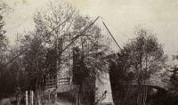
1914: Swinging
Allison, Arkansas, USA - South Sylamore Creek
| Bridgemeister ID: | 5856 (added 2021-05-15) |
| Year Completed: | 1914 |
| Name: | Swinging |
| Location: | Allison, Arkansas, USA |
| Crossing: | South Sylamore Creek |
| Coordinates: | 35.935672 N 92.121123 W |
| Maps: | Acme, GeoHack, Google, OpenStreetMap |
| Use: | Vehicular |
| Status: | Replaced, 1943 |
| Main Cables: | Wire (steel) |
| Suspended Spans: | 1 |
Notes:
- The bridge was heavily "reworked" in 1943 retaining the original main cables.
- Replaced by 1943 Swinging - Allison, Arkansas, USA.
1925: Powhatan
Powhatan, Arkansas, USA - Black River
1928: Des Arc
Des Arc, Arkansas, USA - White River
| Bridgemeister ID: | 152 (added before 2003) |
| Year Completed: | 1928 |
| Name: | Des Arc |
| Also Known As: | Swinging |
| Location: | Des Arc, Arkansas, USA |
| Crossing: | White River |
| Coordinates: | 34.974811 N 91.487684 W |
| Maps: | Acme, GeoHack, Google, OpenStreetMap |
| Principals: | Austin Bridge Co |
| References: | AUB, PTS2 |
| Use: | Vehicular |
| Status: | Demolished, August 1970 |
| Main Cables: | Wire (steel) |
| Suspended Spans: | 3 |
| Main Span: | 1 x 198.1 meters (650 feet) |
| Side Spans: | 2 x 97.5 meters (320 feet) |
Notes:
- The coordinates provided here indicate the approximate alignment of the bridge, about 0.5 miles southeast of the current (2020s) Des Arc White River crossing. The bridge delivered traffic near the east end of East Chester Street in Des Arc.
External Links:
1936: (suspension bridge)
Black Rock vicinity, Randolph County and Lawrence County, Arkansas, USA - Spring River
| Bridgemeister ID: | 1075 (added 2003-12-27) |
| Year Completed: | 1936 |
| Name: | (suspension bridge) |
| Location: | Black Rock vicinity, Randolph County and Lawrence County, Arkansas, USA |
| Crossing: | Spring River |
| Coordinates: | 36.13987 N 91.08400 W |
| Maps: | Acme, GeoHack, Google, OpenStreetMap |
| Principals: | WPA |
| Use: | Vehicular |
| Status: | Derelict (last checked: 2005) |
| Main Cables: | Wire (steel) |
| Main Span: | 1 x 91.4 meters (300 feet) estimated |
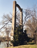
1940: Clear Creek Swinging
Pyatt vicinity, Arkansas, USA - Clear Creek
| Bridgemeister ID: | 1954 (added 2005-11-04) |
| Year Completed: | 1940 |
| Name: | Clear Creek Swinging |
| Location: | Pyatt vicinity, Arkansas, USA |
| Crossing: | Clear Creek |
| Coordinates: | 36.2098 N 92.8598 W |
| Maps: | Acme, GeoHack, Google, OpenStreetMap |
| Principals: | WPA |
| Use: | Vehicular |
| Status: | Replaced, 1975 |
| Main Cables: | Wire (steel) |
| Suspended Spans: | 1 |
External Links:
1941: Haggard Ford
Harrison vicinity, Arkansas, USA - Bear Creek
| Bridgemeister ID: | 199 (added before 2003) |
| Year Completed: | 1941 |
| Name: | Haggard Ford |
| Location: | Harrison vicinity, Arkansas, USA |
| Crossing: | Bear Creek |
| Coordinates: | 36.3458 N 93.1305 W |
| Maps: | Acme, GeoHack, Google, OpenStreetMap |
| Principals: | WPA, Jess Chaney |
| Use: | Vehicular (one-lane) |
| Status: | Restricted to foot traffic (last checked: 2007) |
| Main Cables: | Wire (steel) |
| Suspended Spans: | 1 |
| Main Span: | 1 x 48.8 meters (160 feet) |
Notes:
- Located about eight miles north of Harrison. According to plaque at bridge, restored 1977.
- Gene McCluney writes: "I visited this bridge [in the Summer of 2007] and talked to an adjacent landowner a couple weeks ago. It seems this bridge was closed in 1962 due to instability in one of the piers, and the crossing reverted to a ford or low water crossing until about four years ago when the new vehicular bridge was built. So, there was a suspension bridge in-use there for 20 years, then 40 years of "low water" type crossing, then just recently a new vehicle bridge."
- Similar to (suspension bridge) - Leslie vicinity, Arkansas, USA.
External Links:
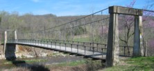
1943: Swinging
Allison, Arkansas, USA - South Sylamore Creek
| Bridgemeister ID: | 5857 (added 2021-05-15) |
| Year Completed: | 1943 |
| Name: | Swinging |
| Location: | Allison, Arkansas, USA |
| Crossing: | South Sylamore Creek |
| Coordinates: | 35.935874 N 92.121329 W |
| Maps: | Acme, GeoHack, Google, OpenStreetMap |
| Use: | Vehicular (one-lane) |
| Status: | Destroyed, December 3, 1982 |
| Main Cables: | Wire (steel) |
| Suspended Spans: | 1 |
Notes:
- 1982, December 3: Mostly destroyed by flood.
- Replaced 1914 Swinging - Allison, Arkansas, USA.
- Replaced by 1985 Sylamore Creek (Swinging) - Allison, Arkansas, USA.
1949: Beaver
Beaver, Arkansas, USA - White River
| Bridgemeister ID: | 200 (added before 2003) |
| Year Completed: | 1949 |
| Name: | Beaver |
| Location: | Beaver, Arkansas, USA |
| Crossing: | White River |
| At or Near Feature: | Table Rock Reservoir |
| Coordinates: | 36.4708 N 93.76856 W |
| Maps: | Acme, GeoHack, Google, OpenStreetMap |
| Principals: | Pioneer Construction Co., Arkansas State Highway Department |
| Use: | Vehicular (one-lane) |
| Status: | Closed, October, 2021 (last checked: 2021) |
| Main Cables: | Wire (steel) |
| Suspended Spans: | 3 |
| Main Span: | 1 x 95.1 meters (312 feet) |
| Side Spans: | 2 x 32 meters (105 feet) |
| Deck width: | 11.1 feet |
Notes:
- 1981: Deck replaced.
- 1990: Added to National Register of Historic Places
- 2002: Deck replaced.
- 2020: Timber deck and railings replaced, September.
- 2021, October: Closed again for repairs.
External Links:
- Historic Bridges of the United States - Beaver Bridge - Carroll County, Arkansas. States bridge was completed in 1949.
- Structurae - Structure ID 20012249
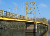
1949: Higden
Higden vicinity, Arkansas, USA - Little Red River
| Bridgemeister ID: | 1821 (added 2005-05-21) |
| Year Completed: | 1949 |
| Name: | Higden |
| Location: | Higden vicinity, Arkansas, USA |
| Crossing: | Little Red River |
| Use: | Vehicular |
| Status: | Removed |
| Main Cables: | Wire (steel) |
| Suspended Spans: | 1 |
Notes:
- The Arkansas History Commission's image archive contains an image of this bridge. The abstract mentions the bridge "is a temporary 'low-water' bridge built when the old suspension bridge nearby was declared unsafe"
1985: Sylamore Creek
Allison, Arkansas, USA - South Sylamore Creek
| Bridgemeister ID: | 202 (added before 2003) |
| Year Completed: | 1985 |
| Name: | Sylamore Creek |
| Also Known As: | Swinging |
| Location: | Allison, Arkansas, USA |
| Crossing: | South Sylamore Creek |
| Coordinates: | 35.936067 N 92.121528 W |
| Maps: | Acme, GeoHack, Google, OpenStreetMap |
| Use: | Vehicular (one-lane) |
| Status: | In use (last checked: 2021) |
| Main Cables: | Wire (steel) |
| Suspended Spans: | 1 |
| Main Span: | 1 x 61 meters (200 feet) |
Notes:
- Some references locate this bridge over North Sylamore Creek and most have it "north of Mountain View". The bridge is located over South Sylamore Creek about one-half mile due west of Allison, Arkansas on what is now Stone County route 283 and appropriately named Swinging Bridge Road.
- Replaced 1943 Swinging - Allison, Arkansas, USA.
External Links:
- Historic Bridges of the United States - Sylamore Creek Swinging Bridge - Stone County, Arkansas
- Structurae - Structure ID 20008201
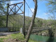
2015: Aux Arc Wilderness
Marshall, Arkansas, USA - Rush Creek
| Bridgemeister ID: | 5558 (added 2020-12-18) |
| Year Completed: | 2015 |
| Name: | Aux Arc Wilderness |
| Location: | Marshall, Arkansas, USA |
| Crossing: | Rush Creek |
| Use: | Vehicular (one-lane) |
| Status: | In use, 2019 |
| Main Cables: | Wire (steel) |
| Suspended Spans: | 1 |
| Main Span: | 1 x 28.7 meters (94 feet) |
| Bridgemeister ID: | 911 (added 2003-10-11) |
| Name: | (footbridge) |
| Location: | Blackburn vicinity, Arkansas, USA |
| Crossing: | Lee Creek |
| At or Near Feature: | Devil's Den State Park |
| Coordinates: | 35.777113 N 94.253950 W |
| Maps: | Acme, GeoHack, Google, OpenStreetMap |
| Use: | Footbridge |
| Status: | Destroyed, April, 2004 |
| Main Cables: | Wire |
| Suspended Spans: | 1 |
Notes:
- An April 28, 2004 AP wire story mentions: "Weekend flooding did an estimated $3 million in damage at Devil's Den State Park... A suspension bridge at the park was taken down by the flood waters." It appears to have since been rebuilt.
- Replaced by (footbridge) - Blackburn vicinity, Arkansas, USA.
| Bridgemeister ID: | 2495 (added 2003-10-11) |
| Name: | (footbridge) |
| Location: | Blackburn vicinity, Arkansas, USA |
| Crossing: | Lee Creek |
| At or Near Feature: | Devil's Den State Park |
| Coordinates: | 35.777184 N 94.254335 W |
| Maps: | Acme, GeoHack, Google, OpenStreetMap |
| Use: | Footbridge |
| Status: | In use (last checked: 2008) |
| Main Cables: | Wire (steel) |
| Suspended Spans: | 1 |
Notes:
| Bridgemeister ID: | 1638 (added 2005-03-13) |
| Name: | (footbridge) |
| Location: | East End vicinity, Arkansas, USA |
| Crossing: | Mary Lake |
| At or Near Feature: | Carmelite Novitiate |
| Coordinates: | 34.538468 N 92.342199 W |
| Maps: | Acme, GeoHack, Google, OpenStreetMap |
| Use: | Footbridge |
| Status: | Extant (last checked: 2021) |
| Main Cables: | Wire |
| Suspended Spans: | 1 |
| Main Span: | 1 x 42 meters (137.8 feet) estimated |

(footbridge)
Russellville, Arkansas, USA - Prairie Creek
| Bridgemeister ID: | 1320 (added 2004-04-25) |
| Name: | (footbridge) |
| Location: | Russellville, Arkansas, USA |
| Crossing: | Prairie Creek |
| At or Near Feature: | Bona Dea Trails System |
| Coordinates: | 35.301683 N 93.159617 W |
| Maps: | Acme, GeoHack, Google, OpenStreetMap |
| Use: | Footbridge |
| Status: | Only towers remain (last checked: 2011) |
| Main Cables: | Wire |
| Suspended Spans: | 1 |
Notes:
- Destroyed (or dismantled) sometime between 2005 and 2009.
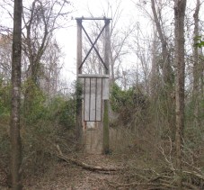
(pipeline bridge)
Curtis vicinity, Arkansas, USA - South Boat Ditch
| Bridgemeister ID: | 2432 (added 2008-04-22) |
| Name: | (pipeline bridge) |
| Location: | Curtis vicinity, Arkansas, USA |
| Crossing: | South Boat Ditch |
| Use: | Pipeline |
| Status: | Extant (last checked: 2008) |
| Main Cables: | Wire (steel) |
| Suspended Spans: | 1 |
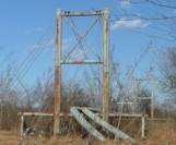
| Bridgemeister ID: | 1820 (added 2005-05-21) |
| Name: | (pipeline bridge) |
| Location: | Fulton, Arkansas, USA |
| Crossing: | Red River |
| Coordinates: | 33.60368 N 93.81316 W |
| Maps: | Acme, GeoHack, Google, OpenStreetMap |
| Use: | Pipeline |
| Status: | Extant (last checked: 2007) |
| Main Cables: | Wire (steel) |
| Suspended Spans: | 3 |
| Main Span: | 1 |
| Side Spans: | 2 |
Notes:
- Call numbers ECD0860-1 and ECD0860-2 of the Arkansas History Commission's image archives show this large pipeline bridge.
External Links:
- Historic Bridges of the United States - Fulton Pipeline Bridge - Hempstead County, Arkansas, and Miller County, Arkansas
- Structurae - Structure ID 20050818
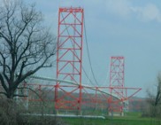
(pipeline bridge)
Redfield, Arkansas, USA - Arkansas River
| Bridgemeister ID: | 4951 (added 2020-08-08) |
| Name: | (pipeline bridge) |
| Location: | Redfield, Arkansas, USA |
| Crossing: | Arkansas River |
| Coordinates: | 34.480073 N 92.124041 W |
| Maps: | Acme, GeoHack, Google, OpenStreetMap |
| Use: | Pipeline |
| Status: | Extant (last checked: 2020) |
| Main Cables: | Wire (steel) |
External Links:
(suspension bridge)
Leslie vicinity, Arkansas, USA - Middle Fork Little Red River
| Bridgemeister ID: | 2363 (added 2007-09-08) |
| Name: | (suspension bridge) |
| Location: | Leslie vicinity, Arkansas, USA |
| Crossing: | Middle Fork Little Red River |
| Coordinates: | 35.81585 N 92.55011 W |
| Maps: | Acme, GeoHack, Google, OpenStreetMap |
| Status: | Derelict (last checked: 2007) |
| Main Cables: | Wire |
External Links:
(suspension bridge)
Leslie, Arkansas, USA - Middle Fork Little Red River
| Bridgemeister ID: | 2661 (added 2019-03-09) |
| Name: | (suspension bridge) |
| Location: | Leslie, Arkansas, USA |
| Crossing: | Middle Fork Little Red River |
| Coordinates: | 35.815960 N 92.550206 W |
| Maps: | Acme, GeoHack, Google, OpenStreetMap |
| Use: | Vehicular (one-lane) |
| Status: | Derelict (last checked: 2019) |
| Main Cables: | Wire (steel) |
Notes:
- Only the towers and main cables remain, as of 2018, derelict near the current US65 Middle Fork Little Red River crossing.
- Similar to 1941 Haggard Ford - Harrison vicinity, Arkansas, USA.
Swinging
Walcott, Arkansas, USA - Dancing Rabbit Arroyo
| Bridgemeister ID: | 7203 (added 2022-07-07) |
| Name: | Swinging |
| Location: | Walcott, Arkansas, USA |
| Crossing: | Dancing Rabbit Arroyo |
| At or Near Feature: | Crowley's Ridge State Park |
| Coordinates: | 36.043750 N 90.666000 W |
| Maps: | Acme, GeoHack, Google, OpenStreetMap |
| Use: | Footbridge |
| Status: | In use (last checked: 2022) |
| Main Cables: | Chain (steel) |
| Main Span: | 1 |
| Side Spans: | 2 |
Notes:
- The park's trail guides mention two swinging bridges on the same trail, but it's unclear if the second bridge, perhaps 500 feet south of the coordinates for the bridge given here, is actually a suspension bridge.
Do you have any information or photos for these bridges that you would like to share? Please email david.denenberg@bridgemeister.com.