Suspension Bridges of British Columbia
This is a list of all 45 bridges from the suspension bridge inventory for British Columbia in Canada. Wherever you see a Bridgemeister ID number click it to isolate the bridge on its own page.
Related Lists:
1863: Alexandra
Spuzzum, British Columbia, Canada - Fraser River
| Bridgemeister ID: | 63 (added before 2003) |
| Year Completed: | 1863 |
| Name: | Alexandra |
| Also Known As: | Trutch's |
| Location: | Spuzzum, British Columbia, Canada |
| Crossing: | Fraser River |
| Principals: | Andrew S. Hallidie, Joseph W. Trutch |
| Use: | Vehicular |
| Status: | Removed, 1912 |
| Main Cables: | Wire (iron) |
| Main Span: | 1 x 82 meters (269 feet) |
Notes:
- Fell into disuse, 1884. Damaged by flood 1904. Dismantled 1912. Some sources indicate the flood damage occurred in 1894.
- Replaced by 1926 Second Alexandra - Spuzzum, British Columbia, Canada.

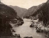
1912: Hagwilget
Hagwilget, British Columbia, Canada - Bulkley River
| Bridgemeister ID: | 1229 (added 2004-02-15) |
| Year Completed: | 1912 |
| Name: | Hagwilget |
| Also Known As: | Bulkley Canyon |
| Location: | Hagwilget, British Columbia, Canada |
| Crossing: | Bulkley River |
| At or Near Feature: | Hagwilget Canyon |
| Coordinates: | 55.257347 N 127.604616 W |
| Maps: | Acme, GeoHack, Google, OpenStreetMap |
| References: | AAJ |
| Use: | Vehicular (one-lane) |
| Status: | Replaced, 1931 |
| Main Cables: | Wire (steel) |
| Suspended Spans: | 1 |
| Main Span: | 1 x 137.5 meters (451 feet) |
| Deck width: | 9 feet |
Notes:
- AAJ: Restricted to foot traffic, 1929.
- Replaced by 1931 Hagwilget (Bulkley Canyon) - Hagwilget, British Columbia, Canada.
- See Walcott - Walcott, British Columbia, Canada. Part or all of the dismantled 1912 Hagwilget bridge may have been reused for this bridge at Walcott.

1913: Brilliant
Castlegar vicinity, British Columbia, Canada - Kootenay River
| Bridgemeister ID: | 128 (added before 2003) |
| Year Completed: | 1913 |
| Name: | Brilliant |
| Also Known As: | Doukhobor |
| Location: | Castlegar vicinity, British Columbia, Canada |
| Crossing: | Kootenay River |
| Coordinates: | 49.31793 N 117.63023 W |
| Maps: | Acme, GeoHack, Google, OpenStreetMap |
| Principals: | J. R. Grant |
| References: | AAJ, PTS2 |
| Use: | Vehicular (one-lane) |
| Status: | Restricted to foot traffic (last checked: 2010) |
| Main Cables: | Wire (steel) |
| Suspended Spans: | 1 |
| Main Span: | 1 x 100.9 meters (331 feet) |
| Deck width: | 16 feet |
Notes:
- 2010, May: Bridge is reopened for pedestrian traffic after a restoration project. Bridge had been closed and derelict prior.
- Near 1984 Zuckerberg Island Heritage Park - Castlegar, British Columbia, Canada.
External Links:
1914: Churn Creek
Gang Ranch, British Columbia, Canada - Fraser River
| Bridgemeister ID: | 131 (added before 2003) |
| Year Completed: | 1914 |
| Name: | Churn Creek |
| Location: | Gang Ranch, British Columbia, Canada |
| Crossing: | Fraser River |
| Coordinates: | 51.527494 N 122.285082 W |
| Maps: | Acme, GeoHack, Google, OpenStreetMap |
| Principals: | Waddell & Harrington |
| References: | BPL |
| Use: | Vehicular (one-lane) |
| Status: | In use (last checked: 2018) |
| Main Cables: | Wire (steel) |
| Suspended Spans: | 1 |
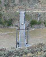
1914: Old
Lillooet, British Columbia, Canada - Fraser River
| Bridgemeister ID: | 130 (added before 2003) |
| Year Completed: | 1914 |
| Name: | Old |
| Location: | Lillooet, British Columbia, Canada |
| Crossing: | Fraser River |
| Coordinates: | 50.711493 N 121.911333 W |
| Maps: | Acme, GeoHack, Google, OpenStreetMap |
| Principals: | Waddell & Harrington |
| References: | BPL |
| Use: | Vehicular (one-lane) |
| Status: | Restricted to foot traffic (last checked: 2015) |
| Main Cables: | Wire (steel) |
| Suspended Spans: | 1 |
| Main Span: | 1 x 121.9 meters (400 feet) estimated |
Notes:
- Known locally as "The Old Bridge."
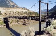
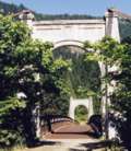
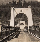
1926: Second Alexandra
Spuzzum, British Columbia, Canada - Fraser River
| Bridgemeister ID: | 147 (added before 2003) |
| Year Completed: | 1926 |
| Name: | Second Alexandra |
| Location: | Spuzzum, British Columbia, Canada |
| Crossing: | Fraser River |
| At or Near Feature: | Caribou Highway |
| Coordinates: | 49.70739 N 121.41669 W |
| Maps: | Acme, GeoHack, Google, OpenStreetMap |
| References: | BPL |
| Use: | Vehicular (one-lane) |
| Status: | Restricted to foot traffic (last checked: 2021) |
| Main Cables: | Wire (steel) |
| Suspended Spans: | 1 |
| Main Span: | 1 x 82.3 meters (270 feet) |
Notes:
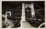
1931: Hagwilget
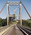
Hagwilget, British Columbia, Canada - Bulkley River
| Bridgemeister ID: | 170 (added before 2003) |
| Year Completed: | 1931 |
| Name: | Hagwilget |
| Also Known As: | Bulkley Canyon |
| Location: | Hagwilget, British Columbia, Canada |
| Crossing: | Bulkley River |
| At or Near Feature: | Hagwilget Canyon |
| Coordinates: | 55.25740 N 127.60380 W |
| Maps: | Acme, GeoHack, Google, OpenStreetMap |
| Principals: | BC Department of Public Works |
| References: | AAJ |
| Use: | Vehicular (one-lane) |
| Status: | In use (last checked: 2008) |
| Main Cables: | Wire (steel) |
| Suspended Spans: | 1 |
| Main Span: | 1 x 140.2 meters (460 feet) |
| Deck width: | 16 feet |
Notes:
External Links:
1932: (suspension bridge)
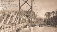
Bella Coola, British Columbia, Canada - Bella Coola River
| Bridgemeister ID: | 1436 (added 2004-07-30) |
| Year Completed: | 1932 |
| Name: | (suspension bridge) |
| Location: | Bella Coola, British Columbia, Canada |
| Crossing: | Bella Coola River |
| Status: | Removed, before 1966 |
| Main Cables: | Wire (steel) |
| Suspended Spans: | 1 |
Notes:
- Later at same location 1957 (footbridge) - Bella Coola, British Columbia, Canada.
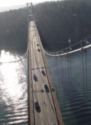
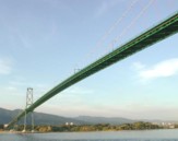
1939: Lions Gate
Vancouver, British Columbia, Canada - Vancouver Harbor
| Bridgemeister ID: | 194 (added before 2003) |
| Year Completed: | 1939 |
| Name: | Lions Gate |
| Also Known As: | First Narrows |
| Location: | Vancouver, British Columbia, Canada |
| Crossing: | Vancouver Harbor |
| At or Near Feature: | Burrard Inlet |
| Coordinates: | 49.31533 N 123.13846 W |
| Maps: | Acme, GeoHack, Google, OpenStreetMap |
| Principals: | Monsarrat and Pratley |
| References: | AAJ, BAR, BMA |
| Use: | Vehicular (major highway) |
| Status: | In use (last checked: 2019) |
| Main Cables: | Wire (steel) |
| Suspended Spans: | 3 |
| Main Span: | 1 x 472.4 meters (1,550 feet) |
| Side Spans: | 2 x 187.5 meters (615 feet) |
| Deck width: | 39 feet |
External Links:

1943: Peace River
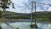
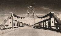
Taylor, British Columbia, Canada - Peace River
| Bridgemeister ID: | 205 (added before 2003) |
| Year Completed: | 1943 |
| Name: | Peace River |
| Location: | Taylor, British Columbia, Canada |
| Crossing: | Peace River |
| Coordinates: | 56.138123 N 120.674371 W |
| Maps: | Acme, GeoHack, Google, OpenStreetMap |
| Principals: | John A. Roebling's Sons Co. |
| References: | CTT |
| Use: | Vehicular |
| Status: | Demolished |
| Main Cables: | Wire (steel) |
| Suspended Spans: | 3 |
| Main Span: | 1 x 609.6 meters (2,000 feet) |
| Side Spans: | 2 |
Notes:
- Partially collapsed October, 1957 after one of the anchorages began to slide.
- Near future location of (pipeline bridge) - Taylor, British Columbia, Canada.
External Links:
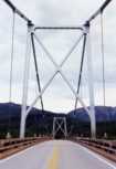
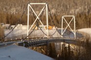
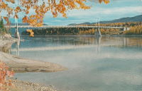
1944: Liard River
Liard River Hot Springs vicinity, British Columbia, Canada - Liard River
| Bridgemeister ID: | 339 (added before 2003) |
| Year Completed: | 1944 |
| Name: | Liard River |
| Location: | Liard River Hot Springs vicinity, British Columbia, Canada |
| Crossing: | Liard River |
| Coordinates: | 59.41312 N 126.09541 W |
| Maps: | Acme, GeoHack, Google, OpenStreetMap |
| Principals: | American Bridge Co. |
| References: | CTT |
| Use: | Vehicular (two-lane, heavy vehicles) |
| Status: | In use (last checked: 2009) |
| Main Cables: | Wire (steel) |
| Suspended Spans: | 3 |
| Main Span: | 1 |
| Side Spans: | 2 |
Notes:
- See 1940 Tacoma Narrows (Galloping Gertie) - Tacoma and Gig Harbor, Washington, USA. According to CTT, "Two sections from the Tacoma bridge's east approach were [re]used in the Liard span."
External Links:
1957: (footbridge)
Bella Coola, British Columbia, Canada - Bella Coola River
| Bridgemeister ID: | 2437 (added 2008-04-22) |
| Year Completed: | 1957 |
| Name: | (footbridge) |
| Location: | Bella Coola, British Columbia, Canada |
| Crossing: | Bella Coola River |
| Principals: | Allison Logging Co. |
| Use: | Footbridge |
| Main Cables: | Wire |
Notes:
- At former location of 1932 (suspension bridge) - Bella Coola, British Columbia, Canada.
1961: Revelstoke
Revelstoke, British Columbia, Canada - Columbia River
| Bridgemeister ID: | 943 (added 2003-10-29) |
| Year Completed: | 1961 |
| Name: | Revelstoke |
| Location: | Revelstoke, British Columbia, Canada |
| Crossing: | Columbia River |
| Coordinates: | 51.00713 N 118.2189 W |
| Maps: | Acme, GeoHack, Google, OpenStreetMap |
| Use: | Vehicular (two-lane, heavy vehicles), with walkway |
| Status: | In use (last checked: 2019) |
| Main Cables: | Wire (steel) |
| Suspended Spans: | 2 |
| Main Span: | 1 x 300.2 meters (985 feet) |
| Side Span: | 1 |
External Links:
1963: (suspension bridge)
Hope, British Columbia, Canada - Coquihalla River
| Bridgemeister ID: | 2448 (added 2004-02-28) |
| Year Completed: | 1963 |
| Name: | (suspension bridge) |
| Location: | Hope, British Columbia, Canada |
| Crossing: | Coquihalla River |
| Coordinates: | 49.386927 N 121.433118 W |
| Maps: | Acme, GeoHack, Google, OpenStreetMap |
| Principals: | Emil Anderson Construction |
| Use: | Vehicular |
| Status: | Destroyed, January 4, 1984 |
Notes:
- Destroyed by flood, January 4, 1984.
- Replaced by 1984 (suspension bridge) - Hope, British Columbia, Canada.
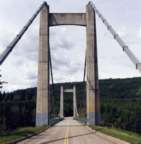
1965: Hudson's Hope
Hudson's Hope, British Columbia, Canada - Peace River
| Bridgemeister ID: | 222 (added before 2003) |
| Year Completed: | 1965 |
| Name: | Hudson's Hope |
| Location: | Hudson's Hope, British Columbia, Canada |
| Crossing: | Peace River |
| Coordinates: | 55.988618 N 121.985539 W |
| Maps: | Acme, GeoHack, Google, OpenStreetMap |
| Use: | Vehicular (two-lane, heavy vehicles) |
| Status: | In use (last checked: 2019) |
| Main Cables: | Wire (steel) |
| Suspended Spans: | 1 |
External Links:
1968: Gitwinksihlkw
Gitwinksihlkw (Canyon City), British Columbia, Canada - Nass River
| Bridgemeister ID: | 254 (added before 2003) |
| Year Completed: | 1968 |
| Name: | Gitwinksihlkw |
| Location: | Gitwinksihlkw (Canyon City), British Columbia, Canada |
| Crossing: | Nass River |
| Coordinates: | 55.191403 N 129.221144 W |
| Maps: | Acme, GeoHack, Google, OpenStreetMap |
| Use: | Footbridge |
| Status: | In use (last checked: 2019) |
| Main Cables: | Wire (steel) |
| Suspended Spans: | 1 |
| Main Span: | 1 x 103.3 meters (339 feet) |
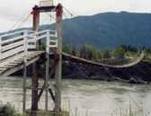
1976: Cheewhat River
British Columbia, Canada - Cheewhat River
| Bridgemeister ID: | 1451 (added 2004-08-01) |
| Year Completed: | 1976 |
| Name: | Cheewhat River |
| Location: | British Columbia, Canada |
| Crossing: | Cheewhat River |
| At or Near Feature: | West Coast Trail |
| Coordinates: | 48.663340 N 124.811974 W |
| Maps: | Acme, GeoHack, Google, OpenStreetMap |
| Use: | Footbridge |
| Status: | In use (last checked: 2016) |
| Main Cables: | Wire (steel) |
| Suspended Spans: | 1 |
1980: Similkameen Ore Conveyor
Princeton, British Columbia, Canada - Similkameen Canyon
| Bridgemeister ID: | 2100 (added 2006-07-07) |
| Year Completed: | 1980 |
| Name: | Similkameen Ore Conveyor |
| Location: | Princeton, British Columbia, Canada |
| Crossing: | Similkameen Canyon |
| Coordinates: | 49.351219 N 120.548909 W |
| Maps: | Acme, GeoHack, Google, OpenStreetMap |
| Principals: | Buckland & Taylor Ltd., Robert McLellan & Co. Ltd. |
| Use: | Conveyor |
| Status: | Extant (last checked: 2019) |
| Main Cables: | Wire (steel) |
| Main Span: | 1 x 403.9 meters (1,325 feet) |
External Links:
1984: (suspension bridge)
Hope, British Columbia, Canada - Coquihalla River
| Bridgemeister ID: | 1253 (added 2004-02-28) |
| Year Completed: | 1984 |
| Name: | (suspension bridge) |
| Location: | Hope, British Columbia, Canada |
| Crossing: | Coquihalla River |
| Coordinates: | 49.387210 N 121.432464 W |
| Maps: | Acme, GeoHack, Google, OpenStreetMap |
| Principals: | Emil Anderson Construction |
| Use: | Vehicular (one-lane) |
| Status: | Replaced (last checked: 2007) |
| Main Cables: | Wire (steel) |
| Suspended Spans: | 1 |
| Main Span: | 1 x 79.2 meters (260 feet) estimated |
Notes:
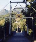
1984: Zuckerberg Island Heritage Park
Castlegar, British Columbia, Canada - Columbia River
| Bridgemeister ID: | 913 (added 2003-10-11) |
| Year Completed: | 1984 |
| Name: | Zuckerberg Island Heritage Park |
| Location: | Castlegar, British Columbia, Canada |
| Crossing: | Columbia River |
| Coordinates: | 49.31616 N 117.65898 W |
| Maps: | Acme, GeoHack, Google, OpenStreetMap |
| Principals: | 44th Field Engineer Squadron |
| Use: | Footbridge |
| Status: | Closed (last checked: 2023) |
| Main Cables: | Wire (steel) |
| Suspended Spans: | 1 |
| Main Span: | 1 x 91.4 meters (300 feet) |
| Deck width: | 3 feet |
Notes:
- 2023, November: Has been closed for some time awaiting repairs.
- 1996: Bridge is reconstructed, according to sign posted at bridge.
- Near 1913 Brilliant (Doukhobor) - Castlegar vicinity, British Columbia, Canada.
2007: Top
Parksville, British Columbia, Canada - Englishman River
| Bridgemeister ID: | 2498 (added 2008-12-24) |
| Year Completed: | 2007 |
| Name: | Top |
| Location: | Parksville, British Columbia, Canada |
| Crossing: | Englishman River |
| At or Near Feature: | Top Bridge Regional Park |
| Coordinates: | 49.297840 N 124.266962 W |
| Maps: | Acme, GeoHack, Google, OpenStreetMap |
| Use: | Footbridge |
| Status: | In use (last checked: 2020) |
| Main Cables: | Wire (steel) |
| Suspended Spans: | 2 |
| Main Spans: | 2 |
2014: Swift Creek
Valemount, British Columbia, Canada - Swift Creek
| Bridgemeister ID: | 3280 (added 2019-11-23) |
| Year Completed: | 2014 |
| Name: | Swift Creek |
| Location: | Valemount, British Columbia, Canada |
| Crossing: | Swift Creek |
| Coordinates: | 52.862358 N 119.241536 W |
| Maps: | Acme, GeoHack, Google, OpenStreetMap |
| Principals: | Robson Energy Services, G. Carson Logging |
| Use: | Footbridge |
| Status: | In use (last checked: 2014) |
| Main Cables: | Wire (steel) |
2016: Columbia River Skywalk
Trail, British Columbia, Canada - Columbia River
| Bridgemeister ID: | 4957 (added 2020-08-09) |
| Year Completed: | 2016 |
| Name: | Columbia River Skywalk |
| Location: | Trail, British Columbia, Canada |
| Crossing: | Columbia River |
| Coordinates: | 49.094381 N 117.702046 W |
| Maps: | Acme, GeoHack, Google, OpenStreetMap |
| Principals: | COWI North America Ltd., Graham Infrastructure LP |
| Use: | Footbridge |
| Status: | In use (last checked: 2020) |
| Main Cables: | Wire (steel) |
| Suspended Spans: | 3 |
| Main Span: | 1 x 225 meters (738.2 feet) |
| Side Spans: | 2 |
External Links:
2018: Seymour River
North Vancouver, British Columbia, Canada - Seymour River
| Bridgemeister ID: | 2653 (added 2019-03-03) |
| Year Completed: | 2018 |
| Name: | Seymour River |
| Location: | North Vancouver, British Columbia, Canada |
| Crossing: | Seymour River |
| Coordinates: | 49.342497 N 123.002236 W |
| Maps: | Acme, GeoHack, Google, OpenStreetMap |
| Use: | Footbridge |
| Status: | In use (last checked: 2019) |
| Main Cables: | Wire (steel) |
| Suspended Spans: | 1 |
(footbridge)
British Columbia, Canada - Tsocowis Creek
| Bridgemeister ID: | 1317 (added 2004-04-20) |
| Name: | (footbridge) |
| Location: | British Columbia, Canada |
| Crossing: | Tsocowis Creek |
| At or Near Feature: | West Coast Trail |
| Coordinates: | 48.713740 N 125.017662 W |
| Maps: | Acme, GeoHack, Google, OpenStreetMap |
| Use: | Footbridge |
| Status: | In use (last checked: 2020) |
| Main Cables: | Wire (steel) |
(footbridge)
Kootenay National Park, British Columbia, Canada - Kootenay River
| Bridgemeister ID: | 1471 (added 2004-08-29) |
| Name: | (footbridge) |
| Location: | Kootenay National Park, British Columbia, Canada |
| Crossing: | Kootenay River |
| Coordinates: | 51.17053 N 116.15066 W |
| Maps: | Acme, GeoHack, Google, OpenStreetMap |
| Use: | Footbridge |
| Status: | Removed |
| Main Cables: | Wire |
Notes:
- Replaced at some point between 2005 and 2018.
(footbridge)
Langley City, British Columbia, Canada - Newlands Brook
| Bridgemeister ID: | 4776 (added 2020-07-03) |
| Name: | (footbridge) |
| Location: | Langley City, British Columbia, Canada |
| Crossing: | Newlands Brook |
| At or Near Feature: | Nickomekl Park |
| Coordinates: | 49.098535 N 122.650566 W |
| Maps: | Acme, GeoHack, Google, OpenStreetMap |
| Use: | Footbridge |
| Status: | In use (last checked: 2020) |
| Main Cables: | Wire (steel) |
(footbridge)
Lytton, British Columbia, Canada - Stein River
| Bridgemeister ID: | 2956 (added 2019-10-05) |
| Name: | (footbridge) |
| Location: | Lytton, British Columbia, Canada |
| Crossing: | Stein River |
| At or Near Feature: | Stein Valley Nlaka'pamux Heritage Park |
| Coordinates: | 50.289630 N 121.778241 W |
| Maps: | Acme, GeoHack, Google, OpenStreetMap |
| Use: | Footbridge |
| Status: | In use (last checked: 2018) |
| Main Cables: | Wire (steel) |
| Suspended Spans: | 1 |
(footbridge)
Port Renfrew vicinity, British Columbia, Canada - Harris Creek
| Bridgemeister ID: | 3078 (added 2019-10-26) |
| Name: | (footbridge) |
| Location: | Port Renfrew vicinity, British Columbia, Canada |
| Crossing: | Harris Creek |
| Coordinates: | 48.648517 N 124.221750 W |
| Maps: | Acme, GeoHack, Google, OpenStreetMap |
| Use: | Footbridge |
| Status: | In use (last checked: 2021) |
| Main Cables: | Wire (steel) |
(footbridge)
Ryan vicinity, British Columbia, Canada - Moyie River
| Bridgemeister ID: | 1868 (added 2005-08-06) |
| Name: | (footbridge) |
| Location: | Ryan vicinity, British Columbia, Canada |
| Crossing: | Moyie River |
| Coordinates: | 49.121617 N 116.043633 W |
| Maps: | Acme, GeoHack, Google, OpenStreetMap |
| Use: | Footbridge |
| Status: | In use (last checked: 2005) |
| Main Cables: | Wire |
| Suspended Spans: | 1 |
(footbridge)
West Creston vicinity, British Columbia, Canada - Summit Creek
| Bridgemeister ID: | 903 (added 2003-10-11) |
| Name: | (footbridge) |
| Location: | West Creston vicinity, British Columbia, Canada |
| Crossing: | Summit Creek |
| At or Near Feature: | Dewdney Trail |
| Coordinates: | 49.14233 N 116.6446 W |
| Maps: | Acme, GeoHack, Google, OpenStreetMap |
| Use: | Footbridge |
| Main Span: | 1 x 36.6 meters (120 feet) estimated |
(footbridge)
Whistler, British Columbia, Canada - Cheakamus River
| Bridgemeister ID: | 5358 (added 2020-11-22) |
| Name: | (footbridge) |
| Location: | Whistler, British Columbia, Canada |
| Crossing: | Cheakamus River |
| Coordinates: | 50.067139 N 123.032569 W |
| Maps: | Acme, GeoHack, Google, OpenStreetMap |
| Use: | Footbridge |
| Status: | In use (last checked: 2020) |
| Main Cables: | Wire (steel) |
(pipeline bridge)
North Cowichan, Chemainus vicinity, British Columbia, Canada
| Bridgemeister ID: | 5173 (added 2020-10-03) |
| Name: | (pipeline bridge) |
| Location: | North Cowichan, Chemainus vicinity, British Columbia, Canada |
| Coordinates: | 48.904068 N 123.757119 W |
| Maps: | Acme, GeoHack, Google, OpenStreetMap |
| Use: | Pipeline |
| Status: | Extant (last checked: 2020) |
| Main Cables: | Wire (steel) |
External Links:
(pipeline bridge)
Savona, British Columbia, Canada - Thompson River
| Bridgemeister ID: | 1511 (added 2004-10-09) |
| Name: | (pipeline bridge) |
| Location: | Savona, British Columbia, Canada |
| Crossing: | Thompson River |
| Use: | Pipeline |
| Status: | Extant (last checked: 2004) |
| Main Cables: | Wire (steel) |
| Suspended Spans: | 1 |
| Main Span: | 1 x 182.9 meters (600 feet) |
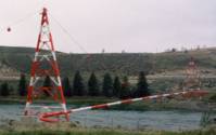
(pipeline bridge)
Taylor, British Columbia, Canada - Peace River
| Bridgemeister ID: | 919 (added 2003-10-18) |
| Name: | (pipeline bridge) |
| Location: | Taylor, British Columbia, Canada |
| Crossing: | Peace River |
| Coordinates: | 56.13737 N 120.66919 W |
| Maps: | Acme, GeoHack, Google, OpenStreetMap |
| Use: | Pipeline |
| Status: | In use |
| Suspended Spans: | 1 |
Notes:
- Near former location of 1943 Peace River - Taylor, British Columbia, Canada.
External Links:
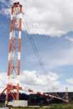
Bunzten Lake
Anmore, British Columbia, Canada - Buntzen Lake
| Bridgemeister ID: | 5174 (added 2020-10-03) |
| Name: | Bunzten Lake |
| Location: | Anmore, British Columbia, Canada |
| Crossing: | Buntzen Lake |
| Coordinates: | 49.365787 N 122.858608 W |
| Maps: | Acme, GeoHack, Google, OpenStreetMap |
| Use: | Footbridge |
| Status: | In use (last checked: 2020) |
| Main Cables: | Wire (steel) |
Notes:
- 2022, September: Bridge is scheduled to be replaced by November 2022.
Cal Cheak
Cal Cheak, Whistler, British Columbia, Canada
| Bridgemeister ID: | 5360 (added 2020-11-22) |
| Name: | Cal Cheak |
| Location: | Cal Cheak, Whistler, British Columbia, Canada |
| Coordinates: | 50.059813 N 123.101920 W |
| Maps: | Acme, GeoHack, Google, OpenStreetMap |
| Use: | Footbridge |
| Status: | In use (last checked: 2020) |
| Main Cables: | Wire (steel) |
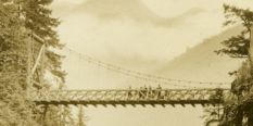
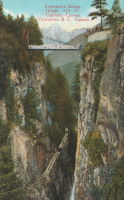
Grand Canyon
Capilano, British Columbia, Canada
| Bridgemeister ID: | 1006 (added 2003-11-21) |
| Name: | Grand Canyon |
| Also Known As: | Second Canyon |
| Location: | Capilano, British Columbia, Canada |
| Use: | Footbridge |
Notes:
- Level footbridge with large timber towers, not the famous Capilano swinging bridge.
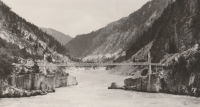
Hell's Gate
Boston Bar, British Columbia, Canada - Fraser River
| Bridgemeister ID: | 1244 (added 2004-02-16) |
| Name: | Hell's Gate |
| Location: | Boston Bar, British Columbia, Canada |
| Crossing: | Fraser River |
| At or Near Feature: | Hell's Gate |
| Coordinates: | 49.780421 N 121.449785 W |
| Maps: | Acme, GeoHack, Google, OpenStreetMap |
| Use: | Footbridge |
| Status: | In use (last checked: 2020) |
| Main Cables: | Wire (steel) |
| Suspended Spans: | 1 |
| Main Span: | 1 x 82.3 meters (270 feet) estimated |
Notes:
- Appears to be wide enough to have once carried vehicles, but is now restricted to pedestrians.

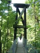
Koksilah River
Cowichan Station, British Columbia, Canada - Koksilah River
| Bridgemeister ID: | 566 (added 2002-12-30) |
| Name: | Koksilah River |
| Location: | Cowichan Station, British Columbia, Canada |
| Crossing: | Koksilah River |
| At or Near Feature: | Bright Angel Provincial Park |
| Coordinates: | 48.73651 N 123.67823 W |
| Maps: | Acme, GeoHack, Google, OpenStreetMap |
| Use: | Footbridge |
| Status: | In use (last checked: 2007) |
| Main Cables: | Wire (steel) |
Menzies Creek
Bloedel vicinity, British Columbia, Canada - Menzies Creek
| Bridgemeister ID: | 2427 (added 2008-04-12) |
| Name: | Menzies Creek |
| Location: | Bloedel vicinity, British Columbia, Canada |
| Crossing: | Menzies Creek |
| Coordinates: | 50.11210 N 125.37409 W |
| Maps: | Acme, GeoHack, Google, OpenStreetMap |
| Use: | Footbridge |
| Status: | In use (last checked: 2008) |
| Main Cables: | Wire (steel) |
Panorama Mountain Resort
Panorama, British Columbia, Canada - Toby Creek
| Bridgemeister ID: | 2676 (added 2019-03-30) |
| Name: | Panorama Mountain Resort |
| Location: | Panorama, British Columbia, Canada |
| Crossing: | Toby Creek |
| Coordinates: | 50.458872 N 116.240551 W |
| Maps: | Acme, GeoHack, Google, OpenStreetMap |
| Use: | Footbridge |
| Status: | In use (last checked: 2015) |
| Main Cables: | Wire (steel) |
Sheep Creek
Williams Lake vicinity, British Columbia, Canada - Fraser River
| Bridgemeister ID: | 1641 (added 2005-03-14) |
| Name: | Sheep Creek |
| Location: | Williams Lake vicinity, British Columbia, Canada |
| Crossing: | Fraser River |
| Coordinates: | 51.982898 N 122.275076 W |
| Maps: | Acme, GeoHack, Google, OpenStreetMap |
| Use: | Vehicular (one-lane) |
| Status: | Removed |
| Main Cables: | Wire |
Notes:
- Crossed the Fraser southwest of Williams Lake next to the present route 20 crossing. Some of the stone piers are still visible next to the present arch bridge. For some time, the two bridges were standing side-by-side (perhaps 100 yards apart).
- Built prior to 1908. Removed after 1959.
Walcott
Walcott, British Columbia, Canada - Bulkley River
| Bridgemeister ID: | 5920 (added 2021-06-10) |
| Name: | Walcott |
| Location: | Walcott, British Columbia, Canada |
| Crossing: | Bulkley River |
| Coordinates: | 54.517482 N 126.838512 W |
| Maps: | Acme, GeoHack, Google, OpenStreetMap |
| Use: | Footbridge |
| Status: | Replaced |
| Main Cables: | Wire (steel) |
| Main Span: | 1 |
Notes:
- Likely built in 1931 or 1932.
- Replaced by Walcott - Walcott, British Columbia, Canada.
- See 1912 Hagwilget (Bulkley Canyon) - Hagwilget, British Columbia, Canada.
External Links:
- Walcott Suspension Bridge on Bulkley River - Northern BC Archives. Image taken in 1932 stating the bridge was "moved from its original location in the Hagwilget Canyon" implying this is the relocated 1912 Bulkely/Hagwilget Canyon suspension bridge that was replaced in 1931. The two bridges, however, don't appear to resemble each other and the Walcott bridge's main span appears to have been about 50 feet shorter than the 1912 Bulkely Canyon bridge . Perhaps only the cables were reused.
Walcott
Walcott, British Columbia, Canada - Bulkley River
| Bridgemeister ID: | 5921 (added 2021-06-10) |
| Name: | Walcott |
| Location: | Walcott, British Columbia, Canada |
| Crossing: | Bulkley River |
| Coordinates: | 54.517548 N 126.839274 W |
| Maps: | Acme, GeoHack, Google, OpenStreetMap |
| Use: | Footbridge |
| Status: | In use (last checked: 2020) |
| Main Cables: | Wire (steel) |
| Main Span: | 1 |
Notes:
- Replaced Walcott - Walcott, British Columbia, Canada. Several components appear to have been retained from the prior bridge, but the towers and deck were replaced at some point giving the appearance of a different suspension bridge.
Do you have any information or photos for these bridges that you would like to share? Please email david.denenberg@bridgemeister.com.