Suspension Bridges 1850-1883 (101-200 of 258)
This is a list of bridges 101 through 200 (of 258 total) in the suspension bridge inventory completed from 1850 through 1883, the year the Brooklyn Bridge was completed. Wherever you see a Bridgemeister ID number click it to isolate the bridge on its own page.
Related Lists:
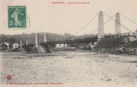
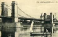
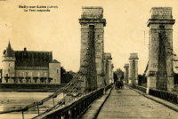
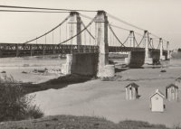
1859: Sully-sur-Loire
Sully-sur-Loire and Saint-Père-sur-Loire, Loiret, France - Loire River
| Bridgemeister ID: | 1709 (added 2005-03-30) |
| Year Completed: | 1859 |
| Name: | Sully-sur-Loire |
| Location: | Sully-sur-Loire and Saint-Père-sur-Loire, Loiret, France |
| Crossing: | Loire River |
| Use: | Vehicular |
| Status: | Collapsed, 1985 |
| Main Cables: | Chain (iron) |
| Main Spans: | 3 |
| Side Spans: | 2 |
Notes:
- 1859: The former three-span Sully-sur-Loire suspension bridge, heavily damaged by flood in 1856, is replaced with a suspension bridge having at least five suspended spans.
- 1933: Refurbished.
- 1940, June 18: Destroyed to slow advancing German troops.
- 1943: Repaired.
- 1944: Bombed by allied forces.
- 1947: Rebuilt.
- 1985, January 16: Collapsed.
- Replaced 1836 Sully-sur-Loire - Sully-sur-Loire and Saint-Père-sur-Loire, Loiret, France.
External Links:
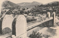
1859: Verdon
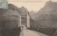
Gréoux-les-Bains, Alpes-de-Haute-Provence, France - Verdon River
| Bridgemeister ID: | 3215 (added 2019-11-11) |
| Year Completed: | 1859 |
| Name: | Verdon |
| Location: | Gréoux-les-Bains, Alpes-de-Haute-Provence, France |
| Crossing: | Verdon River |
| Use: | Vehicular |
| Status: | Destroyed, August, 1944 |
| Main Cables: | Wire |
| Suspended Spans: | 1 |
| Main Span: | 1 |
External Links:
1860: Allegheny River
Pittsburgh, Pennsylvania, USA - Allegheny River
| Bridgemeister ID: | 59 (added before 2003) |
| Year Completed: | 1860 |
| Name: | Allegheny River |
| Also Known As: | Sixth Street, St. Clair |
| Location: | Pittsburgh, Pennsylvania, USA |
| Crossing: | Allegheny River |
| Principals: | John A. Roebling |
| References: | BOB, BOP, BPL, HBE, PBR, PTS2, SJR |
| Use: | Vehicular, with walkway |
| Status: | Replaced, 1892 |
| Main Cables: | Wire (iron) |
| Suspended Spans: | 4 |
| Main Spans: | 2 x 104.9 meters (344 feet) |
| Side Spans: | 2 x 52.1 meters (171 feet) |
| Deck width: | 40 feet |
Notes:
- BPL cites this bridge as the first suspension bridge with metal towers. However, at least two earlier suspension bridges (1857 Watertown, New York and 1856 Bidwell Bar, California) are known to have metal towers and even Roebling's 1846 Smithfield Street Bridge in Pittsburgh had cast iron towers.
- Next to 1884 North Side (Seventh Street) - Pittsburgh, Pennsylvania, USA.
External Links:
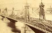
1860: Auburn-Coloma
Auburn and Coloma, California, USA - North Fork American River
| Bridgemeister ID: | 274 (added before 2003) |
| Year Completed: | 1860 |
| Name: | Auburn-Coloma |
| Location: | Auburn and Coloma, California, USA |
| Crossing: | North Fork American River |
| Principals: | John Mollett |
| References: | PTS2 |
| Use: | Vehicular (one-lane) |
| Status: | Removed |
| Main Cables: | Wire (iron) |
| Suspended Spans: | 1 |
Notes:
- 1865 and 1866 are sometimes cited as the year of completion for this bridge.
- Replaced by 1929 Auburn-Coloma - Auburn and Coloma, California, USA.
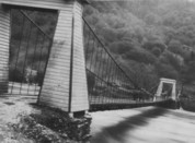
1860: Grand Falls
Grand Falls, New Brunswick, Canada - St. John River
| Bridgemeister ID: | 60 (added before 2003) |
| Year Completed: | 1860 |
| Name: | Grand Falls |
| Location: | Grand Falls, New Brunswick, Canada |
| Crossing: | St. John River |
| Principals: | James Tomlinson |
| References: | AAJ |
| Use: | Vehicular (two-lane) |
| Status: | Replaced, 1915 |
| Main Cables: | Wire (iron) |
| Suspended Spans: | 1 |
| Main Span: | 1 x 63.9 meters (209.75 feet) |
| Deck width: | 16 feet |
Notes:
- Out of use, 1912.

1860: Lascellas
Lascellas, Huesca, Spain - Rio Alcanadre
| Bridgemeister ID: | 4718 (added 2020-06-26) |
| Year Completed: | 1860 |
| Name: | Lascellas |
| Location: | Lascellas, Huesca, Spain |
| Crossing: | Rio Alcanadre |
| Coordinates: | 42.096776 N 0.107794 W |
| Maps: | Acme, GeoHack, Google, OpenStreetMap |
| Use: | Vehicular |
| Status: | Removed |
| Main Cables: | Wire |
| Suspended Spans: | 1 |
Notes:
- Deck wrecked circa 1939. Bridge appears to have been replaced soon after.
External Links:
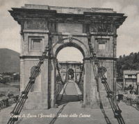
1860: Ponte delle Catene
Fornoli, Bagni di Lucca and Chifenti, Italy - Lima River
| Bridgemeister ID: | 411 (added before 2003) |
| Year Completed: | 1860 |
| Name: | Ponte delle Catene |
| Also Known As: | Catena, Bridge of Chains |
| Location: | Fornoli, Bagni di Lucca and Chifenti, Italy |
| Crossing: | Lima River |
| Coordinates: | 44.006048 N 10.562356 E |
| Maps: | Acme, GeoHack, Google, OpenStreetMap |
| Principals: | Lorenzo Nottolini, Bettino Ricasoli |
| References: | BC2, BC3 |
| Use: | Vehicular |
| Status: | Restricted to foot traffic (last checked: 2019) |
| Main Cables: | Chain (iron) |
| Suspended Spans: | 1 |
Notes:
- Damaged during WWII, rebuilt 1953.
External Links:
1860: Port Gibson
Grindstone Ford, Port Gibson vicinity, Mississippi, USA - Bayou Pierre
| Bridgemeister ID: | 1659 (added 2005-03-19) |
| Year Completed: | 1860 |
| Name: | Port Gibson |
| Location: | Grindstone Ford, Port Gibson vicinity, Mississippi, USA |
| Crossing: | Bayou Pierre |
| References: | PTS2 |
| Status: | Removed, circa 1920's |
Notes:
- Partially burned by retreating Confederate troops May 2nd, 1863 during the Vicksburg Campaign of the Civil War. Union troops extinquished the fire and quickly repaired the bridge.
- Demolished, circa 1920's. Descriptions for the Vicksburg Campaign imply there may have been another suspension bridge in the Port Gibson area.
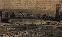
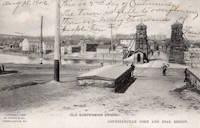
1861: Connellsville
Connellsville and New Haven, Pennsylvania, USA - Youghiogheny River
| Bridgemeister ID: | 278 (added before 2003) |
| Year Completed: | 1861 |
| Name: | Connellsville |
| Location: | Connellsville and New Haven, Pennsylvania, USA |
| Crossing: | Youghiogheny River |
| Use: | Vehicular (one-lane) |
| Status: | Removed |
| Main Cables: | Wire |
| Suspended Spans: | 1 |
1861: Gauley River
Gauley Bridge, West Virginia, USA - Gauley River
| Bridgemeister ID: | 2123 (added 2006-09-17) |
| Year Completed: | 1861 |
| Name: | Gauley River |
| Location: | Gauley Bridge, West Virginia, USA |
| Crossing: | Gauley River |
| Principals: | John W. Murphy |
| References: | AAJ |
| Use: | Vehicular |
| Status: | Destroyed, 1862 |
| Main Cables: | Wire (iron) |
Notes:
- Don Sayenga writes:
"It was built in great haste out of military necessity utilizing abutments and piers of an earlier wooden bridge that had been burnt by a unit of the Confederate Army commanded by Gen. John B. Floyd. This occurred just after the fight known as the Battle of Carnifex Ferry on September 10, 1861. Later the Confederate Army recaptured the bridge location and burnt the new one also. The designer/builder was John W. Murphy (1828-1874) who was working as an engineer in Alabama when the war began in 1861. He held a Civil Engineer degree from Rensselaer. Murphy's concept involved multiple factory-made wire ropes as main cables combined with wooden bracing. The exact location of the bridge seems to have been called the New River Cliffs but I haven't found this on a map. Photos of the bridge came into the possession of Prof. George Plympton, an associate of Murphy's in the latter part of his career. Plympton presented a paper about bridges in 1894 reported by The Railroad Gazette August 24. The photos were given to the Gazette - one of their artists converted the photos to pen-and-ink drawings for publication in the issue of November 9, 1894, p. 773."
Don transcribed the following:
The Railroad Gazette, August 24, 1894, Page 579."Prof. Plympton then related two reminiscences of bridge building between 1852 and 1861...The other instance was the building of a military suspension bridge over the Gauley River in 1861. The government called for a bridge of sufficient strength to permit the passage of General Rosecrans corps, allowing twenty-four days' time. The abutments and piers of the former bridge remained in good condition. Murphy submitted an original plan, which was accepted. The plans were drawn up by Mr. Murphy on the cars, while he was traveling to Washington to submit his ideas to the United States army en gineers. The plans were accepted and Murphy at once went to work. Four one-inch wire ropes, laid side by side, formed his cables. A pyramidal tower was constructed of heavy timbers, and in place of suspending rods a loosely-formed truss was hung upon the cable without fastening. This truss, connected with the floor of the bridge, was finished on the 22nd day after receiving the order to build."
Proceedings of the Franklin Institute, October 21, 1874, Page 306."It was a suspension bridge 520 feet in length, 10 feet roadway, consisting of three spans, supported by eight cables. There was some doubt in the mind of the commanding officer that it would answer the purpose...To test it ...he asked that a battalion be ordered to make a charge over it, which was done, to the satisfaction of the General in command...it afterwards passed and repassed the whole command as long as they occupied that portion of the country. A change of base put it into the possession of the Confederates who burnt it down."
- An article in the July 15, 1951 edition of The Charleston Daily Mail describes the bridge and its demise:
"After the Confederate forces had retreated and burned the old covered bridge, the Federal engineers constructed a make-shift bridge across the Gauley. There are pictures in existence showing this light, cable bridge erected on the old piers of the original bridge. This structure was cut down Sept. 11, 1862, when the Federals retreated from an attack by Confederate Gen. W. W. Loring, who routed the Unionists from the valley for a brief time."
- Jakkula has an 1862 entry for "Gauley River Bridge" with little information, citing the American Railroad Journal, Vol. 37, No. 1472, July 2, 1864, p.651: "A suspension bridge built over the Gauley River, Virginia, by the Government in 1862." It is unclear if this reference is for the same bridge.
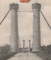
1861: Gray
Gray, Haute-Saône, France - Saône River
| Bridgemeister ID: | 1127 (added 2004-01-14) |
| Year Completed: | 1861 |
| Name: | Gray |
| Location: | Gray, Haute-Saône, France |
| Crossing: | Saône River |
| Use: | Vehicular |
| Status: | Removed |
| Main Cables: | Wire (iron) |
| Suspended Spans: | 1 |

1861: Portsmouth
Portsmouth, Ohio, USA - Scioto River
| Bridgemeister ID: | 61 (added before 2003) |
| Year Completed: | 1861 |
| Name: | Portsmouth |
| Location: | Portsmouth, Ohio, USA |
| Crossing: | Scioto River |
| Principals: | Max J. Becker |
| References: | EOV |
| Status: | Removed |
Notes:
- Reconstruction of the 1858 Portsmouth bridge. A completion year of 1861 is assumed given information provided in EOV. Failed 1884.
- Replaced 1858 Portsmouth - Portsmouth, Ohio, USA.
1861: Weitchpec
Weitchpec, California, USA - Klamath River
| Bridgemeister ID: | 1090 (added 2004-01-01) |
| Year Completed: | 1861 |
| Name: | Weitchpec |
| Location: | Weitchpec, California, USA |
| Crossing: | Klamath River |
| Principals: | Andrew S. Hallidie |
| References: | DSL200106 |
| Use: | Vehicular |
| Status: | Removed |
| Main Cables: | Wire (iron) |
| Suspended Spans: | 1 |
Notes:
1862: (footbridge)
Greystead, England, United Kingdom - River North Tyne
| Bridgemeister ID: | 1252 (added 2004-02-21) |
| Year Completed: | 1862 |
| Name: | (footbridge) |
| Location: | Greystead, England, United Kingdom |
| Crossing: | River North Tyne |
| Coordinates: | 55.169017 N 2.353408 W |
| Maps: | Acme, GeoHack, Google, OpenStreetMap |
| Use: | Footbridge |
| Status: | Extant (last checked: 2019) |
| Main Cables: | Chain |
| Suspended Spans: | 1 |
Notes:
- Footbridge with large stone towers. Near Tarset Burn.
- Several sources suggest this bridge was completed in 1862.
- Similar to 1878 Sedgwick (Low Park Woods, New Sedgwick) - Sedgwick and Sizergh, England, United Kingdom.
External Links:
- Bridges on the Tyne. "Built to connect with Thorneyburn station on the Border Counties Railway."
1862: (suspension bridge)
California, USA - Trinity River
| Bridgemeister ID: | 1093 (added 2004-01-01) |
| Year Completed: | 1862 |
| Name: | (suspension bridge) |
| Location: | California, USA |
| Crossing: | Trinity River |
| Principals: | Andrew S. Hallidie |
| References: | DSL200106 |
| Status: | Removed |
| Main Cables: | Wire (iron) |
1862: (suspension bridge)
California, USA - Stanislaus River
| Bridgemeister ID: | 1094 (added 2004-01-01) |
| Year Completed: | 1862 |
| Name: | (suspension bridge) |
| Location: | California, USA |
| Crossing: | Stanislaus River |
| Principals: | Andrew S. Hallidie |
| References: | DSL200106 |
| Status: | Removed |
| Main Cables: | Wire (iron) |
1862: (suspension bridge)
California, USA - Tuolumne River
| Bridgemeister ID: | 1095 (added 2004-01-01) |
| Year Completed: | 1862 |
| Name: | (suspension bridge) |
| Location: | California, USA |
| Crossing: | Tuolumne River |
| Principals: | Andrew S. Hallidie |
| References: | DSL200106 |
| Status: | Removed |
| Main Cables: | Wire |
1862: (suspension bridge)
McCourtney's Crossing, California, USA - Bear River
| Bridgemeister ID: | 1092 (added 2004-01-01) |
| Year Completed: | 1862 |
| Name: | (suspension bridge) |
| Location: | McCourtney's Crossing, California, USA |
| Crossing: | Bear River |
| Principals: | Andrew S. Hallidie |
| References: | DSL200106 |
| Status: | Removed |
| Main Cables: | Wire (iron) |
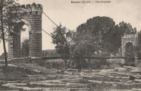
1862: Bessan
Bessan, Hérault, France - Hérault River
| Bridgemeister ID: | 1938 (added 2005-10-29) |
| Year Completed: | 1862 |
| Name: | Bessan |
| Location: | Bessan, Hérault, France |
| Crossing: | Hérault River |
| Status: | Removed |
| Main Cables: | Wire |
| Suspended Spans: | 1 |
External Links:
1862: Chatham
Fredericksburg, Virginia, USA - Rappahannock River
| Bridgemeister ID: | 271 (added before 2003) |
| Year Completed: | 1862 |
| Name: | Chatham |
| Location: | Fredericksburg, Virginia, USA |
| Crossing: | Rappahannock River |
| Coordinates: | 38.304981 N 77.456280 W |
| Maps: | Acme, GeoHack, Google, OpenStreetMap |
| Principals: | Washington A. Roebling |
| References: | GB |
| Status: | Destroyed |
| Main Cables: | Wire |
Notes:
- After several attempts by the Union Army to restore Rappahannock River bridges near Fredericksburg with pontoon bridges during the Civil War, Washington Roebling built a temporary wire suspension bridge on the piers of the former Chatham Bridge. The suspension bridge may have had twelve or more suspended spans (the former Chatham Bridge supposedly had 13 piers). Started July 1 and completed July 18, it survived less than two months, destroyed on September 1, 1862 by an evacuating Union Army.
External Links:
1862: Gloucester Street
Christchurch, New Zealand - Avon River
| Bridgemeister ID: | 655 (added 2003-03-08) |
| Year Completed: | 1862 |
| Name: | Gloucester Street |
| Location: | Christchurch, New Zealand |
| Crossing: | Avon River |
| References: | GAP |
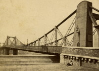
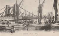
1862: Lambeth
London, England, United Kingdom - River Thames
| Bridgemeister ID: | 829 (added 2003-05-31) |
| Year Completed: | 1862 |
| Name: | Lambeth |
| Location: | London, England, United Kingdom |
| Crossing: | River Thames |
| Principals: | P. W. Barlow |
| References: | BRB, HBE, ONF, PTS2 |
| Use: | Vehicular, with walkway |
| Status: | Replaced, 1932 |
| Suspended Spans: | 3 |
| Main Spans: | 3 x 81.7 meters (268 feet) |
External Links:
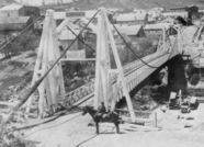
1862: Pine Street
Nevada City, California, USA - Deer Creek
| Bridgemeister ID: | 62 (added before 2003) |
| Year Completed: | 1862 |
| Name: | Pine Street |
| Location: | Nevada City, California, USA |
| Crossing: | Deer Creek |
| Principals: | Andrew S. Hallidie |
| References: | DSL200106 |
| Use: | Vehicular (one-lane) |
| Status: | Removed |
| Main Cables: | Wire (iron) |
| Suspended Spans: | 1 |
1862: Rattlesnake Bar
Folsom vicinity, California, USA - American River
| Bridgemeister ID: | 1091 (added 2004-01-01) |
| Year Completed: | 1862 |
| Name: | Rattlesnake Bar |
| Location: | Folsom vicinity, California, USA |
| Crossing: | American River |
| At or Near Feature: | Rattlesnake Bar |
| Coordinates: | 38.814397 N 121.091726 W |
| Maps: | Acme, GeoHack, Google, OpenStreetMap |
| Principals: | Andrew S. Hallidie |
| References: | DSL200106 |
| Use: | Vehicular (one-lane) |
| Status: | Collapsed, December 21, 1954 |
| Main Cables: | Wire (iron) |
| Suspended Spans: | 1 |
Notes:
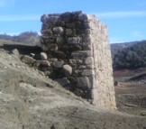
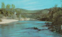
- The location of Rattlesnake Bar is closer to present-day Auburn than Folsom, near the location of Goose Flat marked on modern topographical maps of the region. The area was inundated during the creation of Folsom Lake, but the piers and abutments of the Rattlesnake Bar bridge are visible when the water level is low.
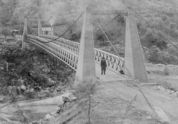
- Rodi Lee writes: "[The bridge] collapsed in 1954 when an overweight truck filled with manure crossed it. The driver was unhurt. There are newspaper articles about the incident (Auburn Journal, Auburn). There are some photos in the article as well. The bridge abutments show when the the lake water is low. The bridge was upstream of Wild Goose Flats."
- See 1855 Whiskey Bar (Pioneer, Whisky) - El Dorado County, California, USA. The cables of the Rattlesnake Bar bridge were reportedly reused from the damaged Whiskey Bar bridge.
External Links:
- 1057. The Suspension Bridge over the American River at Rattlesnake Bar, Placer County - Calisphere.org
- Rattlesnake Bridge - Christine's Blog. Several images of the remnants of the bridge.
1863: Alexandra
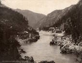
Spuzzum, British Columbia, Canada - Fraser River
| Bridgemeister ID: | 63 (added before 2003) |
| Year Completed: | 1863 |
| Name: | Alexandra |
| Also Known As: | Trutch's |
| Location: | Spuzzum, British Columbia, Canada |
| Crossing: | Fraser River |
| Principals: | Andrew S. Hallidie, Joseph W. Trutch |
| Use: | Vehicular |
| Status: | Removed, 1912 |
| Main Cables: | Wire (iron) |
| Main Span: | 1 x 82 meters (269 feet) |
Notes:
- Fell into disuse, 1884. Damaged by flood 1904. Dismantled 1912. Some sources indicate the flood damage occurred in 1894.
- Replaced by 1926 Second Alexandra - Spuzzum, British Columbia, Canada.

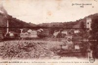
1863: Confolent
Confolent, Beauzac vicinity and Saint-Marice-de-Lignon, Haute-Loire, France - Loire River
| Bridgemeister ID: | 412 (added before 2003) |
| Year Completed: | 1863 |
| Name: | Confolent |
| Also Known As: | Lignon |
| Location: | Confolent, Beauzac vicinity and Saint-Marice-de-Lignon, Haute-Loire, France |
| Crossing: | Loire River |
| Coordinates: | 45.258031 N 4.144228 E |
| Maps: | Acme, GeoHack, Google, OpenStreetMap |
| Principals: | Adolphe Boulland |
| References: | BPF |
| Use: | Vehicular (one-lane), with walkway |
| Status: | In use (last checked: 2019) |
| Main Cables: | Wire (iron) |
| Suspended Spans: | 1 |
Notes:
- Cables damaged 1913, 1921. Refurbished 1922.
External Links:
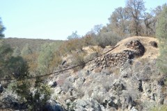
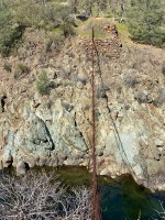
1863: Lamb's
Latrobe vicinity and Plymouth vicinity, California, USA - Cosumnes River
| Bridgemeister ID: | 2117 (added 2006-09-10) |
| Year Completed: | 1863 |
| Name: | Lamb's |
| Location: | Latrobe vicinity and Plymouth vicinity, California, USA |
| Crossing: | Cosumnes River |
| Coordinates: | 38.52222 N 120.95587 W |
| Maps: | Acme, GeoHack, Google, OpenStreetMap |
| Use: | Vehicular (one-lane) |
| Status: | Derelict (last checked: 2020) |
| Main Cables: | Wire (iron) |
| Suspended Spans: | 1 |
Notes:
- The location coordinates provided here are the approximate location of this bridge, crossing the Cosumnes between present day El Dorado and Amador counties at Michigan Bar (as named on USGS topographical maps) on current Latrobe Road where Clark Creek meets the Cosumnes River. Note that USGS topographical maps show another, more prominently marked, "Michigan Bar" a few miles west in Sacramento County.
- A California Highways and Public Works article (unsure of exact citation but it may be the article on the history of California bridges that appeared in the 1941 June issue and was reprinted in the 1950 September/October issue) says "there were four [suspension bridges] on the Cosumnes River, one of which (Lamb's Bridge on the Latrobe-Plymouth Road) killed one man and seven horses when it fell in 1869."
- The October 14, 1976 edition of The Mountain Democrat Times (Placerville, California) has an article about the nearby Huse Bridge (from the Heritage Association of El Dorado) which mentions Lamb's Bridge: "...Lamb's Bridge, several miles downriver, was reconstructed in 1872 and was also a wire bridge of the same type [as Huse's]."
- The Statutes of California passed at the Fourteenth Session of the Legislature, 1863 records: "Chapter XLI. An Act to grant to Larkin Lamb and his Associates the right to construct and maintain a Toll Bridge across the Cosumnes River, in the Counties of Amador and El Dorado. Approved March 6, 1863. The People of the State of California, represented in Senate and Assembly, do enact as follows: Section 1. Larkin Lamb, and those he may associate with him, their heirs and assigns, shall have full power to build, erect, construct, and maintain a public toll bridge across the Cosumnes River, at a point about eighty (80) rods below Dutch Hill;..."
- A November 12, 2017 article in Ledger Dispatch (of Amador and Calaveras counties) titled "Vestiges of Amador-Communities Along the Cosumnes, Part VI: The Lower Reaches - Michigan Bar to Wisconsin Bar" by Deborah Coleen Cook gives a more complete history of Lamb's bridge citing the enactment (February 9, 1863) of the bill to permit construction, construction completing six months later, failure of one of the cables in 1869 under the weight of a large freight wagon, and another cable/anchorage failure in 1872 while the bridge was undergoing major repairs.
- See 1852 Huse - Yeomet, California, USA.
- See 1852 Wilson's - Cosumne, California, USA.
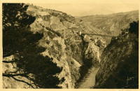
1863: Ponsonnas
Ponsonnas, Isère, France - Drac River
| Bridgemeister ID: | 1079 (added 2003-12-29) |
| Year Completed: | 1863 |
| Name: | Ponsonnas |
| Location: | Ponsonnas, Isère, France |
| Crossing: | Drac River |
| Use: | Vehicular |
| Status: | Replaced, 1941 |
| Suspended Spans: | 1 |
| Main Span: | 1 x 123 meters (403.5 feet) |
Notes:
- Replaced by a 1941 arch bridge that is popular with bungee jumpers.
External Links:
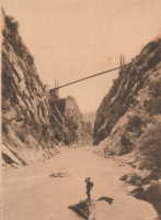
1863: Rousset
Rousset, Curbans vicinity, Alpes-de-Haute-Provence and Hautes-Alpes, France - Durance River
| Bridgemeister ID: | 2063 (added 2006-06-06) |
| Year Completed: | 1863 |
| Name: | Rousset |
| Location: | Rousset, Curbans vicinity, Alpes-de-Haute-Provence and Hautes-Alpes, France |
| Crossing: | Durance River |
| Use: | Vehicular |
| Status: | Removed |
| Main Cables: | Wire |
| Suspended Spans: | 1 |
External Links:
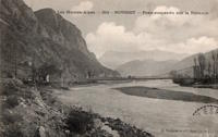
1864: (suspension bridge)
Porta Westfalica, Germany - Weser River
| Bridgemeister ID: | 637 (added 2003-02-13) |
| Year Completed: | 1864 |
| Name: | (suspension bridge) |
| Location: | Porta Westfalica, Germany |
| Crossing: | Weser River |
| References: | BRU, PTS2 |
| Use: | Rail and Vehicular |
| Status: | Destroyed, April 3, 1945 |
| Main Cables: | Eyebar (iron) |
| Suspended Spans: | 1 |
Notes:
- At the time of completion, the bridge connected the villages of Barkhausen and Hausberge, later merged into Porta Westfalica.
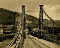
1864: Archidiacre
Venterol, Alpes-de-Haute-Provence and Valserres, Hautes-Alpes, France - Durance River
| Bridgemeister ID: | 4690 (added 2020-06-20) |
| Year Completed: | 1864 |
| Name: | Archidiacre |
| Also Known As: | Venterol |
| Location: | Venterol, Alpes-de-Haute-Provence and Valserres, Hautes-Alpes, France |
| Crossing: | Durance River |
| Coordinates: | 44.475805 N 6.111924 E |
| Maps: | Acme, GeoHack, Google, OpenStreetMap |
| Use: | Vehicular (one-lane) |
| Status: | Demolished, 2010 |
| Main Cables: | Wire |
| Suspended Spans: | 1 |
External Links:
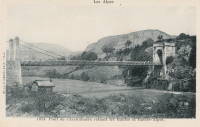
1864: Aspern
Vienna, Austria
| Bridgemeister ID: | 3076 (added 2019-10-26) |
| Year Completed: | 1864 |
| Name: | Aspern |
| Location: | Vienna, Austria |
| Coordinates: | 48.211858 N 16.383001 E |
| Maps: | Acme, GeoHack, Google, OpenStreetMap |
| Principals: | Friedrich Schnirch |
| References: | AAJ, PTS2 |
| Use: | Vehicular |
| Status: | Demolished, 1913 |
| Main Cables: | Eyebar (iron) |
| Suspended Spans: | 1 |
| Main Span: | 1 |
External Links:
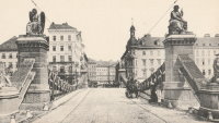
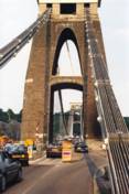
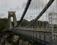
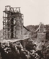
1864: Clifton
Bristol, England, United Kingdom - River Avon
| Bridgemeister ID: | 413 (added before 2003) |
| Year Completed: | 1864 |
| Name: | Clifton |
| Location: | Bristol, England, United Kingdom |
| Crossing: | River Avon |
| Coordinates: | 51.45496 N 2.62781 W |
| Maps: | Acme, GeoHack, Google, OpenStreetMap |
| Principals: | Isambard K. Brunel, P.W. Barlow, Hawkshaw |
| References: | AOB, BBR, BC3, BEM, BMA, BOU, BRB, CTW, HBE, NTB, ONF, PTS2 |
| Use: | Vehicular, with walkway |
| Status: | In use (last checked: 2021) |
| Main Cables: | Eyebar (iron) |
| Suspended Spans: | 1 |
| Main Span: | 1 x 214 meters (702 feet) |
Notes:
- Built with chain cables reused from the Hungerford bridge.
- See 1845 Hungerford - London, England, United Kingdom.
External Links:

1864: Franklin
Franklin, Pennsylvania, USA - Allegheny River
| Bridgemeister ID: | 3186 (added 2019-11-09) |
| Year Completed: | 1864 |
| Name: | Franklin |
| Location: | Franklin, Pennsylvania, USA |
| Crossing: | Allegheny River |
| Principals: | John Murphy |
| References: | AAJ |
| Status: | Destroyed, 1870 |
Notes:
- 1870: Cable ends caught fire precipitating collapse, killing two.
1864: Taieri River
Outram, New Zealand - Taieri River
| Bridgemeister ID: | 656 (added 2003-03-08) |
| Year Completed: | 1864 |
| Name: | Taieri River |
| Also Known As: | West Taieri |
| Location: | Outram, New Zealand |
| Crossing: | Taieri River |
| Principals: | John Turnbull Thomson |
| References: | GAP |
| Use: | Vehicular |
| Status: | Replaced, 1966 |
| Main Cables: | Eyebar (iron) |
| Suspended Spans: | 4 |
| Main Spans: | 2 |
| Side Spans: | 2 |
External Links:
1865: Market Street
Williamsport, Pennsylvania, USA - Susquehanna River
| Bridgemeister ID: | 64 (added before 2003) |
| Year Completed: | 1865 |
| Name: | Market Street |
| Location: | Williamsport, Pennsylvania, USA |
| Crossing: | Susquehanna River |
| Principals: | Alfred P. Boller |
| References: | AAJ, JFI186604 |
| Use: | Vehicular |
| Status: | Destroyed, June 1, 1889 |
| Main Cables: | Wire (iron) |
| Suspended Spans: | 5 |
| Main Spans: | 5 x 61 meters (200 feet) |
Notes:
- JFI186604 (in which Boller mentions about the bridge's "peculiar system of trussing": "This general arrangement for suspension bridges was first practised by John Murphy, Esq., C.E., over the Gauley, in West Virginia, and also at Franklin, Pennsylvania.")
- Destroyed by flood June 1, 1889.
- Near 1878 Maynard Street - Williamsport, Pennsylvania, USA.
- Replaced by 1889 Market Street - Williamsport, Pennsylvania, USA.
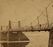
1865: Moulin
Vernosc-lès-Annonay, Ardèche, France - Cance River
| Bridgemeister ID: | 4553 (added 2020-05-31) |
| Year Completed: | 1865 |
| Name: | Moulin |
| Location: | Vernosc-lès-Annonay, Ardèche, France |
| Crossing: | Cance River |
| Coordinates: | 45.210908 N 4.703327 E |
| Maps: | Acme, GeoHack, Google, OpenStreetMap |
| Status: | Removed |
| Main Cables: | Wire (iron) |
| Suspended Spans: | 1 |
Notes:
- Structurae equates this bridge (which was replaced in 2012-2013) to the famous Seguin Brothers test structure at Annonay. Other sources suggest the derelict bridge replaced in 2012-2013 only dated to the 1860s. The detailed description and depiction of the Seguin's Annonay bridge in Tom F. Peters book on early 19th-century suspension bridges definitely does not resemble the 19th-century Moulin bridge. Peters describes the 1822-1823 Seguin bridge as a very narrow, very light, catwalk-style bridge. Peters additionally describes the main cables: "It had a single continuous parallel wire cable made of eight 1.23mm (no. 8 gauge) wires."
- Replaced by 2013 Moulin - Vernosc-lès-Annonay, Ardèche, France.
- See 1822 (footbridge) - Annonay, Ardèche, France.
External Links:
1866: (suspension bridge)
Nashville and Edgefield, Tennessee, USA - Cumberland River
| Bridgemeister ID: | 1965 (added 2005-11-20) |
| Year Completed: | 1866 |
| Name: | (suspension bridge) |
| Location: | Nashville and Edgefield, Tennessee, USA |
| Crossing: | Cumberland River |
| References: | AAJ |
| Use: | Vehicular |
| Status: | Removed, 1884 |
| Main Cables: | Wire |
Notes:
| Bridgemeister ID: | 7460 (added 2022-12-24) |
| Year Completed: | 1866 |
| Name: | Cessenon-sur-Orb |
| Location: | Cessenon-sur-Orb, Hérault, France |
| Crossing: | Orb River |
| Coordinates: | 43.451360 N 3.046595 E |
| Maps: | Acme, GeoHack, Google, OpenStreetMap |
| Use: | Vehicular (one-lane) |
| Status: | Replaced |
| Main Cables: | Wire |
| Suspended Spans: | 1 |
Notes:
- Replaced by Cessenon-sur-Orb - Cessenon-sur-Orb, Hérault, France.
External Links:
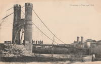
1867: (suspension bridge)
Albuquerque, New Mexico, USA - Rio Grande
| Bridgemeister ID: | 5559 (added 2020-12-18) |
| Year Completed: | 1867 |
| Name: | (suspension bridge) |
| Location: | Albuquerque, New Mexico, USA |
| Crossing: | Rio Grande |
| Use: | Vehicular |
| Status: | Removed |
| Main Cables: | Wire |
Notes:
- Likely completed 1867.
External Links:
1867: (suspension bridge)
Mataura, New Zealand
| Bridgemeister ID: | 657 (added 2003-03-08) |
| Year Completed: | 1867 |
| Name: | (suspension bridge) |
| Location: | Mataura, New Zealand |
| Principals: | John Turnbull Thomson |
| References: | GAP |
1867: Corrieshalloch
Braemore, Scotland, United Kingdom - Corrieshalloch Gorge
| Bridgemeister ID: | 1308 (added 2004-04-10) |
| Year Completed: | 1867 |
| Name: | Corrieshalloch |
| Location: | Braemore, Scotland, United Kingdom |
| Crossing: | Corrieshalloch Gorge |
| At or Near Feature: | Falls of Measach |
| Coordinates: | 57.755753 N 5.021048 W |
| Maps: | Acme, GeoHack, Google, OpenStreetMap |
| Principals: | John Fowler |
| References: | AAJ, HBR |
| Use: | Footbridge |
| Status: | In use (last checked: 2022) |
| Main Cables: | Wire |
| Suspended Spans: | 1 |
| Main Span: | 1 x 25.1 meters (82.5 feet) |
Notes:
- 2022, May: Closed again for maintenance and inspection, reopened by month's end.
- AAJ lists the bridge at "Corry Halloch" bridge completed in 1875. Other sources mention 1867, and 1874.
- 1977: Anchorages replaced (HBR).
- 2021: Closed September 10 due to safety concerns. Repaired and re-opened in October.
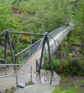
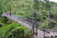
1867: Doldowlod
Doldowlod, Llandrindod Wells, Wales, United Kingdom - River Wye
| Bridgemeister ID: | 5085 (added 2020-09-04) |
| Year Completed: | 1867 |
| Name: | Doldowlod |
| Also Known As: | Llanwrthyl, Ystrad |
| Location: | Doldowlod, Llandrindod Wells, Wales, United Kingdom |
| Crossing: | River Wye |
| Coordinates: | 52.244210 N 3.462324 W |
| Maps: | Acme, GeoHack, Google, OpenStreetMap |
| Principals: | William Dredge |
| Use: | Footbridge |
| Status: | In use (last checked: 2018) |
| Main Cables: | Rod (iron) |
| Suspended Spans: | 1 |
Notes:
- Dredge patent bridge, possibly completed by his son William Dredge.
External Links:
- The Happy Pontist: Welsh Bridges: 10. Doldowlod Bridge. Photos and discussion of its history and uncertainty about the year it was completed.
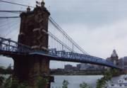
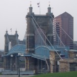
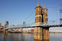
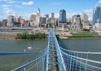
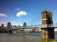
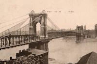
1867: John A. Roebling
Cincinnati, Ohio and Covington, Kentucky, USA - Ohio River
| Bridgemeister ID: | 65 (added before 2003) |
| Year Completed: | 1867 |
| Name: | John A. Roebling |
| Also Known As: | Cincinnati, Cincinnati and Covington |
| Location: | Cincinnati, Ohio and Covington, Kentucky, USA |
| Crossing: | Ohio River |
| Coordinates: | 39.09167 N 84.50833 W |
| Maps: | Acme, GeoHack, Google, OpenStreetMap |
| Principals: | John A. Roebling |
| References: | BAAW, BC3, BOB, BPL, COB, EOV, HBE, LAB, LACE, ONF, PTS2, SJR, TOB |
| Use: | Vehicular (two-lane), with walkway |
| Status: | Closed, February, 2021 (last checked: 2021) |
| Main Cables: | Wire (iron) |
| Suspended Spans: | 3 |
| Main Span: | 1 x 322.2 meters (1,057 feet) |
| Side Spans: | 2 |
Notes:
- 1892: Cable ends restored.
- 1899: Steel cables added to assist original cables.
- 2021, February: Closed to all vehicular traffic for a nine-month restoration project.
- Became longest suspension bridge by eclipsing 1849 Wheeling (Wheeling and Belmont) - Wheeling, West Virginia, USA.
- Eclipsed by new longest suspension bridge 1869 Clifton (Niagara-Clifton, Falls View, First Falls View) - Niagara Falls, New York, USA and Niagara Falls, Ontario, Canada.
External Links:
1867: Mosquito Road
Placerville, California, USA - South Fork American River
| Bridgemeister ID: | 2323 (added 2007-05-06) |
| Year Completed: | 1867 |
| Name: | Mosquito Road |
| Location: | Placerville, California, USA |
| Crossing: | South Fork American River |
| Coordinates: | 38.775791 N 120.748441 W |
| Maps: | Acme, GeoHack, Google, OpenStreetMap |
| Use: | Vehicular |
| Status: | Replaced |
| Main Cables: | Wire |
Notes:
- The February 23, 1995 edition of the Mountain Democrat (Placerville, California) has an article about the Mosquito crossing that mentions: "According to the El Dorado County History of 1883 by Paolo Sioli, 'Mosquito is connected to Placerville by a good wagon-road and a suspension bridge across the South Fork of the American River, a trail is running in the direction of Kelsey, the township center... The original bridge was constructed in 1867, and according to Orval Beckett, as quoted in the booklet, Mosquito Memories, 'This original bridge had no banisters on the sides. It was a suspension cable with No. 9 telephone wires strung between the supports. When you drove onto the bridge, it would 'swing and sway' much like we have seen in the movies. When one end went down the other went up, etc. Imagine the thrill!'"
- Replaced by 1939 Mosquito Road - Placerville, California, USA.
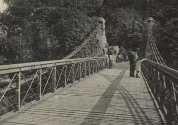
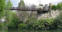
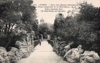
| Bridgemeister ID: | 516 (added before 2003) |
| Year Completed: | 1867 |
| Name: | Parc des Buttes-Chaumont |
| Location: | Paris, France |
| At or Near Feature: | Parc des Buttes-Chaumont |
| Coordinates: | 48.880933 N 2.381533 E |
| Maps: | Acme, GeoHack, Google, OpenStreetMap |
| References: | AAJ |
| Use: | Footbridge |
| Status: | In use (last checked: 2021) |
| Main Cables: | Wire |
| Suspended Spans: | 1 |
| Main Span: | 1 x 61 meters (200 feet) |
External Links:
1867: Public Garden
Boston, Massachusetts, USA - Public Garden lagoon
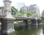
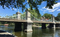
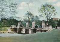
| Bridgemeister ID: | 245 (added before 2003) |
| Year Completed: | 1867 |
| Name: | Public Garden |
| Location: | Boston, Massachusetts, USA |
| Crossing: | Public Garden lagoon |
| Coordinates: | 42.354119 N 71.069920 W |
| Maps: | Acme, GeoHack, Google, OpenStreetMap |
| Principals: | William Gibbons Preston, Clemens Herschel |
| References: | HBE |
| Use: | Footbridge |
| Status: | In use (last checked: 2019) |
| Main Cables: | Eyebar (iron) |
| Suspended Spans: | 3 |
| Main Span: | 1 |
| Side Spans: | 2 |
External Links:

1868: (suspension bridge)
Afton, New York, USA - Susquehanna River
| Bridgemeister ID: | 66 (added before 2003) |
| Year Completed: | 1868 |
| Name: | (suspension bridge) |
| Location: | Afton, New York, USA |
| Crossing: | Susquehanna River |
| Principals: | G. W. & J. V. V. Fishler, James Crowell |
| Use: | Vehicular |
| Status: | Removed |
| Main Cables: | Wire (iron) |
| Suspended Spans: | 1 |
| Main Span: | 1 x 110.3 meters (362 feet) |
| Deck width: | 16 feet |
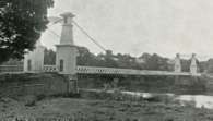
1868: Blue Lick Springs
Kentucky, USA - Licking River
| Bridgemeister ID: | 2659 (added 2019-03-09) |
| Year Completed: | 1868 |
| Name: | Blue Lick Springs |
| Location: | Kentucky, USA |
| Crossing: | Licking River |
| Coordinates: | 38.422314 N 83.999076 W |
| Maps: | Acme, GeoHack, Google, OpenStreetMap |
| Use: | Vehicular (one-lane) |
| Status: | Removed |
| Main Cables: | Wire |
| Suspended Spans: | 1 |
Notes:
- 1897: Replaced by two-span truss bridge that is still (as of 2019) at the same location. The truss bridge was built between the main suspension bridge cables and, apparently, the suspension bridge remained standing for several years.
1868: Calloway's Ford
Elizabethtown vicinity, Hamilton County, Ohio, USA - Whitewater River
| Bridgemeister ID: | 68 (added before 2003) |
| Year Completed: | 1868 |
| Name: | Calloway's Ford |
| Also Known As: | Whitewater, Harrison's |
| Location: | Elizabethtown vicinity, Hamilton County, Ohio, USA |
| Crossing: | Whitewater River |
| Coordinates: | 39.183116 N 84.792638 W |
| Maps: | Acme, GeoHack, Google, OpenStreetMap |
| Principals: | John Gray, Morse, Young |
| References: | EOV |
| Use: | Vehicular |
| Status: | Removed, 1920 |
| Main Cables: | Wire (iron) |
| Main Span: | 1 x 144.8 meters (475 feet) |
| Deck width: | 22 feet |
Notes:
- This bridge was located where present-day Suspension Bridge Road crosses the Whitewater River next to I-275 and north of US50. According to information provided by Sharon Lutz from Marjorie Byrnside Burress, this bridge was renamed "Harrison's Suspension Bridge" in 1891. This should not be confused with the nearby suspension bridge at Harrison.
- According to the information provided by Sharon Lutz from Marjorie Byrnside Burress, "Crossing this bridge was the main thoroughfare from Indiana into Ohio for many years (US 50 was not completed by then). [In 1920] it was decided that the Suspension Bridge had become obsolete and could no longer safely withstand the weight of vehicles. [On May 19, 1920] the cables were severed by means of an oxygen flame, the weight of the cables pulled down some towers. Other towers were weakened by dynamite at their bases and later they were pulled down by the weight of the cables severed at one end with an oxygen flame."
- See 1873 Harrison - Harrison, Ohio and Dearborn County, Indiana, USA.
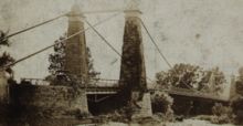
1868: Carpenter's Point
Port Jervis, New Jersey, USA - Neversink River
| Bridgemeister ID: | 2251 (added 2007-03-31) |
| Year Completed: | 1868 |
| Name: | Carpenter's Point |
| Location: | Port Jervis, New Jersey, USA |
| Crossing: | Neversink River |
| Use: | Vehicular (one-lane) |
| Status: | Replaced, 1929 |
| Main Cables: | Wire |
| Suspended Spans: | 1 |
Notes:
- Was at location of current Tri-States Bridge.
1868: Eiserner Steg
Frankfurt, Germany - Main River
| Bridgemeister ID: | 6429 (added 2021-08-11) |
| Year Completed: | 1868 |
| Name: | Eiserner Steg |
| Also Known As: | Eiserne Steg |
| Location: | Frankfurt, Germany |
| Crossing: | Main River |
| Coordinates: | 50.108108 N 8.682128 E |
| Maps: | Acme, GeoHack, Google, OpenStreetMap |
| Principals: | Peter Schmick |
| References: | AAJ, PTS2 |
| Use: | Footbridge |
| Status: | Replaced, 1912 |
| Suspended Spans: | 3 |
| Main Span: | 1 |
| Side Spans: | 2 |
Notes:
- A "stiffened" braced chain suspension bridge. Like several other similar eastern European bridges constructed in the late 1800s and early 1900s it is somewhat questionable whether this bridge should be included in a list of suspension bridges. It was replaced in 1912 by a cantilever bridge that resembles the shape and lines of the former suspension bridge.
External Links:
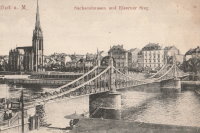
1868: High Street
Hamilton, Ohio, USA - Great Miami River
| Bridgemeister ID: | 67 (added before 2003) |
| Year Completed: | 1868 |
| Name: | High Street |
| Also Known As: | Hamilton |
| Location: | Hamilton, Ohio, USA |
| Crossing: | Great Miami River |
| Principals: | John Gray |
| References: | EOV |
| Use: | Vehicular |
| Status: | Removed |
| Main Cables: | Wire |
| Suspended Spans: | 1 |
External Links:
- Butler County Engineer's Office (BCOE). Mentions this bridge stood from 1866 through 1895.
1868: Skippers Canyon
Maori Point vicinity, New Zealand - Shotover River
| Bridgemeister ID: | 658 (added 2003-03-08) |
| Year Completed: | 1868 |
| Name: | Skippers Canyon |
| Location: | Maori Point vicinity, New Zealand |
| Crossing: | Shotover River |
| At or Near Feature: | Skippers Canyon |
| Principals: | John Turnbull Thomson |
| References: | GAP |
| Use: | Footbridge |
| Status: | Removed |
| Main Cables: | Wire |
Notes:
- Replaced by 1901 Skippers - Maori Point vicinity, New Zealand at a nearby location.
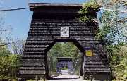
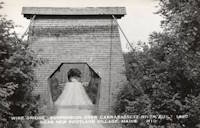
1868: Wire
New Portland, Maine, USA - Carrabasset River
| Bridgemeister ID: | 69 (added before 2003) |
| Year Completed: | 1868 |
| Name: | Wire |
| Location: | New Portland, Maine, USA |
| Crossing: | Carrabasset River |
| Coordinates: | 44.890783 N 70.0925 W |
| Maps: | Acme, GeoHack, Google, OpenStreetMap |
| References: | BC3, BPL, GBD, LAB, RDH |
| Use: | Vehicular (one-lane) |
| Status: | In use (last checked: 2023) |
| Main Cables: | Wire (iron) |
| Suspended Spans: | 1 |
| Main Span: | 1 x 60.5 meters (198.4 feet) |
Notes:
- BPL says c. 1866. Historic landmark plaque at bridge also says 1866.
- Extensive repairs, 1960.
External Links:
1869: (footbridge)
Salado, Texas, USA - Salado Creek
| Bridgemeister ID: | 920 (added 2003-10-18) |
| Year Completed: | 1869 |
| Name: | (footbridge) |
| Location: | Salado, Texas, USA |
| Crossing: | Salado Creek |
| At or Near Feature: | Salado College |
| Use: | Footbridge |
| Status: | Destroyed, 1913 |
| Main Cables: | Wire (iron) |
Notes:
- Destroyed by flood, 1913.
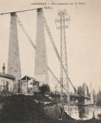
1869: Chavanay
Chavanay, Loire and Isère, France - Rhône River
| Bridgemeister ID: | 1702 (added 2005-03-29) |
| Year Completed: | 1869 |
| Name: | Chavanay |
| Location: | Chavanay, Loire and Isère, France |
| Crossing: | Rhône River |
| Coordinates: | 45.417327 N 4.740458 E |
| Maps: | Acme, GeoHack, Google, OpenStreetMap |
| Use: | Vehicular |
| Status: | Only towers remain (last checked: 2019) |
| Main Cables: | Wire (iron) |
| Suspended Spans: | 1 |
Notes:
- In 2019, one pair of pylons were still standing on the west bank of the Rhône.
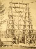
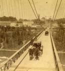
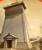
1869: Clifton
Niagara Falls, New York, USA and Niagara Falls, Ontario, Canada - Niagara River
| Bridgemeister ID: | 70 (added before 2003) |
| Year Completed: | 1869 |
| Name: | Clifton |
| Also Known As: | Niagara-Clifton, Falls View, First Falls View |
| Location: | Niagara Falls, New York, USA and Niagara Falls, Ontario, Canada |
| Crossing: | Niagara River |
| Principals: | Samuel Keefer |
| References: | AAJ, BPL, HBE, PTS2 |
| Use: | Vehicular |
| Status: | Replaced, 1889 |
| Main Cables: | Wire (iron) |
| Main Span: | 1 x 386.6 meters (1,268.3 feet) |
| Deck width: | 10 feet |
Notes:
- Opened January 2nd, 1869. Wooden towers replaced with steel towers, 1884. Widened to 17 feet, 1888. Wrecked by wind, January, 1889. Some of the images here may show the replacement bridge.
- Became longest suspension bridge by eclipsing 1867 John A. Roebling (Cincinnati, Cincinnati and Covington) - Cincinnati, Ohio and Covington, Kentucky, USA.
- Eclipsed by new longest suspension bridge 1883 Brooklyn (Great East River) - New York and Brooklyn, New York, USA.
- Replaced by 1889 Second Falls View - Niagara Falls, New York, USA and Niagara Falls, Ontario, Canada.
External Links:
1869: Drahtsteg
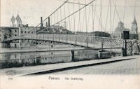
Passau, Bavaria, Germany - Danube River
| Bridgemeister ID: | 5560 (added 2020-12-19) |
| Year Completed: | 1869 |
| Name: | Drahtsteg |
| Location: | Passau, Bavaria, Germany |
| Crossing: | Danube River |
| Coordinates: | 48.575501 N 13.472755 E |
| Maps: | Acme, GeoHack, Google, OpenStreetMap |
| References: | PTS2 |
| Use: | Footbridge |
| Status: | Only towers remain, since 1910 (last checked: 2020) |
| Main Cables: | Wire |
| Suspended Spans: | 1 |
Notes:
- Near future location of 1948 Luitpoldbrücke - Passau, Bavaria, Germany.
External Links:
1869: Lordville
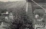
Lordville, New York and Equinunk, Pennsylvania, USA - Delaware River
| Bridgemeister ID: | 71 (added before 2003) |
| Year Completed: | 1869 |
| Name: | Lordville |
| Location: | Lordville, New York and Equinunk, Pennsylvania, USA |
| Crossing: | Delaware River |
| Coordinates: | 41.867938 N 75.213785 W |
| Maps: | Acme, GeoHack, Google, OpenStreetMap |
| Principals: | E.F. Farrington |
| References: | BDR, BOL, PTS2 |
| Use: | Vehicular (one-lane) |
| Status: | Destroyed, 1903 |
| Main Cables: | Wire (iron) |
Notes:
- Destroyed by flood 1903.
- Replaced by 1904 Lordville-Equinunk - Lordville, New York and Equinunk, Pennsylvania, USA.
1869: Rudolfova Lávka
Prague, Czechia - Vltava River
| Bridgemeister ID: | 5939 (added 2021-06-29) |
| Year Completed: | 1869 |
| Name: | Rudolfova Lávka |
| Also Known As: | Rudolfsteg, Kettensteg, Železna Lávka |
| Location: | Prague, Czechia |
| Crossing: | Vltava River |
| Coordinates: | 50.090185 N 14.412677 E |
| Maps: | Acme, GeoHack, Google, OpenStreetMap |
| Principals: | Karel Veselý, František Schön, Ruston and Co. |
| References: | AAJ, PTS2 |
| Use: | Footbridge |
| Status: | Removed, c. 1914 |
| Main Cables: | Chain (iron) |
Notes:
- Removed at some point after the adjacent Mánes bridge was opened in 1914.
External Links:
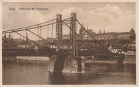
1869: San Francisco
Bilbao, Spain
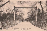
1869: Stadspark
Antwerp, Belgium
| Bridgemeister ID: | 2078 (added 2006-06-10) |
| Year Completed: | 1869 |
| Name: | Stadspark |
| Also Known As: | City Park |
| Location: | Antwerp, Belgium |
| Coordinates: | 51.211054 N 4.414975 E |
| Maps: | Acme, GeoHack, Google, OpenStreetMap |
| Principals: | Cail et Halot |
| References: | ISFF |
| Use: | Footbridge |
| Status: | In use (last checked: 2019) |
| Main Cables: | Chain (iron) |
| Main Span: | 1 x 27.5 meters (90.2 feet) |
| Deck width: | 3.5 |
Notes:
- Cables and deck replaced, 1976.
External Links:
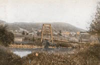
1869: Swinging
Warren and Glade, Pennsylvania, USA - Conewango Creek
| Bridgemeister ID: | 1623 (added 2005-02-27) |
| Year Completed: | 1869 |
| Name: | Swinging |
| Location: | Warren and Glade, Pennsylvania, USA |
| Crossing: | Conewango Creek |
| Coordinates: | 41.847389 N 79.141000 W |
| Maps: | Acme, GeoHack, Google, OpenStreetMap |
| Use: | Footbridge |
| Status: | Replaced, 1904 |
| Main Cables: | Wire (iron) |
Notes:
- Coordinates indicate approximate original location of the bridge.
- Destroyed by storm soon after completion and rebuilt.
- Images of America: Warren by Jodi L. Brandon shows an image of this bridge with a caption stating the bridge was moved to Kelletville (in Forest County, Pennsylvania) in 1906.
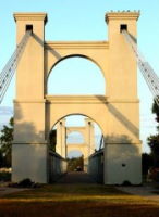
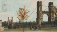
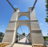
1869: Waco
Waco, Texas, USA - Brazos River
| Bridgemeister ID: | 72 (added before 2003) |
| Year Completed: | 1869 |
| Name: | Waco |
| Location: | Waco, Texas, USA |
| Crossing: | Brazos River |
| Coordinates: | 31.561314 N 97.127063 W |
| Maps: | Acme, GeoHack, Google, OpenStreetMap |
| Principals: | Thomas M. Griffith |
| References: | AAJ, BC3, BPL, BRAZ, GBD, HAERTX98, HBE, PTS2, WSB |
| Use: | Vehicular, with walkway |
| Status: | Restricted to foot traffic (last checked: 2023) |
| Main Cables: | Wire (iron) |
| Suspended Spans: | 1 |
| Main Span: | 1 x 144.8 meters (475 feet) |
| Deck width: | 18 feet |
Notes:
- 1915: Rebuilt.
- 2020, October: Closed for restoration project expecting to last 18-24 months.
- 2021, March: Major restoration project underway, led by Sparks Engineering, Inc.
- 2023, April: The restored bridge is rededicated on April 22. Patrick Sparks of Sparks Engineering reports: . The rededication was held April 22, 2023. "The project involved full rehabilitation including: replacement of the suspension system and anchor rods, strengthening of the anchorages, replacement of the saddle bearings, retrofit strengthening of the east tower, and deck replacement (concrete on the main deck, tropical hardwood on the side walks)."
External Links:
1870: (footbridge)
Rockford, Illinois, USA - Kent Creek
| Bridgemeister ID: | 594 (added 2003-01-11) |
| Year Completed: | 1870 |
| Name: | (footbridge) |
| Location: | Rockford, Illinois, USA |
| Crossing: | Kent Creek |
| At or Near Feature: | Tinker Swiss Cottage Museum |
| Principals: | Robert Tinker |
| Use: | Footbridge |
| Status: | Removed, 1976 |
Notes:
- Ground broken on replacement, October 6, 2004.
- Later at same location 2005 (footbridge) - Rockford, Illinois, USA.
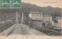
1870: Auzon
Auzon, Haute-Loire, France - Allier River
| Bridgemeister ID: | 6936 (added 2022-01-22) |
| Year Completed: | 1870 |
| Name: | Auzon |
| Location: | Auzon, Haute-Loire, France |
| Crossing: | Allier River |
| Coordinates: | 45.385908 N 3.357088 E |
| Maps: | Acme, GeoHack, Google, OpenStreetMap |
| Use: | Vehicular (one-lane) |
| Status: | Removed, c. 1934 |
| Main Cables: | Wire |
| Main Span: | 1 |
Notes:
- Replaced by an arch bridge in 1934.
- Replaced 1847 Auzon - Auzon, Haute-Loire, France.
External Links:
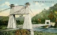
1870: Chehocton
Hancock, New York and Wayne County, Pennsylvania, USA - Delaware River
| Bridgemeister ID: | 284 (added before 2003) |
| Year Completed: | 1870 |
| Name: | Chehocton |
| Location: | Hancock, New York and Wayne County, Pennsylvania, USA |
| Crossing: | Delaware River |
| Principals: | E.F. Farrington, John A. Roebling's Sons Co. |
| Use: | Vehicular |
| Status: | Removed, 1937 |
| Main Cables: | Wire (iron) |
| Suspended Spans: | 1 |
| Main Span: | 1 x 144.8 meters (475 feet) estimated |
Notes:
- Replaced 1937.
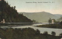
1870: Draht
Kassel, Hessen, Germany - Fulda River
| Bridgemeister ID: | 7753 (added 2023-07-22) |
| Year Completed: | 1870 |
| Name: | Draht |
| Also Known As: | Wire |
| Location: | Kassel, Hessen, Germany |
| Crossing: | Fulda River |
| Coordinates: | 51.312209 N 9.504177 E |
| Maps: | Acme, GeoHack, Google, OpenStreetMap |
| Status: | Destroyed, 1940 |
| Main Cables: | Wire |
| Suspended Spans: | 1 |
Notes:
- 1940: Destroyed by ice.
- Replaced by 1940 Draht (Wire) - Kassel, Hessen, Germany.
External Links:
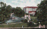
1870: Finck's
Little Falls, New York, USA - Mohawk River
| Bridgemeister ID: | 328 (added before 2003) |
| Year Completed: | 1870 |
| Name: | Finck's |
| Also Known As: | Fink's |
| Location: | Little Falls, New York, USA |
| Crossing: | Mohawk River |
| Coordinates: | 43.034102 N 74.830185 W |
| Maps: | Acme, GeoHack, Google, OpenStreetMap |
| References: | ONC |
| Use: | Vehicular |
| Status: | Destroyed, 1917 |
| Main Cables: | Wire |
Notes:
- Heavily damaged by fire, 1917.
- Coordinates reflect where modern Fincks Basin Road meets the Mohawk River, likely approximate location of this bridge.
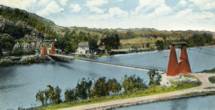
1870: Pond Eddy-Lumberland
Pond Eddy and Lumberland, New York, USA - Delaware River
| Bridgemeister ID: | 297 (added before 2003) |
| Year Completed: | 1870 |
| Name: | Pond Eddy-Lumberland |
| Also Known As: | Decker's |
| Location: | Pond Eddy and Lumberland, New York, USA |
| Crossing: | Delaware River |
| Coordinates: | 41.439349 N 74.819723 W |
| Maps: | Acme, GeoHack, Google, OpenStreetMap |
| Principals: | James D. Decker |
| References: | BDR |
| Use: | Vehicular |
| Status: | Destroyed, October 9, 1903 |
| Main Cables: | Wire (iron) |
| Suspended Spans: | 2 |
| Main Spans: | 2 |
| Deck width: | 12 feet |
Notes:
- Destroyed by flood.
- Coordinates are for the replacement bridge. The suspension bridge would have been extremely close, if not on the same alignment as the replacement.
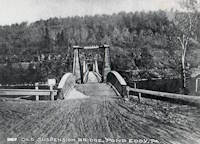
| Bridgemeister ID: | 7962 (added 2023-11-23) |
| Year Completed: | 1870 |
| Name: | Touzac |
| Location: | Touzac, Lot, France |
| Crossing: | Lot River |
| Coordinates: | 44.496083 N 1.049472 E |
| Maps: | Acme, GeoHack, Google, OpenStreetMap |
| Use: | Vehicular (one-lane) |
| Status: | Closed, January 2022 (last checked: 2023) |
| Main Cables: | Wire |
| Suspended Spans: | 1 |
| Main Span: | 1 x 110 meters (360.9 feet) estimated |
Notes:
- 2022, January 21: Bridge is severely damaged by a 40-ton truck attempting to cross. The bridge had a weight restriction of 16 tons since 1932. The long truck was also unable to negotiate the turn at the far end of the bridge and damaged the pylons attempting to reverse.
- 2023, June: Repair work is expected to start in September 2023 and complete in late 2024.
1871: (suspension bridge)
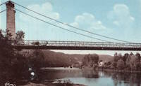
Washburn's Eddy, New York, USA - Hudson River
| Bridgemeister ID: | 74 (added before 2003) |
| Year Completed: | 1871 |
| Name: | (suspension bridge) |
| Location: | Washburn's Eddy, New York, USA |
| Crossing: | Hudson River |
| Principals: | Robert Gilchrist |
| References: | ABC |
| Status: | Removed |
Notes:
- This bridge was a few miles south of the more widely-known Hudson crossing at Riparius.
- Near 1872 Fulsom Landing (Riverside, Folsom Landing, Riparius) - Riparius, New York, USA.
1871: Aboyne
Waterside, Aboyne vicinity, Scotland, United Kingdom - River Dee
| Bridgemeister ID: | 2202 (added 2007-01-28) |
| Year Completed: | 1871 |
| Name: | Aboyne |
| Location: | Waterside, Aboyne vicinity, Scotland, United Kingdom |
| Crossing: | River Dee |
| Principals: | Harper & Co. |
| References: | HARPER |
| Use: | Footbridge |
| Status: | Removed |
| Main Cables: | Wire |
| Main Span: | 1 x 91.4 meters (300 feet) |
Notes:
- HARPER: Likely destroyed by one of these major Dee River flood events: May 1913, December 1914, October 1920.
External Links:
1871: Boatford
Langholm, Borders, Scotland, United Kingdom - River Esk
| Bridgemeister ID: | 1428 (added 2004-07-24) |
| Year Completed: | 1871 |
| Name: | Boatford |
| Location: | Langholm, Borders, Scotland, United Kingdom |
| Crossing: | River Esk |
| References: | AAJ |
| Status: | Collapsed |
Notes:
- Collapsed soon after it was completed under weight of 200 spectators.
- Replaced by 1873 Boatford - Langholm, Borders, Scotland, United Kingdom.
1871: Coubon
Coubon and Volhac, Haute-Loire, France - Loire River
| Bridgemeister ID: | 1724 (added 2005-04-05) |
| Year Completed: | 1871 |
| Name: | Coubon |
| Location: | Coubon and Volhac, Haute-Loire, France |
| Crossing: | Loire River |
| Use: | Vehicular |
| Status: | Destroyed, 1930 |
| Main Cables: | Wire |
| Suspended Spans: | 1 |
Notes:
External Links:
1871: Ferry Street
Binghamton, New York, USA - Chenango River
| Bridgemeister ID: | 276 (added before 2003) |
| Year Completed: | 1871 |
| Name: | Ferry Street |
| Location: | Binghamton, New York, USA |
| Crossing: | Chenango River |
| Principals: | John A. Roebling's Sons, Co. |
| Use: | Vehicular (one-lane) |
| Status: | Removed, 1897 |
| Main Cables: | Wire |
| Suspended Spans: | 1 |
| Main Span: | 1 x 109.7 meters (360 feet) |
Notes:
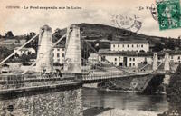
- This bridge was close to the alignment of Binghamton's present Clinton Street bridge. It replaced a bridge that was destroyed by flood in 1865. It was condemned in 1896 and removed in 1897. History Of Broome County indicates an act was passed March 13th, 1871 authorizing the bridge with the contract let to "W.A. Roebling & Son" each cable consisting of seven steel wire ropes, each two inches in diameter.
- An article from the Binghamton Democrat, July 20, 1871: "The Suspension Bridge -- The work on the west abutment of the suspension bridge has been commenced and will be rapidly as advisable pushed forward to completion, and soon thereafter the wire cables will be placed in position, the stays, supports and girders made fast, and ready for the flooring. In the course of six or eight weeks it is hoped that the bridge will be completed, and our people given another way of passing from the 1st to the 2nd wards, and the old-pleasant driveway re-opened, of which we have been debarred since the flood of St-Patrick's Day in the morning in [1865]. Upon the completion of this enterprise, surely no one will ever regret having voted in favor of the free suspension bridge."
- An article from the Binghamton Democrat, Nov. 30, 1871: "The New Bridge -- Its Cost -- For the suspenssion [sic] bridge, the tax-payers voted $28,000. It is finished, and in the Common Council last evening it was asserted that it cost over $30,000 and still all the claims are not satisfied. Mr. Jas. Fanning, contractor for building abutments, seeks relief for $1,000 or upwards which he is out no account of his contract. His petition was after considerable skirmishing finally referred to a committee. We hold that this is wrong, the Common Council has nothing to do with this matter. Mayor Dwight published a card binding himself to pay all over $28,000 that the bridge would cost. The people voted that amount and their representatives have nothing to do with any further cost or expense arrising [sic] from that source."
- Internet searches for this bridge often lead to an image on page 32 of the book "Binghamton", from the "Images of America" series, by Ed Aswad and Suzanne M. Meredith. However, that image is of the Warren Pensylvania suspension bridge and is erroneously captioned as the Binghamton Ferry Street bridge. The bridges may be sometimes confused because of similar surroundings and similar towers. Both are often depicted with a large warehouse building on the far side of the bridge, to the right. Both had "walk-through" towers where the pedestrian walkway passed through portals in the towers. Closer comparisons reveal the Warren towers are substantially larger than the Ferry Street towers. This is not surprising given the Warren bridge was substantially longer than the Ferry Street bridge. All this being said, there are different images purporting to be the Ferry Street bridge that show different towers. The stereoview image linked here appears to show the original towers. Later photos appear to show either replaced towers or, perhaps, the original towers clad in protective housing.
- See 1871 Warren (Hickory Street) - Warren, Pennsylvania, USA. The two bridges are sometimes confused despite the significant size difference.
1871: Hunting
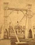
Shocklach Green vicinity, England, United Kingdom - River Dee
| Bridgemeister ID: | 2191 (added 2007-01-26) |
| Year Completed: | 1871 |
| Name: | Hunting |
| Location: | Shocklach Green vicinity, England, United Kingdom |
| Crossing: | River Dee |
| Principals: | Harper & Co. |
| References: | HARPER |
| Use: | Footbridge |
| Status: | Removed, 1935 |
| Main Cables: | Wire |
| Suspended Spans: | 1 |
| Main Span: | 1 x 48.8 meters (160 feet) |
External Links:
1871: Tanarmouth
Glen Tanar, Aboyne vicinity, Scotland, United Kingdom - Water of Tanar
| Bridgemeister ID: | 7972 (added 2023-11-26) |
| Year Completed: | 1871 |
| Name: | Tanarmouth |
| Location: | Glen Tanar, Aboyne vicinity, Scotland, United Kingdom |
| Crossing: | Water of Tanar |
| Coordinates: | 57.066833 N 2.805167 W |
| Maps: | Acme, GeoHack, Google, OpenStreetMap |
| Principals: | Harper & Co. |
| Use: | Footbridge |
| Status: | Removed, 1950 |
| Main Cables: | Wire |
| Main Span: | 1 x 30.5 meters (100 feet) |
External Links:
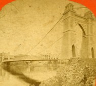
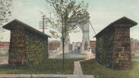
1871: Warren
Warren, Pennsylvania, USA - Allegheny River
| Bridgemeister ID: | 75 (added before 2003) |
| Year Completed: | 1871 |
| Name: | Warren |
| Also Known As: | Hickory Street |
| Location: | Warren, Pennsylvania, USA |
| Crossing: | Allegheny River |
| Principals: | George W. Fishler |
| References: | AAJ, EOV, HAERPA461, HBE, PTS2 |
| Use: | Vehicular, with walkway |
| Status: | Replaced, 1918 |
| Main Cables: | Wire (iron) |
| Suspended Spans: | 1 |
| Main Span: | 1 x 143.3 meters (470 feet) |
| Deck width: | 29 feet |
1872: Barrett
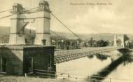
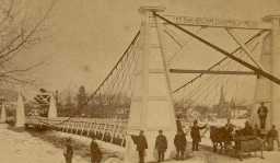
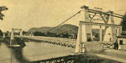
Port Jervis, New York and Matamoras, Pennsylvania, USA - Delaware River
| Bridgemeister ID: | 76 (added before 2003) |
| Year Completed: | 1872 |
| Name: | Barrett |
| Location: | Port Jervis, New York and Matamoras, Pennsylvania, USA |
| Crossing: | Delaware River |
| References: | BDR |
| Use: | Vehicular |
| Status: | Destroyed, October 11, 1903 |
| Main Cables: | Wire (iron) |
| Suspended Spans: | 2 |
| Main Spans: | 2 |
Notes:
- BDR: Destroyed by ice March 17, 1875, rebuilt, destroyed by flood October 11, 1903.
1872: Branch Hill
Branch Hill and Symmes, Ohio, USA - Little Miami River
| Bridgemeister ID: | 77 (added before 2003) |
| Year Completed: | 1872 |
| Name: | Branch Hill |
| Location: | Branch Hill and Symmes, Ohio, USA |
| Crossing: | Little Miami River |
| Principals: | John Gray |
| References: | EOV |
| Use: | Vehicular (one-lane) |
| Status: | Removed |
| Main Cables: | Wire |
Notes:
- Based on correspondence between "Gray's firm" and Washington Roebling, EOV suggests there may be a chance this early bridge contained steel cables.
1872: Chemung
Chemung, New York, USA - Chemung River
| Bridgemeister ID: | 78 (added before 2003) |
| Year Completed: | 1872 |
| Name: | Chemung |
| Location: | Chemung, New York, USA |
| Crossing: | Chemung River |
| Principals: | J.V. Fishler, J.R. Crowell |
| Use: | Vehicular |
| Status: | Removed |
| Main Cables: | Wire (iron) |

1872: Dryburgh Abbey
Dryburgh and St. Boswells, Scotland, United Kingdom - River Tweed
| Bridgemeister ID: | 1439 (added 2004-07-31) |
| Year Completed: | 1872 |
| Name: | Dryburgh Abbey |
| Location: | Dryburgh and St. Boswells, Scotland, United Kingdom |
| Crossing: | River Tweed |
| Coordinates: | 55.580771 N 2.654251 W |
| Maps: | Acme, GeoHack, Google, OpenStreetMap |
| Use: | Footbridge |
| Status: | Replaced, 1911 |
| Main Cables: | Wire |
| Suspended Spans: | 1 |
Notes:
- At former location of 1818 Dryburgh Abbey - Dryburgh and St. Boswells, Scotland, United Kingdom.
- Near Mertoun Estate - Mertoun, Scotland, United Kingdom.
- Replaced by 1911 Dryburgh Abbey - Dryburgh and St. Boswells, Scotland, United Kingdom.
External Links:
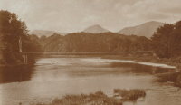
1872: Fulsom Landing
Riparius, New York, USA - Hudson River
| Bridgemeister ID: | 330 (added before 2003) |
| Year Completed: | 1872 |
| Name: | Fulsom Landing |
| Also Known As: | Riverside, Folsom Landing, Riparius |
| Location: | Riparius, New York, USA |
| Crossing: | Hudson River |
| Coordinates: | 43.661963 N 73.898194 W |
| Maps: | Acme, GeoHack, Google, OpenStreetMap |
| Use: | Vehicular (one-lane) |
| Status: | Removed |
| Main Cables: | Wire |
| Suspended Spans: | 1 |
| Main Span: | 1 |
Notes:
- The location of this bridge was originally known as "Folsom Landing" and later became known as "Riverside." In 1886 the name was changed to "Riparius" to avoid confusion with another New York "Riverside" location. The suspension bridge is sometimes referenced by each of these names. To make matters even more confusing, the bridge was known as the "Fulsom Landing" bridge (instead of Folsom).
- Removed at some point after 1919.
- Near 1871 (suspension bridge) - Washburn's Eddy, New York, USA.
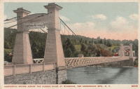
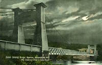
1872: Gilead
Gilead, Maine, USA - Androscoggin River
| Bridgemeister ID: | 2157 (added 2006-12-10) |
| Year Completed: | 1872 |
| Name: | Gilead |
| Location: | Gilead, Maine, USA |
| Crossing: | Androscoggin River |
| Use: | Vehicular |
| Status: | Replaced, 1923 |
| Main Cables: | Wire |
| Main Span: | 1 x 58.5 meters (192 feet) |
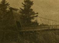
1872: Lower
Turners Falls, Montague, Massachusetts, USA - Connecticut River
| Bridgemeister ID: | 340 (added before 2003) |
| Year Completed: | 1872 |
| Name: | Lower |
| Also Known As: | White |
| Location: | Turners Falls, Montague, Massachusetts, USA |
| Crossing: | Connecticut River |
| Coordinates: | 42.609165 N 72.561433 W |
| Maps: | Acme, GeoHack, Google, OpenStreetMap |
| References: | CCR, PTS2 |
| Use: | Vehicular |
| Status: | Removed, circa 1936 |
| Main Cables: | Wire |
| Suspended Spans: | 1 |
Notes:
- Damaged by flood, 1936 and removed soon after.
- Near 1878 Upper (Red) - Turners Falls, Montague, Massachusetts, USA.
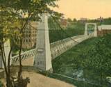
1872: Ravenscraig
Dundee, Scotland, United Kingdom - Caledonian Railway
| Bridgemeister ID: | 5078 (added 2020-08-30) |
| Year Completed: | 1872 |
| Name: | Ravenscraig |
| Location: | Dundee, Scotland, United Kingdom |
| Crossing: | Caledonian Railway |
| Coordinates: | 56.468350 N 2.901061 W |
| Maps: | Acme, GeoHack, Google, OpenStreetMap |
| Principals: | Harper & Co. |
| References: | HARPER |
| Use: | Footbridge |
| Status: | Removed |
| Main Cables: | Wire |
| Suspended Spans: | 1 |
| Main Span: | 1 x 16.8 meters (55.1 feet) |
Notes:
- Coordinates are approximate location of the bridge based on the description in HARPER noting the bridge crossed the railway at the estate of a Colonel Sandeman at Ravenscraig which is the location of the present day (2020) Ravenscraig Gardens in Dundee.
External Links:
| Bridgemeister ID: | 79 (added before 2003) |
| Year Completed: | 1872 |
| Name: | Trinity Cemetery |
| Location: | New York, New York, USA |
| Crossing: | Broadway |
| Principals: | Calvert Vaux |
| References: | CVA |
| Status: | Removed |
| Main Cables: | Wire |
| Suspended Spans: | 1 |
Notes:
- Connected Trinity Cemetery across Broadway. Demolished 1911. Appears to have been wide enough to handle vehicles.
- Eric K. Washington contacted me in 2011 wondering if the Trinity Cemetery bridge was the first suspension bridge constructed in New York City. While it seems unlikely that New York City (even just Manhattan) did not have, at least, other minor suspension bridges constructed before 1872, I have never encountered mention of one.
1873: Boatford
Langholm, Borders, Scotland, United Kingdom - River Esk
| Bridgemeister ID: | 534 (added before 2003) |
| Year Completed: | 1873 |
| Name: | Boatford |
| Location: | Langholm, Borders, Scotland, United Kingdom |
| Crossing: | River Esk |
| Coordinates: | 55.15098 N 3.00273 W |
| Maps: | Acme, GeoHack, Google, OpenStreetMap |
| References: | AAJ |
| Use: | Footbridge |
| Status: | In use (last checked: 2004) |
| Main Span: | 1 x 53.3 meters (175 feet) |
Notes:
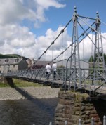
1873: Franklin
Franklin, Ohio, USA - Great Miami River
| Bridgemeister ID: | 80 (added before 2003) |
| Year Completed: | 1873 |
| Name: | Franklin |
| Location: | Franklin, Ohio, USA |
| Crossing: | Great Miami River |
| Principals: | J. W. Shipman & Co., John A. Roebling's Sons Co. |
| References: | EOV, HWCO |
| Use: | Vehicular (one-lane) |
| Status: | Replaced, 1933 |
| Main Cables: | Wire |
| Suspended Spans: | 1 |
Notes:
- Traffic restricted to foot traffic, 1931. Closed, 1933, after the bridge sagged significantly.
- From HWCO: "The towers are thirty-eight feet high, and each consists of four columns, of Phoenix column iron. The cables are of steel wire and each is composed of 343 strands, the whole cable having a diameter of seven inches. The masonry is constructed of Dayton stone, and is of a very substantial character... The wire and iron work was done in the summer of 1873 under the superintendence of Roebling & Sons, of Trenton, N. J. The bridge is stayed by strong wire cables and stiffened by an iron truss. The whole cost was $43,900."
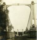
1873: Harrison
Harrison, Ohio and Dearborn County, Indiana, USA - Whitewater River
| Bridgemeister ID: | 81 (added before 2003) |
| Year Completed: | 1873 |
| Name: | Harrison |
| Location: | Harrison, Ohio and Dearborn County, Indiana, USA |
| Crossing: | Whitewater River |
| Principals: | James W. Shipman and Co. |
| References: | EOV |
| Use: | Vehicular (one-lane) |
| Status: | Destroyed, 1913, by flood |
| Main Cables: | Wire |
Notes:
- See 1868 Calloway's Ford (Whitewater, Harrison's) - Elizabethtown vicinity, Hamilton County, Ohio, USA.
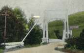
1873: South Street
Wilkes-Barre, Pennsylvania, USA - Lehigh Valley Railroad and North Branch Canal
| Bridgemeister ID: | 353 (added before 2003) |
| Year Completed: | 1873 |
| Name: | South Street |
| Also Known As: | Wire |
| Location: | Wilkes-Barre, Pennsylvania, USA |
| Crossing: | Lehigh Valley Railroad and North Branch Canal |
| Coordinates: | 41.239328 N 75.884643 W |
| Maps: | Acme, GeoHack, Google, OpenStreetMap |
| Use: | Vehicular |
| Status: | Removed, c. 1925 |
| Main Cables: | Wire |
Notes:
- In use until 1910, possibly longer. Replacement opened 1925.
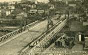
1874: (suspension bridge)
Bannockburn, New Zealand - Kawarau River
| Bridgemeister ID: | 660 (added 2003-03-08) |
| Year Completed: | 1874 |
| Name: | (suspension bridge) |
| Location: | Bannockburn, New Zealand |
| Crossing: | Kawarau River |
| References: | GAP |
| Status: | Replaced |
Notes:
- GAP: Destroyed by flood 1878. Rebuilt 1879 by Jeremiah Drummey. Damaged by neglect, fire.
- Replaced by 1897 Macandrew - Bannockburn, New Zealand.
1874: Canet
Canet and Le Pouget, Hérault, France - Hérault River
| Bridgemeister ID: | 7491 (added 2022-12-30) |
| Year Completed: | 1874 |
| Name: | Canet |
| Location: | Canet and Le Pouget, Hérault, France |
| Crossing: | Hérault River |
| Coordinates: | 43.597444 N 3.493061 E |
| Maps: | Acme, GeoHack, Google, OpenStreetMap |
| Use: | Vehicular |
| Status: | Replaced |
| Main Cables: | Wire (iron) |
| Suspended Spans: | 1 |
Notes:
- Replaced 1845 Canet - Canet and Le Pouget, Hérault, France.
- Replaced by Canet - Canet and Le Pouget, Hérault, France.
External Links:
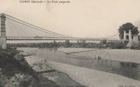
1874: Châtel-de-Neuvre
Châtel-de-Neuvre and La Ferté-Hauterive, Allier, France - Allier River
| Bridgemeister ID: | 4905 (added 2020-07-18) |
| Year Completed: | 1874 |
| Name: | Châtel-de-Neuvre |
| Location: | Châtel-de-Neuvre and La Ferté-Hauterive, Allier, France |
| Crossing: | Allier River |
| Coordinates: | 46.402296 N 3.317844 E |
| Maps: | Acme, GeoHack, Google, OpenStreetMap |
| References: | AAJ |
| Use: | Vehicular |
| Status: | Replaced, 1923 |
| Main Cables: | Wire |
| Suspended Spans: | 2 |
| Main Spans: | 2 |
External Links:
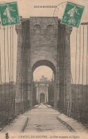
| Bridgemeister ID: | 1232 (added 2004-02-15) |
| Year Completed: | 1874 |
| Name: | Huitong |
| Location: | Longling, Yunnan, China |
| Crossing: | Nujiang |
| Coordinates: | 24.734810 N 98.966987 E |
| Maps: | Acme, GeoHack, Google, OpenStreetMap |
| References: | BCG, BYU |
| Use: | Vehicular (one-lane) |
| Status: | Closed, 1971 (last checked: 2019) |
| Main Cables: | Chain (iron) |
| Suspended Spans: | 1 |
| Main Span: | 1 x 94.3 meters (309.4 feet) |
Notes:
- Originally built with iron chains, modified to steel wire cables, 1935.
Do you have any information or photos for these bridges that you would like to share? Please email david.denenberg@bridgemeister.com.
