Suspension Bridges 1835-1849 (201-241 of 241)
This is a list of bridges 201 through 241 (of 241 total) in the suspension bridge inventory completed from 1835 through 1849, the year the Wheeling suspension bridge was completed. Wherever you see a Bridgemeister ID number click it to isolate the bridge on its own page.
Related Lists:
1846: Maison-Rouge
Courcelles-sur-Seine, Eure, France - Seine River
| Bridgemeister ID: | 5642 (added 2020-12-30) |
| Year Completed: | 1846 |
| Name: | Maison-Rouge |
| Location: | Courcelles-sur-Seine, Eure, France |
| Crossing: | Seine River |
| Coordinates: | 49.179082 N 1.353851 E |
| Maps: | Acme, GeoHack, Google, OpenStreetMap |
| Principals: | Escarraguel Brothers |
| References: | AAJ |
| Use: | Vehicular |
| Status: | Destroyed, October 15, 1870 |
| Main Cables: | Wire (iron) |
Notes:
- Coordinates indicate the approximate former location of this bridge.
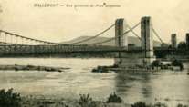
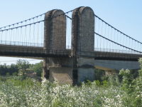
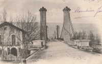
1846: Mallemort
Mallemort, Bouches-du-Rhône and Mérindol, Vaucluse, France - Durance River
| Bridgemeister ID: | 985 (added 2003-11-15) |
| Year Completed: | 1846 |
| Name: | Mallemort |
| Location: | Mallemort, Bouches-du-Rhône and Mérindol, Vaucluse, France |
| Crossing: | Durance River |
| Coordinates: | 43.740533 N 5.176 E |
| Maps: | Acme, GeoHack, Google, OpenStreetMap |
| Use: | Vehicular |
| Status: | Closed (last checked: 2005) |
| Main Cables: | Wire (iron) |
| Suspended Spans: | 3 |
| Main Spans: | 3 |
Notes:
- Damaged 1872, 1880, 1882, 1886 by flood, 1940 by bombs. Extant 2005 but closed.
External Links:
1846: Monongahela
Pittsburgh, Pennsylvania, USA - Monongahela River
| Bridgemeister ID: | 28 (added before 2003) |
| Year Completed: | 1846 |
| Name: | Monongahela |
| Also Known As: | Smithfield Street |
| Location: | Pittsburgh, Pennsylvania, USA |
| Crossing: | Monongahela River |
| Principals: | John A. Roebling |
| References: | BOB, BOP, BPL, HBE, ONF, PBR, PTS2 |
| Use: | Vehicular |
| Status: | Removed, 1882 |
| Main Cables: | Wire (iron) |
| Suspended Spans: | 8 |
| Main Spans: | 8 x 57.3 meters (188 feet) |
| Deck width: | 20 feet |
External Links:
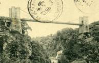
1846: Montpezat
Montpezat-sous-Bauzon, Ardèche, France - Fontaulière River
| Bridgemeister ID: | 2159 (added 2006-12-10) |
| Year Completed: | 1846 |
| Name: | Montpezat |
| Location: | Montpezat-sous-Bauzon, Ardèche, France |
| Crossing: | Fontaulière River |
| Coordinates: | 44.704903 N 4.216498 E |
| Maps: | Acme, GeoHack, Google, OpenStreetMap |
| Use: | Vehicular (one-lane) |
| Status: | Demolished, 1912 |
| Main Cables: | Wire |
| Suspended Spans: | 1 |
External Links:
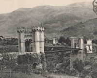
1846: Saint Clair
Lyon, Métropole de Lyon, France - Rhône River
| Bridgemeister ID: | 551 (added before 2003) |
| Year Completed: | 1846 |
| Name: | Saint Clair |
| Also Known As: | Louis Philippe, Vaïsse |
| Location: | Lyon, Métropole de Lyon, France |
| Crossing: | Rhône River |
| References: | AAJ, PQL |
| Use: | Vehicular |
| Status: | Demolished, 1953 |
| Main Cables: | Wire (iron) |
| Suspended Spans: | 2 |
| Deck width: | 7 meters |
Notes:
- Damaged by drifting boat, 1854. Rebuilt, 1856. Bombed, 1944. Rebuilt, 1946. Demolished, 1953.
- Crossed at present-day location of Pont Maréchal de Lattre de Tassigny.
- Originally constructed with two suspended spans. When it was rebuilt in 1856, towers were added increasing the number of suspended spans to six.
- Near 1845 College (Collège) - Lyon, Métropole de Lyon, France.
External Links:

1846: San Alejandro
El Puerto de Santa Maria, Spain - Rio Guadalete
| Bridgemeister ID: | 5548 (added 2020-12-13) |
| Year Completed: | 1846 |
| Name: | San Alejandro |
| Location: | El Puerto de Santa Maria, Spain |
| Crossing: | Rio Guadalete |
| Principals: | Jules Seguin |
| Use: | Vehicular |
| Status: | Collapsed, November 16, 1877 |
| Main Cables: | Wire (iron) |
| Suspended Spans: | 1 |
1847: Auzon
Auzon, Haute-Loire, France - Allier River
| Bridgemeister ID: | 6935 (added 2022-01-22) |
| Year Completed: | 1847 |
| Name: | Auzon |
| Location: | Auzon, Haute-Loire, France |
| Crossing: | Allier River |
| Coordinates: | 45.385816 N 3.356742 E |
| Maps: | Acme, GeoHack, Google, OpenStreetMap |
| Status: | Destroyed, September 26, 1866 |
Notes:
- Replaced 1845 Auzon - Auzon, Haute-Loire, France.
- Replaced by 1870 Auzon - Auzon, Haute-Loire, France.
External Links:
- Art-et-Histoire - Premier pont suspendu d'Auzon - 1845. Deck is destroyed by windstorm, January 20, 1854. Weakened by flood, in 1856. Bridge is repaired, but is eventually destroyed by flood in 1866.
1847: Évieu
Évieu, Ain and Les Avenières Veyrins-Thuellin, Isère, France - Rhône River
| Bridgemeister ID: | 7098 (added 2022-06-03) |
| Year Completed: | 1847 |
| Name: | Évieu |
| Location: | Évieu, Ain and Les Avenières Veyrins-Thuellin, Isère, France |
| Crossing: | Rhône River |
| Use: | Vehicular |
| Status: | Damaged, 1885 |
| Main Cables: | Wire |
Notes:
External Links:
1847: Beauvoir
Beauvoir, Saint-Romans, Isère, France - Isère River
| Bridgemeister ID: | 7713 (added 2023-07-07) |
| Year Completed: | 1847 |
| Name: | Beauvoir |
| Location: | Beauvoir, Saint-Romans, Isère, France |
| Crossing: | Isère River |
| Coordinates: | 45.124700 N 5.330327 E |
| Maps: | Acme, GeoHack, Google, OpenStreetMap |
| Use: | Vehicular |
| Status: | Removed |
| Main Cables: | Wire |
| Suspended Spans: | 1 |
External Links:
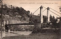
1847: Chusclan
Chusclan, Gard, France - Cèze River
| Bridgemeister ID: | 1606 (added 2005-02-06) |
| Year Completed: | 1847 |
| Name: | Chusclan |
| Location: | Chusclan, Gard, France |
| Crossing: | Cèze River |
| Use: | Vehicular (one-lane) |
| Status: | Removed |
| Main Cables: | Wire (iron) |
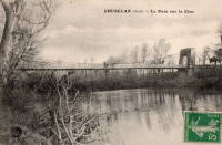
1847: Donzère
Donzère, Drôme and Viviers, Ardèche, France - Rhône River
| Bridgemeister ID: | 970 (added 2003-11-13) |
| Year Completed: | 1847 |
| Name: | Donzère |
| Also Known As: | Robinet |
| Location: | Donzère, Drôme and Viviers, Ardèche, France |
| Crossing: | Rhône River |
| Coordinates: | 44.452367 N 4.6981 E |
| Maps: | Acme, GeoHack, Google, OpenStreetMap |
| References: | AAJ, BPF |
| Use: | Vehicular (one-lane) |
| Status: | In use (last checked: 2021) |
| Main Cables: | Wire (iron) |
| Suspended Spans: | 3 |
| Main Spans: | 3 x 100 meters (328.1 feet) estimated |
External Links:
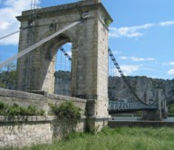
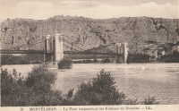
1847: Fombeton
Valernes, Alpes-de-Haute-Provence, France - Durance River
| Bridgemeister ID: | 4563 (added 2020-06-02) |
| Year Completed: | 1847 |
| Name: | Fombeton |
| Location: | Valernes, Alpes-de-Haute-Provence, France |
| Crossing: | Durance River |
| Coordinates: | 44.249224 N 5.921627 E |
| Maps: | Acme, GeoHack, Google, OpenStreetMap |
| Use: | Vehicular (one-lane) |
| Status: | Removed, 2014 |
| Suspended Spans: | 1 |
External Links:
1847: Moyola Park
Castledawson, Northern Ireland, United Kingdom - Moyola River
| Bridgemeister ID: | 3888 (added 2020-03-13) |
| Year Completed: | 1847 |
| Name: | Moyola Park |
| Location: | Castledawson, Northern Ireland, United Kingdom |
| Crossing: | Moyola River |
| Coordinates: | 54.781235 N 6.560394 W |
| Maps: | Acme, GeoHack, Google, OpenStreetMap |
| Principals: | James Dredge |
| Use: | Footbridge |
| Status: | In use |
| Main Cables: | Rod (iron) |
External Links:
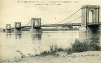
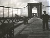
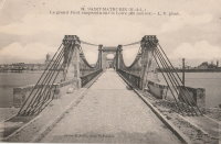
1847: Saint-Mathurin-sur-Loire
Saint-Mathurin-sur-Loire, Maine-et-Loire, France - Loire River
| Bridgemeister ID: | 1589 (added 2005-01-27) |
| Year Completed: | 1847 |
| Name: | Saint-Mathurin-sur-Loire |
| Location: | Saint-Mathurin-sur-Loire, Maine-et-Loire, France |
| Crossing: | Loire River |
| Coordinates: | 47.406833 N 0.318722 W |
| Maps: | Acme, GeoHack, Google, OpenStreetMap |
| Use: | Vehicular |
| Status: | Destroyed, June 18, 1940 |
| Main Cables: | Wire (iron) |
| Main Spans: | 5 |
Notes:
- 1927: The bridge is reconstructed and strengthened.
External Links:
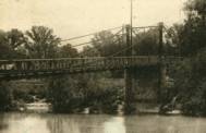
1847: Saint-Symphorien
Tours, Indre-et-Loire, France - Loire River
| Bridgemeister ID: | 1755 (added 2005-04-20) |
| Year Completed: | 1847 |
| Name: | Saint-Symphorien |
| Location: | Tours, Indre-et-Loire, France |
| Crossing: | Loire River |
| At or Near Feature: | l'Île Aucard |
| Coordinates: | 47.398776 N 0.692994 E |
| Maps: | Acme, GeoHack, Google, OpenStreetMap |
| Principals: | Seguin Brothers |
| References: | AAJ |
| Use: | Vehicular (one-lane), with walkway |
| Status: | Replaced |
| Main Cables: | Wire (iron) |
| Suspended Spans: | 3 |
| Main Spans: | 3 |
Notes:
- This was the three-span south section of the Saint-Symphorien bridge.
- 1940-1944: The Saint-Symphorien bridge is destroyed by French troops in June 1940 to slow the German army. Repaired in 1943. Destroyed again in 1944 by the German army. It is unclear whether both the north and south bridges were destroyed during these events.
- Connects to 1847 Saint-Symphorien - Tours, Indre-et-Loire, France.
- Replaced by Saint-Symphorien - Tours, Indre-et-Loire, France.
External Links:
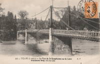
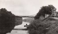
1847: Saint-Symphorien
Tours, Indre-et-Loire, France - Loire River
| Bridgemeister ID: | 7838 (added 2023-09-03) |
| Year Completed: | 1847 |
| Name: | Saint-Symphorien |
| Location: | Tours, Indre-et-Loire, France |
| Crossing: | Loire River |
| At or Near Feature: | l'Île Aucard |
| Coordinates: | 47.401440 N 0.693325 E |
| Maps: | Acme, GeoHack, Google, OpenStreetMap |
| Principals: | Seguin Brothers |
| Use: | Vehicular (one-lane) |
| Status: | Removed |
| Main Cables: | Wire (iron) |
| Suspended Spans: | 2 |
| Main Spans: | 2 |
Notes:
- This was the original two-span north section of the Saint-Symphorien bridge.
- 1875, June 12: The deck of the northern bridge is wrecked by wind. The bridge is repaired.
- 1940-1944: The Saint-Symphorien bridge is destroyed by French troops in June 1940 to slow the German army. Repaired in 1943. Destroyed again in 1944 by the German army. It is unclear whether both the north and south bridges were destroyed during these events.
- Connects to 1847 Saint-Symphorien - Tours, Indre-et-Loire, France.
- Connects to Saint-Symphorien - Tours, Indre-et-Loire, France.
- Replaced by 1963 Saint-Symphorien - Tours, Indre-et-Loire, France.
External Links:
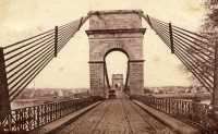
1847: St. Christophe
Lorient, Morbihan, France - Scorff River
| Bridgemeister ID: | 1155 (added 2004-01-18) |
| Year Completed: | 1847 |
| Name: | St. Christophe |
| Also Known As: | Kérentrech, Nemours |
| Location: | Lorient, Morbihan, France |
| Crossing: | Scorff River |
| Principals: | Le Clerc and Noyon |
| References: | AAJ |
| Use: | Vehicular |
| Status: | Removed |
| Main Cables: | Wire (iron) |
| Main Span: | 1 x 180 meters (590.6 feet) |
Notes:
- Large masonry towers. Main span of 180 meters is unusually large for a French bridge of this decade.
External Links:
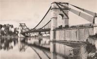
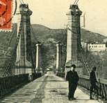
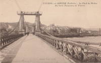
1847: Viviers
Viviers, Ardèche and Drôme, France - Rhône River
| Bridgemeister ID: | 1961 (added 2005-11-05) |
| Year Completed: | 1847 |
| Name: | Viviers |
| Location: | Viviers, Ardèche and Drôme, France |
| Crossing: | Rhône River |
| Coordinates: | 44.481667 N 4.699698 E |
| Maps: | Acme, GeoHack, Google, OpenStreetMap |
| References: | AAJ |
| Use: | Vehicular (one-lane) |
| Status: | Destroyed, 1944 |
| Main Cables: | Wire |
Notes:
- Later at same location 1954 Viviers - Viviers, Ardèche and Châteauneuf-Du-Rhône, Drôme, France.
External Links:
1848: Charreau
Charreau, La Chapelle-Montlinard, Cher, France - Canal Latéral à La Loire
| Bridgemeister ID: | 8391 (added 2024-02-18) |
| Year Completed: | 1848 |
| Name: | Charreau |
| Location: | Charreau, La Chapelle-Montlinard, Cher, France |
| Crossing: | Canal Latéral à La Loire |
| Coordinates: | 47.190667 N 2.982861 E |
| Maps: | Acme, GeoHack, Google, OpenStreetMap |
| Use: | Vehicular (one-lane) |
| Status: | In use (last checked: 2013) |
| Main Cables: | Wire (iron) |
| Suspended Spans: | 1 |
Notes:
External Links:
- Art-et-Histoire - Pont de Charreau à La Chapelle-Montlinard - 1848. Indicates the 1848 bridge replaced an 1840 suspension bridge destroyed in an 1846 flood.
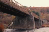
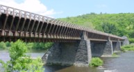
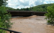
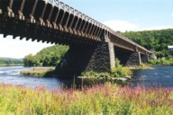
1848: Delaware Aqueduct
Lackawaxen, Pennsylvania and Minisink Ford, New York, USA - Delaware River
| Bridgemeister ID: | 30 (added before 2003) |
| Year Completed: | 1848 |
| Name: | Delaware Aqueduct |
| Also Known As: | Roebling Aqueduct |
| Location: | Lackawaxen, Pennsylvania and Minisink Ford, New York, USA |
| Crossing: | Delaware River |
| Coordinates: | 41.48262 N 74.98461 W |
| Maps: | Acme, GeoHack, Google, OpenStreetMap |
| Principals: | John A. Roebling |
| References: | AAJ, BDR, BOB, BPL, GBD, LAB, LACE, RDH, SJR |
| Use: | Aqueduct and Vehicular (one-lane), with walkway |
| Status: | In use (last checked: 2006) |
| Main Cables: | Wire (iron) |
| Suspended Spans: | 4 |
| Main Spans: | 1 x 43.3 meters (142 feet), 3 x 39.9 meters (131 feet) |
Notes:
- BPL: Completed 1848. RDH/BDR: Completed 1848, not used until 1849.
- Originally constructed to carry the Delaware and Hudson Canal. Converted to a one-lane vehicular bridge soon after the canal closed in 1898. Substantially restored in 1980's and 1990's, but retains original cables.
- Built as part of same project as 1849 Lackawaxen Aqueduct - Lackawaxen, Pennsylvania, USA.
- Built as part of same project as 1851 High Falls Aqueduct - High Falls, New York, USA.
- Built as part of same project as 1851 Neversink Aqueduct - Cuddebackville, New York, USA.
- Near 1849 Lackawaxen Aqueduct - Lackawaxen, Pennsylvania, USA.
External Links:
1848: Nambault
Nambault, La Chapelle-Montlinard, Cher, France - Canal Latéral à La Loire
| Bridgemeister ID: | 8390 (added 2024-02-18) |
| Year Completed: | 1848 |
| Name: | Nambault |
| Location: | Nambault, La Chapelle-Montlinard, Cher, France |
| Crossing: | Canal Latéral à La Loire |
| Coordinates: | 47.179472 N 2.987139 E |
| Maps: | Acme, GeoHack, Google, OpenStreetMap |
| Use: | Vehicular (one-lane) |
| Status: | In use (last checked: 2019) |
| Main Cables: | Wire (iron) |
| Suspended Spans: | 1 |
Notes:
External Links:
- Art-et-Histoire - Pont de Nambault à La Chapelle-Montlinard - 1848. Indicates the 1848 bridge replaced an 1840 suspension bridge destroyed in an 1846 flood.
1848: Niagara Suspension
Niagara Falls, New York, USA and Niagara Falls, Ontario, Canada - Niagara River
| Bridgemeister ID: | 29 (added before 2003) |
| Year Completed: | 1848 |
| Name: | Niagara Suspension |
| Location: | Niagara Falls, New York, USA and Niagara Falls, Ontario, Canada |
| Crossing: | Niagara River |
| Principals: | Charles Ellet |
| References: | BOB, BPL, HBE, ONF, PTS2 |
| Use: | Vehicular (one-lane) |
| Status: | Removed |
| Main Cables: | Wire (iron) |
| Suspended Spans: | 1 |
| Main Span: | 1 x 234.7 meters (770 feet) |
| Deck width: | 7.5 feet |
Notes:
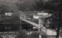
1848: Podolský Chain
Podolí, Czechia - Vltava River
| Bridgemeister ID: | 1816 (added 2005-05-21) |
| Year Completed: | 1848 |
| Name: | Podolský Chain |
| Also Known As: | Podolsko Řetězový |
| Location: | Podolí, Czechia |
| Crossing: | Vltava River |
| Coordinates: | 49.356889 N 14.272972 E |
| Maps: | Acme, GeoHack, Google, OpenStreetMap |
| Principals: | Friedrich Schnirch, Vojtech Lanna |
| Use: | Vehicular (one-lane) |
| Status: | Dismantled, 1960 |
| Main Cables: | Chain (iron) |
| Suspended Spans: | 1 |
Notes:
- Used at original location (Podolí) until 1960, then dismantled. Reassembled in 1975 near Stádlec across the Luznice river. Coordinates provided here are for the original location.
- Moved to 1975 Stádlecký (Stádleck) - Stádlec, Czechia.
External Links:
- File:Řetězový most Podolsko. Image of the bridge prior to its removal and inundation of the area.
- Structurae - Structure ID 20013575
1848: Saint Jacques
Thouars and Saint-Jacques-de-Thouars, Deux-Sèvres, France - Thouet River
| Bridgemeister ID: | 7902 (added 2023-10-15) |
| Year Completed: | 1848 |
| Name: | Saint Jacques |
| Location: | Thouars and Saint-Jacques-de-Thouars, Deux-Sèvres, France |
| Crossing: | Thouet River |
| Coordinates: | 46.968944 N 0.218583 W |
| Maps: | Acme, GeoHack, Google, OpenStreetMap |
| Use: | Vehicular |
| Status: | Collapsed, January, 1890 |
Notes:
- 1890, January: Destroyed by wind during a storm.
External Links:
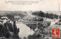
1848: Saint-Satur
Saint-Satur and Saint-Thibault-sur-Loire, Cher, France - Canal Latéral à La Loire
| Bridgemeister ID: | 8392 (added 2024-02-18) |
| Year Completed: | 1848 |
| Name: | Saint-Satur |
| Location: | Saint-Satur and Saint-Thibault-sur-Loire, Cher, France |
| Crossing: | Canal Latéral à La Loire |
| Coordinates: | 47.338639 N 2.858944 E |
| Maps: | Acme, GeoHack, Google, OpenStreetMap |
| Use: | Vehicular (one-lane) |
| Status: | Removed |
| Main Cables: | Wire (iron) |
| Suspended Spans: | 1 |
External Links:
- Art-et-Histoire - Pont de St-Satur sur la Canal latéral de la Loire - 1848. Indicates the 1848 bridge replaced an 1840 suspension bridge destroyed in an 1846 flood.
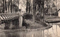
1848: Shadwell
Shadwell, England, United Kingdom
| Bridgemeister ID: | 5641 (added 2020-12-30) |
| Year Completed: | 1848 |
| Name: | Shadwell |
| Location: | Shadwell, England, United Kingdom |
| At or Near Feature: | Ropery Grounds at Sun Tavern Fields |
| Principals: | William Dredge |
| References: | AAJ |
| Use: | Footbridge |
| Status: | Removed |
| Main Cables: | Rod (iron) |
Notes:
- William Dredge was the son of James Dredge known for his "taper principle" bridge design. Based on the description of the Shadwell bridge (in the sources cited by Jakkula), it is unclear if this Shadwell bridge followed Williams' father's design. 1848 is assumed as the year of completion based on the October 7, 1848 Mechanics' Magazine article cited by Jakkula which starts "A foot-suspension bridge has just been erected..."
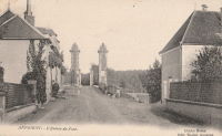
1849: Appoigny
Appoigny, Yonne, France - Yonne River
| Bridgemeister ID: | 6937 (added 2022-01-22) |
| Year Completed: | 1849 |
| Name: | Appoigny |
| Location: | Appoigny, Yonne, France |
| Crossing: | Yonne River |
| Coordinates: | 47.877464 N 3.535881 E |
| Maps: | Acme, GeoHack, Google, OpenStreetMap |
| Use: | Vehicular (one-lane) |
| Status: | Removed |
| Main Cables: | Wire |
External Links:
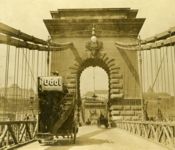
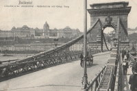
1849: Chain
Budapest, Hungary - Danube River
| Bridgemeister ID: | 402 (added before 2003) |
| Year Completed: | 1849 |
| Name: | Chain |
| Also Known As: | Széchenyi Lánchíd |
| Location: | Budapest, Hungary |
| Crossing: | Danube River |
| Coordinates: | 47.49945 N 19.046567 E |
| Maps: | Acme, GeoHack, Google, OpenStreetMap |
| Principals: | William Tierney Clark, Adam Clark |
| References: | AAJ, BC3, BCO, CTW, HBE, ONF |
| Use: | Vehicular |
| Status: | In use (last checked: 2021) |
| Main Cables: | Chain (iron) |
| Suspended Spans: | 3 |
| Main Span: | 1 x 203 meters (666 feet) |
| Side Spans: | 2 x 90.8 meters (298 feet) |
Notes:
- Don Sayenga notes, the bridge was designed by W.T. Clark, but built by Adam Clark (no relation).
- 1945: Destroyed during WWII, rebuilt 1949.
- 2020: Major rehabilitation project expected to start May, 2021.
External Links:


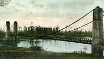
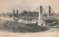
1849: Fourneau
Le Fourneau, Bourbon-Lancy vicinity, Saône-et-Loire and Allier, France - Loire River
| Bridgemeister ID: | 1772 (added 2005-04-22) |
| Year Completed: | 1849 |
| Name: | Fourneau |
| Location: | Le Fourneau, Bourbon-Lancy vicinity, Saône-et-Loire and Allier, France |
| Crossing: | Loire River |
| References: | AAJ |
| Use: | Vehicular |
| Status: | Replaced, 1932 |
| Main Spans: | 2 x 115 meters (377.32 feet) |
| Deck width: | 16.4 feet |
Notes:
1849: Galliéni
Lyon, Métropole de Lyon, France - Rhône River
| Bridgemeister ID: | 1164 (added 2004-01-19) |
| Year Completed: | 1849 |
| Name: | Galliéni |
| Also Known As: | Napoleon |
| Location: | Lyon, Métropole de Lyon, France |
| Crossing: | Rhône River |
| Principals: | Seguin Brothers |
| References: | PQL, PTS2 |
| Use: | Vehicular |
| Status: | Replaced |
| Main Cables: | Wire (iron) |
| Suspended Spans: | 3 |
| Main Span: | 1 x 60 meters (196.9 feet) |
| Side Spans: | 1 x 39 meters (128 feet), 1 x 67 meters (219.8 feet) |
| Deck width: | 7.4 meters |
Notes:
- Replaced by an arch bridge in the early 20th century. Built as part of the same project as the Kitchener-Marchand bridge; they were on the same alignment, with one crossing the Saône and the other the Rhône. Both were originally known as the Napoleon bridges.
- Companion to 1849 Kitchener-Marchand (Napoleon, Kitchener, Midi) - Lyon, Métropole de Lyon, France.
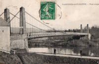
1849: Jaulgonne
Jaulgonne and Varennes, Aisne, France - Marne River
| Bridgemeister ID: | 1940 (added 2005-10-29) |
| Year Completed: | 1849 |
| Name: | Jaulgonne |
| Location: | Jaulgonne and Varennes, Aisne, France |
| Crossing: | Marne River |
| Principals: | Seguin Brothers |
| References: | AAJ |
| Use: | Vehicular |
| Status: | Removed |
| Main Cables: | Wire (iron) |
| Suspended Spans: | 1 |
| Main Span: | 1 x 75 meters (246.07 feet) |
Notes:
- Replaced by Jaulgonne - Jaulgonne and Varennes, Aisne, France.

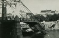
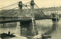
1849: Kitchener-Marchand
Lyon, Métropole de Lyon, France - Saône River
| Bridgemeister ID: | 540 (added before 2003) |
| Year Completed: | 1849 |
| Name: | Kitchener-Marchand |
| Also Known As: | Napoleon, Kitchener, Midi |
| Location: | Lyon, Métropole de Lyon, France |
| Crossing: | Saône River |
| Coordinates: | 45.751418 N 4.822519 E |
| Maps: | Acme, GeoHack, Google, OpenStreetMap |
| Principals: | Ferdinand Seguin |
| References: | PQL |
| Use: | Vehicular |
| Status: | Replaced, 1950's |
| Main Cables: | Wire (iron) |
| Main Span: | 1 x 82.1 meters (269.22 feet) |
Notes:
- Refurbished, 1888. Bombed, 1944. Rebuilt. Replaced, 1950-1959.
- Companion to 1849 Galliéni (Napoleon) - Lyon, Métropole de Lyon, France.
External Links:
1849: Lackawaxen Aqueduct
Lackawaxen, Pennsylvania, USA - Lackawaxen River
| Bridgemeister ID: | 31 (added before 2003) |
| Year Completed: | 1849 |
| Name: | Lackawaxen Aqueduct |
| Location: | Lackawaxen, Pennsylvania, USA |
| Crossing: | Lackawaxen River |
| Principals: | John A. Roebling |
| References: | AAJ, BOB, BPL, RDH, SJR |
| Use: | Aqueduct |
| Status: | Removed |
| Main Cables: | Wire (iron) |
| Suspended Spans: | 2 |
| Main Spans: | 2 x 34.9 meters (114.37 feet) |
Notes:
- BPL says 1848, RDH says same, but not used until 1849.
- Built as part of same project as 1848 Delaware Aqueduct (Roebling Aqueduct) - Lackawaxen, Pennsylvania and Minisink Ford, New York, USA.
- Built as part of same project as 1851 High Falls Aqueduct - High Falls, New York, USA.
- Built as part of same project as 1851 Neversink Aqueduct - Cuddebackville, New York, USA.
- Near 1848 Delaware Aqueduct (Roebling Aqueduct) - Lackawaxen, Pennsylvania and Minisink Ford, New York, USA.
External Links:
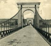
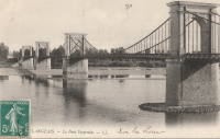
1849: Langeais
Langeais, Indre-et-Loire, France - Loire River
| Bridgemeister ID: | 6718 (added 2021-10-16) |
| Year Completed: | 1849 |
| Name: | Langeais |
| Location: | Langeais, Indre-et-Loire, France |
| Crossing: | Loire River |
| Coordinates: | 47.319030 N 0.404770 E |
| Maps: | Acme, GeoHack, Google, OpenStreetMap |
| References: | AAJ, BPF |
| Use: | Vehicular |
| Status: | Replaced |
| Main Spans: | 3 |
| Side Spans: | 2 |
Notes:
- Damaged by lightning 1859 and repaired. Cables cut during war 1870 and repaired in 1874.
- Replaced by 1937 Langeais - Langeais, Indre-et-Loire, France. However, the 1849 bridge may have been largely before the 1937 bridge.
External Links:
1849: Le Pouzin
Le Pouzin, Ardèche, France - Rhône River
| Bridgemeister ID: | 1153 (added 2004-01-18) |
| Year Completed: | 1849 |
| Name: | Le Pouzin |
| Location: | Le Pouzin, Ardèche, France |
| Crossing: | Rhône River |
| Principals: | Adolphe Boulland |
| References: | AAJ |
| Use: | Vehicular |
| Status: | Destroyed, 1940 |
| Main Cables: | Wire (iron) |
| Suspended Spans: | 3 |
| Main Spans: | 3 x 100 meters (328.1 feet) |
External Links:
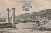
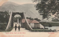
1849: Lochy
Inverlochy, Fort William vicinity, Scotland, United Kingdom - River Lochy
| Bridgemeister ID: | 6209 (added 2021-07-16) |
| Year Completed: | 1849 |
| Name: | Lochy |
| Also Known As: | Lochybridge, Victoria |
| Location: | Inverlochy, Fort William vicinity, Scotland, United Kingdom |
| Crossing: | River Lochy |
| Coordinates: | 56.835137 N 5.076679 W |
| Maps: | Acme, GeoHack, Google, OpenStreetMap |
| Principals: | James Dredge |
| Use: | Vehicular |
| Status: | Removed |
| Main Cables: | Rod (iron) |
| Main Span: | 1 |
Notes:
- 1928: Deck replaced. The aging suspension system was bypassed and the new deck supported by additional piers.
- Similar to 1854 Oich (Aberchalder) - Invergarry vicinity, Scotland, United Kingdom.
1849: Marc Seguin
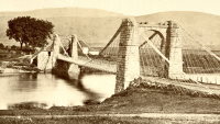
Tournon-sur-Rhône, Ardèche and Tain-L'Hermitage, Drôme, France - Rhône River
| Bridgemeister ID: | 975 (added 2003-11-14) |
| Year Completed: | 1849 |
| Name: | Marc Seguin |
| Location: | Tournon-sur-Rhône, Ardèche and Tain-L'Hermitage, Drôme, France |
| Crossing: | Rhône River |
| Coordinates: | 45.068638 N 4.834972 E |
| Maps: | Acme, GeoHack, Google, OpenStreetMap |
| Principals: | Marc Seguin |
| References: | AAJ, BPF |
| Use: | Vehicular |
| Status: | Restricted to foot traffic (last checked: 2021) |
| Main Cables: | Wire (iron) |
| Suspended Spans: | 2 |
| Main Spans: | 2 |
Notes:
- A second bridge at Tournon, by Seguin, approximately 100 meters downstream from his 1825 bridge. Restored 1989.
- Near 1825 Tain-Tournon - Tournon-sur-Rhône, Ardèche and Tain, Drôme, France.
- Near 1958 Gustave Toursier - Tournon-sur-Rhône, Ardèche and Tain-L'Hermitage, Drôme, France.
External Links:
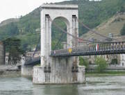
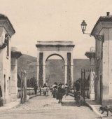
1849: Saint-Nicolas-de-la-Balerme
Saint-Nicolas-de-la-Balerme, Lot-et-Garonne, France
| Bridgemeister ID: | 7712 (added 2023-07-07) |
| Year Completed: | 1849 |
| Name: | Saint-Nicolas-de-la-Balerme |
| Location: | Saint-Nicolas-de-la-Balerme, Lot-et-Garonne, France |
| Use: | Vehicular |
| Status: | Removed, 2005 |
| Main Cables: | Wire |
External Links:
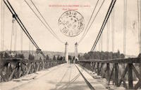
1849: Saint-Sulpice
Saint-Sulpice-la-Pointe, Tarn, France - Agout River
| Bridgemeister ID: | 1180 (added 2004-01-24) |
| Year Completed: | 1849 |
| Name: | Saint-Sulpice |
| Location: | Saint-Sulpice-la-Pointe, Tarn, France |
| Crossing: | Agout River |
| Coordinates: | 43.776706 N 1.686511 E |
| Maps: | Acme, GeoHack, Google, OpenStreetMap |
| Use: | Vehicular (one-lane), with walkway |
| Status: | Destroyed, 1930 |
| Main Cables: | Wire (iron) |
| Suspended Spans: | 1 |
Notes:
- 1930: Destroyed by flood.
- Replaced by 1931 Saint-Sulpice - Saint-Sulpice-la-Pointe, Tarn, France.
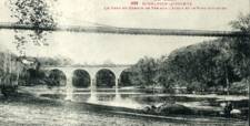
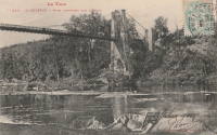
1849: Vallon-en-Sully
Vallon-en-Sully, Allier, France - Cher River
| Bridgemeister ID: | 7461 (added 2022-12-25) |
| Year Completed: | 1849 |
| Name: | Vallon-en-Sully |
| Location: | Vallon-en-Sully, Allier, France |
| Crossing: | Cher River |
| Coordinates: | 46.535271 N 2.614326 E |
| Maps: | Acme, GeoHack, Google, OpenStreetMap |
| Use: | Vehicular |
| Status: | Removed |
| Main Cables: | Wire (iron) |
| Suspended Spans: | 1 |
External Links:
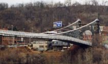
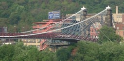
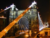
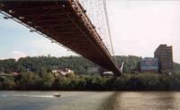
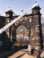
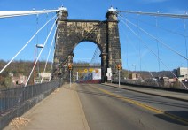
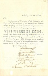
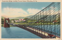
1849: Wheeling
Wheeling, West Virginia, USA - Ohio River
| Bridgemeister ID: | 32 (added before 2003) |
| Year Completed: | 1849 |
| Name: | Wheeling |
| Also Known As: | Wheeling and Belmont |
| Location: | Wheeling, West Virginia, USA |
| Crossing: | Ohio River |
| Coordinates: | 40.07167 N 80.72667 W |
| Maps: | Acme, GeoHack, Google, OpenStreetMap |
| Principals: | Charles Ellet |
| References: | AAJ, BBR, BC3, BOB, BPL, CEJ, COB, GBD, HBE, LAB, LACE, ONF, PTS2, RWS, WCC, WHSB |
| Use: | Vehicular (two-lane, light vehicles only) |
| Status: | Restricted to foot traffic, since September 2019 (last checked: 2020) |
| Main Cables: | Wire (iron) |
| Suspended Spans: | 1 |
| Main Span: | 1 x 307.8 meters (1,010 feet) |
Notes:
- Was still part of Virginia at time of completion.
- 1854: Rebuilt after it was wrecked by a windstorm. Contrary to popular myth, the rebuilding was undertaken by Ellet and his assistant William K. McComas, not by John A. Roebling.
- 1860: Overhauled. Popular myth often attributes this work to the Roeblings. WHSB attributes this work to William K. McComas. After this overhaul, the bridge still does not have the distinctive diagonal cable stays that give it the appearance of a Roebling bridge.
- 1872: Overhauled according to a design by Washington Roebling. John A. Roebling had died in 1869 and was not involved with this work. WHSB notes, "The design essentially Roeblingized the bridge with the diagonal cable stays that are such a prominent feature of the bridge."
- 2019, September: Closed to vehicular traffic indefinitely due to safety concerns after repeated overweight vehicle violations.
- 2020, November: Bids being evaluated for renovation project. Bridge remains closed to vehicular traffic.
- 2021, April: Single bid received was rejected. Bids expected to be resolicited in June. The bridge remains closed to all vehicular traffic.
- 2022, February: $17.9 million renovation project expected to start soon.
- Became longest suspension bridge by eclipsing 1834 Zaehringen (Grand Pont Suspendu) - Fribourg, Switzerland.
- Eclipsed by new longest suspension bridge 1867 John A. Roebling (Cincinnati, Cincinnati and Covington) - Cincinnati, Ohio and Covington, Kentucky, USA.
External Links:
Do you have any information or photos for these bridges that you would like to share? Please email david.denenberg@bridgemeister.com.