Suspension Bridges Completed 1940-1949
This is a list of all 86 bridges from the suspension bridge inventory completed in the decade 1940-1949. Wherever you see a Bridgemeister ID number click it to isolate the bridge on its own page.
Related Lists:
1940: (pipeline bridge)
Sioux City, Iowa and Dakota City vicinity, Nebraska, USA - Missouri River
| Bridgemeister ID: | 2252 (added 2007-03-31) |
| Year Completed: | 1940 |
| Name: | (pipeline bridge) |
| Location: | Sioux City, Iowa and Dakota City vicinity, Nebraska, USA |
| Crossing: | Missouri River |
| Coordinates: | 42.43842 N 96.38387 W |
| Maps: | Acme, GeoHack, Google, OpenStreetMap |
| References: | AAJ |
| Use: | Pipeline |
| Status: | Removed, 2005 |
| Main Cables: | Wire (steel) |
| Main Span: | 1 x 404 meters (1,325.5 feet) estimated |
Notes:
- Large pipeline suspension bridge located near the Big Soo terminal.
External Links:
1940: (suspension bridge)
Gulsvik, Granheim, Flå, Viken, Norway - Hallingdalselva
| Bridgemeister ID: | 4052 (added 2020-03-29) |
| Year Completed: | 1940 |
| Name: | (suspension bridge) |
| Location: | Gulsvik, Granheim, Flå, Viken, Norway |
| Crossing: | Hallingdalselva |
| Coordinates: | 60.386071 N 9.580834 E |
| Maps: | Acme, GeoHack, Google, kart.1881.no, OpenStreetMap |
| Use: | Vehicular |
| Status: | Removed |
| Main Cables: | Wire (steel) |
| Suspended Spans: | 1 |
| Main Span: | 1 x 34 meters (111.5 feet) estimated |
Notes:
- Temporary bridge built by the Germans during WWII to replace the destroyed arch bridge. A new stone arch bridge eventually replaced the suspension bridge.
- Near 1906 Gulsvik - Gulsvik, Granheim, Flå, Viken, Norway.
External Links:
1940: Changgan
Gongguo, Yunnan, China - Lancang River
1940: Clear Creek Swinging
Pyatt vicinity, Arkansas, USA - Clear Creek
| Bridgemeister ID: | 1954 (added 2005-11-04) |
| Year Completed: | 1940 |
| Name: | Clear Creek Swinging |
| Location: | Pyatt vicinity, Arkansas, USA |
| Crossing: | Clear Creek |
| Coordinates: | 36.2098 N 92.8598 W |
| Maps: | Acme, GeoHack, Google, OpenStreetMap |
| Principals: | WPA |
| Use: | Vehicular |
| Status: | Replaced, 1975 |
| Main Cables: | Wire (steel) |
| Suspended Spans: | 1 |
External Links:
1940: Draht
Kassel, Hessen, Germany - Fulda River
| Bridgemeister ID: | 926 (added 2003-10-18) |
| Year Completed: | 1940 |
| Name: | Draht |
| Also Known As: | Wire |
| Location: | Kassel, Hessen, Germany |
| Crossing: | Fulda River |
| Coordinates: | 51.312367 N 9.503317 E |
| Maps: | Acme, GeoHack, Google, OpenStreetMap |
| Use: | Footbridge |
| Status: | In use (last checked: 2016) |
| Main Cables: | Wire (steel) |
| Suspended Spans: | 1 |
| Main Span: | 1 x 84 meters (275.6 feet) |
| Deck width: | 2.77 meters between side rails, 3.16 meters total |
Notes:
- Replaced the previous suspension bridge that had been heavily damaged by ice. Reconstructed 1946, and 1997.
- Replaced 1870 Draht (Wire) - Kassel, Hessen, Germany.
External Links:
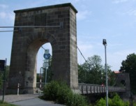
1940: Friedrichsbrücke
Mannheim, Germany - Neckar River
| Bridgemeister ID: | 8462 (added 2024-03-17) |
| Year Completed: | 1940 |
| Name: | Friedrichsbrücke |
| Location: | Mannheim, Germany |
| Crossing: | Neckar River |
| Coordinates: | 49.494500 N 8.472417 E |
| Maps: | Acme, GeoHack, Google, OpenStreetMap |
| Use: | Vehicular |
| Status: | Destroyed, March 25, 1945 |
| Suspended Spans: | 3 |
| Main Span: | 1 |
| Side Spans: | 2 |
Notes:
- This bridge likely functioned more as a cantilever bridge than a suspension bridge.
- Bombed multiple times during WWII and finaly destroyed March 25, 1945.
- Replaced 1891 Friedrichsbrücke - Mannheim, Germany. Translated from the linked Wikipedia page, "Due to the constant increase in traffic, it became necessary to expand the Friedrichsbrücke. Instead of an expensive new building, an engineering balancing act was decided: between 1938 and 1940, the bridge was cut lengthwise, pushed two meters apart, filled in the middle and further structurally adapted. With a lane width of 13.5 m, a total of four lanes including tram tracks could be created."
External Links:
- Wikipedia - Kurpfalzbrücke. History of the bridges at this location.
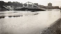
1940: General Santander
Tuluá vicinity and Riofrio vicinity, Colombia - Cauca River
| Bridgemeister ID: | 2011 (added 2006-01-04) |
| Year Completed: | 1940 |
| Name: | General Santander |
| Location: | Tuluá vicinity and Riofrio vicinity, Colombia |
| Crossing: | Cauca River |
| Coordinates: | 4.123901 N 76.269404 W |
| Maps: | Acme, GeoHack, Google, OpenStreetMap |
| Principals: | American Bridge Co. |
| Use: | Vehicular |
| Status: | Replaced |
| Main Cables: | Wire (iron) |
| Suspended Spans: | 1 |
| Main Span: | 1 x 130.15 meters (427 feet) |
Notes:
- Partially collapsed, 1955. Rehabilitated, 1956. Dismantled, 2000.
- Coordinates are for likely alignment. Pier and abutment visible in 2014.
1940: H. Wallace Caldwell Memorial
Riverside, Illinois, USA - Des Plaines River
| Bridgemeister ID: | 775 (added 2003-03-14) |
| Year Completed: | 1940 |
| Name: | H. Wallace Caldwell Memorial |
| Also Known As: | Swinging |
| Location: | Riverside, Illinois, USA |
| Crossing: | Des Plaines River |
| Coordinates: | 41.826083 N 87.8176 W |
| Maps: | Acme, GeoHack, Google, OpenStreetMap |
| Use: | Footbridge |
| Status: | In use (last checked: 2021) |
| Main Cables: | Wire (steel) |
| Suspended Spans: | 1 |
| Main Span: | 1 x 64 meters (210 feet) estimated |
Notes:
- 2002, August 26-27: Deck replaced.
- 2023, March: Project to repaint the bridge expected to start, correcting issues with prior repainting efforts.
- Replaced 1905 Swinging - Riverside, Illinois, USA.
Annotated Citations:
- Uphues, Bob. "Riverside Township confounded in effort to repaint bridge." Riverside-Brookfield Landmark, 19 October 2021, https://www.rblandmark.com/2021/10/19/riverside-township-confounded-in-effort-to-repaint-bridge/
"What was thought to be a pretty straightforward project to refurbish the 210-foot long H. Wallace Caldwell Memorial Bridge – known to local residents as the Swinging Bridge – has turned into something of a nightmare for the Riverside Township Board of Trustees… It turns out that not only was the $75,000 earmarked in the 2021-22 budget far below what it’s going to take to do the job, the township board has had trouble getting companies to even submit bids."
- Uphues, Bob. "Riverside Township confounded in effort to repaint bridge." Riverside-Brookfield Landmark, 21 March 2023, https://www.rblandmark.com/2023/03/21/swinging-bridge-overhaul-set-to-start-in-late-march/
"A long-awaited project to overhaul the painted surfaces of the Swinging Bridge will start March 27 after Riverside Township trustees voted 4-0 on March 14 to approve an ordinance announcing their intention to issue up to $500,000 in alternate revenue bonds to fund the work…"

1940: Hawkins Bar
Trinity Village and Hawkins Bar, California, USA - Trinity River
| Bridgemeister ID: | 2343 (added 2007-08-12) |
| Year Completed: | 1940 |
| Name: | Hawkins Bar |
| Location: | Trinity Village and Hawkins Bar, California, USA |
| Crossing: | Trinity River |
| Use: | Vehicular |
| Status: | Removed |
| Main Cables: | Wire |
Notes:
- Deck destroyed by fire 1954. Repaired and reopened, 1956. Bypassed late 1970s or 1980.
- May have been the site of a previous suspension bridge completed 1904.
- See (suspension bridge) - Salyer and Willow Creek, California, USA.
- See (suspension bridge) - Willow Creek vicinity, California, USA.
1940: Karangarua River
West Coast, New Zealand - Karangarua River
| Bridgemeister ID: | 765 (added 2003-03-08) |
| Year Completed: | 1940 |
| Name: | Karangarua River |
| Location: | West Coast, New Zealand |
| Crossing: | Karangarua River |
| Coordinates: | 43.575031 S 169.805960 E |
| Maps: | Acme, GeoHack, Google, OpenStreetMap |
| References: | GAP |
| Use: | Vehicular (one-lane) |
| Status: | In use (last checked: 2019) |
| Main Cables: | Wire (steel) |
| Suspended Spans: | 1 |
| Main Span: | 1 x 130 meters (426.5 feet) |
| Deck width: | 4.29 meters |
Notes:
- Several suspenders snapped during violent windstorm, April 17, 2004. Repaired and reopened with a few days.
External Links:
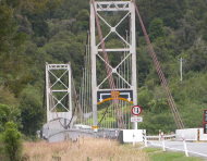
1940: Nolan Toll
Nolan, West Virginia and Pike County, Kentucky, USA - Tug Fork River
| Bridgemeister ID: | 2239 (added 2007-03-27) |
| Year Completed: | 1940 |
| Name: | Nolan Toll |
| Location: | Nolan, West Virginia and Pike County, Kentucky, USA |
| Crossing: | Tug Fork River |
| Coordinates: | 37.73986 N 82.33125 W |
| Maps: | Acme, GeoHack, Google, OpenStreetMap |
| Use: | Vehicular |
| Status: | Only towers remain (last checked: 2009) |
Notes:
- The suspension bridge, and later the current adjacent beam and girder bridge, are privately owned and were previously operated as toll bridges. The current bridge was closed by West Virginia in late 2007.
- Ron Thompson, a member of the family who owns these structures (the suspension bridge formerly, and now the current crossing) writes: "This was a private toll bridge constructed beginning in 1939 by the Big Creek Bridge Company, a privately held corporation headquartered first in Nolan, then in Williamson. The replacement bridge next to it was constructed by the same entity. My father, along with other relatives, inherited most of the corporate stock, and for the last several years he has owned it in its entirety... My grandfather built the original suspension bridge primarily to provide a way to get coal from the surrounding hills in Pike and Martin County, Kentucky to tipples and markets in West Virginia."
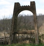
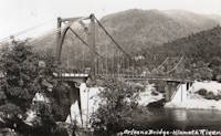
1940: Orleans
Orleans, California, USA - Klamath River
| Bridgemeister ID: | 197 (added before 2003) |
| Year Completed: | 1940 |
| Name: | Orleans |
| Location: | Orleans, California, USA |
| Crossing: | Klamath River |
| Principals: | C.H. Purcell, Murphy Pacific Co. |
| References: | BPL, WOT |
| Status: | Destroyed, 1965 |
Notes:
- BPL: Washed away during 1965 floods. An article in the September 13, 1966 edition of the Humboldt Standard says it was destroyed by flood in 1964.
- Replaced 1912 Orleans - Orleans, California, USA.
- Replaced by 1967 Orleans - Orleans, California, USA.
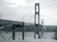
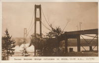
1940: Tacoma Narrows
Tacoma and Gig Harbor, Washington, USA - Puget Sound
| Bridgemeister ID: | 198 (added before 2003) |
| Year Completed: | 1940 |
| Name: | Tacoma Narrows |
| Also Known As: | Galloping Gertie |
| Location: | Tacoma and Gig Harbor, Washington, USA |
| Crossing: | Puget Sound |
| Coordinates: | 47.267015 N 122.548462 W |
| Maps: | Acme, GeoHack, Google, OpenStreetMap |
| Principals: | Leon Moisseiff |
| References: | AAJ, BAR, BBR, BFL, BMA, BPL, COB, CTT, GBD, IT1999F, SPW |
| Use: | Vehicular (two-lane, heavy vehicles), with walkway |
| Status: | Collapsed, 1940 |
| Main Cables: | Wire (steel) |
| Suspended Spans: | 3 |
| Main Span: | 1 x 853.4 meters (2,800 feet) |
| Side Spans: | 2 x 335.3 meters (1,100 feet) |
| Deck width: | 39 feet |
Notes:
- Famously destroyed by wind, November 7, 1940.
- Replaced by 1950 Tacoma Narrows (Sturdy Gertie, Second Tacoma Narrows) - Tacoma and Gig Harbor, Washington, USA.
- See 1944 Liard River - Liard River Hot Springs vicinity, British Columbia, Canada. According to CTT, "Two sections from the Tacoma bridge's east approach were [re]used in the Liard span."
External Links:



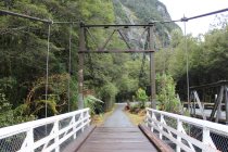
1940: Tutoko
Milford Sound, New Zealand - Tutoko River
| Bridgemeister ID: | 2664 (added 2019-03-15) |
| Year Completed: | 1940 |
| Name: | Tutoko |
| Location: | Milford Sound, New Zealand |
| Crossing: | Tutoko River |
| At or Near Feature: | Fiordland National Park |
| Coordinates: | 44.677972 S 167.963186 E |
| Maps: | Acme, GeoHack, Google, OpenStreetMap |
| Use: | Vehicular (one-lane) |
| Status: | Restricted to foot traffic (last checked: 2017) |
| Main Cables: | Wire (steel) |
| Suspended Spans: | 1 |
Notes:
- Bypassed, 1981.
1941: Belleperche
Cordes-Tolosannes, Tarn-et-Garonne, France - Garonne River
| Bridgemeister ID: | 3193 (added 2019-11-10) |
| Year Completed: | 1941 |
| Name: | Belleperche |
| Location: | Cordes-Tolosannes, Tarn-et-Garonne, France |
| Crossing: | Garonne River |
| Coordinates: | 43.995616 N 1.125695 E |
| Maps: | Acme, GeoHack, Google, OpenStreetMap |
| Use: | Vehicular (two-lane) |
| Status: | In use (last checked: 2019) |
| Main Cables: | Wire (steel) |
| Suspended Spans: | 1 |
| Main Span: | 1 x 150 meters (492.1 feet) |
Notes:
- At former location of 1839 Belleperche - Cordes-Tolosannes, Tarn-et-Garonne, France.
External Links:
1941: Carennac
Carennac, Lot, France - Dordogne River
| Bridgemeister ID: | 3067 (added 2019-10-26) |
| Year Completed: | 1941 |
| Name: | Carennac |
| Location: | Carennac, Lot, France |
| Crossing: | Dordogne River |
| Coordinates: | 44.915186 N 1.743939 E |
| Maps: | Acme, GeoHack, Google, OpenStreetMap |
| Use: | Vehicular (two-lane) |
| Status: | In use (last checked: 2019) |
| Main Cables: | Wire (steel) |
| Suspended Spans: | 1 |
| Main Span: | 1 x 134 meters (439.6 feet) estimated |
Notes:
- Likely completed in 1941, possibly 1940.
- Replaced 1846 Carennac - Carennac, Lot, France.
External Links:
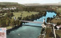
1941: Ebro
Zaragoza, Spain - Ebro River
| Bridgemeister ID: | 8171 (added 2024-02-04) |
| Year Completed: | 1941 |
| Name: | Ebro |
| Location: | Zaragoza, Spain |
| Crossing: | Ebro River |
| Coordinates: | 41.658694 N 0.881194 W |
| Maps: | Acme, GeoHack, Google, OpenStreetMap |
| Use: | Footbridge |
| Status: | Removed |
| Main Cables: | Wire (steel) |
| Suspended Spans: | 1 |
External Links:
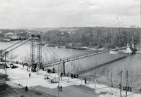
1941: Haggard Ford
Harrison vicinity, Arkansas, USA - Bear Creek
| Bridgemeister ID: | 199 (added before 2003) |
| Year Completed: | 1941 |
| Name: | Haggard Ford |
| Location: | Harrison vicinity, Arkansas, USA |
| Crossing: | Bear Creek |
| Coordinates: | 36.3458 N 93.1305 W |
| Maps: | Acme, GeoHack, Google, OpenStreetMap |
| Principals: | WPA, Jess Chaney |
| Use: | Vehicular (one-lane) |
| Status: | Restricted to foot traffic (last checked: 2007) |
| Main Cables: | Wire (steel) |
| Suspended Spans: | 1 |
| Main Span: | 1 x 48.8 meters (160 feet) |
Notes:
- Located about eight miles north of Harrison. According to plaque at bridge, restored 1977.
- Gene McCluney writes: "I visited this bridge [in the Summer of 2007] and talked to an adjacent landowner a couple weeks ago. It seems this bridge was closed in 1962 due to instability in one of the piers, and the crossing reverted to a ford or low water crossing until about four years ago when the new vehicular bridge was built. So, there was a suspension bridge in-use there for 20 years, then 40 years of "low water" type crossing, then just recently a new vehicle bridge."
- Similar to (suspension bridge) - Leslie vicinity, Arkansas, USA.
External Links:
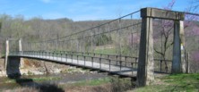
1941: Rangiport
Épône and Gargenville, Yvelines, France - Seine River
| Bridgemeister ID: | 6421 (added 2021-07-31) |
| Year Completed: | 1941 |
| Name: | Rangiport |
| Location: | Épône and Gargenville, Yvelines, France |
| Crossing: | Seine River |
| At or Near Feature: | Île de Rangiport |
| Coordinates: | 48.971502 N 1.808905 E |
| Maps: | Acme, GeoHack, Google, OpenStreetMap |
| Use: | Footbridge |
| Status: | Removed, c. 1965 |
| Main Cables: | Wire (steel) |
Notes:
- Large temporary footbridge built on the piers of the arch bridge destroyed in 1941. This was likely two separate, similar suspension bridges crossing the channels on both sides of Rangiport Island.
External Links:
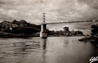
1941: Rodenkirchen
Köln (Cologne), North Rhine-Westphalia, Germany - Rhine River
| Bridgemeister ID: | 455 (added before 2003) |
| Year Completed: | 1941 |
| Name: | Rodenkirchen |
| Also Known As: | Rodenkirchener, Köln-Rodenkirchen |
| Location: | Köln (Cologne), North Rhine-Westphalia, Germany |
| Crossing: | Rhine River |
| Coordinates: | 50.898518 N 6.989139 E |
| Maps: | Acme, GeoHack, Google, OpenStreetMap |
| Principals: | Fritz Leonhardt, Paul Bonatz, Karl Schaechterle |
| References: | BBR, BFL, BRU |
| Use: | Vehicular (two-lane), with walkway |
| Status: | Destroyed, January, 1945 |
| Main Cables: | Wire (steel) |
| Suspended Spans: | 3 |
| Main Spans: | 3 |
Notes:
- Replaced by 1954 Rodenkirchen (Rodenkirchener, Köln-Rodenkirchen) - Köln (Cologne), North Rhine-Westphalia, Germany.
External Links:
1941: Saint-Denis-de-Pile
Saint-Denis-de-Pile and Bonzac, Gironde, France - Isle River
| Bridgemeister ID: | 2962 (added 2019-10-06) |
| Year Completed: | 1941 |
| Name: | Saint-Denis-de-Pile |
| Location: | Saint-Denis-de-Pile and Bonzac, Gironde, France |
| Crossing: | Isle River |
| Coordinates: | 44.993221 N 0.207261 W |
| Maps: | Acme, GeoHack, Google, OpenStreetMap |
| References: | AAJ |
| Use: | Vehicular (two-lane) |
| Status: | In use (last checked: 2019) |
| Main Cables: | Wire (steel) |
| Suspended Spans: | 1 |
Notes:
- 1931, June 3, 1931: Deck and hangers fail during load testing when a truck hits a cable. Ten people die in the accident.
- 1935: Construction starts on a replacement bridge.
- Replaced Saint-Denis-de-Pile - Saint-Denis-de-Pile and Bonzac, Gironde, France.
External Links:
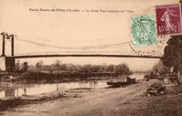
1942: Cuscatlán
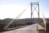
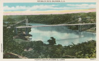
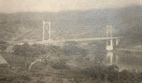
San Vicente and Usulután, El Salvador - Rio Lempa
| Bridgemeister ID: | 948 (added 2003-10-30) |
| Year Completed: | 1942 |
| Name: | Cuscatlán |
| Also Known As: | Rio Lempa |
| Location: | San Vicente and Usulután, El Salvador |
| Crossing: | Rio Lempa |
| Coordinates: | 13.616536 N 88.563753 W |
| Maps: | Acme, GeoHack, Google, OpenStreetMap |
| Principals: | American Bridge Co. |
| Use: | Vehicular (two-lane, heavy vehicles), with walkway |
| Status: | Destroyed, January 1, 1984 |
| Main Cables: | Wire (steel) |
Notes:
- Bombed and destroyed by militants, January 1, 1984. Piers and abutments remain (as of 2021).
External Links:
1942: Margaret
Munnar, Kerala, India - Muthirapuzha River
| Bridgemeister ID: | 3005 (added 2019-10-13) |
| Year Completed: | 1942 |
| Name: | Margaret |
| Location: | Munnar, Kerala, India |
| Crossing: | Muthirapuzha River |
| Coordinates: | 10.078807 N 77.063246 E |
| Maps: | Acme, GeoHack, Google, OpenStreetMap |
| Status: | Destroyed, August 14, 2018 |
| Main Spans: | 2 |
Notes:
- Destroyed by flood, August 14, 2018.
1942: Shimian
Shimian County (石棉县), Ya'an (雅安市), Sichuan, China - Dadu River
| Bridgemeister ID: | 1290 (added 2004-03-16) |
| Year Completed: | 1942 |
| Name: | Shimian |
| Location: | Shimian County (石棉县), Ya'an (雅安市), Sichuan, China |
| Crossing: | Dadu River |
| Coordinates: | 29.241472 N 102.356167 E |
| Maps: | Acme, GeoHack, Google, OpenStreetMap |
| References: | BCG |
| Use: | Vehicular |
| Status: | Extant (last checked: 2021) |
| Main Cables: | Wire (steel) |
| Suspended Spans: | 1 |
| Main Span: | 1 x 10⁵ meters (344.5 feet) |
Notes:
- Rebuilt 1952, 1964.
| Bridgemeister ID: | 3788 (added 2020-02-29) |
| Year Completed: | 1942 |
| Name: | Storforshei |
| Location: | Storforshei, Rana, Nordland, Norway |
| Crossing: | Ranelva |
| Coordinates: | 66.40420 N 14.50999 E |
| Maps: | Acme, GeoHack, Google, kart.1881.no, OpenStreetMap |
| Use: | Rail |
| Status: | Removed |
| Main Cables: | Wire (steel) |
Notes:
- Temporary structure built 1942 or possibly 1943 to replace a large portion of a truss bridge destroyed in 1940 during WWII hostilities.
External Links:
- DigitaltMuseum - Dunderlandsbanens ombygging : provisorisk hengebru på Storforshei
- DigitaltMuseum - Dunderlandsbanens ombygging : Storforshei bru
- DigitaltMuseum - Dunderlandsbanens ombygging : Storforshei bru
- DigitaltMuseum - Jernbanehengebrua på Storforshei
- DigitaltMuseum - Jernbanehengebrua på Storforshei
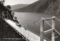
1942: Trolljuv
Rafdal, Markhus vicinity, Etne, Vestland, Norway - Trollajuvet
| Bridgemeister ID: | 4501 (added 2020-05-02) |
| Year Completed: | 1942 |
| Name: | Trolljuv |
| Location: | Rafdal, Markhus vicinity, Etne, Vestland, Norway |
| Crossing: | Trollajuvet |
| At or Near Feature: | Åkrafjorden |
| Coordinates: | 59.785424 N 6.158266 E |
| Maps: | Acme, GeoHack, Google, kart.1881.no, OpenStreetMap |
| Use: | Vehicular (two-lane) |
| Status: | In use (last checked: 2019) |
| Main Cables: | Wire (steel) |
| Suspended Spans: | 1 |
| Main Span: | 1 x 66 meters (216.5 feet) |
External Links:
- DigitaltMuseum - Trolljuv bru
- Nasjonalbiblioteket (National Library of Norway) - Trolljuv bru
- Structurae - Structure ID 20028889
1943: Izeron
Izeron and Saint-Sauveur, Isère, France - Isère River
| Bridgemeister ID: | 7160 (added 2022-06-25) |
| Year Completed: | 1943 |
| Name: | Izeron |
| Location: | Izeron and Saint-Sauveur, Isère, France |
| Crossing: | Isère River |
| Coordinates: | 45.154525 N 5.364199 E |
| Maps: | Acme, GeoHack, Google, OpenStreetMap |
| Use: | Vehicular (one-lane) |
| Status: | Demolished, 2013 |
| Main Cables: | Wire (steel) |
| Suspended Spans: | 1 |
| Main Span: | 1 x 166 meters (544.6 feet) |
Notes:
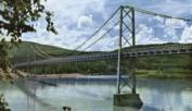
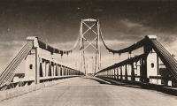
1943: Peace River
Taylor, British Columbia, Canada - Peace River
| Bridgemeister ID: | 205 (added before 2003) |
| Year Completed: | 1943 |
| Name: | Peace River |
| Location: | Taylor, British Columbia, Canada |
| Crossing: | Peace River |
| Coordinates: | 56.138123 N 120.674371 W |
| Maps: | Acme, GeoHack, Google, OpenStreetMap |
| Principals: | John A. Roebling's Sons Co. |
| References: | CTT |
| Use: | Vehicular |
| Status: | Demolished |
| Main Cables: | Wire (steel) |
| Suspended Spans: | 3 |
| Main Span: | 1 x 609.6 meters (2,000 feet) |
| Side Spans: | 2 |
Notes:
- Partially collapsed October, 1957 after one of the anchorages began to slide.
- Near future location of (pipeline bridge) - Taylor, British Columbia, Canada.
External Links:
1943: Sheep
Sheep Crossing (Cave Creek vicinity), Arizona, USA - Verde River
| Bridgemeister ID: | 201 (added before 2003) |
| Year Completed: | 1943 |
| Name: | Sheep |
| Also Known As: | Red Point Sheep, Verde River Sheep |
| Location: | Sheep Crossing (Cave Creek vicinity), Arizona, USA |
| Crossing: | Verde River |
| Coordinates: | 34.077674 N 111.707743 W |
| Maps: | Acme, GeoHack, Google, OpenStreetMap |
| Principals: | Flagstaff Sheep Co., Cyril O. Gilliam, Frank Auza, George W. Smith. |
| References: | HAERAZ10 |
| Use: | Footbridge and Stock |
| Status: | Replaced, 1988 |
| Main Cables: | Wire |
| Main Span: | 1 x 145.1 meters (476 feet) |
| Deck width: | 3 feet |
Notes:
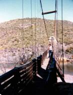
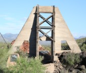
- From a sign at the site: "The Old Verde River Sheep Bridge. The original Verde River Sheep Bridge, also known as the Red Point Sheep Bridge, was constructed at this location in 1943 by Flagstaff Sheep Company, which had been grazing sheep in the area under a Forest Service permit since 1926....
"Erected with hand tools and a few mules during World War II, the bridge was constructed largely with salvaged materials. Overall length of the structure from cable anchorage to cable anchorage was 691 feet, and the distance between the towers was 568 feet. The walkway was 476 feet long and three feet wide. The towers originally were constructed with wood, as was the walkway. Soon after the bridge was completed, the wooden towers were reinforced with concrete buttresses. Each main suspension cable consisted of a pair of... lock-coil, spiral strands, which were obtained from an abandoned tramway that carted copper ore.... Only the towers of the old bridge remain.
"Although several other bridges of this type previously had been built in Arizona, Verde River Sheep Bridge was the last of its kind in the Southwest when it was entered into the National Register of Historic Places in 1978. In 1988, weakened by years of service and floods, the bridge was disassembled. In 1989 the bridge found here today was erected. Reminiscent of the original structure, the new bridge recalls the ingenuity of the pioneer sheepmen and a way of ranching that has virtually disappeared from the Arizona scene." - Many remnants from this bridge are still visible at the site.
- Replaced by 1989 Sheep - Sheep Crossing (Cave Creek vicinity), Arizona, USA.
1943: Swinging
Allison, Arkansas, USA - South Sylamore Creek
| Bridgemeister ID: | 5857 (added 2021-05-15) |
| Year Completed: | 1943 |
| Name: | Swinging |
| Location: | Allison, Arkansas, USA |
| Crossing: | South Sylamore Creek |
| Coordinates: | 35.935874 N 92.121329 W |
| Maps: | Acme, GeoHack, Google, OpenStreetMap |
| Use: | Vehicular (one-lane) |
| Status: | Destroyed, December 3, 1982 |
| Main Cables: | Wire (steel) |
| Suspended Spans: | 1 |
Notes:
- 1982, December 3: Mostly destroyed by flood.
- Replaced 1914 Swinging - Allison, Arkansas, USA.
- Replaced by 1985 Sylamore Creek (Swinging) - Allison, Arkansas, USA.
| Bridgemeister ID: | 3912 (added 2020-03-15) |
| Year Completed: | 1943 |
| Name: | Tynset |
| Location: | Tynset, Innlandet, Norway |
| Crossing: | Glomma |
| Coordinates: | 62.28051 N 10.77184 E |
| Maps: | Acme, GeoHack, Google, kart.1881.no, OpenStreetMap |
| Use: | Vehicular |
| Status: | Removed, 2000 |
| Main Cables: | Wire (steel) |
| Suspended Spans: | 1 |
| Main Span: | 1 x 130 meters (426.5 feet) estimated |
External Links:
1944: Canol
Ross River, Yukon, Canada - Ross River
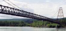
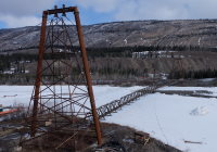
| Bridgemeister ID: | 833 (added 2003-06-01) |
| Year Completed: | 1944 |
| Name: | Canol |
| Also Known As: | Ross River |
| Location: | Ross River, Yukon, Canada |
| Crossing: | Ross River |
| Coordinates: | 61.98769 N 132.44722 W |
| Maps: | Acme, GeoHack, Google, OpenStreetMap |
| Use: | Footbridge |
| Status: | In use (last checked: 2019) |
| Main Span: | 1 x 182.9 meters (600 feet) |
Notes:
- Closed in 2013 due to deteriorating condition and risk of imminent failure. Rehabilitated 2017-2018 and subsequently reopened.
External Links:
| Bridgemeister ID: | 3932 (added 2020-03-20) |
| Year Completed: | 1944 |
| Name: | Fossum |
| Location: | Askim and Spydeberg, Østfold, Norway |
| Crossing: | Glomma |
| Coordinates: | 59.60155 N 11.09936 E |
| Maps: | Acme, GeoHack, Google, kart.1881.no, OpenStreetMap |
| Use: | Vehicular |
| Status: | Removed (last checked: 1965) |
| Main Cables: | Wire (steel) |
| Suspended Spans: | 1 |
| Main Span: | 1 x 84 meters (275.6 feet) |
Notes:
- Built as a temporary replacement for the 1856 two-span wood Fossum bridge damaged during 1940 hostilities. The suspension bridge was built directly over the 1856 bridge resulting in an odd appearance with minimal clearance between the two bridges.
- Replaced by 1961 Fossum - Askim and Spydeberg, Østfold, Norway.
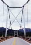
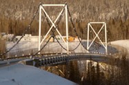
1944: Liard River
Liard River Hot Springs vicinity, British Columbia, Canada - Liard River
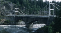
| Bridgemeister ID: | 339 (added before 2003) |
| Year Completed: | 1944 |
| Name: | Liard River |
| Location: | Liard River Hot Springs vicinity, British Columbia, Canada |
| Crossing: | Liard River |
| Coordinates: | 59.41312 N 126.09541 W |
| Maps: | Acme, GeoHack, Google, OpenStreetMap |
| Principals: | American Bridge Co. |
| References: | CTT |
| Use: | Vehicular (two-lane, heavy vehicles) |
| Status: | In use (last checked: 2009) |
| Main Cables: | Wire (steel) |
| Suspended Spans: | 3 |
| Main Span: | 1 |
| Side Spans: | 2 |
Notes:
- See 1940 Tacoma Narrows (Galloping Gertie) - Tacoma and Gig Harbor, Washington, USA. According to CTT, "Two sections from the Tacoma bridge's east approach were [re]used in the Liard span."
External Links:

1945: Aiguilly
Roanne vicinity and Vougy vicinity, Loire, France - Loire River
| Bridgemeister ID: | 4923 (added 2020-07-26) |
| Year Completed: | 1945 |
| Name: | Aiguilly |
| Location: | Roanne vicinity and Vougy vicinity, Loire, France |
| Crossing: | Loire River |
| Use: | Vehicular |
| Status: | Demolished, 1982 |
| Main Cables: | Wire (steel) |
| Suspended Spans: | 1 |
| Main Span: | 1 x 135 meters (442.9 feet) |
Notes:
External Links:
1945: Ölfusá
Selfoss, Iceland - Ölfusá River
| Bridgemeister ID: | 2921 (added 2019-09-15) |
| Year Completed: | 1945 |
| Name: | Ölfusá |
| Location: | Selfoss, Iceland |
| Crossing: | Ölfusá River |
| Coordinates: | 63.938889 N 21.004853 W |
| Maps: | Acme, GeoHack, Google, OpenStreetMap |
| Use: | Vehicular (two-lane) |
| Status: | In use |
| Main Cables: | Wire (steel) |
| Suspended Spans: | 1 |
Notes:
- Replaced 1891 Ölfusá - Selfoss, Iceland.
External Links:
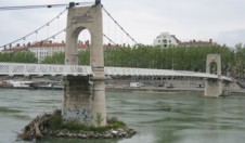
1945: College
Lyon, Métropole de Lyon, France - Rhône River
| Bridgemeister ID: | 6423 (added 2021-08-09) |
| Year Completed: | 1945 |
| Name: | College |
| Also Known As: | Collège |
| Location: | Lyon, Métropole de Lyon, France |
| Crossing: | Rhône River |
| Coordinates: | 45.765661 N 4.840563 E |
| Maps: | Acme, GeoHack, Google, OpenStreetMap |
| References: | BPF, PQL |
| Use: | Footbridge |
| Status: | In use (last checked: 2021) |
| Main Cables: | Wire (steel) |
| Suspended Spans: | 3 |
| Main Span: | 1 x 109.7 meters (359.9 feet) |
| Side Spans: | 2 |
Notes:
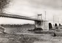
1945: Saint-Esprit
Pont-Saint-Esprit, Gard and Mondragon, Vaucluse, France - Rhône River
| Bridgemeister ID: | 8139 (added 2024-01-20) |
| Year Completed: | 1945 |
| Name: | Saint-Esprit |
| Location: | Pont-Saint-Esprit, Gard and Mondragon, Vaucluse, France |
| Crossing: | Rhône River |
| Coordinates: | 44.258917 N 4.650833 E |
| Maps: | Acme, GeoHack, Google, OpenStreetMap |
| Use: | Vehicular |
| Status: | Replaced, 1954 |
| Main Cables: | Wire (steel) |
| Suspended Spans: | 1 |
Notes:
- This suspension span replaced one arch of the Saint-Espirit bridge that had been destroyed in 1944 during WWII. It was replaced by a new concrete arch in 1954.
External Links:
1945: Triel-sur-Seine
Triel-sur-Seine and Vernouillet, Yvelines, France - Seine River
| Bridgemeister ID: | 7810 (added 2023-09-01) |
| Year Completed: | 1945 |
| Name: | Triel-sur-Seine |
| Location: | Triel-sur-Seine and Vernouillet, Yvelines, France |
| Crossing: | Seine River |
| Coordinates: | 48.978374 N 2.001012 E |
| Maps: | Acme, GeoHack, Google, OpenStreetMap |
| Use: | Footbridge |
| Status: | Replaced, 1956 |
| Main Cables: | Wire (steel) |
| Suspended Spans: | 3 |
| Main Span: | 1 |
| Side Spans: | 2 |
Notes:
- A temporary suspension footbridge erected on the piers of the former Triel-sur-Seine suspension bridge.
- Replaced 1838 Triel-sur-Seine - Triel-sur-Seine and Vernouillet, Yvelines, France.
- Replaced by 1956 Triel-sur-Seine - Triel-sur-Seine and Vernouillet, Yvelines, France.
External Links:
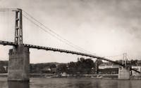
1945: TVA Apalachia
Reliance vicinity, Tennessee, USA - Hiwassee River
| Bridgemeister ID: | 790 (added 2003-03-22) |
| Year Completed: | 1945 |
| Name: | TVA Apalachia |
| Location: | Reliance vicinity, Tennessee, USA |
| Crossing: | Hiwassee River |
| Coordinates: | 35.18269 N 84.43894 W |
| Maps: | Acme, GeoHack, Google, OpenStreetMap |
| Use: | Footbridge |
| Status: | In use (last checked: 2022) |
| Main Cables: | Wire (steel) |
| Suspended Spans: | 1 |
| Main Span: | 1 x 120.4 meters (395 feet) |
Notes:
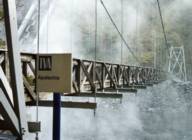
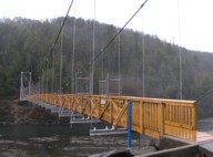
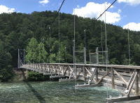
- Patrick S. O'Donnell notes this footbridge is large, "its main span is 395 feet with 455 feet between the towers, as [one] tower is set back from the end of the deck."
- Rebuilt 1975 and again in 2008.
External Links:
| Bridgemeister ID: | 3764 (added 2020-02-29) |
| Year Completed: | 1946 |
| Name: | Alta |
| Location: | Alta, Troms og Finnmark, Norway |
| Crossing: | Altaelva |
| Coordinates: | 69.968215 N 23.375254 E |
| Maps: | Acme, GeoHack, Google, kart.1881.no, OpenStreetMap |
| Use: | Vehicular |
| Status: | Removed |
| Main Cables: | Wire (steel) |
| Suspended Spans: | 1 |
Notes:
- Patrick S. O'Donnell notes: Appears to have been a temporary motor vehicle suspension bridge, constructed following WWII and the destruction of a three span through truss that was opened in 1896. The suspension bridge appears to be timber towered and about half the length of the current Alta bridge. It appears they filled in half the waterway as it was not very deep or fast flowing.
- Replaced by 1948 Alta - Alta, Troms og Finnmark, Norway.
External Links:
1946: Boran
Boran-sur-Oise, Oise, France - Oise River
| Bridgemeister ID: | 6952 (added 2022-02-13) |
| Year Completed: | 1946 |
| Name: | Boran |
| Location: | Boran-sur-Oise, Oise, France |
| Crossing: | Oise River |
| Coordinates: | 49.168337 N 2.366662 E |
| Maps: | Acme, GeoHack, Google, OpenStreetMap |
| Use: | Vehicular, with walkway |
| Status: | In use (last checked: 2017) |
| Main Cables: | Wire (steel) |
| Suspended Spans: | 1 |
| Main Span: | 1 |
Notes:
- At former location of 1841 Boran - Boran-sur-Oise, Oise, France.
External Links:
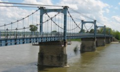
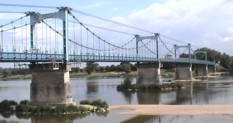
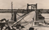
1946: Châteauneuf-sur-Loire
Châteauneuf-sur-Loire, Loiret, France - Loire River
| Bridgemeister ID: | 1015 (added 2003-11-22) |
| Year Completed: | 1946 |
| Name: | Châteauneuf-sur-Loire |
| Location: | Châteauneuf-sur-Loire, Loiret, France |
| Crossing: | Loire River |
| Coordinates: | 47.8581 N 2.22345 E |
| Maps: | Acme, GeoHack, Google, OpenStreetMap |
| Use: | Vehicular (two-lane), with walkway |
| Status: | In use (last checked: 2021) |
| Main Cables: | Wire (steel) |
| Suspended Spans: | 5 |
| Main Spans: | 2 x 49.15 meters (161.3 feet), 3 x 59.5 meters (195.2 feet) |
| Deck width: | 7 meters |
Notes:
External Links:
1946: Doveridge
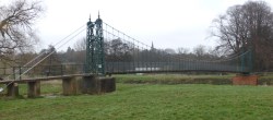
Doveridge, England, United Kingdom - River Dove
| Bridgemeister ID: | 2173 (added 2007-01-13) |
| Year Completed: | 1946 |
| Name: | Doveridge |
| Location: | Doveridge, England, United Kingdom |
| Crossing: | River Dove |
| Coordinates: | 52.903057 N 1.836045 W |
| Maps: | Acme, GeoHack, Google, OpenStreetMap |
| Principals: | David Rowell & Co. |
| Use: | Footbridge |
| Status: | In use (last checked: 2021) |
| Main Cables: | Wire (steel) |
| Suspended Spans: | 1 |
Notes:
- 2021, January: Experienced severe flooding due to Storm Christoph.
- Replaced 1898 Doveridge - Doveridge, England, United Kingdom.

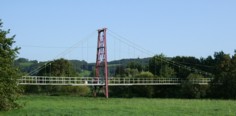
1946: Halfter
Halft, Eitorf vicinity, North Rhine-Westphalia, Germany - Sieg River
| Bridgemeister ID: | 1881 (added 2005-09-24) |
| Year Completed: | 1946 |
| Name: | Halfter |
| Location: | Halft, Eitorf vicinity, North Rhine-Westphalia, Germany |
| Crossing: | Sieg River |
| Coordinates: | 50.77129 N 7.47618 E |
| Maps: | Acme, GeoHack, Google, OpenStreetMap |
| Use: | Footbridge |
| Status: | In use (last checked: 2006) |
| Main Cables: | Wire (steel) |
| Suspended Spans: | 3 |
| Main Span: | 1 x 75 meters (246.1 feet) |
| Side Spans: | 2 x 15 meters (49.2 feet) |
| Deck width: | 1.7 meters |
Notes:
- Eckhard Bernstorff notes the bridge was built by local residents after World War II using cables from cable cars.
1946: Senkiw
Franklin, Manitoba, Canada - Roseau River
| Bridgemeister ID: | 5177 (added 2020-10-03) |
| Year Completed: | 1946 |
| Name: | Senkiw |
| Location: | Franklin, Manitoba, Canada |
| Crossing: | Roseau River |
| Coordinates: | 49.198470 N 96.882782 W |
| Maps: | Acme, GeoHack, Google, OpenStreetMap |
| Use: | Footbridge |
| Status: | In use (last checked: 2020) |
| Main Cables: | Wire |
| Suspended Spans: | 1 |
Notes:
- Refurbished, 2004-2005.
External Links:
1947: (footbridge)
Driva, Oppdal, Trøndelag, Norway - Driva River
| Bridgemeister ID: | 3905 (added 2020-03-14) |
| Year Completed: | 1947 |
| Name: | (footbridge) |
| Location: | Driva, Oppdal, Trøndelag, Norway |
| Crossing: | Driva River |
| Coordinates: | 62.53715 N 9.61297 E |
| Maps: | Acme, GeoHack, Google, kart.1881.no, OpenStreetMap |
| Use: | Footbridge |
| Status: | Destroyed, 2003 |
| Main Span: | 1 x 57.5 meters (188.6 feet) estimated |
Notes:
- Destroyed by flood, 2003.
- Replaced by 2013 (footbridge) - Driva, Oppdal, Trøndelag, Norway.
| Bridgemeister ID: | 6106 (added 2021-07-04) |
| Year Completed: | 1947 |
| Name: | (footbridge) |
| Location: | Krzyżanowice, Proszówki vicinity, Poland |
| Crossing: | Raba |
| Coordinates: | 50.008323 N 20.434253 E |
| Maps: | Acme, GeoHack, Google, OpenStreetMap |
| Use: | Footbridge |
| Status: | In use (last checked: 2021) |
| Main Cables: | Wire (steel) |
| Suspended Spans: | 1 |
1947: Grésin
Bellegarde-sur-Valserine vicinity, Ain and Haute-Savoie, France - Rhône River
| Bridgemeister ID: | 1003 (added 2003-11-18) |
| Year Completed: | 1947 |
| Name: | Grésin |
| Location: | Bellegarde-sur-Valserine vicinity, Ain and Haute-Savoie, France |
| Crossing: | Rhône River |
| Coordinates: | 46.085407 N 5.861124 E |
| Maps: | Acme, GeoHack, Google, OpenStreetMap |
| Use: | Footbridge |
| Status: | In use (last checked: 2018) |
| Main Cables: | Wire (steel) |
| Suspended Spans: | 1 |
External Links:
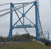
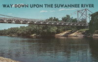
1947: Hal Adams
Mayo vicinity and Luraville, Florida, USA - Suwannee River
| Bridgemeister ID: | 203 (added before 2003) |
| Year Completed: | 1947 |
| Name: | Hal Adams |
| Location: | Mayo vicinity and Luraville, Florida, USA |
| Crossing: | Suwannee River |
| Coordinates: | 30.099 N 83.1715 W |
| Maps: | Acme, GeoHack, Google, OpenStreetMap |
| Principals: | Florida DOT |
| Use: | Vehicular |
| Status: | In use (last checked: 2021) |
| Main Cables: | Wire (steel) |
| Suspended Spans: | 1 |
| Main Span: | 1 x 128 meters (420 feet) |
External Links:
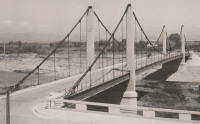
1947: Jean Jacquet
Rivesaltes, Pyrénées-Orientales, France - Agly River
| Bridgemeister ID: | 2467 (added 2008-12-19) |
| Year Completed: | 1947 |
| Name: | Jean Jacquet |
| Also Known As: | Jacquet |
| Location: | Rivesaltes, Pyrénées-Orientales, France |
| Crossing: | Agly River |
| Coordinates: | 42.771912 N 2.871446 E |
| Maps: | Acme, GeoHack, Google, OpenStreetMap |
| Use: | Vehicular (two-lane) |
| Status: | In use (last checked: 2019) |
| Main Cables: | Wire (steel) |
| Suspended Spans: | 3 |
| Main Span: | 1 |
| Side Spans: | 2 |
External Links:
1947: Les Andelys
Les Andelys, Eure, France - Seine River
| Bridgemeister ID: | 456 (added before 2003) |
| Year Completed: | 1947 |
| Name: | Les Andelys |
| Location: | Les Andelys, Eure, France |
| Crossing: | Seine River |
| Coordinates: | 49.236625 N 1.398946 E |
| Maps: | Acme, GeoHack, Google, OpenStreetMap |
| References: | BPF |
| Use: | Vehicular (two-lane, heavy vehicles), with walkway |
| Status: | In use (last checked: 2021) |
| Main Cables: | Wire (steel) |
| Suspended Spans: | 1 |
| Main Span: | 1 x 146 meters (479 feet) |
Notes:
- 1988: Suspension system refurbished. Main cables and suspenders may have been replaced at this time.
- Replaced 1920 Les Andelys - Les Andelys, Eure, France.
External Links:
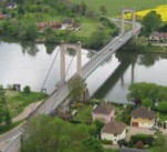
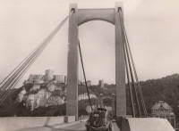
1947: Lumberville-Raven Rock
Lumberville, Pennsylvania and Bulls Island State Park, New Jersey, USA - Delaware River
| Bridgemeister ID: | 204 (added before 2003) |
| Year Completed: | 1947 |
| Name: | Lumberville-Raven Rock |
| Also Known As: | Bulls Island |
| Location: | Lumberville, Pennsylvania and Bulls Island State Park, New Jersey, USA |
| Crossing: | Delaware River |
| Coordinates: | 40.407017 N 75.038183 W |
| Maps: | Acme, GeoHack, Google, OpenStreetMap |
| Principals: | John A. Roebling's Sons Co. |
| References: | BDR, BONJ, SSB |
| Use: | Footbridge |
| Status: | In use (last checked: 2007) |
| Main Cables: | Wire (steel) |
| Suspended Spans: | 5 |
| Main Spans: | 5 |
| Characteristics: | Braced (trussed) chain/cable, Hinged cables |
Notes:
- SSB has an old picture of the bridge from a "Roebling publication". The original caption inside the picture says: "Practical application of Roebling Bridge research is the Lumberville footbridge which spans the Delaware River about twenty miles above Trenton. Pictured below, it utilizes four slabs of Roebling prestressed concrete and the Roebling-developed cable stiffening principle for the first time in the Western Hemisphere." and the authors of SSB go on to describe it asa "two-hinged braced cable suspension footbridge."
External Links:
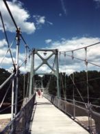
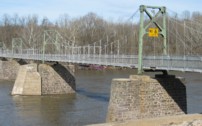
1947: Mitchell County Bridge 223
Red Hill vicinity, North Carolina, USA - Big Rock Creek
| Bridgemeister ID: | 788 (added 2003-03-22) |
| Year Completed: | 1947 |
| Name: | Mitchell County Bridge 223 |
| Location: | Red Hill vicinity, North Carolina, USA |
| Crossing: | Big Rock Creek |
| Coordinates: | 36.04363 N 82.22528 W |
| Maps: | Acme, GeoHack, Google, OpenStreetMap |
| Principals: | North Carolina Bridge Maintenance Unit |
| Use: | Footbridge |
| Status: | In use (last checked: 2018) |
| Main Cables: | Wire (steel) |
| Suspended Spans: | 1 |
| Main Span: | 1 x 28.2 meters (92.5 feet) |
Notes:
- From the NCDOT page about this bridge: "According to state records, the western deadman was replaced in 2002 along with several hangers. The anchor cable at the deadman was replaced in 1974, but otherwise records do not identify any major repairs to or rebuilding of the structure."
External Links:
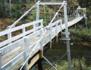
1947: Rideau Park
Calgary, Alberta, Canada - Elbow River
| Bridgemeister ID: | 968 (added 2003-11-01) |
| Year Completed: | 1947 |
| Name: | Rideau Park |
| Location: | Calgary, Alberta, Canada |
| Crossing: | Elbow River |
| At or Near Feature: | Wood's Park-Elbow Island Park |
| Coordinates: | 51.02491 N 114.0781 W |
| Maps: | Acme, GeoHack, Google, OpenStreetMap |
| Use: | Footbridge |
| Status: | Destroyed, 2013 |
| Main Cables: | Wire |
Notes:
- Footbridge with wood towers, distinct from other Elbow River footbridges in the inventory.
- Destroyed by flood, 2013.
- Replaced by 2014 Rideau Park - Calgary, Alberta, Canada.
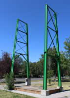
1948: (footbridge)
Chattanooga, Tennessee, USA - South Chickamauga Creek
| Bridgemeister ID: | 248 (added before 2003) |
| Year Completed: | 1948 |
| Name: | (footbridge) |
| Location: | Chattanooga, Tennessee, USA |
| Crossing: | South Chickamauga Creek |
| At or Near Feature: | Elise Chapin Wildlife Sanctuary |
| Coordinates: | 34.99694 N 85.18442 W |
| Maps: | Acme, GeoHack, Google, OpenStreetMap |
| Use: | Footbridge |
| Status: | Destroyed, July 16, 2000 |
Notes:
- Destroyed by falling tree, July 16, 2000.
- Replaced by 2001 (footbridge) - Chattanooga, Tennessee, USA.
1948: (suspension bridge)
Awa, Nigeria and Ekok, Cameroon - Cross River
| Bridgemeister ID: | 7142 (added 2022-06-25) |
| Year Completed: | 1948 |
| Name: | (suspension bridge) |
| Location: | Awa, Nigeria and Ekok, Cameroon |
| Crossing: | Cross River |
| Coordinates: | 5.811633 N 8.847657 E |
| Maps: | Acme, GeoHack, Google, OpenStreetMap |
| Use: | Vehicular (one-lane), with walkway |
| Status: | In use (last checked: 2018) |
| Main Cables: | Wire (steel) |
| Suspended Spans: | 1 |
| Main Span: | 1 x 10² meters (334.6 feet) estimated |
External Links:
- Confini amministrativi - Riigipiirid - Political borders - 国境 - 边界 - 2011 CM-NG Kamerun-Nigeeria Camerun-Nigeria. Two images of the bridge from 2011.
- Confini amministrativi - Riigipiirid - Political borders - 国境 - 边界 - 2018 CM-NG Kamerun-Nigeeria Camerun-Nigeria. Image of the bridge from 2018.
- Twitter. Image of the bridge, posted June 24, 2022.
| Bridgemeister ID: | 2739 (added 2019-06-23) |
| Year Completed: | 1948 |
| Name: | Alta |
| Location: | Alta, Troms og Finnmark, Norway |
| Crossing: | Altaelva |
| Coordinates: | 69.968701 N 23.374410 E |
| Maps: | Acme, GeoHack, Google, kart.1881.no, OpenStreetMap |
| Use: | Vehicular (two-lane), with walkway |
| Status: | In use (last checked: 2019) |
| Main Cables: | Wire (steel) |
| Suspended Spans: | 1 |
Notes:
External Links:
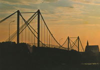
1948: Chalonnes
Chalonnes-sur-Loire, Maine-et-Loire, France - Loire River
| Bridgemeister ID: | 1014 (added 2003-11-22) |
| Year Completed: | 1948 |
| Name: | Chalonnes |
| Location: | Chalonnes-sur-Loire, Maine-et-Loire, France |
| Crossing: | Loire River |
| Coordinates: | 47.354367 N 0.761583 W |
| Maps: | Acme, GeoHack, Google, OpenStreetMap |
| Use: | Vehicular (two-lane, heavy vehicles), with walkway |
| Status: | In use (last checked: 2019) |
| Main Cables: | Wire (steel) |
| Suspended Spans: | 1 |
| Main Span: | 1 x 109.65 meters (359.7 feet) |
Notes:
- At former location of 1841 Chalonnes - Chalonnes-sur-Loire, Maine-et-Loire, France.
External Links:
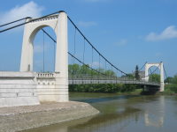
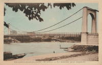
1948: Ennery
Ennery and Hauconcourt, Maizières-lès-Metz vicinity, Moselle, France - Moselle/Mosel River
| Bridgemeister ID: | 2377 (added 2007-10-14) |
| Year Completed: | 1948 |
| Name: | Ennery |
| Location: | Ennery and Hauconcourt, Maizières-lès-Metz vicinity, Moselle, France |
| Crossing: | Moselle/Mosel River |
| Coordinates: | 49.223593 N 6.197988 E |
| Maps: | Acme, GeoHack, Google, OpenStreetMap |
| Use: | Vehicular |
| Status: | Removed, 2012-2014 |
| Main Cables: | Wire (steel) |
| Suspended Spans: | 3 |
| Main Span: | 1 |
| Side Spans: | 2 |
Notes:
- Removed, c. 2012-2014. Replaced with a non-suspension bridge in 2014.
External Links:
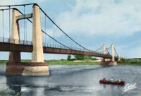
1948: Gennes
Gennes and Les Rosiers-sur-Loire, Maine-et-Loire, France - Loire River
| Bridgemeister ID: | 1174 (added 2004-01-23) |
| Year Completed: | 1948 |
| Name: | Gennes |
| Location: | Gennes and Les Rosiers-sur-Loire, Maine-et-Loire, France |
| Crossing: | Loire River |
| Coordinates: | 47.345283 N 0.230567 W |
| Maps: | Acme, GeoHack, Google, OpenStreetMap |
| Use: | Vehicular (two-lane, heavy vehicles), with walkway |
| Status: | In use (last checked: 2005) |
| Main Cables: | Wire (steel) |
| Suspended Spans: | 3 |
| Main Span: | 1 |
| Side Spans: | 2 |
Notes:
- Replaced 1932 Gennes - Gennes and Les Rosiers-sur-Loire, Maine-et-Loire, France.
- Connects to 1948 Les Rosiers-sur-Loire - Les Rosiers-sur-Loire and Gennes, Maine-et-Loire, France.
External Links:
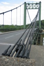
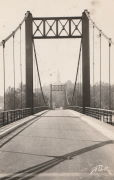
| Bridgemeister ID: | 1230 (added 2004-02-15) |
| Year Completed: | 1948 |
| Name: | Jicheng |
| Also Known As: | Huiren, Dongfeng |
| Location: | Baoshan and Tengchong, Yunnan, China |
| Crossing: | Nujiang |
| Coordinates: | 24.986196 N 98.872567 E |
| Maps: | Acme, GeoHack, Google, OpenStreetMap |
| References: | BCG, BYU |
| Use: | Vehicular |
| Status: | Derelict |
| Main Cables: | Wire (steel) |
| Suspended Spans: | 1 |
| Main Span: | 1 x 140 meters (459.3 feet) |
Notes:
- Bypassed in 1988 by Dongfeng cable-stayed bridge. The Jicheng bridge was also previously known as "Dongfeng".
1948: Kapaia
Kapaia, Hawaii, USA - Hanamaulu Stream
| Bridgemeister ID: | 2470 (added 2008-12-20) |
| Year Completed: | 1948 |
| Name: | Kapaia |
| Location: | Kapaia, Hawaii, USA |
| Crossing: | Hanamaulu Stream |
| Coordinates: | 21.990740 N 159.364568 W |
| Maps: | Acme, GeoHack, Google, OpenStreetMap |
| Use: | Footbridge |
| Status: | Replaced, 2018 |
| Main Cables: | Wire |
| Suspended Spans: | 1 |
Notes:
- Replaced in 2018 with a replica structure after having been derelict and falling into increasing disrepair since 2006.
- Replaced by 2018 Kapaia - Kapaia, Hawaii, USA.
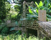
1948: Keikyän
Niemenmäki, Finland - Kokemäenjoki
| Bridgemeister ID: | 3290 (added 2019-11-24) |
| Year Completed: | 1948 |
| Name: | Keikyän |
| Also Known As: | Keikyä |
| Location: | Niemenmäki, Finland |
| Crossing: | Kokemäenjoki |
| Coordinates: | 61.278435 N 22.704704 E |
| Maps: | Acme, GeoHack, Google, OpenStreetMap |
| Use: | Footbridge |
| Status: | In use (last checked: 2022) |
| Main Cables: | Wire (steel) |
| Main Spans: | 1 x 49 meters (160.8 feet) estimated, 1 x 79 meters (259.2 feet) estimated |
| Side Spans: | 4 |
1948: Les Rosiers-sur-Loire
Les Rosiers-sur-Loire and Gennes, Maine-et-Loire, France - Loire River
| Bridgemeister ID: | 1534 (added 2004-10-31) |
| Year Completed: | 1948 |
| Name: | Les Rosiers-sur-Loire |
| Location: | Les Rosiers-sur-Loire and Gennes, Maine-et-Loire, France |
| Crossing: | Loire River |
| Coordinates: | 47.348533 N 0.2277 W |
| Maps: | Acme, GeoHack, Google, OpenStreetMap |
| Use: | Vehicular (two-lane, heavy vehicles), with walkway |
| Status: | In use (last checked: 2005) |
| Main Cables: | Wire (steel) |
| Suspended Spans: | 3 |
| Main Span: | 1 |
| Side Spans: | 2 |
Notes:
- Replaced 1932 Les Rosiers-sur-Loire - Les Rosiers-sur-Loire and Gennes, Maine-et-Loire, France.
- Connects to 1948 Gennes - Gennes and Les Rosiers-sur-Loire, Maine-et-Loire, France.
External Links:
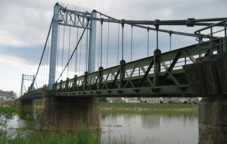
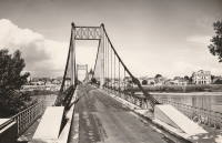
1948: Luitpoldbrücke
Passau, Bavaria, Germany - Danube River
| Bridgemeister ID: | 932 (added 2003-10-25) |
| Year Completed: | 1948 |
| Name: | Luitpoldbrücke |
| Location: | Passau, Bavaria, Germany |
| Crossing: | Danube River |
| Coordinates: | 48.5756 N 13.4716 E |
| Maps: | Acme, GeoHack, Google, OpenStreetMap |
| Use: | Vehicular (two-lane), with walkway |
| Status: | In use (last checked: 2020) |
| Main Cables: | Wire (steel) |
| Suspended Spans: | 1 |
| Characteristics: | Rocker towers |
Notes:
- No tower on one side, cables are anchored directly into hillside.
- c. 2017: Closed for renovation.
- Replaced 1911 Prinzregent-Luitpoldbrücke - Passau, Bavaria, Germany.
- Near former location of 1869 Drahtsteg - Passau, Bavaria, Germany.
External Links:
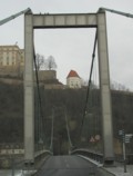
1948: Meung-sur-Loire
Meung-sur-Loire, Loiret, France - Loire River
| Bridgemeister ID: | 1175 (added 2004-01-23) |
| Year Completed: | 1948 |
| Name: | Meung-sur-Loire |
| Location: | Meung-sur-Loire, Loiret, France |
| Crossing: | Loire River |
| Coordinates: | 47.822517 N 1.7026 E |
| Maps: | Acme, GeoHack, Google, OpenStreetMap |
| Use: | Vehicular (two-lane, heavy vehicles), with walkway |
| Status: | In use (last checked: 2021) |
| Main Cables: | Wire (steel) |
| Suspended Spans: | 4 |
| Main Spans: | 2 x 74 meters (242.8 feet) |
| Side Spans: | 2 x 70.5 meters (231.3 feet) |
Notes:
External Links:
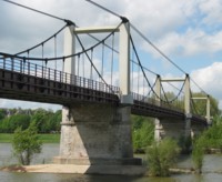
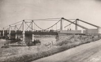
| Bridgemeister ID: | 2738 (added 2019-06-23) |
| Year Completed: | 1948 |
| Name: | Tana |
| Location: | Tana, Troms og Finnmark, Norway |
| Crossing: | Tana |
| Coordinates: | 70.199153 N 28.199913 E |
| Maps: | Acme, GeoHack, Google, kart.1881.no, OpenStreetMap |
| Use: | Vehicular |
| Status: | Demolished, 2020-2021 (last checked: 2019) |
| Main Cables: | Wire (steel) |
| Suspended Spans: | 1 |
| Main Span: | 1 x 194 meters (636.5 feet) |
External Links:
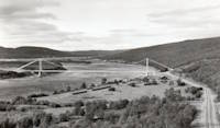
1948: Wolffs Road
West Eyreton, North Canterbury, New Zealand - Eyre River N. Branch
| Bridgemeister ID: | 762 (added 2003-03-08) |
| Year Completed: | 1948 |
| Name: | Wolffs Road |
| Location: | West Eyreton, North Canterbury, New Zealand |
| Crossing: | Eyre River N. Branch |
| Coordinates: | 43.336539 S 172.291641 E |
| Maps: | Acme, GeoHack, Google, OpenStreetMap |
| Principals: | R. G. Wolff |
| References: | GAP |
| Use: | Footbridge |
| Status: | Extant (last checked: 2020) |
| Main Cables: | Wire (steel) |
| Suspended Spans: | 1 |
| Main Span: | 1 x 76 meters (249.3 feet) |
External Links:
| Bridgemeister ID: | 2087 (added 2006-06-24) |
| Year Completed: | 1949 |
| Name: | (footbridge) |
| Location: | Minneapolis, Minnesota, USA |
| At or Near Feature: | University of Minnesota |
| Principals: | Joseph A. Wise, Mid-West Engineering Inc. |
| Use: | Footbridge |
| Status: | Dismantled |
| Main Cables: | Wire |
| Suspended Spans: | 1 |
Notes:
- Crossed railroad tracks near Bierman Field on University of Minnesota campus.
- Moved to Dinkytown ("M" Bridge) - Minneapolis, Minnesota, USA. The bridge was moved to another location on the University of Minnesota campus.
1949: (footbridge)
Valence, Drôme and Guilherand-Granges, Ardèche, France - Rhône River
| Bridgemeister ID: | 6517 (added 2021-08-27) |
| Year Completed: | 1949 |
| Name: | (footbridge) |
| Location: | Valence, Drôme and Guilherand-Granges, Ardèche, France |
| Crossing: | Rhône River |
| Coordinates: | 44.931773 N 4.883700 E |
| Maps: | Acme, GeoHack, Google, OpenStreetMap |
| Use: | Footbridge |
| Status: | Removed, 1960s |
| Main Cables: | Wire (steel) |
| Main Spans: | 2 |
Notes:
- At former location of 1830 Valence - Valence, Drôme and Guilherand-Granges, Ardèche, France.
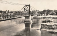
1949: (pipeline bridge)
Purcell vicinity, Oklahoma, USA - Canadian River
| Bridgemeister ID: | 1447 (added 2004-07-31) |
| Year Completed: | 1949 |
| Name: | (pipeline bridge) |
| Location: | Purcell vicinity, Oklahoma, USA |
| Crossing: | Canadian River |
| Principals: | Austin Bridge Co. |
| References: | AUB |
| Use: | Pipeline |
| Main Cables: | Wire (steel) |
Notes:
- Unusual for a pipeline suspension bridge, this bridge has at least two main spans.
1949: Åbacka
Åbacka, Finland - Perhonjoki
| Bridgemeister ID: | 4335 (added 2020-04-11) |
| Year Completed: | 1949 |
| Name: | Åbacka |
| Location: | Åbacka, Finland |
| Crossing: | Perhonjoki |
| Coordinates: | 63.732500 N 23.312316 E |
| Maps: | Acme, GeoHack, Google, OpenStreetMap |
| Principals: | Gilmar Ånäs |
| Use: | Footbridge |
| Status: | In use (last checked: 2020) |
| Main Cables: | Wire |
1949: Beaver
Beaver, Arkansas, USA - White River
| Bridgemeister ID: | 200 (added before 2003) |
| Year Completed: | 1949 |
| Name: | Beaver |
| Location: | Beaver, Arkansas, USA |
| Crossing: | White River |
| At or Near Feature: | Table Rock Reservoir |
| Coordinates: | 36.4708 N 93.76856 W |
| Maps: | Acme, GeoHack, Google, OpenStreetMap |
| Principals: | Pioneer Construction Co., Arkansas State Highway Department |
| Use: | Vehicular (one-lane) |
| Status: | Closed, October, 2021 (last checked: 2021) |
| Main Cables: | Wire (steel) |
| Suspended Spans: | 3 |
| Main Span: | 1 x 95.1 meters (312 feet) |
| Side Spans: | 2 x 32 meters (105 feet) |
| Deck width: | 11.1 feet |
Notes:
- 1981: Deck replaced.
- 1990: Added to National Register of Historic Places
- 2002: Deck replaced.
- 2020: Timber deck and railings replaced, September.
- 2021, October: Closed again for repairs.
External Links:
- Historic Bridges of the United States - Beaver Bridge - Carroll County, Arkansas. States bridge was completed in 1949.
- Structurae - Structure ID 20012249
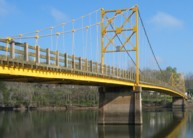
| Bridgemeister ID: | 3928 (added 2020-03-20) |
| Year Completed: | 1949 |
| Name: | Brandval |
| Location: | Brandval, Innlandet, Norway |
| Crossing: | Glomma |
| Coordinates: | 60.31928 N 12.01030 E |
| Maps: | Acme, GeoHack, Google, kart.1881.no, OpenStreetMap |
| Use: | Vehicular (one-lane), with walkway |
| Status: | In use (last checked: 2019) |
| Main Cables: | Wire (steel) |
| Suspended Spans: | 1 |
| Main Span: | 1 x 187 meters (613.5 feet) estimated |
1949: Foss
Tveit, Kristiansand, Agder, Norway - Tovdalselva
| Bridgemeister ID: | 1613 (added 2005-02-20) |
| Year Completed: | 1949 |
| Name: | Foss |
| Location: | Tveit, Kristiansand, Agder, Norway |
| Crossing: | Tovdalselva |
| Coordinates: | 58.259667 N 8.159376 E |
| Maps: | Acme, GeoHack, Google, kart.1881.no, OpenStreetMap |
| Use: | Footbridge |
| Status: | Demolished (last checked: 2007) |
| Main Cables: | Wire (steel) |
| Main Span: | 1 x 65.5 meters (214.9 feet) estimated |
Notes:
1949: Hawkesworth
San Ignacio and Santa Elena, Belize - Macal River
| Bridgemeister ID: | 1634 (added 2005-03-12) |
| Year Completed: | 1949 |
| Name: | Hawkesworth |
| Location: | San Ignacio and Santa Elena, Belize |
| Crossing: | Macal River |
| Coordinates: | 17.156828 N 89.068307 W |
| Maps: | Acme, GeoHack, Google, OpenStreetMap |
| Use: | Vehicular (one-lane) |
| Status: | In use (last checked: 2018) |
| Main Cables: | Wire (steel) |
| Suspended Spans: | 3 |
| Main Span: | 1 |
| Side Spans: | 2 |
External Links:
1949: Higden
Higden vicinity, Arkansas, USA - Little Red River
| Bridgemeister ID: | 1821 (added 2005-05-21) |
| Year Completed: | 1949 |
| Name: | Higden |
| Location: | Higden vicinity, Arkansas, USA |
| Crossing: | Little Red River |
| Use: | Vehicular |
| Status: | Removed |
| Main Cables: | Wire (steel) |
| Suspended Spans: | 1 |
Notes:
- The Arkansas History Commission's image archive contains an image of this bridge. The abstract mentions the bridge "is a temporary 'low-water' bridge built when the old suspension bridge nearby was declared unsafe"
| Bridgemeister ID: | 3929 (added 2020-03-20) |
| Year Completed: | 1949 |
| Name: | Kongsvinger |
| Location: | Kongsvinger, Innlandet, Norway |
| Crossing: | Glomma |
| Coordinates: | 60.18934 N 11.99692 E |
| Maps: | Acme, GeoHack, Google, kart.1881.no, OpenStreetMap |
| Use: | Vehicular (two-lane), with walkway |
| Status: | In use (last checked: 2019) |
| Main Cables: | Wire (steel) |
| Suspended Spans: | 1 |
| Main Span: | 1 x 10⁴ meters (341.2 feet) estimated |
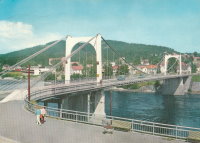
1949: Lacroix-Saint-Ouen
Lacroix-Saint-Ouen, Oise, France - Oise River
| Bridgemeister ID: | 7082 (added 2022-05-28) |
| Year Completed: | 1949 |
| Name: | Lacroix-Saint-Ouen |
| Location: | Lacroix-Saint-Ouen, Oise, France |
| Crossing: | Oise River |
| Coordinates: | 49.352884 N 2.767171 E |
| Maps: | Acme, GeoHack, Google, OpenStreetMap |
| Use: | Vehicular (one-lane) |
| Status: | In use (last checked: 2019) |
| Main Cables: | Wire (steel) |
| Suspended Spans: | 1 |
| Main Span: | 1 x 65 meters (213.3 feet) estimated |
Notes:
- At former location of 1846 Lacroix-Saint-Ouen - Lacroix-Saint-Ouen, Oise, France.
External Links:
1949: Montjean-sur-Loire
Montjean-sur-Loire, Maine-et-Loire, France - Loire River
| Bridgemeister ID: | 1538 (added 2004-10-31) |
| Year Completed: | 1949 |
| Name: | Montjean-sur-Loire |
| Location: | Montjean-sur-Loire, Maine-et-Loire, France |
| Crossing: | Loire River |
| Coordinates: | 47.393783 N 0.859783 W |
| Maps: | Acme, GeoHack, Google, OpenStreetMap |
| Use: | Vehicular (two-lane, heavy vehicles), with walkway |
| Status: | In use (last checked: 2021) |
| Main Cables: | Wire (steel) |
| Suspended Spans: | 6 |
| Main Spans: | 4 |
| Side Spans: | 2 |
Notes:
- At former location of 1938 Montjean-sur-Loire - Montjean-sur-Loire, Maine-et-Loire, France.
External Links:
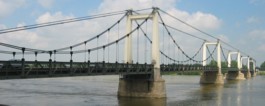
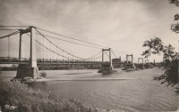
1949: Volonne
Volonne, Alpes-de-Haute-Provence, France - Durance River
| Bridgemeister ID: | 1491 (added 2004-09-19) |
| Year Completed: | 1949 |
| Name: | Volonne |
| Location: | Volonne, Alpes-de-Haute-Provence, France |
| Crossing: | Durance River |
| Coordinates: | 44.108633 N 6.00785 E |
| Maps: | Acme, GeoHack, Google, OpenStreetMap |
| Use: | Vehicular (one-lane), with walkway |
| Status: | Removed, c. 2006 |
| Main Cables: | Wire (steel) |
| Suspended Spans: | 1 |
Notes:
- Replaced by a cable-stayed bridge in the mid 2000s.
- Replaced 1928 Volonne - Volonne, Alpes-de-Haute-Provence, France.
External Links:
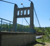
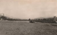
1949: Wehlen
Wehlen, Rheinland-Pfalz, Germany - Moselle/Mosel River
| Bridgemeister ID: | 533 (added before 2003) |
| Year Completed: | 1949 |
| Name: | Wehlen |
| Location: | Wehlen, Rheinland-Pfalz, Germany |
| Crossing: | Moselle/Mosel River |
| Coordinates: | 49.943276 N 7.045824 E |
| Maps: | Acme, GeoHack, Google, OpenStreetMap |
| References: | BFL |
| Use: | Vehicular (two-lane, heavy vehicles), with walkway |
| Status: | Replaced |
| Main Cables: | Wire (steel) |
| Suspended Spans: | 3 |
| Main Span: | 1 x 132 meters (433.1 feet) |
| Side Spans: | 2 x 37 meters (121.4 feet) |
| Deck width: | 8.8 meters |
Notes:
- Replaced by 1994 Wehlen - Wehlen, Rheinland-Pfalz, Germany.
External Links:
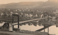
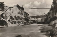
(footbridge)
Injoux-Génissiat, Ain and Franclens, Haute-Savoie, France - Rhône River
| Bridgemeister ID: | 7403 (added 2022-12-03) |
| Name: | (footbridge) |
| Location: | Injoux-Génissiat, Ain and Franclens, Haute-Savoie, France |
| Crossing: | Rhône River |
| At or Near Feature: | Barrage de Génissiat |
| Coordinates: | 46.050202 N 5.811581 E |
| Maps: | Acme, GeoHack, Google, OpenStreetMap |
| Use: | Footbridge |
| Status: | Removed |
| Main Cables: | Wire (steel) |
| Suspended Spans: | 1 |
Notes:
- Likely built around 1946-1947 during construction of the Génissiat dam.
Do you have any information or photos for these bridges that you would like to share? Please email david.denenberg@bridgemeister.com.