Suspension Bridges Crossing Hudson River
This is a list of all 5 bridges from the suspension bridge inventory crossing Hudson River. Please note that different rivers with the same name will be grouped together. For example, selecting 'Bear Creek' shows bridges across several different Bear Creeks. Also, similarly named rivers are grouped separately. For example, 'River Dee' (UK) bridges are grouped separately from 'Dee River' (Australia) bridges. Wherever you see a Bridgemeister ID number click it to isolate the bridge on its own page.
Related Lists:
1871: (suspension bridge)
Washburn's Eddy, New York, USA - Hudson River
| Bridgemeister ID: | 74 (added before 2003) |
| Year Completed: | 1871 |
| Name: | (suspension bridge) |
| Location: | Washburn's Eddy, New York, USA |
| Crossing: | Hudson River |
| Principals: | Robert Gilchrist |
| References: | ABC |
| Status: | Removed |
Notes:
- This bridge was a few miles south of the more widely-known Hudson crossing at Riparius.
- Near 1872 Fulsom Landing (Riverside, Folsom Landing, Riparius) - Riparius, New York, USA.
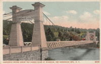
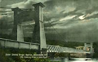
1872: Fulsom Landing
Riparius, New York, USA - Hudson River
| Bridgemeister ID: | 330 (added before 2003) |
| Year Completed: | 1872 |
| Name: | Fulsom Landing |
| Also Known As: | Riverside, Folsom Landing, Riparius |
| Location: | Riparius, New York, USA |
| Crossing: | Hudson River |
| Coordinates: | 43.661963 N 73.898194 W |
| Maps: | Acme, GeoHack, Google, OpenStreetMap |
| Use: | Vehicular (one-lane) |
| Status: | Removed |
| Main Cables: | Wire |
| Suspended Spans: | 1 |
| Main Span: | 1 |
Notes:
- The location of this bridge was originally known as "Folsom Landing" and later became known as "Riverside." In 1886 the name was changed to "Riparius" to avoid confusion with another New York "Riverside" location. The suspension bridge is sometimes referenced by each of these names. To make matters even more confusing, the bridge was known as the "Fulsom Landing" bridge (instead of Folsom).
- Removed at some point after 1919.
- Near 1871 (suspension bridge) - Washburn's Eddy, New York, USA.
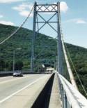
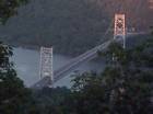
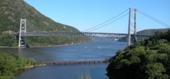
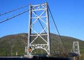
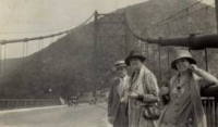
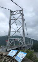
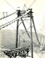
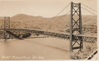
1924: Bear Mountain
Anthony's Nose and Bear Mountain, New York, USA - Hudson River
| Bridgemeister ID: | 141 (added before 2003) |
| Year Completed: | 1924 |
| Name: | Bear Mountain |
| Location: | Anthony's Nose and Bear Mountain, New York, USA |
| Crossing: | Hudson River |
| Coordinates: | 41.32 N 73.985 W |
| Maps: | Acme, GeoHack, Google, OpenStreetMap |
| Principals: | Howard C. Baird |
| References: | AAJ, BAAW, BBR, CPW, PTS2, SJR |
| Use: | Vehicular (two-lane, heavy vehicles), with walkway |
| Status: | In use (last checked: 2022) |
| Main Cables: | Wire (steel) |
| Suspended Spans: | 1 |
| Main Span: | 1 x 497.4 meters (1,632 feet) |
| Deck width: | 48 feet |
Notes:
- Became longest suspension bridge by eclipsing 1903 Williamsburg - New York and Brooklyn, New York, USA.
- Eclipsed by new longest suspension bridge 1926 Benjamin Franklin (Philadelphia-Camden) - Philadelphia, Pennsylvania and Camden, New Jersey, USA.
- Near 2002 Popolopen (William J. Moreau Popolopen) - Fort Montgomery, New York, USA.
External Links:
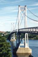
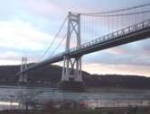
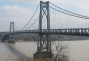
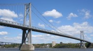
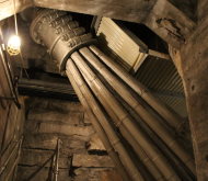
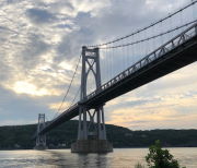
1930: Mid-Hudson
Poughkeepsie and Highland, New York, USA - Hudson River
| Bridgemeister ID: | 166 (added before 2003) |
| Year Completed: | 1930 |
| Name: | Mid-Hudson |
| Also Known As: | Franklin Delano Roosevelt Mid-Hudson |
| Location: | Poughkeepsie and Highland, New York, USA |
| Crossing: | Hudson River |
| Coordinates: | 41.702933 N 73.946683 W |
| Maps: | Acme, GeoHack, Google, OpenStreetMap |
| Principals: | Ralph Modjeski |
| References: | AAJ, BPL, PTS2, SJR, USS |
| Use: | Vehicular (two-lane, heavy vehicles), with walkway |
| Status: | In use (last checked: 2019) |
| Main Cables: | Wire (steel) |
| Suspended Spans: | 3 |
| Main Span: | 1 x 457.2 meters (1,500 feet) |
| Side Spans: | 2 x 228.6 meters (750 feet) |
| Deck width: | 39 feet |
Notes:
- Although the length of the main span of the bridge is officially 1,500 feet, the actual length is 1,495 feet. During construction one of the caissons slid and tilted from its intended location. While efforts were made to move the caisson back, it was ultimately fixed in a position that left the main span five feet short of 1,500. Not wanting to lose the claim of having a 1,500-foot bridge, the shortfall has been kept out of official records since.
External Links:
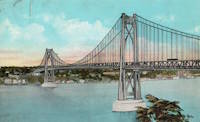
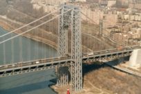
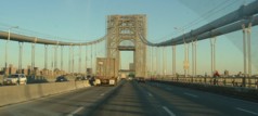
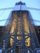
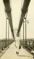
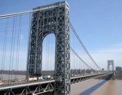
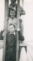
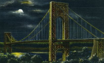
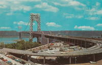
1931: George Washington
New York, New York and Fort Lee, New Jersey, USA - Hudson River
| Bridgemeister ID: | 169 (added before 2003) |
| Year Completed: | 1931 |
| Name: | George Washington |
| Also Known As: | GWB |
| Location: | New York, New York and Fort Lee, New Jersey, USA |
| Crossing: | Hudson River |
| Coordinates: | 40.85333 N 73.955 W |
| Maps: | Acme, GeoHack, Google, OpenStreetMap |
| Principals: | O.H. Ammann, Leon Moisseiff, Dana, Gilbert |
| References: | AAJ, AOB, ARF, BBR, BC3, BFL, BMA, BONJ, BOU, BPL, BRU, COB, CTW, ENR19270811a, ENR19270811b, ENR19290411c, GBD, LAB, LACE, PTS2, SIX, SJR |
| Use: | Vehicular (double-deck), with walkway |
| Status: | In use (last checked: 2022) |
| Main Cables: | Wire (steel) |
| Suspended Spans: | 3 |
| Main Span: | 1 x 1,066.8 meters (3,500 feet) |
| Side Spans: | 2 x 198.1 meters (650 feet) |
| Deck width: | 120 feet |
Notes:
- Became longest suspension bridge by eclipsing 1929 Ambassador - Detroit, Michigan, USA and Windsor, Ontario, Canada.
- Eclipsed by new longest suspension bridge 1937 Golden Gate - San Francisco and Marin County, California, USA.
External Links:
Do you have any information or photos for these bridges that you would like to share? Please email david.denenberg@bridgemeister.com.