Suspension Bridges Crossing Big Sandy River Levisa Fork
This is a list of all 15 bridges from the suspension bridge inventory crossing Big Sandy River Levisa Fork. Please note that different rivers with the same name will be grouped together. For example, selecting 'Bear Creek' shows bridges across several different Bear Creeks. Also, similarly named rivers are grouped separately. For example, 'River Dee' (UK) bridges are grouped separately from 'Dee River' (Australia) bridges. Wherever you see a Bridgemeister ID number click it to isolate the bridge on its own page.
Related Lists:
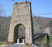
1936: Pauley
Pikeville, Kentucky, USA - Big Sandy River Levisa Fork
| Bridgemeister ID: | 1068 (added 2003-12-27) |
| Year Completed: | 1936 |
| Name: | Pauley |
| Location: | Pikeville, Kentucky, USA |
| Crossing: | Big Sandy River Levisa Fork |
| Coordinates: | 37.492833 N 82.5355 W |
| Maps: | Acme, GeoHack, Google, OpenStreetMap |
| Principals: | O.S. Batten, WPA |
| Use: | Vehicular (one-lane) |
| Status: | Restricted to foot traffic (last checked: 2021) |
| Main Cables: | Wire (steel) |
| Suspended Spans: | 1 |
| Main Span: | 1 x 115.8 meters (380 feet) estimated |
Notes:
- The National Register of Historic Places registration form is inconsistent regarding the completion year of this bridge stating (in one passage) it was completed in 1940 but also mentioning it was completed "circa 1940" a few times.
- Closed to vehicular traffic, 1991. Closed to all traffic, September 2000. Restored and reopened to pedestrian traffic, 2006.

1999: Forrest and Maxie Preston Memorial Pedestrian
River, Johnson County, Kentucky, USA - Big Sandy River Levisa Fork
| Bridgemeister ID: | 329 (added before 2003) |
| Year Completed: | 1999 |
| Name: | Forrest and Maxie Preston Memorial Pedestrian |
| Location: | River, Johnson County, Kentucky, USA |
| Crossing: | Big Sandy River Levisa Fork |
| Coordinates: | 37.86015 N 82.726117 W |
| Maps: | Acme, GeoHack, Google, OpenStreetMap |
| Principals: | Bush and Burchett Inc., Bocook Engineering, S.E.A. Engineers Inc., Issam Harik |
| References: | UKODF99 |
| Use: | Footbridge |
| Status: | In use (last checked: 2005) |
| Main Cables: | Wire (steel) |
| Suspended Spans: | 3 |
| Main Span: | 1 x 96.3 meters (316 feet) estimated |
| Side Spans: | 2 x 14.3 meters (47 feet) estimated |
Notes:
- From an old Kentucky Transportation Cabinet web page: "Interested in seeing the world's longest plastic bridge? Visit Johnson County, where the 410-ft-long Forest and Maxie Preston Memorial Pedestrian Bridge recently opened. The bridge was built from a high performance composite material - glass fiber that is reinforced with plastic resins."
- A University of Kentucky web page refers to the deck material as "glass fiber-reinforced polymer composites."
External Links:
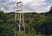
(footbridge)
Broad Bottom, Kentucky, USA - Big Sandy River Levisa Fork
| Bridgemeister ID: | 1468 (added 2004-08-28) |
| Name: | (footbridge) |
| Location: | Broad Bottom, Kentucky, USA |
| Crossing: | Big Sandy River Levisa Fork |
| Coordinates: | 37.536417 N 82.594967 W |
| Maps: | Acme, GeoHack, Google, OpenStreetMap |
| Use: | Footbridge |
| Status: | In use (last checked: 2005) |
| Main Cables: | Wire (steel) |
| Suspended Spans: | 1 |
| Main Span: | 1 x 121.9 meters (400 feet) estimated |
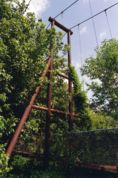
(footbridge)
Dwale, Kentucky, USA - Big Sandy River Levisa Fork
| Bridgemeister ID: | 2261 (added 2007-04-19) |
| Name: | (footbridge) |
| Location: | Dwale, Kentucky, USA |
| Crossing: | Big Sandy River Levisa Fork |
| Coordinates: | 37.62283 N 82.72169 W |
| Maps: | Acme, GeoHack, Google, OpenStreetMap |
| Use: | Footbridge |
| Status: | Derelict (last checked: 2007) |
| Main Cables: | Wire |
| Suspended Spans: | 1 |
Notes:
- Patrick S. O'Donnell provided a rough main span estimate of 300 feet.
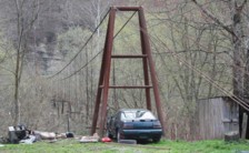
(footbridge)
Fords Branch, Kentucky, USA - Big Sandy River Levisa Fork
| Bridgemeister ID: | 1479 (added 2004-09-03) |
| Name: | (footbridge) |
| Location: | Fords Branch, Kentucky, USA |
| Crossing: | Big Sandy River Levisa Fork |
| Coordinates: | 37.43476 N 82.50923 W |
| Maps: | Acme, GeoHack, Google, OpenStreetMap |
| Use: | Footbridge |
| Status: | Derelict (last checked: 2007) |
| Main Cables: | Wire |
Notes:
- Patrick S. O'Donnell provided a rough main span estimate of 350 feet.
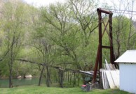
(footbridge)
Grundy, Virginia, USA - Big Sandy River Levisa Fork
| Bridgemeister ID: | 3801 (added 2020-03-01) |
| Name: | (footbridge) |
| Location: | Grundy, Virginia, USA |
| Crossing: | Big Sandy River Levisa Fork |
| Coordinates: | 37.286200 N 82.122450 W |
| Maps: | Acme, GeoHack, Google, OpenStreetMap |
| Use: | Footbridge |
| Status: | In use (last checked: 2015) |
| Main Cables: | Wire |
| Main Span: | 1 |
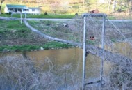
(footbridge)
Kewanee, Kentucky, USA - Big Sandy River Levisa Fork
| Bridgemeister ID: | 1478 (added 2004-09-03) |
| Name: | (footbridge) |
| Location: | Kewanee, Kentucky, USA |
| Crossing: | Big Sandy River Levisa Fork |
| Coordinates: | 37.445933 N 82.5153 W |
| Maps: | Acme, GeoHack, Google, OpenStreetMap |
| Use: | Footbridge |
| Status: | In use (last checked: 2007) |
| Main Cables: | Wire (steel) |
| Suspended Spans: | 1 |
| Main Span: | 1 x 125 meters (410 feet) estimated |
Notes:
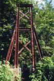
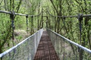
(footbridge)
Toonerville, Kentucky, USA - Big Sandy River Levisa Fork
| Bridgemeister ID: | 2263 (added 2007-04-20) |
| Name: | (footbridge) |
| Location: | Toonerville, Kentucky, USA |
| Crossing: | Big Sandy River Levisa Fork |
| Coordinates: | 37.36810 N 82.23335 W |
| Maps: | Acme, GeoHack, Google, OpenStreetMap |
| Use: | Footbridge |
| Status: | Derelict (last checked: 2007) |
| Main Cables: | Wire |
| Suspended Spans: | 1 |
Notes:
- Patrick S. O'Donnell provided a rough main span estimate of 175 feet.
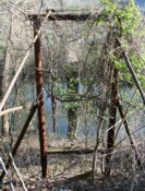
(footbridge)
Toonerville, Kentucky, USA - Big Sandy River Levisa Fork
| Bridgemeister ID: | 3816 (added 2020-03-01) |
| Name: | (footbridge) |
| Location: | Toonerville, Kentucky, USA |
| Crossing: | Big Sandy River Levisa Fork |
| Coordinates: | 37.369177 N 82.246554 W |
| Maps: | Acme, GeoHack, Google, OpenStreetMap |
| Use: | Footbridge |
| Status: | Derelict (last checked: 2007) |
| Main Cables: | Wire |
| Main Span: | 1 x 38.1 meters (125 feet) estimated |
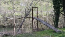
Bill Perk Litteral Memorial
Paintsville, Kentucky, USA - Big Sandy River Levisa Fork
| Bridgemeister ID: | 360 (added before 2003) |
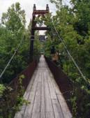
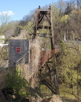
| Name: | Bill Perk Litteral Memorial |
| Also Known As: | Swinging |
| Location: | Paintsville, Kentucky, USA |
| Crossing: | Big Sandy River Levisa Fork |
| Coordinates: | 37.81233 N 82.80991 W |
| Maps: | Acme, GeoHack, Google, OpenStreetMap |
| Use: | Footbridge |
| Status: | Derelict (last checked: 2023) |
| Main Cables: | Wire (steel) |
| Suspended Spans: | 3 |
| Main Span: | 1 x 59.4 meters (195 feet) estimated |
| Side Spans: | 1 x 27.1 meters (89 feet) estimated, 1 x 20.7 meters (68 feet) estimated |
Boldman
Pikeville vicinity, Kentucky, USA - Big Sandy River Levisa Fork
| Bridgemeister ID: | 318 (added before 2003) |
| Name: | Boldman |
| Location: | Pikeville vicinity, Kentucky, USA |
| Crossing: | Big Sandy River Levisa Fork |
| Use: | Vehicular (one-lane) |
| Status: | Removed |
| Main Cables: | Wire (steel) |
| Suspended Spans: | 1 |
Notes:
- Carried Kentucky route 1384 over the Levisa Fork. Likely removed in time frame 1985-1994.
External Links:
Emma
Emma, Kentucky, USA - Big Sandy River Levisa Fork
| Bridgemeister ID: | 5597 (added 2020-12-23) |
| Name: | Emma |
| Location: | Emma, Kentucky, USA |
| Crossing: | Big Sandy River Levisa Fork |
| Coordinates: | 37.634650 N 82.699258 W |
| Maps: | Acme, GeoHack, Google, OpenStreetMap |
| Use: | Vehicular (one-lane) |
| Status: | Removed |
| Main Cables: | Wire |
| Main Span: | 1 |
External Links:
Knottly Hollow
Lancer, Kentucky, USA - Big Sandy River Levisa Fork
| Bridgemeister ID: | 5596 (added 2020-12-23) |
| Name: | Knottly Hollow |
| Location: | Lancer, Kentucky, USA |
| Crossing: | Big Sandy River Levisa Fork |
| Coordinates: | 37.671249 N 82.717030 W |
| Maps: | Acme, GeoHack, Google, OpenStreetMap |
| Use: | Vehicular |
| Status: | Collapsed |
| Main Cables: | Wire |
| Main Span: | 1 |
Notes:
- Collapsed, July, 1962 while a car was crossing. Three adults were killed, one child was injured, but survived.
- From a UPI wire news article appearing in July 1962 Kentucky newspapers: "The swinging bridge fell when a cable snapped afler being weakened by rubbing against a concrele abutment, [Commisioner of Highways Henry Ward] said."
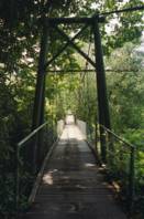
Swinging
Paintsville, Kentucky, USA - Big Sandy River Levisa Fork
| Bridgemeister ID: | 1490 (added 2004-09-19) |
| Name: | Swinging |
| Location: | Paintsville, Kentucky, USA |
| Crossing: | Big Sandy River Levisa Fork |
| At or Near Feature: | Paintsville Country Club |
| Coordinates: | 37.808576 N 82.773829 W |
| Maps: | Acme, GeoHack, Google, OpenStreetMap |
| Use: | Footbridge and Golf cart |
| Status: | In use (last checked: 2019) |
| Main Cables: | Wire (steel) |
| Suspended Spans: | 1 |
| Main Span: | 1 x 112.8 meters (370 feet) |
Notes:
- Used by golf carts. Just barely wide enough for one golf cart.
Tram
Tram, Kentucky, USA - Big Sandy River Levisa Fork
| Bridgemeister ID: | 5598 (added 2020-12-23) |
| Name: | Tram |
| Location: | Tram, Kentucky, USA |
| Crossing: | Big Sandy River Levisa Fork |
| Coordinates: | 37.573858 N 82.646108 W |
| Maps: | Acme, GeoHack, Google, OpenStreetMap |
| Use: | Vehicular (one-lane) |
| Status: | Removed |
| Main Cables: | Wire |
| Main Span: | 1 |
Notes:
- Appears to have been removed at some point in 1980s or early 1990s.
Do you have any information or photos for these bridges that you would like to share? Please email david.denenberg@bridgemeister.com.