Suspension Bridges Crossing Bear Creek
This is a list of all 4 bridges from the suspension bridge inventory crossing Bear Creek. Please note that different rivers with the same name will be grouped together. For example, selecting 'Bear Creek' shows bridges across several different Bear Creeks. Also, similarly named rivers are grouped separately. For example, 'River Dee' (UK) bridges are grouped separately from 'Dee River' (Australia) bridges. Wherever you see a Bridgemeister ID number click it to isolate the bridge on its own page.
Related Lists:
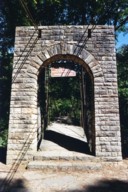
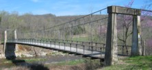
1939: Swinging
Tishomingo State Park, Mississippi, USA - Bear Creek
| Bridgemeister ID: | 850 (added 2003-07-27) |
| Year Completed: | 1939 |
| Name: | Swinging |
| Location: | Tishomingo State Park, Mississippi, USA |
| Crossing: | Bear Creek |
| Coordinates: | 34.605183 N 88.17955 W |
| Maps: | Acme, GeoHack, Google, OpenStreetMap |
| Use: | Footbridge |
| Status: | In use (last checked: 2020) |
| Main Cables: | Wire (steel) |
| Suspended Spans: | 1 |
| Main Span: | 1 x 57.9 meters (190 feet) estimated |
Notes:
- Likely built by the CCC, this bridge has an interesting zig-zag pattern of suspenders. The suspenders are inclined and are continuous across the bridge like a shoelace with one set of eyelets at deck level and the other set of eyelets along the main cables.

1941: Haggard Ford
Harrison vicinity, Arkansas, USA - Bear Creek
| Bridgemeister ID: | 199 (added before 2003) |
| Year Completed: | 1941 |
| Name: | Haggard Ford |
| Location: | Harrison vicinity, Arkansas, USA |
| Crossing: | Bear Creek |
| Coordinates: | 36.3458 N 93.1305 W |
| Maps: | Acme, GeoHack, Google, OpenStreetMap |
| Principals: | WPA, Jess Chaney |
| Use: | Vehicular (one-lane) |
| Status: | Restricted to foot traffic (last checked: 2007) |
| Main Cables: | Wire (steel) |
| Suspended Spans: | 1 |
| Main Span: | 1 x 48.8 meters (160 feet) |
Notes:
- Located about eight miles north of Harrison. According to plaque at bridge, restored 1977.
- Gene McCluney writes: "I visited this bridge [in the Summer of 2007] and talked to an adjacent landowner a couple weeks ago. It seems this bridge was closed in 1962 due to instability in one of the piers, and the crossing reverted to a ford or low water crossing until about four years ago when the new vehicular bridge was built. So, there was a suspension bridge in-use there for 20 years, then 40 years of "low water" type crossing, then just recently a new vehicle bridge."
- Similar to (suspension bridge) - Leslie vicinity, Arkansas, USA.
External Links:

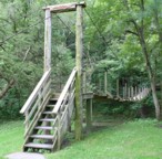
(footbridge)
Baldwin vicinity, Iowa, USA - Bear Creek
| Bridgemeister ID: | 1875 (added 2005-09-22) |
| Name: | (footbridge) |
| Location: | Baldwin vicinity, Iowa, USA |
| Crossing: | Bear Creek |
| At or Near Feature: | Eden Valley County Refuge |
| Coordinates: | 42.04455 N 90.86093 W |
| Maps: | Acme, GeoHack, Google, OpenStreetMap |
| Use: | Footbridge |
| Status: | In use (last checked: 2007) |
| Suspended Spans: | 1 |
| Main Span: | 1 x 27.4 meters (90 feet) |

Bear Creek
Valdez vicinity, Alaska, USA - Bear Creek
| Bridgemeister ID: | 1187 (added 2004-01-24) |
| Name: | Bear Creek |
| Location: | Valdez vicinity, Alaska, USA |
| Crossing: | Bear Creek |
| Use: | Vehicular |
Notes:
- Carried Richardson Highway across Bear Creek circa 1930's and earlier.
- Alaska Digital Archives identifier UAF-2003-63-179 shows a very similar (or the same) suspension bridge as crossing Sheep Creek on the Valdez Trail but they also note a potential discrepancy with another image in the archive that labels the bridge as carrying the Richardson Highway.
Do you have any information or photos for these bridges that you would like to share? Please email david.denenberg@bridgemeister.com.