Suspension Bridges Crossing Androscoggin River
This is a list of all 6 bridges from the suspension bridge inventory crossing Androscoggin River. Please note that different rivers with the same name will be grouped together. For example, selecting 'Bear Creek' shows bridges across several different Bear Creeks. Also, similarly named rivers are grouped separately. For example, 'River Dee' (UK) bridges are grouped separately from 'Dee River' (Australia) bridges. Wherever you see a Bridgemeister ID number click it to isolate the bridge on its own page.
Related Lists:
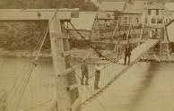
1872: Gilead
Gilead, Maine, USA - Androscoggin River
| Bridgemeister ID: | 2157 (added 2006-12-10) |
| Year Completed: | 1872 |
| Name: | Gilead |
| Location: | Gilead, Maine, USA |
| Crossing: | Androscoggin River |
| Use: | Vehicular |
| Status: | Replaced, 1923 |
| Main Cables: | Wire |
| Main Span: | 1 x 58.5 meters (192 feet) |
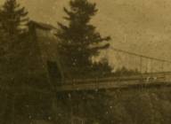
1892: Androscoggin Pedestrian
Topsham and Brunswick, Maine, USA - Androscoggin River
| Bridgemeister ID: | 101 (added before 2003) |
| Year Completed: | 1892 |
| Name: | Androscoggin Pedestrian |
| Also Known As: | Swinging, Androscoggin Swinging |
| Location: | Topsham and Brunswick, Maine, USA |
| Crossing: | Androscoggin River |
| Coordinates: | 43.918069 N 69.973122 W |
| Maps: | Acme, GeoHack, Google, OpenStreetMap |
| Principals: | John A. Roebling's Sons Co. |
| References: | PPH19991019, PPH20050801 |
| Use: | Footbridge |
| Status: | Destroyed, 1936 |
| Main Cables: | Wire (steel) |
Notes:
- c. 1913-1916: Original timber towers replaced with steel towers.
- 1936: Deck destroyed by flood. Steel towers and cables survive.
- Replaced by 1936 Androscoggin Pedestrian (Swinging) - Topsham and Brunswick, Maine, USA.
External Links:
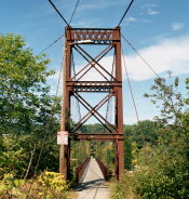
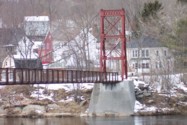
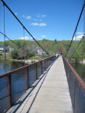
1936: Androscoggin Pedestrian
Topsham and Brunswick, Maine, USA - Androscoggin River
| Bridgemeister ID: | 182 (added before 2003) |
| Year Completed: | 1936 |
| Name: | Androscoggin Pedestrian |
| Also Known As: | Swinging |
| Location: | Topsham and Brunswick, Maine, USA |
| Crossing: | Androscoggin River |
| Coordinates: | 43.917500 N 69.972520 W |
| Maps: | Acme, GeoHack, Google, OpenStreetMap |
| Principals: | Works Progress Administration |
| References: | PPH19991019, PPH20050801 |
| Use: | Footbridge |
| Status: | In use (last checked: 2020) |
| Main Cables: | Wire (steel) |
| Suspended Spans: | 1 |
| Main Span: | 1 x 101.2 meters (332 feet) |
| Deck width: | 6 feet |
Notes:
- 2004, January: Added to National Register of Historic Places.
- 2006, December: Substantial rehabilitation completed.
- 2011, May: Dedicated as a Maine Historic Civil Engineering Landmark.
- Replaced 1892 Androscoggin Pedestrian (Swinging, Androscoggin Swinging) - Topsham and Brunswick, Maine, USA.
External Links:
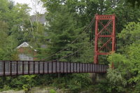
(footbridge)
Rumford, Maine, USA - Androscoggin River
| Bridgemeister ID: | 265 (added before 2003) |
| Name: | (footbridge) |
| Location: | Rumford, Maine, USA |
| Crossing: | Androscoggin River |
| At or Near Feature: | Rumford Falls |
| Use: | Footbridge |
| Status: | Removed |
| Main Cables: | Wire |
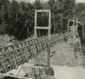
(footbridge)
Rumford, Maine, USA - Androscoggin River
| Bridgemeister ID: | 1696 (added 2005-03-27) |
| Name: | (footbridge) |
| Location: | Rumford, Maine, USA |
| Crossing: | Androscoggin River |
| Coordinates: | 44.55148 N 70.54430 W |
| Maps: | Acme, GeoHack, Google, OpenStreetMap |
| Use: | Footbridge and Pipeline |
| Status: | In use (last checked: 2012) |
| Main Cables: | Wire (steel) |
| Main Span: | 1 x 91.4 meters (300 feet) |
Notes:
- John A Roebling's Son Co. added the pipeline onto an existing footbridge. From a Roebling ad: "... supports a 400 foot section of the 30 inch diameter water line (capacity 12,000,000 gpd) across the Androscoggin River. A substantial saving was accomodated by erecting this bridge with its 300 ft. center span adjacent to and attached to an existing footbridge."
- See (pipeline bridge) - Rumford, Maine, USA. The pipelines were constructed as part of the same project.
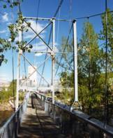
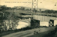
Chandler's
Gorham, New Hampshire, USA - Androscoggin River
| Bridgemeister ID: | 322 (added before 2003) |
| Name: | Chandler's |
| Location: | Gorham, New Hampshire, USA |
| Crossing: | Androscoggin River |
| Use: | Footbridge |
| Status: | Removed |
| Main Cables: | Wire |
| Main Span: | 1 x 68.6 meters (225 feet) |
Notes:
- Was located at the end of present-day Alpine Street.
Do you have any information or photos for these bridges that you would like to share? Please email david.denenberg@bridgemeister.com.