Suspension Bridges of United Kingdom (101-200 of 257)
This is a list of bridges 101 through 200 (of 257 total) from the suspension bridge inventory for the country United Kingdom. Wherever you see a Bridgemeister ID number click it to isolate the bridge on its own page.
Related Lists:
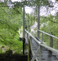
1893: Feugh
Banchory, Scotland, United Kingdom - Water of Feugh
| Bridgemeister ID: | 2196 (added 2007-01-26) |
| Year Completed: | 1893 |
| Name: | Feugh |
| Location: | Banchory, Scotland, United Kingdom |
| Crossing: | Water of Feugh |
| Coordinates: | 57.042679 N 2.493234 W |
| Maps: | Acme, GeoHack, Google, OpenStreetMap |
| Principals: | Louis Harper |
| References: | AAJ, HARPER |
| Use: | Footbridge |
| Status: | In use (last checked: 2014) |
| Main Cables: | Wire |
| Suspended Spans: | 1 |
| Main Span: | 1 x 30 meters (98.4 feet) |
Notes:
- Towers replaced, at some point. Unclear how much of the present-day (2020) bridge is original.
External Links:
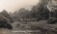
1893: Trentham
Trentham, England, United Kingdom - River Trent
| Bridgemeister ID: | 2200 (added 2007-01-28) |
| Year Completed: | 1893 |
| Name: | Trentham |
| Location: | Trentham, England, United Kingdom |
| Crossing: | River Trent |
| References: | HARPER |
| Use: | Footbridge |
| Status: | Replaced, c.1930's |
| Main Cables: | Wire |
| Suspended Spans: | 1 |
| Main Span: | 1 x 21.3 meters (70 feet) |
External Links:
1894: (footbridge)
Grimsby, England, United Kingdom - River Freshney
| Bridgemeister ID: | 5079 (added 2020-08-30) |
| Year Completed: | 1894 |
| Name: | (footbridge) |
| Location: | Grimsby, England, United Kingdom |
| Crossing: | River Freshney |
| Coordinates: | 53.570454 N 0.095989 W |
| Maps: | Acme, GeoHack, Google, OpenStreetMap |
| Principals: | Harper & Co. |
| References: | HARPER |
| Use: | Footbridge |
| Status: | Only towers remain (last checked: 2014) |
| Main Cables: | Wire |
| Suspended Spans: | 1 |
| Main Span: | 1 x 10.7 meters (35 feet) |
Notes:
- Replaced, but elements of the suspension bridge were retained in the new structure which is now (2020) boarded up.
- Built as part of same project as 1894 (footbridge) - Grimsby, England, United Kingdom.
- Built as part of same project as 1894 (footbridge) - Grimsby, England, United Kingdom.
1894: (footbridge)
Grimsby, England, United Kingdom - River Freshney
| Bridgemeister ID: | 5080 (added 2020-08-30) |
| Year Completed: | 1894 |
| Name: | (footbridge) |
| Location: | Grimsby, England, United Kingdom |
| Crossing: | River Freshney |
| Coordinates: | 53.569623 N 0.094252 W |
| Maps: | Acme, GeoHack, Google, OpenStreetMap |
| Principals: | Harper & Co. |
| References: | HARPER |
| Use: | Footbridge |
| Status: | Replaced |
| Main Cables: | Wire |
| Suspended Spans: | 1 |
| Main Span: | 1 x 15.2 meters (50 feet) |
Notes:
- Coordinates are for likely location of this bridge, since replaced.
- Built as part of same project as 1894 (footbridge) - Grimsby, England, United Kingdom.
- Built as part of same project as 1894 (footbridge) - Grimsby, England, United Kingdom.
1894: (footbridge)
Grimsby, England, United Kingdom - River Freshney
| Bridgemeister ID: | 5081 (added 2020-08-30) |
| Year Completed: | 1894 |
| Name: | (footbridge) |
| Location: | Grimsby, England, United Kingdom |
| Crossing: | River Freshney |
| Coordinates: | 53.568240 N 0.092003 W |
| Maps: | Acme, GeoHack, Google, OpenStreetMap |
| Principals: | Harper & Co. |
| References: | HARPER |
| Use: | Footbridge |
| Status: | Replaced |
| Main Cables: | Wire |
| Suspended Spans: | 1 |
| Main Span: | 1 x 15.2 meters (50 feet) |
Notes:
- Coordinates are for likely location of this bridge, since replaced.
- Built as part of same project as 1894 (footbridge) - Grimsby, England, United Kingdom.
- Built as part of same project as 1894 (footbridge) - Grimsby, England, United Kingdom.
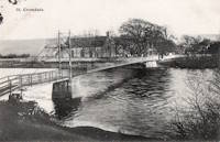
1894: Cromdale
Cromdale, Scotland, United Kingdom - River Spey
| Bridgemeister ID: | 5077 (added 2020-08-30) |
| Year Completed: | 1894 |
| Name: | Cromdale |
| Location: | Cromdale, Scotland, United Kingdom |
| Crossing: | River Spey |
| Coordinates: | 57.341528 N 3.553306 W |
| Maps: | Acme, GeoHack, Google, OpenStreetMap |
| References: | HARPER |
| Use: | Footbridge |
| Status: | Removed, 1921 |
| Main Cables: | Wire |
| Suspended Spans: | 1 |
Notes:
1894: Devil's Dyke Aerial Cableway
Fulking, Brighton vicinity, England, United Kingdom - Devil's Dyke
| Bridgemeister ID: | 4843 (added 2020-07-11) |
| Year Completed: | 1894 |
| Name: | Devil's Dyke Aerial Cableway |
| Location: | Fulking, Brighton vicinity, England, United Kingdom |
| Crossing: | Devil's Dyke |
| References: | AAJ |
| Use: | Tramway |
| Status: | Closed, 1909 |
| Main Cables: | Wire (steel) |
| Suspended Spans: | 3 |
| Main Span: | 1 |
| Side Spans: | 2 |
External Links:
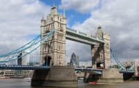
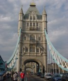
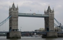
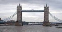
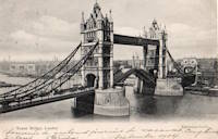
1894: Tower
London, England, United Kingdom - River Thames
| Bridgemeister ID: | 3845 (added 2020-03-07) |
| Year Completed: | 1894 |
| Name: | Tower |
| Location: | London, England, United Kingdom |
| Crossing: | River Thames |
| Coordinates: | 51.505837 N 0.075281 W |
| Maps: | Acme, GeoHack, Google, OpenStreetMap |
| References: | PTS2 |
| Use: | Vehicular |
| Status: | In use (last checked: 2023) |
| Suspended Spans: | 2 |
| Side Spans: | 2 x 82.3 meters (270 feet) |
1895: Sellack Boat
Sellack Boat, Ross on Wye, England, United Kingdom - River Wye
| Bridgemeister ID: | 1210 (added 2004-02-07) |
| Year Completed: | 1895 |
| Name: | Sellack Boat |
| Location: | Sellack Boat, Ross on Wye, England, United Kingdom |
| Crossing: | River Wye |
| Coordinates: | 51.948935 N 2.634423 W |
| Maps: | Acme, GeoHack, Google, OpenStreetMap |
| Principals: | Louis Harper, Harpers Limited |
| References: | HARPER |
| Use: | Footbridge |
| Status: | In use (last checked: 2014) |
| Main Cables: | Wire |
| Suspended Spans: | 1 |
| Main Span: | 1 x 57.9 meters (190 feet) |
| Deck width: | 6 feet |
Notes:
- HARPER: 1895. Previously had 1898.
External Links:
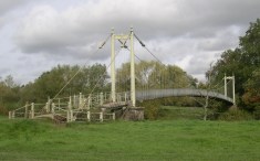
1897: (footbridge)
Addingham, England, United Kingdom - River Wharfe
| Bridgemeister ID: | 1207 (added 2004-02-07) |
| Year Completed: | 1897 |
| Name: | (footbridge) |
| Location: | Addingham, England, United Kingdom |
| Crossing: | River Wharfe |
| Use: | Footbridge |
| Status: | Destroyed, 1936 |
| Main Cables: | Wire |
Notes:
- Destroyed by flood, 1936.
- Replaced by (footbridge) - Addingham, England, United Kingdom.
1897: Carfin
Crossford, Carluke, Scotland, United Kingdom - River Clyde
| Bridgemeister ID: | 5172 (added 2020-09-26) |
| Year Completed: | 1897 |
| Name: | Carfin |
| Also Known As: | Crossford |
| Location: | Crossford, Carluke, Scotland, United Kingdom |
| Crossing: | River Clyde |
| Coordinates: | 55.693646 N 3.863803 W |
| Maps: | Acme, GeoHack, Google, OpenStreetMap |
| Principals: | P & R Flemming & Co. |
| Use: | Footbridge |
| Status: | Closed (last checked: 2020) |
| Main Cables: | Rod |
| Suspended Spans: | 2 |
| Main Spans: | 2 |
Notes:
- Restored early 1990s, but has since fallen into disrepair and is closed. Unusual main "cables" appear to be steel rods or some kind of segmented rigid steel members.
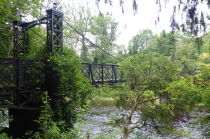
1897: Jubilee
Annan, Scotland, United Kingdom - River Annan
| Bridgemeister ID: | 6206 (added 2021-07-15) |
| Year Completed: | 1897 |
| Name: | Jubilee |
| Location: | Annan, Scotland, United Kingdom |
| Crossing: | River Annan |
| Coordinates: | 55.005848 N 3.265549 W |
| Maps: | Acme, GeoHack, Google, OpenStreetMap |
| Use: | Footbridge |
| Status: | Destroyed, October 28, 2021 |
| Main Cables: | Wire (steel) |
| Suspended Spans: | 1 |
Notes:
- 2021, October 28: Destroyed by flood.
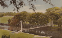
1898: Brinkburn
Morpeth, England, United Kingdom - River Coquet
| Bridgemeister ID: | 4657 (added 2020-06-18) |
| Year Completed: | 1898 |
| Name: | Brinkburn |
| Location: | Morpeth, England, United Kingdom |
| Crossing: | River Coquet |
| Coordinates: | 55.279751 N 1.819533 W |
| Maps: | Acme, GeoHack, Google, OpenStreetMap |
| Use: | Footbridge |
| Status: | Extant (last checked: 2016) |
| Main Cables: | Wire |
| Suspended Spans: | 1 |
External Links:
1898: Doveridge
Doveridge, England, United Kingdom - River Dove
| Bridgemeister ID: | 2151 (added 2006-11-18) |
| Year Completed: | 1898 |
| Name: | Doveridge |
| Location: | Doveridge, England, United Kingdom |
| Crossing: | River Dove |
| Coordinates: | 52.903130 N 1.836442 W |
| Maps: | Acme, GeoHack, Google, OpenStreetMap |
| Principals: | Louis Harper |
| References: | HARPER |
| Use: | Footbridge |
| Status: | Collapsed, 1946 |
| Main Cables: | Wire |
| Suspended Spans: | 1 |
Notes:
- Replaced by 1946 Doveridge - Doveridge, England, United Kingdom.
External Links:
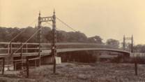

1898: Lowther
Keswick, England, United Kingdom - River Greta
| Bridgemeister ID: | 2180 (added 2007-01-13) |
| Year Completed: | 1898 |
| Name: | Lowther |
| Also Known As: | Keswick |
| Location: | Keswick, England, United Kingdom |
| Crossing: | River Greta |
| Principals: | Louis Harper |
| References: | HARPER |
| Use: | Footbridge |
| Status: | Demolished, 1979 |
| Main Cables: | Wire |
| Suspended Spans: | 1 |
| Main Span: | 1 x 27.4 meters (90 feet) |
External Links:
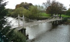
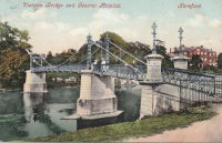
1898: Victoria
Hereford, England, United Kingdom - River Wye
| Bridgemeister ID: | 424 (added before 2003) |
| Year Completed: | 1898 |
| Name: | Victoria |
| Location: | Hereford, England, United Kingdom |
| Crossing: | River Wye |
| Coordinates: | 52.051075 N 2.712197 W |
| Maps: | Acme, GeoHack, Google, OpenStreetMap |
| Principals: | Alexander Findlay and Co. |
| References: | NTB |
| Use: | Footbridge |
| Status: | In use (last checked: 2018) |
| Main Cables: | Eyebar |
| Suspended Spans: | 3 |
| Main Span: | 1 x 24.4 meters (80 feet) |
| Side Spans: | 2 |

1900: Dunes
Bighouse, Melvich Bay vicinity, Scotland, United Kingdom - Halladale River
| Bridgemeister ID: | 2567 (added 2012-02-05) |
| Year Completed: | 1900 |
| Name: | Dunes |
| Location: | Bighouse, Melvich Bay vicinity, Scotland, United Kingdom |
| Crossing: | Halladale River |
| Coordinates: | 58.55716 N 3.91118 W |
| Maps: | Acme, GeoHack, Google, OpenStreetMap |
| References: | HBR |
| Use: | Footbridge |
| Status: | Removed |
| Main Cables: | Wire |
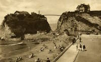
1900: Newquay
Newquay, Cornwall, England, United Kingdom
| Bridgemeister ID: | 800 (added 2003-03-29) |
| Year Completed: | 1900 |
| Name: | Newquay |
| Location: | Newquay, Cornwall, England, United Kingdom |
| Coordinates: | 50.415743 N 5.082486 W |
| Maps: | Acme, GeoHack, Google, OpenStreetMap |
| Principals: | Louis Harper |
| References: | HARPER |
| Use: | Footbridge |
| Status: | In use (last checked: 2019) |
| Main Cables: | Wire |
| Suspended Spans: | 1 |
| Main Span: | 1 x 30.5 meters (100 feet) estimated |
| Deck width: | 4 feet |
Notes:
- Douglas Harper notes: "The pylons have been swathed in concrete, presumably for protection against the elements."
External Links:
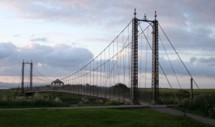
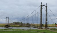
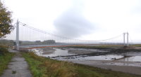
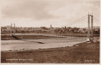
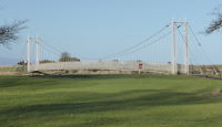
1902: Alexandra
Tain, Ross-Shire, Scotland, United Kingdom - River Tain
| Bridgemeister ID: | 2350 (added 2007-08-18) |
| Year Completed: | 1902 |
| Name: | Alexandra |
| Location: | Tain, Ross-Shire, Scotland, United Kingdom |
| Crossing: | River Tain |
| Coordinates: | 57.81496 N 4.04622 W |
| Maps: | Acme, GeoHack, Google, OpenStreetMap |
| Principals: | Rose Street Foundry (Inverness) |
| Use: | Footbridge |
| Status: | In use (last checked: 2018) |
| Main Cables: | Wire (steel) |
| Suspended Spans: | 1 |
| Main Span: | 1 x 43 meters (141 feet) |
Notes:
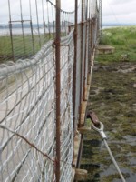
- Closed, 2011. Sign posted at the bridge in 2011 stated "No pedestrians beyond this point. Footbridge Closed. Imminent Danger of Collapse."
- Most news stories on the bridge's condition state it was closed continuously, due to deteriorating conditions, from 2011 through 2015, but this was not entirely accurate. The bridge was open in August 2014, but restricted to two people at a time (see accompanying photo sets). Closed again, sometime soon after. Contract awarded for refurbishment, April 2015.
1902: Gobbins
Whitehead vicinity, Northern Ireland, United Kingdom
| Bridgemeister ID: | 1357 (added 2004-05-15) |
| Year Completed: | 1902 |
| Name: | Gobbins |
| Location: | Whitehead vicinity, Northern Ireland, United Kingdom |
| At or Near Feature: | Gobbins Cliff Path |
| Coordinates: | 54.808223 N 5.691737 W |
| Maps: | Acme, GeoHack, Google, OpenStreetMap |
| Use: | Footbridge |
| Status: | Replaced, 2015 |
| Main Cables: | Wire |
| Suspended Spans: | 1 |
Notes:
- 2014-2015: Gobbins Cliff Path restored to its original condition, including replacement of the suspension bridge.
- Replaced by 2015 Gobbins - Whitehead vicinity, Northern Ireland, United Kingdom.

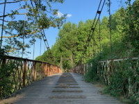
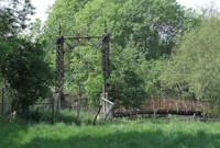
1903: Pickhill
Pickhill, Wales, United Kingdom - River Dee
| Bridgemeister ID: | 4562 (added 2020-06-01) |
| Year Completed: | 1903 |
| Name: | Pickhill |
| Also Known As: | Pickhill Meadows |
| Location: | Pickhill, Wales, United Kingdom |
| Crossing: | River Dee |
| Coordinates: | 53.017265 N 2.884666 W |
| Maps: | Acme, GeoHack, Google, OpenStreetMap |
| Principals: | David Rowell & Co. |
| Use: | Vehicular (one-lane) |
| Status: | Restricted to foot traffic (last checked: 2020) |
| Main Cables: | Wire (steel) |
| Suspended Spans: | 1 |
| Main Span: | 1 x 41 meters (134.5 feet) |
| Deck width: | 3 meters |
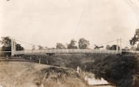
1903: Sands
Swalwell, England, United Kingdom - River Derwent
| Bridgemeister ID: | 1251 (added 2004-02-21) |
| Year Completed: | 1903 |
| Name: | Sands |
| Also Known As: | Hikey |
| Location: | Swalwell, England, United Kingdom |
| Crossing: | River Derwent |
| Coordinates: | 54.956267 N 1.6877 W |
| Maps: | Acme, GeoHack, Google, OpenStreetMap |
| Principals: | David Rowell & Co. |
| Use: | Footbridge |
| Status: | In use (last checked: 2007) |
| Main Cables: | Wire |
| Suspended Spans: | 1 |


1904: (footbridge)
Conwy, Wales, United Kingdom - River Conwy
| Bridgemeister ID: | 512 (added before 2003) |
| Year Completed: | 1904 |
| Name: | (footbridge) |
| Location: | Conwy, Wales, United Kingdom |
| Crossing: | River Conwy |
| Coordinates: | 53.280346 N 3.823733 W |
| Maps: | Acme, GeoHack, Google, OpenStreetMap |
| Principals: | Alfred Thorne |
| Use: | Footbridge |
| Status: | Removed |
| Main Cables: | Wire (steel) |
| Suspended Spans: | 1 |
Notes:
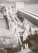
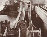
- This entry refers to the steel suspension footbridge nestled between Telford's suspension bridge and Stephenson's rail bridge. Click the photo to get a better view of this bridge. According to Susan Ellis, Senior Archivist of the Conwy County Borough Council, the bridge was built on the recommendation of John J. Webster who was hired to inspect Telford's suspension bridge in 1902 "following fears about the safety of its condition. He reported back making various recommendation for strengthening the bridge, including that a separate footbridge be constructed."
- This footbridge was in existence until at least 1957.
- Next to 1826 Conwy (Conway) - Conwy, Wales, United Kingdom.
Annotated Citations:
- "Conway Suspension Bridge." The Engineer, 20 May 1904.
This detailed account of the 1904 reinforcement of Telford's adjacent bridge does not mention the existence of, or building of, an additional footbridge. It does describe adding a cantilevered walkway to one side of Telford's bridge. This walkway was, indeed, built, and can be seen in the linked image on the left side of the older bridge. Thus, it is not entirely clear whether this bridge was actually constructed in 1904 and the work of Alfred Thorne (who was very much associated with the Telford bridge reinforcement project)
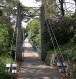
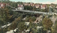
1904: Alum Chine
Bournemouth, England, United Kingdom - Alum Chine
| Bridgemeister ID: | 785 (added 2003-03-16) |
| Year Completed: | 1904 |
| Name: | Alum Chine |
| Location: | Bournemouth, England, United Kingdom |
| Crossing: | Alum Chine |
| Coordinates: | 50.7143 N 1.90058 W |
| Maps: | Acme, GeoHack, Google, OpenStreetMap |
| Principals: | David Rowell & Co. |
| Use: | Footbridge |
| Status: | In use (last checked: 2020) |
| Main Cables: | Wire |
| Suspended Spans: | 1 |
Notes:
- Renovated, 1973. Refurbished, 2004.
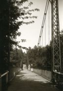
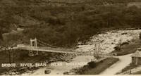
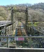
1904: Elan Village
Elan, Rhayader, Wales, United Kingdom - River Elan
| Bridgemeister ID: | 1255 (added 2004-02-28) |
| Year Completed: | 1904 |
| Name: | Elan Village |
| Location: | Elan, Rhayader, Wales, United Kingdom |
| Crossing: | River Elan |
| Coordinates: | 52.27099 N 3.56900 W |
| Maps: | Acme, GeoHack, Google, OpenStreetMap |
| Principals: | Birmingham Water Corporation |
| Status: | Closed, 1988 (last checked: 2013) |
| Suspended Spans: | 1 |
Notes:
- Rebuilt twice.
External Links:
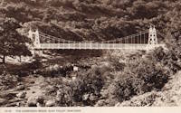
1905: Apley
Apley Park, England, United Kingdom - River Severn
| Bridgemeister ID: | 769 (added 2003-03-13) |
| Year Completed: | 1905 |
| Name: | Apley |
| Also Known As: | Linley |
| Location: | Apley Park, England, United Kingdom |
| Crossing: | River Severn |
| Coordinates: | 52.581949 N 2.434328 W |
| Maps: | Acme, GeoHack, Google, OpenStreetMap |
| Principals: | David Rowell & Co. |
| Use: | Vehicular (one-lane) |
| Status: | In use (last checked: 2011) |
| Main Cables: | Wire (steel) |
| Main Span: | 1 |
Notes:
- Capable of carrying light vehicular traffic.
External Links:

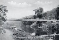
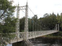
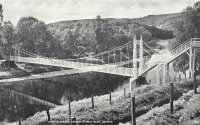
1905: Cambus O'May
Ballater, Scotland, United Kingdom - River Dee
| Bridgemeister ID: | 429 (added before 2003) |
| Year Completed: | 1905 |
| Name: | Cambus O'May |
| Also Known As: | Gordon |
| Location: | Ballater, Scotland, United Kingdom |
| Crossing: | River Dee |
| Coordinates: | 57.065803 N 2.956825 W |
| Maps: | Acme, GeoHack, Google, OpenStreetMap |
| Principals: | James Abernethy & Co. |
| References: | BC2, BC3, BEM, HARPER, HBR, NTB |
| Use: | Footbridge |
| Status: | In use (last checked: April, 2021) |
| Main Cables: | Wire (steel) |
| Suspended Spans: | 1 |
| Main Span: | 1 x 51.8 meters (170 feet) |
Notes:
- 1988: Refurbished (HBR)
- 2015, December: Damaged by the River Dee flood caused by Storm Frank. Closed indefinitely. Repairs expected to start in 2020.
- 2020, August 31: Repairs underway, expected to be completed in approximately 16 weeks.
- 2020, December: Storm Frank repairs now expected to be completed in January 2021.
- 2021, January: Completion of repairs delayed due to COVID-19 pandemic "stay at home" recommendations.
- 2021, April 1: Repairs completed, bridge reopened.
External Links:
- Cambus O' May | Harper Bridges
- The Happy Pontist: Scottish Bridges: 20. Cambus O'May Footbridge
- The Happy Pontist: Scottish Bridges: 43. Cambus O' May Bridge (revisited)
- The Happy Pontist: Scottish Bridges: 55. Cambus O'May Bridge (after the flood)
- Structurae - Structure ID 20019638

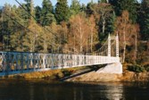
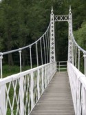
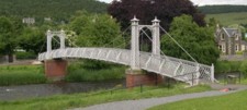
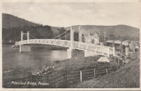
1905: Priorsford
Peebles, Scotland, United Kingdom - River Tweed
| Bridgemeister ID: | 1441 (added 2004-07-31) |
| Year Completed: | 1905 |
| Name: | Priorsford |
| Location: | Peebles, Scotland, United Kingdom |
| Crossing: | River Tweed |
| Coordinates: | 55.649532 N 3.187578 W |
| Maps: | Acme, GeoHack, Google, OpenStreetMap |
| Principals: | Robert Inglis |
| References: | BC3 |
| Use: | Footbridge |
| Status: | In use (last checked: 2014) |
| Main Cables: | Wire (steel) |
| Main Span: | 1 x 29.6 meters (97 feet) |
External Links:

1905: Widnes-Runcorn Transporter
Runcorn, England, United Kingdom - River Mersey, Manchester Ship Canal
| Bridgemeister ID: | 954 (added 2003-10-31) |
| Year Completed: | 1905 |
| Name: | Widnes-Runcorn Transporter |
| Location: | Runcorn, England, United Kingdom |
| Crossing: | River Mersey, Manchester Ship Canal |
| Principals: | J.J. Webster, J.T. Wood, Charles Smith |
| References: | AAJ, BRB, HBE |
| Use: | Transporter |
| Status: | Removed |
| Main Cables: | Wire (steel) |
| Suspended Spans: | 1 |
| Main Span: | 1 x 304.8 meters (1,000 feet) |
External Links:
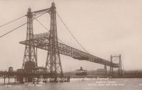
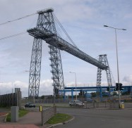
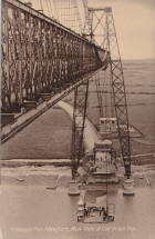
1906: Newport Transporter
Newport, Wales, United Kingdom - River Usk
| Bridgemeister ID: | 939 (added 2003-10-25) |
| Year Completed: | 1906 |
| Name: | Newport Transporter |
| Location: | Newport, Wales, United Kingdom |
| Crossing: | River Usk |
| Coordinates: | 51.570642 N 2.985246 W |
| Maps: | Acme, GeoHack, Google, OpenStreetMap |
| Principals: | Ferdinand Arnodin |
| References: | AAJ, NTB |
| Use: | Transporter |
| Status: | In use (last checked: 2011) |
| Main Cables: | Wire (steel) |
| Suspended Spans: | 1 |
| Main Span: | 1 x 196.6 meters (645 feet) |
External Links:
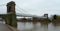
1906: Wilford
West Bridgford, Nottingham, England, United Kingdom - River Trent
| Bridgemeister ID: | 1087 (added 2004-01-01) |
| Year Completed: | 1906 |
| Name: | Wilford |
| Also Known As: | Nottingham, Meadows, Welbeck |
| Location: | West Bridgford, Nottingham, England, United Kingdom |
| Crossing: | River Trent |
| Coordinates: | 52.933167 N 1.137967 W |
| Maps: | Acme, GeoHack, Google, OpenStreetMap |
| Use: | Pipeline and Footbridge |
| Status: | In use (last checked: 2017) |
| Main Cables: | Wire |
| Suspended Spans: | 1 |
| Main Span: | 1 x 68.6 meters (225 feet) |
| Deck width: | 12 feet |
Notes:
- Designed primarily to carry water and gas mains, but also carries a wide footpath.
- Closed, July 2008, after reports of falling debris. In December 2008, Severn Trent Water announced plans to refurbish the bridge in 2009. Bridge was reopened February 12, 2010.
External Links:

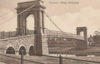
1907: Romney
Kendal, England, United Kingdom - River Kent
| Bridgemeister ID: | 2426 (added 2008-03-12) |
| Year Completed: | 1907 |
| Name: | Romney |
| Also Known As: | Dockwray |
| Location: | Kendal, England, United Kingdom |
| Crossing: | River Kent |
| Coordinates: | 54.33595 N 2.74507 W |
| Maps: | Acme, GeoHack, Google, OpenStreetMap |
| Use: | Footbridge |
| Status: | In use (last checked: 2010) |
| Main Cables: | Wire |
Notes:
- Coordinates are for the current location of the bridge. It was moved there (from its original location where Romney Road meets the River Kent in Kendal) in the 1990s. A sign at the current (2011) bridge says: "The bridge was erected in 1993 on the initiative of Kendal Civic Society. It incorporates part of the structure of the former Romeny Footbridge erected in 1907..."
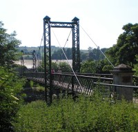
1908: Wardown Park
Luton, Bedfordshire, England, United Kingdom - River Lea
| Bridgemeister ID: | 784 (added 2003-03-16) |
| Year Completed: | 1908 |
| Name: | Wardown Park |
| Location: | Luton, Bedfordshire, England, United Kingdom |
| Crossing: | River Lea |
| At or Near Feature: | Wardown Park |
| Coordinates: | 51.89201 N 0.418833 W |
| Maps: | Acme, GeoHack, Google, OpenStreetMap |
| Use: | Footbridge |
| Status: | In use (last checked: 2015) |
| Main Cables: | Wire |
| Suspended Spans: | 1 |
Notes:
- 2015: Refurbished and reopened after having been closed for several years.
External Links:

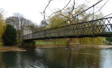
1910: Castle
Shrewsbury, England, United Kingdom
| Bridgemeister ID: | 1919 (added 2005-10-09) |
| Year Completed: | 1910 |
| Name: | Castle |
| Location: | Shrewsbury, England, United Kingdom |
| Principals: | David Rowell & Co. |
| Status: | Replaced, 1951 |
1911: Coronation
Pitlochry, Scotland, United Kingdom - River Tummel
| Bridgemeister ID: | 2621 (added 2018-12-30) |
| Year Completed: | 1911 |
| Name: | Coronation |
| Location: | Pitlochry, Scotland, United Kingdom |
| Crossing: | River Tummel |
| At or Near Feature: | Linn of Tummel vicinity |
| Coordinates: | 56.720118 N 3.793993 W |
| Maps: | Acme, GeoHack, Google, OpenStreetMap |
| Use: | Footbridge |
| Status: | In use (last checked: 2022) |
| Main Cables: | Wire (steel) |
| Suspended Spans: | 1 |
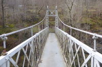
1911: Dryburgh Abbey
Dryburgh and St. Boswells, Scotland, United Kingdom - River Tweed
| Bridgemeister ID: | 6218 (added 2021-07-16) |
| Year Completed: | 1911 |
| Name: | Dryburgh Abbey |
| Location: | Dryburgh and St. Boswells, Scotland, United Kingdom |
| Crossing: | River Tweed |
| Coordinates: | 55.580452 N 2.654235 W |
| Maps: | Acme, GeoHack, Google, OpenStreetMap |
| Use: | Footbridge |
| Status: | In use (last checked: 2021) |
| Main Cables: | Wire (steel) |
| Suspended Spans: | 1 |
Notes:
- Although the current (as of 2021) Dryburgh Abbey bridge is often attributed to 1872, it more closely resembles bridges built starting in the 1890s.
- Replaced 1872 Dryburgh Abbey - Dryburgh and St. Boswells, Scotland, United Kingdom.
- Near Mertoun Estate - Mertoun, Scotland, United Kingdom.
External Links:
- The Happy Pontist: Scottish Bridges: 15. Dryburgh Abbey Footbridge
- Structurae - Structure ID 20016083
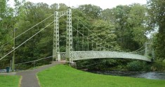
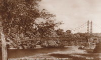
1911: King George V
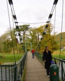
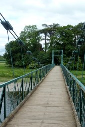
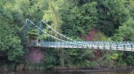
Newton Stewart, Scotland, United Kingdom - River Cree
| Bridgemeister ID: | 2468 (added 2008-12-19) |
| Year Completed: | 1911 |
| Name: | King George V |
| Location: | Newton Stewart, Scotland, United Kingdom |
| Crossing: | River Cree |
| Coordinates: | 54.967048 N 4.485349 W |
| Maps: | Acme, GeoHack, Google, OpenStreetMap |
| Principals: | D. H. and F. Reid Engineers, Victoria Bridge Works |
| Use: | Footbridge |
| Status: | In use (last checked: 2019) |
| Main Cables: | Wire (steel) |
| Suspended Spans: | 1 |
Notes:
- Plaques posted at the bridge indicate major refurbishments in 1982 and 2001.
External Links:
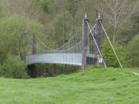
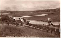
1911: Swing
Llandeilo, Wales, United Kingdom - Towy River
| Bridgemeister ID: | 1399 (added 2004-07-04) |
| Year Completed: | 1911 |
| Name: | Swing |
| Also Known As: | King's, Shaky |
| Location: | Llandeilo, Wales, United Kingdom |
| Crossing: | Towy River |
| Coordinates: | 51.884462 N 3.986061 W |
| Maps: | Acme, GeoHack, Google, OpenStreetMap |
| Use: | Footbridge |
| Status: | In use (last checked: 2018) |
| Main Cables: | Wire (steel) |
| Suspended Spans: | 1 |
External Links:
1912: Howley
Howley, Warrington, Cheshire and Latchford, England, United Kingdom - River Mersey
| Bridgemeister ID: | 1836 (added 2005-07-02) |
| Year Completed: | 1912 |
| Name: | Howley |
| Location: | Howley, Warrington, Cheshire and Latchford, England, United Kingdom |
| Crossing: | River Mersey |
| At or Near Feature: | Victoria Park |
| Coordinates: | 53.387333 N 2.57845 W |
| Maps: | Acme, GeoHack, Google, OpenStreetMap |
| Principals: | David Rowell & Co. |
| Use: | Footbridge |
| Status: | In use (last checked: 2012) |
| Main Cables: | Wire (steel) |
| Suspended Spans: | 1 |
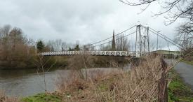
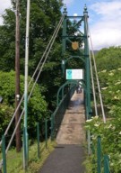
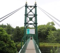
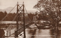
1913: Port-na-Craig
Pitlochry and Port-na Craig, Scotland, United Kingdom - River Tummel
| Bridgemeister ID: | 547 (added before 2003) |
| Year Completed: | 1913 |
| Name: | Port-na-Craig |
| Location: | Pitlochry and Port-na Craig, Scotland, United Kingdom |
| Crossing: | River Tummel |
| Coordinates: | 56.698167 N 3.733017 W |
| Maps: | Acme, GeoHack, Google, OpenStreetMap |
| Use: | Footbridge |
| Status: | In use (last checked: 2014) |
| Main Cables: | Wire (steel) |
| Suspended Spans: | 1 |
1920: Reeth Swing
Reeth vicinity, Swaledale, England, United Kingdom - River Swale
| Bridgemeister ID: | 807 (added 2003-03-30) |
| Year Completed: | 1920 |
| Name: | Reeth Swing |
| Location: | Reeth vicinity, Swaledale, England, United Kingdom |
| Crossing: | River Swale |
| Coordinates: | 54.385673 N 1.952474 W |
| Maps: | Acme, GeoHack, Google, OpenStreetMap |
| Principals: | J. Hird |
| Use: | Footbridge |
| Status: | In use (last checked: 2014) |
| Main Cables: | Wire |
| Suspended Spans: | 1 |
Notes:
- Destroyed by flood, rebuilt in 2002.
External Links:
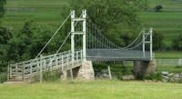
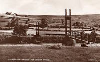
1922: Llanstephan
Llanstephan, Wales, United Kingdom - River Wye
| Bridgemeister ID: | 1964 (added 2005-11-12) |
| Year Completed: | 1922 |
| Name: | Llanstephan |
| Location: | Llanstephan, Wales, United Kingdom |
| Crossing: | River Wye |
| Coordinates: | 52.06604 N 3.29614 W |
| Maps: | Acme, GeoHack, Google, OpenStreetMap |
| Principals: | David Rowell & Co. |
| Use: | Vehicular (one-lane) |
| Status: | In use (last checked: 2021) |
| Main Cables: | Wire (steel) |
| Suspended Spans: | 1 |
External Links:
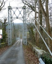
1922: Porthill
Shrewsbury, England, United Kingdom - River Severn
| Bridgemeister ID: | 434 (added before 2003) |
| Year Completed: | 1922 |
| Name: | Porthill |
| Location: | Shrewsbury, England, United Kingdom |
| Crossing: | River Severn |
| Coordinates: | 52.708233 N 2.763083 W |
| Maps: | Acme, GeoHack, Google, OpenStreetMap |
| Principals: | David Rowell & Co. |
| References: | NTB |
| Use: | Footbridge |
| Status: | In use (last checked: 2010) |
| Suspended Spans: | 1 |
External Links:
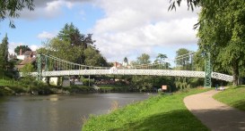
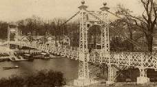
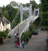
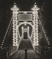
1923: Queens Park
Chester and Handbridge, England, United Kingdom - River Dee
| Bridgemeister ID: | 435 (added before 2003) |
| Year Completed: | 1923 |
| Name: | Queens Park |
| Location: | Chester and Handbridge, England, United Kingdom |
| Crossing: | River Dee |
| Coordinates: | 53.18796 N 2.88421 W |
| Maps: | Acme, GeoHack, Google, OpenStreetMap |
| Principals: | Charles Greenwood, David Rowell & Co., William E. Barker |
| References: | BRB, NTB |
| Use: | Footbridge |
| Status: | In use (last checked: 2019) |
| Main Cables: | Wire (steel) |
| Suspended Spans: | 1 |
| Main Span: | 1 x 83.8 meters (275 feet) |
Notes:
External Links:
- Chesterwiki - Suspension Bridge. Interesting details about the bridge.
1924: Burrator Reservoir
Sheepstor, England, United Kingdom - Burrator Reservoir
| Bridgemeister ID: | 2314 (added 2007-05-05) |
| Year Completed: | 1924 |
| Name: | Burrator Reservoir |
| Location: | Sheepstor, England, United Kingdom |
| Crossing: | Burrator Reservoir |
| Use: | Vehicular |
| Status: | Removed |
| Main Cables: | Wire (steel) |
Notes:
- Large temporary bridge built to carry traffic across the reservoir while work was underway to raise Burrator Dam. Possibly completed 1925.
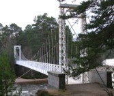
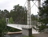
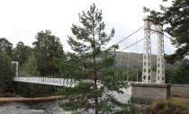
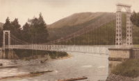
1924: Invercauld
Braemar vicinity, Scotland, United Kingdom - River Dee
| Bridgemeister ID: | 1906 (added 2005-10-08) |
| Year Completed: | 1924 |
| Name: | Invercauld |
| Also Known As: | Ballochbuie, Garbh Allt Shiel |
| Location: | Braemar vicinity, Scotland, United Kingdom |
| Crossing: | River Dee |
| Coordinates: | 57.001768 N 3.322743 W |
| Maps: | Acme, GeoHack, Google, OpenStreetMap |
| Principals: | James Abernethy & Co. |
| References: | HARPER, HBR |
| Use: | Footbridge |
| Status: | In use (last checked: 2014) |
| Main Cables: | Wire (steel) |
| Suspended Spans: | 1 |
External Links:
1926: Fron
Fron, Llandyssil, Wales, United Kingdom - River Severn
| Bridgemeister ID: | 4617 (added 2020-06-07) |
| Year Completed: | 1926 |
| Name: | Fron |
| Location: | Fron, Llandyssil, Wales, United Kingdom |
| Crossing: | River Severn |
| Coordinates: | 52.568132 N 3.207281 W |
| Maps: | Acme, GeoHack, Google, OpenStreetMap |
| Principals: | David Rowell & Co. |
| Use: | Footbridge |
| Status: | Extant (last checked: 2009) |
| Main Cables: | Wire (steel) |
External Links:
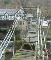
1929: Chainbridge
Berwyn, Llangollen, Wales, United Kingdom - River Dee
| Bridgemeister ID: | 1303 (added 2004-04-09) |
| Year Completed: | 1929 |
| Name: | Chainbridge |
| Also Known As: | Chain |
| Location: | Berwyn, Llangollen, Wales, United Kingdom |
| Crossing: | River Dee |
| Coordinates: | 52.98025 N 3.1946 W |
| Maps: | Acme, GeoHack, Google, OpenStreetMap |
| Principals: | Sir Henry Robertson |
| Use: | Footbridge |
| Status: | In use (last checked: 2019) |
| Main Cables: | Chain |
| Suspended Spans: | 1 |
| Main Span: | 1 |
Notes:
- Crosses both River Dee and Llangollen Canal
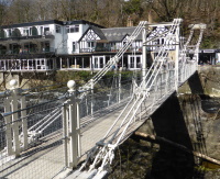
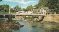
- A thorough report on these bridges was published in 2010 by the Royal Commission on the Ancient and Historical Monuments of Wales (RCAHMW), Chain Bridge, Llantysilio, Denbighshire. The Pickering bridge (built 1817, according to the report) was contructed with the deck laid on the chains. This bridge was removed in 1870 but appears not to have been replaced until at least 1876. The new bridge, not simply refurbished, was constructed with the deck supported by the chains underneath, but in an "underspanned" fashion with small pillars resting on the chains, supporting a level deck. This bridge was destroyed by flood on Feb. 16, 1928. The report also investigates whether the chains of the current (1929) bridge are the original chains from the 1817 Pickering bridge and concludes there is evidence "supporting the hypothesis that the chains we see on the bridge today are same as those put on the bridge in 1817" and adds "If the present chains are the originals, there is little reason to doubt that they are the oldest suspension bridge chains in the western world."
- 2015: Underwent major restoration and reopened.
External Links:
- Chainbridge Hotel. The bridge is situated next to the hotel. Their web site notes the original "chain bridge" at this location was built in 1814 by Exuperious Pickering and was refurbished in 1870 and rebuilt in 1929.
- Structurae - Structure ID 20074318
1930: Sappers'
Betws-y-Coed, Wales, United Kingdom - River Conwy
| Bridgemeister ID: | 445 (added before 2003) |
| Year Completed: | 1930 |
| Name: | Sappers' |
| Location: | Betws-y-Coed, Wales, United Kingdom |
| Crossing: | River Conwy |
| Coordinates: | 53.09221 N 3.79928 W |
| Maps: | Acme, GeoHack, Google, OpenStreetMap |
| Principals: | David Rowell & Co. |
| Use: | Footbridge |
| Status: | Closed, December 2021 (last checked: 2023) |
| Main Cables: | Wire (steel) |
| Suspended Spans: | 1 |
Notes:
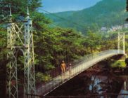
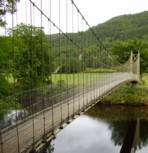
- 2021, December: Closed due to deteriorating condition. Repairs expected to start in April 2022.
- 2023, February: Still closed. May be replaced.
Annotated Citations:
- Evans, Hari. "Near century old Snowdonia wobbly bridge that's rotting away and may soon be replaced." North Wales Live, 9 Feb. 2023, https://www.dailypost.co.uk/news/north-wales-news/near-century-old-snowdonia-wobbly-26198160.
"The suspension bridge used to be renowned for its wobbly midpoint and was a key shortcut across the River Conwy for locals and tourists. However, structural reviews conducted last year found that virtually the entire bridge would need to be refurbished, with the entire timber deck as well as other parts replaced completely."
External Links:
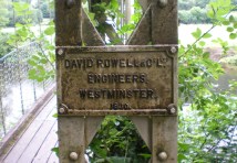
1934: (footbridge)
Ilkley, England, United Kingdom - River Wharfe
| Bridgemeister ID: | 1261 (added 2004-03-13) |
| Year Completed: | 1934 |
| Name: | (footbridge) |
| Location: | Ilkley, England, United Kingdom |
| Crossing: | River Wharfe |
| Coordinates: | 53.93241 N 1.81483 W |
| Maps: | Acme, GeoHack, Google, OpenStreetMap |
| Principals: | David Rowell & Co. |
| Use: | Footbridge |
| Status: | In use (last checked: 2022) |
| Main Cables: | Wire (steel) |
| Suspended Spans: | 1 |
Notes:
- Refurbished, 2001.
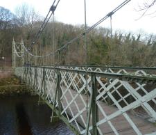
1935: Gaol Ferry
Bristol, England, United Kingdom - River Avon-New Cut
| Bridgemeister ID: | 1917 (added 2005-10-09) |
| Year Completed: | 1935 |
| Name: | Gaol Ferry |
| Also Known As: | Southville, St. Paul's, Coronation Road |
| Location: | Bristol, England, United Kingdom |
| Crossing: | River Avon-New Cut |
| Coordinates: | 51.445871 N 2.599464 W |
| Maps: | Acme, GeoHack, Google, OpenStreetMap |
| Principals: | David Rowell & Co. |
| Use: | Footbridge |
| Status: | Closed, August 2022 (last checked: August 2023) |
| Main Cables: | Wire (steel) |
| Suspended Spans: | 1 |
Notes:
- 2023, September: The bridge is scheduled to reopen following repairs.
Annotated Citations:
- Cork, Tristan. "Key footbridge connecting South Bristol to city centre to close for months." Bristol Post, 9 Dec. 2021, https://www.bristolpost.co.uk/news/bristol-news/key-footbridge-connecting-south-bristol-6326291.
Bridge is undergoing some repairs in late December 2021, but is still open. Expected to be closed January-March 2022 for more extensive repairs.
- Woolerton, Betty. "Gaol Ferry Bridge likely to be closed for another three months." Bristol 24/7, 24 Feb. 2023, https://www.bristol247.com/news-and-features/news/gaol-ferry-bridge-likely-to-be-closed-for-another-three-months/.
"A discovery of 'paper thin' steel work on Gaol Ferry Bridge has been cited as the reason for the extension of its closure by an unprecedented extra three months… Now, the council’s cabinet member for transport has apologised after contractors Griffiths have found 'the bridge is in a worse condition than we had thought.'"
External Links:
- Date for Gaol Ferry bridge closure in Bristol announced - BBC News. The bridge will be closed for 6-9 months from August 2022 for restoration.
- Structurae - Structure ID 20082369
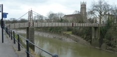
1935: Goyt Valley
Buxton, England, United Kingdom - River Goyt
| Bridgemeister ID: | 520 (added before 2003) |
| Year Completed: | 1935 |
| Name: | Goyt Valley |
| Also Known As: | Buxton |
| Location: | Buxton, England, United Kingdom |
| Crossing: | River Goyt |
| References: | NTB |
| Use: | Footbridge |
| Status: | Removed, 1960s |
| Main Cables: | Wire |
| Suspended Spans: | 1 |
Notes:
- Dismantled during construction of the Errwood Reservoir.
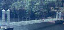
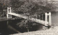
1935: Trews Weir
Exeter, Devon, England, United Kingdom - River Exe
| Bridgemeister ID: | 915 (added 2003-10-11) |
| Year Completed: | 1935 |
| Name: | Trews Weir |
| Also Known As: | New Cricklepit |
| Location: | Exeter, Devon, England, United Kingdom |
| Crossing: | River Exe |
| Coordinates: | 50.71295 N 3.52333 W |
| Maps: | Acme, GeoHack, Google, OpenStreetMap |
| Use: | Footbridge |
| Status: | In use (last checked: 2008) |
| Main Cables: | Wire (steel) |
| Suspended Spans: | 1 |
External Links:
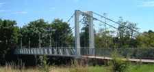
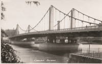
1937: Chelsea
London, England, United Kingdom - River Thames
| Bridgemeister ID: | 450 (added before 2003) |
| Year Completed: | 1937 |
| Name: | Chelsea |
| Location: | London, England, United Kingdom |
| Crossing: | River Thames |
| Coordinates: | 51.48438 N 0.14984 W |
| Maps: | Acme, GeoHack, Google, OpenStreetMap |
| Principals: | Sir Pierson Frank, Rendel, Tritton and Palmer |
| References: | AAJ, BTH |
| Use: | Vehicular (three or more lanes), with walkway |
| Status: | In use (last checked: 2019) |
| Main Cables: | Wire (steel) |
| Suspended Spans: | 3 |
| Main Span: | 1 x 107.3 meters (352 feet) |
| Side Spans: | 2 x 52.7 meters (173 feet) |
| Deck width: | 64 feet |
Notes:
External Links:
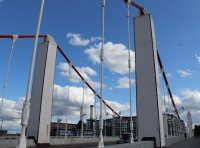
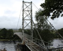
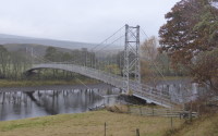
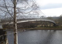
1938: Brae Doune
Brae Doune, Scotland, United Kingdom - River Oykel
| Bridgemeister ID: | 2635 (added 2019-03-02) |
| Year Completed: | 1938 |
| Name: | Brae Doune |
| Also Known As: | Tuitean |
| Location: | Brae Doune, Scotland, United Kingdom |
| Crossing: | River Oykel |
| Coordinates: | 57.974258 N 4.638333 W |
| Maps: | Acme, GeoHack, Google, OpenStreetMap |
| Principals: | John Henderson and Co. (Aberdeen) |
| Use: | Footbridge |
| Status: | Closed (last checked: 2022) |
| Main Cables: | Wire (steel) |
| Suspended Spans: | 1 |
| Main Span: | 1 x 91.4 meters (300 feet) |
1939: Thames Ditton Island
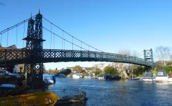
Thames Ditton, England, United Kingdom - River Thames
| Bridgemeister ID: | 2089 (added 2006-07-02) |
| Year Completed: | 1939 |
| Name: | Thames Ditton Island |
| Location: | Thames Ditton, England, United Kingdom |
| Crossing: | River Thames |
| Coordinates: | 51.39303 N 0.33127 W |
| Maps: | Acme, GeoHack, Google, OpenStreetMap |
| Principals: | David Rowell & Co. |
| Use: | Footbridge |
| Status: | In use (last checked: 2012) |
| Main Cables: | Wire |
| Suspended Spans: | 3 |
| Main Span: | 1 |
| Side Spans: | 2 |
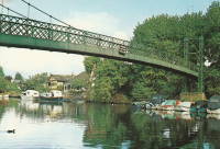
1946: Doveridge
Doveridge, England, United Kingdom - River Dove
| Bridgemeister ID: | 2173 (added 2007-01-13) |
| Year Completed: | 1946 |
| Name: | Doveridge |
| Location: | Doveridge, England, United Kingdom |
| Crossing: | River Dove |
| Coordinates: | 52.903057 N 1.836045 W |
| Maps: | Acme, GeoHack, Google, OpenStreetMap |
| Principals: | David Rowell & Co. |
| Use: | Footbridge |
| Status: | In use (last checked: 2021) |
| Main Cables: | Wire (steel) |
| Suspended Spans: | 1 |
Notes:
- 2021, January: Experienced severe flooding due to Storm Christoph.
- Replaced 1898 Doveridge - Doveridge, England, United Kingdom.

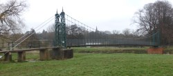
1950: Burgate
Burgate, Fordingbridge vicinity, Hampshire, England, United Kingdom - River Avon
| Bridgemeister ID: | 820 (added 2003-05-31) |
| Year Completed: | 1950 |
| Name: | Burgate |
| Location: | Burgate, Fordingbridge vicinity, Hampshire, England, United Kingdom |
| Crossing: | River Avon |
| Coordinates: | 50.938883 N 1.781117 W |
| Maps: | Acme, GeoHack, Google, OpenStreetMap |
| Principals: | E.W.H. Gifford |
| Use: | Footbridge |
| Status: | In use (last checked: 2013) |
| Suspended Spans: | 1 |
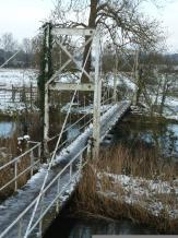
1951: Dinckley
Dinckley, Lancashire and Hurst Green, Lancashire, England, United Kingdom - River Ribble
| Bridgemeister ID: | 914 (added 2003-10-11) |
| Year Completed: | 1951 |
| Name: | Dinckley |
| Location: | Dinckley, Lancashire and Hurst Green, Lancashire, England, United Kingdom |
| Crossing: | River Ribble |
| Coordinates: | 53.82456 N 2.4788 W |
| Maps: | Acme, GeoHack, Google, OpenStreetMap |
| Use: | Footbridge |
| Status: | Replaced, April 2019 |
| Main Cables: | Wire (steel) |
| Suspended Spans: | 1 |
Notes:
- Damaged by flood and subsequently closed, December 2015.
- Replaced with a non-suspension bridge, April 2019.
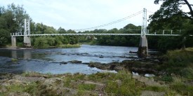
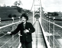
1951: Festival
Aberhafesp, Wales, United Kingdom - River Severn
| Bridgemeister ID: | 1921 (added 2005-10-09) |
| Year Completed: | 1951 |
| Name: | Festival |
| Location: | Aberhafesp, Wales, United Kingdom |
| Crossing: | River Severn |
| Coordinates: | 52.521329 N 3.389172 W |
| Maps: | Acme, GeoHack, Google, OpenStreetMap |
| Principals: | David Rowell & Co. |
| Use: | Footbridge |
| Status: | In use (last checked: 2016) |
| Main Cables: | Wire (steel) |
| Suspended Spans: | 1 |
External Links:
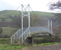
1958: (footbridge)
Glanamman, Ammanford, Wales, United Kingdom - Amman River
| Bridgemeister ID: | 1398 (added 2004-07-04) |
| Year Completed: | 1958 |
| Name: | (footbridge) |
| Location: | Glanamman, Ammanford, Wales, United Kingdom |
| Crossing: | Amman River |
| Coordinates: | 51.8007 N 3.95425 W |
| Maps: | Acme, GeoHack, Google, OpenStreetMap |
| Principals: | David Rowell & Co. |
| Use: | Footbridge |
| Status: | In use (last checked: 2013) |
| Main Cables: | Wire (steel) |
| Suspended Spans: | 1 |
Notes:
- Allan Agate writes: "I was the Project Engineer for this footbridge and can therefore confirm it was designed and built by David Rowell Ltd and almost certainly the last suspension bridge they built. It was a hybrid of earlier bridges making use of new bolted hot rolled sections instead of riveted composite tower construction. The date was about 1962/3." I am not sure of the provenance of the 1958 date associated with this bridge and I don't have reason to question Mr. Agate's recollection of the bridge completed a few years later.
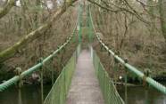
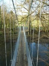
1962: Tamar
Devon and Cornwall, England, United Kingdom - Tamar River estuary
| Bridgemeister ID: | 461 (added before 2003) |
| Year Completed: | 1962 |
| Name: | Tamar |
| Location: | Devon and Cornwall, England, United Kingdom |
| Crossing: | Tamar River estuary |
| Coordinates: | 50.40917 N 4.2033 W |
| Maps: | Acme, GeoHack, Google, OpenStreetMap |
| Principals: | Mott, Hay and Anderson |
| References: | AOB, BBR, NTB, WOT |
| Use: | Vehicular (major highway) |
| Status: | In use (last checked: 2021) |
| Main Cables: | Wire (steel) |
| Suspended Spans: | 3 |
| Main Span: | 1 x 336.4 meters (1,103.7 feet) |
| Side Spans: | 2 |
Notes:
- 2001: Major strengthening and widening project completed.
- 2021: Deck resurfacing project underway including replacement of expansion joints.
External Links:
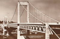
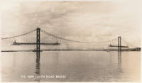
1964: Forth Road
Queensferry, Scotland, United Kingdom - Firth of Forth
| Bridgemeister ID: | 463 (added before 2003) |
| Year Completed: | 1964 |
| Name: | Forth Road |
| Location: | Queensferry, Scotland, United Kingdom |
| Crossing: | Firth of Forth |
| Coordinates: | 56.004020 N 3.404095 W |
| Maps: | Acme, GeoHack, Google, OpenStreetMap |
| References: | BBR, BC3, BDU, BFL, FRB, NTB, WOT |
| Use: | Vehicular (major highway), with walkway |
| Status: | In use (last checked: 2021) |
| Main Cables: | Wire (steel) |
| Suspended Spans: | 3 |
| Main Span: | 1 x 1,006 meters (3,300.5 feet) |
| Side Spans: | 2 x 408 meters (1,338.6 feet) |
Notes:
- December 4, 2015: Closed to all traffic because of structural issues. Reopened for lighter traffic, December 23, 2015. Fully reopened February 20, 2016.
- September 5, 2017: All traffic diverted to newly-opened nearby Queensferry Crossing. Closed completely for repairs. Reopened February 1, 2018 but restricted to public transportation (buses and taxis), pedestrians, and cyclists.
External Links:
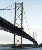

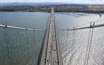
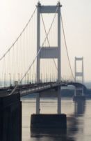
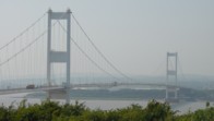
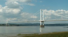
1966: Severn
Aust and Beachley, England, United Kingdom - River Severn
| Bridgemeister ID: | 465 (added before 2003) |
| Year Completed: | 1966 |
| Name: | Severn |
| Also Known As: | First Severn Crossing |
| Location: | Aust and Beachley, England, United Kingdom |
| Crossing: | River Severn |
| Coordinates: | 51.610422 N 2.641658 W |
| Maps: | Acme, GeoHack, Google, OpenStreetMap |
| References: | AOB, BAAW, BBR, BDU, BFL, COB, NTB, SEV |
| Use: | Vehicular (major highway) |
| Status: | In use (last checked: 2021) |
| Main Cables: | Wire (steel) |
| Suspended Spans: | 3 |
| Main Span: | 1 x 987.6 meters (3,240 feet) |
| Side Spans: | 2 x 304.8 meters (1,000 feet) |
External Links:
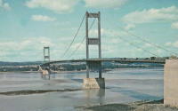
1973: (footbridge)
Newtown, Wales, United Kingdom - River Severn
| Bridgemeister ID: | 4616 (added 2020-06-07) |
| Year Completed: | 1973 |
| Name: | (footbridge) |
| Location: | Newtown, Wales, United Kingdom |
| Crossing: | River Severn |
| At or Near Feature: | Dolerw Park |
| Coordinates: | 52.514964 N 3.319958 W |
| Maps: | Acme, GeoHack, Google, OpenStreetMap |
| Use: | Footbridge |
| Status: | In use (last checked: 2018) |
| Main Cables: | Wire (steel) |
| Suspended Spans: | 1 |
External Links:
1980: Shakin
Burnhervie, Inverurie vicinity, Scotland, United Kingdom - River Don
| Bridgemeister ID: | 1578 (added 2005-01-22) |
| Year Completed: | 1980 |
| Name: | Shakin |
| Location: | Burnhervie, Inverurie vicinity, Scotland, United Kingdom |
| Crossing: | River Don |
| Coordinates: | 57.261031 N 2.440388 W |
| Maps: | Acme, GeoHack, Google, OpenStreetMap |
| Use: | Footbridge |
| Status: | Replaced, 2005 |
| Main Cables: | Wire (steel) |
| Suspended Spans: | 1 |
Notes:
- Replaced by a cable-stayed bridge, 2005.
- Replaced 1880 Burnhervie - Burnhervie, Inverurie vicinity, Scotland, United Kingdom.
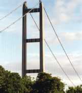
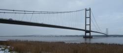
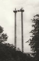
1981: Humber
Hull, Humberside, England, United Kingdom - Humber River
| Bridgemeister ID: | 475 (added before 2003) |
| Year Completed: | 1981 |
| Name: | Humber |
| Location: | Hull, Humberside, England, United Kingdom |
| Crossing: | Humber River |
| Coordinates: | 53.70654 N 0.44997 W |
| Maps: | Acme, GeoHack, Google, OpenStreetMap |
| Principals: | Gilbert Roberts, Bill Harvey, Freeman Fox & Partners |
| References: | AOB, BAR, BC3, BDU, BFL |
| Use: | Vehicular (four-lane), with walkway |
| Status: | In use (last checked: 2021) |
| Main Cables: | Wire (steel) |
| Suspended Spans: | 3 |
| Main Span: | 1 x 1,410 meters (4,626 feet) |
| Side Spans: | 1 x 280 meters (918.6 feet), 1 x 530 meters (1,738.8 feet) |
| Deck width: | 28.5 meters |
Notes:
- Became longest suspension bridge by eclipsing 1964 Verrazzano Narrows (Verrazano Narrows) - Brooklyn and Staten Island, New York, USA.
- Eclipsed by new longest suspension bridge 1998 Akashi Kaikyo (明石海峡大橋) - Maiko, Tarumi-ward, Kobe and Matsuho, Awaji Island, Hyogo, Japan.
External Links:
1982: (footbridge)
Glen Nevis vicinity, Scotland, United Kingdom - River Nevis
| Bridgemeister ID: | 1458 (added 2004-08-21) |
| Year Completed: | 1982 |
| Name: | (footbridge) |
| Location: | Glen Nevis vicinity, Scotland, United Kingdom |
| Crossing: | River Nevis |
| Coordinates: | 56.811717 N 5.076033 W |
| Maps: | Acme, GeoHack, Google, OpenStreetMap |
| Use: | Footbridge |
| Status: | In use (last checked: 2009) |
| Main Cables: | Wire (steel) |
| Suspended Spans: | 1 |
| Main Span: | 1 x 32.6 meters (107 feet) |
Notes:
- This is not the popular wire rope crossing at Glen Nevis which is literally three ropes -- two to hold onto and one to walk on. Instead, this listing is a traditional suspension footbridge just north of Glen Nevis.
- Don McGillivray worked on this bridge and sent information about its construction.
"The Suspension bridge was principally built by five Royal Engineers from 15 Field Support Squadron Royal Engineers in the summer of 1982. They were Sapper Terry Bradley (Metal workworker) Sapper Paul Brookes (Draughtsman), Sapper Ian Duggan (Surveyor), Sapper Taff Green (Draughtsman) Sapper Don McGillivray (Blacksmith).
"The pier footings and anchorages were excavated by hand as the plant machines were being used on another project at Caol and upriver at the priority bridge opposite the YMCA.The Accrow shuttering and Re-bar was humped and Concrete was pumped across the river over a series of aluminium Mk4 assualt boats. Once the concrete cured, the steel work, provided by Highland Engineering was manhandled across the river using the same boats. The steel uprights and main cable were raised and positioned using a block and tackle from a wooden Gyn. The main cables were anchored on the east bank and were tensioned on the west bank using two tirfor winches. The hangers and stringers were strung out from the west bank in a series like stepping stones until the decking could be positioned.
"The Bridge took five weeks start to finish the best part of the build was the weather which was hot and as we were constantly dropping tools etc. in the river, you had to jump in after it. We later moved up to finish the two span through deck bridge at the YMCA. This bridge replaced an old narrow bridge that used to be a part of a WW2 Mulberry Harbour section."
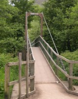
1983: (footbridge)
Glenlivet, Scotland, United Kingdom - River Livet
| Bridgemeister ID: | 2638 (added 2019-03-02) |
| Year Completed: | 1983 |
| Name: | (footbridge) |
| Location: | Glenlivet, Scotland, United Kingdom |
| Crossing: | River Livet |
| At or Near Feature: | Speyside Way - Tomintoul Spur |
| Coordinates: | 57.347297 N 3.331187 W |
| Maps: | Acme, GeoHack, Google, OpenStreetMap |
| Use: | Footbridge |
| Status: | In use (last checked: 2014) |
| Main Cables: | Wire (steel) |
| Suspended Spans: | 1 |
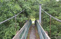
1988: (footbridge)
Inverness, Scotland, United Kingdom - River Ness
| Bridgemeister ID: | 905 (added 2003-10-11) |
| Year Completed: | 1988 |
| Name: | (footbridge) |
| Location: | Inverness, Scotland, United Kingdom |
| Crossing: | River Ness |
| At or Near Feature: | Ness Islands |
| Coordinates: | 57.462946 N 4.233579 W |
| Maps: | Acme, GeoHack, Google, OpenStreetMap |
| Principals: | Cruden and Tough |
| References: | HBR |
| Use: | Footbridge |
| Status: | In use (last checked: 2019) |
| Main Cables: | Wire (steel) |
| Suspended Spans: | 3 |
| Main Span: | 1 |
| Side Spans: | 2 |
Notes:
- One of two footbridges in the Ness Islands near the locations of the two 1853 Ness Islands bridges. This one has towers that are more in the river than the other 1988 bridge.
- Near 1988 (footbridge) - Inverness, Scotland, United Kingdom.
- See 1853 General's Well - Inverness, Scotland, United Kingdom.
- See 1853 Island Bank Road - Inverness, Scotland, United Kingdom.
External Links:
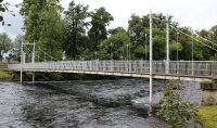
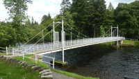
1988: (footbridge)
Inverness, Scotland, United Kingdom - River Ness
| Bridgemeister ID: | 906 (added 2003-10-11) |
| Year Completed: | 1988 |
| Name: | (footbridge) |
| Location: | Inverness, Scotland, United Kingdom |
| Crossing: | River Ness |
| At or Near Feature: | Ness Islands |
| Coordinates: | 57.465699 N 4.228247 W |
| Maps: | Acme, GeoHack, Google, OpenStreetMap |
| References: | HBR |
| Use: | Footbridge |
| Status: | In use (last checked: 2019) |
| Main Cables: | Wire (steel) |
| Suspended Spans: | 1 |
Notes:
- One of two footbridges in the Ness Islands near the locations of the two 1853 Ness Islands bridges. This one has towers set back from the river.
- Near 1988 (footbridge) - Inverness, Scotland, United Kingdom.
- See 1853 General's Well - Inverness, Scotland, United Kingdom.
- See 1853 Island Bank Road - Inverness, Scotland, United Kingdom.
External Links:
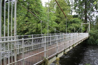
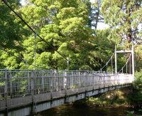
1988: Exeter Quay
Exeter, Devon, England, United Kingdom
| Bridgemeister ID: | 1104 (added 2004-01-03) |
| Year Completed: | 1988 |
| Name: | Exeter Quay |
| Also Known As: | Cricklepit |
| Location: | Exeter, Devon, England, United Kingdom |
| Coordinates: | 50.71811 N 3.53233 W |
| Maps: | Acme, GeoHack, Google, OpenStreetMap |
| Use: | Footbridge |
| Status: | In use (last checked: 2004) |
| Main Cables: | Wire (steel) |
| Suspended Spans: | 1 |
Notes:
- This is a distinct footbridge from the nearby Trews Weir (New Cricklepit) bridge.
External Links:
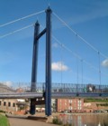
1999: (footbridge)
Monteviot, Ancrum vicinity, Scotland, United Kingdom - River Teviot
| Bridgemeister ID: | 1434 (added 2004-07-30) |
| Year Completed: | 1999 |
| Name: | (footbridge) |
| Location: | Monteviot, Ancrum vicinity, Scotland, United Kingdom |
| Crossing: | River Teviot |
| Coordinates: | 55.512985 N 2.555607 W |
| Maps: | Acme, GeoHack, Google, OpenStreetMap |
| Use: | Footbridge |
| Status: | In use (last checked: 2009) |
| Main Cables: | Wire (steel) |
| Suspended Spans: | 1 |
| Main Span: | 1 x 69.8 meters (229 feet) |
| Deck width: | 3 feet |
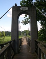
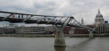
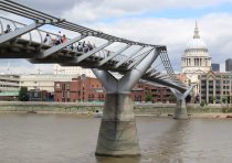
2000: Millennium
London, England, United Kingdom - River Thames
| Bridgemeister ID: | 568 (added 2002-12-31) |
| Year Completed: | 2000 |
| Name: | Millennium |
| Location: | London, England, United Kingdom |
| Crossing: | River Thames |
| Coordinates: | 51.50964 N 0.09856 W |
| Maps: | Acme, GeoHack, Google, OpenStreetMap |
| Principals: | Anthony Caro, Foster & Partners, Ove Arup & Partners |
| References: | BAR, BBU |
| Use: | Footbridge |
| Status: | In use (last checked: 2019) |
| Main Cables: | Wire (steel) |
| Suspended Spans: | 3 |
| Main Span: | 1 |
| Side Spans: | 2 |
External Links:
2001: Halgavor
Bodmin, Cornwall and Lanhydrock, England, United Kingdom - A30 Highway
| Bridgemeister ID: | 964 (added 2003-11-01) |
| Year Completed: | 2001 |
| Name: | Halgavor |
| Location: | Bodmin, Cornwall and Lanhydrock, England, United Kingdom |
| Crossing: | A30 Highway |
| Coordinates: | 50.4503 N 4.697267 W |
| Maps: | Acme, GeoHack, Google, OpenStreetMap |
| Principals: | Flint & Neill Partnership, Wilkinson Eyre |
| References: | BAR |
| Use: | Footbridge |
| Status: | In use (last checked: 2008) |
| Main Cables: | Wire (steel) |
| Suspended Spans: | 1 |
| Main Span: | 1 x 48 meters (157.5 feet) |
| Deck width: | 3.5 meters |
Notes:
- Unconventional design with swept-back towers. Wide deck, intended to carry pedestrians, cyclists, and horses.
External Links:
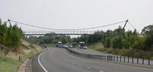
2003: A5 Nesscliffe Bypass
Nesscliffe, Shropshire, England, United Kingdom - A5 Roadway
| Bridgemeister ID: | 1315 (added 2004-04-18) |
| Year Completed: | 2003 |
| Name: | A5 Nesscliffe Bypass |
| Location: | Nesscliffe, Shropshire, England, United Kingdom |
| Crossing: | A5 Roadway |
| Coordinates: | 52.76524 N 2.91796 W |
| Maps: | Acme, GeoHack, Google, OpenStreetMap |
| Use: | Footbridge |
| Status: | In use (last checked: 2012) |
| Main Cables: | Wire (steel) |
| Suspended Spans: | 1 |
Notes:
- Sign at bridge notes it was officially opened March 21, 2003.
2004: Doll
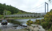
Doll vicinity, Brora, Scotland, United Kingdom - River Brora
| Bridgemeister ID: | 2613 (added 2014-04-15) |
| Year Completed: | 2004 |
| Name: | Doll |
| Also Known As: | Ford |
| Location: | Doll vicinity, Brora, Scotland, United Kingdom |
| Crossing: | River Brora |
| At or Near Feature: | Brora Ford |
| Coordinates: | 58.01495 N 3.91287 W |
| Maps: | Acme, GeoHack, Google, OpenStreetMap |
| Use: | Footbridge |
| Status: | In use (last checked: 2022) |
| Main Cables: | Wire (steel) |
| Suspended Spans: | 1 |
2011: Peace
Derry, Northern Ireland, United Kingdom - River Foyle
| Bridgemeister ID: | 3557 (added 2019-12-26) |
| Year Completed: | 2011 |
| Name: | Peace |
| Location: | Derry, Northern Ireland, United Kingdom |
| Crossing: | River Foyle |
| Coordinates: | 54.997957 N 7.315452 W |
| Maps: | Acme, GeoHack, Google, OpenStreetMap |
| Use: | Footbridge |
| Status: | In use (last checked: 2019) |
| Main Cables: | Wire (steel) |
| Suspended Spans: | 3 |
| Main Span: | 1 |
| Side Spans: | 2 |
External Links:
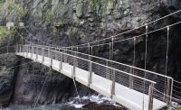
2015: Gobbins
Whitehead vicinity, Northern Ireland, United Kingdom
| Bridgemeister ID: | 2682 (added 2019-05-26) |
| Year Completed: | 2015 |
| Name: | Gobbins |
| Location: | Whitehead vicinity, Northern Ireland, United Kingdom |
| At or Near Feature: | Gobbins Cliff Path |
| Coordinates: | 54.808021 N 5.691815 W |
| Maps: | Acme, GeoHack, Google, OpenStreetMap |
| Use: | Footbridge |
| Status: | In use (last checked: 2019) |
| Main Cables: | Wire (steel) |
| Suspended Spans: | 1 |
Notes:
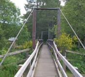
(footbridge)
Aberlour, Scotland, United Kingdom - Burn of Aberlour
| Bridgemeister ID: | 2529 (added 2010-05-19) |
| Name: | (footbridge) |
| Location: | Aberlour, Scotland, United Kingdom |
| Crossing: | Burn of Aberlour |
| At or Near Feature: | Speyside Way |
| Coordinates: | 57.4688 N 3.2317 W |
| Maps: | Acme, GeoHack, Google, OpenStreetMap |
| Use: | Footbridge |
| Status: | In use (last checked: 2009) |
| Main Cables: | Wire (steel) |
| Suspended Spans: | 1 |
| Main Span: | 1 x 23.2 meters (76 feet) |
Notes:
- Near Victoria (Penny, Aberlour) - Charlestown of Aberlour and Wester Elchies, Scotland, United Kingdom.
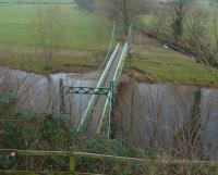
(footbridge)
Addingham, England, United Kingdom - River Wharfe
| Bridgemeister ID: | 1208 (added 2004-02-07) |
| Name: | (footbridge) |
| Location: | Addingham, England, United Kingdom |
| Crossing: | River Wharfe |
| Coordinates: | 53.94536 N 1.87446 W |
| Maps: | Acme, GeoHack, Google, OpenStreetMap |
| Use: | Footbridge |
| Status: | In use (last checked: 2013) |
| Main Cables: | Wire (steel) |
| Suspended Spans: | 1 |
Notes:
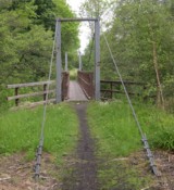
(footbridge)
Badintagairt, Lairg, Scotland, United Kingdom - River Cassley
| Bridgemeister ID: | 7131 (added 2022-06-19) |
| Name: | (footbridge) |
| Location: | Badintagairt, Lairg, Scotland, United Kingdom |
| Crossing: | River Cassley |
| Coordinates: | 58.050790 N 4.665025 W |
| Maps: | Acme, GeoHack, Google, OpenStreetMap |
| Use: | Footbridge |
| Status: | Derelict, since c. 2019-2021 (last checked: 2022) |
| Main Span: | 1 |
Notes:
- Appears to have been largely destroyed at some point in the 2019-2021 time frame.
(footbridge)
Ballindalloch vicinity, Scotland, United Kingdom - Allt a'Gheallaidh
| Bridgemeister ID: | 2530 (added 2010-05-19) |
| Name: | (footbridge) |
| Location: | Ballindalloch vicinity, Scotland, United Kingdom |
| Crossing: | Allt a'Gheallaidh |
| At or Near Feature: | Speyside Way |
| Coordinates: | 57.4225 N 3.3745 W |
| Maps: | Acme, GeoHack, Google, OpenStreetMap |
| Use: | Footbridge |
| Status: | In use (last checked: 2009) |
| Main Cables: | Wire (steel) |
| Suspended Spans: | 1 |
| Main Span: | 1 x 24.8 meters (81.5 feet) |
(footbridge)
Berriedale, Scotland, United Kingdom - Berriedale Water
| Bridgemeister ID: | 7132 (added 2022-06-19) |
| Name: | (footbridge) |
| Location: | Berriedale, Scotland, United Kingdom |
| Crossing: | Berriedale Water |
| Coordinates: | 58.182341 N 3.497737 W |
| Maps: | Acme, GeoHack, Google, OpenStreetMap |
| Use: | Footbridge |
| Status: | In use (last checked: 2021) |
| Main Cables: | Wire |
| Suspended Spans: | 1 |
| Main Span: | 1 |
(footbridge)
Branxholm, Hawick, Scotland, United Kingdom - River Teviot
| Bridgemeister ID: | 8210 (added 2024-02-05) |
| Name: | (footbridge) |
| Location: | Branxholm, Hawick, Scotland, United Kingdom |
| Crossing: | River Teviot |
| At or Near Feature: | Branxholme Castle |
| Coordinates: | 55.395528 N 2.845694 W |
| Maps: | Acme, GeoHack, Google, OpenStreetMap |
| Use: | Footbridge |
| Status: | Removed |
| Main Span: | 1 |
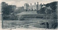
(footbridge)
Churchtown, Lancashire, England, United Kingdom - River Wyre
| Bridgemeister ID: | 3140 (added 2019-11-02) |
| Name: | (footbridge) |
| Location: | Churchtown, Lancashire, England, United Kingdom |
| Crossing: | River Wyre |
| Coordinates: | 53.877182 N 2.791870 W |
| Maps: | Acme, GeoHack, Google, OpenStreetMap |
| Use: | Footbridge |
| Status: | In use (last checked: 2016) |
| Main Cables: | Wire (steel) |
(footbridge)
Contin vicinity, Scotland, United Kingdom - Black Water River
| Bridgemeister ID: | 907 (added 2003-10-11) |
| Name: | (footbridge) |
| Location: | Contin vicinity, Scotland, United Kingdom |
| Crossing: | Black Water River |
| At or Near Feature: | Rogie Falls |
| Coordinates: | 57.589014 N 4.603213 W |
| Maps: | Acme, GeoHack, Google, OpenStreetMap |
| Use: | Footbridge |
| Status: | Replaced, c. 2014 |
| Main Cables: | Wire (steel) |
| Suspended Spans: | 1 |
Notes:
- Sign at bridge reads: "Reconstructed by the Territorial Army in 1975."
- Replaced, likely in 2014.
- Replaced by (footbridge) - Contin vicinity, Scotland, United Kingdom.
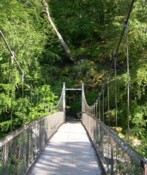
(footbridge)
Contin vicinity, Scotland, United Kingdom - Black Water River
| Bridgemeister ID: | 2932 (added 2003-10-11) |
| Name: | (footbridge) |
| Location: | Contin vicinity, Scotland, United Kingdom |
| Crossing: | Black Water River |
| At or Near Feature: | Rogie Falls |
| Coordinates: | 57.588906 N 4.603127 W |
| Maps: | Acme, GeoHack, Google, OpenStreetMap |
| Use: | Footbridge |
| Status: | In use (last checked: 2019) |
| Main Cables: | Wire (steel) |
| Suspended Spans: | 1 |
Notes:
- Replaced (footbridge) - Contin vicinity, Scotland, United Kingdom. Likely erected in 2014.
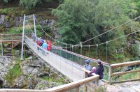
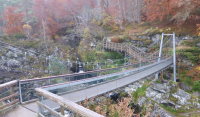
(footbridge)
Cwmcrawnon, Powys, Wales, United Kingdom - River Usk
| Bridgemeister ID: | 2933 (added 2019-09-16) |
| Name: | (footbridge) |
| Location: | Cwmcrawnon, Powys, Wales, United Kingdom |
| Crossing: | River Usk |
| At or Near Feature: | Buckland Old Mill |
| Coordinates: | 51.873303 N 3.257608 W |
| Maps: | Acme, GeoHack, Google, OpenStreetMap |
| Use: | Footbridge |
| Status: | Extant (last checked: 2009) |
| Main Cables: | Wire (steel) |
(footbridge)
Danaglar Castle, Scotland, United Kingdom - Shee Water
| Bridgemeister ID: | 6248 (added 2021-07-18) |
| Name: | (footbridge) |
| Location: | Danaglar Castle, Scotland, United Kingdom |
| Crossing: | Shee Water |
| At or Near Feature: | Danaglar Ford |
| Use: | Footbridge |
| Main Cables: | Wire |
| Suspended Spans: | 1 |
Notes:
- Likely removed. Exact location unknown but appears to have been in the vicinity of Danaglar Castle.
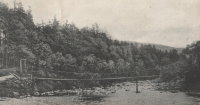
(footbridge)
Duchally, Lairg, Scotland, United Kingdom - River Cassley
| Bridgemeister ID: | 7130 (added 2022-06-19) |
| Name: | (footbridge) |
| Location: | Duchally, Lairg, Scotland, United Kingdom |
| Crossing: | River Cassley |
| Coordinates: | 58.108786 N 4.736285 W |
| Maps: | Acme, GeoHack, Google, OpenStreetMap |
| Use: | Footbridge |
| Status: | Extant (last checked: 2021) |
| Main Cables: | Wire |
| Suspended Spans: | 1 |
| Main Span: | 1 x 32 meters (105 feet) estimated |
(footbridge)
Duible vicinity, Helmsdale, Scotland, United Kingdom - River Helmsdale
| Bridgemeister ID: | 2698 (added 2019-05-27) |
| Name: | (footbridge) |
| Location: | Duible vicinity, Helmsdale, Scotland, United Kingdom |
| Crossing: | River Helmsdale |
| Coordinates: | 58.149375 N 3.819557 W |
| Maps: | Acme, GeoHack, Google, OpenStreetMap |
| Use: | Footbridge |
| Status: | Extant (last checked: 2019) |
| Main Cables: | Wire (steel) |
| Suspended Spans: | 1 |
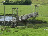
(footbridge)
Dunbeath, Scotland, United Kingdom - Houstry Burn
| Bridgemeister ID: | 1914 (added 2005-10-09) |
| Name: | (footbridge) |
| Location: | Dunbeath, Scotland, United Kingdom |
| Crossing: | Houstry Burn |
| Coordinates: | 58.254200 N 3.439300 W |
| Maps: | Acme, GeoHack, Google, OpenStreetMap |
| Principals: | Wm. Smith and Son |
| Use: | Footbridge |
| Status: | In use (last checked: 2010) |
| Main Cables: | Wire |
| Suspended Spans: | 1 |
Notes:
- Very short footbridge.
- Near Milton - Dunbeath, Scotland, United Kingdom.
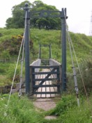
(footbridge)
Esholt, Apperley Bridge vicinity, England, United Kingdom - River Aire
| Bridgemeister ID: | 1254 (added 2004-02-28) |
| Name: | (footbridge) |
| Location: | Esholt, Apperley Bridge vicinity, England, United Kingdom |
| Crossing: | River Aire |
| Coordinates: | 53.84566 N 1.71667 W |
| Maps: | Acme, GeoHack, Google, OpenStreetMap |
| Use: | Footbridge |
| Status: | In use (last checked: 2014) |
| Main Cables: | Eyebar |
| Main Span: | 1 |
Notes:
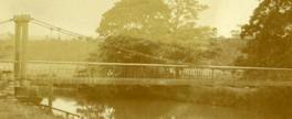
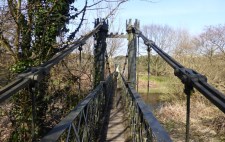
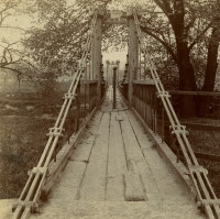
(footbridge)
Eskdale, England, United Kingdom - River Esk
| Bridgemeister ID: | 2464 (added 2008-09-28) |
| Name: | (footbridge) |
| Location: | Eskdale, England, United Kingdom |
| Crossing: | River Esk |
| Use: | Footbridge |
| Status: | In use (last checked: 2008) |
| Main Cables: | Wire (steel) |
| Suspended Spans: | 1 |
(footbridge)
Glen Brittle, Skye, Scotland, United Kingdom - River Brittle
| Bridgemeister ID: | 3163 (added 2019-11-03) |
| Name: | (footbridge) |
| Location: | Glen Brittle, Skye, Scotland, United Kingdom |
| Crossing: | River Brittle |
| Coordinates: | 57.206041 N 6.292533 W |
| Maps: | Acme, GeoHack, Google, OpenStreetMap |
| Use: | Footbridge |
| Status: | Removed, c. 2011-2021 |
| Main Cables: | Wire |
| Suspended Spans: | 1 |
Notes:
- Removed at some point in the 2011-2021 time frame and replaced with a non-suspension bridge.
(footbridge)
Holme, Peterborough, England, United Kingdom - Great Northern Railway track
| Bridgemeister ID: | 5082 (added 2020-09-02) |
| Name: | (footbridge) |
| Location: | Holme, Peterborough, England, United Kingdom |
| Crossing: | Great Northern Railway track |
| Coordinates: | 52.474283 N 0.237478 W |
| Maps: | Acme, GeoHack, Google, OpenStreetMap |
| Principals: | Harper & Co. |
| References: | HARPER |
| Use: | Footbridge |
| Status: | Removed |
| Main Cables: | Wire |
| Suspended Spans: | 1 |
Notes:
- HARPER: Likely constructed in 1870s.
- Coordinates indicate likely approximate former location of the bridge.
External Links:
(footbridge)
Kilbraur, Scotland, United Kingdom - River Brora
| Bridgemeister ID: | 6764 (added 2021-10-26) |
| Name: | (footbridge) |
| Location: | Kilbraur, Scotland, United Kingdom |
| Crossing: | River Brora |
| Coordinates: | 58.066959 N 3.996902 W |
| Maps: | Acme, GeoHack, Google, OpenStreetMap |
| Use: | Footbridge |
| Status: | In use (last checked: 2021) |
| Main Cables: | Wire |
| Suspended Spans: | 1 |
Notes:
- Likely built in 1960s or 1970s.
(footbridge)
Kildonan Lodge vicinity, Helmsdale, Scotland, United Kingdom - River Helmsdale
| Bridgemeister ID: | 2906 (added 2019-09-15) |
| Name: | (footbridge) |
| Location: | Kildonan Lodge vicinity, Helmsdale, Scotland, United Kingdom |
| Crossing: | River Helmsdale |
| Coordinates: | 58.184200 N 3.871900 W |
| Maps: | Acme, GeoHack, Google, OpenStreetMap |
| Use: | Footbridge |
| Status: | In use (last checked: 2010) |
| Main Cables: | Wire (steel) |
| Suspended Spans: | 1 |
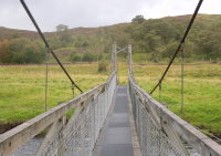
(footbridge)
Kildonan Lodge, Helmsdale, Scotland, United Kingdom - River Helmsdale
| Bridgemeister ID: | 2907 (added 2019-09-15) |
| Name: | (footbridge) |
| Location: | Kildonan Lodge, Helmsdale, Scotland, United Kingdom |
| Crossing: | River Helmsdale |
| Coordinates: | 58.1767 N 3.8664 W |
| Maps: | Acme, GeoHack, Google, OpenStreetMap |
| Use: | Footbridge |
| Status: | In use (last checked: 2011) |
| Main Cables: | Wire (steel) |
| Suspended Spans: | 1 |
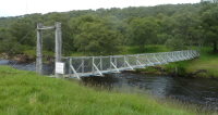
Do you have any information or photos for these bridges that you would like to share? Please email david.denenberg@bridgemeister.com.